Easy example on how to put marker on a d3.js map.
You got 2 options:
- using d3.geo.path() which does all the work for you
- using svg circles and translating them via projection(d.geometry.coordinates)
| <!DOCTYPE html> | |
| <meta charset="utf-8"> | |
| <style> | |
| .graticule { | |
| fill: none; | |
| stroke: #777; | |
| stroke-opacity: .5; | |
| stroke-width: .5px; | |
| } | |
| .land { | |
| fill: #222; | |
| } | |
| .boundary { | |
| fill: none; | |
| stroke: #fff; | |
| stroke-width: .5px; | |
| } | |
| circle { | |
| fill: yellow; | |
| } | |
| .geopath { | |
| fill: green; | |
| } | |
| </style> | |
| <body> | |
| <script src="http://d3js.org/d3.v3.min.js"></script> | |
| <script src="http://d3js.org/topojson.v1.min.js"></script> | |
| <script> | |
| var width = 1200, | |
| height = 720; | |
| var projection = d3.geo.mercator() | |
| .scale(8000) | |
| .precision(.1) | |
| .center([13.320255,52.52831499]) | |
| .translate([width / 2, height / 2]) | |
| var path = d3.geo.path() | |
| .projection(projection); | |
| var graticule = d3.geo.graticule(); | |
| var svg = d3.select("body").append("svg") | |
| .attr("width", width) | |
| .attr("height", height); | |
| svg.append("path") | |
| .datum(graticule) | |
| .attr("class", "graticule") | |
| .attr("d", path); | |
| d3.json("world-50m.json", function(error, world) { | |
| svg.insert("path", ".graticule") | |
| .datum(topojson.feature(world, world.objects.land)) | |
| .attr("class", "land") | |
| .attr("d", path); | |
| svg.insert("path", ".graticule") | |
| .datum(topojson.mesh(world, world.objects.countries, function(a, b) { return a !== b; })) | |
| .attr("class", "boundary") | |
| .attr("d", path); | |
| }); | |
| d3.json("stops_berlin.geojson", function(error, data) { | |
| // using d3.geo.path() which does all the work for you | |
| svg.append("path") | |
| .datum(data) | |
| .classed("geopath", true) | |
| .attr("d", path) | |
| // or insert your own custom dots by hand | |
| svg.append("g") | |
| .selectAll("g") | |
| .data(data.features) | |
| .enter() | |
| .append("g") | |
| .attr("transform", function(d) { return "translate(" + projection(d.geometry.coordinates) + ")"; }) | |
| .append("circle") | |
| .attr("r", 1) | |
| }); | |
| d3.select(self.frameElement).style("height", height + "px"); | |
| </script> |
| { | |
| "type": "FeatureCollection", | |
| "features": [ | |
| { | |
| "geometry": { | |
| "type": "Point", | |
| "coordinates": [ | |
| 13.320255, | |
| 52.528314999999999 | |
| ] | |
| }, | |
| "type": "Feature", | |
| "properties": { | |
| "name": "Wiebestr./Huttenstr. (Berlin)" | |
| } | |
| }, | |
| { | |
| "geometry": { | |
| "type": "Point", | |
| "coordinates": [ | |
| 13.323632, | |
| 52.527900000000002 | |
| ] | |
| }, | |
| "type": "Feature", | |
| "properties": { | |
| "name": "Reuchlinstr. (Berlin)" | |
| } | |
| }, | |
| { | |
| "geometry": { | |
| "type": "Point", | |
| "coordinates": [ | |
| 13.315976000000001, | |
| 52.5291 | |
| ] | |
| }, | |
| "type": "Feature", | |
| "properties": { | |
| "name": "Neues Ufer (Berlin)" | |
| } | |
| }, | |
| { | |
| "geometry": { | |
| "type": "Point", | |
| "coordinates": [ | |
| 13.309834, | |
| 52.525753000000002 | |
| ] | |
| }, | |
| "type": "Feature", | |
| "properties": { | |
| "name": "Ilsenburger Str. (Berlin)" | |
| } | |
| }, | |
| { | |
| "geometry": { | |
| "type": "Point", | |
| "coordinates": [ | |
| 13.314256, | |
| 52.525793000000007 | |
| ] | |
| }, | |
| "type": "Feature", | |
| "properties": { | |
| "name": "Goslarer Platz (Berlin)" | |
| } | |
| }, | |
| { | |
| "geometry": { | |
| "type": "Point", | |
| "coordinates": [ | |
| 13.360957999999998, | |
| 52.538395999999999 | |
| ] | |
| }, | |
| "type": "Feature", | |
| "properties": { | |
| "name": "Fennbr\u00fccke (Berlin)" | |
| } | |
| }, | |
| { | |
| "geometry": { | |
| "type": "Point", | |
| "coordinates": [ | |
| 13.343836999999999, | |
| 52.536182999999994 | |
| ] | |
| }, | |
| "type": "Feature", | |
| "properties": { | |
| "name": "S+U Westhafen (Berlin)" | |
| } | |
| }, | |
| { | |
| "geometry": { | |
| "type": "Point", | |
| "coordinates": [ | |
| 13.363610000000001, | |
| 52.538849999999996 | |
| ] | |
| }, | |
| "type": "Feature", | |
| "properties": { | |
| "name": "Am Nordhafen (Berlin)" | |
| } | |
| }, | |
| { | |
| "geometry": { | |
| "type": "Point", | |
| "coordinates": [ | |
| 13.36876, | |
| 52.530028000000001 | |
| ] | |
| }, | |
| "type": "Feature", | |
| "properties": { | |
| "name": "D\u00f6beritzer Str. (Berlin)" | |
| } | |
| }, | |
| { | |
| "geometry": { | |
| "type": "Point", | |
| "coordinates": [ | |
| 13.365223, | |
| 52.525764000000002 | |
| ] | |
| }, | |
| "type": "Feature", | |
| "properties": { | |
| "name": "Lehrter Str./Invalidenstr. (Berlin)" | |
| } | |
| }, | |
| { | |
| "geometry": { | |
| "type": "Point", | |
| "coordinates": [ | |
| 13.361216000000001, | |
| 52.536739000000004 | |
| ] | |
| }, | |
| "type": "Feature", | |
| "properties": { | |
| "name": "Friedrich-Krause-Ufer (Berlin)" | |
| } | |
| }, | |
| { | |
| "geometry": { | |
| "type": "Point", | |
| "coordinates": [ | |
| 13.330429999999998, | |
| 52.527104000000001 | |
| ] | |
| }, | |
| "type": "Feature", | |
| "properties": { | |
| "name": "Turmstr./Waldstr. (Berlin)" | |
| } | |
| }, | |
| { | |
| "geometry": { | |
| "type": "Point", | |
| "coordinates": [ | |
| 13.328742999999999, | |
| 52.527339000000005 | |
| ] | |
| }, | |
| "type": "Feature", | |
| "properties": { | |
| "name": "Turmstr./Beusselstr. (Berlin)" | |
| } | |
| }, | |
| { | |
| "geometry": { | |
| "type": "Point", | |
| "coordinates": [ | |
| 13.328510000000001, | |
| 52.530856000000007 | |
| ] | |
| }, | |
| "type": "Feature", | |
| "properties": { | |
| "name": "Wittstocker Str. (Berlin)" | |
| } | |
| }, | |
| { | |
| "geometry": { | |
| "type": "Point", | |
| "coordinates": [ | |
| 13.356395999999998, | |
| 52.535293999999993 | |
| ] | |
| }, | |
| "type": "Feature", | |
| "properties": { | |
| "name": "Quitzowstr. (Berlin)" | |
| } | |
| }, | |
| { | |
| "geometry": { | |
| "type": "Point", | |
| "coordinates": [ | |
| 13.341417000000002, | |
| 52.532229000000001 | |
| ] | |
| }, | |
| "type": "Feature", | |
| "properties": { | |
| "name": "U Birkenstr. (Berlin)" | |
| } | |
| }, | |
| { | |
| "geometry": { | |
| "type": "Point", | |
| "coordinates": [ | |
| 13.351405999999999, | |
| 52.526363000000003 | |
| ] | |
| }, | |
| "type": "Feature", | |
| "properties": { | |
| "name": "Wilsnacker Str. (Berlin)" | |
| } | |
| }, | |
| { | |
| "geometry": { | |
| "type": "Point", | |
| "coordinates": [ | |
| 13.350532000000001, | |
| 52.532457999999998 | |
| ] | |
| }, | |
| "type": "Feature", | |
| "properties": { | |
| "name": "Stendaler Str. (Berlin)" | |
| } | |
| }, | |
| { | |
| "geometry": { | |
| "type": "Point", | |
| "coordinates": [ | |
| 13.358032999999999, | |
| 52.535329000000004 | |
| ] | |
| }, | |
| "type": "Feature", | |
| "properties": { | |
| "name": "Perleberger Br\u00fccke (Berlin)" | |
| } | |
| }, | |
| { | |
| "geometry": { | |
| "type": "Point", | |
| "coordinates": [ | |
| 13.345507999999999, | |
| 52.526251000000002 | |
| ] | |
| }, | |
| "type": "Feature", | |
| "properties": { | |
| "name": "Turmstr./L\u00fcbecker Str. (Berlin)" | |
| } | |
| }, | |
| { | |
| "geometry": { | |
| "type": "Point", | |
| "coordinates": [ | |
| 13.354804999999999, | |
| 52.526683999999996 | |
| ] | |
| }, | |
| "type": "Feature", | |
| "properties": { | |
| "name": "Turmstr./Rathenower Str. (Berlin)" | |
| } | |
| }, | |
| { | |
| "geometry": { | |
| "type": "Point", | |
| "coordinates": [ | |
| 13.344006, | |
| 52.529189000000002 | |
| ] | |
| }, | |
| "type": "Feature", | |
| "properties": { | |
| "name": "Stromstr. (Berlin)" | |
| } | |
| }, | |
| { | |
| "geometry": { | |
| "type": "Point", | |
| "coordinates": [ | |
| 13.352907, | |
| 52.529654000000001 | |
| ] | |
| }, | |
| "type": "Feature", | |
| "properties": { | |
| "name": "Birkenstr./Rathenower Str. (Berlin)" | |
| } | |
| }, | |
| { | |
| "geometry": { | |
| "type": "Point", | |
| "coordinates": [ | |
| 13.364157999999998, | |
| 52.527034999999998 | |
| ] | |
| }, | |
| "type": "Feature", | |
| "properties": { | |
| "name": "Seydlitzstr. (Berlin)" | |
| } | |
| }, | |
| { | |
| "geometry": { | |
| "type": "Point", | |
| "coordinates": [ | |
| 13.362430999999999, | |
| 52.530281000000002 | |
| ] | |
| }, | |
| "type": "Feature", | |
| "properties": { | |
| "name": "Poststadion (Berlin)" | |
| } | |
| }, | |
| { | |
| "geometry": { | |
| "type": "Point", | |
| "coordinates": [ | |
| 13.359639000000001, | |
| 52.533386999999998 | |
| ] | |
| }, | |
| "type": "Feature", | |
| "properties": { | |
| "name": "Kruppstr. (Berlin)" | |
| } | |
| }, | |
| { | |
| "geometry": { | |
| "type": "Point", | |
| "coordinates": [ | |
| 13.347673, | |
| 52.531025 | |
| ] | |
| }, | |
| "type": "Feature", | |
| "properties": { | |
| "name": "Havelberger Str. (Berlin)" | |
| } | |
| }, | |
| { | |
| "geometry": { | |
| "type": "Point", | |
| "coordinates": [ | |
| 13.342165, | |
| 52.518110999999998 | |
| ] | |
| }, | |
| "type": "Feature", | |
| "properties": { | |
| "name": "U Hansaplatz (Berlin)" | |
| } | |
| }, | |
| { | |
| "geometry": { | |
| "type": "Point", | |
| "coordinates": [ | |
| 13.347098000000001, | |
| 52.519950999999999 | |
| ] | |
| }, | |
| "type": "Feature", | |
| "properties": { | |
| "name": "S Bellevue (Berlin)" | |
| } | |
| }, | |
| { | |
| "geometry": { | |
| "type": "Point", | |
| "coordinates": [ | |
| 13.336235, | |
| 52.513963000000004 | |
| ] | |
| }, | |
| "type": "Feature", | |
| "properties": { | |
| "name": "S Tiergarten (Berlin)" | |
| } | |
| }, | |
| { | |
| "geometry": { | |
| "type": "Point", | |
| "coordinates": [ | |
| 13.341417000000002, | |
| 52.525938000000004 | |
| ] | |
| }, | |
| "type": "Feature", | |
| "properties": { | |
| "name": "U Turmstr. (Berlin)" | |
| } | |
| }, | |
| { | |
| "geometry": { | |
| "type": "Point", | |
| "coordinates": [ | |
| 13.339573000000001, | |
| 52.518597999999997 | |
| ] | |
| }, | |
| "type": "Feature", | |
| "properties": { | |
| "name": "Bachstr. (Berlin)" | |
| } | |
| }, | |
| { | |
| "geometry": { | |
| "type": "Point", | |
| "coordinates": [ | |
| 13.329892000000001, | |
| 52.523929000000003 | |
| ] | |
| }, | |
| "type": "Feature", | |
| "properties": { | |
| "name": "Alt-Moabit/Gotzkowskystr. (Berlin)" | |
| } | |
| }, | |
| { | |
| "geometry": { | |
| "type": "Point", | |
| "coordinates": [ | |
| 13.335728, | |
| 52.520547000000001 | |
| ] | |
| }, | |
| "type": "Feature", | |
| "properties": { | |
| "name": "Solinger Str. (Berlin)" | |
| } | |
| }, | |
| { | |
| "geometry": { | |
| "type": "Point", | |
| "coordinates": [ | |
| 13.339166000000001, | |
| 52.526061999999996 | |
| ] | |
| }, | |
| "type": "Feature", | |
| "properties": { | |
| "name": "Rathaus Tiergarten (Berlin)" | |
| } | |
| }, | |
| { | |
| "geometry": { | |
| "type": "Point", | |
| "coordinates": [ | |
| 13.334925, | |
| 52.524681000000008 | |
| ] | |
| }, | |
| "type": "Feature", | |
| "properties": { | |
| "name": "Ottostr. (Berlin)" | |
| } | |
| }, | |
| { | |
| "geometry": { | |
| "type": "Point", | |
| "coordinates": [ | |
| 13.341988000000001, | |
| 52.526299999999999 | |
| ] | |
| }, | |
| "type": "Feature", | |
| "properties": { | |
| "name": "U Turmstr. (Berlin) [Bus Turmstr.]" | |
| } | |
| }, | |
| { | |
| "geometry": { | |
| "type": "Point", | |
| "coordinates": [ | |
| 13.343019, | |
| 52.525812000000002 | |
| ] | |
| }, | |
| "type": "Feature", | |
| "properties": { | |
| "name": "U Turmstr. (Berlin) [Bus Stromstr.]" | |
| } | |
| }, | |
| { | |
| "geometry": { | |
| "type": "Point", | |
| "coordinates": [ | |
| 13.341934, | |
| 52.525509999999997 | |
| ] | |
| }, | |
| "type": "Feature", | |
| "properties": { | |
| "name": "U Turmstr. (Berlin) [Bus Alt-Moabit]" | |
| } | |
| }, | |
| { | |
| "geometry": { | |
| "type": "Point", | |
| "coordinates": [ | |
| 13.331505999999999, | |
| 52.522220999999995 | |
| ] | |
| }, | |
| "type": "Feature", | |
| "properties": { | |
| "name": "Zinzendorfstr. (Berlin)" | |
| } | |
| }, | |
| { | |
| "geometry": { | |
| "type": "Point", | |
| "coordinates": [ | |
| 13.349582, | |
| 52.524542000000004 | |
| ] | |
| }, | |
| "type": "Feature", | |
| "properties": { | |
| "name": "Kirchstr./Alt-Moabit (Berlin)" | |
| } | |
| }, | |
| { | |
| "geometry": { | |
| "type": "Point", | |
| "coordinates": [ | |
| 13.357070000000002, | |
| 52.523692000000004 | |
| ] | |
| }, | |
| "type": "Feature", | |
| "properties": { | |
| "name": "Alt-Moabit/Rathenower Str. (Berlin)" | |
| } | |
| }, | |
| { | |
| "geometry": { | |
| "type": "Point", | |
| "coordinates": [ | |
| 13.345764000000001, | |
| 52.524990000000003 | |
| ] | |
| }, | |
| "type": "Feature", | |
| "properties": { | |
| "name": "Kleiner Tiergarten (Berlin)" | |
| } | |
| }, | |
| { | |
| "geometry": { | |
| "type": "Point", | |
| "coordinates": [ | |
| 13.370707999999999, | |
| 52.523966000000001 | |
| ] | |
| }, | |
| "type": "Feature", | |
| "properties": { | |
| "name": "Washingtonplatz/Hauptbahnhof (Berlin)" | |
| } | |
| }, | |
| { | |
| "geometry": { | |
| "type": "Point", | |
| "coordinates": [ | |
| 13.355661999999999, | |
| 52.520068999999992 | |
| ] | |
| }, | |
| "type": "Feature", | |
| "properties": { | |
| "name": "Paulstr. (Berlin)" | |
| } | |
| }, | |
| { | |
| "geometry": { | |
| "type": "Point", | |
| "coordinates": [ | |
| 13.354203, | |
| 52.516715000000005 | |
| ] | |
| }, | |
| "type": "Feature", | |
| "properties": { | |
| "name": "Schloss Bellevue (Berlin)" | |
| } | |
| }, | |
| { | |
| "geometry": { | |
| "type": "Point", | |
| "coordinates": [ | |
| 13.363364000000001, | |
| 52.517598 | |
| ] | |
| }, | |
| "type": "Feature", | |
| "properties": { | |
| "name": "Haus der Kulturen der Welt (Berlin)" | |
| } | |
| }, | |
| { | |
| "geometry": { | |
| "type": "Point", | |
| "coordinates": [ | |
| 13.373454000000001, | |
| 52.519907999999994 | |
| ] | |
| }, | |
| "type": "Feature", | |
| "properties": { | |
| "name": "U Bundestag (Berlin)" | |
| } | |
| }, | |
| { | |
| "geometry": { | |
| "type": "Point", | |
| "coordinates": [ | |
| 13.366052, | |
| 52.524928000000003 | |
| ] | |
| }, | |
| "type": "Feature", | |
| "properties": { | |
| "name": "Clara-Jaschke-Str. (Berlin)" | |
| } | |
| }, | |
| { | |
| "geometry": { | |
| "type": "Point", | |
| "coordinates": [ | |
| 13.353543, | |
| 52.524002000000003 | |
| ] | |
| }, | |
| "type": "Feature", | |
| "properties": { | |
| "name": "Spenerstr. (Berlin)" | |
| } | |
| }, | |
| { | |
| "geometry": { | |
| "type": "Point", | |
| "coordinates": [ | |
| 13.361978000000001, | |
| 52.524211000000001 | |
| ] | |
| }, | |
| "type": "Feature", | |
| "properties": { | |
| "name": "Lesser-Ury-Weg (Berlin)" | |
| } | |
| }, | |
| { | |
| "geometry": { | |
| "type": "Point", | |
| "coordinates": [ | |
| 13.361649999999999, | |
| 52.523136000000001 | |
| ] | |
| }, | |
| "type": "Feature", | |
| "properties": { | |
| "name": "L\u00fcneburger Str. (Berlin)" | |
| } | |
| }, | |
| { | |
| "geometry": { | |
| "type": "Point", | |
| "coordinates": [ | |
| 13.371197, | |
| 52.520743000000003 | |
| ] | |
| }, | |
| "type": "Feature", | |
| "properties": { | |
| "name": "Bundeskanzleramt (Berlin)" | |
| } | |
| }, | |
| { | |
| "geometry": { | |
| "type": "Point", | |
| "coordinates": [ | |
| 13.350176999999999, | |
| 52.515143000000002 | |
| ] | |
| }, | |
| "type": "Feature", | |
| "properties": { | |
| "name": "Gro\u00dfer Stern (Berlin)" | |
| } | |
| }, | |
| { | |
| "geometry": { | |
| "type": "Point", | |
| "coordinates": [ | |
| 13.376479999999999, | |
| 52.517716 | |
| ] | |
| }, | |
| "type": "Feature", | |
| "properties": { | |
| "name": "Reichstag/Bundestag (Berlin)" | |
| } | |
| }, | |
| { | |
| "geometry": { | |
| "type": "Point", | |
| "coordinates": [ | |
| 13.370442000000001, | |
| 52.517786000000001 | |
| ] | |
| }, | |
| "type": "Feature", | |
| "properties": { | |
| "name": "Platz der Republik (Berlin)" | |
| } | |
| }, | |
| { | |
| "geometry": { | |
| "type": "Point", | |
| "coordinates": [ | |
| 13.351405999999999, | |
| 52.509593000000002 | |
| ] | |
| }, | |
| "type": "Feature", | |
| "properties": { | |
| "name": "Nordische Botschaften/Adenauer-Stiftung (Berlin)" | |
| } | |
| }, | |
| { | |
| "geometry": { | |
| "type": "Point", | |
| "coordinates": [ | |
| 13.332614999999999, | |
| 52.509231000000007 | |
| ] | |
| }, | |
| "type": "Feature", | |
| "properties": { | |
| "name": "Hertzallee (Berlin)" | |
| } | |
| }, | |
| { | |
| "geometry": { | |
| "type": "Point", | |
| "coordinates": [ | |
| 13.345672, | |
| 52.506567000000004 | |
| ] | |
| }, | |
| "type": "Feature", | |
| "properties": { | |
| "name": "Budapester Str. (Berlin)" | |
| } | |
| }, | |
| { | |
| "geometry": { | |
| "type": "Point", | |
| "coordinates": [ | |
| 13.348664999999999, | |
| 52.507619999999996 | |
| ] | |
| }, | |
| "type": "Feature", | |
| "properties": { | |
| "name": "Corneliusbr\u00fccke (Berlin)" | |
| } | |
| }, | |
| { | |
| "geometry": { | |
| "type": "Point", | |
| "coordinates": [ | |
| 13.349926000000002, | |
| 52.503103000000003 | |
| ] | |
| }, | |
| "type": "Feature", | |
| "properties": { | |
| "name": "Schillstr. (Berlin)" | |
| } | |
| }, | |
| { | |
| "geometry": { | |
| "type": "Point", | |
| "coordinates": [ | |
| 13.351557000000001, | |
| 52.504899999999999 | |
| ] | |
| }, | |
| "type": "Feature", | |
| "properties": { | |
| "name": "L\u00fctzowplatz (Berlin)" | |
| } | |
| }, | |
| { | |
| "geometry": { | |
| "type": "Point", | |
| "coordinates": [ | |
| 13.361942000000001, | |
| 52.509706000000008 | |
| ] | |
| }, | |
| "type": "Feature", | |
| "properties": { | |
| "name": "Tiergartenstr. (Berlin)" | |
| } | |
| }, | |
| { | |
| "geometry": { | |
| "type": "Point", | |
| "coordinates": [ | |
| 13.363292000000001, | |
| 52.505735999999999 | |
| ] | |
| }, | |
| "type": "Feature", | |
| "properties": { | |
| "name": "Gedenkst\u00e4tte Dt. Widerstand (Berlin)" | |
| } | |
| }, | |
| { | |
| "geometry": { | |
| "type": "Point", | |
| "coordinates": [ | |
| 13.356266, | |
| 52.507165000000001 | |
| ] | |
| }, | |
| "type": "Feature", | |
| "properties": { | |
| "name": "K\u00f6bisstr. (Berlin)" | |
| } | |
| }, | |
| { | |
| "geometry": { | |
| "type": "Point", | |
| "coordinates": [ | |
| 13.357866, | |
| 52.506518000000007 | |
| ] | |
| }, | |
| "type": "Feature", | |
| "properties": { | |
| "name": "Hiroshimasteg (Berlin)" | |
| } | |
| }, | |
| { | |
| "geometry": { | |
| "type": "Point", | |
| "coordinates": [ | |
| 13.343957999999999, | |
| 52.504430000000006 | |
| ] | |
| }, | |
| "type": "Feature", | |
| "properties": { | |
| "name": "Bayreuther Str. (Berlin)" | |
| } | |
| }, | |
| { | |
| "geometry": { | |
| "type": "Point", | |
| "coordinates": [ | |
| 13.362814000000002, | |
| 52.499809999999997 | |
| ] | |
| }, | |
| "type": "Feature", | |
| "properties": { | |
| "name": "U Kurf\u00fcrstenstr. (Berlin)" | |
| } | |
| }, | |
| { | |
| "geometry": { | |
| "type": "Point", | |
| "coordinates": [ | |
| 13.366002999999999, | |
| 52.503422 | |
| ] | |
| }, | |
| "type": "Feature", | |
| "properties": { | |
| "name": "L\u00fctzowstr./Potsdamer Str. (Berlin)" | |
| } | |
| }, | |
| { | |
| "geometry": { | |
| "type": "Point", | |
| "coordinates": [ | |
| 13.368306, | |
| 52.505947999999997 | |
| ] | |
| }, | |
| "type": "Feature", | |
| "properties": { | |
| "name": "Potsdamer Br\u00fccke (Berlin)" | |
| } | |
| }, | |
| { | |
| "geometry": { | |
| "type": "Point", | |
| "coordinates": [ | |
| 13.368433999999999, | |
| 52.510080000000002 | |
| ] | |
| }, | |
| "type": "Feature", | |
| "properties": { | |
| "name": "Philharmonie (Berlin)" | |
| } | |
| }, | |
| { | |
| "geometry": { | |
| "type": "Point", | |
| "coordinates": [ | |
| 13.370745000000001, | |
| 52.508616000000004 | |
| ] | |
| }, | |
| "type": "Feature", | |
| "properties": { | |
| "name": "Philharmonie S\u00fcd (Berlin)" | |
| } | |
| }, | |
| { | |
| "geometry": { | |
| "type": "Point", | |
| "coordinates": [ | |
| 13.374301999999998, | |
| 52.509293000000007 | |
| ] | |
| }, | |
| "type": "Feature", | |
| "properties": { | |
| "name": "Varian-Fry-Str. (Berlin)" | |
| } | |
| }, | |
| { | |
| "geometry": { | |
| "type": "Point", | |
| "coordinates": [ | |
| 13.374719000000001, | |
| 52.503806000000004 | |
| ] | |
| }, | |
| "type": "Feature", | |
| "properties": { | |
| "name": "U Mendelssohn-Bartholdy-Park (Berlin)" | |
| } | |
| }, | |
| { | |
| "geometry": { | |
| "type": "Point", | |
| "coordinates": [ | |
| 13.377751000000002, | |
| 52.502332999999993 | |
| ] | |
| }, | |
| "type": "Feature", | |
| "properties": { | |
| "name": "Sch\u00f6neberger Br\u00fccke (Berlin)" | |
| } | |
| }, | |
| { | |
| "geometry": { | |
| "type": "Point", | |
| "coordinates": [ | |
| 13.369180999999999, | |
| 52.507564000000002 | |
| ] | |
| }, | |
| "type": "Feature", | |
| "properties": { | |
| "name": "Kulturforum (Berlin)" | |
| } | |
| }, | |
| { | |
| "geometry": { | |
| "type": "Point", | |
| "coordinates": [ | |
| 13.391539999999999, | |
| 52.565352000000004 | |
| ] | |
| }, | |
| "type": "Feature", | |
| "properties": { | |
| "name": "S Wollankstr./Sternstr. (Berlin)" | |
| } | |
| }, | |
| { | |
| "geometry": { | |
| "type": "Point", | |
| "coordinates": [ | |
| 13.386241, | |
| 52.558656000000006 | |
| ] | |
| }, | |
| "type": "Feature", | |
| "properties": { | |
| "name": "Prinzenallee/Soldiner Str. (Berlin)" | |
| } | |
| }, | |
| { | |
| "geometry": { | |
| "type": "Point", | |
| "coordinates": [ | |
| 13.370523, | |
| 52.560142000000006 | |
| ] | |
| }, | |
| "type": "Feature", | |
| "properties": { | |
| "name": "Residenzstr./Reginhardstr. (Berlin)" | |
| } | |
| }, | |
| { | |
| "geometry": { | |
| "type": "Point", | |
| "coordinates": [ | |
| 13.381051000000001, | |
| 52.560082999999999 | |
| ] | |
| }, | |
| "type": "Feature", | |
| "properties": { | |
| "name": "Soldiner Str./Koloniestr. (Berlin)" | |
| } | |
| }, | |
| { | |
| "geometry": { | |
| "type": "Point", | |
| "coordinates": [ | |
| 13.384648, | |
| 52.567544999999996 | |
| ] | |
| }, | |
| "type": "Feature", | |
| "properties": { | |
| "name": "Verl\u00e4ngerte Koloniestr. (Berlin)" | |
| } | |
| }, | |
| { | |
| "geometry": { | |
| "type": "Point", | |
| "coordinates": [ | |
| 13.387758999999999, | |
| 52.560497999999995 | |
| ] | |
| }, | |
| "type": "Feature", | |
| "properties": { | |
| "name": "St.-Elisabeth-Kirchhof (Berlin)" | |
| } | |
| }, | |
| { | |
| "geometry": { | |
| "type": "Point", | |
| "coordinates": [ | |
| 13.388319000000001, | |
| 52.548817000000007 | |
| ] | |
| }, | |
| "type": "Feature", | |
| "properties": { | |
| "name": "S+U Gesundbrunnen Bhf (Berlin)" | |
| } | |
| }, | |
| { | |
| "geometry": { | |
| "type": "Point", | |
| "coordinates": [ | |
| 13.393157, | |
| 52.541930000000008 | |
| ] | |
| }, | |
| "type": "Feature", | |
| "properties": { | |
| "name": "U Voltastr. (Berlin)" | |
| } | |
| }, | |
| { | |
| "geometry": { | |
| "type": "Point", | |
| "coordinates": [ | |
| 13.388794000000001, | |
| 52.531672999999998 | |
| ] | |
| }, | |
| "type": "Feature", | |
| "properties": { | |
| "name": "S Nordbahnhof (Berlin)" | |
| } | |
| }, | |
| { | |
| "geometry": { | |
| "type": "Point", | |
| "coordinates": [ | |
| 13.4018, | |
| 52.539769999999997 | |
| ] | |
| }, | |
| "type": "Feature", | |
| "properties": { | |
| "name": "Wolliner Str. (Berlin)" | |
| } | |
| }, | |
| { | |
| "geometry": { | |
| "type": "Point", | |
| "coordinates": [ | |
| 13.387132000000001, | |
| 52.539232999999996 | |
| ] | |
| }, | |
| "type": "Feature", | |
| "properties": { | |
| "name": "Usedomer Str./Feldstr. (Berlin)" | |
| } | |
| }, | |
| { | |
| "geometry": { | |
| "type": "Point", | |
| "coordinates": [ | |
| 13.398978, | |
| 52.539085 | |
| ] | |
| }, | |
| "type": "Feature", | |
| "properties": { | |
| "name": "Ruppiner Str. (Berlin)" | |
| } | |
| }, | |
| { | |
| "geometry": { | |
| "type": "Point", | |
| "coordinates": [ | |
| 13.387492000000002, | |
| 52.533359999999995 | |
| ] | |
| }, | |
| "type": "Feature", | |
| "properties": { | |
| "name": "S Nordbahnhof/Gartenstr. (Berlin)" | |
| } | |
| }, | |
| { | |
| "geometry": { | |
| "type": "Point", | |
| "coordinates": [ | |
| 13.396231, | |
| 52.537993999999998 | |
| ] | |
| }, | |
| "type": "Feature", | |
| "properties": { | |
| "name": "U Bernauer Str. (Berlin)" | |
| } | |
| }, | |
| { | |
| "geometry": { | |
| "type": "Point", | |
| "coordinates": [ | |
| 13.399173000000001, | |
| 52.544304000000004 | |
| ] | |
| }, | |
| "type": "Feature", | |
| "properties": { | |
| "name": "Lortzingstr. (Berlin)" | |
| } | |
| }, | |
| { | |
| "geometry": { | |
| "type": "Point", | |
| "coordinates": [ | |
| 13.384276000000002, | |
| 52.538421999999997 | |
| ] | |
| }, | |
| "type": "Feature", | |
| "properties": { | |
| "name": "Gartenplatz (Berlin)" | |
| } | |
| }, | |
| { | |
| "geometry": { | |
| "type": "Point", | |
| "coordinates": [ | |
| 13.385861999999999, | |
| 52.534952000000004 | |
| ] | |
| }, | |
| "type": "Feature", | |
| "properties": { | |
| "name": "Theodor-Heuss-Weg (Berlin)" | |
| } | |
| }, | |
| { | |
| "geometry": { | |
| "type": "Point", | |
| "coordinates": [ | |
| 13.383818, | |
| 52.536521999999998 | |
| ] | |
| }, | |
| "type": "Feature", | |
| "properties": { | |
| "name": "Gartenstr./Feldstr. (Berlin)" | |
| } | |
| }, | |
| { | |
| "geometry": { | |
| "type": "Point", | |
| "coordinates": [ | |
| 13.390483999999999, | |
| 52.535697999999996 | |
| ] | |
| }, | |
| "type": "Feature", | |
| "properties": { | |
| "name": "Gedenkst\u00e4tte Berliner Mauer (Berlin)" | |
| } | |
| }, | |
| { | |
| "geometry": { | |
| "type": "Point", | |
| "coordinates": [ | |
| 13.399429000000001, | |
| 52.542611000000001 | |
| ] | |
| }, | |
| "type": "Feature", | |
| "properties": { | |
| "name": "Demminer Str. (Berlin)" | |
| } | |
| }, | |
| { | |
| "geometry": { | |
| "type": "Point", | |
| "coordinates": [ | |
| 13.398079000000001, | |
| 52.546042000000007 | |
| ] | |
| }, | |
| "type": "Feature", | |
| "properties": { | |
| "name": "Gleimstr. (Berlin)" | |
| } | |
| }, | |
| { | |
| "geometry": { | |
| "type": "Point", | |
| "coordinates": [ | |
| 13.394920999999998, | |
| 52.545954000000002 | |
| ] | |
| }, | |
| "type": "Feature", | |
| "properties": { | |
| "name": "Swinem\u00fcnder Str. (Berlin)" | |
| } | |
| }, | |
| { | |
| "geometry": { | |
| "type": "Point", | |
| "coordinates": [ | |
| 13.390792999999999, | |
| 52.545014000000002 | |
| ] | |
| }, | |
| "type": "Feature", | |
| "properties": { | |
| "name": "R\u00fcgener Str. (Berlin)" | |
| } | |
| }, | |
| { | |
| "geometry": { | |
| "type": "Point", | |
| "coordinates": [ | |
| 13.381993, | |
| 52.547391000000005 | |
| ] | |
| }, | |
| "type": "Feature", | |
| "properties": { | |
| "name": "Humboldtsteg (Berlin)" | |
| } | |
| }, | |
| { | |
| "geometry": { | |
| "type": "Point", | |
| "coordinates": [ | |
| 13.390796, | |
| 52.555357999999998 | |
| ] | |
| }, | |
| "type": "Feature", | |
| "properties": { | |
| "name": "Gr\u00fcntaler Str. (Berlin)" | |
| } | |
| }, | |
| { | |
| "geometry": { | |
| "type": "Point", | |
| "coordinates": [ | |
| 13.389467000000002, | |
| 52.539916000000005 | |
| ] | |
| }, | |
| "type": "Feature", | |
| "properties": { | |
| "name": "Usedomer Str. (Berlin)" | |
| } | |
| }, | |
| { | |
| "geometry": { | |
| "type": "Point", | |
| "coordinates": [ | |
| 13.378726, | |
| 52.544742000000006 | |
| ] | |
| }, | |
| "type": "Feature", | |
| "properties": { | |
| "name": "S Humboldthain (Berlin)" | |
| } | |
| }, | |
| { | |
| "geometry": { | |
| "type": "Point", | |
| "coordinates": [ | |
| 13.370393, | |
| 52.539894999999994 | |
| ] | |
| }, | |
| "type": "Feature", | |
| "properties": { | |
| "name": "U Reinickendorfer Str. (Berlin)" | |
| } | |
| }, | |
| { | |
| "geometry": { | |
| "type": "Point", | |
| "coordinates": [ | |
| 13.370188000000001, | |
| 52.544669999999996 | |
| ] | |
| }, | |
| "type": "Feature", | |
| "properties": { | |
| "name": "Nettelbeckplatz/S Wedding (Berlin)" | |
| } | |
| }, | |
| { | |
| "geometry": { | |
| "type": "Point", | |
| "coordinates": [ | |
| 13.369411999999999, | |
| 52.541524000000003 | |
| ] | |
| }, | |
| "type": "Feature", | |
| "properties": { | |
| "name": "U Reinickendorfer Str./Fennstr. (Berlin)" | |
| } | |
| }, | |
| { | |
| "geometry": { | |
| "type": "Point", | |
| "coordinates": [ | |
| 13.377996, | |
| 52.550142000000001 | |
| ] | |
| }, | |
| "type": "Feature", | |
| "properties": { | |
| "name": "Brunnenplatz (Berlin)" | |
| } | |
| }, | |
| { | |
| "geometry": { | |
| "type": "Point", | |
| "coordinates": [ | |
| 13.375717000000002, | |
| 52.543257999999994 | |
| ] | |
| }, | |
| "type": "Feature", | |
| "properties": { | |
| "name": "Gerichtstr./Hochstr. (Berlin)" | |
| } | |
| }, | |
| { | |
| "geometry": { | |
| "type": "Point", | |
| "coordinates": [ | |
| 13.373891, | |
| 52.547593000000006 | |
| ] | |
| }, | |
| "type": "Feature", | |
| "properties": { | |
| "name": "Wiesenstr. (Berlin)" | |
| } | |
| }, | |
| { | |
| "geometry": { | |
| "type": "Point", | |
| "coordinates": [ | |
| 13.369164000000001, | |
| 52.548214000000002 | |
| ] | |
| }, | |
| "type": "Feature", | |
| "properties": { | |
| "name": "Schererstr. (Berlin)" | |
| } | |
| }, | |
| { | |
| "geometry": { | |
| "type": "Point", | |
| "coordinates": [ | |
| 13.349534, | |
| 52.542202000000003 | |
| ] | |
| }, | |
| "type": "Feature", | |
| "properties": { | |
| "name": "U Amrumer Str. (Berlin)" | |
| } | |
| }, | |
| { | |
| "geometry": { | |
| "type": "Point", | |
| "coordinates": [ | |
| 13.359395000000001, | |
| 52.546493000000005 | |
| ] | |
| }, | |
| "type": "Feature", | |
| "properties": { | |
| "name": "U Leopoldplatz (Berlin)" | |
| } | |
| }, | |
| { | |
| "geometry": { | |
| "type": "Point", | |
| "coordinates": [ | |
| 13.351969, | |
| 52.550469999999997 | |
| ] | |
| }, | |
| "type": "Feature", | |
| "properties": { | |
| "name": "U Seestr. (Berlin)" | |
| } | |
| }, | |
| { | |
| "geometry": { | |
| "type": "Point", | |
| "coordinates": [ | |
| 13.366060000000001, | |
| 52.542731999999994 | |
| ] | |
| }, | |
| "type": "Feature", | |
| "properties": { | |
| "name": "S+U Wedding (Berlin)" | |
| } | |
| }, | |
| { | |
| "geometry": { | |
| "type": "Point", | |
| "coordinates": [ | |
| 13.344054999999999, | |
| 52.546218999999994 | |
| ] | |
| }, | |
| "type": "Feature", | |
| "properties": { | |
| "name": "Seestr./Amrumer Str. (Berlin)" | |
| } | |
| }, | |
| { | |
| "geometry": { | |
| "type": "Point", | |
| "coordinates": [ | |
| 13.362664000000001, | |
| 52.544478000000005 | |
| ] | |
| }, | |
| "type": "Feature", | |
| "properties": { | |
| "name": "Gerichtstr. (Berlin)" | |
| } | |
| }, | |
| { | |
| "geometry": { | |
| "type": "Point", | |
| "coordinates": [ | |
| 13.356577, | |
| 52.547846999999997 | |
| ] | |
| }, | |
| "type": "Feature", | |
| "properties": { | |
| "name": "Rathaus Wedding (Berlin)" | |
| } | |
| }, | |
| { | |
| "geometry": { | |
| "type": "Point", | |
| "coordinates": [ | |
| 13.35506, | |
| 52.544053000000005 | |
| ] | |
| }, | |
| "type": "Feature", | |
| "properties": { | |
| "name": "Luxemburger Str. (Berlin)" | |
| } | |
| }, | |
| { | |
| "geometry": { | |
| "type": "Point", | |
| "coordinates": [ | |
| 13.354144, | |
| 52.541601 | |
| ] | |
| }, | |
| "type": "Feature", | |
| "properties": { | |
| "name": "Samoastr. (Berlin)" | |
| } | |
| }, | |
| { | |
| "geometry": { | |
| "type": "Point", | |
| "coordinates": [ | |
| 13.357664999999999, | |
| 52.541067000000005 | |
| ] | |
| }, | |
| "type": "Feature", | |
| "properties": { | |
| "name": "Kiautschoustr. (Berlin)" | |
| } | |
| }, | |
| { | |
| "geometry": { | |
| "type": "Point", | |
| "coordinates": [ | |
| 13.348701, | |
| 52.548682999999997 | |
| ] | |
| }, | |
| "type": "Feature", | |
| "properties": { | |
| "name": "Antwerpener Str. (Berlin)" | |
| } | |
| }, | |
| { | |
| "geometry": { | |
| "type": "Point", | |
| "coordinates": [ | |
| 13.367364999999999, | |
| 52.551524000000001 | |
| ] | |
| }, | |
| "type": "Feature", | |
| "properties": { | |
| "name": "U Nauener Platz (Berlin)" | |
| } | |
| }, | |
| { | |
| "geometry": { | |
| "type": "Point", | |
| "coordinates": [ | |
| 13.373284, | |
| 52.556938000000002 | |
| ] | |
| }, | |
| "type": "Feature", | |
| "properties": { | |
| "name": "U Osloer Str. (Berlin)" | |
| } | |
| }, | |
| { | |
| "geometry": { | |
| "type": "Point", | |
| "coordinates": [ | |
| 13.381836999999999, | |
| 52.552255000000002 | |
| ] | |
| }, | |
| "type": "Feature", | |
| "properties": { | |
| "name": "U Pankstr. (Berlin)" | |
| } | |
| }, | |
| { | |
| "geometry": { | |
| "type": "Point", | |
| "coordinates": [ | |
| 13.383663, | |
| 52.555935999999996 | |
| ] | |
| }, | |
| "type": "Feature", | |
| "properties": { | |
| "name": "Osloer Str./Prinzenallee (Berlin)" | |
| } | |
| }, | |
| { | |
| "geometry": { | |
| "type": "Point", | |
| "coordinates": [ | |
| 13.377547, | |
| 52.556529000000005 | |
| ] | |
| }, | |
| "type": "Feature", | |
| "properties": { | |
| "name": "Drontheimer Str. (Berlin)" | |
| } | |
| }, | |
| { | |
| "geometry": { | |
| "type": "Point", | |
| "coordinates": [ | |
| 13.363996999999999, | |
| 52.549415000000003 | |
| ] | |
| }, | |
| "type": "Feature", | |
| "properties": { | |
| "name": "Maxstr. (Berlin)" | |
| } | |
| }, | |
| { | |
| "geometry": { | |
| "type": "Point", | |
| "coordinates": [ | |
| 13.371704000000001, | |
| 52.554017000000002 | |
| ] | |
| }, | |
| "type": "Feature", | |
| "properties": { | |
| "name": "Exerzierstr. (Berlin)" | |
| } | |
| }, | |
| { | |
| "geometry": { | |
| "type": "Point", | |
| "coordinates": [ | |
| 13.378167000000001, | |
| 52.553258999999997 | |
| ] | |
| }, | |
| "type": "Feature", | |
| "properties": { | |
| "name": "Uferstr. (Berlin)" | |
| } | |
| }, | |
| { | |
| "geometry": { | |
| "type": "Point", | |
| "coordinates": [ | |
| 13.376929000000001, | |
| 52.560328000000005 | |
| ] | |
| }, | |
| "type": "Feature", | |
| "properties": { | |
| "name": "Ritterlandweg/Soldiner Str. (Berlin)" | |
| } | |
| }, | |
| { | |
| "geometry": { | |
| "type": "Point", | |
| "coordinates": [ | |
| 13.372492000000001, | |
| 52.558016000000002 | |
| ] | |
| }, | |
| "type": "Feature", | |
| "properties": { | |
| "name": "U Osloer Str. (Berlin) [Bus Troms\u00f6er Str.]" | |
| } | |
| }, | |
| { | |
| "geometry": { | |
| "type": "Point", | |
| "coordinates": [ | |
| 13.336933999999999, | |
| 52.542327 | |
| ] | |
| }, | |
| "type": "Feature", | |
| "properties": { | |
| "name": "Sylter Str. (Berlin)" | |
| } | |
| }, | |
| { | |
| "geometry": { | |
| "type": "Point", | |
| "coordinates": [ | |
| 13.338739000000002, | |
| 52.543493000000005 | |
| ] | |
| }, | |
| "type": "Feature", | |
| "properties": { | |
| "name": "Virchow-Klinikum (Berlin)" | |
| } | |
| }, | |
| { | |
| "geometry": { | |
| "type": "Point", | |
| "coordinates": [ | |
| 13.341013, | |
| 52.556669999999997 | |
| ] | |
| }, | |
| "type": "Feature", | |
| "properties": { | |
| "name": "U Rehberge (Berlin)" | |
| } | |
| }, | |
| { | |
| "geometry": { | |
| "type": "Point", | |
| "coordinates": [ | |
| 13.333501999999999, | |
| 52.560862 | |
| ] | |
| }, | |
| "type": "Feature", | |
| "properties": { | |
| "name": "U Afrikanische Str. (Berlin)" | |
| } | |
| }, | |
| { | |
| "geometry": { | |
| "type": "Point", | |
| "coordinates": [ | |
| 13.336881, | |
| 52.552681000000007 | |
| ] | |
| }, | |
| "type": "Feature", | |
| "properties": { | |
| "name": "Otawistr. (Berlin)" | |
| } | |
| }, | |
| { | |
| "geometry": { | |
| "type": "Point", | |
| "coordinates": [ | |
| 13.345972, | |
| 52.554915000000001 | |
| ] | |
| }, | |
| "type": "Feature", | |
| "properties": { | |
| "name": "Glasgower Str. (Berlin)" | |
| } | |
| }, | |
| { | |
| "geometry": { | |
| "type": "Point", | |
| "coordinates": [ | |
| 13.342898000000002, | |
| 52.563361999999998 | |
| ] | |
| }, | |
| "type": "Feature", | |
| "properties": { | |
| "name": "Londoner Str. (Berlin)" | |
| } | |
| }, | |
| { | |
| "geometry": { | |
| "type": "Point", | |
| "coordinates": [ | |
| 13.346592999999999, | |
| 52.553506000000006 | |
| ] | |
| }, | |
| "type": "Feature", | |
| "properties": { | |
| "name": "T\u00fcrkenstr. (Berlin)" | |
| } | |
| }, | |
| { | |
| "geometry": { | |
| "type": "Point", | |
| "coordinates": [ | |
| 13.351614000000001, | |
| 52.558562000000002 | |
| ] | |
| }, | |
| "type": "Feature", | |
| "properties": { | |
| "name": "Bristolstr. (Berlin)" | |
| } | |
| }, | |
| { | |
| "geometry": { | |
| "type": "Point", | |
| "coordinates": [ | |
| 13.338707999999999, | |
| 52.564254000000005 | |
| ] | |
| }, | |
| "type": "Feature", | |
| "properties": { | |
| "name": "Septimerstr. (Berlin)" | |
| } | |
| }, | |
| { | |
| "geometry": { | |
| "type": "Point", | |
| "coordinates": [ | |
| 13.334651000000001, | |
| 52.556930000000001 | |
| ] | |
| }, | |
| "type": "Feature", | |
| "properties": { | |
| "name": "Nachtigalplatz (Berlin)" | |
| } | |
| }, | |
| { | |
| "geometry": { | |
| "type": "Point", | |
| "coordinates": [ | |
| 13.338887, | |
| 52.550770999999997 | |
| ] | |
| }, | |
| "type": "Feature", | |
| "properties": { | |
| "name": "Transvaalstr. (Berlin)" | |
| } | |
| }, | |
| { | |
| "geometry": { | |
| "type": "Point", | |
| "coordinates": [ | |
| 13.365603, | |
| 52.556981999999998 | |
| ] | |
| }, | |
| "type": "Feature", | |
| "properties": { | |
| "name": "Louise-Schroeder-Platz (Berlin)" | |
| } | |
| }, | |
| { | |
| "geometry": { | |
| "type": "Point", | |
| "coordinates": [ | |
| 13.353757, | |
| 52.562088000000003 | |
| ] | |
| }, | |
| "type": "Feature", | |
| "properties": { | |
| "name": "Holl\u00e4nderstr./Aroser Allee (Berlin)" | |
| } | |
| }, | |
| { | |
| "geometry": { | |
| "type": "Point", | |
| "coordinates": [ | |
| 13.359577999999999, | |
| 52.561948999999998 | |
| ] | |
| }, | |
| "type": "Feature", | |
| "properties": { | |
| "name": "Brienzer Str. (Berlin)" | |
| } | |
| }, | |
| { | |
| "geometry": { | |
| "type": "Point", | |
| "coordinates": [ | |
| 13.365956000000001, | |
| 52.555062999999997 | |
| ] | |
| }, | |
| "type": "Feature", | |
| "properties": { | |
| "name": "Iranische Str. (Berlin)" | |
| } | |
| }, | |
| { | |
| "geometry": { | |
| "type": "Point", | |
| "coordinates": [ | |
| 13.358290999999999, | |
| 52.553695999999995 | |
| ] | |
| }, | |
| "type": "Feature", | |
| "properties": { | |
| "name": "Osram-H\u00f6fe (Berlin)" | |
| } | |
| }, | |
| { | |
| "geometry": { | |
| "type": "Point", | |
| "coordinates": [ | |
| 13.382076999999999, | |
| 52.504538000000004 | |
| ] | |
| }, | |
| "type": "Feature", | |
| "properties": { | |
| "name": "S Anhalter Bahnhof (Berlin)" | |
| } | |
| }, | |
| { | |
| "geometry": { | |
| "type": "Point", | |
| "coordinates": [ | |
| 13.390863000000001, | |
| 52.506672999999999 | |
| ] | |
| }, | |
| "type": "Feature", | |
| "properties": { | |
| "name": "U Kochstr./Checkpoint Charlie (Berlin)" | |
| } | |
| }, | |
| { | |
| "geometry": { | |
| "type": "Point", | |
| "coordinates": [ | |
| 13.391760000000001, | |
| 52.497774 | |
| ] | |
| }, | |
| "type": "Feature", | |
| "properties": { | |
| "name": "U Hallesches Tor (Berlin)" | |
| } | |
| }, | |
| { | |
| "geometry": { | |
| "type": "Point", | |
| "coordinates": [ | |
| 13.398369000000001, | |
| 52.506962000000001 | |
| ] | |
| }, | |
| "type": "Feature", | |
| "properties": { | |
| "name": "Lindenstr./Oranienstr. (Berlin)" | |
| } | |
| }, | |
| { | |
| "geometry": { | |
| "type": "Point", | |
| "coordinates": [ | |
| 13.379666, | |
| 52.506553000000004 | |
| ] | |
| }, | |
| "type": "Feature", | |
| "properties": { | |
| "name": "Abgeordnetenhaus (Berlin)" | |
| } | |
| }, | |
| { | |
| "geometry": { | |
| "type": "Point", | |
| "coordinates": [ | |
| 13.389263, | |
| 52.497973999999999 | |
| ] | |
| }, | |
| "type": "Feature", | |
| "properties": { | |
| "name": "Mehringbr\u00fccke (Berlin)" | |
| } | |
| }, | |
| { | |
| "geometry": { | |
| "type": "Point", | |
| "coordinates": [ | |
| 13.38744, | |
| 52.500413000000002 | |
| ] | |
| }, | |
| "type": "Feature", | |
| "properties": { | |
| "name": "Willy-Brandt-Haus (Berlin)" | |
| } | |
| }, | |
| { | |
| "geometry": { | |
| "type": "Point", | |
| "coordinates": [ | |
| 13.396616, | |
| 52.495784999999998 | |
| ] | |
| }, | |
| "type": "Feature", | |
| "properties": { | |
| "name": "Bl\u00fccherstr. (Berlin)" | |
| } | |
| }, | |
| { | |
| "geometry": { | |
| "type": "Point", | |
| "coordinates": [ | |
| 13.386360999999999, | |
| 52.505890000000001 | |
| ] | |
| }, | |
| "type": "Feature", | |
| "properties": { | |
| "name": "Wilhelmstr./Kochstr. (Berlin)" | |
| } | |
| }, | |
| { | |
| "geometry": { | |
| "type": "Point", | |
| "coordinates": [ | |
| 13.393535999999999, | |
| 52.506884999999997 | |
| ] | |
| }, | |
| "type": "Feature", | |
| "properties": { | |
| "name": "Charlottenstr. (Berlin)" | |
| } | |
| }, | |
| { | |
| "geometry": { | |
| "type": "Point", | |
| "coordinates": [ | |
| 13.401835, | |
| 52.506174999999999 | |
| ] | |
| }, | |
| "type": "Feature", | |
| "properties": { | |
| "name": "Waldeckpark (Berlin)" | |
| } | |
| }, | |
| { | |
| "geometry": { | |
| "type": "Point", | |
| "coordinates": [ | |
| 13.405322, | |
| 52.505154000000005 | |
| ] | |
| }, | |
| "type": "Feature", | |
| "properties": { | |
| "name": "Alexandrinenstr. (Berlin)" | |
| } | |
| }, | |
| { | |
| "geometry": { | |
| "type": "Point", | |
| "coordinates": [ | |
| 13.395639000000001, | |
| 52.503543000000008 | |
| ] | |
| }, | |
| "type": "Feature", | |
| "properties": { | |
| "name": "J\u00fcdisches Museum (Berlin)" | |
| } | |
| }, | |
| { | |
| "geometry": { | |
| "type": "Point", | |
| "coordinates": [ | |
| 13.394804000000001, | |
| 52.500417000000006 | |
| ] | |
| }, | |
| "type": "Feature", | |
| "properties": { | |
| "name": "Franz-Kl\u00fchs-Str. (Berlin)" | |
| } | |
| }, | |
| { | |
| "geometry": { | |
| "type": "Point", | |
| "coordinates": [ | |
| 13.388605999999999, | |
| 52.501415000000001 | |
| ] | |
| }, | |
| "type": "Feature", | |
| "properties": { | |
| "name": "Wilhelmstr./Franz-Kl\u00fchs-Str. (Berlin)" | |
| } | |
| }, | |
| { | |
| "geometry": { | |
| "type": "Point", | |
| "coordinates": [ | |
| 13.410947, | |
| 52.503739000000003 | |
| ] | |
| }, | |
| "type": "Feature", | |
| "properties": { | |
| "name": "U Moritzplatz (Berlin)" | |
| } | |
| }, | |
| { | |
| "geometry": { | |
| "type": "Point", | |
| "coordinates": [ | |
| 13.417748000000001, | |
| 52.499046999999997 | |
| ] | |
| }, | |
| "type": "Feature", | |
| "properties": { | |
| "name": "U Kottbusser Tor (Berlin)" | |
| } | |
| }, | |
| { | |
| "geometry": { | |
| "type": "Point", | |
| "coordinates": [ | |
| 13.406530999999999, | |
| 52.498274000000002 | |
| ] | |
| }, | |
| "type": "Feature", | |
| "properties": { | |
| "name": "U Prinzenstr. (Berlin)" | |
| } | |
| }, | |
| { | |
| "geometry": { | |
| "type": "Point", | |
| "coordinates": [ | |
| 13.409274999999999, | |
| 52.501646999999998 | |
| ] | |
| }, | |
| "type": "Feature", | |
| "properties": { | |
| "name": "Prinzenstr./Ritterstr. (Berlin)" | |
| } | |
| }, | |
| { | |
| "geometry": { | |
| "type": "Point", | |
| "coordinates": [ | |
| 13.414339999999999, | |
| 52.500239000000001 | |
| ] | |
| }, | |
| "type": "Feature", | |
| "properties": { | |
| "name": "Segitzdamm (Berlin)" | |
| } | |
| }, | |
| { | |
| "geometry": { | |
| "type": "Point", | |
| "coordinates": [ | |
| 13.415729999999998, | |
| 52.502243999999997 | |
| ] | |
| }, | |
| "type": "Feature", | |
| "properties": { | |
| "name": "Oranienplatz (Berlin)" | |
| } | |
| }, | |
| { | |
| "geometry": { | |
| "type": "Point", | |
| "coordinates": [ | |
| 13.418379000000002, | |
| 52.499893999999998 | |
| ] | |
| }, | |
| "type": "Feature", | |
| "properties": { | |
| "name": "U Kottbusser Tor (Berlin) [Bus Adalbertstr.]" | |
| } | |
| }, | |
| { | |
| "geometry": { | |
| "type": "Point", | |
| "coordinates": [ | |
| 13.416758999999999, | |
| 52.499445999999999 | |
| ] | |
| }, | |
| "type": "Feature", | |
| "properties": { | |
| "name": "U Kottbusser Tor (Berlin) [Bus Reichenbg. Str.]" | |
| } | |
| }, | |
| { | |
| "geometry": { | |
| "type": "Point", | |
| "coordinates": [ | |
| 13.419004999999999, | |
| 52.498304000000005 | |
| ] | |
| }, | |
| "type": "Feature", | |
| "properties": { | |
| "name": "U Kottbusser Tor (Berlin) [Bus Kottbusser Str.]" | |
| } | |
| }, | |
| { | |
| "geometry": { | |
| "type": "Point", | |
| "coordinates": [ | |
| 13.428467999999999, | |
| 52.499034999999999 | |
| ] | |
| }, | |
| "type": "Feature", | |
| "properties": { | |
| "name": "U G\u00f6rlitzer Bahnhof (Berlin)" | |
| } | |
| }, | |
| { | |
| "geometry": { | |
| "type": "Point", | |
| "coordinates": [ | |
| 13.441926, | |
| 52.500758999999995 | |
| ] | |
| }, | |
| "type": "Feature", | |
| "properties": { | |
| "name": "U Schlesisches Tor (Berlin)" | |
| } | |
| }, | |
| { | |
| "geometry": { | |
| "type": "Point", | |
| "coordinates": [ | |
| 13.419293, | |
| 52.501284999999996 | |
| ] | |
| }, | |
| "type": "Feature", | |
| "properties": { | |
| "name": "Adalbertstr./Oranienstr. (Berlin)" | |
| } | |
| }, | |
| { | |
| "geometry": { | |
| "type": "Point", | |
| "coordinates": [ | |
| 13.432010999999999, | |
| 52.505633999999993 | |
| ] | |
| }, | |
| "type": "Feature", | |
| "properties": { | |
| "name": "Manteuffelstr./K\u00f6penicker Str. (Berlin)" | |
| } | |
| }, | |
| { | |
| "geometry": { | |
| "type": "Point", | |
| "coordinates": [ | |
| 13.427919000000001, | |
| 52.501171999999997 | |
| ] | |
| }, | |
| "type": "Feature", | |
| "properties": { | |
| "name": "Waldemarstr./Manteuffelstr. (Berlin)" | |
| } | |
| }, | |
| { | |
| "geometry": { | |
| "type": "Point", | |
| "coordinates": [ | |
| 13.431914000000001, | |
| 52.499469999999995 | |
| ] | |
| }, | |
| "type": "Feature", | |
| "properties": { | |
| "name": "Lausitzer Platz (Berlin)" | |
| } | |
| }, | |
| { | |
| "geometry": { | |
| "type": "Point", | |
| "coordinates": [ | |
| 13.428439000000001, | |
| 52.507214000000005 | |
| ] | |
| }, | |
| "type": "Feature", | |
| "properties": { | |
| "name": "Bethaniendamm (Berlin)" | |
| } | |
| }, | |
| { | |
| "geometry": { | |
| "type": "Point", | |
| "coordinates": [ | |
| 13.421819000000001, | |
| 52.502890000000001 | |
| ] | |
| }, | |
| "type": "Feature", | |
| "properties": { | |
| "name": "Waldemarstr./Adalbertstr. (Berlin)" | |
| } | |
| }, | |
| { | |
| "geometry": { | |
| "type": "Point", | |
| "coordinates": [ | |
| 13.424417999999999, | |
| 52.502203000000002 | |
| ] | |
| }, | |
| "type": "Feature", | |
| "properties": { | |
| "name": "Mariannenplatz (Berlin)" | |
| } | |
| }, | |
| { | |
| "geometry": { | |
| "type": "Point", | |
| "coordinates": [ | |
| 13.430012, | |
| 52.503492000000001 | |
| ] | |
| }, | |
| "type": "Feature", | |
| "properties": { | |
| "name": "Wrangelstr. (Berlin)" | |
| } | |
| }, | |
| { | |
| "geometry": { | |
| "type": "Point", | |
| "coordinates": [ | |
| 13.434934, | |
| 52.504474999999999 | |
| ] | |
| }, | |
| "type": "Feature", | |
| "properties": { | |
| "name": "Eisenbahnstr. (Berlin)" | |
| } | |
| }, | |
| { | |
| "geometry": { | |
| "type": "Point", | |
| "coordinates": [ | |
| 13.443949, | |
| 52.500052000000004 | |
| ] | |
| }, | |
| "type": "Feature", | |
| "properties": { | |
| "name": "Falckensteinstr. (Berlin)" | |
| } | |
| }, | |
| { | |
| "geometry": { | |
| "type": "Point", | |
| "coordinates": [ | |
| 13.422912, | |
| 52.500270999999998 | |
| ] | |
| }, | |
| "type": "Feature", | |
| "properties": { | |
| "name": "Heinrichplatz (Berlin)" | |
| } | |
| }, | |
| { | |
| "geometry": { | |
| "type": "Point", | |
| "coordinates": [ | |
| 13.449298000000001, | |
| 52.497011000000001 | |
| ] | |
| }, | |
| "type": "Feature", | |
| "properties": { | |
| "name": "Heckmannufer (Berlin)" | |
| } | |
| }, | |
| { | |
| "geometry": { | |
| "type": "Point", | |
| "coordinates": [ | |
| 13.437272, | |
| 52.493535999999999 | |
| ] | |
| }, | |
| "type": "Feature", | |
| "properties": { | |
| "name": "Glogauer Str. (Berlin)" | |
| } | |
| }, | |
| { | |
| "geometry": { | |
| "type": "Point", | |
| "coordinates": [ | |
| 13.430476000000001, | |
| 52.495568999999996 | |
| ] | |
| }, | |
| "type": "Feature", | |
| "properties": { | |
| "name": "Ohlauer Str. (Berlin)" | |
| } | |
| }, | |
| { | |
| "geometry": { | |
| "type": "Point", | |
| "coordinates": [ | |
| 13.447260999999999, | |
| 52.498214000000004 | |
| ] | |
| }, | |
| "type": "Feature", | |
| "properties": { | |
| "name": "Taborstr. (Berlin)" | |
| } | |
| }, | |
| { | |
| "geometry": { | |
| "type": "Point", | |
| "coordinates": [ | |
| 13.431279999999999, | |
| 52.497643999999994 | |
| ] | |
| }, | |
| "type": "Feature", | |
| "properties": { | |
| "name": "Spreewaldplatz (Berlin)" | |
| } | |
| }, | |
| { | |
| "geometry": { | |
| "type": "Point", | |
| "coordinates": [ | |
| 13.395382000000001, | |
| 52.491252000000003 | |
| ] | |
| }, | |
| "type": "Feature", | |
| "properties": { | |
| "name": "U Gneisenaustr. (Berlin)" | |
| } | |
| }, | |
| { | |
| "geometry": { | |
| "type": "Point", | |
| "coordinates": [ | |
| 13.395845000000001, | |
| 52.498427 | |
| ] | |
| }, | |
| "type": "Feature", | |
| "properties": { | |
| "name": "Zossener Br\u00fccke (Berlin)" | |
| } | |
| }, | |
| { | |
| "geometry": { | |
| "type": "Point", | |
| "coordinates": [ | |
| 13.393820999999999, | |
| 52.489382999999997 | |
| ] | |
| }, | |
| "type": "Feature", | |
| "properties": { | |
| "name": "Marheinekeplatz (Berlin)" | |
| } | |
| }, | |
| { | |
| "geometry": { | |
| "type": "Point", | |
| "coordinates": [ | |
| 13.394414000000001, | |
| 52.486247999999996 | |
| ] | |
| }, | |
| "type": "Feature", | |
| "properties": { | |
| "name": "J\u00fcterboger Str. (Berlin)" | |
| } | |
| }, | |
| { | |
| "geometry": { | |
| "type": "Point", | |
| "coordinates": [ | |
| 13.400214000000002, | |
| 52.490386000000001 | |
| ] | |
| }, | |
| "type": "Feature", | |
| "properties": { | |
| "name": "Gneisenaustr./Baerwaldstr. (Berlin)" | |
| } | |
| }, | |
| { | |
| "geometry": { | |
| "type": "Point", | |
| "coordinates": [ | |
| 13.403182000000001, | |
| 52.49391 | |
| ] | |
| }, | |
| "type": "Feature", | |
| "properties": { | |
| "name": "Urbanstr./Baerwaldstr. (Berlin)" | |
| } | |
| }, | |
| { | |
| "geometry": { | |
| "type": "Point", | |
| "coordinates": [ | |
| 13.400634, | |
| 52.494335 | |
| ] | |
| }, | |
| "type": "Feature", | |
| "properties": { | |
| "name": "Tempelherrenstr. (Berlin)" | |
| } | |
| }, | |
| { | |
| "geometry": { | |
| "type": "Point", | |
| "coordinates": [ | |
| 13.422241, | |
| 52.493179000000005 | |
| ] | |
| }, | |
| "type": "Feature", | |
| "properties": { | |
| "name": "U Sch\u00f6nleinstr. (Berlin)" | |
| } | |
| }, | |
| { | |
| "geometry": { | |
| "type": "Point", | |
| "coordinates": [ | |
| 13.407685000000001, | |
| 52.489218999999991 | |
| ] | |
| }, | |
| "type": "Feature", | |
| "properties": { | |
| "name": "U S\u00fcdstern (Berlin)" | |
| } | |
| }, | |
| { | |
| "geometry": { | |
| "type": "Point", | |
| "coordinates": [ | |
| 13.406787, | |
| 52.493364 | |
| ] | |
| }, | |
| "type": "Feature", | |
| "properties": { | |
| "name": "Geibelstr. (Berlin)" | |
| } | |
| }, | |
| { | |
| "geometry": { | |
| "type": "Point", | |
| "coordinates": [ | |
| 13.412339999999999, | |
| 52.492038999999998 | |
| ] | |
| }, | |
| "type": "Feature", | |
| "properties": { | |
| "name": "K\u00f6rtestr. (Berlin)" | |
| } | |
| }, | |
| { | |
| "geometry": { | |
| "type": "Point", | |
| "coordinates": [ | |
| 13.418968, | |
| 52.487556000000005 | |
| ] | |
| }, | |
| "type": "Feature", | |
| "properties": { | |
| "name": "Hasenheide (Berlin)" | |
| } | |
| }, | |
| { | |
| "geometry": { | |
| "type": "Point", | |
| "coordinates": [ | |
| 13.412986999999999, | |
| 52.488337999999999 | |
| ] | |
| }, | |
| "type": "Feature", | |
| "properties": { | |
| "name": "Fichtestr. (Berlin)" | |
| } | |
| }, | |
| { | |
| "geometry": { | |
| "type": "Point", | |
| "coordinates": [ | |
| 13.416148000000002, | |
| 52.490968999999993 | |
| ] | |
| }, | |
| "type": "Feature", | |
| "properties": { | |
| "name": "Graefestr. (Berlin)" | |
| } | |
| }, | |
| { | |
| "geometry": { | |
| "type": "Point", | |
| "coordinates": [ | |
| 13.404342000000002, | |
| 52.495190000000001 | |
| ] | |
| }, | |
| "type": "Feature", | |
| "properties": { | |
| "name": "Wilmsstr. (Berlin)" | |
| } | |
| }, | |
| { | |
| "geometry": { | |
| "type": "Point", | |
| "coordinates": [ | |
| 13.420698000000002, | |
| 52.495533999999999 | |
| ] | |
| }, | |
| "type": "Feature", | |
| "properties": { | |
| "name": "Kottbusser Br\u00fccke (Berlin)" | |
| } | |
| }, | |
| { | |
| "geometry": { | |
| "type": "Point", | |
| "coordinates": [ | |
| 13.389342000000001, | |
| 52.495817000000002 | |
| ] | |
| }, | |
| "type": "Feature", | |
| "properties": { | |
| "name": "Obentrautstr./U Mehringdamm (Berlin)" | |
| } | |
| }, | |
| { | |
| "geometry": { | |
| "type": "Point", | |
| "coordinates": [ | |
| 13.388152999999999, | |
| 52.493575 | |
| ] | |
| }, | |
| "type": "Feature", | |
| "properties": { | |
| "name": "U Mehringdamm (Berlin)" | |
| } | |
| }, | |
| { | |
| "geometry": { | |
| "type": "Point", | |
| "coordinates": [ | |
| 13.386351000000001, | |
| 52.484977000000001 | |
| ] | |
| }, | |
| "type": "Feature", | |
| "properties": { | |
| "name": "U Platz der Luftbr\u00fccke (Berlin)" | |
| } | |
| }, | |
| { | |
| "geometry": { | |
| "type": "Point", | |
| "coordinates": [ | |
| 13.374293, | |
| 52.499586999999998 | |
| ] | |
| }, | |
| "type": "Feature", | |
| "properties": { | |
| "name": "U Gleisdreieck (Berlin)" | |
| } | |
| }, | |
| { | |
| "geometry": { | |
| "type": "Point", | |
| "coordinates": [ | |
| 13.383255999999999, | |
| 52.498943999999995 | |
| ] | |
| }, | |
| "type": "Feature", | |
| "properties": { | |
| "name": "U M\u00f6ckernbr\u00fccke (Berlin)" | |
| } | |
| }, | |
| { | |
| "geometry": { | |
| "type": "Point", | |
| "coordinates": [ | |
| 13.383826000000001, | |
| 52.493634 | |
| ] | |
| }, | |
| "type": "Feature", | |
| "properties": { | |
| "name": "Yorckstr./Gro\u00dfbeerenstr. (Berlin)" | |
| } | |
| }, | |
| { | |
| "geometry": { | |
| "type": "Point", | |
| "coordinates": [ | |
| 13.387038, | |
| 52.483441000000006 | |
| ] | |
| }, | |
| "type": "Feature", | |
| "properties": { | |
| "name": "Platz der Luftbr\u00fccke (Berlin)" | |
| } | |
| }, | |
| { | |
| "geometry": { | |
| "type": "Point", | |
| "coordinates": [ | |
| 13.384291000000001, | |
| 52.484093000000009 | |
| ] | |
| }, | |
| "type": "Feature", | |
| "properties": { | |
| "name": "Kaiserkorso (Berlin)" | |
| } | |
| }, | |
| { | |
| "geometry": { | |
| "type": "Point", | |
| "coordinates": [ | |
| 13.377064000000001, | |
| 52.489309999999996 | |
| ] | |
| }, | |
| "type": "Feature", | |
| "properties": { | |
| "name": "Katzbachstr./Kreuzbergstr. (Berlin)" | |
| } | |
| }, | |
| { | |
| "geometry": { | |
| "type": "Point", | |
| "coordinates": [ | |
| 13.386510999999999, | |
| 52.490070999999993 | |
| ] | |
| }, | |
| "type": "Feature", | |
| "properties": { | |
| "name": "Bergmannstr. (Berlin)" | |
| } | |
| }, | |
| { | |
| "geometry": { | |
| "type": "Point", | |
| "coordinates": [ | |
| 13.382332999999999, | |
| 52.490173999999996 | |
| ] | |
| }, | |
| "type": "Feature", | |
| "properties": { | |
| "name": "Kreuzberg/Wasserfall (Berlin)" | |
| } | |
| }, | |
| { | |
| "geometry": { | |
| "type": "Point", | |
| "coordinates": [ | |
| 13.388392000000001, | |
| 52.492771999999995 | |
| ] | |
| }, | |
| "type": "Feature", | |
| "properties": { | |
| "name": "U Mehringdamm (Berlin)" | |
| } | |
| }, | |
| { | |
| "geometry": { | |
| "type": "Point", | |
| "coordinates": [ | |
| 13.390011999999999, | |
| 52.484358999999998 | |
| ] | |
| }, | |
| "type": "Feature", | |
| "properties": { | |
| "name": "Columbiadamm/Platz der Luftbr\u00fccke (Berlin)" | |
| } | |
| }, | |
| { | |
| "geometry": { | |
| "type": "Point", | |
| "coordinates": [ | |
| 13.293660999999998, | |
| 52.536984999999994 | |
| ] | |
| }, | |
| "type": "Feature", | |
| "properties": { | |
| "name": "U Jakob-Kaiser-Platz (Berlin)" | |
| } | |
| }, | |
| { | |
| "geometry": { | |
| "type": "Point", | |
| "coordinates": [ | |
| 13.286578, | |
| 52.536703000000003 | |
| ] | |
| }, | |
| "type": "Feature", | |
| "properties": { | |
| "name": "U Halemweg (Berlin)" | |
| } | |
| }, | |
| { | |
| "geometry": { | |
| "type": "Point", | |
| "coordinates": [ | |
| 13.295064000000002, | |
| 52.539576000000004 | |
| ] | |
| }, | |
| "type": "Feature", | |
| "properties": { | |
| "name": "Weltlingerbr\u00fccke (Berlin)" | |
| } | |
| }, | |
| { | |
| "geometry": { | |
| "type": "Point", | |
| "coordinates": [ | |
| 13.299222, | |
| 52.546620999999995 | |
| ] | |
| }, | |
| "type": "Feature", | |
| "properties": { | |
| "name": "Hinckeldeybr\u00fccke (Berlin)" | |
| } | |
| }, | |
| { | |
| "geometry": { | |
| "type": "Point", | |
| "coordinates": [ | |
| 13.298170000000001, | |
| 52.534948999999997 | |
| ] | |
| }, | |
| "type": "Feature", | |
| "properties": { | |
| "name": "Goerdelerdamm (Berlin)" | |
| } | |
| }, | |
| { | |
| "geometry": { | |
| "type": "Point", | |
| "coordinates": [ | |
| 13.291279000000001, | |
| 52.539670999999998 | |
| ] | |
| }, | |
| "type": "Feature", | |
| "properties": { | |
| "name": "Habermannzeile (Berlin)" | |
| } | |
| }, | |
| { | |
| "geometry": { | |
| "type": "Point", | |
| "coordinates": [ | |
| 13.290865, | |
| 52.537105000000004 | |
| ] | |
| }, | |
| "type": "Feature", | |
| "properties": { | |
| "name": "Hofackerzeile (Berlin)" | |
| } | |
| }, | |
| { | |
| "geometry": { | |
| "type": "Point", | |
| "coordinates": [ | |
| 13.289038, | |
| 52.535148 | |
| ] | |
| }, | |
| "type": "Feature", | |
| "properties": { | |
| "name": "Dahrendorfzeile (Berlin)" | |
| } | |
| }, | |
| { | |
| "geometry": { | |
| "type": "Point", | |
| "coordinates": [ | |
| 13.302133999999999, | |
| 52.539407999999995 | |
| ] | |
| }, | |
| "type": "Feature", | |
| "properties": { | |
| "name": "Gloedenpfad (Berlin)" | |
| } | |
| }, | |
| { | |
| "geometry": { | |
| "type": "Point", | |
| "coordinates": [ | |
| 13.326345999999999, | |
| 52.538249999999998 | |
| ] | |
| }, | |
| "type": "Feature", | |
| "properties": { | |
| "name": "Seestr./Beusselstr. (Berlin)" | |
| } | |
| }, | |
| { | |
| "geometry": { | |
| "type": "Point", | |
| "coordinates": [ | |
| 13.317793, | |
| 52.546973000000001 | |
| ] | |
| }, | |
| "type": "Feature", | |
| "properties": { | |
| "name": "Buchholzweg (Berlin)" | |
| } | |
| }, | |
| { | |
| "geometry": { | |
| "type": "Point", | |
| "coordinates": [ | |
| 13.324382999999999, | |
| 52.542099999999998 | |
| ] | |
| }, | |
| "type": "Feature", | |
| "properties": { | |
| "name": "Gedenkst\u00e4tte Pl\u00f6tzensee (Berlin)" | |
| } | |
| }, | |
| { | |
| "geometry": { | |
| "type": "Point", | |
| "coordinates": [ | |
| 13.312576999999999, | |
| 52.547552000000003 | |
| ] | |
| }, | |
| "type": "Feature", | |
| "properties": { | |
| "name": "Friedrich-Olbricht-Damm/Saatwinkler Damm (Berlin)" | |
| } | |
| }, | |
| { | |
| "geometry": { | |
| "type": "Point", | |
| "coordinates": [ | |
| 13.312723999999999, | |
| 52.545079000000001 | |
| ] | |
| }, | |
| "type": "Feature", | |
| "properties": { | |
| "name": "Stieffring (Berlin)" | |
| } | |
| }, | |
| { | |
| "geometry": { | |
| "type": "Point", | |
| "coordinates": [ | |
| 13.310108999999999, | |
| 52.539445999999998 | |
| ] | |
| }, | |
| "type": "Feature", | |
| "properties": { | |
| "name": "Thaters Privatweg (Berlin)" | |
| } | |
| }, | |
| { | |
| "geometry": { | |
| "type": "Point", | |
| "coordinates": [ | |
| 13.305230999999999, | |
| 52.539464000000002 | |
| ] | |
| }, | |
| "type": "Feature", | |
| "properties": { | |
| "name": "Kolonie Zukunft (Berlin)" | |
| } | |
| }, | |
| { | |
| "geometry": { | |
| "type": "Point", | |
| "coordinates": [ | |
| 13.327004999999998, | |
| 52.536650999999999 | |
| ] | |
| }, | |
| "type": "Feature", | |
| "properties": { | |
| "name": "Berliner Gro\u00dfmarkt (Berlin)" | |
| } | |
| }, | |
| { | |
| "geometry": { | |
| "type": "Point", | |
| "coordinates": [ | |
| 13.300401999999998, | |
| 52.535653000000003 | |
| ] | |
| }, | |
| "type": "Feature", | |
| "properties": { | |
| "name": "Reichweindamm (Berlin)" | |
| } | |
| }, | |
| { | |
| "geometry": { | |
| "type": "Point", | |
| "coordinates": [ | |
| 13.314967000000001, | |
| 52.541216000000006 | |
| ] | |
| }, | |
| "type": "Feature", | |
| "properties": { | |
| "name": "Friedrich-Olbricht-Damm/Heckerdamm (Berlin)" | |
| } | |
| }, | |
| { | |
| "geometry": { | |
| "type": "Point", | |
| "coordinates": [ | |
| 13.305714999999999, | |
| 52.525978000000002 | |
| ] | |
| }, | |
| "type": "Feature", | |
| "properties": { | |
| "name": "U Mierendorffplatz (Berlin)" | |
| } | |
| }, | |
| { | |
| "geometry": { | |
| "type": "Point", | |
| "coordinates": [ | |
| 13.305918999999999, | |
| 52.522919999999992 | |
| ] | |
| }, | |
| "type": "Feature", | |
| "properties": { | |
| "name": "Quedlinburger Str. (Berlin)" | |
| } | |
| }, | |
| { | |
| "geometry": { | |
| "type": "Point", | |
| "coordinates": [ | |
| 13.302707999999999, | |
| 52.536903000000002 | |
| ] | |
| }, | |
| "type": "Feature", | |
| "properties": { | |
| "name": "Wirmerzeile (Berlin)" | |
| } | |
| }, | |
| { | |
| "geometry": { | |
| "type": "Point", | |
| "coordinates": [ | |
| 13.304866000000001, | |
| 52.528143999999998 | |
| ] | |
| }, | |
| "type": "Feature", | |
| "properties": { | |
| "name": "Keplerstr. (Berlin)" | |
| } | |
| }, | |
| { | |
| "geometry": { | |
| "type": "Point", | |
| "coordinates": [ | |
| 13.279295999999999, | |
| 52.524468999999996 | |
| ] | |
| }, | |
| "type": "Feature", | |
| "properties": { | |
| "name": "Friedh\u00f6fe F\u00fcrstenbrunner Weg (Berlin)" | |
| } | |
| }, | |
| { | |
| "geometry": { | |
| "type": "Point", | |
| "coordinates": [ | |
| 13.269789999999999, | |
| 52.528498999999996 | |
| ] | |
| }, | |
| "type": "Feature", | |
| "properties": { | |
| "name": "Rohrdammbr\u00fccke (Berlin)" | |
| } | |
| }, | |
| { | |
| "geometry": { | |
| "type": "Point", | |
| "coordinates": [ | |
| 13.267227999999999, | |
| 52.520384 | |
| ] | |
| }, | |
| "type": "Feature", | |
| "properties": { | |
| "name": "Kirschenallee (Berlin)" | |
| } | |
| }, | |
| { | |
| "geometry": { | |
| "type": "Point", | |
| "coordinates": [ | |
| 13.245063, | |
| 52.524825 | |
| ] | |
| }, | |
| "type": "Feature", | |
| "properties": { | |
| "name": "Machandelweg (Berlin)" | |
| } | |
| }, | |
| { | |
| "geometry": { | |
| "type": "Point", | |
| "coordinates": [ | |
| 13.279929999999998, | |
| 52.520956999999996 | |
| ] | |
| }, | |
| "type": "Feature", | |
| "properties": { | |
| "name": "F\u00fcrstenbrunner Weg (Berlin)" | |
| } | |
| }, | |
| { | |
| "geometry": { | |
| "type": "Point", | |
| "coordinates": [ | |
| 13.272226999999999, | |
| 52.519513000000003 | |
| ] | |
| }, | |
| "type": "Feature", | |
| "properties": { | |
| "name": "Kastanienallee (Berlin)" | |
| } | |
| }, | |
| { | |
| "geometry": { | |
| "type": "Point", | |
| "coordinates": [ | |
| 13.276432000000002, | |
| 52.518712000000001 | |
| ] | |
| }, | |
| "type": "Feature", | |
| "properties": { | |
| "name": "DRK-Kliniken Westend (Berlin)" | |
| } | |
| }, | |
| { | |
| "geometry": { | |
| "type": "Point", | |
| "coordinates": [ | |
| 13.299064000000001, | |
| 52.530275000000003 | |
| ] | |
| }, | |
| "type": "Feature", | |
| "properties": { | |
| "name": "S+U Jungfernheide Bhf (Berlin)" | |
| } | |
| }, | |
| { | |
| "geometry": { | |
| "type": "Point", | |
| "coordinates": [ | |
| 13.328702999999999, | |
| 52.534314000000002 | |
| ] | |
| }, | |
| "type": "Feature", | |
| "properties": { | |
| "name": "S Beusselstr. (Berlin)" | |
| } | |
| }, | |
| { | |
| "geometry": { | |
| "type": "Point", | |
| "coordinates": [ | |
| 13.286792000000002, | |
| 52.518816000000001 | |
| ] | |
| }, | |
| "type": "Feature", | |
| "properties": { | |
| "name": "Sophie-Charlotten-Str. (Berlin)" | |
| } | |
| }, | |
| { | |
| "geometry": { | |
| "type": "Point", | |
| "coordinates": [ | |
| 13.285612, | |
| 52.524319999999996 | |
| ] | |
| }, | |
| "type": "Feature", | |
| "properties": { | |
| "name": "Pulsstr. (Berlin)" | |
| } | |
| }, | |
| { | |
| "geometry": { | |
| "type": "Point", | |
| "coordinates": [ | |
| 13.296238000000001, | |
| 52.529406999999992 | |
| ] | |
| }, | |
| "type": "Feature", | |
| "properties": { | |
| "name": "Tegeler Weg/S Jungfernheide (Berlin)" | |
| } | |
| }, | |
| { | |
| "geometry": { | |
| "type": "Point", | |
| "coordinates": [ | |
| 13.297388, | |
| 52.526913999999998 | |
| ] | |
| }, | |
| "type": "Feature", | |
| "properties": { | |
| "name": "Osnabr\u00fccker Str. (Berlin)" | |
| } | |
| }, | |
| { | |
| "geometry": { | |
| "type": "Point", | |
| "coordinates": [ | |
| 13.299907999999999, | |
| 52.522941000000003 | |
| ] | |
| }, | |
| "type": "Feature", | |
| "properties": { | |
| "name": "Schlossbr\u00fccke (Berlin)" | |
| } | |
| }, | |
| { | |
| "geometry": { | |
| "type": "Point", | |
| "coordinates": [ | |
| 13.285902999999999, | |
| 52.522168999999991 | |
| ] | |
| }, | |
| "type": "Feature", | |
| "properties": { | |
| "name": "Mollwitzstr. (Berlin)" | |
| } | |
| }, | |
| { | |
| "geometry": { | |
| "type": "Point", | |
| "coordinates": [ | |
| 13.288736999999999, | |
| 52.522839000000005 | |
| ] | |
| }, | |
| "type": "Feature", | |
| "properties": { | |
| "name": "Schlosspark-Klinik (Berlin)" | |
| } | |
| }, | |
| { | |
| "geometry": { | |
| "type": "Point", | |
| "coordinates": [ | |
| 13.305898999999998, | |
| 52.532177000000004 | |
| ] | |
| }, | |
| "type": "Feature", | |
| "properties": { | |
| "name": "Goerdelersteg (Berlin)" | |
| } | |
| }, | |
| { | |
| "geometry": { | |
| "type": "Point", | |
| "coordinates": [ | |
| 13.32375, | |
| 52.517150000000001 | |
| ] | |
| }, | |
| "type": "Feature", | |
| "properties": { | |
| "name": "Marchbr\u00fccke (Berlin)" | |
| } | |
| }, | |
| { | |
| "geometry": { | |
| "type": "Point", | |
| "coordinates": [ | |
| 13.322639000000001, | |
| 52.513494999999992 | |
| ] | |
| }, | |
| "type": "Feature", | |
| "properties": { | |
| "name": "Marchstr. (Berlin)" | |
| } | |
| }, | |
| { | |
| "geometry": { | |
| "type": "Point", | |
| "coordinates": [ | |
| 13.328141, | |
| 52.522043000000004 | |
| ] | |
| }, | |
| "type": "Feature", | |
| "properties": { | |
| "name": "Franklinstr. (Berlin)" | |
| } | |
| }, | |
| { | |
| "geometry": { | |
| "type": "Point", | |
| "coordinates": [ | |
| 13.321238000000001, | |
| 52.520827000000004 | |
| ] | |
| }, | |
| "type": "Feature", | |
| "properties": { | |
| "name": "Helmholtzstr. (Berlin)" | |
| } | |
| }, | |
| { | |
| "geometry": { | |
| "type": "Point", | |
| "coordinates": [ | |
| 13.297463, | |
| 52.510969999999993 | |
| ] | |
| }, | |
| "type": "Feature", | |
| "properties": { | |
| "name": "U Sophie-Charlotte-Platz (Berlin)" | |
| } | |
| }, | |
| { | |
| "geometry": { | |
| "type": "Point", | |
| "coordinates": [ | |
| 13.291367999999999, | |
| 52.519125000000003 | |
| ] | |
| }, | |
| "type": "Feature", | |
| "properties": { | |
| "name": "Klausenerplatz (Berlin)" | |
| } | |
| }, | |
| { | |
| "geometry": { | |
| "type": "Point", | |
| "coordinates": [ | |
| 13.300864000000001, | |
| 52.515391000000001 | |
| ] | |
| }, | |
| "type": "Feature", | |
| "properties": { | |
| "name": "Haubachstr. (Berlin)" | |
| } | |
| }, | |
| { | |
| "geometry": { | |
| "type": "Point", | |
| "coordinates": [ | |
| 13.301597000000001, | |
| 52.511283999999996 | |
| ] | |
| }, | |
| "type": "Feature", | |
| "properties": { | |
| "name": "Bismarckstr./Kaiser-Friedrich-Str. (Berlin)" | |
| } | |
| }, | |
| { | |
| "geometry": { | |
| "type": "Point", | |
| "coordinates": [ | |
| 13.304013000000001, | |
| 52.518268000000006 | |
| ] | |
| }, | |
| "type": "Feature", | |
| "properties": { | |
| "name": "Eosanderstr. (Berlin)" | |
| } | |
| }, | |
| { | |
| "geometry": { | |
| "type": "Point", | |
| "coordinates": [ | |
| 13.296444000000001, | |
| 52.516373999999999 | |
| ] | |
| }, | |
| "type": "Feature", | |
| "properties": { | |
| "name": "Seelingstr. (Berlin)" | |
| } | |
| }, | |
| { | |
| "geometry": { | |
| "type": "Point", | |
| "coordinates": [ | |
| 13.296900000000001, | |
| 52.513367000000002 | |
| ] | |
| }, | |
| "type": "Feature", | |
| "properties": { | |
| "name": "Zillestr. (Berlin)" | |
| } | |
| }, | |
| { | |
| "geometry": { | |
| "type": "Point", | |
| "coordinates": [ | |
| 13.295954, | |
| 52.519255000000001 | |
| ] | |
| }, | |
| "type": "Feature", | |
| "properties": { | |
| "name": "Schloss Charlottenburg (Berlin)" | |
| } | |
| }, | |
| { | |
| "geometry": { | |
| "type": "Point", | |
| "coordinates": [ | |
| 13.299632000000001, | |
| 52.519573999999999 | |
| ] | |
| }, | |
| "type": "Feature", | |
| "properties": { | |
| "name": "Luisenplatz/Schloss Charlottenburg (Berlin)" | |
| } | |
| }, | |
| { | |
| "geometry": { | |
| "type": "Point", | |
| "coordinates": [ | |
| 13.309420000000001, | |
| 52.511827000000004 | |
| ] | |
| }, | |
| "type": "Feature", | |
| "properties": { | |
| "name": "U Deutsche Oper (Berlin)" | |
| } | |
| }, | |
| { | |
| "geometry": { | |
| "type": "Point", | |
| "coordinates": [ | |
| 13.307220999999998, | |
| 52.517154000000005 | |
| ] | |
| }, | |
| "type": "Feature", | |
| "properties": { | |
| "name": "U Richard-Wagner-Platz (Berlin)" | |
| } | |
| }, | |
| { | |
| "geometry": { | |
| "type": "Point", | |
| "coordinates": [ | |
| 13.320267999999999, | |
| 52.518438000000003 | |
| ] | |
| }, | |
| "type": "Feature", | |
| "properties": { | |
| "name": "Dovebr\u00fccke (Berlin)" | |
| } | |
| }, | |
| { | |
| "geometry": { | |
| "type": "Point", | |
| "coordinates": [ | |
| 13.317441000000001, | |
| 52.517507999999992 | |
| ] | |
| }, | |
| "type": "Feature", | |
| "properties": { | |
| "name": "Guerickestr. (Berlin)" | |
| } | |
| }, | |
| { | |
| "geometry": { | |
| "type": "Point", | |
| "coordinates": [ | |
| 13.310404999999999, | |
| 52.516210999999998 | |
| ] | |
| }, | |
| "type": "Feature", | |
| "properties": { | |
| "name": "Warburgzeile (Berlin)" | |
| } | |
| }, | |
| { | |
| "geometry": { | |
| "type": "Point", | |
| "coordinates": [ | |
| 13.322581, | |
| 52.511581999999997 | |
| ] | |
| }, | |
| "type": "Feature", | |
| "properties": { | |
| "name": "U Ernst-Reuter-Platz (Berlin)" | |
| } | |
| }, | |
| { | |
| "geometry": { | |
| "type": "Point", | |
| "coordinates": [ | |
| 13.315249, | |
| 52.514637999999998 | |
| ] | |
| }, | |
| "type": "Feature", | |
| "properties": { | |
| "name": "Otto-Suhr-Allee/Leibnizstr. (Berlin)" | |
| } | |
| }, | |
| { | |
| "geometry": { | |
| "type": "Point", | |
| "coordinates": [ | |
| 13.325730999999999, | |
| 52.505623999999997 | |
| ] | |
| }, | |
| "type": "Feature", | |
| "properties": { | |
| "name": "Uhlandstr./Kantstr. (Berlin)" | |
| } | |
| }, | |
| { | |
| "geometry": { | |
| "type": "Point", | |
| "coordinates": [ | |
| 13.326201999999999, | |
| 52.509043000000005 | |
| ] | |
| }, | |
| "type": "Feature", | |
| "properties": { | |
| "name": "Steinplatz (Berlin)" | |
| } | |
| }, | |
| { | |
| "geometry": { | |
| "type": "Point", | |
| "coordinates": [ | |
| 13.330429999999998, | |
| 52.507126 | |
| ] | |
| }, | |
| "type": "Feature", | |
| "properties": { | |
| "name": "Jebensstr. (Berlin)" | |
| } | |
| }, | |
| { | |
| "geometry": { | |
| "type": "Point", | |
| "coordinates": [ | |
| 13.332927, | |
| 52.506881999999997 | |
| ] | |
| }, | |
| "type": "Feature", | |
| "properties": { | |
| "name": "S+U Zoologischer Garten Bhf (Berlin)" | |
| } | |
| }, | |
| { | |
| "geometry": { | |
| "type": "Point", | |
| "coordinates": [ | |
| 13.336770999999999, | |
| 52.500556999999993 | |
| ] | |
| }, | |
| "type": "Feature", | |
| "properties": { | |
| "name": "U Augsburger Str. (Berlin)" | |
| } | |
| }, | |
| { | |
| "geometry": { | |
| "type": "Point", | |
| "coordinates": [ | |
| 13.331419, | |
| 52.503762999999999 | |
| ] | |
| }, | |
| "type": "Feature", | |
| "properties": { | |
| "name": "U Kurf\u00fcrstendamm (Berlin)" | |
| } | |
| }, | |
| { | |
| "geometry": { | |
| "type": "Point", | |
| "coordinates": [ | |
| 13.337256, | |
| 52.503930000000004 | |
| ] | |
| }, | |
| "type": "Feature", | |
| "properties": { | |
| "name": "Europa-Center (Berlin)" | |
| } | |
| }, | |
| { | |
| "geometry": { | |
| "type": "Point", | |
| "coordinates": [ | |
| 13.330804000000001, | |
| 52.505350999999997 | |
| ] | |
| }, | |
| "type": "Feature", | |
| "properties": { | |
| "name": "Joachimsthaler Str./Kantstr. (Berlin)" | |
| } | |
| }, | |
| { | |
| "geometry": { | |
| "type": "Point", | |
| "coordinates": [ | |
| 13.337201, | |
| 52.505044999999996 | |
| ] | |
| }, | |
| "type": "Feature", | |
| "properties": { | |
| "name": "Breitscheidplatz (Berlin)" | |
| } | |
| }, | |
| { | |
| "geometry": { | |
| "type": "Point", | |
| "coordinates": [ | |
| 13.326232999999998, | |
| 52.502742000000005 | |
| ] | |
| }, | |
| "type": "Feature", | |
| "properties": { | |
| "name": "U Uhlandstr. (Berlin)" | |
| } | |
| }, | |
| { | |
| "geometry": { | |
| "type": "Point", | |
| "coordinates": [ | |
| 13.307348000000001, | |
| 52.500085999999996 | |
| ] | |
| }, | |
| "type": "Feature", | |
| "properties": { | |
| "name": "U Adenauerplatz (Berlin)" | |
| } | |
| }, | |
| { | |
| "geometry": { | |
| "type": "Point", | |
| "coordinates": [ | |
| 13.312999, | |
| 52.50094 | |
| ] | |
| }, | |
| "type": "Feature", | |
| "properties": { | |
| "name": "Olivaer Platz (Berlin)" | |
| } | |
| }, | |
| { | |
| "geometry": { | |
| "type": "Point", | |
| "coordinates": [ | |
| 13.325460000000001, | |
| 52.500028 | |
| ] | |
| }, | |
| "type": "Feature", | |
| "properties": { | |
| "name": "Lietzenburger Str./Uhlandstr. (Berlin)" | |
| } | |
| }, | |
| { | |
| "geometry": { | |
| "type": "Point", | |
| "coordinates": [ | |
| 13.312913, | |
| 52.499556999999996 | |
| ] | |
| }, | |
| "type": "Feature", | |
| "properties": { | |
| "name": "Olivaer Platz S\u00fcd (Berlin)" | |
| } | |
| }, | |
| { | |
| "geometry": { | |
| "type": "Point", | |
| "coordinates": [ | |
| 13.320164999999999, | |
| 52.501731999999997 | |
| ] | |
| }, | |
| "type": "Feature", | |
| "properties": { | |
| "name": "Bleibtreustr. (Berlin)" | |
| } | |
| }, | |
| { | |
| "geometry": { | |
| "type": "Point", | |
| "coordinates": [ | |
| 13.324423999999999, | |
| 52.497909999999997 | |
| ] | |
| }, | |
| "type": "Feature", | |
| "properties": { | |
| "name": "Pariser Str. (Berlin)" | |
| } | |
| }, | |
| { | |
| "geometry": { | |
| "type": "Point", | |
| "coordinates": [ | |
| 13.330729000000002, | |
| 52.500444999999992 | |
| ] | |
| }, | |
| "type": "Feature", | |
| "properties": { | |
| "name": "Friedrich-Hollaender-Platz (Berlin)" | |
| } | |
| }, | |
| { | |
| "geometry": { | |
| "type": "Point", | |
| "coordinates": [ | |
| 13.305211999999999, | |
| 52.505051999999999 | |
| ] | |
| }, | |
| "type": "Feature", | |
| "properties": { | |
| "name": "S Charlottenburg Bhf (Berlin)" | |
| } | |
| }, | |
| { | |
| "geometry": { | |
| "type": "Point", | |
| "coordinates": [ | |
| 13.283035999999999, | |
| 52.501152000000005 | |
| ] | |
| }, | |
| "type": "Feature", | |
| "properties": { | |
| "name": "S Westkreuz (Berlin)" | |
| } | |
| }, | |
| { | |
| "geometry": { | |
| "type": "Point", | |
| "coordinates": [ | |
| 13.295426999999998, | |
| 52.506857999999994 | |
| ] | |
| }, | |
| "type": "Feature", | |
| "properties": { | |
| "name": "Amtsgerichtsplatz (Berlin)" | |
| } | |
| }, | |
| { | |
| "geometry": { | |
| "type": "Point", | |
| "coordinates": [ | |
| 13.283042999999999, | |
| 52.506454000000005 | |
| ] | |
| }, | |
| "type": "Feature", | |
| "properties": { | |
| "name": "S Messe Nord/ICC (Berlin)" | |
| } | |
| }, | |
| { | |
| "geometry": { | |
| "type": "Point", | |
| "coordinates": [ | |
| 13.302495, | |
| 52.506781000000004 | |
| ] | |
| }, | |
| "type": "Feature", | |
| "properties": { | |
| "name": "Kaiser-Friedrich-Str./Kantstr. (Berlin)" | |
| } | |
| }, | |
| { | |
| "geometry": { | |
| "type": "Point", | |
| "coordinates": [ | |
| 13.289779000000001, | |
| 52.506615000000004 | |
| ] | |
| }, | |
| "type": "Feature", | |
| "properties": { | |
| "name": "Kuno-Fischer-Str. (Berlin)" | |
| } | |
| }, | |
| { | |
| "geometry": { | |
| "type": "Point", | |
| "coordinates": [ | |
| 13.307055999999999, | |
| 52.506641000000002 | |
| ] | |
| }, | |
| "type": "Feature", | |
| "properties": { | |
| "name": "U Wilmersdorfer Str./Kantstr. (Berlin)" | |
| } | |
| }, | |
| { | |
| "geometry": { | |
| "type": "Point", | |
| "coordinates": [ | |
| 13.305285999999999, | |
| 52.511513000000001 | |
| ] | |
| }, | |
| "type": "Feature", | |
| "properties": { | |
| "name": "U Bismarckstr. (Berlin)" | |
| } | |
| }, | |
| { | |
| "geometry": { | |
| "type": "Point", | |
| "coordinates": [ | |
| 13.306885000000001, | |
| 52.505834 | |
| ] | |
| }, | |
| "type": "Feature", | |
| "properties": { | |
| "name": "U Wilmersdorfer Str. (Berlin)" | |
| } | |
| }, | |
| { | |
| "geometry": { | |
| "type": "Point", | |
| "coordinates": [ | |
| 13.319003, | |
| 52.505223000000001 | |
| ] | |
| }, | |
| "type": "Feature", | |
| "properties": { | |
| "name": "S Savignyplatz (Berlin)" | |
| } | |
| }, | |
| { | |
| "geometry": { | |
| "type": "Point", | |
| "coordinates": [ | |
| 13.322379000000002, | |
| 52.505814000000001 | |
| ] | |
| }, | |
| "type": "Feature", | |
| "properties": { | |
| "name": "Savignyplatz (Berlin)" | |
| } | |
| }, | |
| { | |
| "geometry": { | |
| "type": "Point", | |
| "coordinates": [ | |
| 13.313967999999999, | |
| 52.506293999999997 | |
| ] | |
| }, | |
| "type": "Feature", | |
| "properties": { | |
| "name": "Kantstr./Leibnizstr. (Berlin)" | |
| } | |
| }, | |
| { | |
| "geometry": { | |
| "type": "Point", | |
| "coordinates": [ | |
| 13.314776, | |
| 52.512127 | |
| ] | |
| }, | |
| "type": "Feature", | |
| "properties": { | |
| "name": "Bismarckstr./Leibnizstr. (Berlin)" | |
| } | |
| }, | |
| { | |
| "geometry": { | |
| "type": "Point", | |
| "coordinates": [ | |
| 13.314309, | |
| 52.508825000000002 | |
| ] | |
| }, | |
| "type": "Feature", | |
| "properties": { | |
| "name": "Goethestr. (Berlin)" | |
| } | |
| }, | |
| { | |
| "geometry": { | |
| "type": "Point", | |
| "coordinates": [ | |
| 13.317644, | |
| 52.506073999999998 | |
| ] | |
| }, | |
| "type": "Feature", | |
| "properties": { | |
| "name": "Schl\u00fcterstr. (Berlin)" | |
| } | |
| }, | |
| { | |
| "geometry": { | |
| "type": "Point", | |
| "coordinates": [ | |
| 13.313585, | |
| 52.503332999999998 | |
| ] | |
| }, | |
| "type": "Feature", | |
| "properties": { | |
| "name": "Mommsenstr. (Berlin)" | |
| } | |
| }, | |
| { | |
| "geometry": { | |
| "type": "Point", | |
| "coordinates": [ | |
| 13.228287, | |
| 52.506594999999997 | |
| ] | |
| }, | |
| "type": "Feature", | |
| "properties": { | |
| "name": "Scholzplatz (Berlin)" | |
| } | |
| }, | |
| { | |
| "geometry": { | |
| "type": "Point", | |
| "coordinates": [ | |
| 13.235297000000001, | |
| 52.507088000000003 | |
| ] | |
| }, | |
| "type": "Feature", | |
| "properties": { | |
| "name": "Ragniter Allee (Berlin)" | |
| } | |
| }, | |
| { | |
| "geometry": { | |
| "type": "Point", | |
| "coordinates": [ | |
| 13.249343, | |
| 52.507938000000003 | |
| ] | |
| }, | |
| "type": "Feature", | |
| "properties": { | |
| "name": "Mohrunger Allee (Berlin)" | |
| } | |
| }, | |
| { | |
| "geometry": { | |
| "type": "Point", | |
| "coordinates": [ | |
| 13.209539000000001, | |
| 52.500731000000009 | |
| ] | |
| }, | |
| "type": "Feature", | |
| "properties": { | |
| "name": "Am Postfenn (Berlin)" | |
| } | |
| }, | |
| { | |
| "geometry": { | |
| "type": "Point", | |
| "coordinates": [ | |
| 13.199504000000001, | |
| 52.494568999999991 | |
| ] | |
| }, | |
| "type": "Feature", | |
| "properties": { | |
| "name": "Schildhorn (Berlin)" | |
| } | |
| }, | |
| { | |
| "geometry": { | |
| "type": "Point", | |
| "coordinates": [ | |
| 13.241902, | |
| 52.525587000000002 | |
| ] | |
| }, | |
| "type": "Feature", | |
| "properties": { | |
| "name": "U Ruhleben (Berlin)" | |
| } | |
| }, | |
| { | |
| "geometry": { | |
| "type": "Point", | |
| "coordinates": [ | |
| 13.250500000000001, | |
| 52.517047999999996 | |
| ] | |
| }, | |
| "type": "Feature", | |
| "properties": { | |
| "name": "U Olympia-Stadion (Berlin)" | |
| } | |
| }, | |
| { | |
| "geometry": { | |
| "type": "Point", | |
| "coordinates": [ | |
| 13.2501, | |
| 52.523703000000005 | |
| ] | |
| }, | |
| "type": "Feature", | |
| "properties": { | |
| "name": "Spandauer Damm/Reichsstr. (Berlin)" | |
| } | |
| }, | |
| { | |
| "geometry": { | |
| "type": "Point", | |
| "coordinates": [ | |
| 13.255018, | |
| 52.522554000000007 | |
| ] | |
| }, | |
| "type": "Feature", | |
| "properties": { | |
| "name": "Park Ruhwald (Berlin)" | |
| } | |
| }, | |
| { | |
| "geometry": { | |
| "type": "Point", | |
| "coordinates": [ | |
| 13.259298000000001, | |
| 52.521781000000004 | |
| ] | |
| }, | |
| "type": "Feature", | |
| "properties": { | |
| "name": "Meiningenallee (Berlin)" | |
| } | |
| }, | |
| { | |
| "geometry": { | |
| "type": "Point", | |
| "coordinates": [ | |
| 13.243588000000001, | |
| 52.527906000000009 | |
| ] | |
| }, | |
| "type": "Feature", | |
| "properties": { | |
| "name": "Wiesendammbr\u00fccke (Berlin)" | |
| } | |
| }, | |
| { | |
| "geometry": { | |
| "type": "Point", | |
| "coordinates": [ | |
| 13.241523000000001, | |
| 52.507472999999997 | |
| ] | |
| }, | |
| "type": "Feature", | |
| "properties": { | |
| "name": "Flatowallee (Berlin)" | |
| } | |
| }, | |
| { | |
| "geometry": { | |
| "type": "Point", | |
| "coordinates": [ | |
| 13.241110999999998, | |
| 52.511134999999996 | |
| ] | |
| }, | |
| "type": "Feature", | |
| "properties": { | |
| "name": "S Olympiastadion (Berlin)" | |
| } | |
| }, | |
| { | |
| "geometry": { | |
| "type": "Point", | |
| "coordinates": [ | |
| 13.266432, | |
| 52.494769999999995 | |
| ] | |
| }, | |
| "type": "Feature", | |
| "properties": { | |
| "name": "Maik\u00e4ferpfad (Berlin)" | |
| } | |
| }, | |
| { | |
| "geometry": { | |
| "type": "Point", | |
| "coordinates": [ | |
| 13.262872, | |
| 52.496426 | |
| ] | |
| }, | |
| "type": "Feature", | |
| "properties": { | |
| "name": "K\u00fchler Weg (Berlin)" | |
| } | |
| }, | |
| { | |
| "geometry": { | |
| "type": "Point", | |
| "coordinates": [ | |
| 13.262126, | |
| 52.501196999999998 | |
| ] | |
| }, | |
| "type": "Feature", | |
| "properties": { | |
| "name": "Waldschulallee/Harbigstr. (Berlin)" | |
| } | |
| }, | |
| { | |
| "geometry": { | |
| "type": "Point", | |
| "coordinates": [ | |
| 13.27045, | |
| 52.498770999999998 | |
| ] | |
| }, | |
| "type": "Feature", | |
| "properties": { | |
| "name": "S Messe S\u00fcd (Berlin)" | |
| } | |
| }, | |
| { | |
| "geometry": { | |
| "type": "Point", | |
| "coordinates": [ | |
| 13.227195999999999, | |
| 52.510263999999999 | |
| ] | |
| }, | |
| "type": "Feature", | |
| "properties": { | |
| "name": "S Pichelsberg (Berlin)" | |
| } | |
| }, | |
| { | |
| "geometry": { | |
| "type": "Point", | |
| "coordinates": [ | |
| 13.272175000000001, | |
| 52.499345999999996 | |
| ] | |
| }, | |
| "type": "Feature", | |
| "properties": { | |
| "name": "Jaff\u00e9str. (Berlin)" | |
| } | |
| }, | |
| { | |
| "geometry": { | |
| "type": "Point", | |
| "coordinates": [ | |
| 13.263043, | |
| 52.492118999999995 | |
| ] | |
| }, | |
| "type": "Feature", | |
| "properties": { | |
| "name": "Alte Allee (Berlin)" | |
| } | |
| }, | |
| { | |
| "geometry": { | |
| "type": "Point", | |
| "coordinates": [ | |
| 13.264926000000001, | |
| 52.493600000000001 | |
| ] | |
| }, | |
| "type": "Feature", | |
| "properties": { | |
| "name": "Kiefernweg (Berlin)" | |
| } | |
| }, | |
| { | |
| "geometry": { | |
| "type": "Point", | |
| "coordinates": [ | |
| 13.274917000000002, | |
| 52.501508999999999 | |
| ] | |
| }, | |
| "type": "Feature", | |
| "properties": { | |
| "name": "Messegel\u00e4nde/Verwaltung (Berlin)" | |
| } | |
| }, | |
| { | |
| "geometry": { | |
| "type": "Point", | |
| "coordinates": [ | |
| 13.279604999999998, | |
| 52.504693999999994 | |
| ] | |
| }, | |
| "type": "Feature", | |
| "properties": { | |
| "name": "Messegel\u00e4nde/ICC (Berlin)" | |
| } | |
| }, | |
| { | |
| "geometry": { | |
| "type": "Point", | |
| "coordinates": [ | |
| 13.259910000000001, | |
| 52.516408999999996 | |
| ] | |
| }, | |
| "type": "Feature", | |
| "properties": { | |
| "name": "U Neu-Westend (Berlin)" | |
| } | |
| }, | |
| { | |
| "geometry": { | |
| "type": "Point", | |
| "coordinates": [ | |
| 13.256217999999999, | |
| 52.519693000000004 | |
| ] | |
| }, | |
| "type": "Feature", | |
| "properties": { | |
| "name": "Brixplatz (Berlin)" | |
| } | |
| }, | |
| { | |
| "geometry": { | |
| "type": "Point", | |
| "coordinates": [ | |
| 13.258514000000002, | |
| 52.508272999999996 | |
| ] | |
| }, | |
| "type": "Feature", | |
| "properties": { | |
| "name": "S Heerstr. (Berlin)" | |
| } | |
| }, | |
| { | |
| "geometry": { | |
| "type": "Point", | |
| "coordinates": [ | |
| 13.263973999999999, | |
| 52.514299000000001 | |
| ] | |
| }, | |
| "type": "Feature", | |
| "properties": { | |
| "name": "Hessenallee (Berlin)" | |
| } | |
| }, | |
| { | |
| "geometry": { | |
| "type": "Point", | |
| "coordinates": [ | |
| 13.268901999999999, | |
| 52.511478000000004 | |
| ] | |
| }, | |
| "type": "Feature", | |
| "properties": { | |
| "name": "Reichsstr./Kastanienallee (Berlin)" | |
| } | |
| }, | |
| { | |
| "geometry": { | |
| "type": "Point", | |
| "coordinates": [ | |
| 13.265618, | |
| 52.508943000000002 | |
| ] | |
| }, | |
| "type": "Feature", | |
| "properties": { | |
| "name": "W\u00fcrttembergallee (Berlin)" | |
| } | |
| }, | |
| { | |
| "geometry": { | |
| "type": "Point", | |
| "coordinates": [ | |
| 13.253244, | |
| 52.521324 | |
| ] | |
| }, | |
| "type": "Feature", | |
| "properties": { | |
| "name": "Westendallee (Berlin)" | |
| } | |
| }, | |
| { | |
| "geometry": { | |
| "type": "Point", | |
| "coordinates": [ | |
| 13.257910000000001, | |
| 52.518586999999997 | |
| ] | |
| }, | |
| "type": "Feature", | |
| "properties": { | |
| "name": "Altenburger Allee (Berlin)" | |
| } | |
| }, | |
| { | |
| "geometry": { | |
| "type": "Point", | |
| "coordinates": [ | |
| 13.272976999999999, | |
| 52.509797999999996 | |
| ] | |
| }, | |
| "type": "Feature", | |
| "properties": { | |
| "name": "U Theodor-Heuss-Platz (Berlin)" | |
| } | |
| }, | |
| { | |
| "geometry": { | |
| "type": "Point", | |
| "coordinates": [ | |
| 13.281967000000002, | |
| 52.509970999999993 | |
| ] | |
| }, | |
| "type": "Feature", | |
| "properties": { | |
| "name": "U Kaiserdamm (Berlin)" | |
| } | |
| }, | |
| { | |
| "geometry": { | |
| "type": "Point", | |
| "coordinates": [ | |
| 13.272214999999999, | |
| 52.508907999999998 | |
| ] | |
| }, | |
| "type": "Feature", | |
| "properties": { | |
| "name": "U Theodor-Heuss-Platz S\u00fcd (Berlin)" | |
| } | |
| }, | |
| { | |
| "geometry": { | |
| "type": "Point", | |
| "coordinates": [ | |
| 13.280702999999999, | |
| 52.507001000000002 | |
| ] | |
| }, | |
| "type": "Feature", | |
| "properties": { | |
| "name": "Messedamm/ZOB (Berlin)" | |
| } | |
| }, | |
| { | |
| "geometry": { | |
| "type": "Point", | |
| "coordinates": [ | |
| 13.281432000000001, | |
| 52.512826000000004 | |
| ] | |
| }, | |
| "type": "Feature", | |
| "properties": { | |
| "name": "Knobelsdorffstr. (Berlin)" | |
| } | |
| }, | |
| { | |
| "geometry": { | |
| "type": "Point", | |
| "coordinates": [ | |
| 13.280296, | |
| 52.518346999999999 | |
| ] | |
| }, | |
| "type": "Feature", | |
| "properties": { | |
| "name": "K\u00f6nigin-Elisabeth-Str/Spandauer Damm (Berlin)" | |
| } | |
| }, | |
| { | |
| "geometry": { | |
| "type": "Point", | |
| "coordinates": [ | |
| 13.284236999999999, | |
| 52.518609999999995 | |
| ] | |
| }, | |
| "type": "Feature", | |
| "properties": { | |
| "name": "S Westend (Berlin)" | |
| } | |
| }, | |
| { | |
| "geometry": { | |
| "type": "Point", | |
| "coordinates": [ | |
| 13.278779999999999, | |
| 52.506733999999994 | |
| ] | |
| }, | |
| "type": "Feature", | |
| "properties": { | |
| "name": "Masurenallee/ZOB (Berlin)" | |
| } | |
| }, | |
| { | |
| "geometry": { | |
| "type": "Point", | |
| "coordinates": [ | |
| 13.281127, | |
| 52.506384999999995 | |
| ] | |
| }, | |
| "type": "Feature", | |
| "properties": { | |
| "name": "Neue Kantstr./ZOB (Berlin)" | |
| } | |
| }, | |
| { | |
| "geometry": { | |
| "type": "Point", | |
| "coordinates": [ | |
| 13.276591, | |
| 52.507422999999996 | |
| ] | |
| }, | |
| "type": "Feature", | |
| "properties": { | |
| "name": "Haus des Rundfunks (Berlin)" | |
| } | |
| }, | |
| { | |
| "geometry": { | |
| "type": "Point", | |
| "coordinates": [ | |
| 13.271070999999999, | |
| 52.510088000000003 | |
| ] | |
| }, | |
| "type": "Feature", | |
| "properties": { | |
| "name": "U Theodor-Heuss-Platz West (Berlin)" | |
| } | |
| }, | |
| { | |
| "geometry": { | |
| "type": "Point", | |
| "coordinates": [ | |
| 13.176935, | |
| 52.585025999999999 | |
| ] | |
| }, | |
| "type": "Feature", | |
| "properties": { | |
| "name": "Oberj\u00e4gerweg (Berlin)" | |
| } | |
| }, | |
| { | |
| "geometry": { | |
| "type": "Point", | |
| "coordinates": [ | |
| 13.192623999999999, | |
| 52.566715000000002 | |
| ] | |
| }, | |
| "type": "Feature", | |
| "properties": { | |
| "name": "Johannesstift (Berlin)" | |
| } | |
| }, | |
| { | |
| "geometry": { | |
| "type": "Point", | |
| "coordinates": [ | |
| 13.198584, | |
| 52.555439 | |
| ] | |
| }, | |
| "type": "Feature", | |
| "properties": { | |
| "name": "Klinkeplatz (Berlin)" | |
| } | |
| }, | |
| { | |
| "geometry": { | |
| "type": "Point", | |
| "coordinates": [ | |
| 13.207320000000001, | |
| 52.554074 | |
| ] | |
| }, | |
| "type": "Feature", | |
| "properties": { | |
| "name": "Havelschanze (Berlin)" | |
| } | |
| }, | |
| { | |
| "geometry": { | |
| "type": "Point", | |
| "coordinates": [ | |
| 13.212685, | |
| 52.573260999999995 | |
| ] | |
| }, | |
| "type": "Feature", | |
| "properties": { | |
| "name": "Aalemannufer (Berlin)" | |
| } | |
| }, | |
| { | |
| "geometry": { | |
| "type": "Point", | |
| "coordinates": [ | |
| 13.208439000000002, | |
| 52.561521999999997 | |
| ] | |
| }, | |
| "type": "Feature", | |
| "properties": { | |
| "name": "Rauchstr. (Berlin)" | |
| } | |
| }, | |
| { | |
| "geometry": { | |
| "type": "Point", | |
| "coordinates": [ | |
| 13.196875, | |
| 52.562511000000001 | |
| ] | |
| }, | |
| "type": "Feature", | |
| "properties": { | |
| "name": "Cautiusstr. (Berlin)" | |
| } | |
| }, | |
| { | |
| "geometry": { | |
| "type": "Point", | |
| "coordinates": [ | |
| 13.197451000000001, | |
| 52.559835999999997 | |
| ] | |
| }, | |
| "type": "Feature", | |
| "properties": { | |
| "name": "M\u00f6geldorfer Weg (Berlin)" | |
| } | |
| }, | |
| { | |
| "geometry": { | |
| "type": "Point", | |
| "coordinates": [ | |
| 13.199755999999999, | |
| 52.551894999999995 | |
| ] | |
| }, | |
| "type": "Feature", | |
| "properties": { | |
| "name": "Sch\u00fclerbergstr. (Berlin)" | |
| } | |
| }, | |
| { | |
| "geometry": { | |
| "type": "Point", | |
| "coordinates": [ | |
| 13.207776999999998, | |
| 52.557278000000004 | |
| ] | |
| }, | |
| "type": "Feature", | |
| "properties": { | |
| "name": "Amorbacher Weg (Berlin)" | |
| } | |
| }, | |
| { | |
| "geometry": { | |
| "type": "Point", | |
| "coordinates": [ | |
| 13.209339999999999, | |
| 52.565341000000004 | |
| ] | |
| }, | |
| "type": "Feature", | |
| "properties": { | |
| "name": "Mertensstr. (Berlin)" | |
| } | |
| }, | |
| { | |
| "geometry": { | |
| "type": "Point", | |
| "coordinates": [ | |
| 13.212766, | |
| 52.570850999999998 | |
| ] | |
| }, | |
| "type": "Feature", | |
| "properties": { | |
| "name": "Siedlung Hakenfelde (Berlin)" | |
| } | |
| }, | |
| { | |
| "geometry": { | |
| "type": "Point", | |
| "coordinates": [ | |
| 13.21297, | |
| 52.561116000000005 | |
| ] | |
| }, | |
| "type": "Feature", | |
| "properties": { | |
| "name": "Goltzstr./Rauchstr. (Berlin)" | |
| } | |
| }, | |
| { | |
| "geometry": { | |
| "type": "Point", | |
| "coordinates": [ | |
| 13.215279999999998, | |
| 52.564686999999999 | |
| ] | |
| }, | |
| "type": "Feature", | |
| "properties": { | |
| "name": "Mertensstr./Goltzstr. (Berlin)" | |
| } | |
| }, | |
| { | |
| "geometry": { | |
| "type": "Point", | |
| "coordinates": [ | |
| 13.211625, | |
| 52.575445999999999 | |
| ] | |
| }, | |
| "type": "Feature", | |
| "properties": { | |
| "name": "Rustweg (Berlin)" | |
| } | |
| }, | |
| { | |
| "geometry": { | |
| "type": "Point", | |
| "coordinates": [ | |
| 13.210807999999998, | |
| 52.567762000000002 | |
| ] | |
| }, | |
| "type": "Feature", | |
| "properties": { | |
| "name": "Werderstr. (Berlin)" | |
| } | |
| }, | |
| { | |
| "geometry": { | |
| "type": "Point", | |
| "coordinates": [ | |
| 13.210170999999999, | |
| 52.567650999999998 | |
| ] | |
| }, | |
| "type": "Feature", | |
| "properties": { | |
| "name": "Eschenweg (Berlin)" | |
| } | |
| }, | |
| { | |
| "geometry": { | |
| "type": "Point", | |
| "coordinates": [ | |
| 13.218835, | |
| 52.559922999999998 | |
| ] | |
| }, | |
| "type": "Feature", | |
| "properties": { | |
| "name": "Hugo-Cassirer-Str. (Berlin)" | |
| } | |
| }, | |
| { | |
| "geometry": { | |
| "type": "Point", | |
| "coordinates": [ | |
| 13.219177999999999, | |
| 52.556334 | |
| ] | |
| }, | |
| "type": "Feature", | |
| "properties": { | |
| "name": "Spandauer-See-Br\u00fccke (Berlin)" | |
| } | |
| }, | |
| { | |
| "geometry": { | |
| "type": "Point", | |
| "coordinates": [ | |
| 13.220607999999999, | |
| 52.560048999999999 | |
| ] | |
| }, | |
| "type": "Feature", | |
| "properties": { | |
| "name": "Ashdodstr. (Berlin)" | |
| } | |
| }, | |
| { | |
| "geometry": { | |
| "type": "Point", | |
| "coordinates": [ | |
| 13.210345000000002, | |
| 52.578271999999998 | |
| ] | |
| }, | |
| "type": "Feature", | |
| "properties": { | |
| "name": "Papenberger Weg (Berlin)" | |
| } | |
| }, | |
| { | |
| "geometry": { | |
| "type": "Point", | |
| "coordinates": [ | |
| 13.207193999999999, | |
| 52.584380000000003 | |
| ] | |
| }, | |
| "type": "Feature", | |
| "properties": { | |
| "name": "B\u00fcrgerablage (Berlin)" | |
| } | |
| }, | |
| { | |
| "geometry": { | |
| "type": "Point", | |
| "coordinates": [ | |
| 13.165501999999998, | |
| 52.551158999999998 | |
| ] | |
| }, | |
| "type": "Feature", | |
| "properties": { | |
| "name": "Am Kiesteich (Berlin)" | |
| } | |
| }, | |
| { | |
| "geometry": { | |
| "type": "Point", | |
| "coordinates": [ | |
| 13.153634, | |
| 52.553441000000007 | |
| ] | |
| }, | |
| "type": "Feature", | |
| "properties": { | |
| "name": "Falkenseer Chaussee/Stadtrandstr. (Berlin)" | |
| } | |
| }, | |
| { | |
| "geometry": { | |
| "type": "Point", | |
| "coordinates": [ | |
| 13.164188000000001, | |
| 52.556663 | |
| ] | |
| }, | |
| "type": "Feature", | |
| "properties": { | |
| "name": "Wasserwerk Spandau (Berlin)" | |
| } | |
| }, | |
| { | |
| "geometry": { | |
| "type": "Point", | |
| "coordinates": [ | |
| 13.149149, | |
| 52.556719999999999 | |
| ] | |
| }, | |
| "type": "Feature", | |
| "properties": { | |
| "name": "Freudstr./Goldk\u00e4ferweg (Berlin)" | |
| } | |
| }, | |
| { | |
| "geometry": { | |
| "type": "Point", | |
| "coordinates": [ | |
| 13.158376000000001, | |
| 52.562183999999995 | |
| ] | |
| }, | |
| "type": "Feature", | |
| "properties": { | |
| "name": "Waldkrankenhaus (Berlin)" | |
| } | |
| }, | |
| { | |
| "geometry": { | |
| "type": "Point", | |
| "coordinates": [ | |
| 13.157157999999999, | |
| 52.560173999999996 | |
| ] | |
| }, | |
| "type": "Feature", | |
| "properties": { | |
| "name": "Griesingerstr./Stadtrandstr. (Berlin)" | |
| } | |
| }, | |
| { | |
| "geometry": { | |
| "type": "Point", | |
| "coordinates": [ | |
| 13.152818, | |
| 52.550439000000004 | |
| ] | |
| }, | |
| "type": "Feature", | |
| "properties": { | |
| "name": "Hochhausweg (Berlin)" | |
| } | |
| }, | |
| { | |
| "geometry": { | |
| "type": "Point", | |
| "coordinates": [ | |
| 13.162464999999999, | |
| 52.548375999999998 | |
| ] | |
| }, | |
| "type": "Feature", | |
| "properties": { | |
| "name": "Spektefeld (Berlin)" | |
| } | |
| }, | |
| { | |
| "geometry": { | |
| "type": "Point", | |
| "coordinates": [ | |
| 13.159554999999999, | |
| 52.54871 | |
| ] | |
| }, | |
| "type": "Feature", | |
| "properties": { | |
| "name": "Paul-Gerhardt-Ring (Berlin)" | |
| } | |
| }, | |
| { | |
| "geometry": { | |
| "type": "Point", | |
| "coordinates": [ | |
| 13.156216000000001, | |
| 52.549031000000006 | |
| ] | |
| }, | |
| "type": "Feature", | |
| "properties": { | |
| "name": "Im Spektefeld/Schulzentrum (Berlin)" | |
| } | |
| }, | |
| { | |
| "geometry": { | |
| "type": "Point", | |
| "coordinates": [ | |
| 13.15509, | |
| 52.556644999999996 | |
| ] | |
| }, | |
| "type": "Feature", | |
| "properties": { | |
| "name": "Gl\u00fchw\u00fcrmchenweg (Berlin)" | |
| } | |
| }, | |
| { | |
| "geometry": { | |
| "type": "Point", | |
| "coordinates": [ | |
| 13.169247, | |
| 52.555616000000001 | |
| ] | |
| }, | |
| "type": "Feature", | |
| "properties": { | |
| "name": "Wolburgsweg (Berlin)" | |
| } | |
| }, | |
| { | |
| "geometry": { | |
| "type": "Point", | |
| "coordinates": [ | |
| 13.174744, | |
| 52.554402000000003 | |
| ] | |
| }, | |
| "type": "Feature", | |
| "properties": { | |
| "name": "Frankenwaldstr. (Berlin)" | |
| } | |
| }, | |
| { | |
| "geometry": { | |
| "type": "Point", | |
| "coordinates": [ | |
| 13.180017000000001, | |
| 52.553091000000002 | |
| ] | |
| }, | |
| "type": "Feature", | |
| "properties": { | |
| "name": "Friedhof In den Kisseln (Berlin)" | |
| } | |
| }, | |
| { | |
| "geometry": { | |
| "type": "Point", | |
| "coordinates": [ | |
| 13.165723999999999, | |
| 52.562876000000003 | |
| ] | |
| }, | |
| "type": "Feature", | |
| "properties": { | |
| "name": "Sandwiesenweg (Berlin)" | |
| } | |
| }, | |
| { | |
| "geometry": { | |
| "type": "Point", | |
| "coordinates": [ | |
| 13.172098999999999, | |
| 52.560818000000005 | |
| ] | |
| }, | |
| "type": "Feature", | |
| "properties": { | |
| "name": "B\u00f6tzow-Bahn (Berlin)" | |
| } | |
| }, | |
| { | |
| "geometry": { | |
| "type": "Point", | |
| "coordinates": [ | |
| 13.177342000000001, | |
| 52.559490000000004 | |
| ] | |
| }, | |
| "type": "Feature", | |
| "properties": { | |
| "name": "Gliensteig (Berlin)" | |
| } | |
| }, | |
| { | |
| "geometry": { | |
| "type": "Point", | |
| "coordinates": [ | |
| 13.182392999999999, | |
| 52.558135999999998 | |
| ] | |
| }, | |
| "type": "Feature", | |
| "properties": { | |
| "name": "Schwanter Weg (Berlin)" | |
| } | |
| }, | |
| { | |
| "geometry": { | |
| "type": "Point", | |
| "coordinates": [ | |
| 13.149376999999999, | |
| 52.554147999999998 | |
| ] | |
| }, | |
| "type": "Feature", | |
| "properties": { | |
| "name": "Freudstr. (Berlin)" | |
| } | |
| }, | |
| { | |
| "geometry": { | |
| "type": "Point", | |
| "coordinates": [ | |
| 13.159502, | |
| 52.552306000000009 | |
| ] | |
| }, | |
| "type": "Feature", | |
| "properties": { | |
| "name": "Am Bogen (Berlin)" | |
| } | |
| }, | |
| { | |
| "geometry": { | |
| "type": "Point", | |
| "coordinates": [ | |
| 13.162054000000001, | |
| 52.551786 | |
| ] | |
| }, | |
| "type": "Feature", | |
| "properties": { | |
| "name": "Beerwinkel (Berlin)" | |
| } | |
| }, | |
| { | |
| "geometry": { | |
| "type": "Point", | |
| "coordinates": [ | |
| 13.161498999999999, | |
| 52.545850999999999 | |
| ] | |
| }, | |
| "type": "Feature", | |
| "properties": { | |
| "name": "Spektebr\u00fccke (Berlin)" | |
| } | |
| }, | |
| { | |
| "geometry": { | |
| "type": "Point", | |
| "coordinates": [ | |
| 13.161579000000001, | |
| 52.563968000000003 | |
| ] | |
| }, | |
| "type": "Feature", | |
| "properties": { | |
| "name": "Radelandstr./Pflegeheim (Berlin)" | |
| } | |
| }, | |
| { | |
| "geometry": { | |
| "type": "Point", | |
| "coordinates": [ | |
| 13.184733, | |
| 52.547561999999999 | |
| ] | |
| }, | |
| "type": "Feature", | |
| "properties": { | |
| "name": "Falkenseer Chaussee/Zeppelinstr. (Berlin)" | |
| } | |
| }, | |
| { | |
| "geometry": { | |
| "type": "Point", | |
| "coordinates": [ | |
| 13.185576999999999, | |
| 52.551507999999998 | |
| ] | |
| }, | |
| "type": "Feature", | |
| "properties": { | |
| "name": "Pionierstr./Zeppelinstr. (Berlin)" | |
| } | |
| }, | |
| { | |
| "geometry": { | |
| "type": "Point", | |
| "coordinates": [ | |
| 13.190894, | |
| 52.546422 | |
| ] | |
| }, | |
| "type": "Feature", | |
| "properties": { | |
| "name": "Hohenzollernring/Falkenseer Chaussee (Berlin)" | |
| } | |
| }, | |
| { | |
| "geometry": { | |
| "type": "Point", | |
| "coordinates": [ | |
| 13.168064000000001, | |
| 52.541617000000002 | |
| ] | |
| }, | |
| "type": "Feature", | |
| "properties": { | |
| "name": "Dyrotzer Str. (Berlin)" | |
| } | |
| }, | |
| { | |
| "geometry": { | |
| "type": "Point", | |
| "coordinates": [ | |
| 13.188503000000001, | |
| 52.556152000000004 | |
| ] | |
| }, | |
| "type": "Feature", | |
| "properties": { | |
| "name": "Pausiner Str. (Berlin)" | |
| } | |
| }, | |
| { | |
| "geometry": { | |
| "type": "Point", | |
| "coordinates": [ | |
| 13.183492000000001, | |
| 52.541993999999995 | |
| ] | |
| }, | |
| "type": "Feature", | |
| "properties": { | |
| "name": "Spekteweg (Berlin)" | |
| } | |
| }, | |
| { | |
| "geometry": { | |
| "type": "Point", | |
| "coordinates": [ | |
| 13.184068, | |
| 52.544773999999997 | |
| ] | |
| }, | |
| "type": "Feature", | |
| "properties": { | |
| "name": "Merziger Str. (Berlin)" | |
| } | |
| }, | |
| { | |
| "geometry": { | |
| "type": "Point", | |
| "coordinates": [ | |
| 13.178117000000002, | |
| 52.548769999999998 | |
| ] | |
| }, | |
| "type": "Feature", | |
| "properties": { | |
| "name": "Westerwaldstr. (Berlin)" | |
| } | |
| }, | |
| { | |
| "geometry": { | |
| "type": "Point", | |
| "coordinates": [ | |
| 13.172413000000001, | |
| 52.549931999999998 | |
| ] | |
| }, | |
| "type": "Feature", | |
| "properties": { | |
| "name": "M\u00fclheimer Str. (Berlin)" | |
| } | |
| }, | |
| { | |
| "geometry": { | |
| "type": "Point", | |
| "coordinates": [ | |
| 13.190258999999999, | |
| 52.550203000000003 | |
| ] | |
| }, | |
| "type": "Feature", | |
| "properties": { | |
| "name": "Falkenhagener Tor (Berlin)" | |
| } | |
| }, | |
| { | |
| "geometry": { | |
| "type": "Point", | |
| "coordinates": [ | |
| 13.188253, | |
| 52.546897999999999 | |
| ] | |
| }, | |
| "type": "Feature", | |
| "properties": { | |
| "name": "Zweibr\u00fccker Str. (Berlin)" | |
| } | |
| }, | |
| { | |
| "geometry": { | |
| "type": "Point", | |
| "coordinates": [ | |
| 13.175098999999999, | |
| 52.540108999999994 | |
| ] | |
| }, | |
| "type": "Feature", | |
| "properties": { | |
| "name": "Viersener Str. (Berlin)" | |
| } | |
| }, | |
| { | |
| "geometry": { | |
| "type": "Point", | |
| "coordinates": [ | |
| 13.164237, | |
| 52.541833999999994 | |
| ] | |
| }, | |
| "type": "Feature", | |
| "properties": { | |
| "name": "Leuthingerweg (Berlin)" | |
| } | |
| }, | |
| { | |
| "geometry": { | |
| "type": "Point", | |
| "coordinates": [ | |
| 13.209804999999999, | |
| 52.547938000000002 | |
| ] | |
| }, | |
| "type": "Feature", | |
| "properties": { | |
| "name": "Eiswerderstr. (Berlin)" | |
| } | |
| }, | |
| { | |
| "geometry": { | |
| "type": "Point", | |
| "coordinates": [ | |
| 13.208095999999999, | |
| 52.545285999999997 | |
| ] | |
| }, | |
| "type": "Feature", | |
| "properties": { | |
| "name": "Kirchhofstr. (Berlin)" | |
| } | |
| }, | |
| { | |
| "geometry": { | |
| "type": "Point", | |
| "coordinates": [ | |
| 13.209882, | |
| 52.550722999999998 | |
| ] | |
| }, | |
| "type": "Feature", | |
| "properties": { | |
| "name": "Neue Bergstr. (Berlin)" | |
| } | |
| }, | |
| { | |
| "geometry": { | |
| "type": "Point", | |
| "coordinates": [ | |
| 13.197476999999999, | |
| 52.534797999999995 | |
| ] | |
| }, | |
| "type": "Feature", | |
| "properties": { | |
| "name": "S Spandau Bhf (Berlin)" | |
| } | |
| }, | |
| { | |
| "geometry": { | |
| "type": "Point", | |
| "coordinates": [ | |
| 13.18244, | |
| 52.538490000000003 | |
| ] | |
| }, | |
| "type": "Feature", | |
| "properties": { | |
| "name": "Zeppelinstr./Seegefelder Str. (Berlin)" | |
| } | |
| }, | |
| { | |
| "geometry": { | |
| "type": "Point", | |
| "coordinates": [ | |
| 13.201979000000001, | |
| 52.540989000000003 | |
| ] | |
| }, | |
| "type": "Feature", | |
| "properties": { | |
| "name": "Falkenseer Platz (Berlin)" | |
| } | |
| }, | |
| { | |
| "geometry": { | |
| "type": "Point", | |
| "coordinates": [ | |
| 13.190334, | |
| 52.536631999999997 | |
| ] | |
| }, | |
| "type": "Feature", | |
| "properties": { | |
| "name": "Borkzeile (Berlin)" | |
| } | |
| }, | |
| { | |
| "geometry": { | |
| "type": "Point", | |
| "coordinates": [ | |
| 13.194288, | |
| 52.535693000000002 | |
| ] | |
| }, | |
| "type": "Feature", | |
| "properties": { | |
| "name": "Galenstr. (Berlin)" | |
| } | |
| }, | |
| { | |
| "geometry": { | |
| "type": "Point", | |
| "coordinates": [ | |
| 13.193104, | |
| 52.54365 | |
| ] | |
| }, | |
| "type": "Feature", | |
| "properties": { | |
| "name": "Borchertweg (Berlin)" | |
| } | |
| }, | |
| { | |
| "geometry": { | |
| "type": "Point", | |
| "coordinates": [ | |
| 13.186824, | |
| 52.537656000000005 | |
| ] | |
| }, | |
| "type": "Feature", | |
| "properties": { | |
| "name": "Dallgower Str. (Berlin)" | |
| } | |
| }, | |
| { | |
| "geometry": { | |
| "type": "Point", | |
| "coordinates": [ | |
| 13.194976, | |
| 52.540943999999996 | |
| ] | |
| }, | |
| "type": "Feature", | |
| "properties": { | |
| "name": "Jenneweg (Berlin)" | |
| } | |
| }, | |
| { | |
| "geometry": { | |
| "type": "Point", | |
| "coordinates": [ | |
| 13.197464999999999, | |
| 52.538717000000005 | |
| ] | |
| }, | |
| "type": "Feature", | |
| "properties": { | |
| "name": "Galenstr./Hohenzollernring (Berlin)" | |
| } | |
| }, | |
| { | |
| "geometry": { | |
| "type": "Point", | |
| "coordinates": [ | |
| 13.193387, | |
| 52.545946999999998 | |
| ] | |
| }, | |
| "type": "Feature", | |
| "properties": { | |
| "name": "Askanierring (Berlin)" | |
| } | |
| }, | |
| { | |
| "geometry": { | |
| "type": "Point", | |
| "coordinates": [ | |
| 13.198608999999999, | |
| 52.542839000000001 | |
| ] | |
| }, | |
| "type": "Feature", | |
| "properties": { | |
| "name": "Flankenschanze (Berlin)" | |
| } | |
| }, | |
| { | |
| "geometry": { | |
| "type": "Point", | |
| "coordinates": [ | |
| 13.178756, | |
| 52.539083999999995 | |
| ] | |
| }, | |
| "type": "Feature", | |
| "properties": { | |
| "name": "Schulzenstr. (Berlin)" | |
| } | |
| }, | |
| { | |
| "geometry": { | |
| "type": "Point", | |
| "coordinates": [ | |
| 13.205957999999999, | |
| 52.542044999999995 | |
| ] | |
| }, | |
| "type": "Feature", | |
| "properties": { | |
| "name": "Wr\u00f6hm\u00e4nnerpark (Berlin)" | |
| } | |
| }, | |
| { | |
| "geometry": { | |
| "type": "Point", | |
| "coordinates": [ | |
| 13.20072, | |
| 52.538603000000002 | |
| ] | |
| }, | |
| "type": "Feature", | |
| "properties": { | |
| "name": "Moritzstr. (Berlin)" | |
| } | |
| }, | |
| { | |
| "geometry": { | |
| "type": "Point", | |
| "coordinates": [ | |
| 13.200832, | |
| 52.548657999999996 | |
| ] | |
| }, | |
| "type": "Feature", | |
| "properties": { | |
| "name": "H\u00fcgelschanze (Berlin)" | |
| } | |
| }, | |
| { | |
| "geometry": { | |
| "type": "Point", | |
| "coordinates": [ | |
| 13.194345000000002, | |
| 52.548634 | |
| ] | |
| }, | |
| "type": "Feature", | |
| "properties": { | |
| "name": "Windm\u00fchlenberg (Berlin)" | |
| } | |
| }, | |
| { | |
| "geometry": { | |
| "type": "Point", | |
| "coordinates": [ | |
| 13.200073000000001, | |
| 52.546220999999996 | |
| ] | |
| }, | |
| "type": "Feature", | |
| "properties": { | |
| "name": "Kurze Str./Mittelstr. (Berlin)" | |
| } | |
| }, | |
| { | |
| "geometry": { | |
| "type": "Point", | |
| "coordinates": [ | |
| 13.203689000000001, | |
| 52.545304000000002 | |
| ] | |
| }, | |
| "type": "Feature", | |
| "properties": { | |
| "name": "Predigergarten (Berlin)" | |
| } | |
| }, | |
| { | |
| "geometry": { | |
| "type": "Point", | |
| "coordinates": [ | |
| 13.206763, | |
| 52.539161 | |
| ] | |
| }, | |
| "type": "Feature", | |
| "properties": { | |
| "name": "U Altstadt Spandau (Berlin)" | |
| } | |
| }, | |
| { | |
| "geometry": { | |
| "type": "Point", | |
| "coordinates": [ | |
| 13.199891000000001, | |
| 52.535798 | |
| ] | |
| }, | |
| "type": "Feature", | |
| "properties": { | |
| "name": "S+U Rathaus Spandau (Berlin)" | |
| } | |
| }, | |
| { | |
| "geometry": { | |
| "type": "Point", | |
| "coordinates": [ | |
| 13.204760999999998, | |
| 52.536035999999996 | |
| ] | |
| }, | |
| "type": "Feature", | |
| "properties": { | |
| "name": "Breite Str./Markt (Berlin)" | |
| } | |
| }, | |
| { | |
| "geometry": { | |
| "type": "Point", | |
| "coordinates": [ | |
| 13.198747000000001, | |
| 52.534919999999993 | |
| ] | |
| }, | |
| "type": "Feature", | |
| "properties": { | |
| "name": "S+U Rathaus Spandau (Berlin) [Bus Seegef. Str.]" | |
| } | |
| }, | |
| { | |
| "geometry": { | |
| "type": "Point", | |
| "coordinates": [ | |
| 13.231795000000002, | |
| 52.527758999999996 | |
| ] | |
| }, | |
| "type": "Feature", | |
| "properties": { | |
| "name": "Krematorium Ruhleben (Berlin)" | |
| } | |
| }, | |
| { | |
| "geometry": { | |
| "type": "Point", | |
| "coordinates": [ | |
| 13.228245000000001, | |
| 52.528334999999998 | |
| ] | |
| }, | |
| "type": "Feature", | |
| "properties": { | |
| "name": "Polizeidirektion 2 (Berlin)" | |
| } | |
| }, | |
| { | |
| "geometry": { | |
| "type": "Point", | |
| "coordinates": [ | |
| 13.221653, | |
| 52.528672999999998 | |
| ] | |
| }, | |
| "type": "Feature", | |
| "properties": { | |
| "name": "G\u00fcterbahnhof Ruhleben (Berlin)" | |
| } | |
| }, | |
| { | |
| "geometry": { | |
| "type": "Point", | |
| "coordinates": [ | |
| 13.207656, | |
| 52.528727000000003 | |
| ] | |
| }, | |
| "type": "Feature", | |
| "properties": { | |
| "name": "Heidereuterstr. (Berlin)" | |
| } | |
| }, | |
| { | |
| "geometry": { | |
| "type": "Point", | |
| "coordinates": [ | |
| 13.221418, | |
| 52.530832999999994 | |
| ] | |
| }, | |
| "type": "Feature", | |
| "properties": { | |
| "name": "Freiheit 16-43 (Berlin)" | |
| } | |
| }, | |
| { | |
| "geometry": { | |
| "type": "Point", | |
| "coordinates": [ | |
| 13.213782999999999, | |
| 52.53181 | |
| ] | |
| }, | |
| "type": "Feature", | |
| "properties": { | |
| "name": "Pichelswerderstr. (Berlin)" | |
| } | |
| }, | |
| { | |
| "geometry": { | |
| "type": "Point", | |
| "coordinates": [ | |
| 13.237576000000001, | |
| 52.528956999999998 | |
| ] | |
| }, | |
| "type": "Feature", | |
| "properties": { | |
| "name": "Werkring (Berlin)" | |
| } | |
| }, | |
| { | |
| "geometry": { | |
| "type": "Point", | |
| "coordinates": [ | |
| 13.207303, | |
| 52.526088999999999 | |
| ] | |
| }, | |
| "type": "Feature", | |
| "properties": { | |
| "name": "Tiefwerderweg (Berlin)" | |
| } | |
| }, | |
| { | |
| "geometry": { | |
| "type": "Point", | |
| "coordinates": [ | |
| 13.233023999999999, | |
| 52.529543999999994 | |
| ] | |
| }, | |
| "type": "Feature", | |
| "properties": { | |
| "name": "Kl\u00e4rwerkstr. (Berlin)" | |
| } | |
| }, | |
| { | |
| "geometry": { | |
| "type": "Point", | |
| "coordinates": [ | |
| 13.209129999999998, | |
| 52.532505000000008 | |
| ] | |
| }, | |
| "type": "Feature", | |
| "properties": { | |
| "name": "S Stresow (Berlin)" | |
| } | |
| }, | |
| { | |
| "geometry": { | |
| "type": "Point", | |
| "coordinates": [ | |
| 13.206764999999999, | |
| 52.533859 | |
| ] | |
| }, | |
| "type": "Feature", | |
| "properties": { | |
| "name": "Stresowplatz (Berlin)" | |
| } | |
| }, | |
| { | |
| "geometry": { | |
| "type": "Point", | |
| "coordinates": [ | |
| 13.204022, | |
| 52.530561999999996 | |
| ] | |
| }, | |
| "type": "Feature", | |
| "properties": { | |
| "name": "Ruhlebener Str./Grunewaldstr. (Berlin)" | |
| } | |
| }, | |
| { | |
| "geometry": { | |
| "type": "Point", | |
| "coordinates": [ | |
| 13.198193, | |
| 52.532956999999996 | |
| ] | |
| }, | |
| "type": "Feature", | |
| "properties": { | |
| "name": "Brunsb\u00fctteler Damm/Ruhlebener Str. (Berlin)" | |
| } | |
| }, | |
| { | |
| "geometry": { | |
| "type": "Point", | |
| "coordinates": [ | |
| 13.195345000000001, | |
| 52.529041000000007 | |
| ] | |
| }, | |
| "type": "Feature", | |
| "properties": { | |
| "name": "Ziegelhof (Berlin)" | |
| } | |
| }, | |
| { | |
| "geometry": { | |
| "type": "Point", | |
| "coordinates": [ | |
| 13.176905999999999, | |
| 52.533827000000002 | |
| ] | |
| }, | |
| "type": "Feature", | |
| "properties": { | |
| "name": "P\u00e4wesiner Weg (Berlin)" | |
| } | |
| }, | |
| { | |
| "geometry": { | |
| "type": "Point", | |
| "coordinates": [ | |
| 13.191882999999999, | |
| 52.528528000000001 | |
| ] | |
| }, | |
| "type": "Feature", | |
| "properties": { | |
| "name": "Krumme G\u00e4rten (Berlin)" | |
| } | |
| }, | |
| { | |
| "geometry": { | |
| "type": "Point", | |
| "coordinates": [ | |
| 13.197167000000002, | |
| 52.52505 | |
| ] | |
| }, | |
| "type": "Feature", | |
| "properties": { | |
| "name": "Metzer Platz (Berlin)" | |
| } | |
| }, | |
| { | |
| "geometry": { | |
| "type": "Point", | |
| "coordinates": [ | |
| 13.19365, | |
| 52.533902000000005 | |
| ] | |
| }, | |
| "type": "Feature", | |
| "properties": { | |
| "name": "Elsflether Weg (Berlin)" | |
| } | |
| }, | |
| { | |
| "geometry": { | |
| "type": "Point", | |
| "coordinates": [ | |
| 13.188207999999999, | |
| 52.534316000000004 | |
| ] | |
| }, | |
| "type": "Feature", | |
| "properties": { | |
| "name": "Gr\u00fcnhofer Weg (Berlin)" | |
| } | |
| }, | |
| { | |
| "geometry": { | |
| "type": "Point", | |
| "coordinates": [ | |
| 13.182454999999999, | |
| 52.534104000000006 | |
| ] | |
| }, | |
| "type": "Feature", | |
| "properties": { | |
| "name": "Nauener Str. (Berlin)" | |
| } | |
| }, | |
| { | |
| "geometry": { | |
| "type": "Point", | |
| "coordinates": [ | |
| 13.170164000000002, | |
| 52.533580000000008 | |
| ] | |
| }, | |
| "type": "Feature", | |
| "properties": { | |
| "name": "Egelpfuhlstr. (Berlin)" | |
| } | |
| }, | |
| { | |
| "geometry": { | |
| "type": "Point", | |
| "coordinates": [ | |
| 13.163289000000001, | |
| 52.533296999999997 | |
| ] | |
| }, | |
| "type": "Feature", | |
| "properties": { | |
| "name": "Harburger Weg (Berlin)" | |
| } | |
| }, | |
| { | |
| "geometry": { | |
| "type": "Point", | |
| "coordinates": [ | |
| 13.18624, | |
| 52.517619999999994 | |
| ] | |
| }, | |
| "type": "Feature", | |
| "properties": { | |
| "name": "Am Omnibushof (Berlin)" | |
| } | |
| }, | |
| { | |
| "geometry": { | |
| "type": "Point", | |
| "coordinates": [ | |
| 13.179157999999999, | |
| 52.516693000000004 | |
| ] | |
| }, | |
| "type": "Feature", | |
| "properties": { | |
| "name": "Heerstr./Wilhelmstr. (Berlin)" | |
| } | |
| }, | |
| { | |
| "geometry": { | |
| "type": "Point", | |
| "coordinates": [ | |
| 13.171582999999998, | |
| 52.511017000000002 | |
| ] | |
| }, | |
| "type": "Feature", | |
| "properties": { | |
| "name": "Weinmeisterhornweg (Berlin)" | |
| } | |
| }, | |
| { | |
| "geometry": { | |
| "type": "Point", | |
| "coordinates": [ | |
| 13.188927, | |
| 52.521664000000001 | |
| ] | |
| }, | |
| "type": "Feature", | |
| "properties": { | |
| "name": "Melanchthonplatz (Berlin)" | |
| } | |
| }, | |
| { | |
| "geometry": { | |
| "type": "Point", | |
| "coordinates": [ | |
| 13.177503, | |
| 52.525302000000003 | |
| ] | |
| }, | |
| "type": "Feature", | |
| "properties": { | |
| "name": "Lutoner Str. (Berlin)" | |
| } | |
| }, | |
| { | |
| "geometry": { | |
| "type": "Point", | |
| "coordinates": [ | |
| 13.184842999999999, | |
| 52.515540000000001 | |
| ] | |
| }, | |
| "type": "Feature", | |
| "properties": { | |
| "name": "Gatower Str./Heerstr. (Berlin)" | |
| } | |
| }, | |
| { | |
| "geometry": { | |
| "type": "Point", | |
| "coordinates": [ | |
| 13.193448999999999, | |
| 52.521053000000002 | |
| ] | |
| }, | |
| "type": "Feature", | |
| "properties": { | |
| "name": "F\u00f6lderichplatz (Berlin)" | |
| } | |
| }, | |
| { | |
| "geometry": { | |
| "type": "Point", | |
| "coordinates": [ | |
| 13.184598000000001, | |
| 52.523406000000008 | |
| ] | |
| }, | |
| "type": "Feature", | |
| "properties": { | |
| "name": "Kolonie Hasenheide (Berlin)" | |
| } | |
| }, | |
| { | |
| "geometry": { | |
| "type": "Point", | |
| "coordinates": [ | |
| 13.174837, | |
| 52.513734999999997 | |
| ] | |
| }, | |
| "type": "Feature", | |
| "properties": { | |
| "name": "Rodensteinstr. (Berlin)" | |
| } | |
| }, | |
| { | |
| "geometry": { | |
| "type": "Point", | |
| "coordinates": [ | |
| 13.167581, | |
| 52.508423000000001 | |
| ] | |
| }, | |
| "type": "Feature", | |
| "properties": { | |
| "name": "Karolinenh\u00f6he (Berlin)" | |
| } | |
| }, | |
| { | |
| "geometry": { | |
| "type": "Point", | |
| "coordinates": [ | |
| 13.187884, | |
| 52.527758999999996 | |
| ] | |
| }, | |
| "type": "Feature", | |
| "properties": { | |
| "name": "Seecktstr. (Berlin)" | |
| } | |
| }, | |
| { | |
| "geometry": { | |
| "type": "Point", | |
| "coordinates": [ | |
| 13.181876999999998, | |
| 52.526327000000002 | |
| ] | |
| }, | |
| "type": "Feature", | |
| "properties": { | |
| "name": "Seeburger Str./P\u00e4wesiner Weg (Berlin)" | |
| } | |
| }, | |
| { | |
| "geometry": { | |
| "type": "Point", | |
| "coordinates": [ | |
| 13.180164000000001, | |
| 52.509143000000002 | |
| ] | |
| }, | |
| "type": "Feature", | |
| "properties": { | |
| "name": "Gatower Str./Weinmeisterhornweg (Berlin)" | |
| } | |
| }, | |
| { | |
| "geometry": { | |
| "type": "Point", | |
| "coordinates": [ | |
| 13.182608999999999, | |
| 52.512443999999995 | |
| ] | |
| }, | |
| "type": "Feature", | |
| "properties": { | |
| "name": "Sandheideweg (Berlin)" | |
| } | |
| }, | |
| { | |
| "geometry": { | |
| "type": "Point", | |
| "coordinates": [ | |
| 13.179716000000001, | |
| 52.503395999999995 | |
| ] | |
| }, | |
| "type": "Feature", | |
| "properties": { | |
| "name": "Zur Haveld\u00fcne (Berlin)" | |
| } | |
| }, | |
| { | |
| "geometry": { | |
| "type": "Point", | |
| "coordinates": [ | |
| 13.180045999999999, | |
| 52.498143999999996 | |
| ] | |
| }, | |
| "type": "Feature", | |
| "properties": { | |
| "name": "Biberburg (Berlin)" | |
| } | |
| }, | |
| { | |
| "geometry": { | |
| "type": "Point", | |
| "coordinates": [ | |
| 13.180183999999999, | |
| 52.493416000000003 | |
| ] | |
| }, | |
| "type": "Feature", | |
| "properties": { | |
| "name": "Emil-Basdeck-Str. (Berlin)" | |
| } | |
| }, | |
| { | |
| "geometry": { | |
| "type": "Point", | |
| "coordinates": [ | |
| 13.180320999999999, | |
| 52.490807999999994 | |
| ] | |
| }, | |
| "type": "Feature", | |
| "properties": { | |
| "name": "Pfirsichweg (Berlin)" | |
| } | |
| }, | |
| { | |
| "geometry": { | |
| "type": "Point", | |
| "coordinates": [ | |
| 13.182214000000002, | |
| 52.486744999999992 | |
| ] | |
| }, | |
| "type": "Feature", | |
| "properties": { | |
| "name": "Gatow Kirche (Berlin)" | |
| } | |
| }, | |
| { | |
| "geometry": { | |
| "type": "Point", | |
| "coordinates": [ | |
| 13.21645, | |
| 52.527018999999996 | |
| ] | |
| }, | |
| "type": "Feature", | |
| "properties": { | |
| "name": "Teltower Str. (Berlin)" | |
| } | |
| }, | |
| { | |
| "geometry": { | |
| "type": "Point", | |
| "coordinates": [ | |
| 13.217129000000002, | |
| 52.508947999999997 | |
| ] | |
| }, | |
| "type": "Feature", | |
| "properties": { | |
| "name": "St\u00f6\u00dfenseebr\u00fccke (Berlin)" | |
| } | |
| }, | |
| { | |
| "geometry": { | |
| "type": "Point", | |
| "coordinates": [ | |
| 13.200635, | |
| 52.512298000000001 | |
| ] | |
| }, | |
| "type": "Feature", | |
| "properties": { | |
| "name": "Freybr\u00fccke (Berlin)" | |
| } | |
| }, | |
| { | |
| "geometry": { | |
| "type": "Point", | |
| "coordinates": [ | |
| 13.208779999999999, | |
| 52.510652 | |
| ] | |
| }, | |
| "type": "Feature", | |
| "properties": { | |
| "name": "Pichelswerder (Berlin)" | |
| } | |
| }, | |
| { | |
| "geometry": { | |
| "type": "Point", | |
| "coordinates": [ | |
| 13.202804, | |
| 52.523743999999994 | |
| ] | |
| }, | |
| "type": "Feature", | |
| "properties": { | |
| "name": "G\u00f6telstr. (Berlin)" | |
| } | |
| }, | |
| { | |
| "geometry": { | |
| "type": "Point", | |
| "coordinates": [ | |
| 13.197745999999999, | |
| 52.522509999999997 | |
| ] | |
| }, | |
| "type": "Feature", | |
| "properties": { | |
| "name": "Pichelsdorfer Str./Wei\u00dfenburger Str. (Berlin)" | |
| } | |
| }, | |
| { | |
| "geometry": { | |
| "type": "Point", | |
| "coordinates": [ | |
| 13.196948000000001, | |
| 52.513207999999999 | |
| ] | |
| }, | |
| "type": "Feature", | |
| "properties": { | |
| "name": "Alt-Pichelsdorf (Berlin)" | |
| } | |
| }, | |
| { | |
| "geometry": { | |
| "type": "Point", | |
| "coordinates": [ | |
| 13.193863, | |
| 52.525461 | |
| ] | |
| }, | |
| "type": "Feature", | |
| "properties": { | |
| "name": "Metzer Str. (Berlin)" | |
| } | |
| }, | |
| { | |
| "geometry": { | |
| "type": "Point", | |
| "coordinates": [ | |
| 13.197626999999999, | |
| 52.517594999999993 | |
| ] | |
| }, | |
| "type": "Feature", | |
| "properties": { | |
| "name": "Genfenbergstr. (Berlin)" | |
| } | |
| }, | |
| { | |
| "geometry": { | |
| "type": "Point", | |
| "coordinates": [ | |
| 13.191198999999999, | |
| 52.514155000000002 | |
| ] | |
| }, | |
| "type": "Feature", | |
| "properties": { | |
| "name": "Jaczostr. (Berlin)" | |
| } | |
| }, | |
| { | |
| "geometry": { | |
| "type": "Point", | |
| "coordinates": [ | |
| 13.197794, | |
| 52.521008999999999 | |
| ] | |
| }, | |
| "type": "Feature", | |
| "properties": { | |
| "name": "Betckestr. (Berlin)" | |
| } | |
| }, | |
| { | |
| "geometry": { | |
| "type": "Point", | |
| "coordinates": [ | |
| 13.217625, | |
| 52.537521999999996 | |
| ] | |
| }, | |
| "type": "Feature", | |
| "properties": { | |
| "name": "U Zitadelle (Berlin)" | |
| } | |
| }, | |
| { | |
| "geometry": { | |
| "type": "Point", | |
| "coordinates": [ | |
| 13.214263000000001, | |
| 52.538544999999992 | |
| ] | |
| }, | |
| "type": "Feature", | |
| "properties": { | |
| "name": "Zitadelle Spandau (Berlin)" | |
| } | |
| }, | |
| { | |
| "geometry": { | |
| "type": "Point", | |
| "coordinates": [ | |
| 13.223360999999999, | |
| 52.537104000000006 | |
| ] | |
| }, | |
| "type": "Feature", | |
| "properties": { | |
| "name": "Motorradwerk (Berlin)" | |
| } | |
| }, | |
| { | |
| "geometry": { | |
| "type": "Point", | |
| "coordinates": [ | |
| 13.248593, | |
| 52.538097999999998 | |
| ] | |
| }, | |
| "type": "Feature", | |
| "properties": { | |
| "name": "U Paulsternstr. (Berlin)" | |
| } | |
| }, | |
| { | |
| "geometry": { | |
| "type": "Point", | |
| "coordinates": [ | |
| 13.232308999999999, | |
| 52.538718000000003 | |
| ] | |
| }, | |
| "type": "Feature", | |
| "properties": { | |
| "name": "U Haselhorst (Berlin)" | |
| } | |
| }, | |
| { | |
| "geometry": { | |
| "type": "Point", | |
| "coordinates": [ | |
| 13.246203, | |
| 52.544280000000008 | |
| ] | |
| }, | |
| "type": "Feature", | |
| "properties": { | |
| "name": "Paulsternstr./Gartenfelder Str. (Berlin)" | |
| } | |
| }, | |
| { | |
| "geometry": { | |
| "type": "Point", | |
| "coordinates": [ | |
| 13.23676, | |
| 52.547119999999993 | |
| ] | |
| }, | |
| "type": "Feature", | |
| "properties": { | |
| "name": "L\u00fcdenscheider Weg (Berlin)" | |
| } | |
| }, | |
| { | |
| "geometry": { | |
| "type": "Point", | |
| "coordinates": [ | |
| 13.240627999999999, | |
| 52.543125000000003 | |
| ] | |
| }, | |
| "type": "Feature", | |
| "properties": { | |
| "name": "Haselhorster Damm/Gartenfelder Str. (Berlin)" | |
| } | |
| }, | |
| { | |
| "geometry": { | |
| "type": "Point", | |
| "coordinates": [ | |
| 13.235876999999999, | |
| 52.541916000000001 | |
| ] | |
| }, | |
| "type": "Feature", | |
| "properties": { | |
| "name": "Siedlung Haselhorst (Berlin)" | |
| } | |
| }, | |
| { | |
| "geometry": { | |
| "type": "Point", | |
| "coordinates": [ | |
| 13.238320000000002, | |
| 52.544936999999997 | |
| ] | |
| }, | |
| "type": "Feature", | |
| "properties": { | |
| "name": "Burscheider Weg (Berlin)" | |
| } | |
| }, | |
| { | |
| "geometry": { | |
| "type": "Point", | |
| "coordinates": [ | |
| 13.231826999999999, | |
| 52.544691 | |
| ] | |
| }, | |
| "type": "Feature", | |
| "properties": { | |
| "name": "L\u00fcdenscheider Weg/Daumstr. (Berlin)" | |
| } | |
| }, | |
| { | |
| "geometry": { | |
| "type": "Point", | |
| "coordinates": [ | |
| 13.230873999999998, | |
| 52.552753000000003 | |
| ] | |
| }, | |
| "type": "Feature", | |
| "properties": { | |
| "name": "Kolonie Haselbusch (Berlin)" | |
| } | |
| }, | |
| { | |
| "geometry": { | |
| "type": "Point", | |
| "coordinates": [ | |
| 13.230682, | |
| 52.546409999999995 | |
| ] | |
| }, | |
| "type": "Feature", | |
| "properties": { | |
| "name": "Stadion Haselhorst (Berlin)" | |
| } | |
| }, | |
| { | |
| "geometry": { | |
| "type": "Point", | |
| "coordinates": [ | |
| 13.227676999999998, | |
| 52.549155000000006 | |
| ] | |
| }, | |
| "type": "Feature", | |
| "properties": { | |
| "name": "Kleine Eiswerderstr. (Berlin)" | |
| } | |
| }, | |
| { | |
| "geometry": { | |
| "type": "Point", | |
| "coordinates": [ | |
| 13.225756000000001, | |
| 52.554809999999996 | |
| ] | |
| }, | |
| "type": "Feature", | |
| "properties": { | |
| "name": "Daumstr./Rhenaniastr. (Berlin)" | |
| } | |
| }, | |
| { | |
| "geometry": { | |
| "type": "Point", | |
| "coordinates": [ | |
| 13.227109, | |
| 52.557834 | |
| ] | |
| }, | |
| "type": "Feature", | |
| "properties": { | |
| "name": "Haveleck (Berlin)" | |
| } | |
| }, | |
| { | |
| "geometry": { | |
| "type": "Point", | |
| "coordinates": [ | |
| 13.232362, | |
| 52.539580000000008 | |
| ] | |
| }, | |
| "type": "Feature", | |
| "properties": { | |
| "name": "U Haselhorst/Daumstr. (Berlin)" | |
| } | |
| }, | |
| { | |
| "geometry": { | |
| "type": "Point", | |
| "coordinates": [ | |
| 13.273323000000001, | |
| 52.537026000000004 | |
| ] | |
| }, | |
| "type": "Feature", | |
| "properties": { | |
| "name": "U Siemensdamm (Berlin)" | |
| } | |
| }, | |
| { | |
| "geometry": { | |
| "type": "Point", | |
| "coordinates": [ | |
| 13.258942000000001, | |
| 52.547955000000002 | |
| ] | |
| }, | |
| "type": "Feature", | |
| "properties": { | |
| "name": "Saatwinkler Damm/Rohrdamm (Berlin)" | |
| } | |
| }, | |
| { | |
| "geometry": { | |
| "type": "Point", | |
| "coordinates": [ | |
| 13.267773999999999, | |
| 52.536762000000003 | |
| ] | |
| }, | |
| "type": "Feature", | |
| "properties": { | |
| "name": "Quellweg (Berlin)" | |
| } | |
| }, | |
| { | |
| "geometry": { | |
| "type": "Point", | |
| "coordinates": [ | |
| 13.270269000000001, | |
| 52.548652000000004 | |
| ] | |
| }, | |
| "type": "Feature", | |
| "properties": { | |
| "name": "M\u00e4ckeritzbr\u00fccke (Berlin)" | |
| } | |
| }, | |
| { | |
| "geometry": { | |
| "type": "Point", | |
| "coordinates": [ | |
| 13.247776999999999, | |
| 52.548316 | |
| ] | |
| }, | |
| "type": "Feature", | |
| "properties": { | |
| "name": "Gartenfeld (Berlin)" | |
| } | |
| }, | |
| { | |
| "geometry": { | |
| "type": "Point", | |
| "coordinates": [ | |
| 13.266956, | |
| 52.535484999999994 | |
| ] | |
| }, | |
| "type": "Feature", | |
| "properties": { | |
| "name": "Wernerwerkdamm (Berlin)" | |
| } | |
| }, | |
| { | |
| "geometry": { | |
| "type": "Point", | |
| "coordinates": [ | |
| 13.286695000000002, | |
| 52.538156999999998 | |
| ] | |
| }, | |
| "type": "Feature", | |
| "properties": { | |
| "name": "Toeplerstr./Halemweg (Berlin)" | |
| } | |
| }, | |
| { | |
| "geometry": { | |
| "type": "Point", | |
| "coordinates": [ | |
| 13.282303000000001, | |
| 52.538168999999996 | |
| ] | |
| }, | |
| "type": "Feature", | |
| "properties": { | |
| "name": "Schweiggerweg (Berlin)" | |
| } | |
| }, | |
| { | |
| "geometry": { | |
| "type": "Point", | |
| "coordinates": [ | |
| 13.280282000000001, | |
| 52.538118999999995 | |
| ] | |
| }, | |
| "type": "Feature", | |
| "properties": { | |
| "name": "Goebelplatz (Berlin)" | |
| } | |
| }, | |
| { | |
| "geometry": { | |
| "type": "Point", | |
| "coordinates": [ | |
| 13.278831, | |
| 52.536875999999999 | |
| ] | |
| }, | |
| "type": "Feature", | |
| "properties": { | |
| "name": "Popitzweg (Berlin)" | |
| } | |
| }, | |
| { | |
| "geometry": { | |
| "type": "Point", | |
| "coordinates": [ | |
| 13.262892000000001, | |
| 52.548460999999996 | |
| ] | |
| }, | |
| "type": "Feature", | |
| "properties": { | |
| "name": "Saatwinkler Damm 137 (Berlin)" | |
| } | |
| }, | |
| { | |
| "geometry": { | |
| "type": "Point", | |
| "coordinates": [ | |
| 13.262870000000001, | |
| 52.536904000000007 | |
| ] | |
| }, | |
| "type": "Feature", | |
| "properties": { | |
| "name": "U Rohrdamm (Berlin)" | |
| } | |
| }, | |
| { | |
| "geometry": { | |
| "type": "Point", | |
| "coordinates": [ | |
| 13.256535999999999, | |
| 52.537565000000001 | |
| ] | |
| }, | |
| "type": "Feature", | |
| "properties": { | |
| "name": "Schaltwerk (Berlin)" | |
| } | |
| }, | |
| { | |
| "geometry": { | |
| "type": "Point", | |
| "coordinates": [ | |
| 13.267348999999999, | |
| 52.531238999999999 | |
| ] | |
| }, | |
| "type": "Feature", | |
| "properties": { | |
| "name": "Rohrdamm/Wasserwerk (Berlin)" | |
| } | |
| }, | |
| { | |
| "geometry": { | |
| "type": "Point", | |
| "coordinates": [ | |
| 13.262401000000001, | |
| 52.541635999999997 | |
| ] | |
| }, | |
| "type": "Feature", | |
| "properties": { | |
| "name": "Stra\u00dfe am Schaltwerk (Berlin)" | |
| } | |
| }, | |
| { | |
| "geometry": { | |
| "type": "Point", | |
| "coordinates": [ | |
| 13.261082, | |
| 52.543951 | |
| ] | |
| }, | |
| "type": "Feature", | |
| "properties": { | |
| "name": "K\u00f6ttgenstr. (Berlin)" | |
| } | |
| }, | |
| { | |
| "geometry": { | |
| "type": "Point", | |
| "coordinates": [ | |
| 13.259922, | |
| 52.546146999999998 | |
| ] | |
| }, | |
| "type": "Feature", | |
| "properties": { | |
| "name": "Harriesstr. (Berlin)" | |
| } | |
| }, | |
| { | |
| "geometry": { | |
| "type": "Point", | |
| "coordinates": [ | |
| 13.157871999999999, | |
| 52.532981999999997 | |
| ] | |
| }, | |
| "type": "Feature", | |
| "properties": { | |
| "name": "Magistratsweg/Brunsb\u00fctteler Damm (Berlin)" | |
| } | |
| }, | |
| { | |
| "geometry": { | |
| "type": "Point", | |
| "coordinates": [ | |
| 13.147275, | |
| 52.540841 | |
| ] | |
| }, | |
| "type": "Feature", | |
| "properties": { | |
| "name": "Heidebergplan (Berlin)" | |
| } | |
| }, | |
| { | |
| "geometry": { | |
| "type": "Point", | |
| "coordinates": [ | |
| 13.142624, | |
| 52.532581999999998 | |
| ] | |
| }, | |
| "type": "Feature", | |
| "properties": { | |
| "name": "Brunsb\u00fctteler Damm/Nennhauser Damm (Berlin)" | |
| } | |
| }, | |
| { | |
| "geometry": { | |
| "type": "Point", | |
| "coordinates": [ | |
| 13.137432999999998, | |
| 52.535282999999993 | |
| ] | |
| }, | |
| "type": "Feature", | |
| "properties": { | |
| "name": "Staakener Feldstr. (Berlin)" | |
| } | |
| }, | |
| { | |
| "geometry": { | |
| "type": "Point", | |
| "coordinates": [ | |
| 13.149587, | |
| 52.539641000000003 | |
| ] | |
| }, | |
| "type": "Feature", | |
| "properties": { | |
| "name": "Gartenstadt Staaken (Berlin)" | |
| } | |
| }, | |
| { | |
| "geometry": { | |
| "type": "Point", | |
| "coordinates": [ | |
| 13.157151000000001, | |
| 52.539172000000001 | |
| ] | |
| }, | |
| "type": "Feature", | |
| "properties": { | |
| "name": "Klosterbuschweg (Berlin)" | |
| } | |
| }, | |
| { | |
| "geometry": { | |
| "type": "Point", | |
| "coordinates": [ | |
| 13.15119, | |
| 52.544568000000005 | |
| ] | |
| }, | |
| "type": "Feature", | |
| "properties": { | |
| "name": "Stra\u00dfe 603 (Berlin)" | |
| } | |
| }, | |
| { | |
| "geometry": { | |
| "type": "Point", | |
| "coordinates": [ | |
| 13.150526000000001, | |
| 52.541699000000001 | |
| ] | |
| }, | |
| "type": "Feature", | |
| "properties": { | |
| "name": "Eckenerweg (Berlin)" | |
| } | |
| }, | |
| { | |
| "geometry": { | |
| "type": "Point", | |
| "coordinates": [ | |
| 13.132942999999999, | |
| 52.528640000000003 | |
| ] | |
| }, | |
| "type": "Feature", | |
| "properties": { | |
| "name": "D\u00f6beritzer Weg (Berlin)" | |
| } | |
| }, | |
| { | |
| "geometry": { | |
| "type": "Point", | |
| "coordinates": [ | |
| 13.13313, | |
| 52.530183999999998 | |
| ] | |
| }, | |
| "type": "Feature", | |
| "properties": { | |
| "name": "Schulstr. (Berlin)" | |
| } | |
| }, | |
| { | |
| "geometry": { | |
| "type": "Point", | |
| "coordinates": [ | |
| 13.130560999999998, | |
| 52.536292000000003 | |
| ] | |
| }, | |
| "type": "Feature", | |
| "properties": { | |
| "name": "Am alten Gaswerk (Berlin)" | |
| } | |
| }, | |
| { | |
| "geometry": { | |
| "type": "Point", | |
| "coordinates": [ | |
| 13.124495000000001, | |
| 52.535370999999998 | |
| ] | |
| }, | |
| "type": "Feature", | |
| "properties": { | |
| "name": "Brunsb\u00fctteler Damm/Stadtgrenze (Berlin)" | |
| } | |
| }, | |
| { | |
| "geometry": { | |
| "type": "Point", | |
| "coordinates": [ | |
| 13.156965, | |
| 52.535480000000007 | |
| ] | |
| }, | |
| "type": "Feature", | |
| "properties": { | |
| "name": "Brandwerder (Berlin)" | |
| } | |
| }, | |
| { | |
| "geometry": { | |
| "type": "Point", | |
| "coordinates": [ | |
| 13.137421, | |
| 52.547936999999997 | |
| ] | |
| }, | |
| "type": "Feature", | |
| "properties": { | |
| "name": "M\u00f6thlower Str. (Berlin)" | |
| } | |
| }, | |
| { | |
| "geometry": { | |
| "type": "Point", | |
| "coordinates": [ | |
| 13.133322, | |
| 52.549054000000005 | |
| ] | |
| }, | |
| "type": "Feature", | |
| "properties": { | |
| "name": "Alfons-Loewe-Str. (Berlin)" | |
| } | |
| }, | |
| { | |
| "geometry": { | |
| "type": "Point", | |
| "coordinates": [ | |
| 13.143329999999999, | |
| 52.542756999999995 | |
| ] | |
| }, | |
| "type": "Feature", | |
| "properties": { | |
| "name": "Ungewitterweg (Berlin)" | |
| } | |
| }, | |
| { | |
| "geometry": { | |
| "type": "Point", | |
| "coordinates": [ | |
| 13.143776000000001, | |
| 52.546303000000002 | |
| ] | |
| }, | |
| "type": "Feature", | |
| "properties": { | |
| "name": "Seegefelder Weg (Berlin)" | |
| } | |
| }, | |
| { | |
| "geometry": { | |
| "type": "Point", | |
| "coordinates": [ | |
| 13.152963, | |
| 52.532904000000002 | |
| ] | |
| }, | |
| "type": "Feature", | |
| "properties": { | |
| "name": "Louise-Schroeder-Siedlung (Berlin)" | |
| } | |
| }, | |
| { | |
| "geometry": { | |
| "type": "Point", | |
| "coordinates": [ | |
| 13.148377999999999, | |
| 52.532823 | |
| ] | |
| }, | |
| "type": "Feature", | |
| "properties": { | |
| "name": "Zweiwinkelweg (Berlin)" | |
| } | |
| }, | |
| { | |
| "geometry": { | |
| "type": "Point", | |
| "coordinates": [ | |
| 13.157844000000001, | |
| 52.543082999999996 | |
| ] | |
| }, | |
| "type": "Feature", | |
| "properties": { | |
| "name": "Seegefelder Weg/Klosterbuschweg (Berlin)" | |
| } | |
| }, | |
| { | |
| "geometry": { | |
| "type": "Point", | |
| "coordinates": [ | |
| 13.135542000000001, | |
| 52.540270999999997 | |
| ] | |
| }, | |
| "type": "Feature", | |
| "properties": { | |
| "name": "Isenburger Weg (Berlin)" | |
| } | |
| }, | |
| { | |
| "geometry": { | |
| "type": "Point", | |
| "coordinates": [ | |
| 13.132577, | |
| 52.54074 | |
| ] | |
| }, | |
| "type": "Feature", | |
| "properties": { | |
| "name": "Fachinger Str. (Berlin)" | |
| } | |
| }, | |
| { | |
| "geometry": { | |
| "type": "Point", | |
| "coordinates": [ | |
| 13.131967000000001, | |
| 52.541653000000004 | |
| ] | |
| }, | |
| "type": "Feature", | |
| "properties": { | |
| "name": "Oberdorfer Steig (Berlin)" | |
| } | |
| }, | |
| { | |
| "geometry": { | |
| "type": "Point", | |
| "coordinates": [ | |
| 13.140532, | |
| 52.530337000000003 | |
| ] | |
| }, | |
| "type": "Feature", | |
| "properties": { | |
| "name": "Hauptstr. (Berlin)" | |
| } | |
| }, | |
| { | |
| "geometry": { | |
| "type": "Point", | |
| "coordinates": [ | |
| 13.127127999999999, | |
| 52.528839000000005 | |
| ] | |
| }, | |
| "type": "Feature", | |
| "properties": { | |
| "name": "Am Zeppelinpark (Berlin)" | |
| } | |
| }, | |
| { | |
| "geometry": { | |
| "type": "Point", | |
| "coordinates": [ | |
| 13.128912, | |
| 52.544368999999996 | |
| ] | |
| }, | |
| "type": "Feature", | |
| "properties": { | |
| "name": "Ferbitzer Weg (Berlin)" | |
| } | |
| }, | |
| { | |
| "geometry": { | |
| "type": "Point", | |
| "coordinates": [ | |
| 13.129103000000001, | |
| 52.548384999999996 | |
| ] | |
| }, | |
| "type": "Feature", | |
| "properties": { | |
| "name": "J\u00e4nickendorfer Weg (Berlin)" | |
| } | |
| }, | |
| { | |
| "geometry": { | |
| "type": "Point", | |
| "coordinates": [ | |
| 13.146610000000001, | |
| 52.539643000000005 | |
| ] | |
| }, | |
| "type": "Feature", | |
| "properties": { | |
| "name": "Am Kurzen Weg (Berlin)" | |
| } | |
| }, | |
| { | |
| "geometry": { | |
| "type": "Point", | |
| "coordinates": [ | |
| 13.143395999999999, | |
| 52.539611000000001 | |
| ] | |
| }, | |
| "type": "Feature", | |
| "properties": { | |
| "name": "Finkenkruger Weg (Berlin)" | |
| } | |
| }, | |
| { | |
| "geometry": { | |
| "type": "Point", | |
| "coordinates": [ | |
| 13.161838000000001, | |
| 52.523524000000002 | |
| ] | |
| }, | |
| "type": "Feature", | |
| "properties": { | |
| "name": "Rudolf-Wissell-Siedlung (Berlin)" | |
| } | |
| }, | |
| { | |
| "geometry": { | |
| "type": "Point", | |
| "coordinates": [ | |
| 13.17, | |
| 52.518545999999994 | |
| ] | |
| }, | |
| "type": "Feature", | |
| "properties": { | |
| "name": "Sandstr. (Berlin)" | |
| } | |
| }, | |
| { | |
| "geometry": { | |
| "type": "Point", | |
| "coordinates": [ | |
| 13.146630999999999, | |
| 52.523474999999998 | |
| ] | |
| }, | |
| "type": "Feature", | |
| "properties": { | |
| "name": "Hahneberg (Berlin)" | |
| } | |
| }, | |
| { | |
| "geometry": { | |
| "type": "Point", | |
| "coordinates": [ | |
| 13.155775, | |
| 52.521580000000007 | |
| ] | |
| }, | |
| "type": "Feature", | |
| "properties": { | |
| "name": "Reimerweg (Berlin)" | |
| } | |
| }, | |
| { | |
| "geometry": { | |
| "type": "Point", | |
| "coordinates": [ | |
| 13.172873000000001, | |
| 52.522966000000004 | |
| ] | |
| }, | |
| "type": "Feature", | |
| "properties": { | |
| "name": "Leubnitzer Weg (Berlin)" | |
| } | |
| }, | |
| { | |
| "geometry": { | |
| "type": "Point", | |
| "coordinates": [ | |
| 13.137869, | |
| 52.525374999999997 | |
| ] | |
| }, | |
| "type": "Feature", | |
| "properties": { | |
| "name": "Weidenweg (Berlin)" | |
| } | |
| }, | |
| { | |
| "geometry": { | |
| "type": "Point", | |
| "coordinates": [ | |
| 13.162964000000001, | |
| 52.520996999999994 | |
| ] | |
| }, | |
| "type": "Feature", | |
| "properties": { | |
| "name": "Heerstr./Magistratsweg (Berlin)" | |
| } | |
| }, | |
| { | |
| "geometry": { | |
| "type": "Point", | |
| "coordinates": [ | |
| 13.174926000000001, | |
| 52.522585999999997 | |
| ] | |
| }, | |
| "type": "Feature", | |
| "properties": { | |
| "name": "Blasewitzer Ring (Berlin)" | |
| } | |
| }, | |
| { | |
| "geometry": { | |
| "type": "Point", | |
| "coordinates": [ | |
| 13.132299, | |
| 52.526506999999995 | |
| ] | |
| }, | |
| "type": "Feature", | |
| "properties": { | |
| "name": "Buschower Weg (Berlin)" | |
| } | |
| }, | |
| { | |
| "geometry": { | |
| "type": "Point", | |
| "coordinates": [ | |
| 13.123122, | |
| 52.528948999999997 | |
| ] | |
| }, | |
| "type": "Feature", | |
| "properties": { | |
| "name": "Heerstr./Nennhauser Damm (Berlin)" | |
| } | |
| }, | |
| { | |
| "geometry": { | |
| "type": "Point", | |
| "coordinates": [ | |
| 13.166357999999999, | |
| 52.523982999999994 | |
| ] | |
| }, | |
| "type": "Feature", | |
| "properties": { | |
| "name": "Baluschekweg (Berlin)" | |
| } | |
| }, | |
| { | |
| "geometry": { | |
| "type": "Point", | |
| "coordinates": [ | |
| 13.160163000000001, | |
| 52.527639000000001 | |
| ] | |
| }, | |
| "type": "Feature", | |
| "properties": { | |
| "name": "Springerzeile (Berlin)" | |
| } | |
| }, | |
| { | |
| "geometry": { | |
| "type": "Point", | |
| "coordinates": [ | |
| 13.173069, | |
| 52.51981 | |
| ] | |
| }, | |
| "type": "Feature", | |
| "properties": { | |
| "name": "Obstallee (Berlin)" | |
| } | |
| }, | |
| { | |
| "geometry": { | |
| "type": "Point", | |
| "coordinates": [ | |
| 13.160581000000001, | |
| 52.520570999999997 | |
| ] | |
| }, | |
| "type": "Feature", | |
| "properties": { | |
| "name": "Heerstr. 438-446 (Berlin)" | |
| } | |
| }, | |
| { | |
| "geometry": { | |
| "type": "Point", | |
| "coordinates": [ | |
| 13.15443, | |
| 52.521996999999999 | |
| ] | |
| }, | |
| "type": "Feature", | |
| "properties": { | |
| "name": "Reimerweg (Berlin)" | |
| } | |
| }, | |
| { | |
| "geometry": { | |
| "type": "Point", | |
| "coordinates": [ | |
| 13.152853, | |
| 52.498331999999998 | |
| ] | |
| }, | |
| "type": "Feature", | |
| "properties": { | |
| "name": "Landschaftsfriedhof Gatow (Berlin)" | |
| } | |
| }, | |
| { | |
| "geometry": { | |
| "type": "Point", | |
| "coordinates": [ | |
| 13.183067000000001, | |
| 52.483410999999997 | |
| ] | |
| }, | |
| "type": "Feature", | |
| "properties": { | |
| "name": "Alt-Gatow (Berlin)" | |
| } | |
| }, | |
| { | |
| "geometry": { | |
| "type": "Point", | |
| "coordinates": [ | |
| 13.173754999999998, | |
| 52.481455000000004 | |
| ] | |
| }, | |
| "type": "Feature", | |
| "properties": { | |
| "name": "Annenweg (Berlin)" | |
| } | |
| }, | |
| { | |
| "geometry": { | |
| "type": "Point", | |
| "coordinates": [ | |
| 13.151902999999999, | |
| 52.482281000000008 | |
| ] | |
| }, | |
| "type": "Feature", | |
| "properties": { | |
| "name": "Gatower Heide (Berlin)" | |
| } | |
| }, | |
| { | |
| "geometry": { | |
| "type": "Point", | |
| "coordinates": [ | |
| 13.169473000000002, | |
| 52.470406999999994 | |
| ] | |
| }, | |
| "type": "Feature", | |
| "properties": { | |
| "name": "Breitehornweg (Berlin)" | |
| } | |
| }, | |
| { | |
| "geometry": { | |
| "type": "Point", | |
| "coordinates": [ | |
| 13.142531, | |
| 52.479604000000002 | |
| ] | |
| }, | |
| "type": "Feature", | |
| "properties": { | |
| "name": "Habichtswald (Berlin)" | |
| } | |
| }, | |
| { | |
| "geometry": { | |
| "type": "Point", | |
| "coordinates": [ | |
| 13.119913, | |
| 52.477529000000004 | |
| ] | |
| }, | |
| "type": "Feature", | |
| "properties": { | |
| "name": "Ritterfelddamm/Potsdamer Chaussee (Berlin)" | |
| } | |
| }, | |
| { | |
| "geometry": { | |
| "type": "Point", | |
| "coordinates": [ | |
| 13.174520000000001, | |
| 52.474240000000002 | |
| ] | |
| }, | |
| "type": "Feature", | |
| "properties": { | |
| "name": "Helleberge (Berlin)" | |
| } | |
| }, | |
| { | |
| "geometry": { | |
| "type": "Point", | |
| "coordinates": [ | |
| 13.179251000000001, | |
| 52.478902000000005 | |
| ] | |
| }, | |
| "type": "Feature", | |
| "properties": { | |
| "name": "Am Graben (Berlin)" | |
| } | |
| }, | |
| { | |
| "geometry": { | |
| "type": "Point", | |
| "coordinates": [ | |
| 13.165581, | |
| 52.467354 | |
| ] | |
| }, | |
| "type": "Feature", | |
| "properties": { | |
| "name": "Christoph-Kolumbus-Str. (Berlin)" | |
| } | |
| }, | |
| { | |
| "geometry": { | |
| "type": "Point", | |
| "coordinates": [ | |
| 13.161857000000001, | |
| 52.464523999999997 | |
| ] | |
| }, | |
| "type": "Feature", | |
| "properties": { | |
| "name": "General-Steinhoff-Kaserne (Berlin)" | |
| } | |
| }, | |
| { | |
| "geometry": { | |
| "type": "Point", | |
| "coordinates": [ | |
| 13.135535000000001, | |
| 52.485180000000007 | |
| ] | |
| }, | |
| "type": "Feature", | |
| "properties": { | |
| "name": "Au\u00dfenweg (Berlin)" | |
| } | |
| }, | |
| { | |
| "geometry": { | |
| "type": "Point", | |
| "coordinates": [ | |
| 13.120966000000001, | |
| 52.474938999999999 | |
| ] | |
| }, | |
| "type": "Feature", | |
| "properties": { | |
| "name": "Gutsstr. (Berlin)" | |
| } | |
| }, | |
| { | |
| "geometry": { | |
| "type": "Point", | |
| "coordinates": [ | |
| 13.144273000000002, | |
| 52.454315000000001 | |
| ] | |
| }, | |
| "type": "Feature", | |
| "properties": { | |
| "name": "Alt-Kladow (Berlin)" | |
| } | |
| }, | |
| { | |
| "geometry": { | |
| "type": "Point", | |
| "coordinates": [ | |
| 13.125912, | |
| 52.445576000000003 | |
| ] | |
| }, | |
| "type": "Feature", | |
| "properties": { | |
| "name": "Hottengrund (Berlin)" | |
| } | |
| }, | |
| { | |
| "geometry": { | |
| "type": "Point", | |
| "coordinates": [ | |
| 13.114564000000001, | |
| 52.448766000000006 | |
| ] | |
| }, | |
| "type": "Feature", | |
| "properties": { | |
| "name": "Lanzendorfer Weg (Berlin)" | |
| } | |
| }, | |
| { | |
| "geometry": { | |
| "type": "Point", | |
| "coordinates": [ | |
| 13.138351, | |
| 52.452259999999995 | |
| ] | |
| }, | |
| "type": "Feature", | |
| "properties": { | |
| "name": "Parnemannweg (Berlin)" | |
| } | |
| }, | |
| { | |
| "geometry": { | |
| "type": "Point", | |
| "coordinates": [ | |
| 13.122032999999998, | |
| 52.453269999999996 | |
| ] | |
| }, | |
| "type": "Feature", | |
| "properties": { | |
| "name": "Krampnitzer Weg/Selbitzer Str. (Berlin)" | |
| } | |
| }, | |
| { | |
| "geometry": { | |
| "type": "Point", | |
| "coordinates": [ | |
| 13.128971, | |
| 52.465695999999994 | |
| ] | |
| }, | |
| "type": "Feature", | |
| "properties": { | |
| "name": "Waldallee (Berlin)" | |
| } | |
| }, | |
| { | |
| "geometry": { | |
| "type": "Point", | |
| "coordinates": [ | |
| 13.158717999999999, | |
| 52.462676000000002 | |
| ] | |
| }, | |
| "type": "Feature", | |
| "properties": { | |
| "name": "Krankenhaus Havelh\u00f6he (Berlin)" | |
| } | |
| }, | |
| { | |
| "geometry": { | |
| "type": "Point", | |
| "coordinates": [ | |
| 13.127379999999999, | |
| 52.472542000000004 | |
| ] | |
| }, | |
| "type": "Feature", | |
| "properties": { | |
| "name": "Landstadt Gatow (Berlin)" | |
| } | |
| }, | |
| { | |
| "geometry": { | |
| "type": "Point", | |
| "coordinates": [ | |
| 13.128689000000001, | |
| 52.452945999999997 | |
| ] | |
| }, | |
| "type": "Feature", | |
| "properties": { | |
| "name": "Grimmelshausenstr. (Berlin)" | |
| } | |
| }, | |
| { | |
| "geometry": { | |
| "type": "Point", | |
| "coordinates": [ | |
| 13.118579, | |
| 52.450462999999999 | |
| ] | |
| }, | |
| "type": "Feature", | |
| "properties": { | |
| "name": "Pottensteiner Weg (Berlin)" | |
| } | |
| }, | |
| { | |
| "geometry": { | |
| "type": "Point", | |
| "coordinates": [ | |
| 13.153935000000001, | |
| 52.459811000000002 | |
| ] | |
| }, | |
| "type": "Feature", | |
| "properties": { | |
| "name": "Neukladower Allee (Berlin)" | |
| } | |
| }, | |
| { | |
| "geometry": { | |
| "type": "Point", | |
| "coordinates": [ | |
| 13.148010999999999, | |
| 52.456616000000004 | |
| ] | |
| }, | |
| "type": "Feature", | |
| "properties": { | |
| "name": "Finnenhaus-Siedlung (Berlin)" | |
| } | |
| }, | |
| { | |
| "geometry": { | |
| "type": "Point", | |
| "coordinates": [ | |
| 13.140788000000001, | |
| 52.456056000000004 | |
| ] | |
| }, | |
| "type": "Feature", | |
| "properties": { | |
| "name": "Schallweg (Berlin)" | |
| } | |
| }, | |
| { | |
| "geometry": { | |
| "type": "Point", | |
| "coordinates": [ | |
| 13.138137, | |
| 52.458220999999995 | |
| ] | |
| }, | |
| "type": "Feature", | |
| "properties": { | |
| "name": "Schwabinger Weg (Berlin)" | |
| } | |
| }, | |
| { | |
| "geometry": { | |
| "type": "Point", | |
| "coordinates": [ | |
| 13.133723000000002, | |
| 52.461643000000002 | |
| ] | |
| }, | |
| "type": "Feature", | |
| "properties": { | |
| "name": "Gredinger Str. (Berlin)" | |
| } | |
| }, | |
| { | |
| "geometry": { | |
| "type": "Point", | |
| "coordinates": [ | |
| 13.126438, | |
| 52.467904000000004 | |
| ] | |
| }, | |
| "type": "Feature", | |
| "properties": { | |
| "name": "Seekorso (Berlin)" | |
| } | |
| }, | |
| { | |
| "geometry": { | |
| "type": "Point", | |
| "coordinates": [ | |
| 13.123567999999999, | |
| 52.470770999999999 | |
| ] | |
| }, | |
| "type": "Feature", | |
| "properties": { | |
| "name": "Kurpromenade (Berlin)" | |
| } | |
| }, | |
| { | |
| "geometry": { | |
| "type": "Point", | |
| "coordinates": [ | |
| 13.132076000000001, | |
| 52.450802000000003 | |
| ] | |
| }, | |
| "type": "Feature", | |
| "properties": { | |
| "name": "G\u00f6\u00dfweinsteiner Gang (Berlin)" | |
| } | |
| }, | |
| { | |
| "geometry": { | |
| "type": "Point", | |
| "coordinates": [ | |
| 13.129932999999999, | |
| 52.449258999999998 | |
| ] | |
| }, | |
| "type": "Feature", | |
| "properties": { | |
| "name": "Temmeweg (Berlin)" | |
| } | |
| }, | |
| { | |
| "geometry": { | |
| "type": "Point", | |
| "coordinates": [ | |
| 13.127471, | |
| 52.447287000000003 | |
| ] | |
| }, | |
| "type": "Feature", | |
| "properties": { | |
| "name": "Kaserne Hottengrund (Berlin)" | |
| } | |
| }, | |
| { | |
| "geometry": { | |
| "type": "Point", | |
| "coordinates": [ | |
| 13.123904999999999, | |
| 52.457421999999994 | |
| ] | |
| }, | |
| "type": "Feature", | |
| "properties": { | |
| "name": "Benfeyweg (Berlin)" | |
| } | |
| }, | |
| { | |
| "geometry": { | |
| "type": "Point", | |
| "coordinates": [ | |
| 13.126747, | |
| 52.460432999999995 | |
| ] | |
| }, | |
| "type": "Feature", | |
| "properties": { | |
| "name": "Zingerleweg (Berlin)" | |
| } | |
| }, | |
| { | |
| "geometry": { | |
| "type": "Point", | |
| "coordinates": [ | |
| 13.129246999999999, | |
| 52.463842000000007 | |
| ] | |
| }, | |
| "type": "Feature", | |
| "properties": { | |
| "name": "Katzwanger Steig (Berlin)" | |
| } | |
| }, | |
| { | |
| "geometry": { | |
| "type": "Point", | |
| "coordinates": [ | |
| 13.290151000000002, | |
| 52.496697999999995 | |
| ] | |
| }, | |
| "type": "Feature", | |
| "properties": { | |
| "name": "S Halensee (Berlin)" | |
| } | |
| }, | |
| { | |
| "geometry": { | |
| "type": "Point", | |
| "coordinates": [ | |
| 13.295988000000001, | |
| 52.495888000000001 | |
| ] | |
| }, | |
| "type": "Feature", | |
| "properties": { | |
| "name": "Joachim-Friedrich-Str./Westf\u00e4lische Str. (Berlin)" | |
| } | |
| }, | |
| { | |
| "geometry": { | |
| "type": "Point", | |
| "coordinates": [ | |
| 13.296346, | |
| 52.498041000000001 | |
| ] | |
| }, | |
| "type": "Feature", | |
| "properties": { | |
| "name": "Kurf\u00fcrstendamm/Joachim-Friedrich-Str. (Berlin)" | |
| } | |
| }, | |
| { | |
| "geometry": { | |
| "type": "Point", | |
| "coordinates": [ | |
| 13.301805999999999, | |
| 52.498925 | |
| ] | |
| }, | |
| "type": "Feature", | |
| "properties": { | |
| "name": "Lehniner Platz/Schaub\u00fchne (Berlin)" | |
| } | |
| }, | |
| { | |
| "geometry": { | |
| "type": "Point", | |
| "coordinates": [ | |
| 13.296570999999998, | |
| 52.492672999999996 | |
| ] | |
| }, | |
| "type": "Feature", | |
| "properties": { | |
| "name": "Seesener Str. (Berlin)" | |
| } | |
| }, | |
| { | |
| "geometry": { | |
| "type": "Point", | |
| "coordinates": [ | |
| 13.293044, | |
| 52.490887000000001 | |
| ] | |
| }, | |
| "type": "Feature", | |
| "properties": { | |
| "name": "Grieser Platz (Berlin)" | |
| } | |
| }, | |
| { | |
| "geometry": { | |
| "type": "Point", | |
| "coordinates": [ | |
| 13.314519000000001, | |
| 52.490200999999999 | |
| ] | |
| }, | |
| "type": "Feature", | |
| "properties": { | |
| "name": "U Fehrbelliner Platz (Berlin)" | |
| } | |
| }, | |
| { | |
| "geometry": { | |
| "type": "Point", | |
| "coordinates": [ | |
| 13.321617999999999, | |
| 52.486346999999995 | |
| ] | |
| }, | |
| "type": "Feature", | |
| "properties": { | |
| "name": "U Blissestr. (Berlin)" | |
| } | |
| }, | |
| { | |
| "geometry": { | |
| "type": "Point", | |
| "coordinates": [ | |
| 13.311024, | |
| 52.491498 | |
| ] | |
| }, | |
| "type": "Feature", | |
| "properties": { | |
| "name": "Konstanzer Str. (Berlin)" | |
| } | |
| }, | |
| { | |
| "geometry": { | |
| "type": "Point", | |
| "coordinates": [ | |
| 13.30799, | |
| 52.488475999999999 | |
| ] | |
| }, | |
| "type": "Feature", | |
| "properties": { | |
| "name": "Hoffmann-von-Fallersleben-Platz (Berlin)" | |
| } | |
| }, | |
| { | |
| "geometry": { | |
| "type": "Point", | |
| "coordinates": [ | |
| 13.314582000000001, | |
| 52.488376000000002 | |
| ] | |
| }, | |
| "type": "Feature", | |
| "properties": { | |
| "name": "Mansfelder Str./Barstr. (Berlin)" | |
| } | |
| }, | |
| { | |
| "geometry": { | |
| "type": "Point", | |
| "coordinates": [ | |
| 13.310084, | |
| 52.493567000000006 | |
| ] | |
| }, | |
| "type": "Feature", | |
| "properties": { | |
| "name": "U Konstanzer Str. (Berlin)" | |
| } | |
| }, | |
| { | |
| "geometry": { | |
| "type": "Point", | |
| "coordinates": [ | |
| 13.304898000000001, | |
| 52.493453000000002 | |
| ] | |
| }, | |
| "type": "Feature", | |
| "properties": { | |
| "name": "Eisenzahnstr. (Berlin)" | |
| } | |
| }, | |
| { | |
| "geometry": { | |
| "type": "Point", | |
| "coordinates": [ | |
| 13.311629, | |
| 52.496974000000002 | |
| ] | |
| }, | |
| "type": "Feature", | |
| "properties": { | |
| "name": "D\u00fcsseldorfer Str. (Berlin)" | |
| } | |
| }, | |
| { | |
| "geometry": { | |
| "type": "Point", | |
| "coordinates": [ | |
| 13.301385, | |
| 52.494650999999998 | |
| ] | |
| }, | |
| "type": "Feature", | |
| "properties": { | |
| "name": "Hochmeisterplatz (Berlin)" | |
| } | |
| }, | |
| { | |
| "geometry": { | |
| "type": "Point", | |
| "coordinates": [ | |
| 13.330613, | |
| 52.496581999999997 | |
| ] | |
| }, | |
| "type": "Feature", | |
| "properties": { | |
| "name": "U Spichernstr. (Berlin)" | |
| } | |
| }, | |
| { | |
| "geometry": { | |
| "type": "Point", | |
| "coordinates": [ | |
| 13.324051000000001, | |
| 52.493832999999995 | |
| ] | |
| }, | |
| "type": "Feature", | |
| "properties": { | |
| "name": "U Hohenzollernplatz (Berlin)" | |
| } | |
| }, | |
| { | |
| "geometry": { | |
| "type": "Point", | |
| "coordinates": [ | |
| 13.323245999999999, | |
| 52.491542000000003 | |
| ] | |
| }, | |
| "type": "Feature", | |
| "properties": { | |
| "name": "G\u00fcntzelstr./Uhlandstr. (Berlin)" | |
| } | |
| }, | |
| { | |
| "geometry": { | |
| "type": "Point", | |
| "coordinates": [ | |
| 13.322876999999998, | |
| 52.489550999999999 | |
| ] | |
| }, | |
| "type": "Feature", | |
| "properties": { | |
| "name": "Fechnerstr. (Berlin)" | |
| } | |
| }, | |
| { | |
| "geometry": { | |
| "type": "Point", | |
| "coordinates": [ | |
| 13.323383999999999, | |
| 52.486328 | |
| ] | |
| }, | |
| "type": "Feature", | |
| "properties": { | |
| "name": "U Blissestr./Fechnerstr. (Berlin)" | |
| } | |
| }, | |
| { | |
| "geometry": { | |
| "type": "Point", | |
| "coordinates": [ | |
| 13.33121, | |
| 52.491992000000003 | |
| ] | |
| }, | |
| "type": "Feature", | |
| "properties": { | |
| "name": "U G\u00fcntzelstr. (Berlin)" | |
| } | |
| }, | |
| { | |
| "geometry": { | |
| "type": "Point", | |
| "coordinates": [ | |
| 13.328523000000001, | |
| 52.486844999999995 | |
| ] | |
| }, | |
| "type": "Feature", | |
| "properties": { | |
| "name": "Landhausstr. (Berlin)" | |
| } | |
| }, | |
| { | |
| "geometry": { | |
| "type": "Point", | |
| "coordinates": [ | |
| 13.300711999999999, | |
| 52.488314000000003 | |
| ] | |
| }, | |
| "type": "Feature", | |
| "properties": { | |
| "name": "S Hohenzollerndamm (Berlin)" | |
| } | |
| }, | |
| { | |
| "geometry": { | |
| "type": "Point", | |
| "coordinates": [ | |
| 13.320360000000001, | |
| 52.483665000000002 | |
| ] | |
| }, | |
| "type": "Feature", | |
| "properties": { | |
| "name": "Am Volkspark (Berlin)" | |
| } | |
| }, | |
| { | |
| "geometry": { | |
| "type": "Point", | |
| "coordinates": [ | |
| 13.320326000000001, | |
| 52.479118000000007 | |
| ] | |
| }, | |
| "type": "Feature", | |
| "properties": { | |
| "name": "Detmolder Str./Blissestr. (Berlin)" | |
| } | |
| }, | |
| { | |
| "geometry": { | |
| "type": "Point", | |
| "coordinates": [ | |
| 13.315889000000002, | |
| 52.481828 | |
| ] | |
| }, | |
| "type": "Feature", | |
| "properties": { | |
| "name": "Brabanter Platz (Berlin)" | |
| } | |
| }, | |
| { | |
| "geometry": { | |
| "type": "Point", | |
| "coordinates": [ | |
| 13.299192000000001, | |
| 52.487189000000001 | |
| ] | |
| }, | |
| "type": "Feature", | |
| "properties": { | |
| "name": "Friedrichsruher Str. (Berlin)" | |
| } | |
| }, | |
| { | |
| "geometry": { | |
| "type": "Point", | |
| "coordinates": [ | |
| 13.331354999999999, | |
| 52.487046999999997 | |
| ] | |
| }, | |
| "type": "Feature", | |
| "properties": { | |
| "name": "U Berliner Str. (Berlin)" | |
| } | |
| }, | |
| { | |
| "geometry": { | |
| "type": "Point", | |
| "coordinates": [ | |
| 13.329148999999999, | |
| 52.477366000000004 | |
| ] | |
| }, | |
| "type": "Feature", | |
| "properties": { | |
| "name": "S+U Bundesplatz (Berlin)" | |
| } | |
| }, | |
| { | |
| "geometry": { | |
| "type": "Point", | |
| "coordinates": [ | |
| 13.336618, | |
| 52.485818999999992 | |
| ] | |
| }, | |
| "type": "Feature", | |
| "properties": { | |
| "name": "Kufsteiner Str. (Berlin)" | |
| } | |
| }, | |
| { | |
| "geometry": { | |
| "type": "Point", | |
| "coordinates": [ | |
| 13.320363, | |
| 52.481805000000001 | |
| ] | |
| }, | |
| "type": "Feature", | |
| "properties": { | |
| "name": "Birger-Forell-Platz (Berlin)" | |
| } | |
| }, | |
| { | |
| "geometry": { | |
| "type": "Point", | |
| "coordinates": [ | |
| 13.32944, | |
| 52.481648999999997 | |
| ] | |
| }, | |
| "type": "Feature", | |
| "properties": { | |
| "name": "Durlacher Str. (Berlin)" | |
| } | |
| }, | |
| { | |
| "geometry": { | |
| "type": "Point", | |
| "coordinates": [ | |
| 13.332795000000001, | |
| 52.478673000000001 | |
| ] | |
| }, | |
| "type": "Feature", | |
| "properties": { | |
| "name": "Wexstr. (Berlin)" | |
| } | |
| }, | |
| { | |
| "geometry": { | |
| "type": "Point", | |
| "coordinates": [ | |
| 13.314387, | |
| 52.472462 | |
| ] | |
| }, | |
| "type": "Feature", | |
| "properties": { | |
| "name": "U R\u00fcdesheimer Platz (Berlin)" | |
| } | |
| }, | |
| { | |
| "geometry": { | |
| "type": "Point", | |
| "coordinates": [ | |
| 13.311843, | |
| 52.479445999999996 | |
| ] | |
| }, | |
| "type": "Feature", | |
| "properties": { | |
| "name": "S+U Heidelberger Platz (Berlin)" | |
| } | |
| }, | |
| { | |
| "geometry": { | |
| "type": "Point", | |
| "coordinates": [ | |
| 13.319217000000002, | |
| 52.471571999999995 | |
| ] | |
| }, | |
| "type": "Feature", | |
| "properties": { | |
| "name": "Wiesbadener Str./Laubacher Str. (Berlin)" | |
| } | |
| }, | |
| { | |
| "geometry": { | |
| "type": "Point", | |
| "coordinates": [ | |
| 13.299372, | |
| 52.473319999999994 | |
| ] | |
| }, | |
| "type": "Feature", | |
| "properties": { | |
| "name": "Zoppoter Str. (Berlin)" | |
| } | |
| }, | |
| { | |
| "geometry": { | |
| "type": "Point", | |
| "coordinates": [ | |
| 13.320263000000001, | |
| 52.477016000000006 | |
| ] | |
| }, | |
| "type": "Feature", | |
| "properties": { | |
| "name": "Hanauer Str. (Berlin)" | |
| } | |
| }, | |
| { | |
| "geometry": { | |
| "type": "Point", | |
| "coordinates": [ | |
| 13.320373999999999, | |
| 52.474318000000004 | |
| ] | |
| }, | |
| "type": "Feature", | |
| "properties": { | |
| "name": "Deidesheimer Str. (Berlin)" | |
| } | |
| }, | |
| { | |
| "geometry": { | |
| "type": "Point", | |
| "coordinates": [ | |
| 13.315539000000001, | |
| 52.469608999999998 | |
| ] | |
| }, | |
| "type": "Feature", | |
| "properties": { | |
| "name": "Laubenheimer Str. (Berlin)" | |
| } | |
| }, | |
| { | |
| "geometry": { | |
| "type": "Point", | |
| "coordinates": [ | |
| 13.324873999999999, | |
| 52.475669999999994 | |
| ] | |
| }, | |
| "type": "Feature", | |
| "properties": { | |
| "name": "G\u00f6rresstr. (Berlin)" | |
| } | |
| }, | |
| { | |
| "geometry": { | |
| "type": "Point", | |
| "coordinates": [ | |
| 13.322570000000001, | |
| 52.473934 | |
| ] | |
| }, | |
| "type": "Feature", | |
| "properties": { | |
| "name": "S\u00fcdwestkorso/Taunusstr. (Berlin)" | |
| } | |
| }, | |
| { | |
| "geometry": { | |
| "type": "Point", | |
| "coordinates": [ | |
| 13.309013, | |
| 52.478308999999996 | |
| ] | |
| }, | |
| "type": "Feature", | |
| "properties": { | |
| "name": "Forckenbeckstr./Sportanlagen (Berlin)" | |
| } | |
| }, | |
| { | |
| "geometry": { | |
| "type": "Point", | |
| "coordinates": [ | |
| 13.303628, | |
| 52.475393999999994 | |
| ] | |
| }, | |
| "type": "Feature", | |
| "properties": { | |
| "name": "Rudolf-Mosse-Platz (Berlin)" | |
| } | |
| }, | |
| { | |
| "geometry": { | |
| "type": "Point", | |
| "coordinates": [ | |
| 13.294613, | |
| 52.474154000000006 | |
| ] | |
| }, | |
| "type": "Feature", | |
| "properties": { | |
| "name": "Kirchstr. (Berlin)" | |
| } | |
| }, | |
| { | |
| "geometry": { | |
| "type": "Point", | |
| "coordinates": [ | |
| 13.304682000000001, | |
| 52.472712999999999 | |
| ] | |
| }, | |
| "type": "Feature", | |
| "properties": { | |
| "name": "Sodener Str. (Berlin)" | |
| } | |
| }, | |
| { | |
| "geometry": { | |
| "type": "Point", | |
| "coordinates": [ | |
| 13.309571999999999, | |
| 52.472370999999995 | |
| ] | |
| }, | |
| "type": "Feature", | |
| "properties": { | |
| "name": "Binger Str. (Berlin)" | |
| } | |
| }, | |
| { | |
| "geometry": { | |
| "type": "Point", | |
| "coordinates": [ | |
| 13.293776000000001, | |
| 52.484237999999998 | |
| ] | |
| }, | |
| "type": "Feature", | |
| "properties": { | |
| "name": "Salzbrunner Str. (Berlin)" | |
| } | |
| }, | |
| { | |
| "geometry": { | |
| "type": "Point", | |
| "coordinates": [ | |
| 13.28969, | |
| 52.481937000000002 | |
| ] | |
| }, | |
| "type": "Feature", | |
| "properties": { | |
| "name": "Forckenbeckstr. (Berlin)" | |
| } | |
| }, | |
| { | |
| "geometry": { | |
| "type": "Point", | |
| "coordinates": [ | |
| 13.295973000000002, | |
| 52.485372999999996 | |
| ] | |
| }, | |
| "type": "Feature", | |
| "properties": { | |
| "name": "Cunostr. (Berlin)" | |
| } | |
| }, | |
| { | |
| "geometry": { | |
| "type": "Point", | |
| "coordinates": [ | |
| 13.285354000000002, | |
| 52.479647 | |
| ] | |
| }, | |
| "type": "Feature", | |
| "properties": { | |
| "name": "Elsterplatz (Berlin)" | |
| } | |
| }, | |
| { | |
| "geometry": { | |
| "type": "Point", | |
| "coordinates": [ | |
| 13.287849, | |
| 52.477391000000004 | |
| ] | |
| }, | |
| "type": "Feature", | |
| "properties": { | |
| "name": "Rathaus Schmargendorf (Berlin)" | |
| } | |
| }, | |
| { | |
| "geometry": { | |
| "type": "Point", | |
| "coordinates": [ | |
| 13.285741, | |
| 52.479293000000006 | |
| ] | |
| }, | |
| "type": "Feature", | |
| "properties": { | |
| "name": "Elsterplatz (Berlin)" | |
| } | |
| }, | |
| { | |
| "geometry": { | |
| "type": "Point", | |
| "coordinates": [ | |
| 13.290644, | |
| 52.475330000000007 | |
| ] | |
| }, | |
| "type": "Feature", | |
| "properties": { | |
| "name": "Berkaer Str./Breite Str. (Berlin)" | |
| } | |
| }, | |
| { | |
| "geometry": { | |
| "type": "Point", | |
| "coordinates": [ | |
| 13.289655999999999, | |
| 52.471232999999998 | |
| ] | |
| }, | |
| "type": "Feature", | |
| "properties": { | |
| "name": "Platz am Wilden Eber (Berlin)" | |
| } | |
| }, | |
| { | |
| "geometry": { | |
| "type": "Point", | |
| "coordinates": [ | |
| 13.285998000000001, | |
| 52.475972999999996 | |
| ] | |
| }, | |
| "type": "Feature", | |
| "properties": { | |
| "name": "Sulzaer Str. (Berlin)" | |
| } | |
| }, | |
| { | |
| "geometry": { | |
| "type": "Point", | |
| "coordinates": [ | |
| 13.289330999999999, | |
| 52.467668999999994 | |
| ] | |
| }, | |
| "type": "Feature", | |
| "properties": { | |
| "name": "Bernadottestr. (Berlin)" | |
| } | |
| }, | |
| { | |
| "geometry": { | |
| "type": "Point", | |
| "coordinates": [ | |
| 13.280478, | |
| 52.477488999999998 | |
| ] | |
| }, | |
| "type": "Feature", | |
| "properties": { | |
| "name": "Roseneck/Teplitzer Str. (Berlin)" | |
| } | |
| }, | |
| { | |
| "geometry": { | |
| "type": "Point", | |
| "coordinates": [ | |
| 13.204073999999999, | |
| 52.491530000000004 | |
| ] | |
| }, | |
| "type": "Feature", | |
| "properties": { | |
| "name": "Havelweg (Berlin)" | |
| } | |
| }, | |
| { | |
| "geometry": { | |
| "type": "Point", | |
| "coordinates": [ | |
| 13.197367000000002, | |
| 52.480408999999995 | |
| ] | |
| }, | |
| "type": "Feature", | |
| "properties": { | |
| "name": "Waldhaus (Berlin)" | |
| } | |
| }, | |
| { | |
| "geometry": { | |
| "type": "Point", | |
| "coordinates": [ | |
| 13.197848, | |
| 52.478597999999998 | |
| ] | |
| }, | |
| "type": "Feature", | |
| "properties": { | |
| "name": "Grunewaldturm (Berlin)" | |
| } | |
| }, | |
| { | |
| "geometry": { | |
| "type": "Point", | |
| "coordinates": [ | |
| 13.196551999999999, | |
| 52.467188 | |
| ] | |
| }, | |
| "type": "Feature", | |
| "properties": { | |
| "name": "Lindwerder (Berlin)" | |
| } | |
| }, | |
| { | |
| "geometry": { | |
| "type": "Point", | |
| "coordinates": [ | |
| 13.190613000000001, | |
| 52.459789000000001 | |
| ] | |
| }, | |
| "type": "Feature", | |
| "properties": { | |
| "name": "Havelchaussee (Berlin)" | |
| } | |
| }, | |
| { | |
| "geometry": { | |
| "type": "Point", | |
| "coordinates": [ | |
| 13.189801000000001, | |
| 52.454772999999996 | |
| ] | |
| }, | |
| "type": "Feature", | |
| "properties": { | |
| "name": "Gro\u00dfe Steinlanke (Berlin)" | |
| } | |
| }, | |
| { | |
| "geometry": { | |
| "type": "Point", | |
| "coordinates": [ | |
| 13.261944, | |
| 52.488680000000002 | |
| ] | |
| }, | |
| "type": "Feature", | |
| "properties": { | |
| "name": "S Grunewald (Berlin)" | |
| } | |
| }, | |
| { | |
| "geometry": { | |
| "type": "Point", | |
| "coordinates": [ | |
| 13.288076, | |
| 52.488156000000004 | |
| ] | |
| }, | |
| "type": "Feature", | |
| "properties": { | |
| "name": "Wangenheimstr. (Berlin)" | |
| } | |
| }, | |
| { | |
| "geometry": { | |
| "type": "Point", | |
| "coordinates": [ | |
| 13.287228000000001, | |
| 52.495920999999996 | |
| ] | |
| }, | |
| "type": "Feature", | |
| "properties": { | |
| "name": "Rathenauplatz (Berlin)" | |
| } | |
| }, | |
| { | |
| "geometry": { | |
| "type": "Point", | |
| "coordinates": [ | |
| 13.284405, | |
| 52.486469999999997 | |
| ] | |
| }, | |
| "type": "Feature", | |
| "properties": { | |
| "name": "Herthastr. (Berlin)" | |
| } | |
| }, | |
| { | |
| "geometry": { | |
| "type": "Point", | |
| "coordinates": [ | |
| 13.265912, | |
| 52.483317000000007 | |
| ] | |
| }, | |
| "type": "Feature", | |
| "properties": { | |
| "name": "Hagenplatz (Berlin)" | |
| } | |
| }, | |
| { | |
| "geometry": { | |
| "type": "Point", | |
| "coordinates": [ | |
| 13.281452999999999, | |
| 52.477118999999995 | |
| ] | |
| }, | |
| "type": "Feature", | |
| "properties": { | |
| "name": "Roseneck/Hohenzollerndamm (Berlin)" | |
| } | |
| }, | |
| { | |
| "geometry": { | |
| "type": "Point", | |
| "coordinates": [ | |
| 13.281537, | |
| 52.476434999999995 | |
| ] | |
| }, | |
| "type": "Feature", | |
| "properties": { | |
| "name": "Roseneck (Berlin)" | |
| } | |
| }, | |
| { | |
| "geometry": { | |
| "type": "Point", | |
| "coordinates": [ | |
| 13.275916, | |
| 52.490210999999995 | |
| ] | |
| }, | |
| "type": "Feature", | |
| "properties": { | |
| "name": "Erdener Str. (Berlin)" | |
| } | |
| }, | |
| { | |
| "geometry": { | |
| "type": "Point", | |
| "coordinates": [ | |
| 13.282931, | |
| 52.497557999999998 | |
| ] | |
| }, | |
| "type": "Feature", | |
| "properties": { | |
| "name": "Trabener Steg (Berlin)" | |
| } | |
| }, | |
| { | |
| "geometry": { | |
| "type": "Point", | |
| "coordinates": [ | |
| 13.284947000000001, | |
| 52.491937 | |
| ] | |
| }, | |
| "type": "Feature", | |
| "properties": { | |
| "name": "Bismarckplatz (Berlin)" | |
| } | |
| }, | |
| { | |
| "geometry": { | |
| "type": "Point", | |
| "coordinates": [ | |
| 13.284670999999999, | |
| 52.489550000000001 | |
| ] | |
| }, | |
| "type": "Feature", | |
| "properties": { | |
| "name": "Lynarstr. (Berlin)" | |
| } | |
| }, | |
| { | |
| "geometry": { | |
| "type": "Point", | |
| "coordinates": [ | |
| 13.285625, | |
| 52.482889 | |
| ] | |
| }, | |
| "type": "Feature", | |
| "properties": { | |
| "name": "Elgersburger Str. (Berlin)" | |
| } | |
| }, | |
| { | |
| "geometry": { | |
| "type": "Point", | |
| "coordinates": [ | |
| 13.271870999999999, | |
| 52.486803000000002 | |
| ] | |
| }, | |
| "type": "Feature", | |
| "properties": { | |
| "name": "Hasensprung (Berlin)" | |
| } | |
| }, | |
| { | |
| "geometry": { | |
| "type": "Point", | |
| "coordinates": [ | |
| 13.280127999999999, | |
| 52.491782999999998 | |
| ] | |
| }, | |
| "type": "Feature", | |
| "properties": { | |
| "name": "Herbertstr. (Berlin)" | |
| } | |
| }, | |
| { | |
| "geometry": { | |
| "type": "Point", | |
| "coordinates": [ | |
| 13.281172, | |
| 52.482118999999997 | |
| ] | |
| }, | |
| "type": "Feature", | |
| "properties": { | |
| "name": "Joseph-Joachim-Platz (Berlin)" | |
| } | |
| }, | |
| { | |
| "geometry": { | |
| "type": "Point", | |
| "coordinates": [ | |
| 13.26798, | |
| 52.484597999999998 | |
| ] | |
| }, | |
| "type": "Feature", | |
| "properties": { | |
| "name": "Taubertstr. (Berlin)" | |
| } | |
| }, | |
| { | |
| "geometry": { | |
| "type": "Point", | |
| "coordinates": [ | |
| 13.271585, | |
| 52.479948999999998 | |
| ] | |
| }, | |
| "type": "Feature", | |
| "properties": { | |
| "name": "Richard-Strauss-Str. (Berlin)" | |
| } | |
| }, | |
| { | |
| "geometry": { | |
| "type": "Point", | |
| "coordinates": [ | |
| 13.275603, | |
| 52.478405000000002 | |
| ] | |
| }, | |
| "type": "Feature", | |
| "properties": { | |
| "name": "Hubertusbader Str. (Berlin)" | |
| } | |
| }, | |
| { | |
| "geometry": { | |
| "type": "Point", | |
| "coordinates": [ | |
| 13.282792000000001, | |
| 52.484178 | |
| ] | |
| }, | |
| "type": "Feature", | |
| "properties": { | |
| "name": "Delbr\u00fcckstr. (Berlin)" | |
| } | |
| }, | |
| { | |
| "geometry": { | |
| "type": "Point", | |
| "coordinates": [ | |
| 13.279653, | |
| 52.475933999999995 | |
| ] | |
| }, | |
| "type": "Feature", | |
| "properties": { | |
| "name": "Kronberger Str. (Berlin)" | |
| } | |
| }, | |
| { | |
| "geometry": { | |
| "type": "Point", | |
| "coordinates": [ | |
| 13.226659, | |
| 52.421143999999998 | |
| ] | |
| }, | |
| "type": "Feature", | |
| "properties": { | |
| "name": "Neuruppiner Str. (Berlin)" | |
| } | |
| }, | |
| { | |
| "geometry": { | |
| "type": "Point", | |
| "coordinates": [ | |
| 13.251681, | |
| 52.423838000000003 | |
| ] | |
| }, | |
| "type": "Feature", | |
| "properties": { | |
| "name": "Behring-Krankenhaus (Berlin)" | |
| } | |
| }, | |
| { | |
| "geometry": { | |
| "type": "Point", | |
| "coordinates": [ | |
| 13.24264, | |
| 52.433756999999993 | |
| ] | |
| }, | |
| "type": "Feature", | |
| "properties": { | |
| "name": "F\u00fcrstenstr. (Berlin)" | |
| } | |
| }, | |
| { | |
| "geometry": { | |
| "type": "Point", | |
| "coordinates": [ | |
| 13.249343, | |
| 52.434738000000003 | |
| ] | |
| }, | |
| "type": "Feature", | |
| "properties": { | |
| "name": "Mittelstr. (Berlin)" | |
| } | |
| }, | |
| { | |
| "geometry": { | |
| "type": "Point", | |
| "coordinates": [ | |
| 13.233893999999999, | |
| 52.423333 | |
| ] | |
| }, | |
| "type": "Feature", | |
| "properties": { | |
| "name": "Fercher Str. (Berlin)" | |
| } | |
| }, | |
| { | |
| "geometry": { | |
| "type": "Point", | |
| "coordinates": [ | |
| 13.235702999999999, | |
| 52.432283999999996 | |
| ] | |
| }, | |
| "type": "Feature", | |
| "properties": { | |
| "name": "Wolzogenstr. (Berlin)" | |
| } | |
| }, | |
| { | |
| "geometry": { | |
| "type": "Point", | |
| "coordinates": [ | |
| 13.239714999999999, | |
| 52.424387000000003 | |
| ] | |
| }, | |
| "type": "Feature", | |
| "properties": { | |
| "name": "Ludwigsfelder Str. (Berlin)" | |
| } | |
| }, | |
| { | |
| "geometry": { | |
| "type": "Point", | |
| "coordinates": [ | |
| 13.245247000000001, | |
| 52.426099000000001 | |
| ] | |
| }, | |
| "type": "Feature", | |
| "properties": { | |
| "name": "Loebellstr. (Berlin)" | |
| } | |
| }, | |
| { | |
| "geometry": { | |
| "type": "Point", | |
| "coordinates": [ | |
| 13.247992000000002, | |
| 52.426969 | |
| ] | |
| }, | |
| "type": "Feature", | |
| "properties": { | |
| "name": "Radtkestr. (Berlin)" | |
| } | |
| }, | |
| { | |
| "geometry": { | |
| "type": "Point", | |
| "coordinates": [ | |
| 13.251685, | |
| 52.428134 | |
| ] | |
| }, | |
| "type": "Feature", | |
| "properties": { | |
| "name": "Camphausenstr. (Berlin)" | |
| } | |
| }, | |
| { | |
| "geometry": { | |
| "type": "Point", | |
| "coordinates": [ | |
| 13.259226999999999, | |
| 52.431208999999996 | |
| ] | |
| }, | |
| "type": "Feature", | |
| "properties": { | |
| "name": "S Zehlendorf (Berlin)" | |
| } | |
| }, | |
| { | |
| "geometry": { | |
| "type": "Point", | |
| "coordinates": [ | |
| 13.273501000000001, | |
| 52.436186999999997 | |
| ] | |
| }, | |
| "type": "Feature", | |
| "properties": { | |
| "name": "S Sundgauer Str. (Berlin)" | |
| } | |
| }, | |
| { | |
| "geometry": { | |
| "type": "Point", | |
| "coordinates": [ | |
| 13.275742000000001, | |
| 52.433861999999998 | |
| ] | |
| }, | |
| "type": "Feature", | |
| "properties": { | |
| "name": "Bolchener Str. (Berlin)" | |
| } | |
| }, | |
| { | |
| "geometry": { | |
| "type": "Point", | |
| "coordinates": [ | |
| 13.260339999999999, | |
| 52.426928000000004 | |
| ] | |
| }, | |
| "type": "Feature", | |
| "properties": { | |
| "name": "Sch\u00f6nower Park (Berlin)" | |
| } | |
| }, | |
| { | |
| "geometry": { | |
| "type": "Point", | |
| "coordinates": [ | |
| 13.271713, | |
| 52.427227999999999 | |
| ] | |
| }, | |
| "type": "Feature", | |
| "properties": { | |
| "name": "J\u00e4nickestr. (Berlin)" | |
| } | |
| }, | |
| { | |
| "geometry": { | |
| "type": "Point", | |
| "coordinates": [ | |
| 13.265988, | |
| 52.430606000000004 | |
| ] | |
| }, | |
| "type": "Feature", | |
| "properties": { | |
| "name": "Stubenrauchstr. (Berlin)" | |
| } | |
| }, | |
| { | |
| "geometry": { | |
| "type": "Point", | |
| "coordinates": [ | |
| 13.278632999999999, | |
| 52.432142000000006 | |
| ] | |
| }, | |
| "type": "Feature", | |
| "properties": { | |
| "name": "Dahlemer Weg (Berlin)" | |
| } | |
| }, | |
| { | |
| "geometry": { | |
| "type": "Point", | |
| "coordinates": [ | |
| 13.260454999999999, | |
| 52.435078000000004 | |
| ] | |
| }, | |
| "type": "Feature", | |
| "properties": { | |
| "name": "Zehlendorf Eiche (Berlin)" | |
| } | |
| }, | |
| { | |
| "geometry": { | |
| "type": "Point", | |
| "coordinates": [ | |
| 13.256891, | |
| 52.429706000000003 | |
| ] | |
| }, | |
| "type": "Feature", | |
| "properties": { | |
| "name": "Machnower Str./Berlepschstr. (Berlin)" | |
| } | |
| }, | |
| { | |
| "geometry": { | |
| "type": "Point", | |
| "coordinates": [ | |
| 13.254906, | |
| 52.427651000000004 | |
| ] | |
| }, | |
| "type": "Feature", | |
| "properties": { | |
| "name": "Schrockstr. (Berlin)" | |
| } | |
| }, | |
| { | |
| "geometry": { | |
| "type": "Point", | |
| "coordinates": [ | |
| 13.259484, | |
| 52.430432999999994 | |
| ] | |
| }, | |
| "type": "Feature", | |
| "properties": { | |
| "name": "Machnower Str. (Berlin)" | |
| } | |
| }, | |
| { | |
| "geometry": { | |
| "type": "Point", | |
| "coordinates": [ | |
| 13.262004999999998, | |
| 52.424987000000002 | |
| ] | |
| }, | |
| "type": "Feature", | |
| "properties": { | |
| "name": "Schweizerhofpark (Berlin)" | |
| } | |
| }, | |
| { | |
| "geometry": { | |
| "type": "Point", | |
| "coordinates": [ | |
| 13.267689000000001, | |
| 52.428897999999997 | |
| ] | |
| }, | |
| "type": "Feature", | |
| "properties": { | |
| "name": "Knesebeckstr. (Berlin)" | |
| } | |
| }, | |
| { | |
| "geometry": { | |
| "type": "Point", | |
| "coordinates": [ | |
| 13.276848999999999, | |
| 52.426382000000004 | |
| ] | |
| }, | |
| "type": "Feature", | |
| "properties": { | |
| "name": "M\u00fcrwiker Str. (Berlin)" | |
| } | |
| }, | |
| { | |
| "geometry": { | |
| "type": "Point", | |
| "coordinates": [ | |
| 13.25813, | |
| 52.433475999999999 | |
| ] | |
| }, | |
| "type": "Feature", | |
| "properties": { | |
| "name": "Rathaus Zehlendorf (Berlin)" | |
| } | |
| }, | |
| { | |
| "geometry": { | |
| "type": "Point", | |
| "coordinates": [ | |
| 13.260218, | |
| 52.434514 | |
| ] | |
| }, | |
| "type": "Feature", | |
| "properties": { | |
| "name": "Zehlendorf Eiche (Berlin)" | |
| } | |
| }, | |
| { | |
| "geometry": { | |
| "type": "Point", | |
| "coordinates": [ | |
| 13.267298, | |
| 52.409652000000001 | |
| ] | |
| }, | |
| "type": "Feature", | |
| "properties": { | |
| "name": "Beeskowdamm (Berlin)" | |
| } | |
| }, | |
| { | |
| "geometry": { | |
| "type": "Point", | |
| "coordinates": [ | |
| 13.251735999999999, | |
| 52.409178999999995 | |
| ] | |
| }, | |
| "type": "Feature", | |
| "properties": { | |
| "name": "Sachtlebenstr. (Berlin)" | |
| } | |
| }, | |
| { | |
| "geometry": { | |
| "type": "Point", | |
| "coordinates": [ | |
| 13.266148000000001, | |
| 52.415172999999996 | |
| ] | |
| }, | |
| "type": "Feature", | |
| "properties": { | |
| "name": "Am Birkenknick (Berlin)" | |
| } | |
| }, | |
| { | |
| "geometry": { | |
| "type": "Point", | |
| "coordinates": [ | |
| 13.249113000000001, | |
| 52.419327000000003 | |
| ] | |
| }, | |
| "type": "Feature", | |
| "properties": { | |
| "name": "Ludwigsfelder Str./Sachtlebenstr. (Berlin)" | |
| } | |
| }, | |
| { | |
| "geometry": { | |
| "type": "Point", | |
| "coordinates": [ | |
| 13.263773, | |
| 52.422065000000003 | |
| ] | |
| }, | |
| "type": "Feature", | |
| "properties": { | |
| "name": "Leo-Baeck-Str. (Berlin)" | |
| } | |
| }, | |
| { | |
| "geometry": { | |
| "type": "Point", | |
| "coordinates": [ | |
| 13.249967999999999, | |
| 52.420953999999995 | |
| ] | |
| }, | |
| "type": "Feature", | |
| "properties": { | |
| "name": "Gutzmannstr. (Berlin)" | |
| } | |
| }, | |
| { | |
| "geometry": { | |
| "type": "Point", | |
| "coordinates": [ | |
| 13.251307000000001, | |
| 52.415295 | |
| ] | |
| }, | |
| "type": "Feature", | |
| "properties": { | |
| "name": "Nieritzweg (Berlin)" | |
| } | |
| }, | |
| { | |
| "geometry": { | |
| "type": "Point", | |
| "coordinates": [ | |
| 13.251779000000001, | |
| 52.411704 | |
| ] | |
| }, | |
| "type": "Feature", | |
| "properties": { | |
| "name": "Windsteiner Weg (Berlin)" | |
| } | |
| }, | |
| { | |
| "geometry": { | |
| "type": "Point", | |
| "coordinates": [ | |
| 13.264785, | |
| 52.419384999999998 | |
| ] | |
| }, | |
| "type": "Feature", | |
| "properties": { | |
| "name": "Laehrstr. (Berlin)" | |
| } | |
| }, | |
| { | |
| "geometry": { | |
| "type": "Point", | |
| "coordinates": [ | |
| 13.266928, | |
| 52.412109000000001 | |
| ] | |
| }, | |
| "type": "Feature", | |
| "properties": { | |
| "name": "Am Rehwechsel (Berlin)" | |
| } | |
| }, | |
| { | |
| "geometry": { | |
| "type": "Point", | |
| "coordinates": [ | |
| 13.266113000000001, | |
| 52.410338000000003 | |
| ] | |
| }, | |
| "type": "Feature", | |
| "properties": { | |
| "name": "Andr\u00e9ezeile (Berlin)" | |
| } | |
| }, | |
| { | |
| "geometry": { | |
| "type": "Point", | |
| "coordinates": [ | |
| 13.267737, | |
| 52.407022999999995 | |
| ] | |
| }, | |
| "type": "Feature", | |
| "properties": { | |
| "name": "Alt-Sch\u00f6now (Berlin)" | |
| } | |
| }, | |
| { | |
| "geometry": { | |
| "type": "Point", | |
| "coordinates": [ | |
| 13.240360000000001, | |
| 52.442615000000004 | |
| ] | |
| }, | |
| "type": "Feature", | |
| "properties": { | |
| "name": "U Krumme Lanke (Berlin)" | |
| } | |
| }, | |
| { | |
| "geometry": { | |
| "type": "Point", | |
| "coordinates": [ | |
| 13.251085, | |
| 52.450024999999997 | |
| ] | |
| }, | |
| "type": "Feature", | |
| "properties": { | |
| "name": "Onkel-Tom-Str. (Berlin)" | |
| } | |
| }, | |
| { | |
| "geometry": { | |
| "type": "Point", | |
| "coordinates": [ | |
| 13.262310999999999, | |
| 52.438276000000002 | |
| ] | |
| }, | |
| "type": "Feature", | |
| "properties": { | |
| "name": "Scharfestr. (Berlin)" | |
| } | |
| }, | |
| { | |
| "geometry": { | |
| "type": "Point", | |
| "coordinates": [ | |
| 13.244857000000001, | |
| 52.446666 | |
| ] | |
| }, | |
| "type": "Feature", | |
| "properties": { | |
| "name": "Altkanzlerstr. (Berlin)" | |
| } | |
| }, | |
| { | |
| "geometry": { | |
| "type": "Point", | |
| "coordinates": [ | |
| 13.276743, | |
| 52.439999 | |
| ] | |
| }, | |
| "type": "Feature", | |
| "properties": { | |
| "name": "Holl\u00e4ndische M\u00fchle (Berlin)" | |
| } | |
| }, | |
| { | |
| "geometry": { | |
| "type": "Point", | |
| "coordinates": [ | |
| 13.26436, | |
| 52.435359999999996 | |
| ] | |
| }, | |
| "type": "Feature", | |
| "properties": { | |
| "name": "Kleinaustr. (Berlin)" | |
| } | |
| }, | |
| { | |
| "geometry": { | |
| "type": "Point", | |
| "coordinates": [ | |
| 13.267579000000001, | |
| 52.445058999999993 | |
| ] | |
| }, | |
| "type": "Feature", | |
| "properties": { | |
| "name": "Leichhardtstr. (Berlin)" | |
| } | |
| }, | |
| { | |
| "geometry": { | |
| "type": "Point", | |
| "coordinates": [ | |
| 13.265452999999999, | |
| 52.442186999999997 | |
| ] | |
| }, | |
| "type": "Feature", | |
| "properties": { | |
| "name": "Sch\u00fctzallee (Berlin)" | |
| } | |
| }, | |
| { | |
| "geometry": { | |
| "type": "Point", | |
| "coordinates": [ | |
| 13.261689000000002, | |
| 52.441724000000001 | |
| ] | |
| }, | |
| "type": "Feature", | |
| "properties": { | |
| "name": "Sch\u00fctzallee/Riemeisterstr. (Berlin)" | |
| } | |
| }, | |
| { | |
| "geometry": { | |
| "type": "Point", | |
| "coordinates": [ | |
| 13.260651000000001, | |
| 52.444504000000002 | |
| ] | |
| }, | |
| "type": "Feature", | |
| "properties": { | |
| "name": "Sophie-Charlotte-Str. (Berlin)" | |
| } | |
| }, | |
| { | |
| "geometry": { | |
| "type": "Point", | |
| "coordinates": [ | |
| 13.258354999999998, | |
| 52.446505000000002 | |
| ] | |
| }, | |
| "type": "Feature", | |
| "properties": { | |
| "name": "Am Fischtal (Berlin)" | |
| } | |
| }, | |
| { | |
| "geometry": { | |
| "type": "Point", | |
| "coordinates": [ | |
| 13.256345000000001, | |
| 52.448233999999999 | |
| ] | |
| }, | |
| "type": "Feature", | |
| "properties": { | |
| "name": "Im Gestell (Berlin)" | |
| } | |
| }, | |
| { | |
| "geometry": { | |
| "type": "Point", | |
| "coordinates": [ | |
| 13.247522, | |
| 52.448328000000004 | |
| ] | |
| }, | |
| "type": "Feature", | |
| "properties": { | |
| "name": "Siebenendenweg (Berlin)" | |
| } | |
| }, | |
| { | |
| "geometry": { | |
| "type": "Point", | |
| "coordinates": [ | |
| 13.270197, | |
| 52.437877 | |
| ] | |
| }, | |
| "type": "Feature", | |
| "properties": { | |
| "name": "Winfriedstr. (Berlin)" | |
| } | |
| }, | |
| { | |
| "geometry": { | |
| "type": "Point", | |
| "coordinates": [ | |
| 13.254016, | |
| 52.450145999999997 | |
| ] | |
| }, | |
| "type": "Feature", | |
| "properties": { | |
| "name": "U Onkel Toms H\u00fctte (Berlin)" | |
| } | |
| }, | |
| { | |
| "geometry": { | |
| "type": "Point", | |
| "coordinates": [ | |
| 13.232060000000001, | |
| 52.437166000000005 | |
| ] | |
| }, | |
| "type": "Feature", | |
| "properties": { | |
| "name": "S Mexikoplatz (Berlin)" | |
| } | |
| }, | |
| { | |
| "geometry": { | |
| "type": "Point", | |
| "coordinates": [ | |
| 13.229832, | |
| 52.431077999999999 | |
| ] | |
| }, | |
| "type": "Feature", | |
| "properties": { | |
| "name": "Potsdamer Chaussee/Lindenthaler Allee (Berlin)" | |
| } | |
| }, | |
| { | |
| "geometry": { | |
| "type": "Point", | |
| "coordinates": [ | |
| 13.25221, | |
| 52.437314000000001 | |
| ] | |
| }, | |
| "type": "Feature", | |
| "properties": { | |
| "name": "Pl\u00fcschowstr. (Berlin)" | |
| } | |
| }, | |
| { | |
| "geometry": { | |
| "type": "Point", | |
| "coordinates": [ | |
| 13.244725000000001, | |
| 52.440447999999996 | |
| ] | |
| }, | |
| "type": "Feature", | |
| "properties": { | |
| "name": "Sven-Hedin-Platz (Berlin)" | |
| } | |
| }, | |
| { | |
| "geometry": { | |
| "type": "Point", | |
| "coordinates": [ | |
| 13.236304000000001, | |
| 52.440114000000001 | |
| ] | |
| }, | |
| "type": "Feature", | |
| "properties": { | |
| "name": "Forststr. (Berlin)" | |
| } | |
| }, | |
| { | |
| "geometry": { | |
| "type": "Point", | |
| "coordinates": [ | |
| 13.229761999999999, | |
| 52.433838000000002 | |
| ] | |
| }, | |
| "type": "Feature", | |
| "properties": { | |
| "name": "Niklasstr. (Berlin)" | |
| } | |
| }, | |
| { | |
| "geometry": { | |
| "type": "Point", | |
| "coordinates": [ | |
| 13.213985999999998, | |
| 52.439806000000004 | |
| ] | |
| }, | |
| "type": "Feature", | |
| "properties": { | |
| "name": "S Schlachtensee (Berlin)" | |
| } | |
| }, | |
| { | |
| "geometry": { | |
| "type": "Point", | |
| "coordinates": [ | |
| 13.248925, | |
| 52.438668999999997 | |
| ] | |
| }, | |
| "type": "Feature", | |
| "properties": { | |
| "name": "Hartmannsweilerweg (Berlin)" | |
| } | |
| }, | |
| { | |
| "geometry": { | |
| "type": "Point", | |
| "coordinates": [ | |
| 13.250063000000001, | |
| 52.435728000000005 | |
| ] | |
| }, | |
| "type": "Feature", | |
| "properties": { | |
| "name": "Busseallee (Berlin)" | |
| } | |
| }, | |
| { | |
| "geometry": { | |
| "type": "Point", | |
| "coordinates": [ | |
| 13.255846999999999, | |
| 52.435918000000008 | |
| ] | |
| }, | |
| "type": "Feature", | |
| "properties": { | |
| "name": "Fischerh\u00fcttenstr. (Berlin)" | |
| } | |
| }, | |
| { | |
| "geometry": { | |
| "type": "Point", | |
| "coordinates": [ | |
| 13.278409, | |
| 52.468578000000001 | |
| ] | |
| }, | |
| "type": "Feature", | |
| "properties": { | |
| "name": "P\u00fccklerstr. (Berlin)" | |
| } | |
| }, | |
| { | |
| "geometry": { | |
| "type": "Point", | |
| "coordinates": [ | |
| 13.278549, | |
| 52.473385 | |
| ] | |
| }, | |
| "type": "Feature", | |
| "properties": { | |
| "name": "Messelstr. (Berlin)" | |
| } | |
| }, | |
| { | |
| "geometry": { | |
| "type": "Point", | |
| "coordinates": [ | |
| 13.281651, | |
| 52.451000000000001 | |
| ] | |
| }, | |
| "type": "Feature", | |
| "properties": { | |
| "name": "U Thielplatz (Berlin)" | |
| } | |
| }, | |
| { | |
| "geometry": { | |
| "type": "Point", | |
| "coordinates": [ | |
| 13.309276000000001, | |
| 52.467342000000002 | |
| ] | |
| }, | |
| "type": "Feature", | |
| "properties": { | |
| "name": "U Breitenbachplatz (Berlin)" | |
| } | |
| }, | |
| { | |
| "geometry": { | |
| "type": "Point", | |
| "coordinates": [ | |
| 13.266012, | |
| 52.455024000000002 | |
| ] | |
| }, | |
| "type": "Feature", | |
| "properties": { | |
| "name": "Am Waldfriedhof (Berlin)" | |
| } | |
| }, | |
| { | |
| "geometry": { | |
| "type": "Point", | |
| "coordinates": [ | |
| 13.274764000000001, | |
| 52.460089000000004 | |
| ] | |
| }, | |
| "type": "Feature", | |
| "properties": { | |
| "name": "K\u00f6nigin-Luise-Str./Clayallee (Berlin)" | |
| } | |
| }, | |
| { | |
| "geometry": { | |
| "type": "Point", | |
| "coordinates": [ | |
| 13.287100000000001, | |
| 52.458778000000002 | |
| ] | |
| }, | |
| "type": "Feature", | |
| "properties": { | |
| "name": "Dom\u00e4ne Dahlem (Berlin)" | |
| } | |
| }, | |
| { | |
| "geometry": { | |
| "type": "Point", | |
| "coordinates": [ | |
| 13.279778, | |
| 52.459468000000008 | |
| ] | |
| }, | |
| "type": "Feature", | |
| "properties": { | |
| "name": "Vogelsang (Berlin)" | |
| } | |
| }, | |
| { | |
| "geometry": { | |
| "type": "Point", | |
| "coordinates": [ | |
| 13.285477999999999, | |
| 52.453618999999996 | |
| ] | |
| }, | |
| "type": "Feature", | |
| "properties": { | |
| "name": "L\u00f6hleinstr. (Berlin)" | |
| } | |
| }, | |
| { | |
| "geometry": { | |
| "type": "Point", | |
| "coordinates": [ | |
| 13.288589999999999, | |
| 52.465466000000006 | |
| ] | |
| }, | |
| "type": "Feature", | |
| "properties": { | |
| "name": "Im Dol (Berlin)" | |
| } | |
| }, | |
| { | |
| "geometry": { | |
| "type": "Point", | |
| "coordinates": [ | |
| 13.287494000000001, | |
| 52.461208999999997 | |
| ] | |
| }, | |
| "type": "Feature", | |
| "properties": { | |
| "name": "Drosselweg (Berlin)" | |
| } | |
| }, | |
| { | |
| "geometry": { | |
| "type": "Point", | |
| "coordinates": [ | |
| 13.284006, | |
| 52.458631999999994 | |
| ] | |
| }, | |
| "type": "Feature", | |
| "properties": { | |
| "name": "Bachstelzenweg (Berlin)" | |
| } | |
| }, | |
| { | |
| "geometry": { | |
| "type": "Point", | |
| "coordinates": [ | |
| 13.273660000000001, | |
| 52.456479000000002 | |
| ] | |
| }, | |
| "type": "Feature", | |
| "properties": { | |
| "name": "Alliiertenmuseum (Berlin)" | |
| } | |
| }, | |
| { | |
| "geometry": { | |
| "type": "Point", | |
| "coordinates": [ | |
| 13.272235999999999, | |
| 52.453518999999993 | |
| ] | |
| }, | |
| "type": "Feature", | |
| "properties": { | |
| "name": "H\u00fcttenweg (Berlin)" | |
| } | |
| }, | |
| { | |
| "geometry": { | |
| "type": "Point", | |
| "coordinates": [ | |
| 13.263266, | |
| 52.453643000000007 | |
| ] | |
| }, | |
| "type": "Feature", | |
| "properties": { | |
| "name": "Am Hegewinkel (Berlin)" | |
| } | |
| }, | |
| { | |
| "geometry": { | |
| "type": "Point", | |
| "coordinates": [ | |
| 13.263307000000001, | |
| 52.451484999999998 | |
| ] | |
| }, | |
| "type": "Feature", | |
| "properties": { | |
| "name": "Waltraudstr. (Berlin)" | |
| } | |
| }, | |
| { | |
| "geometry": { | |
| "type": "Point", | |
| "coordinates": [ | |
| 13.277297000000001, | |
| 52.464734999999997 | |
| ] | |
| }, | |
| "type": "Feature", | |
| "properties": { | |
| "name": "Finkenstr. (Berlin)" | |
| } | |
| }, | |
| { | |
| "geometry": { | |
| "type": "Point", | |
| "coordinates": [ | |
| 13.304854999999998, | |
| 52.469611 | |
| ] | |
| }, | |
| "type": "Feature", | |
| "properties": { | |
| "name": "Dillenburger Str. (Berlin)" | |
| } | |
| }, | |
| { | |
| "geometry": { | |
| "type": "Point", | |
| "coordinates": [ | |
| 13.26891, | |
| 52.450418999999997 | |
| ] | |
| }, | |
| "type": "Feature", | |
| "properties": { | |
| "name": "U Oskar-Helene-Heim (Berlin)" | |
| } | |
| }, | |
| { | |
| "geometry": { | |
| "type": "Point", | |
| "coordinates": [ | |
| 13.295203000000001, | |
| 52.464171999999998 | |
| ] | |
| }, | |
| "type": "Feature", | |
| "properties": { | |
| "name": "U Podbielskiallee (Berlin)" | |
| } | |
| }, | |
| { | |
| "geometry": { | |
| "type": "Point", | |
| "coordinates": [ | |
| 13.290010999999998, | |
| 52.457694999999994 | |
| ] | |
| }, | |
| "type": "Feature", | |
| "properties": { | |
| "name": "U Dahlem-Dorf (Berlin)" | |
| } | |
| }, | |
| { | |
| "geometry": { | |
| "type": "Point", | |
| "coordinates": [ | |
| 13.303720000000002, | |
| 52.458595999999993 | |
| ] | |
| }, | |
| "type": "Feature", | |
| "properties": { | |
| "name": "K\u00f6nigin-Luise-Platz/Botanischer Garten (Berlin)" | |
| } | |
| }, | |
| { | |
| "geometry": { | |
| "type": "Point", | |
| "coordinates": [ | |
| 13.288827, | |
| 52.443876000000003 | |
| ] | |
| }, | |
| "type": "Feature", | |
| "properties": { | |
| "name": "Von-Laue-Str. (Berlin)" | |
| } | |
| }, | |
| { | |
| "geometry": { | |
| "type": "Point", | |
| "coordinates": [ | |
| 13.269353000000001, | |
| 52.448418999999994 | |
| ] | |
| }, | |
| "type": "Feature", | |
| "properties": { | |
| "name": "Clayallee 229 (Berlin)" | |
| } | |
| }, | |
| { | |
| "geometry": { | |
| "type": "Point", | |
| "coordinates": [ | |
| 13.287661999999999, | |
| 52.450827000000004 | |
| ] | |
| }, | |
| "type": "Feature", | |
| "properties": { | |
| "name": "Hittorfstr. (Berlin)" | |
| } | |
| }, | |
| { | |
| "geometry": { | |
| "type": "Point", | |
| "coordinates": [ | |
| 13.298860000000001, | |
| 52.453931000000004 | |
| ] | |
| }, | |
| "type": "Feature", | |
| "properties": { | |
| "name": "Limonenstr. (Berlin)" | |
| } | |
| }, | |
| { | |
| "geometry": { | |
| "type": "Point", | |
| "coordinates": [ | |
| 13.295847, | |
| 52.451043000000006 | |
| ] | |
| }, | |
| "type": "Feature", | |
| "properties": { | |
| "name": "Altensteinstr./Fabeckstr. (Berlin)" | |
| } | |
| }, | |
| { | |
| "geometry": { | |
| "type": "Point", | |
| "coordinates": [ | |
| 13.294169, | |
| 52.448500000000003 | |
| ] | |
| }, | |
| "type": "Feature", | |
| "properties": { | |
| "name": "Reichensteiner Weg (Berlin)" | |
| } | |
| }, | |
| { | |
| "geometry": { | |
| "type": "Point", | |
| "coordinates": [ | |
| 13.306823000000001, | |
| 52.466011999999999 | |
| ] | |
| }, | |
| "type": "Feature", | |
| "properties": { | |
| "name": "Schorlemerallee (Berlin)" | |
| } | |
| }, | |
| { | |
| "geometry": { | |
| "type": "Point", | |
| "coordinates": [ | |
| 13.30444, | |
| 52.461562999999998 | |
| ] | |
| }, | |
| "type": "Feature", | |
| "properties": { | |
| "name": "Rohlfsstr. (Berlin)" | |
| } | |
| }, | |
| { | |
| "geometry": { | |
| "type": "Point", | |
| "coordinates": [ | |
| 13.299357000000001, | |
| 52.457843999999994 | |
| ] | |
| }, | |
| "type": "Feature", | |
| "properties": { | |
| "name": "Arnimallee (Berlin)" | |
| } | |
| }, | |
| { | |
| "geometry": { | |
| "type": "Point", | |
| "coordinates": [ | |
| 13.295064999999999, | |
| 52.457962999999999 | |
| ] | |
| }, | |
| "type": "Feature", | |
| "properties": { | |
| "name": "Museen Dahlem (Berlin)" | |
| } | |
| }, | |
| { | |
| "geometry": { | |
| "type": "Point", | |
| "coordinates": [ | |
| 13.290766, | |
| 52.448312999999999 | |
| ] | |
| }, | |
| "type": "Feature", | |
| "properties": { | |
| "name": "Ehrenbergstr. (Berlin)" | |
| } | |
| }, | |
| { | |
| "geometry": { | |
| "type": "Point", | |
| "coordinates": [ | |
| 13.277382999999999, | |
| 52.450426 | |
| ] | |
| }, | |
| "type": "Feature", | |
| "properties": { | |
| "name": "Bitscher Str. (Berlin)" | |
| } | |
| }, | |
| { | |
| "geometry": { | |
| "type": "Point", | |
| "coordinates": [ | |
| 13.270408999999999, | |
| 52.450384999999997 | |
| ] | |
| }, | |
| "type": "Feature", | |
| "properties": { | |
| "name": "U Oskar-Helene-Heim (Berlin) [Bus Clayallee]" | |
| } | |
| }, | |
| { | |
| "geometry": { | |
| "type": "Point", | |
| "coordinates": [ | |
| 13.188725, | |
| 52.433385999999999 | |
| ] | |
| }, | |
| "type": "Feature", | |
| "properties": { | |
| "name": "Wannseebadweg (Berlin)" | |
| } | |
| }, | |
| { | |
| "geometry": { | |
| "type": "Point", | |
| "coordinates": [ | |
| 13.185062, | |
| 52.430033999999999 | |
| ] | |
| }, | |
| "type": "Feature", | |
| "properties": { | |
| "name": "Wasserwerk Beelitzhof (Berlin)" | |
| } | |
| }, | |
| { | |
| "geometry": { | |
| "type": "Point", | |
| "coordinates": [ | |
| 13.186031, | |
| 52.427265999999996 | |
| ] | |
| }, | |
| "type": "Feature", | |
| "properties": { | |
| "name": "Am Sandwerder (Berlin)" | |
| } | |
| }, | |
| { | |
| "geometry": { | |
| "type": "Point", | |
| "coordinates": [ | |
| 13.183760999999999, | |
| 52.423728999999994 | |
| ] | |
| }, | |
| "type": "Feature", | |
| "properties": { | |
| "name": "Tillmannsweg (Berlin)" | |
| } | |
| }, | |
| { | |
| "geometry": { | |
| "type": "Point", | |
| "coordinates": [ | |
| 13.193114000000001, | |
| 52.451073000000001 | |
| ] | |
| }, | |
| "type": "Feature", | |
| "properties": { | |
| "name": "Gro\u00dfes Fenster (Berlin)" | |
| } | |
| }, | |
| { | |
| "geometry": { | |
| "type": "Point", | |
| "coordinates": [ | |
| 13.199282999999999, | |
| 52.443165 | |
| ] | |
| }, | |
| "type": "Feature", | |
| "properties": { | |
| "name": "Kronprinzessinnenweg/Havelchaussee (Berlin)" | |
| } | |
| }, | |
| { | |
| "geometry": { | |
| "type": "Point", | |
| "coordinates": [ | |
| 13.186467000000002, | |
| 52.431996999999996 | |
| ] | |
| }, | |
| "type": "Feature", | |
| "properties": { | |
| "name": "Badeweg (Berlin)" | |
| } | |
| }, | |
| { | |
| "geometry": { | |
| "type": "Point", | |
| "coordinates": [ | |
| 13.180620000000001, | |
| 52.438230000000004 | |
| ] | |
| }, | |
| "type": "Feature", | |
| "properties": { | |
| "name": "Strandbad Wannsee (Berlin)" | |
| } | |
| }, | |
| { | |
| "geometry": { | |
| "type": "Point", | |
| "coordinates": [ | |
| 13.193298, | |
| 52.43121 | |
| ] | |
| }, | |
| "type": "Feature", | |
| "properties": { | |
| "name": "S Nikolassee (Berlin)" | |
| } | |
| }, | |
| { | |
| "geometry": { | |
| "type": "Point", | |
| "coordinates": [ | |
| 13.203606000000001, | |
| 52.423709000000002 | |
| ] | |
| }, | |
| "type": "Feature", | |
| "properties": { | |
| "name": "Quantzstr. (Berlin)" | |
| } | |
| }, | |
| { | |
| "geometry": { | |
| "type": "Point", | |
| "coordinates": [ | |
| 13.199831, | |
| 52.434118000000005 | |
| ] | |
| }, | |
| "type": "Feature", | |
| "properties": { | |
| "name": "An der Rehwiese (Berlin)" | |
| } | |
| }, | |
| { | |
| "geometry": { | |
| "type": "Point", | |
| "coordinates": [ | |
| 13.195926, | |
| 52.427830999999998 | |
| ] | |
| }, | |
| "type": "Feature", | |
| "properties": { | |
| "name": "Prinz-Friedrich-Leopold-Str. (Berlin)" | |
| } | |
| }, | |
| { | |
| "geometry": { | |
| "type": "Point", | |
| "coordinates": [ | |
| 13.188915, | |
| 52.419165999999997 | |
| ] | |
| }, | |
| "type": "Feature", | |
| "properties": { | |
| "name": "Isoldestr. (Berlin)" | |
| } | |
| }, | |
| { | |
| "geometry": { | |
| "type": "Point", | |
| "coordinates": [ | |
| 13.180892000000002, | |
| 52.418715999999996 | |
| ] | |
| }, | |
| "type": "Feature", | |
| "properties": { | |
| "name": "Nibelungenstr. (Berlin)" | |
| } | |
| }, | |
| { | |
| "geometry": { | |
| "type": "Point", | |
| "coordinates": [ | |
| 13.206681, | |
| 52.434013 | |
| ] | |
| }, | |
| "type": "Feature", | |
| "properties": { | |
| "name": "L\u00fcckhoffstr. (Berlin)" | |
| } | |
| }, | |
| { | |
| "geometry": { | |
| "type": "Point", | |
| "coordinates": [ | |
| 13.205982000000001, | |
| 52.424582999999998 | |
| ] | |
| }, | |
| "type": "Feature", | |
| "properties": { | |
| "name": "Waldhaus-Klinik (Berlin)" | |
| } | |
| }, | |
| { | |
| "geometry": { | |
| "type": "Point", | |
| "coordinates": [ | |
| 13.193565, | |
| 52.428583000000003 | |
| ] | |
| }, | |
| "type": "Feature", | |
| "properties": { | |
| "name": "Teutonenstr. (Berlin)" | |
| } | |
| }, | |
| { | |
| "geometry": { | |
| "type": "Point", | |
| "coordinates": [ | |
| 13.224309, | |
| 52.429167000000007 | |
| ] | |
| }, | |
| "type": "Feature", | |
| "properties": { | |
| "name": "Spanische Allee/Potsdamer Chaussee (Berlin)" | |
| } | |
| }, | |
| { | |
| "geometry": { | |
| "type": "Point", | |
| "coordinates": [ | |
| 13.211238, | |
| 52.433966000000005 | |
| ] | |
| }, | |
| "type": "Feature", | |
| "properties": { | |
| "name": "Schopenhauerstr. (Berlin)" | |
| } | |
| }, | |
| { | |
| "geometry": { | |
| "type": "Point", | |
| "coordinates": [ | |
| 13.229656, | |
| 52.427422 | |
| ] | |
| }, | |
| "type": "Feature", | |
| "properties": { | |
| "name": "Clauertstr. (Berlin)" | |
| } | |
| }, | |
| { | |
| "geometry": { | |
| "type": "Point", | |
| "coordinates": [ | |
| 13.218178, | |
| 52.428107000000004 | |
| ] | |
| }, | |
| "type": "Feature", | |
| "properties": { | |
| "name": "Kurstr. (Berlin)" | |
| } | |
| }, | |
| { | |
| "geometry": { | |
| "type": "Point", | |
| "coordinates": [ | |
| 13.227202999999999, | |
| 52.426431999999998 | |
| ] | |
| }, | |
| "type": "Feature", | |
| "properties": { | |
| "name": "Am Rohrgarten (Berlin)" | |
| } | |
| }, | |
| { | |
| "geometry": { | |
| "type": "Point", | |
| "coordinates": [ | |
| 13.214763, | |
| 52.427413999999999 | |
| ] | |
| }, | |
| "type": "Feature", | |
| "properties": { | |
| "name": "Wasgensteig (Berlin)" | |
| } | |
| }, | |
| { | |
| "geometry": { | |
| "type": "Point", | |
| "coordinates": [ | |
| 13.209346, | |
| 52.426113000000001 | |
| ] | |
| }, | |
| "type": "Feature", | |
| "properties": { | |
| "name": "Waldfriedhof Zehlendorf (Berlin)" | |
| } | |
| }, | |
| { | |
| "geometry": { | |
| "type": "Point", | |
| "coordinates": [ | |
| 13.218444, | |
| 52.432409 | |
| ] | |
| }, | |
| "type": "Feature", | |
| "properties": { | |
| "name": "Krankenhaus Hubertus (Berlin)" | |
| } | |
| }, | |
| { | |
| "geometry": { | |
| "type": "Point", | |
| "coordinates": [ | |
| 13.22579, | |
| 52.423714000000004 | |
| ] | |
| }, | |
| "type": "Feature", | |
| "properties": { | |
| "name": "Lloyd-G.-Wells-Str. (Berlin)" | |
| } | |
| }, | |
| { | |
| "geometry": { | |
| "type": "Point", | |
| "coordinates": [ | |
| 13.092686, | |
| 52.41348 | |
| ] | |
| }, | |
| "type": "Feature", | |
| "properties": { | |
| "name": "Glienicker Lake (Berlin)" | |
| } | |
| }, | |
| { | |
| "geometry": { | |
| "type": "Point", | |
| "coordinates": [ | |
| 13.123459, | |
| 52.428362 | |
| ] | |
| }, | |
| "type": "Feature", | |
| "properties": { | |
| "name": "Pfaueninsel (Berlin)" | |
| } | |
| }, | |
| { | |
| "geometry": { | |
| "type": "Point", | |
| "coordinates": [ | |
| 13.138904, | |
| 52.417250000000003 | |
| ] | |
| }, | |
| "type": "Feature", | |
| "properties": { | |
| "name": "Friedenstr. (Berlin)" | |
| } | |
| }, | |
| { | |
| "geometry": { | |
| "type": "Point", | |
| "coordinates": [ | |
| 13.125572, | |
| 52.415526 | |
| ] | |
| }, | |
| "type": "Feature", | |
| "properties": { | |
| "name": "Sch\u00e4ferberg (Berlin)" | |
| } | |
| }, | |
| { | |
| "geometry": { | |
| "type": "Point", | |
| "coordinates": [ | |
| 13.109251, | |
| 52.414081000000003 | |
| ] | |
| }, | |
| "type": "Feature", | |
| "properties": { | |
| "name": "Nikolskoer Weg (Berlin)" | |
| } | |
| }, | |
| { | |
| "geometry": { | |
| "type": "Point", | |
| "coordinates": [ | |
| 13.144522, | |
| 52.417941999999996 | |
| ] | |
| }, | |
| "type": "Feature", | |
| "properties": { | |
| "name": "Schuchardtweg (Berlin)" | |
| } | |
| }, | |
| { | |
| "geometry": { | |
| "type": "Point", | |
| "coordinates": [ | |
| 13.132679000000001, | |
| 52.425587 | |
| ] | |
| }, | |
| "type": "Feature", | |
| "properties": { | |
| "name": "R\u00fcbezahlweg (Berlin)" | |
| } | |
| }, | |
| { | |
| "geometry": { | |
| "type": "Point", | |
| "coordinates": [ | |
| 13.096472, | |
| 52.413221 | |
| ] | |
| }, | |
| "type": "Feature", | |
| "properties": { | |
| "name": "Schloss Glienicke (Berlin)" | |
| } | |
| }, | |
| { | |
| "geometry": { | |
| "type": "Point", | |
| "coordinates": [ | |
| 13.167180999999999, | |
| 52.420479 | |
| ] | |
| }, | |
| "type": "Feature", | |
| "properties": { | |
| "name": "Am Kleinen Wannsee (Berlin)" | |
| } | |
| }, | |
| { | |
| "geometry": { | |
| "type": "Point", | |
| "coordinates": [ | |
| 13.148898999999998, | |
| 52.418403000000005 | |
| ] | |
| }, | |
| "type": "Feature", | |
| "properties": { | |
| "name": "Rathaus Wannsee (Berlin)" | |
| } | |
| }, | |
| { | |
| "geometry": { | |
| "type": "Point", | |
| "coordinates": [ | |
| 13.142358999999999, | |
| 52.412750000000003 | |
| ] | |
| }, | |
| "type": "Feature", | |
| "properties": { | |
| "name": "Wilhelmplatz (Berlin)" | |
| } | |
| }, | |
| { | |
| "geometry": { | |
| "type": "Point", | |
| "coordinates": [ | |
| 13.133319, | |
| 52.411552 | |
| ] | |
| }, | |
| "type": "Feature", | |
| "properties": { | |
| "name": "Hahn-Meitner-Platz (Berlin)" | |
| } | |
| }, | |
| { | |
| "geometry": { | |
| "type": "Point", | |
| "coordinates": [ | |
| 13.159660000000001, | |
| 52.427419 | |
| ] | |
| }, | |
| "type": "Feature", | |
| "properties": { | |
| "name": "Stra\u00dfe zum L\u00f6wen (Berlin)" | |
| } | |
| }, | |
| { | |
| "geometry": { | |
| "type": "Point", | |
| "coordinates": [ | |
| 13.161272, | |
| 52.423862999999997 | |
| ] | |
| }, | |
| "type": "Feature", | |
| "properties": { | |
| "name": "Seglerweg (Berlin)" | |
| } | |
| }, | |
| { | |
| "geometry": { | |
| "type": "Point", | |
| "coordinates": [ | |
| 13.161639000000001, | |
| 52.426645000000001 | |
| ] | |
| }, | |
| "type": "Feature", | |
| "properties": { | |
| "name": "Koblanckstr. (Berlin)" | |
| } | |
| }, | |
| { | |
| "geometry": { | |
| "type": "Point", | |
| "coordinates": [ | |
| 13.163608999999999, | |
| 52.428871999999998 | |
| ] | |
| }, | |
| "type": "Feature", | |
| "properties": { | |
| "name": "Liebermann-Villa (Berlin)" | |
| } | |
| }, | |
| { | |
| "geometry": { | |
| "type": "Point", | |
| "coordinates": [ | |
| 13.165150000000001, | |
| 52.431553000000001 | |
| ] | |
| }, | |
| "type": "Feature", | |
| "properties": { | |
| "name": "Am Gro\u00dfen Wannsee (Berlin)" | |
| } | |
| }, | |
| { | |
| "geometry": { | |
| "type": "Point", | |
| "coordinates": [ | |
| 13.163566000000001, | |
| 52.432827000000003 | |
| ] | |
| }, | |
| "type": "Feature", | |
| "properties": { | |
| "name": "Haus der Wannsee-Konferenz (Berlin)" | |
| } | |
| }, | |
| { | |
| "geometry": { | |
| "type": "Point", | |
| "coordinates": [ | |
| 13.160848999999999, | |
| 52.430157999999999 | |
| ] | |
| }, | |
| "type": "Feature", | |
| "properties": { | |
| "name": "Zum Heckeshorn (Berlin)" | |
| } | |
| }, | |
| { | |
| "geometry": { | |
| "type": "Point", | |
| "coordinates": [ | |
| 13.159982999999999, | |
| 52.419561000000002 | |
| ] | |
| }, | |
| "type": "Feature", | |
| "properties": { | |
| "name": "Wernerstr. (Berlin)" | |
| } | |
| }, | |
| { | |
| "geometry": { | |
| "type": "Point", | |
| "coordinates": [ | |
| 13.153942000000001, | |
| 52.418990999999998 | |
| ] | |
| }, | |
| "type": "Feature", | |
| "properties": { | |
| "name": "Pfaueninselchaussee/K\u00f6nigstr. (Berlin)" | |
| } | |
| }, | |
| { | |
| "geometry": { | |
| "type": "Point", | |
| "coordinates": [ | |
| 13.145619, | |
| 52.415478 | |
| ] | |
| }, | |
| "type": "Feature", | |
| "properties": { | |
| "name": "Charlottenstr./Chausseestr. (Berlin)" | |
| } | |
| }, | |
| { | |
| "geometry": { | |
| "type": "Point", | |
| "coordinates": [ | |
| 13.161617999999999, | |
| 52.420264000000003 | |
| ] | |
| }, | |
| "type": "Feature", | |
| "properties": { | |
| "name": "Conradstr. (Berlin)" | |
| } | |
| }, | |
| { | |
| "geometry": { | |
| "type": "Point", | |
| "coordinates": [ | |
| 13.136907999999998, | |
| 52.411670000000001 | |
| ] | |
| }, | |
| "type": "Feature", | |
| "properties": { | |
| "name": "Am Birkenh\u00fcgel (Berlin)" | |
| } | |
| }, | |
| { | |
| "geometry": { | |
| "type": "Point", | |
| "coordinates": [ | |
| 13.140618, | |
| 52.412478999999998 | |
| ] | |
| }, | |
| "type": "Feature", | |
| "properties": { | |
| "name": "Wilhelmplatz (Berlin)" | |
| } | |
| }, | |
| { | |
| "geometry": { | |
| "type": "Point", | |
| "coordinates": [ | |
| 13.175429999999999, | |
| 52.420037999999998 | |
| ] | |
| }, | |
| "type": "Feature", | |
| "properties": { | |
| "name": "Wannseebr\u00fccke (Berlin)" | |
| } | |
| }, | |
| { | |
| "geometry": { | |
| "type": "Point", | |
| "coordinates": [ | |
| 13.179098999999999, | |
| 52.421457000000004 | |
| ] | |
| }, | |
| "type": "Feature", | |
| "properties": { | |
| "name": "S Wannsee Bhf (Berlin)" | |
| } | |
| }, | |
| { | |
| "geometry": { | |
| "type": "Point", | |
| "coordinates": [ | |
| 13.129909, | |
| 52.389116999999999 | |
| ] | |
| }, | |
| "type": "Feature", | |
| "properties": { | |
| "name": "Steinst\u00fccken (Berlin)" | |
| } | |
| }, | |
| { | |
| "geometry": { | |
| "type": "Point", | |
| "coordinates": [ | |
| 13.14357, | |
| 52.397630999999997 | |
| ] | |
| }, | |
| "type": "Feature", | |
| "properties": { | |
| "name": "K\u00e4tchenweg (Berlin)" | |
| } | |
| }, | |
| { | |
| "geometry": { | |
| "type": "Point", | |
| "coordinates": [ | |
| 13.143588000000001, | |
| 52.405161999999997 | |
| ] | |
| }, | |
| "type": "Feature", | |
| "properties": { | |
| "name": "Hubertusbr\u00fccke (Berlin)" | |
| } | |
| }, | |
| { | |
| "geometry": { | |
| "type": "Point", | |
| "coordinates": [ | |
| 13.141726999999999, | |
| 52.399653000000001 | |
| ] | |
| }, | |
| "type": "Feature", | |
| "properties": { | |
| "name": "Neue Kreisstr. (Berlin)" | |
| } | |
| }, | |
| { | |
| "geometry": { | |
| "type": "Point", | |
| "coordinates": [ | |
| 13.140572000000001, | |
| 52.396473999999998 | |
| ] | |
| }, | |
| "type": "Feature", | |
| "properties": { | |
| "name": "K\u00f6nigsweg (Berlin)" | |
| } | |
| }, | |
| { | |
| "geometry": { | |
| "type": "Point", | |
| "coordinates": [ | |
| 13.143697, | |
| 52.409385 | |
| ] | |
| }, | |
| "type": "Feature", | |
| "properties": { | |
| "name": "St\u00f6lpchensee (Berlin)" | |
| } | |
| }, | |
| { | |
| "geometry": { | |
| "type": "Point", | |
| "coordinates": [ | |
| 13.131557999999998, | |
| 52.391553999999999 | |
| ] | |
| }, | |
| "type": "Feature", | |
| "properties": { | |
| "name": "Stahnsdorfer Br\u00fccke (Berlin)" | |
| } | |
| }, | |
| { | |
| "geometry": { | |
| "type": "Point", | |
| "coordinates": [ | |
| 13.341989000000002, | |
| 52.483331999999997 | |
| ] | |
| }, | |
| "type": "Feature", | |
| "properties": { | |
| "name": "U Rathaus Sch\u00f6neberg (Berlin)" | |
| } | |
| }, | |
| { | |
| "geometry": { | |
| "type": "Point", | |
| "coordinates": [ | |
| 13.360917000000001, | |
| 52.490844999999993 | |
| ] | |
| }, | |
| "type": "Feature", | |
| "properties": { | |
| "name": "U Kleistpark (Berlin)" | |
| } | |
| }, | |
| { | |
| "geometry": { | |
| "type": "Point", | |
| "coordinates": [ | |
| 13.350276000000001, | |
| 52.489529000000005 | |
| ] | |
| }, | |
| "type": "Feature", | |
| "properties": { | |
| "name": "U Eisenacher Str. (Berlin)" | |
| } | |
| }, | |
| { | |
| "geometry": { | |
| "type": "Point", | |
| "coordinates": [ | |
| 13.352848000000002, | |
| 52.479810999999998 | |
| ] | |
| }, | |
| "type": "Feature", | |
| "properties": { | |
| "name": "S Sch\u00f6neberg (Berlin)" | |
| } | |
| }, | |
| { | |
| "geometry": { | |
| "type": "Point", | |
| "coordinates": [ | |
| 13.342874999999999, | |
| 52.478099999999998 | |
| ] | |
| }, | |
| "type": "Feature", | |
| "properties": { | |
| "name": "S+U Innsbrucker Platz (Berlin)" | |
| } | |
| }, | |
| { | |
| "geometry": { | |
| "type": "Point", | |
| "coordinates": [ | |
| 13.345076999999998, | |
| 52.485147999999995 | |
| ] | |
| }, | |
| "type": "Feature", | |
| "properties": { | |
| "name": "Rathaus Sch\u00f6neberg (Berlin)" | |
| } | |
| }, | |
| { | |
| "geometry": { | |
| "type": "Point", | |
| "coordinates": [ | |
| 13.348375000000001, | |
| 52.481793999999994 | |
| ] | |
| }, | |
| "type": "Feature", | |
| "properties": { | |
| "name": "Dominicusstr./Hauptstr. (Berlin)" | |
| } | |
| }, | |
| { | |
| "geometry": { | |
| "type": "Point", | |
| "coordinates": [ | |
| 13.35716, | |
| 52.486942000000006 | |
| ] | |
| }, | |
| "type": "Feature", | |
| "properties": { | |
| "name": "Kaiser-Wilhelm-Platz (Berlin)" | |
| } | |
| }, | |
| { | |
| "geometry": { | |
| "type": "Point", | |
| "coordinates": [ | |
| 13.352978, | |
| 52.48451 | |
| ] | |
| }, | |
| "type": "Feature", | |
| "properties": { | |
| "name": "Albertstr. (Berlin)" | |
| } | |
| }, | |
| { | |
| "geometry": { | |
| "type": "Point", | |
| "coordinates": [ | |
| 13.361054000000001, | |
| 52.494330000000005 | |
| ] | |
| }, | |
| "type": "Feature", | |
| "properties": { | |
| "name": "Goebenstr. (Berlin)" | |
| } | |
| }, | |
| { | |
| "geometry": { | |
| "type": "Point", | |
| "coordinates": [ | |
| 13.345946, | |
| 52.479863000000002 | |
| ] | |
| }, | |
| "type": "Feature", | |
| "properties": { | |
| "name": "Hauptstr./Martin-Luther-Str. (Berlin)" | |
| } | |
| }, | |
| { | |
| "geometry": { | |
| "type": "Point", | |
| "coordinates": [ | |
| 13.345006, | |
| 52.489084999999996 | |
| ] | |
| }, | |
| "type": "Feature", | |
| "properties": { | |
| "name": "Grunewaldstr. (Berlin)" | |
| } | |
| }, | |
| { | |
| "geometry": { | |
| "type": "Point", | |
| "coordinates": [ | |
| 13.343264000000001, | |
| 52.496168999999995 | |
| ] | |
| }, | |
| "type": "Feature", | |
| "properties": { | |
| "name": "U Viktoria-Luise-Platz (Berlin)" | |
| } | |
| }, | |
| { | |
| "geometry": { | |
| "type": "Point", | |
| "coordinates": [ | |
| 13.340237, | |
| 52.488654000000004 | |
| ] | |
| }, | |
| "type": "Feature", | |
| "properties": { | |
| "name": "U Bayerischer Platz (Berlin)" | |
| } | |
| }, | |
| { | |
| "geometry": { | |
| "type": "Point", | |
| "coordinates": [ | |
| 13.346156000000001, | |
| 52.494429000000004 | |
| ] | |
| }, | |
| "type": "Feature", | |
| "properties": { | |
| "name": "Hohenstaufenstr. (Berlin)" | |
| } | |
| }, | |
| { | |
| "geometry": { | |
| "type": "Point", | |
| "coordinates": [ | |
| 13.349179000000001, | |
| 52.494582999999999 | |
| ] | |
| }, | |
| "type": "Feature", | |
| "properties": { | |
| "name": "Eisenacher Str. (Berlin)" | |
| } | |
| }, | |
| { | |
| "geometry": { | |
| "type": "Point", | |
| "coordinates": [ | |
| 13.342617000000001, | |
| 52.494289000000002 | |
| ] | |
| }, | |
| "type": "Feature", | |
| "properties": { | |
| "name": "M\u00fcnchener Str. (Berlin)" | |
| } | |
| }, | |
| { | |
| "geometry": { | |
| "type": "Point", | |
| "coordinates": [ | |
| 13.336592999999999, | |
| 52.494717000000001 | |
| ] | |
| }, | |
| "type": "Feature", | |
| "properties": { | |
| "name": "Bamberger Str. (Berlin)" | |
| } | |
| }, | |
| { | |
| "geometry": { | |
| "type": "Point", | |
| "coordinates": [ | |
| 13.345164000000002, | |
| 52.491861 | |
| ] | |
| }, | |
| "type": "Feature", | |
| "properties": { | |
| "name": "Barbarossastr. (Berlin)" | |
| } | |
| }, | |
| { | |
| "geometry": { | |
| "type": "Point", | |
| "coordinates": [ | |
| 13.346395999999999, | |
| 52.497481999999998 | |
| ] | |
| }, | |
| "type": "Feature", | |
| "properties": { | |
| "name": "Motzstr. (Berlin)" | |
| } | |
| }, | |
| { | |
| "geometry": { | |
| "type": "Point", | |
| "coordinates": [ | |
| 13.342560999999998, | |
| 52.502108999999997 | |
| ] | |
| }, | |
| "type": "Feature", | |
| "properties": { | |
| "name": "U Wittenbergplatz (Berlin)" | |
| } | |
| }, | |
| { | |
| "geometry": { | |
| "type": "Point", | |
| "coordinates": [ | |
| 13.353825000000001, | |
| 52.499643999999996 | |
| ] | |
| }, | |
| "type": "Feature", | |
| "properties": { | |
| "name": "U Nollendorfplatz (Berlin)" | |
| } | |
| }, | |
| { | |
| "geometry": { | |
| "type": "Point", | |
| "coordinates": [ | |
| 13.362451999999999, | |
| 52.497656999999997 | |
| ] | |
| }, | |
| "type": "Feature", | |
| "properties": { | |
| "name": "U B\u00fclowstr. (Berlin)" | |
| } | |
| }, | |
| { | |
| "geometry": { | |
| "type": "Point", | |
| "coordinates": [ | |
| 13.3468, | |
| 52.501072000000001 | |
| ] | |
| }, | |
| "type": "Feature", | |
| "properties": { | |
| "name": "An der Urania (Berlin)" | |
| } | |
| }, | |
| { | |
| "geometry": { | |
| "type": "Point", | |
| "coordinates": [ | |
| 13.355703, | |
| 52.494606999999995 | |
| ] | |
| }, | |
| "type": "Feature", | |
| "properties": { | |
| "name": "Winterfeldtplatz (Berlin)" | |
| } | |
| }, | |
| { | |
| "geometry": { | |
| "type": "Point", | |
| "coordinates": [ | |
| 13.369038, | |
| 52.493033999999994 | |
| ] | |
| }, | |
| "type": "Feature", | |
| "properties": { | |
| "name": "S Yorckstr. S1 (Berlin)" | |
| } | |
| }, | |
| { | |
| "geometry": { | |
| "type": "Point", | |
| "coordinates": [ | |
| 13.367985999999998, | |
| 52.492344999999993 | |
| ] | |
| }, | |
| "type": "Feature", | |
| "properties": { | |
| "name": "S+U Yorckstr. S1 U7 (Berlin)" | |
| } | |
| }, | |
| { | |
| "geometry": { | |
| "type": "Point", | |
| "coordinates": [ | |
| 13.370429000000001, | |
| 52.492766000000003 | |
| ] | |
| }, | |
| "type": "Feature", | |
| "properties": { | |
| "name": "S+U Yorckstr. (Berlin)" | |
| } | |
| }, | |
| { | |
| "geometry": { | |
| "type": "Point", | |
| "coordinates": [ | |
| 13.360775, | |
| 52.486263000000001 | |
| ] | |
| }, | |
| "type": "Feature", | |
| "properties": { | |
| "name": "S Julius-Leber-Br\u00fccke (Berlin)" | |
| } | |
| }, | |
| { | |
| "geometry": { | |
| "type": "Point", | |
| "coordinates": [ | |
| 13.361257, | |
| 52.479444999999998 | |
| ] | |
| }, | |
| "type": "Feature", | |
| "properties": { | |
| "name": "Torgauer Str. (Berlin)" | |
| } | |
| }, | |
| { | |
| "geometry": { | |
| "type": "Point", | |
| "coordinates": [ | |
| 13.366226999999999, | |
| 52.495906000000005 | |
| ] | |
| }, | |
| "type": "Feature", | |
| "properties": { | |
| "name": "Dennewitzplatz (Berlin)" | |
| } | |
| }, | |
| { | |
| "geometry": { | |
| "type": "Point", | |
| "coordinates": [ | |
| 13.364816000000001, | |
| 52.485047999999999 | |
| ] | |
| }, | |
| "type": "Feature", | |
| "properties": { | |
| "name": "Hohenfriedbergstr. (Berlin)" | |
| } | |
| }, | |
| { | |
| "geometry": { | |
| "type": "Point", | |
| "coordinates": [ | |
| 13.368201999999998, | |
| 52.485081000000008 | |
| ] | |
| }, | |
| "type": "Feature", | |
| "properties": { | |
| "name": "Kesselsdorfstr. (Berlin)" | |
| } | |
| }, | |
| { | |
| "geometry": { | |
| "type": "Point", | |
| "coordinates": [ | |
| 13.361442000000002, | |
| 52.483550000000001 | |
| ] | |
| }, | |
| "type": "Feature", | |
| "properties": { | |
| "name": "Gustav-M\u00fcller-Platz (Berlin)" | |
| } | |
| }, | |
| { | |
| "geometry": { | |
| "type": "Point", | |
| "coordinates": [ | |
| 13.361507999999999, | |
| 52.481400999999998 | |
| ] | |
| }, | |
| "type": "Feature", | |
| "properties": { | |
| "name": "Leuthener Str. (Berlin)" | |
| } | |
| }, | |
| { | |
| "geometry": { | |
| "type": "Point", | |
| "coordinates": [ | |
| 13.378026, | |
| 52.491815000000003 | |
| ] | |
| }, | |
| "type": "Feature", | |
| "properties": { | |
| "name": "Katzbachstr. (Berlin)" | |
| } | |
| }, | |
| { | |
| "geometry": { | |
| "type": "Point", | |
| "coordinates": [ | |
| 13.367134, | |
| 52.493343000000003 | |
| ] | |
| }, | |
| "type": "Feature", | |
| "properties": { | |
| "name": "Mansteinstr. (Berlin)" | |
| } | |
| }, | |
| { | |
| "geometry": { | |
| "type": "Point", | |
| "coordinates": [ | |
| 13.367182999999999, | |
| 52.474505000000008 | |
| ] | |
| }, | |
| "type": "Feature", | |
| "properties": { | |
| "name": "S S\u00fcdkreuz Bhf/Ostseite (Berlin)" | |
| } | |
| }, | |
| { | |
| "geometry": { | |
| "type": "Point", | |
| "coordinates": [ | |
| 13.365579, | |
| 52.475468000000006 | |
| ] | |
| }, | |
| "type": "Feature", | |
| "properties": { | |
| "name": "S S\u00fcdkreuz Bhf (Berlin)" | |
| } | |
| }, | |
| { | |
| "geometry": { | |
| "type": "Point", | |
| "coordinates": [ | |
| 13.356028, | |
| 52.459239000000004 | |
| ] | |
| }, | |
| "type": "Feature", | |
| "properties": { | |
| "name": "S Priesterweg (Berlin)" | |
| } | |
| }, | |
| { | |
| "geometry": { | |
| "type": "Point", | |
| "coordinates": [ | |
| 13.372226000000001, | |
| 52.492322999999999 | |
| ] | |
| }, | |
| "type": "Feature", | |
| "properties": { | |
| "name": "S+U Yorckstr. S2 S25 U7 (Berlin)" | |
| } | |
| }, | |
| { | |
| "geometry": { | |
| "type": "Point", | |
| "coordinates": [ | |
| 13.372067000000001, | |
| 52.469720999999993 | |
| ] | |
| }, | |
| "type": "Feature", | |
| "properties": { | |
| "name": "Sch\u00f6neberger Str. (Berlin)" | |
| } | |
| }, | |
| { | |
| "geometry": { | |
| "type": "Point", | |
| "coordinates": [ | |
| 13.361626000000001, | |
| 52.459947 | |
| ] | |
| }, | |
| "type": "Feature", | |
| "properties": { | |
| "name": "Lindenhof (Berlin)" | |
| } | |
| }, | |
| { | |
| "geometry": { | |
| "type": "Point", | |
| "coordinates": [ | |
| 13.359446999999999, | |
| 52.456575000000001 | |
| ] | |
| }, | |
| "type": "Feature", | |
| "properties": { | |
| "name": "R\u00f6blingstr./Arnulfstr. (Berlin)" | |
| } | |
| }, | |
| { | |
| "geometry": { | |
| "type": "Point", | |
| "coordinates": [ | |
| 13.369802999999999, | |
| 52.461255000000001 | |
| ] | |
| }, | |
| "type": "Feature", | |
| "properties": { | |
| "name": "Alboinplatz (Berlin)" | |
| } | |
| }, | |
| { | |
| "geometry": { | |
| "type": "Point", | |
| "coordinates": [ | |
| 13.371676000000001, | |
| 52.492607999999997 | |
| ] | |
| }, | |
| "type": "Feature", | |
| "properties": { | |
| "name": "S Yorckstr. S2 S25 (Berlin)" | |
| } | |
| }, | |
| { | |
| "geometry": { | |
| "type": "Point", | |
| "coordinates": [ | |
| 13.367123999999999, | |
| 52.472609999999996 | |
| ] | |
| }, | |
| "type": "Feature", | |
| "properties": { | |
| "name": "Reichartstr. (Berlin)" | |
| } | |
| }, | |
| { | |
| "geometry": { | |
| "type": "Point", | |
| "coordinates": [ | |
| 13.369867000000001, | |
| 52.455744999999993 | |
| ] | |
| }, | |
| "type": "Feature", | |
| "properties": { | |
| "name": "Alboinstr./Arnulfstr. (Berlin)" | |
| } | |
| }, | |
| { | |
| "geometry": { | |
| "type": "Point", | |
| "coordinates": [ | |
| 13.364442000000002, | |
| 52.455860999999999 | |
| ] | |
| }, | |
| "type": "Feature", | |
| "properties": { | |
| "name": "Domnauer Str. (Berlin)" | |
| } | |
| }, | |
| { | |
| "geometry": { | |
| "type": "Point", | |
| "coordinates": [ | |
| 13.360956, | |
| 52.453493000000002 | |
| ] | |
| }, | |
| "type": "Feature", | |
| "properties": { | |
| "name": "Friedhof R\u00f6blingstr. (Berlin)" | |
| } | |
| }, | |
| { | |
| "geometry": { | |
| "type": "Point", | |
| "coordinates": [ | |
| 13.370269, | |
| 52.466803000000006 | |
| ] | |
| }, | |
| "type": "Feature", | |
| "properties": { | |
| "name": "Eresburgstr. (Berlin)" | |
| } | |
| }, | |
| { | |
| "geometry": { | |
| "type": "Point", | |
| "coordinates": [ | |
| 13.369978, | |
| 52.463570999999995 | |
| ] | |
| }, | |
| "type": "Feature", | |
| "properties": { | |
| "name": "Egelingzeile (Berlin)" | |
| } | |
| }, | |
| { | |
| "geometry": { | |
| "type": "Point", | |
| "coordinates": [ | |
| 13.372971, | |
| 52.485052000000003 | |
| ] | |
| }, | |
| "type": "Feature", | |
| "properties": { | |
| "name": "Kolonnenbr\u00fccke (Berlin)" | |
| } | |
| }, | |
| { | |
| "geometry": { | |
| "type": "Point", | |
| "coordinates": [ | |
| 13.366504000000001, | |
| 52.459729000000003 | |
| ] | |
| }, | |
| "type": "Feature", | |
| "properties": { | |
| "name": "Bessemerstr. (Berlin)" | |
| } | |
| }, | |
| { | |
| "geometry": { | |
| "type": "Point", | |
| "coordinates": [ | |
| 13.364224999999999, | |
| 52.459800000000001 | |
| ] | |
| }, | |
| "type": "Feature", | |
| "properties": { | |
| "name": "Suttnerstr. (Berlin)" | |
| } | |
| }, | |
| { | |
| "geometry": { | |
| "type": "Point", | |
| "coordinates": [ | |
| 13.359577999999999, | |
| 52.475618000000004 | |
| ] | |
| }, | |
| "type": "Feature", | |
| "properties": { | |
| "name": "Sachsendamm/Gotenstr. (Berlin)" | |
| } | |
| }, | |
| { | |
| "geometry": { | |
| "type": "Point", | |
| "coordinates": [ | |
| 13.356525, | |
| 52.477323999999996 | |
| ] | |
| }, | |
| "type": "Feature", | |
| "properties": { | |
| "name": "Sportzentrum Sch\u00f6neberg (Berlin)" | |
| } | |
| }, | |
| { | |
| "geometry": { | |
| "type": "Point", | |
| "coordinates": [ | |
| 13.340598000000002, | |
| 52.470002000000001 | |
| ] | |
| }, | |
| "type": "Feature", | |
| "properties": { | |
| "name": "S Friedenau (Berlin)" | |
| } | |
| }, | |
| { | |
| "geometry": { | |
| "type": "Point", | |
| "coordinates": [ | |
| 13.336795, | |
| 52.467393000000008 | |
| ] | |
| }, | |
| "type": "Feature", | |
| "properties": { | |
| "name": "Friedenauer Br\u00fccke (Berlin)" | |
| } | |
| }, | |
| { | |
| "geometry": { | |
| "type": "Point", | |
| "coordinates": [ | |
| 13.344428000000001, | |
| 52.466768000000002 | |
| ] | |
| }, | |
| "type": "Feature", | |
| "properties": { | |
| "name": "Grazer Platz/Beckerstr. (Berlin)" | |
| } | |
| }, | |
| { | |
| "geometry": { | |
| "type": "Point", | |
| "coordinates": [ | |
| 13.348460999999999, | |
| 52.459081999999995 | |
| ] | |
| }, | |
| "type": "Feature", | |
| "properties": { | |
| "name": "Insulaner (Berlin)" | |
| } | |
| }, | |
| { | |
| "geometry": { | |
| "type": "Point", | |
| "coordinates": [ | |
| 13.346306, | |
| 52.460329000000002 | |
| ] | |
| }, | |
| "type": "Feature", | |
| "properties": { | |
| "name": "G\u00f6ttinger Str. (Berlin)" | |
| } | |
| }, | |
| { | |
| "geometry": { | |
| "type": "Point", | |
| "coordinates": [ | |
| 13.347494000000001, | |
| 52.466939000000004 | |
| ] | |
| }, | |
| "type": "Feature", | |
| "properties": { | |
| "name": "Grazer Platz (Berlin)" | |
| } | |
| }, | |
| { | |
| "geometry": { | |
| "type": "Point", | |
| "coordinates": [ | |
| 13.343076000000002, | |
| 52.475023999999998 | |
| ] | |
| }, | |
| "type": "Feature", | |
| "properties": { | |
| "name": "Cecilieng\u00e4rten (Berlin)" | |
| } | |
| }, | |
| { | |
| "geometry": { | |
| "type": "Point", | |
| "coordinates": [ | |
| 13.34808, | |
| 52.463481999999992 | |
| ] | |
| }, | |
| "type": "Feature", | |
| "properties": { | |
| "name": "Br\u00fcggemannstr. (Berlin)" | |
| } | |
| }, | |
| { | |
| "geometry": { | |
| "type": "Point", | |
| "coordinates": [ | |
| 13.342435, | |
| 52.458808999999995 | |
| ] | |
| }, | |
| "type": "Feature", | |
| "properties": { | |
| "name": "Altmarkstr. (Berlin)" | |
| } | |
| }, | |
| { | |
| "geometry": { | |
| "type": "Point", | |
| "coordinates": [ | |
| 13.343873, | |
| 52.469784999999995 | |
| ] | |
| }, | |
| "type": "Feature", | |
| "properties": { | |
| "name": "Rubensstr./S Friedenau (Berlin)" | |
| } | |
| }, | |
| { | |
| "geometry": { | |
| "type": "Point", | |
| "coordinates": [ | |
| 13.344687, | |
| 52.463206000000007 | |
| ] | |
| }, | |
| "type": "Feature", | |
| "properties": { | |
| "name": "Auguste-Viktoria-Klinikum (Berlin)" | |
| } | |
| }, | |
| { | |
| "geometry": { | |
| "type": "Point", | |
| "coordinates": [ | |
| 13.348839000000002, | |
| 52.457487 | |
| ] | |
| }, | |
| "type": "Feature", | |
| "properties": { | |
| "name": "Planetarium (Berlin)" | |
| } | |
| }, | |
| { | |
| "geometry": { | |
| "type": "Point", | |
| "coordinates": [ | |
| 13.328408999999999, | |
| 52.464998000000001 | |
| ] | |
| }, | |
| "type": "Feature", | |
| "properties": { | |
| "name": "U Walther-Schreiber-Platz (Berlin)" | |
| } | |
| }, | |
| { | |
| "geometry": { | |
| "type": "Point", | |
| "coordinates": [ | |
| 13.328676000000002, | |
| 52.471439000000004 | |
| ] | |
| }, | |
| "type": "Feature", | |
| "properties": { | |
| "name": "U Friedrich-Wilhelm-Platz (Berlin)" | |
| } | |
| }, | |
| { | |
| "geometry": { | |
| "type": "Point", | |
| "coordinates": [ | |
| 13.332339000000001, | |
| 52.468927000000001 | |
| ] | |
| }, | |
| "type": "Feature", | |
| "properties": { | |
| "name": "Kaisereiche (Berlin)" | |
| } | |
| }, | |
| { | |
| "geometry": { | |
| "type": "Point", | |
| "coordinates": [ | |
| 13.336028000000001, | |
| 52.472200999999998 | |
| ] | |
| }, | |
| "type": "Feature", | |
| "properties": { | |
| "name": "Breslauer Platz (Berlin)" | |
| } | |
| }, | |
| { | |
| "geometry": { | |
| "type": "Point", | |
| "coordinates": [ | |
| 13.340206, | |
| 52.475532999999999 | |
| ] | |
| }, | |
| "type": "Feature", | |
| "properties": { | |
| "name": "H\u00e4hnelstr. (Berlin)" | |
| } | |
| }, | |
| { | |
| "geometry": { | |
| "type": "Point", | |
| "coordinates": [ | |
| 13.324088, | |
| 52.471554000000005 | |
| ] | |
| }, | |
| "type": "Feature", | |
| "properties": { | |
| "name": "Schillerplatz (Berlin)" | |
| } | |
| }, | |
| { | |
| "geometry": { | |
| "type": "Point", | |
| "coordinates": [ | |
| 13.316498999999999, | |
| 52.464323 | |
| ] | |
| }, | |
| "type": "Feature", | |
| "properties": { | |
| "name": "Gritznerstr. (Berlin)" | |
| } | |
| }, | |
| { | |
| "geometry": { | |
| "type": "Point", | |
| "coordinates": [ | |
| 13.314054999999998, | |
| 52.465257999999999 | |
| ] | |
| }, | |
| "type": "Feature", | |
| "properties": { | |
| "name": "Paulsenstr. (Berlin)" | |
| } | |
| }, | |
| { | |
| "geometry": { | |
| "type": "Point", | |
| "coordinates": [ | |
| 13.319745999999999, | |
| 52.463181000000006 | |
| ] | |
| }, | |
| "type": "Feature", | |
| "properties": { | |
| "name": "Lepsiusstr. (Berlin)" | |
| } | |
| }, | |
| { | |
| "geometry": { | |
| "type": "Point", | |
| "coordinates": [ | |
| 13.322151999999999, | |
| 52.455066000000002 | |
| ] | |
| }, | |
| "type": "Feature", | |
| "properties": { | |
| "name": "S+U Rathaus Steglitz (Berlin)" | |
| } | |
| }, | |
| { | |
| "geometry": { | |
| "type": "Point", | |
| "coordinates": [ | |
| 13.324835999999999, | |
| 52.461182999999998 | |
| ] | |
| }, | |
| "type": "Feature", | |
| "properties": { | |
| "name": "U Schlo\u00dfstr. (Berlin)" | |
| } | |
| }, | |
| { | |
| "geometry": { | |
| "type": "Point", | |
| "coordinates": [ | |
| 13.308878, | |
| 52.459887000000002 | |
| ] | |
| }, | |
| "type": "Feature", | |
| "properties": { | |
| "name": "Schmidt-Ott-Str. (Berlin)" | |
| } | |
| }, | |
| { | |
| "geometry": { | |
| "type": "Point", | |
| "coordinates": [ | |
| 13.315613000000001, | |
| 52.458787999999998 | |
| ] | |
| }, | |
| "type": "Feature", | |
| "properties": { | |
| "name": "Grunewaldstr./Lepsiusstr. (Berlin)" | |
| } | |
| }, | |
| { | |
| "geometry": { | |
| "type": "Point", | |
| "coordinates": [ | |
| 13.322497, | |
| 52.458729000000005 | |
| ] | |
| }, | |
| "type": "Feature", | |
| "properties": { | |
| "name": "Kieler Str. (Berlin)" | |
| } | |
| }, | |
| { | |
| "geometry": { | |
| "type": "Point", | |
| "coordinates": [ | |
| 13.322473, | |
| 52.455961000000002 | |
| ] | |
| }, | |
| "type": "Feature", | |
| "properties": { | |
| "name": "S Rathaus Steglitz (Berlin)" | |
| } | |
| }, | |
| { | |
| "geometry": { | |
| "type": "Point", | |
| "coordinates": [ | |
| 13.320851999999999, | |
| 52.455888999999999 | |
| ] | |
| }, | |
| "type": "Feature", | |
| "properties": { | |
| "name": "S+U Rathaus Steglitz/Kreisel (Berlin)" | |
| } | |
| }, | |
| { | |
| "geometry": { | |
| "type": "Point", | |
| "coordinates": [ | |
| 13.319985999999998, | |
| 52.456437999999999 | |
| ] | |
| }, | |
| "type": "Feature", | |
| "properties": { | |
| "name": "S+U Rathaus Steglitz (Berlin) [U9]" | |
| } | |
| }, | |
| { | |
| "geometry": { | |
| "type": "Point", | |
| "coordinates": [ | |
| 13.320584, | |
| 52.456755000000001 | |
| ] | |
| }, | |
| "type": "Feature", | |
| "properties": { | |
| "name": "S+U Rathaus Steglitz (Berlin) [Bus Schlo\u00dfstr.]" | |
| } | |
| }, | |
| { | |
| "geometry": { | |
| "type": "Point", | |
| "coordinates": [ | |
| 13.321685, | |
| 52.456680000000006 | |
| ] | |
| }, | |
| "type": "Feature", | |
| "properties": { | |
| "name": "S+U Rathaus Steglitz (Berlin) [Bus Albrechtstr.]" | |
| } | |
| }, | |
| { | |
| "geometry": { | |
| "type": "Point", | |
| "coordinates": [ | |
| 13.331660999999999, | |
| 52.458193999999992 | |
| ] | |
| }, | |
| "type": "Feature", | |
| "properties": { | |
| "name": "Filandastr. (Berlin)" | |
| } | |
| }, | |
| { | |
| "geometry": { | |
| "type": "Point", | |
| "coordinates": [ | |
| 13.332412, | |
| 52.463578000000005 | |
| ] | |
| }, | |
| "type": "Feature", | |
| "properties": { | |
| "name": "S Feuerbachstr. (Berlin)" | |
| } | |
| }, | |
| { | |
| "geometry": { | |
| "type": "Point", | |
| "coordinates": [ | |
| 13.338942999999999, | |
| 52.464456999999996 | |
| ] | |
| }, | |
| "type": "Feature", | |
| "properties": { | |
| "name": "Knausplatz (Berlin)" | |
| } | |
| }, | |
| { | |
| "geometry": { | |
| "type": "Point", | |
| "coordinates": [ | |
| 13.339174999999999, | |
| 52.458550000000002 | |
| ] | |
| }, | |
| "type": "Feature", | |
| "properties": { | |
| "name": "Bismarckstr./Bergstr. (Berlin)" | |
| } | |
| }, | |
| { | |
| "geometry": { | |
| "type": "Point", | |
| "coordinates": [ | |
| 13.339317999999999, | |
| 52.461793000000007 | |
| ] | |
| }, | |
| "type": "Feature", | |
| "properties": { | |
| "name": "Lauenburger Platz (Berlin)" | |
| } | |
| }, | |
| { | |
| "geometry": { | |
| "type": "Point", | |
| "coordinates": [ | |
| 13.338875, | |
| 52.454473 | |
| ] | |
| }, | |
| "type": "Feature", | |
| "properties": { | |
| "name": "Selerweg (Berlin)" | |
| } | |
| }, | |
| { | |
| "geometry": { | |
| "type": "Point", | |
| "coordinates": [ | |
| 13.343245999999999, | |
| 52.462728000000006 | |
| ] | |
| }, | |
| "type": "Feature", | |
| "properties": { | |
| "name": "Cranachstr. (Berlin)" | |
| } | |
| }, | |
| { | |
| "geometry": { | |
| "type": "Point", | |
| "coordinates": [ | |
| 13.332234, | |
| 52.452795999999999 | |
| ] | |
| }, | |
| "type": "Feature", | |
| "properties": { | |
| "name": "Neue Filandastr. (Berlin)" | |
| } | |
| }, | |
| { | |
| "geometry": { | |
| "type": "Point", | |
| "coordinates": [ | |
| 13.326352999999999, | |
| 52.447522999999997 | |
| ] | |
| }, | |
| "type": "Feature", | |
| "properties": { | |
| "name": "Birkbuschstr./Klingsorstr. (Berlin)" | |
| } | |
| }, | |
| { | |
| "geometry": { | |
| "type": "Point", | |
| "coordinates": [ | |
| 13.320320000000001, | |
| 52.452354000000007 | |
| ] | |
| }, | |
| "type": "Feature", | |
| "properties": { | |
| "name": "Carmerplatz (Berlin)" | |
| } | |
| }, | |
| { | |
| "geometry": { | |
| "type": "Point", | |
| "coordinates": [ | |
| 13.32375, | |
| 52.449511999999999 | |
| ] | |
| }, | |
| "type": "Feature", | |
| "properties": { | |
| "name": "Haydnstr. (Berlin)" | |
| } | |
| }, | |
| { | |
| "geometry": { | |
| "type": "Point", | |
| "coordinates": [ | |
| 13.324475, | |
| 52.445737999999999 | |
| ] | |
| }, | |
| "type": "Feature", | |
| "properties": { | |
| "name": "Amfortasweg (Berlin)" | |
| } | |
| }, | |
| { | |
| "geometry": { | |
| "type": "Point", | |
| "coordinates": [ | |
| 13.329694, | |
| 52.445643000000004 | |
| ] | |
| }, | |
| "type": "Feature", | |
| "properties": { | |
| "name": "Vionvillestr. (Berlin)" | |
| } | |
| }, | |
| { | |
| "geometry": { | |
| "type": "Point", | |
| "coordinates": [ | |
| 13.327788, | |
| 52.458057999999994 | |
| ] | |
| }, | |
| "type": "Feature", | |
| "properties": { | |
| "name": "Robert-L\u00fcck-Str. (Berlin)" | |
| } | |
| }, | |
| { | |
| "geometry": { | |
| "type": "Point", | |
| "coordinates": [ | |
| 13.329035999999999, | |
| 52.454090000000001 | |
| ] | |
| }, | |
| "type": "Feature", | |
| "properties": { | |
| "name": "Breite Str. (Berlin)" | |
| } | |
| }, | |
| { | |
| "geometry": { | |
| "type": "Point", | |
| "coordinates": [ | |
| 13.326507000000001, | |
| 52.455080000000002 | |
| ] | |
| }, | |
| "type": "Feature", | |
| "properties": { | |
| "name": "Heesestr. (Berlin)" | |
| } | |
| }, | |
| { | |
| "geometry": { | |
| "type": "Point", | |
| "coordinates": [ | |
| 13.338210999999999, | |
| 52.451019999999993 | |
| ] | |
| }, | |
| "type": "Feature", | |
| "properties": { | |
| "name": "Steglitzer Damm/Bismarckstr. (Berlin)" | |
| } | |
| }, | |
| { | |
| "geometry": { | |
| "type": "Point", | |
| "coordinates": [ | |
| 13.348542999999999, | |
| 52.454067000000002 | |
| ] | |
| }, | |
| "type": "Feature", | |
| "properties": { | |
| "name": "Kottesteig (Berlin)" | |
| } | |
| }, | |
| { | |
| "geometry": { | |
| "type": "Point", | |
| "coordinates": [ | |
| 13.340185999999999, | |
| 52.448211999999998 | |
| ] | |
| }, | |
| "type": "Feature", | |
| "properties": { | |
| "name": "Stindestr. (Berlin)" | |
| } | |
| }, | |
| { | |
| "geometry": { | |
| "type": "Point", | |
| "coordinates": [ | |
| 13.346612, | |
| 52.450088999999998 | |
| ] | |
| }, | |
| "type": "Feature", | |
| "properties": { | |
| "name": "Steglitzer Damm/Halskestr. (Berlin)" | |
| } | |
| }, | |
| { | |
| "geometry": { | |
| "type": "Point", | |
| "coordinates": [ | |
| 13.342798999999999, | |
| 52.447104000000003 | |
| ] | |
| }, | |
| "type": "Feature", | |
| "properties": { | |
| "name": "Siemensstr./Halskestr. (Berlin)" | |
| } | |
| }, | |
| { | |
| "geometry": { | |
| "type": "Point", | |
| "coordinates": [ | |
| 13.350083999999999, | |
| 52.449627 | |
| ] | |
| }, | |
| "type": "Feature", | |
| "properties": { | |
| "name": "Liebenowzeile (Berlin)" | |
| } | |
| }, | |
| { | |
| "geometry": { | |
| "type": "Point", | |
| "coordinates": [ | |
| 13.354076999999998, | |
| 52.448898999999997 | |
| ] | |
| }, | |
| "type": "Feature", | |
| "properties": { | |
| "name": "S S\u00fcdende (Berlin)" | |
| } | |
| }, | |
| { | |
| "geometry": { | |
| "type": "Point", | |
| "coordinates": [ | |
| 13.357114000000001, | |
| 52.448647999999999 | |
| ] | |
| }, | |
| "type": "Feature", | |
| "properties": { | |
| "name": "H\u00fcnefeldzeile (Berlin)" | |
| } | |
| }, | |
| { | |
| "geometry": { | |
| "type": "Point", | |
| "coordinates": [ | |
| 13.317499, | |
| 52.430780000000006 | |
| ] | |
| }, | |
| "type": "Feature", | |
| "properties": { | |
| "name": "Ostpreu\u00dfendamm/K\u00f6nigsberger Str. (Berlin)" | |
| } | |
| }, | |
| { | |
| "geometry": { | |
| "type": "Point", | |
| "coordinates": [ | |
| 13.316580999999999, | |
| 52.425640999999999 | |
| ] | |
| }, | |
| "type": "Feature", | |
| "properties": { | |
| "name": "Bogenstr. (Berlin)" | |
| } | |
| }, | |
| { | |
| "geometry": { | |
| "type": "Point", | |
| "coordinates": [ | |
| 13.321860999999998, | |
| 52.436033999999999 | |
| ] | |
| }, | |
| "type": "Feature", | |
| "properties": { | |
| "name": "Boothstr. (Berlin)" | |
| } | |
| }, | |
| { | |
| "geometry": { | |
| "type": "Point", | |
| "coordinates": [ | |
| 13.318082, | |
| 52.432085999999998 | |
| ] | |
| }, | |
| "type": "Feature", | |
| "properties": { | |
| "name": "Herwarthstr. (Berlin)" | |
| } | |
| }, | |
| { | |
| "geometry": { | |
| "type": "Point", | |
| "coordinates": [ | |
| 13.320023000000001, | |
| 52.434086000000001 | |
| ] | |
| }, | |
| "type": "Feature", | |
| "properties": { | |
| "name": "Promenadenstr. (Berlin)" | |
| } | |
| }, | |
| { | |
| "geometry": { | |
| "type": "Point", | |
| "coordinates": [ | |
| 13.314341000000001, | |
| 52.423976000000003 | |
| ] | |
| }, | |
| "type": "Feature", | |
| "properties": { | |
| "name": "Giesensdorfer Str. (Berlin)" | |
| } | |
| }, | |
| { | |
| "geometry": { | |
| "type": "Point", | |
| "coordinates": [ | |
| 13.319903, | |
| 52.426600999999998 | |
| ] | |
| }, | |
| "type": "Feature", | |
| "properties": { | |
| "name": "Hochbergweg (Berlin)" | |
| } | |
| }, | |
| { | |
| "geometry": { | |
| "type": "Point", | |
| "coordinates": [ | |
| 13.319145000000001, | |
| 52.418952000000004 | |
| ] | |
| }, | |
| "type": "Feature", | |
| "properties": { | |
| "name": "Blanckertzweg (Berlin)" | |
| } | |
| }, | |
| { | |
| "geometry": { | |
| "type": "Point", | |
| "coordinates": [ | |
| 13.308662, | |
| 52.409956000000001 | |
| ] | |
| }, | |
| "type": "Feature", | |
| "properties": { | |
| "name": "S Lichterfelde S\u00fcd (Berlin)" | |
| } | |
| }, | |
| { | |
| "geometry": { | |
| "type": "Point", | |
| "coordinates": [ | |
| 13.302660999999999, | |
| 52.412771999999997 | |
| ] | |
| }, | |
| "type": "Feature", | |
| "properties": { | |
| "name": "Lippst\u00e4dter Str. (Berlin)" | |
| } | |
| }, | |
| { | |
| "geometry": { | |
| "type": "Point", | |
| "coordinates": [ | |
| 13.320433999999999, | |
| 52.411918999999997 | |
| ] | |
| }, | |
| "type": "Feature", | |
| "properties": { | |
| "name": "Mercatorweg (Berlin)" | |
| } | |
| }, | |
| { | |
| "geometry": { | |
| "type": "Point", | |
| "coordinates": [ | |
| 13.315932, | |
| 52.416210999999997 | |
| ] | |
| }, | |
| "type": "Feature", | |
| "properties": { | |
| "name": "Celsiusstr. Nord (Berlin)" | |
| } | |
| }, | |
| { | |
| "geometry": { | |
| "type": "Point", | |
| "coordinates": [ | |
| 13.310148999999999, | |
| 52.420949 | |
| ] | |
| }, | |
| "type": "Feature", | |
| "properties": { | |
| "name": "Ostpreu\u00dfendamm/Osdorfer Str. (Berlin)" | |
| } | |
| }, | |
| { | |
| "geometry": { | |
| "type": "Point", | |
| "coordinates": [ | |
| 13.302135, | |
| 52.414359999999995 | |
| ] | |
| }, | |
| "type": "Feature", | |
| "properties": { | |
| "name": "Ostpreu\u00dfendamm S\u00fcd (Berlin)" | |
| } | |
| }, | |
| { | |
| "geometry": { | |
| "type": "Point", | |
| "coordinates": [ | |
| 13.311617999999999, | |
| 52.42042 | |
| ] | |
| }, | |
| "type": "Feature", | |
| "properties": { | |
| "name": "Schwatlostr. (Berlin)" | |
| } | |
| }, | |
| { | |
| "geometry": { | |
| "type": "Point", | |
| "coordinates": [ | |
| 13.318260999999998, | |
| 52.413973999999996 | |
| ] | |
| }, | |
| "type": "Feature", | |
| "properties": { | |
| "name": "Woltmannweg (Berlin)" | |
| } | |
| }, | |
| { | |
| "geometry": { | |
| "type": "Point", | |
| "coordinates": [ | |
| 13.299057000000001, | |
| 52.412156000000003 | |
| ] | |
| }, | |
| "type": "Feature", | |
| "properties": { | |
| "name": "Schwelmer Str. (Berlin)" | |
| } | |
| }, | |
| { | |
| "geometry": { | |
| "type": "Point", | |
| "coordinates": [ | |
| 13.313865, | |
| 52.418372999999995 | |
| ] | |
| }, | |
| "type": "Feature", | |
| "properties": { | |
| "name": "S Osdorfer Str. (Berlin)" | |
| } | |
| }, | |
| { | |
| "geometry": { | |
| "type": "Point", | |
| "coordinates": [ | |
| 13.303541000000001, | |
| 52.415692 | |
| ] | |
| }, | |
| "type": "Feature", | |
| "properties": { | |
| "name": "Feldstr. (Berlin)" | |
| } | |
| }, | |
| { | |
| "geometry": { | |
| "type": "Point", | |
| "coordinates": [ | |
| 13.305064000000002, | |
| 52.410516999999999 | |
| ] | |
| }, | |
| "type": "Feature", | |
| "properties": { | |
| "name": "Ahlener Weg (Berlin)" | |
| } | |
| }, | |
| { | |
| "geometry": { | |
| "type": "Point", | |
| "coordinates": [ | |
| 13.306085000000001, | |
| 52.417712999999999 | |
| ] | |
| }, | |
| "type": "Feature", | |
| "properties": { | |
| "name": "Lindenstr. (Berlin)" | |
| } | |
| }, | |
| { | |
| "geometry": { | |
| "type": "Point", | |
| "coordinates": [ | |
| 13.323064000000002, | |
| 52.410433000000005 | |
| ] | |
| }, | |
| "type": "Feature", | |
| "properties": { | |
| "name": "Landweg (Berlin)" | |
| } | |
| }, | |
| { | |
| "geometry": { | |
| "type": "Point", | |
| "coordinates": [ | |
| 13.314129999999999, | |
| 52.410973999999996 | |
| ] | |
| }, | |
| "type": "Feature", | |
| "properties": { | |
| "name": "Celsiusstr. S\u00fcd (Berlin)" | |
| } | |
| }, | |
| { | |
| "geometry": { | |
| "type": "Point", | |
| "coordinates": [ | |
| 13.308564000000002, | |
| 52.411097999999996 | |
| ] | |
| }, | |
| "type": "Feature", | |
| "properties": { | |
| "name": "S Lichterfelde S\u00fcd (Berlin) [Bus F\u00fcrstenstr.]" | |
| } | |
| }, | |
| { | |
| "geometry": { | |
| "type": "Point", | |
| "coordinates": [ | |
| 13.311396999999999, | |
| 52.410986000000001 | |
| ] | |
| }, | |
| "type": "Feature", | |
| "properties": { | |
| "name": "S Lichterfelde S\u00fcd (Berlin) [Bus R\u00e9aumurstr.]" | |
| } | |
| }, | |
| { | |
| "geometry": { | |
| "type": "Point", | |
| "coordinates": [ | |
| 13.328078, | |
| 52.429097999999996 | |
| ] | |
| }, | |
| "type": "Feature", | |
| "properties": { | |
| "name": "S Lichterfelde Ost Bhf (Berlin)" | |
| } | |
| }, | |
| { | |
| "geometry": { | |
| "type": "Point", | |
| "coordinates": [ | |
| 13.34172, | |
| 52.415948 | |
| ] | |
| }, | |
| "type": "Feature", | |
| "properties": { | |
| "name": "Sondershauser Str. (Berlin)" | |
| } | |
| }, | |
| { | |
| "geometry": { | |
| "type": "Point", | |
| "coordinates": [ | |
| 13.328267000000002, | |
| 52.424620000000004 | |
| ] | |
| }, | |
| "type": "Feature", | |
| "properties": { | |
| "name": "Oberhofer Platz (Berlin)" | |
| } | |
| }, | |
| { | |
| "geometry": { | |
| "type": "Point", | |
| "coordinates": [ | |
| 13.333442000000002, | |
| 52.429971999999999 | |
| ] | |
| }, | |
| "type": "Feature", | |
| "properties": { | |
| "name": "Amalienstr. (Berlin)" | |
| } | |
| }, | |
| { | |
| "geometry": { | |
| "type": "Point", | |
| "coordinates": [ | |
| 13.324457000000001, | |
| 52.416215000000001 | |
| ] | |
| }, | |
| "type": "Feature", | |
| "properties": { | |
| "name": "Saaleckplatz (Berlin)" | |
| } | |
| }, | |
| { | |
| "geometry": { | |
| "type": "Point", | |
| "coordinates": [ | |
| 13.329604999999999, | |
| 52.410953000000006 | |
| ] | |
| }, | |
| "type": "Feature", | |
| "properties": { | |
| "name": "Sch\u00fctte-Lanz-Str./Lichterfelder Ring (Berlin)" | |
| } | |
| }, | |
| { | |
| "geometry": { | |
| "type": "Point", | |
| "coordinates": [ | |
| 13.333174, | |
| 52.424008000000001 | |
| ] | |
| }, | |
| "type": "Feature", | |
| "properties": { | |
| "name": "Lange Str. (Berlin)" | |
| } | |
| }, | |
| { | |
| "geometry": { | |
| "type": "Point", | |
| "coordinates": [ | |
| 13.332834, | |
| 52.417621000000004 | |
| ] | |
| }, | |
| "type": "Feature", | |
| "properties": { | |
| "name": "Oberhofer Weg (Berlin)" | |
| } | |
| }, | |
| { | |
| "geometry": { | |
| "type": "Point", | |
| "coordinates": [ | |
| 13.322114000000001, | |
| 52.429272999999995 | |
| ] | |
| }, | |
| "type": "Feature", | |
| "properties": { | |
| "name": "Marienstr. (Berlin)" | |
| } | |
| }, | |
| { | |
| "geometry": { | |
| "type": "Point", | |
| "coordinates": [ | |
| 13.325047, | |
| 52.428044 | |
| ] | |
| }, | |
| "type": "Feature", | |
| "properties": { | |
| "name": "Jungfernstieg (Berlin)" | |
| } | |
| }, | |
| { | |
| "geometry": { | |
| "type": "Point", | |
| "coordinates": [ | |
| 13.32649, | |
| 52.421261000000001 | |
| ] | |
| }, | |
| "type": "Feature", | |
| "properties": { | |
| "name": "Grabenstr. (Berlin)" | |
| } | |
| }, | |
| { | |
| "geometry": { | |
| "type": "Point", | |
| "coordinates": [ | |
| 13.324719, | |
| 52.418574999999997 | |
| ] | |
| }, | |
| "type": "Feature", | |
| "properties": { | |
| "name": "Heinersdorfer Str./Hildburghauser Str. (Berlin)" | |
| } | |
| }, | |
| { | |
| "geometry": { | |
| "type": "Point", | |
| "coordinates": [ | |
| 13.326339000000001, | |
| 52.414270000000002 | |
| ] | |
| }, | |
| "type": "Feature", | |
| "properties": { | |
| "name": "Lilienthalpark (Berlin)" | |
| } | |
| }, | |
| { | |
| "geometry": { | |
| "type": "Point", | |
| "coordinates": [ | |
| 13.331427, | |
| 52.426535000000001 | |
| ] | |
| }, | |
| "type": "Feature", | |
| "properties": { | |
| "name": "J\u00e4gerstr. (Berlin)" | |
| } | |
| }, | |
| { | |
| "geometry": { | |
| "type": "Point", | |
| "coordinates": [ | |
| 13.334949, | |
| 52.420985999999999 | |
| ] | |
| }, | |
| "type": "Feature", | |
| "properties": { | |
| "name": "Geraer Str. (Berlin)" | |
| } | |
| }, | |
| { | |
| "geometry": { | |
| "type": "Point", | |
| "coordinates": [ | |
| 13.336688000000001, | |
| 52.418709999999997 | |
| ] | |
| }, | |
| "type": "Feature", | |
| "properties": { | |
| "name": "Georgenstr. (Berlin)" | |
| } | |
| }, | |
| { | |
| "geometry": { | |
| "type": "Point", | |
| "coordinates": [ | |
| 13.338184, | |
| 52.416643999999998 | |
| ] | |
| }, | |
| "type": "Feature", | |
| "properties": { | |
| "name": "Stanzer Zeile (Berlin)" | |
| } | |
| }, | |
| { | |
| "geometry": { | |
| "type": "Point", | |
| "coordinates": [ | |
| 13.346526000000001, | |
| 52.414977 | |
| ] | |
| }, | |
| "type": "Feature", | |
| "properties": { | |
| "name": "Stadtilmer Weg (Berlin)" | |
| } | |
| }, | |
| { | |
| "geometry": { | |
| "type": "Point", | |
| "coordinates": [ | |
| 13.326725, | |
| 52.427109000000002 | |
| ] | |
| }, | |
| "type": "Feature", | |
| "properties": { | |
| "name": "Kranoldplatz (Berlin)" | |
| } | |
| }, | |
| { | |
| "geometry": { | |
| "type": "Point", | |
| "coordinates": [ | |
| 13.306085000000001, | |
| 52.417712999999999 | |
| ] | |
| }, | |
| "type": "Feature", | |
| "properties": { | |
| "name": "Lindenstr. (Berlin) [Busendstelle]" | |
| } | |
| }, | |
| { | |
| "geometry": { | |
| "type": "Point", | |
| "coordinates": [ | |
| 13.272482999999999, | |
| 52.409551 | |
| ] | |
| }, | |
| "type": "Feature", | |
| "properties": { | |
| "name": "Wupperstr. (Berlin)" | |
| } | |
| }, | |
| { | |
| "geometry": { | |
| "type": "Point", | |
| "coordinates": [ | |
| 13.276620999999999, | |
| 52.412894999999999 | |
| ] | |
| }, | |
| "type": "Feature", | |
| "properties": { | |
| "name": "Alsterweg (Berlin)" | |
| } | |
| }, | |
| { | |
| "geometry": { | |
| "type": "Point", | |
| "coordinates": [ | |
| 13.279957000000001, | |
| 52.414916999999996 | |
| ] | |
| }, | |
| "type": "Feature", | |
| "properties": { | |
| "name": "Persantestr. (Berlin)" | |
| } | |
| }, | |
| { | |
| "geometry": { | |
| "type": "Point", | |
| "coordinates": [ | |
| 13.292682999999998, | |
| 52.442970999999993 | |
| ] | |
| }, | |
| "type": "Feature", | |
| "properties": { | |
| "name": "S Lichterfelde West (Berlin)" | |
| } | |
| }, | |
| { | |
| "geometry": { | |
| "type": "Point", | |
| "coordinates": [ | |
| 13.306041, | |
| 52.447552000000002 | |
| ] | |
| }, | |
| "type": "Feature", | |
| "properties": { | |
| "name": "S Botanischer Garten (Berlin)" | |
| } | |
| }, | |
| { | |
| "geometry": { | |
| "type": "Point", | |
| "coordinates": [ | |
| 13.293510999999999, | |
| 52.445622 | |
| ] | |
| }, | |
| "type": "Feature", | |
| "properties": { | |
| "name": "Unter den Eichen/Drakestr. (Berlin)" | |
| } | |
| }, | |
| { | |
| "geometry": { | |
| "type": "Point", | |
| "coordinates": [ | |
| 13.282026999999999, | |
| 52.441676000000001 | |
| ] | |
| }, | |
| "type": "Feature", | |
| "properties": { | |
| "name": "Thielallee/Dahlemer Weg (Berlin)" | |
| } | |
| }, | |
| { | |
| "geometry": { | |
| "type": "Point", | |
| "coordinates": [ | |
| 13.310251999999998, | |
| 52.451666000000003 | |
| ] | |
| }, | |
| "type": "Feature", | |
| "properties": { | |
| "name": "Botanischer Garten (Berlin)" | |
| } | |
| }, | |
| { | |
| "geometry": { | |
| "type": "Point", | |
| "coordinates": [ | |
| 13.300172, | |
| 52.448066000000004 | |
| ] | |
| }, | |
| "type": "Feature", | |
| "properties": { | |
| "name": "Fabeckstr. (Berlin)" | |
| } | |
| }, | |
| { | |
| "geometry": { | |
| "type": "Point", | |
| "coordinates": [ | |
| 13.297371, | |
| 52.442344999999996 | |
| ] | |
| }, | |
| "type": "Feature", | |
| "properties": { | |
| "name": "Drakestr./Gardesch\u00fctzenweg (Berlin)" | |
| } | |
| }, | |
| { | |
| "geometry": { | |
| "type": "Point", | |
| "coordinates": [ | |
| 13.303920000000002, | |
| 52.449444999999997 | |
| ] | |
| }, | |
| "type": "Feature", | |
| "properties": { | |
| "name": "Asternplatz (Berlin)" | |
| } | |
| }, | |
| { | |
| "geometry": { | |
| "type": "Point", | |
| "coordinates": [ | |
| 13.318885999999999, | |
| 52.454078000000003 | |
| ] | |
| }, | |
| "type": "Feature", | |
| "properties": { | |
| "name": "Schlossparktheater (Berlin)" | |
| } | |
| }, | |
| { | |
| "geometry": { | |
| "type": "Point", | |
| "coordinates": [ | |
| 13.310897000000001, | |
| 52.448118000000008 | |
| ] | |
| }, | |
| "type": "Feature", | |
| "properties": { | |
| "name": "Lipaer Str. (Berlin)" | |
| } | |
| }, | |
| { | |
| "geometry": { | |
| "type": "Point", | |
| "coordinates": [ | |
| 13.301985999999999, | |
| 52.444720999999994 | |
| ] | |
| }, | |
| "type": "Feature", | |
| "properties": { | |
| "name": "Tietzenweg (Berlin)" | |
| } | |
| }, | |
| { | |
| "geometry": { | |
| "type": "Point", | |
| "coordinates": [ | |
| 13.296659, | |
| 52.443116000000003 | |
| ] | |
| }, | |
| "type": "Feature", | |
| "properties": { | |
| "name": "S Lichterfelde West (Berlin) [Bus]" | |
| } | |
| }, | |
| { | |
| "geometry": { | |
| "type": "Point", | |
| "coordinates": [ | |
| 13.315776999999999, | |
| 52.453429000000007 | |
| ] | |
| }, | |
| "type": "Feature", | |
| "properties": { | |
| "name": "Braillestr. (Berlin)" | |
| } | |
| }, | |
| { | |
| "geometry": { | |
| "type": "Point", | |
| "coordinates": [ | |
| 13.287075, | |
| 52.432715000000002 | |
| ] | |
| }, | |
| "type": "Feature", | |
| "properties": { | |
| "name": "Carstennstr./Ringstr. (Berlin)" | |
| } | |
| }, | |
| { | |
| "geometry": { | |
| "type": "Point", | |
| "coordinates": [ | |
| 13.292894, | |
| 52.424042 | |
| ] | |
| }, | |
| "type": "Feature", | |
| "properties": { | |
| "name": "Luzerner Str. (Berlin)" | |
| } | |
| }, | |
| { | |
| "geometry": { | |
| "type": "Point", | |
| "coordinates": [ | |
| 13.281135999999998, | |
| 52.421087 | |
| ] | |
| }, | |
| "type": "Feature", | |
| "properties": { | |
| "name": "Pinnauweg (Berlin)" | |
| } | |
| }, | |
| { | |
| "geometry": { | |
| "type": "Point", | |
| "coordinates": [ | |
| 13.283498999999999, | |
| 52.416918000000003 | |
| ] | |
| }, | |
| "type": "Feature", | |
| "properties": { | |
| "name": "Darser Str. (Berlin)" | |
| } | |
| }, | |
| { | |
| "geometry": { | |
| "type": "Point", | |
| "coordinates": [ | |
| 13.288904, | |
| 52.429900000000004 | |
| ] | |
| }, | |
| "type": "Feature", | |
| "properties": { | |
| "name": "Hochbaumstr. (Berlin)" | |
| } | |
| }, | |
| { | |
| "geometry": { | |
| "type": "Point", | |
| "coordinates": [ | |
| 13.287081000000001, | |
| 52.417796000000003 | |
| ] | |
| }, | |
| "type": "Feature", | |
| "properties": { | |
| "name": "Billy-Wilder-Promenade (Berlin)" | |
| } | |
| }, | |
| { | |
| "geometry": { | |
| "type": "Point", | |
| "coordinates": [ | |
| 13.294860999999999, | |
| 52.419949000000003 | |
| ] | |
| }, | |
| "type": "Feature", | |
| "properties": { | |
| "name": "Lichterfelder Weg (Berlin)" | |
| } | |
| }, | |
| { | |
| "geometry": { | |
| "type": "Point", | |
| "coordinates": [ | |
| 13.286773999999999, | |
| 52.422383000000004 | |
| ] | |
| }, | |
| "type": "Feature", | |
| "properties": { | |
| "name": "Platz des 4. Juli (Berlin)" | |
| } | |
| }, | |
| { | |
| "geometry": { | |
| "type": "Point", | |
| "coordinates": [ | |
| 13.296235999999999, | |
| 52.423698999999999 | |
| ] | |
| }, | |
| "type": "Feature", | |
| "properties": { | |
| "name": "Thuner Platz (Berlin)" | |
| } | |
| }, | |
| { | |
| "geometry": { | |
| "type": "Point", | |
| "coordinates": [ | |
| 13.290763, | |
| 52.427103000000002 | |
| ] | |
| }, | |
| "type": "Feature", | |
| "properties": { | |
| "name": "Z\u00fcricher Str. (Berlin)" | |
| } | |
| }, | |
| { | |
| "geometry": { | |
| "type": "Point", | |
| "coordinates": [ | |
| 13.289268, | |
| 52.435288 | |
| ] | |
| }, | |
| "type": "Feature", | |
| "properties": { | |
| "name": "K\u00f6hlerstr. (Berlin)" | |
| } | |
| }, | |
| { | |
| "geometry": { | |
| "type": "Point", | |
| "coordinates": [ | |
| 13.293076000000001, | |
| 52.436783999999996 | |
| ] | |
| }, | |
| "type": "Feature", | |
| "properties": { | |
| "name": "Johanneskirchplatz (Berlin)" | |
| } | |
| }, | |
| { | |
| "geometry": { | |
| "type": "Point", | |
| "coordinates": [ | |
| 13.298506, | |
| 52.421913000000004 | |
| ] | |
| }, | |
| "type": "Feature", | |
| "properties": { | |
| "name": "Appenzeller Str. (Berlin)" | |
| } | |
| }, | |
| { | |
| "geometry": { | |
| "type": "Point", | |
| "coordinates": [ | |
| 13.299873999999999, | |
| 52.432421999999995 | |
| ] | |
| }, | |
| "type": "Feature", | |
| "properties": { | |
| "name": "Bundesarchiv (Berlin)" | |
| } | |
| }, | |
| { | |
| "geometry": { | |
| "type": "Point", | |
| "coordinates": [ | |
| 13.302470999999999, | |
| 52.437722999999998 | |
| ] | |
| }, | |
| "type": "Feature", | |
| "properties": { | |
| "name": "Holbeinstr. (Berlin)" | |
| } | |
| }, | |
| { | |
| "geometry": { | |
| "type": "Point", | |
| "coordinates": [ | |
| 13.301430999999999, | |
| 52.420425000000002 | |
| ] | |
| }, | |
| "type": "Feature", | |
| "properties": { | |
| "name": "Prettauer Pfad (Berlin)" | |
| } | |
| }, | |
| { | |
| "geometry": { | |
| "type": "Point", | |
| "coordinates": [ | |
| 13.302842999999999, | |
| 52.425424 | |
| ] | |
| }, | |
| "type": "Feature", | |
| "properties": { | |
| "name": "Engadiner Weg (Berlin)" | |
| } | |
| }, | |
| { | |
| "geometry": { | |
| "type": "Point", | |
| "coordinates": [ | |
| 13.306857000000001, | |
| 52.428911999999997 | |
| ] | |
| }, | |
| "type": "Feature", | |
| "properties": { | |
| "name": "Bremer Str. (Berlin)" | |
| } | |
| }, | |
| { | |
| "geometry": { | |
| "type": "Point", | |
| "coordinates": [ | |
| 13.292810000000001, | |
| 52.432724 | |
| ] | |
| }, | |
| "type": "Feature", | |
| "properties": { | |
| "name": "Berner Str. (Berlin)" | |
| } | |
| }, | |
| { | |
| "geometry": { | |
| "type": "Point", | |
| "coordinates": [ | |
| 13.309679000000001, | |
| 52.431369999999994 | |
| ] | |
| }, | |
| "type": "Feature", | |
| "properties": { | |
| "name": "Goerzallee/Drakestr. (Berlin)" | |
| } | |
| }, | |
| { | |
| "geometry": { | |
| "type": "Point", | |
| "coordinates": [ | |
| 13.306788000000001, | |
| 52.433038000000003 | |
| ] | |
| }, | |
| "type": "Feature", | |
| "properties": { | |
| "name": "Karwendelstr. (Berlin)" | |
| } | |
| }, | |
| { | |
| "geometry": { | |
| "type": "Point", | |
| "coordinates": [ | |
| 13.315422, | |
| 52.449918999999994 | |
| ] | |
| }, | |
| "type": "Feature", | |
| "properties": { | |
| "name": "H\u00e4ndelplatz (Berlin)" | |
| } | |
| }, | |
| { | |
| "geometry": { | |
| "type": "Point", | |
| "coordinates": [ | |
| 13.315757999999999, | |
| 52.443418000000008 | |
| ] | |
| }, | |
| "type": "Feature", | |
| "properties": { | |
| "name": "Hindenburgdamm/Klingsorstr. (Berlin)" | |
| } | |
| }, | |
| { | |
| "geometry": { | |
| "type": "Point", | |
| "coordinates": [ | |
| 13.299794, | |
| 52.440215000000002 | |
| ] | |
| }, | |
| "type": "Feature", | |
| "properties": { | |
| "name": "Drakestr./Ringstr. (Berlin)" | |
| } | |
| }, | |
| { | |
| "geometry": { | |
| "type": "Point", | |
| "coordinates": [ | |
| 13.313328, | |
| 52.435392000000007 | |
| ] | |
| }, | |
| "type": "Feature", | |
| "properties": { | |
| "name": "B\u00e4kestr. (Berlin)" | |
| } | |
| }, | |
| { | |
| "geometry": { | |
| "type": "Point", | |
| "coordinates": [ | |
| 13.320935999999998, | |
| 52.443934999999996 | |
| ] | |
| }, | |
| "type": "Feature", | |
| "properties": { | |
| "name": "Klingsorplatz/Klinikum (Berlin)" | |
| } | |
| }, | |
| { | |
| "geometry": { | |
| "type": "Point", | |
| "coordinates": [ | |
| 13.316084, | |
| 52.441023000000001 | |
| ] | |
| }, | |
| "type": "Feature", | |
| "properties": { | |
| "name": "Charit\u00e9 - Campus Benjamin Franklin (Berlin)" | |
| } | |
| }, | |
| { | |
| "geometry": { | |
| "type": "Point", | |
| "coordinates": [ | |
| 13.295398, | |
| 52.437756000000007 | |
| ] | |
| }, | |
| "type": "Feature", | |
| "properties": { | |
| "name": "Baseler Str. (Berlin)" | |
| } | |
| }, | |
| { | |
| "geometry": { | |
| "type": "Point", | |
| "coordinates": [ | |
| 13.315773000000002, | |
| 52.438492000000004 | |
| ] | |
| }, | |
| "type": "Feature", | |
| "properties": { | |
| "name": "Krahmerstr./Stockweg (Berlin)" | |
| } | |
| }, | |
| { | |
| "geometry": { | |
| "type": "Point", | |
| "coordinates": [ | |
| 13.315313, | |
| 52.446756999999998 | |
| ] | |
| }, | |
| "type": "Feature", | |
| "properties": { | |
| "name": "Manteuffelstr. (Berlin)" | |
| } | |
| }, | |
| { | |
| "geometry": { | |
| "type": "Point", | |
| "coordinates": [ | |
| 13.338992000000001, | |
| 52.444253000000003 | |
| ] | |
| }, | |
| "type": "Feature", | |
| "properties": { | |
| "name": "Leonorenstr./Siemensstr. (Berlin)" | |
| } | |
| }, | |
| { | |
| "geometry": { | |
| "type": "Point", | |
| "coordinates": [ | |
| 13.332201999999999, | |
| 52.442487 | |
| ] | |
| }, | |
| "type": "Feature", | |
| "properties": { | |
| "name": "Mozartstr. (Berlin)" | |
| } | |
| }, | |
| { | |
| "geometry": { | |
| "type": "Point", | |
| "coordinates": [ | |
| 13.327139000000001, | |
| 52.439919999999994 | |
| ] | |
| }, | |
| "type": "Feature", | |
| "properties": { | |
| "name": "G\u00e4rtnerstr. (Berlin)" | |
| } | |
| }, | |
| { | |
| "geometry": { | |
| "type": "Point", | |
| "coordinates": [ | |
| 13.325132, | |
| 52.438701999999999 | |
| ] | |
| }, | |
| "type": "Feature", | |
| "properties": { | |
| "name": "Stadion Lichterfelde (Berlin)" | |
| } | |
| }, | |
| { | |
| "geometry": { | |
| "type": "Point", | |
| "coordinates": [ | |
| 13.331454000000001, | |
| 52.443529000000005 | |
| ] | |
| }, | |
| "type": "Feature", | |
| "properties": { | |
| "name": "Teltowkanalstr. (Berlin)" | |
| } | |
| }, | |
| { | |
| "geometry": { | |
| "type": "Point", | |
| "coordinates": [ | |
| 13.359051999999998, | |
| 52.434192000000003 | |
| ] | |
| }, | |
| "type": "Feature", | |
| "properties": { | |
| "name": "Kamenzer Damm/Wedellstr. (Berlin)" | |
| } | |
| }, | |
| { | |
| "geometry": { | |
| "type": "Point", | |
| "coordinates": [ | |
| 13.345749, | |
| 52.436259 | |
| ] | |
| }, | |
| "type": "Feature", | |
| "properties": { | |
| "name": "Lankwitz Kirche (Berlin)" | |
| } | |
| }, | |
| { | |
| "geometry": { | |
| "type": "Point", | |
| "coordinates": [ | |
| 13.351153, | |
| 52.439872999999999 | |
| ] | |
| }, | |
| "type": "Feature", | |
| "properties": { | |
| "name": "Edenkobener Weg (Berlin)" | |
| } | |
| }, | |
| { | |
| "geometry": { | |
| "type": "Point", | |
| "coordinates": [ | |
| 13.357682999999998, | |
| 52.437488000000002 | |
| ] | |
| }, | |
| "type": "Feature", | |
| "properties": { | |
| "name": "Wunsiedeler Weg (Berlin)" | |
| } | |
| }, | |
| { | |
| "geometry": { | |
| "type": "Point", | |
| "coordinates": [ | |
| 13.353259, | |
| 52.433261000000002 | |
| ] | |
| }, | |
| "type": "Feature", | |
| "properties": { | |
| "name": "Malteserstr./Kamenzer Damm (Berlin)" | |
| } | |
| }, | |
| { | |
| "geometry": { | |
| "type": "Point", | |
| "coordinates": [ | |
| 13.338685, | |
| 52.432195999999998 | |
| ] | |
| }, | |
| "type": "Feature", | |
| "properties": { | |
| "name": "Kaiser-Wilhelm-Str./Seydlitzstr. (Berlin)" | |
| } | |
| }, | |
| { | |
| "geometry": { | |
| "type": "Point", | |
| "coordinates": [ | |
| 13.34276, | |
| 52.439033999999999 | |
| ] | |
| }, | |
| "type": "Feature", | |
| "properties": { | |
| "name": "S Lankwitz (Berlin)" | |
| } | |
| }, | |
| { | |
| "geometry": { | |
| "type": "Point", | |
| "coordinates": [ | |
| 13.342067999999999, | |
| 52.441441000000005 | |
| ] | |
| }, | |
| "type": "Feature", | |
| "properties": { | |
| "name": "Stadtbad Lankwitz (Berlin)" | |
| } | |
| }, | |
| { | |
| "geometry": { | |
| "type": "Point", | |
| "coordinates": [ | |
| 13.346195999999999, | |
| 52.434052000000001 | |
| ] | |
| }, | |
| "type": "Feature", | |
| "properties": { | |
| "name": "Kameradenweg (Berlin)" | |
| } | |
| }, | |
| { | |
| "geometry": { | |
| "type": "Point", | |
| "coordinates": [ | |
| 13.346323000000002, | |
| 52.431929000000004 | |
| ] | |
| }, | |
| "type": "Feature", | |
| "properties": { | |
| "name": "Havensteinstr. (Berlin)" | |
| } | |
| }, | |
| { | |
| "geometry": { | |
| "type": "Point", | |
| "coordinates": [ | |
| 13.347044, | |
| 52.428578000000002 | |
| ] | |
| }, | |
| "type": "Feature", | |
| "properties": { | |
| "name": "Eiswaldtstr. (Berlin)" | |
| } | |
| }, | |
| { | |
| "geometry": { | |
| "type": "Point", | |
| "coordinates": [ | |
| 13.350069, | |
| 52.434249999999999 | |
| ] | |
| }, | |
| "type": "Feature", | |
| "properties": { | |
| "name": "Paul-Schneider-Str. (Berlin)" | |
| } | |
| }, | |
| { | |
| "geometry": { | |
| "type": "Point", | |
| "coordinates": [ | |
| 13.353720999999998, | |
| 52.438710999999998 | |
| ] | |
| }, | |
| "type": "Feature", | |
| "properties": { | |
| "name": "Langkofelweg (Berlin)" | |
| } | |
| }, | |
| { | |
| "geometry": { | |
| "type": "Point", | |
| "coordinates": [ | |
| 13.342247, | |
| 52.434257999999993 | |
| ] | |
| }, | |
| "type": "Feature", | |
| "properties": { | |
| "name": "Dillgesstr. (Berlin)" | |
| } | |
| }, | |
| { | |
| "geometry": { | |
| "type": "Point", | |
| "coordinates": [ | |
| 13.348343, | |
| 52.437892000000005 | |
| ] | |
| }, | |
| "type": "Feature", | |
| "properties": { | |
| "name": "Bruchwitzstr. (Berlin)" | |
| } | |
| }, | |
| { | |
| "geometry": { | |
| "type": "Point", | |
| "coordinates": [ | |
| 13.35064, | |
| 52.420223 | |
| ] | |
| }, | |
| "type": "Feature", | |
| "properties": { | |
| "name": "Brotteroder Str. (Berlin)" | |
| } | |
| }, | |
| { | |
| "geometry": { | |
| "type": "Point", | |
| "coordinates": [ | |
| 13.34784, | |
| 52.424309000000001 | |
| ] | |
| }, | |
| "type": "Feature", | |
| "properties": { | |
| "name": "St. Marien-Krankenhaus (Berlin)" | |
| } | |
| }, | |
| { | |
| "geometry": { | |
| "type": "Point", | |
| "coordinates": [ | |
| 13.349197, | |
| 52.422063999999999 | |
| ] | |
| }, | |
| "type": "Feature", | |
| "properties": { | |
| "name": "Blankenhainer Str. (Berlin)" | |
| } | |
| }, | |
| { | |
| "geometry": { | |
| "type": "Point", | |
| "coordinates": [ | |
| 13.35294, | |
| 52.416584 | |
| ] | |
| }, | |
| "type": "Feature", | |
| "properties": { | |
| "name": "Maximilian-Kaller-Str. (Berlin)" | |
| } | |
| }, | |
| { | |
| "geometry": { | |
| "type": "Point", | |
| "coordinates": [ | |
| 13.355341000000001, | |
| 52.429219999999994 | |
| ] | |
| }, | |
| "type": "Feature", | |
| "properties": { | |
| "name": "Am Gemeindepark (Berlin)" | |
| } | |
| }, | |
| { | |
| "geometry": { | |
| "type": "Point", | |
| "coordinates": [ | |
| 13.364568999999999, | |
| 52.427630999999998 | |
| ] | |
| }, | |
| "type": "Feature", | |
| "properties": { | |
| "name": "Preysingstr. (Berlin)" | |
| } | |
| }, | |
| { | |
| "geometry": { | |
| "type": "Point", | |
| "coordinates": [ | |
| 13.355233999999999, | |
| 52.427657000000004 | |
| ] | |
| }, | |
| "type": "Feature", | |
| "properties": { | |
| "name": "Emmichstr. (Berlin)" | |
| } | |
| }, | |
| { | |
| "geometry": { | |
| "type": "Point", | |
| "coordinates": [ | |
| 13.357391, | |
| 52.423192999999998 | |
| ] | |
| }, | |
| "type": "Feature", | |
| "properties": { | |
| "name": "Marchandstr. (Berlin)" | |
| } | |
| }, | |
| { | |
| "geometry": { | |
| "type": "Point", | |
| "coordinates": [ | |
| 13.358791, | |
| 52.420444000000003 | |
| ] | |
| }, | |
| "type": "Feature", | |
| "properties": { | |
| "name": "Friedrichrodaer Str. (Berlin)" | |
| } | |
| }, | |
| { | |
| "geometry": { | |
| "type": "Point", | |
| "coordinates": [ | |
| 13.361659, | |
| 52.41572 | |
| ] | |
| }, | |
| "type": "Feature", | |
| "properties": { | |
| "name": "Vom Guten Hirten (Berlin)" | |
| } | |
| }, | |
| { | |
| "geometry": { | |
| "type": "Point", | |
| "coordinates": [ | |
| 13.358564999999999, | |
| 52.429361999999998 | |
| ] | |
| }, | |
| "type": "Feature", | |
| "properties": { | |
| "name": "Wedellstr. (Berlin)" | |
| } | |
| }, | |
| { | |
| "geometry": { | |
| "type": "Point", | |
| "coordinates": [ | |
| 13.362519000000001, | |
| 52.428364000000002 | |
| ] | |
| }, | |
| "type": "Feature", | |
| "properties": { | |
| "name": "Wichurastr. (Berlin)" | |
| } | |
| }, | |
| { | |
| "geometry": { | |
| "type": "Point", | |
| "coordinates": [ | |
| 13.367891, | |
| 52.426658000000003 | |
| ] | |
| }, | |
| "type": "Feature", | |
| "properties": { | |
| "name": "Sonnenscheinpfad (Berlin)" | |
| } | |
| }, | |
| { | |
| "geometry": { | |
| "type": "Point", | |
| "coordinates": [ | |
| 13.386725, | |
| 52.478142000000005 | |
| ] | |
| }, | |
| "type": "Feature", | |
| "properties": { | |
| "name": "U Paradestr. (Berlin)" | |
| } | |
| }, | |
| { | |
| "geometry": { | |
| "type": "Point", | |
| "coordinates": [ | |
| 13.376780999999999, | |
| 52.484935999999998 | |
| ] | |
| }, | |
| "type": "Feature", | |
| "properties": { | |
| "name": "Dudenstr./Katzbachstr. (Berlin)" | |
| } | |
| }, | |
| { | |
| "geometry": { | |
| "type": "Point", | |
| "coordinates": [ | |
| 13.377905999999999, | |
| 52.472448999999997 | |
| ] | |
| }, | |
| "type": "Feature", | |
| "properties": { | |
| "name": "Boelckestr./Hoeppnerstr. (Berlin)" | |
| } | |
| }, | |
| { | |
| "geometry": { | |
| "type": "Point", | |
| "coordinates": [ | |
| 13.377548999999998, | |
| 52.475597999999998 | |
| ] | |
| }, | |
| "type": "Feature", | |
| "properties": { | |
| "name": "Rumeyplan (Berlin)" | |
| } | |
| }, | |
| { | |
| "geometry": { | |
| "type": "Point", | |
| "coordinates": [ | |
| 13.373749999999999, | |
| 52.472721999999997 | |
| ] | |
| }, | |
| "type": "Feature", | |
| "properties": { | |
| "name": "Hoeppnerstr. (Berlin)" | |
| } | |
| }, | |
| { | |
| "geometry": { | |
| "type": "Point", | |
| "coordinates": [ | |
| 13.375575, | |
| 52.476034999999996 | |
| ] | |
| }, | |
| "type": "Feature", | |
| "properties": { | |
| "name": "B\u00e4umerplan (Berlin)" | |
| } | |
| }, | |
| { | |
| "geometry": { | |
| "type": "Point", | |
| "coordinates": [ | |
| 13.371348000000001, | |
| 52.474529000000004 | |
| ] | |
| }, | |
| "type": "Feature", | |
| "properties": { | |
| "name": "Gontermannstr. (Berlin)" | |
| } | |
| }, | |
| { | |
| "geometry": { | |
| "type": "Point", | |
| "coordinates": [ | |
| 13.376735999999999, | |
| 52.478797999999998 | |
| ] | |
| }, | |
| "type": "Feature", | |
| "properties": { | |
| "name": "W\u00fcsthoffstr. (Berlin)" | |
| } | |
| }, | |
| { | |
| "geometry": { | |
| "type": "Point", | |
| "coordinates": [ | |
| 13.377443, | |
| 52.482106000000009 | |
| ] | |
| }, | |
| "type": "Feature", | |
| "properties": { | |
| "name": "Badener Ring (Berlin)" | |
| } | |
| }, | |
| { | |
| "geometry": { | |
| "type": "Point", | |
| "coordinates": [ | |
| 13.376867000000001, | |
| 52.487693999999998 | |
| ] | |
| }, | |
| "type": "Feature", | |
| "properties": { | |
| "name": "Monumentenstr. (Berlin)" | |
| } | |
| }, | |
| { | |
| "geometry": { | |
| "type": "Point", | |
| "coordinates": [ | |
| 13.38124, | |
| 52.482565000000001 | |
| ] | |
| }, | |
| "type": "Feature", | |
| "properties": { | |
| "name": "Bayernring (Berlin)" | |
| } | |
| }, | |
| { | |
| "geometry": { | |
| "type": "Point", | |
| "coordinates": [ | |
| 13.379363, | |
| 52.480906999999995 | |
| ] | |
| }, | |
| "type": "Feature", | |
| "properties": { | |
| "name": "Schreiberring (Berlin)" | |
| } | |
| }, | |
| { | |
| "geometry": { | |
| "type": "Point", | |
| "coordinates": [ | |
| 13.378366, | |
| 52.478194999999992 | |
| ] | |
| }, | |
| "type": "Feature", | |
| "properties": { | |
| "name": "Adolf-Scheidt-Platz (Berlin)" | |
| } | |
| }, | |
| { | |
| "geometry": { | |
| "type": "Point", | |
| "coordinates": [ | |
| 13.385754, | |
| 52.470693999999995 | |
| ] | |
| }, | |
| "type": "Feature", | |
| "properties": { | |
| "name": "S+U Tempelhof (Berlin)" | |
| } | |
| }, | |
| { | |
| "geometry": { | |
| "type": "Point", | |
| "coordinates": [ | |
| 13.385795999999999, | |
| 52.465930000000007 | |
| ] | |
| }, | |
| "type": "Feature", | |
| "properties": { | |
| "name": "U Alt-Tempelhof (Berlin)" | |
| } | |
| }, | |
| { | |
| "geometry": { | |
| "type": "Point", | |
| "coordinates": [ | |
| 13.378098000000001, | |
| 52.466326000000002 | |
| ] | |
| }, | |
| "type": "Feature", | |
| "properties": { | |
| "name": "Berlinickeplatz (Berlin)" | |
| } | |
| }, | |
| { | |
| "geometry": { | |
| "type": "Point", | |
| "coordinates": [ | |
| 13.376711999999999, | |
| 52.461067000000007 | |
| ] | |
| }, | |
| "type": "Feature", | |
| "properties": { | |
| "name": "Albrechtstr./Manteuffelstr. (Berlin)" | |
| } | |
| }, | |
| { | |
| "geometry": { | |
| "type": "Point", | |
| "coordinates": [ | |
| 13.400675, | |
| 52.463687999999998 | |
| ] | |
| }, | |
| "type": "Feature", | |
| "properties": { | |
| "name": "Oberlandstr./Germaniastr. (Berlin)" | |
| } | |
| }, | |
| { | |
| "geometry": { | |
| "type": "Point", | |
| "coordinates": [ | |
| 13.394597000000001, | |
| 52.465511999999997 | |
| ] | |
| }, | |
| "type": "Feature", | |
| "properties": { | |
| "name": "Felixstr. (Berlin)" | |
| } | |
| }, | |
| { | |
| "geometry": { | |
| "type": "Point", | |
| "coordinates": [ | |
| 13.404539999999999, | |
| 52.463516000000006 | |
| ] | |
| }, | |
| "type": "Feature", | |
| "properties": { | |
| "name": "Oberlandstr./BAB (Berlin)" | |
| } | |
| }, | |
| { | |
| "geometry": { | |
| "type": "Point", | |
| "coordinates": [ | |
| 13.377997000000001, | |
| 52.468277 | |
| ] | |
| }, | |
| "type": "Feature", | |
| "properties": { | |
| "name": "Ringbahnstr. (Berlin)" | |
| } | |
| }, | |
| { | |
| "geometry": { | |
| "type": "Point", | |
| "coordinates": [ | |
| 13.385842000000002, | |
| 52.468806000000008 | |
| ] | |
| }, | |
| "type": "Feature", | |
| "properties": { | |
| "name": "U Tempelhof/Ringbahnstr. (Berlin)" | |
| } | |
| }, | |
| { | |
| "geometry": { | |
| "type": "Point", | |
| "coordinates": [ | |
| 13.361177, | |
| 52.447297999999996 | |
| ] | |
| }, | |
| "type": "Feature", | |
| "properties": { | |
| "name": "S Attilastr. (Berlin)" | |
| } | |
| }, | |
| { | |
| "geometry": { | |
| "type": "Point", | |
| "coordinates": [ | |
| 13.384904999999998, | |
| 52.460512000000001 | |
| ] | |
| }, | |
| "type": "Feature", | |
| "properties": { | |
| "name": "U Kaiserin-Augusta-Str. (Berlin)" | |
| } | |
| }, | |
| { | |
| "geometry": { | |
| "type": "Point", | |
| "coordinates": [ | |
| 13.366839000000001, | |
| 52.449649999999998 | |
| ] | |
| }, | |
| "type": "Feature", | |
| "properties": { | |
| "name": "R\u00f6blingstr./Attilastr. (Berlin)" | |
| } | |
| }, | |
| { | |
| "geometry": { | |
| "type": "Point", | |
| "coordinates": [ | |
| 13.375857999999999, | |
| 52.455845999999994 | |
| ] | |
| }, | |
| "type": "Feature", | |
| "properties": { | |
| "name": "Attilaplatz (Berlin)" | |
| } | |
| }, | |
| { | |
| "geometry": { | |
| "type": "Point", | |
| "coordinates": [ | |
| 13.374696999999999, | |
| 52.454951999999999 | |
| ] | |
| }, | |
| "type": "Feature", | |
| "properties": { | |
| "name": "Tankredstr. (Berlin)" | |
| } | |
| }, | |
| { | |
| "geometry": { | |
| "type": "Point", | |
| "coordinates": [ | |
| 13.373891, | |
| 52.455508999999999 | |
| ] | |
| }, | |
| "type": "Feature", | |
| "properties": { | |
| "name": "Wittekindstr. (Berlin)" | |
| } | |
| }, | |
| { | |
| "geometry": { | |
| "type": "Point", | |
| "coordinates": [ | |
| 13.368504999999999, | |
| 52.445496999999996 | |
| ] | |
| }, | |
| "type": "Feature", | |
| "properties": { | |
| "name": "Ringstr./Kurf\u00fcrstenstr. (Berlin)" | |
| } | |
| }, | |
| { | |
| "geometry": { | |
| "type": "Point", | |
| "coordinates": [ | |
| 13.37125, | |
| 52.447218000000007 | |
| ] | |
| }, | |
| "type": "Feature", | |
| "properties": { | |
| "name": "Gersdorfstr./Kurf\u00fcrstenstr. (Berlin)" | |
| } | |
| }, | |
| { | |
| "geometry": { | |
| "type": "Point", | |
| "coordinates": [ | |
| 13.376129999999998, | |
| 52.458431000000004 | |
| ] | |
| }, | |
| "type": "Feature", | |
| "properties": { | |
| "name": "Friedrich-Wilhelm-Str. (Berlin)" | |
| } | |
| }, | |
| { | |
| "geometry": { | |
| "type": "Point", | |
| "coordinates": [ | |
| 13.385317000000001, | |
| 52.462843999999997 | |
| ] | |
| }, | |
| "type": "Feature", | |
| "properties": { | |
| "name": "Rathaus Tempelhof (Berlin)" | |
| } | |
| }, | |
| { | |
| "geometry": { | |
| "type": "Point", | |
| "coordinates": [ | |
| 13.371835000000001, | |
| 52.452809999999999 | |
| ] | |
| }, | |
| "type": "Feature", | |
| "properties": { | |
| "name": "Chlodwigstr. (Berlin)" | |
| } | |
| }, | |
| { | |
| "geometry": { | |
| "type": "Point", | |
| "coordinates": [ | |
| 13.355464999999999, | |
| 52.444747999999997 | |
| ] | |
| }, | |
| "type": "Feature", | |
| "properties": { | |
| "name": "Mergentheimer Str. (Berlin)" | |
| } | |
| }, | |
| { | |
| "geometry": { | |
| "type": "Point", | |
| "coordinates": [ | |
| 13.394479, | |
| 52.484118000000002 | |
| ] | |
| }, | |
| "type": "Feature", | |
| "properties": { | |
| "name": "Columbiadamm/Friesenstr. (Berlin)" | |
| } | |
| }, | |
| { | |
| "geometry": { | |
| "type": "Point", | |
| "coordinates": [ | |
| 13.400120000000001, | |
| 52.483744999999992 | |
| ] | |
| }, | |
| "type": "Feature", | |
| "properties": { | |
| "name": "Gol\u00dfener Str. (Berlin)" | |
| } | |
| }, | |
| { | |
| "geometry": { | |
| "type": "Point", | |
| "coordinates": [ | |
| 13.383784, | |
| 52.456203000000002 | |
| ] | |
| }, | |
| "type": "Feature", | |
| "properties": { | |
| "name": "Tempelhofer Damm/Ordensmeisterstr. (Berlin)" | |
| } | |
| }, | |
| { | |
| "geometry": { | |
| "type": "Point", | |
| "coordinates": [ | |
| 13.409898999999999, | |
| 52.464081999999998 | |
| ] | |
| }, | |
| "type": "Feature", | |
| "properties": { | |
| "name": "Oberlandstr. Mitte (Berlin)" | |
| } | |
| }, | |
| { | |
| "geometry": { | |
| "type": "Point", | |
| "coordinates": [ | |
| 13.400976000000002, | |
| 52.459244999999996 | |
| ] | |
| }, | |
| "type": "Feature", | |
| "properties": { | |
| "name": "Komturstr. (Berlin)" | |
| } | |
| }, | |
| { | |
| "geometry": { | |
| "type": "Point", | |
| "coordinates": [ | |
| 13.417039000000001, | |
| 52.460068999999997 | |
| ] | |
| }, | |
| "type": "Feature", | |
| "properties": { | |
| "name": "Bergholzstr. (Berlin)" | |
| } | |
| }, | |
| { | |
| "geometry": { | |
| "type": "Point", | |
| "coordinates": [ | |
| 13.409928000000001, | |
| 52.455318999999996 | |
| ] | |
| }, | |
| "type": "Feature", | |
| "properties": { | |
| "name": "Industriestr. (Berlin)" | |
| } | |
| }, | |
| { | |
| "geometry": { | |
| "type": "Point", | |
| "coordinates": [ | |
| 13.407328, | |
| 52.460041000000004 | |
| ] | |
| }, | |
| "type": "Feature", | |
| "properties": { | |
| "name": "Rohdestr. (Berlin)" | |
| } | |
| }, | |
| { | |
| "geometry": { | |
| "type": "Point", | |
| "coordinates": [ | |
| 13.3965, | |
| 52.453105000000008 | |
| ] | |
| }, | |
| "type": "Feature", | |
| "properties": { | |
| "name": "Colditzstr./Ullsteinstr. (Berlin)" | |
| } | |
| }, | |
| { | |
| "geometry": { | |
| "type": "Point", | |
| "coordinates": [ | |
| 13.421470999999999, | |
| 52.465192000000002 | |
| ] | |
| }, | |
| "type": "Feature", | |
| "properties": { | |
| "name": "Eschersheimer Str. (Berlin)" | |
| } | |
| }, | |
| { | |
| "geometry": { | |
| "type": "Point", | |
| "coordinates": [ | |
| 13.384848000000002, | |
| 52.455876000000004 | |
| ] | |
| }, | |
| "type": "Feature", | |
| "properties": { | |
| "name": "Tempelhofer Damm/U Ullsteinstr. (Berlin)" | |
| } | |
| }, | |
| { | |
| "geometry": { | |
| "type": "Point", | |
| "coordinates": [ | |
| 13.392795000000001, | |
| 52.457831000000006 | |
| ] | |
| }, | |
| "type": "Feature", | |
| "properties": { | |
| "name": "Colditzstr. (Berlin)" | |
| } | |
| }, | |
| { | |
| "geometry": { | |
| "type": "Point", | |
| "coordinates": [ | |
| 13.388007, | |
| 52.456701000000002 | |
| ] | |
| }, | |
| "type": "Feature", | |
| "properties": { | |
| "name": "Wenckebachstr. (Berlin)" | |
| } | |
| }, | |
| { | |
| "geometry": { | |
| "type": "Point", | |
| "coordinates": [ | |
| 13.415227999999999, | |
| 52.464619999999996 | |
| ] | |
| }, | |
| "type": "Feature", | |
| "properties": { | |
| "name": "Oberlandgarten (Berlin)" | |
| } | |
| }, | |
| { | |
| "geometry": { | |
| "type": "Point", | |
| "coordinates": [ | |
| 13.426729000000002, | |
| 52.465793999999995 | |
| ] | |
| }, | |
| "type": "Feature", | |
| "properties": { | |
| "name": "Bambachstr. (Berlin)" | |
| } | |
| }, | |
| { | |
| "geometry": { | |
| "type": "Point", | |
| "coordinates": [ | |
| 13.4132, | |
| 52.457795999999995 | |
| ] | |
| }, | |
| "type": "Feature", | |
| "properties": { | |
| "name": "Saalburgstr. (Berlin)" | |
| } | |
| }, | |
| { | |
| "geometry": { | |
| "type": "Point", | |
| "coordinates": [ | |
| 13.407941000000001, | |
| 52.452511000000001 | |
| ] | |
| }, | |
| "type": "Feature", | |
| "properties": { | |
| "name": "Rixdorfer Str./Ullsteinstr. (Berlin)" | |
| } | |
| }, | |
| { | |
| "geometry": { | |
| "type": "Point", | |
| "coordinates": [ | |
| 13.393142000000001, | |
| 52.452992000000002 | |
| ] | |
| }, | |
| "type": "Feature", | |
| "properties": { | |
| "name": "Volkmarstr./Ullsteinstr. (Berlin)" | |
| } | |
| }, | |
| { | |
| "geometry": { | |
| "type": "Point", | |
| "coordinates": [ | |
| 13.395489999999999, | |
| 52.454654000000005 | |
| ] | |
| }, | |
| "type": "Feature", | |
| "properties": { | |
| "name": "Volkmarstr. (Berlin)" | |
| } | |
| }, | |
| { | |
| "geometry": { | |
| "type": "Point", | |
| "coordinates": [ | |
| 13.384770999999999, | |
| 52.453449999999997 | |
| ] | |
| }, | |
| "type": "Feature", | |
| "properties": { | |
| "name": "U Ullsteinstr. (Berlin)" | |
| } | |
| }, | |
| { | |
| "geometry": { | |
| "type": "Point", | |
| "coordinates": [ | |
| 13.385560999999999, | |
| 52.445801000000003 | |
| ] | |
| }, | |
| "type": "Feature", | |
| "properties": { | |
| "name": "U Westphalweg (Berlin)" | |
| } | |
| }, | |
| { | |
| "geometry": { | |
| "type": "Point", | |
| "coordinates": [ | |
| 13.398636999999999, | |
| 52.443491000000002 | |
| ] | |
| }, | |
| "type": "Feature", | |
| "properties": { | |
| "name": "Imbrosweg (Berlin)" | |
| } | |
| }, | |
| { | |
| "geometry": { | |
| "type": "Point", | |
| "coordinates": [ | |
| 13.402064999999999, | |
| 52.446775000000002 | |
| ] | |
| }, | |
| "type": "Feature", | |
| "properties": { | |
| "name": "Skutaristr. (Berlin)" | |
| } | |
| }, | |
| { | |
| "geometry": { | |
| "type": "Point", | |
| "coordinates": [ | |
| 13.405010000000001, | |
| 52.449652 | |
| ] | |
| }, | |
| "type": "Feature", | |
| "properties": { | |
| "name": "Friedhof Mariendorf (Berlin)" | |
| } | |
| }, | |
| { | |
| "geometry": { | |
| "type": "Point", | |
| "coordinates": [ | |
| 13.385307999999998, | |
| 52.448051 | |
| ] | |
| }, | |
| "type": "Feature", | |
| "properties": { | |
| "name": "Mariendorfer Damm/Eisenacher Str. (Berlin)" | |
| } | |
| }, | |
| { | |
| "geometry": { | |
| "type": "Point", | |
| "coordinates": [ | |
| 13.391429, | |
| 52.447637999999998 | |
| ] | |
| }, | |
| "type": "Feature", | |
| "properties": { | |
| "name": "Kollostr. (Berlin)" | |
| } | |
| }, | |
| { | |
| "geometry": { | |
| "type": "Point", | |
| "coordinates": [ | |
| 13.395757000000001, | |
| 52.447299000000001 | |
| ] | |
| }, | |
| "type": "Feature", | |
| "properties": { | |
| "name": "Kosleckweg (Berlin)" | |
| } | |
| }, | |
| { | |
| "geometry": { | |
| "type": "Point", | |
| "coordinates": [ | |
| 13.398545, | |
| 52.447086999999996 | |
| ] | |
| }, | |
| "type": "Feature", | |
| "properties": { | |
| "name": "Didostr. (Berlin)" | |
| } | |
| }, | |
| { | |
| "geometry": { | |
| "type": "Point", | |
| "coordinates": [ | |
| 13.404463, | |
| 52.442144999999996 | |
| ] | |
| }, | |
| "type": "Feature", | |
| "properties": { | |
| "name": "Goldenes Horn Mitte (Berlin)" | |
| } | |
| }, | |
| { | |
| "geometry": { | |
| "type": "Point", | |
| "coordinates": [ | |
| 13.407145999999999, | |
| 52.444674999999997 | |
| ] | |
| }, | |
| "type": "Feature", | |
| "properties": { | |
| "name": "Am Hellespont (Berlin)" | |
| } | |
| }, | |
| { | |
| "geometry": { | |
| "type": "Point", | |
| "coordinates": [ | |
| 13.387174, | |
| 52.447983999999998 | |
| ] | |
| }, | |
| "type": "Feature", | |
| "properties": { | |
| "name": "Lerchenweg (Berlin)" | |
| } | |
| }, | |
| { | |
| "geometry": { | |
| "type": "Point", | |
| "coordinates": [ | |
| 13.423070999999998, | |
| 52.452284999999996 | |
| ] | |
| }, | |
| "type": "Feature", | |
| "properties": { | |
| "name": "Gradestr. 91 (Berlin)" | |
| } | |
| }, | |
| { | |
| "geometry": { | |
| "type": "Point", | |
| "coordinates": [ | |
| 13.428692000000002, | |
| 52.452333999999993 | |
| ] | |
| }, | |
| "type": "Feature", | |
| "properties": { | |
| "name": "Gradestr. 71 (Berlin)" | |
| } | |
| }, | |
| { | |
| "geometry": { | |
| "type": "Point", | |
| "coordinates": [ | |
| 13.400153, | |
| 52.444929000000002 | |
| ] | |
| }, | |
| "type": "Feature", | |
| "properties": { | |
| "name": "Dirschelweg (Berlin)" | |
| } | |
| }, | |
| { | |
| "geometry": { | |
| "type": "Point", | |
| "coordinates": [ | |
| 13.374065, | |
| 52.445036999999999 | |
| ] | |
| }, | |
| "type": "Feature", | |
| "properties": { | |
| "name": "Gersdorfstr./Kaiserstr. (Berlin)" | |
| } | |
| }, | |
| { | |
| "geometry": { | |
| "type": "Point", | |
| "coordinates": [ | |
| 13.410770000000001, | |
| 52.444846999999996 | |
| ] | |
| }, | |
| "type": "Feature", | |
| "properties": { | |
| "name": "Dardanellenweg (Berlin)" | |
| } | |
| }, | |
| { | |
| "geometry": { | |
| "type": "Point", | |
| "coordinates": [ | |
| 13.379498999999999, | |
| 52.445269999999994 | |
| ] | |
| }, | |
| "type": "Feature", | |
| "properties": { | |
| "name": "Rathausstr./Kaiserstr. (Berlin)" | |
| } | |
| }, | |
| { | |
| "geometry": { | |
| "type": "Point", | |
| "coordinates": [ | |
| 13.378144000000001, | |
| 52.442374000000001 | |
| ] | |
| }, | |
| "type": "Feature", | |
| "properties": { | |
| "name": "Pr\u00fch\u00dfstr. (Berlin)" | |
| } | |
| }, | |
| { | |
| "geometry": { | |
| "type": "Point", | |
| "coordinates": [ | |
| 13.409521, | |
| 52.442120999999993 | |
| ] | |
| }, | |
| "type": "Feature", | |
| "properties": { | |
| "name": "Imbrosweg Ost (Berlin)" | |
| } | |
| }, | |
| { | |
| "geometry": { | |
| "type": "Point", | |
| "coordinates": [ | |
| 13.387456, | |
| 52.439641000000002 | |
| ] | |
| }, | |
| "type": "Feature", | |
| "properties": { | |
| "name": "U Alt-Mariendorf (Berlin)" | |
| } | |
| }, | |
| { | |
| "geometry": { | |
| "type": "Point", | |
| "coordinates": [ | |
| 13.409454, | |
| 52.439101999999998 | |
| ] | |
| }, | |
| "type": "Feature", | |
| "properties": { | |
| "name": "Rotkopfweg (Berlin)" | |
| } | |
| }, | |
| { | |
| "geometry": { | |
| "type": "Point", | |
| "coordinates": [ | |
| 13.395594000000001, | |
| 52.440281999999996 | |
| ] | |
| }, | |
| "type": "Feature", | |
| "properties": { | |
| "name": "Rixdorfer Str./Britzer Str. (Berlin)" | |
| } | |
| }, | |
| { | |
| "geometry": { | |
| "type": "Point", | |
| "coordinates": [ | |
| 13.380339999999999, | |
| 52.437809999999999 | |
| ] | |
| }, | |
| "type": "Feature", | |
| "properties": { | |
| "name": "Friedenstr./Gro\u00dfbeerenstr. (Berlin)" | |
| } | |
| }, | |
| { | |
| "geometry": { | |
| "type": "Point", | |
| "coordinates": [ | |
| 13.390098999999999, | |
| 52.434360999999996 | |
| ] | |
| }, | |
| "type": "Feature", | |
| "properties": { | |
| "name": "Hundsteinweg (Berlin)" | |
| } | |
| }, | |
| { | |
| "geometry": { | |
| "type": "Point", | |
| "coordinates": [ | |
| 13.382631, | |
| 52.439121999999998 | |
| ] | |
| }, | |
| "type": "Feature", | |
| "properties": { | |
| "name": "Forddamm (Berlin)" | |
| } | |
| }, | |
| { | |
| "geometry": { | |
| "type": "Point", | |
| "coordinates": [ | |
| 13.392151999999999, | |
| 52.440242000000005 | |
| ] | |
| }, | |
| "type": "Feature", | |
| "properties": { | |
| "name": "Am Heidefriedhof (Berlin)" | |
| } | |
| }, | |
| { | |
| "geometry": { | |
| "type": "Point", | |
| "coordinates": [ | |
| 13.403967999999999, | |
| 52.439554000000001 | |
| ] | |
| }, | |
| "type": "Feature", | |
| "properties": { | |
| "name": "Goldenes Horn S\u00fcd (Berlin)" | |
| } | |
| }, | |
| { | |
| "geometry": { | |
| "type": "Point", | |
| "coordinates": [ | |
| 13.380910999999999, | |
| 52.441039000000004 | |
| ] | |
| }, | |
| "type": "Feature", | |
| "properties": { | |
| "name": "Ringstr./Rathausstr. (Berlin)" | |
| } | |
| }, | |
| { | |
| "geometry": { | |
| "type": "Point", | |
| "coordinates": [ | |
| 13.396324999999999, | |
| 52.423394999999999 | |
| ] | |
| }, | |
| "type": "Feature", | |
| "properties": { | |
| "name": "Tauernallee/S\u00e4ntisstr. (Berlin)" | |
| } | |
| }, | |
| { | |
| "geometry": { | |
| "type": "Point", | |
| "coordinates": [ | |
| 13.391876999999999, | |
| 52.431527000000003 | |
| ] | |
| }, | |
| "type": "Feature", | |
| "properties": { | |
| "name": "Trabrennbahn (Berlin)" | |
| } | |
| }, | |
| { | |
| "geometry": { | |
| "type": "Point", | |
| "coordinates": [ | |
| 13.406331, | |
| 52.427402000000001 | |
| ] | |
| }, | |
| "type": "Feature", | |
| "properties": { | |
| "name": "Sangerhauser Weg (Berlin)" | |
| } | |
| }, | |
| { | |
| "geometry": { | |
| "type": "Point", | |
| "coordinates": [ | |
| 13.390601999999999, | |
| 52.419992999999998 | |
| ] | |
| }, | |
| "type": "Feature", | |
| "properties": { | |
| "name": "Richard-Tauber-Damm/S\u00e4ntisstr. (Berlin)" | |
| } | |
| }, | |
| { | |
| "geometry": { | |
| "type": "Point", | |
| "coordinates": [ | |
| 13.398334, | |
| 52.419525 | |
| ] | |
| }, | |
| "type": "Feature", | |
| "properties": { | |
| "name": "Ankogelweg (Berlin)" | |
| } | |
| }, | |
| { | |
| "geometry": { | |
| "type": "Point", | |
| "coordinates": [ | |
| 13.392792999999999, | |
| 52.429332999999993 | |
| ] | |
| }, | |
| "type": "Feature", | |
| "properties": { | |
| "name": "Pilatusweg (Berlin)" | |
| } | |
| }, | |
| { | |
| "geometry": { | |
| "type": "Point", | |
| "coordinates": [ | |
| 13.394449, | |
| 52.426392 | |
| ] | |
| }, | |
| "type": "Feature", | |
| "properties": { | |
| "name": "Gl\u00e4rnischweg (Berlin)" | |
| } | |
| }, | |
| { | |
| "geometry": { | |
| "type": "Point", | |
| "coordinates": [ | |
| 13.399767000000001, | |
| 52.416981999999997 | |
| ] | |
| }, | |
| "type": "Feature", | |
| "properties": { | |
| "name": "Sandsteinweg (Berlin)" | |
| } | |
| }, | |
| { | |
| "geometry": { | |
| "type": "Point", | |
| "coordinates": [ | |
| 13.400435, | |
| 52.425530000000002 | |
| ] | |
| }, | |
| "type": "Feature", | |
| "properties": { | |
| "name": "Watzmannweg (Berlin)" | |
| } | |
| }, | |
| { | |
| "geometry": { | |
| "type": "Point", | |
| "coordinates": [ | |
| 13.409106, | |
| 52.426361999999997 | |
| ] | |
| }, | |
| "type": "Feature", | |
| "properties": { | |
| "name": "Gr\u00fcnsteinweg (Berlin)" | |
| } | |
| }, | |
| { | |
| "geometry": { | |
| "type": "Point", | |
| "coordinates": [ | |
| 13.414648000000001, | |
| 52.423582000000003 | |
| ] | |
| }, | |
| "type": "Feature", | |
| "properties": { | |
| "name": "Tropfsteinweg (Berlin)" | |
| } | |
| }, | |
| { | |
| "geometry": { | |
| "type": "Point", | |
| "coordinates": [ | |
| 13.415179, | |
| 52.421328000000003 | |
| ] | |
| }, | |
| "type": "Feature", | |
| "properties": { | |
| "name": "Asbestweg (Berlin)" | |
| } | |
| }, | |
| { | |
| "geometry": { | |
| "type": "Point", | |
| "coordinates": [ | |
| 13.387504000000002, | |
| 52.440232999999999 | |
| ] | |
| }, | |
| "type": "Feature", | |
| "properties": { | |
| "name": "U Alt-Mariendorf (Berlin) [Bus Alt-Mariendorf]" | |
| } | |
| }, | |
| { | |
| "geometry": { | |
| "type": "Point", | |
| "coordinates": [ | |
| 13.387610999999998, | |
| 52.438965000000003 | |
| ] | |
| }, | |
| "type": "Feature", | |
| "properties": { | |
| "name": "U Alt-Mariendorf (Berlin) [Bus Rei\u00dfeckstr.]" | |
| } | |
| }, | |
| { | |
| "geometry": { | |
| "type": "Point", | |
| "coordinates": [ | |
| 13.378291000000001, | |
| 52.434823000000002 | |
| ] | |
| }, | |
| "type": "Feature", | |
| "properties": { | |
| "name": "K\u00f6rtingstr. (Berlin)" | |
| } | |
| }, | |
| { | |
| "geometry": { | |
| "type": "Point", | |
| "coordinates": [ | |
| 13.365582, | |
| 52.435168000000004 | |
| ] | |
| }, | |
| "type": "Feature", | |
| "properties": { | |
| "name": "Haynauer Str. (Berlin)" | |
| } | |
| }, | |
| { | |
| "geometry": { | |
| "type": "Point", | |
| "coordinates": [ | |
| 13.375673999999998, | |
| 52.429200000000002 | |
| ] | |
| }, | |
| "type": "Feature", | |
| "properties": { | |
| "name": "Wilhelm-von-Siemens-Str. (Berlin)" | |
| } | |
| }, | |
| { | |
| "geometry": { | |
| "type": "Point", | |
| "coordinates": [ | |
| 13.362567000000002, | |
| 52.436578000000004 | |
| ] | |
| }, | |
| "type": "Feature", | |
| "properties": { | |
| "name": "D\u00f6hlauer Pfad (Berlin)" | |
| } | |
| }, | |
| { | |
| "geometry": { | |
| "type": "Point", | |
| "coordinates": [ | |
| 13.372098999999999, | |
| 52.436684 | |
| ] | |
| }, | |
| "type": "Feature", | |
| "properties": { | |
| "name": "Greinerstr. (Berlin)" | |
| } | |
| }, | |
| { | |
| "geometry": { | |
| "type": "Point", | |
| "coordinates": [ | |
| 13.376013, | |
| 52.437249000000001 | |
| ] | |
| }, | |
| "type": "Feature", | |
| "properties": { | |
| "name": "Porschestr. (Berlin)" | |
| } | |
| }, | |
| { | |
| "geometry": { | |
| "type": "Point", | |
| "coordinates": [ | |
| 13.361989999999999, | |
| 52.43459 | |
| ] | |
| }, | |
| "type": "Feature", | |
| "properties": { | |
| "name": "Halbauer Weg (Berlin)" | |
| } | |
| }, | |
| { | |
| "geometry": { | |
| "type": "Point", | |
| "coordinates": [ | |
| 13.382689000000001, | |
| 52.410919 | |
| ] | |
| }, | |
| "type": "Feature", | |
| "properties": { | |
| "name": "S Buckower Chaussee (Berlin)" | |
| } | |
| }, | |
| { | |
| "geometry": { | |
| "type": "Point", | |
| "coordinates": [ | |
| 13.376226000000001, | |
| 52.409170000000003 | |
| ] | |
| }, | |
| "type": "Feature", | |
| "properties": { | |
| "name": "Nahmitzer Damm/Motzener Str. (Berlin)" | |
| } | |
| }, | |
| { | |
| "geometry": { | |
| "type": "Point", | |
| "coordinates": [ | |
| 13.392504999999998, | |
| 52.412762999999998 | |
| ] | |
| }, | |
| "type": "Feature", | |
| "properties": { | |
| "name": "Halker Zeile (Berlin)" | |
| } | |
| }, | |
| { | |
| "geometry": { | |
| "type": "Point", | |
| "coordinates": [ | |
| 13.384988, | |
| 52.421902000000003 | |
| ] | |
| }, | |
| "type": "Feature", | |
| "properties": { | |
| "name": "Daimlerstr. (Berlin)" | |
| } | |
| }, | |
| { | |
| "geometry": { | |
| "type": "Point", | |
| "coordinates": [ | |
| 13.382382000000002, | |
| 52.423190999999996 | |
| ] | |
| }, | |
| "type": "Feature", | |
| "properties": { | |
| "name": "Titlisweg (Berlin)" | |
| } | |
| }, | |
| { | |
| "geometry": { | |
| "type": "Point", | |
| "coordinates": [ | |
| 13.392299, | |
| 52.414617 | |
| ] | |
| }, | |
| "type": "Feature", | |
| "properties": { | |
| "name": "Schwechtenstr. (Berlin)" | |
| } | |
| }, | |
| { | |
| "geometry": { | |
| "type": "Point", | |
| "coordinates": [ | |
| 13.380404, | |
| 52.423870000000001 | |
| ] | |
| }, | |
| "type": "Feature", | |
| "properties": { | |
| "name": "Fritz-Werner-Str. (Berlin)" | |
| } | |
| }, | |
| { | |
| "geometry": { | |
| "type": "Point", | |
| "coordinates": [ | |
| 13.375643999999999, | |
| 52.425874999999998 | |
| ] | |
| }, | |
| "type": "Feature", | |
| "properties": { | |
| "name": "Gro\u00dfbeerenstr./Daimlerstr. (Berlin)" | |
| } | |
| }, | |
| { | |
| "geometry": { | |
| "type": "Point", | |
| "coordinates": [ | |
| 13.392837, | |
| 52.416740999999995 | |
| ] | |
| }, | |
| "type": "Feature", | |
| "properties": { | |
| "name": "Culemeyerstr. (Berlin)" | |
| } | |
| }, | |
| { | |
| "geometry": { | |
| "type": "Point", | |
| "coordinates": [ | |
| 13.375022, | |
| 52.423815999999995 | |
| ] | |
| }, | |
| "type": "Feature", | |
| "properties": { | |
| "name": "S Marienfelde (Berlin)" | |
| } | |
| }, | |
| { | |
| "geometry": { | |
| "type": "Point", | |
| "coordinates": [ | |
| 13.372548999999999, | |
| 52.425156999999999 | |
| ] | |
| }, | |
| "type": "Feature", | |
| "properties": { | |
| "name": "Bel\u00dfstr./Marienfelder Allee (Berlin)" | |
| } | |
| }, | |
| { | |
| "geometry": { | |
| "type": "Point", | |
| "coordinates": [ | |
| 13.350269000000001, | |
| 52.414314000000005 | |
| ] | |
| }, | |
| "type": "Feature", | |
| "properties": { | |
| "name": "Weskammstr. (Berlin)" | |
| } | |
| }, | |
| { | |
| "geometry": { | |
| "type": "Point", | |
| "coordinates": [ | |
| 13.353591, | |
| 52.402825999999997 | |
| ] | |
| }, | |
| "type": "Feature", | |
| "properties": { | |
| "name": "Stadtrandsiedlung (Berlin)" | |
| } | |
| }, | |
| { | |
| "geometry": { | |
| "type": "Point", | |
| "coordinates": [ | |
| 13.382707999999999, | |
| 52.404026000000002 | |
| ] | |
| }, | |
| "type": "Feature", | |
| "properties": { | |
| "name": "Nunsdorfer Ring S\u00fcd (Berlin)" | |
| } | |
| }, | |
| { | |
| "geometry": { | |
| "type": "Point", | |
| "coordinates": [ | |
| 13.355292000000002, | |
| 52.413259000000004 | |
| ] | |
| }, | |
| "type": "Feature", | |
| "properties": { | |
| "name": "Tirschenreuther Ring (Berlin)" | |
| } | |
| }, | |
| { | |
| "geometry": { | |
| "type": "Point", | |
| "coordinates": [ | |
| 13.363116, | |
| 52.411991 | |
| ] | |
| }, | |
| "type": "Feature", | |
| "properties": { | |
| "name": "Nahmitzer Damm/Marienfelder Allee (Berlin)" | |
| } | |
| }, | |
| { | |
| "geometry": { | |
| "type": "Point", | |
| "coordinates": [ | |
| 13.361532, | |
| 52.412566999999996 | |
| ] | |
| }, | |
| "type": "Feature", | |
| "properties": { | |
| "name": "Friedenfelser Str. (Berlin)" | |
| } | |
| }, | |
| { | |
| "geometry": { | |
| "type": "Point", | |
| "coordinates": [ | |
| 13.349875000000001, | |
| 52.411541 | |
| ] | |
| }, | |
| "type": "Feature", | |
| "properties": { | |
| "name": "Lichterfelder Ring/Waldsassener Str. (Berlin)" | |
| } | |
| }, | |
| { | |
| "geometry": { | |
| "type": "Point", | |
| "coordinates": [ | |
| 13.359292999999999, | |
| 52.40907 | |
| ] | |
| }, | |
| "type": "Feature", | |
| "properties": { | |
| "name": "Ahrensdorfer Str. (Berlin)" | |
| } | |
| }, | |
| { | |
| "geometry": { | |
| "type": "Point", | |
| "coordinates": [ | |
| 13.356449, | |
| 52.405453000000001 | |
| ] | |
| }, | |
| "type": "Feature", | |
| "properties": { | |
| "name": "Bau\u00dfnernweg (Berlin)" | |
| } | |
| }, | |
| { | |
| "geometry": { | |
| "type": "Point", | |
| "coordinates": [ | |
| 13.363842999999999, | |
| 52.414095000000003 | |
| ] | |
| }, | |
| "type": "Feature", | |
| "properties": { | |
| "name": "Friedhof Marienfelde (Berlin)" | |
| } | |
| }, | |
| { | |
| "geometry": { | |
| "type": "Point", | |
| "coordinates": [ | |
| 13.366610000000001, | |
| 52.417549999999999 | |
| ] | |
| }, | |
| "type": "Feature", | |
| "properties": { | |
| "name": "Hanielweg (Berlin)" | |
| } | |
| }, | |
| { | |
| "geometry": { | |
| "type": "Point", | |
| "coordinates": [ | |
| 13.369266, | |
| 52.420718999999998 | |
| ] | |
| }, | |
| "type": "Feature", | |
| "properties": { | |
| "name": "Stegerwaldstr. (Berlin)" | |
| } | |
| }, | |
| { | |
| "geometry": { | |
| "type": "Point", | |
| "coordinates": [ | |
| 13.370699999999999, | |
| 52.422428000000004 | |
| ] | |
| }, | |
| "type": "Feature", | |
| "properties": { | |
| "name": "Hranitzkystr. (Berlin)" | |
| } | |
| }, | |
| { | |
| "geometry": { | |
| "type": "Point", | |
| "coordinates": [ | |
| 13.382573000000001, | |
| 52.401600999999999 | |
| ] | |
| }, | |
| "type": "Feature", | |
| "properties": { | |
| "name": "Sperenberger Str. (Berlin)" | |
| } | |
| }, | |
| { | |
| "geometry": { | |
| "type": "Point", | |
| "coordinates": [ | |
| 13.379523999999998, | |
| 52.406525000000002 | |
| ] | |
| }, | |
| "type": "Feature", | |
| "properties": { | |
| "name": "Nunsdorfer Ring Nord (Berlin)" | |
| } | |
| }, | |
| { | |
| "geometry": { | |
| "type": "Point", | |
| "coordinates": [ | |
| 13.352220999999998, | |
| 52.402239000000002 | |
| ] | |
| }, | |
| "type": "Feature", | |
| "properties": { | |
| "name": "Stadtrandsiedlung (Berlin)" | |
| } | |
| }, | |
| { | |
| "geometry": { | |
| "type": "Point", | |
| "coordinates": [ | |
| 13.350655, | |
| 52.408215999999996 | |
| ] | |
| }, | |
| "type": "Feature", | |
| "properties": { | |
| "name": "Waldsassener Str. (Berlin)" | |
| } | |
| }, | |
| { | |
| "geometry": { | |
| "type": "Point", | |
| "coordinates": [ | |
| 13.366382999999999, | |
| 52.410695000000004 | |
| ] | |
| }, | |
| "type": "Feature", | |
| "properties": { | |
| "name": "Nahmitzer Damm (Berlin)" | |
| } | |
| }, | |
| { | |
| "geometry": { | |
| "type": "Point", | |
| "coordinates": [ | |
| 13.401117000000001, | |
| 52.414566999999998 | |
| ] | |
| }, | |
| "type": "Feature", | |
| "properties": { | |
| "name": "Mariendorfer Damm/Buckower Chaussee (Berlin)" | |
| } | |
| }, | |
| { | |
| "geometry": { | |
| "type": "Point", | |
| "coordinates": [ | |
| 13.406148999999999, | |
| 52.405060999999996 | |
| ] | |
| }, | |
| "type": "Feature", | |
| "properties": { | |
| "name": "Goethestr./Potsdamer Str. (Berlin)" | |
| } | |
| }, | |
| { | |
| "geometry": { | |
| "type": "Point", | |
| "coordinates": [ | |
| 13.412991, | |
| 52.403038000000002 | |
| ] | |
| }, | |
| "type": "Feature", | |
| "properties": { | |
| "name": "Kloster-Zinna-Str. (Berlin)" | |
| } | |
| }, | |
| { | |
| "geometry": { | |
| "type": "Point", | |
| "coordinates": [ | |
| 13.406645999999999, | |
| 52.398511999999997 | |
| ] | |
| }, | |
| "type": "Feature", | |
| "properties": { | |
| "name": "Grimmstr. (Berlin)" | |
| } | |
| }, | |
| { | |
| "geometry": { | |
| "type": "Point", | |
| "coordinates": [ | |
| 13.425882000000001, | |
| 52.413640999999998 | |
| ] | |
| }, | |
| "type": "Feature", | |
| "properties": { | |
| "name": "Warmensteinacher Str. (Berlin)" | |
| } | |
| }, | |
| { | |
| "geometry": { | |
| "type": "Point", | |
| "coordinates": [ | |
| 13.396022, | |
| 52.413359999999997 | |
| ] | |
| }, | |
| "type": "Feature", | |
| "properties": { | |
| "name": "Kettinger Str. (Berlin)" | |
| } | |
| }, | |
| { | |
| "geometry": { | |
| "type": "Point", | |
| "coordinates": [ | |
| 13.403582999999999, | |
| 52.410303999999996 | |
| ] | |
| }, | |
| "type": "Feature", | |
| "properties": { | |
| "name": "Raabestr. (Berlin)" | |
| } | |
| }, | |
| { | |
| "geometry": { | |
| "type": "Point", | |
| "coordinates": [ | |
| 13.420542000000001, | |
| 52.415314000000002 | |
| ] | |
| }, | |
| "type": "Feature", | |
| "properties": { | |
| "name": "Am R\u00f6tepfuhl (Berlin)" | |
| } | |
| }, | |
| { | |
| "geometry": { | |
| "type": "Point", | |
| "coordinates": [ | |
| 13.421204999999999, | |
| 52.413078000000006 | |
| ] | |
| }, | |
| "type": "Feature", | |
| "properties": { | |
| "name": "Gerlinger Str. (Berlin)" | |
| } | |
| }, | |
| { | |
| "geometry": { | |
| "type": "Point", | |
| "coordinates": [ | |
| 13.419189000000001, | |
| 52.412095000000001 | |
| ] | |
| }, | |
| "type": "Feature", | |
| "properties": { | |
| "name": "Baldersheimer Weg (Berlin)" | |
| } | |
| }, | |
| { | |
| "geometry": { | |
| "type": "Point", | |
| "coordinates": [ | |
| 13.417833999999999, | |
| 52.410160999999995 | |
| ] | |
| }, | |
| "type": "Feature", | |
| "properties": { | |
| "name": "Rathenower Str./T\u00f6pchiner Weg (Berlin)" | |
| } | |
| }, | |
| { | |
| "geometry": { | |
| "type": "Point", | |
| "coordinates": [ | |
| 13.416032000000001, | |
| 52.407603000000002 | |
| ] | |
| }, | |
| "type": "Feature", | |
| "properties": { | |
| "name": "Seltersstr. (Berlin)" | |
| } | |
| }, | |
| { | |
| "geometry": { | |
| "type": "Point", | |
| "coordinates": [ | |
| 13.414470000000001, | |
| 52.405177000000002 | |
| ] | |
| }, | |
| "type": "Feature", | |
| "properties": { | |
| "name": "Kambergstr. (Berlin)" | |
| } | |
| }, | |
| { | |
| "geometry": { | |
| "type": "Point", | |
| "coordinates": [ | |
| 13.410817999999999, | |
| 52.399873999999997 | |
| ] | |
| }, | |
| "type": "Feature", | |
| "properties": { | |
| "name": "Homburgstr. (Berlin)" | |
| } | |
| }, | |
| { | |
| "geometry": { | |
| "type": "Point", | |
| "coordinates": [ | |
| 13.404762, | |
| 52.393771000000001 | |
| ] | |
| }, | |
| "type": "Feature", | |
| "properties": { | |
| "name": "Finchleystr. (Berlin)" | |
| } | |
| }, | |
| { | |
| "geometry": { | |
| "type": "Point", | |
| "coordinates": [ | |
| 13.396357999999999, | |
| 52.387706000000001 | |
| ] | |
| }, | |
| "type": "Feature", | |
| "properties": { | |
| "name": "S Lichtenrade (Berlin)" | |
| } | |
| }, | |
| { | |
| "geometry": { | |
| "type": "Point", | |
| "coordinates": [ | |
| 13.389457, | |
| 52.398563000000003 | |
| ] | |
| }, | |
| "type": "Feature", | |
| "properties": { | |
| "name": "S Schichauweg (Berlin)" | |
| } | |
| }, | |
| { | |
| "geometry": { | |
| "type": "Point", | |
| "coordinates": [ | |
| 13.398652999999999, | |
| 52.395703999999995 | |
| ] | |
| }, | |
| "type": "Feature", | |
| "properties": { | |
| "name": "Barnetstr./Steinstr. (Berlin)" | |
| } | |
| }, | |
| { | |
| "geometry": { | |
| "type": "Point", | |
| "coordinates": [ | |
| 13.406717, | |
| 52.393793000000002 | |
| ] | |
| }, | |
| "type": "Feature", | |
| "properties": { | |
| "name": "Lichtenrader Damm/Barnetstr. (Berlin)" | |
| } | |
| }, | |
| { | |
| "geometry": { | |
| "type": "Point", | |
| "coordinates": [ | |
| 13.412374, | |
| 52.394309999999997 | |
| ] | |
| }, | |
| "type": "Feature", | |
| "properties": { | |
| "name": "Im Domstift/Gro\u00df-Ziethener Str. (Berlin)" | |
| } | |
| }, | |
| { | |
| "geometry": { | |
| "type": "Point", | |
| "coordinates": [ | |
| 13.420175, | |
| 52.390639 | |
| ] | |
| }, | |
| "type": "Feature", | |
| "properties": { | |
| "name": "Nahariyastr. (Berlin)" | |
| } | |
| }, | |
| { | |
| "geometry": { | |
| "type": "Point", | |
| "coordinates": [ | |
| 13.409089000000002, | |
| 52.387114000000004 | |
| ] | |
| }, | |
| "type": "Feature", | |
| "properties": { | |
| "name": "Goltzstr./Lichtenrader Damm (Berlin)" | |
| } | |
| }, | |
| { | |
| "geometry": { | |
| "type": "Point", | |
| "coordinates": [ | |
| 13.386272, | |
| 52.388812999999999 | |
| ] | |
| }, | |
| "type": "Feature", | |
| "properties": { | |
| "name": "Blohmstr./Illigstr. (Berlin)" | |
| } | |
| }, | |
| { | |
| "geometry": { | |
| "type": "Point", | |
| "coordinates": [ | |
| 13.398326999999998, | |
| 52.382137 | |
| ] | |
| }, | |
| "type": "Feature", | |
| "properties": { | |
| "name": "Wolziger Zeile (Berlin)" | |
| } | |
| }, | |
| { | |
| "geometry": { | |
| "type": "Point", | |
| "coordinates": [ | |
| 13.424458, | |
| 52.385428999999995 | |
| ] | |
| }, | |
| "type": "Feature", | |
| "properties": { | |
| "name": "Pechsteinstr. (Berlin)" | |
| } | |
| }, | |
| { | |
| "geometry": { | |
| "type": "Point", | |
| "coordinates": [ | |
| 13.382001999999998, | |
| 52.397903999999997 | |
| ] | |
| }, | |
| "type": "Feature", | |
| "properties": { | |
| "name": "Egestorffstr. (Berlin)" | |
| } | |
| }, | |
| { | |
| "geometry": { | |
| "type": "Point", | |
| "coordinates": [ | |
| 13.403257999999999, | |
| 52.386662000000001 | |
| ] | |
| }, | |
| "type": "Feature", | |
| "properties": { | |
| "name": "Rehagener Str. (Berlin)" | |
| } | |
| }, | |
| { | |
| "geometry": { | |
| "type": "Point", | |
| "coordinates": [ | |
| 13.388720000000001, | |
| 52.388649000000001 | |
| ] | |
| }, | |
| "type": "Feature", | |
| "properties": { | |
| "name": "Cecilienstr. (Berlin)" | |
| } | |
| }, | |
| { | |
| "geometry": { | |
| "type": "Point", | |
| "coordinates": [ | |
| 13.39303, | |
| 52.39817 | |
| ] | |
| }, | |
| "type": "Feature", | |
| "properties": { | |
| "name": "Simpsonweg (Berlin)" | |
| } | |
| }, | |
| { | |
| "geometry": { | |
| "type": "Point", | |
| "coordinates": [ | |
| 13.416967999999999, | |
| 52.394622999999996 | |
| ] | |
| }, | |
| "type": "Feature", | |
| "properties": { | |
| "name": "Taunusstr. (Berlin)" | |
| } | |
| }, | |
| { | |
| "geometry": { | |
| "type": "Point", | |
| "coordinates": [ | |
| 13.419101999999999, | |
| 52.394750000000002 | |
| ] | |
| }, | |
| "type": "Feature", | |
| "properties": { | |
| "name": "Rennsteig (Berlin)" | |
| } | |
| }, | |
| { | |
| "geometry": { | |
| "type": "Point", | |
| "coordinates": [ | |
| 13.407585999999998, | |
| 52.389710999999998 | |
| ] | |
| }, | |
| "type": "Feature", | |
| "properties": { | |
| "name": "Lichtenrader Damm 254 (Berlin)" | |
| } | |
| }, | |
| { | |
| "geometry": { | |
| "type": "Point", | |
| "coordinates": [ | |
| 13.397951999999998, | |
| 52.393510999999997 | |
| ] | |
| }, | |
| "type": "Feature", | |
| "properties": { | |
| "name": "Rhinstr. (Berlin)" | |
| } | |
| }, | |
| { | |
| "geometry": { | |
| "type": "Point", | |
| "coordinates": [ | |
| 13.401795000000002, | |
| 52.391469999999998 | |
| ] | |
| }, | |
| "type": "Feature", | |
| "properties": { | |
| "name": "John-Locke-Str. (Berlin)" | |
| } | |
| }, | |
| { | |
| "geometry": { | |
| "type": "Point", | |
| "coordinates": [ | |
| 13.411693, | |
| 52.384934999999999 | |
| ] | |
| }, | |
| "type": "Feature", | |
| "properties": { | |
| "name": "N\u00fcrnberger Str. (Berlin)" | |
| } | |
| }, | |
| { | |
| "geometry": { | |
| "type": "Point", | |
| "coordinates": [ | |
| 13.415384, | |
| 52.380468999999998 | |
| ] | |
| }, | |
| "type": "Feature", | |
| "properties": { | |
| "name": "Kolonie M\u00e4rkische Heide (Berlin)" | |
| } | |
| }, | |
| { | |
| "geometry": { | |
| "type": "Point", | |
| "coordinates": [ | |
| 13.396364000000002, | |
| 52.384640999999995 | |
| ] | |
| }, | |
| "type": "Feature", | |
| "properties": { | |
| "name": "Hilbertstr. (Berlin)" | |
| } | |
| }, | |
| { | |
| "geometry": { | |
| "type": "Point", | |
| "coordinates": [ | |
| 13.403801999999999, | |
| 52.382035999999999 | |
| ] | |
| }, | |
| "type": "Feature", | |
| "properties": { | |
| "name": "Galluner Str. (Berlin)" | |
| } | |
| }, | |
| { | |
| "geometry": { | |
| "type": "Point", | |
| "coordinates": [ | |
| 13.407326999999999, | |
| 52.382038999999999 | |
| ] | |
| }, | |
| "type": "Feature", | |
| "properties": { | |
| "name": "Paplitzer Str. (Berlin)" | |
| } | |
| }, | |
| { | |
| "geometry": { | |
| "type": "Point", | |
| "coordinates": [ | |
| 13.418505, | |
| 52.38391 | |
| ] | |
| }, | |
| "type": "Feature", | |
| "properties": { | |
| "name": "Augsburger Str. (Berlin)" | |
| } | |
| }, | |
| { | |
| "geometry": { | |
| "type": "Point", | |
| "coordinates": [ | |
| 13.424723999999999, | |
| 52.388212000000003 | |
| ] | |
| }, | |
| "type": "Feature", | |
| "properties": { | |
| "name": "W\u00fcrzburger Str. (Berlin)" | |
| } | |
| }, | |
| { | |
| "geometry": { | |
| "type": "Point", | |
| "coordinates": [ | |
| 13.423532999999999, | |
| 52.390454999999996 | |
| ] | |
| }, | |
| "type": "Feature", | |
| "properties": { | |
| "name": "Tietjenstr. (Berlin)" | |
| } | |
| }, | |
| { | |
| "geometry": { | |
| "type": "Point", | |
| "coordinates": [ | |
| 13.412402999999999, | |
| 52.390597999999997 | |
| ] | |
| }, | |
| "type": "Feature", | |
| "properties": { | |
| "name": "Bornhagenweg (Berlin)" | |
| } | |
| }, | |
| { | |
| "geometry": { | |
| "type": "Point", | |
| "coordinates": [ | |
| 13.392788000000001, | |
| 52.391405999999996 | |
| ] | |
| }, | |
| "type": "Feature", | |
| "properties": { | |
| "name": "Maffeistr. Ost (Berlin)" | |
| } | |
| }, | |
| { | |
| "geometry": { | |
| "type": "Point", | |
| "coordinates": [ | |
| 13.391376000000001, | |
| 52.394162999999999 | |
| ] | |
| }, | |
| "type": "Feature", | |
| "properties": { | |
| "name": "Grenzweg Ost (Berlin)" | |
| } | |
| }, | |
| { | |
| "geometry": { | |
| "type": "Point", | |
| "coordinates": [ | |
| 13.386253, | |
| 52.394296000000004 | |
| ] | |
| }, | |
| "type": "Feature", | |
| "properties": { | |
| "name": "Illigstr./Grenzweg (Berlin)" | |
| } | |
| }, | |
| { | |
| "geometry": { | |
| "type": "Point", | |
| "coordinates": [ | |
| 13.385872000000001, | |
| 52.391047 | |
| ] | |
| }, | |
| "type": "Feature", | |
| "properties": { | |
| "name": "Illigstr./Maffeistr. (Berlin)" | |
| } | |
| }, | |
| { | |
| "geometry": { | |
| "type": "Point", | |
| "coordinates": [ | |
| 13.419857, | |
| 52.392628999999999 | |
| ] | |
| }, | |
| "type": "Feature", | |
| "properties": { | |
| "name": "Skarbinastr. (Berlin)" | |
| } | |
| }, | |
| { | |
| "geometry": { | |
| "type": "Point", | |
| "coordinates": [ | |
| 13.401407999999998, | |
| 52.387619000000001 | |
| ] | |
| }, | |
| "type": "Feature", | |
| "properties": { | |
| "name": "Riedingerstr. (Berlin)" | |
| } | |
| }, | |
| { | |
| "geometry": { | |
| "type": "Point", | |
| "coordinates": [ | |
| 13.385403, | |
| 52.397190000000002 | |
| ] | |
| }, | |
| "type": "Feature", | |
| "properties": { | |
| "name": "Illigstr./Schichauweg (Berlin)" | |
| } | |
| }, | |
| { | |
| "geometry": { | |
| "type": "Point", | |
| "coordinates": [ | |
| 13.416910000000001, | |
| 52.377691999999996 | |
| ] | |
| }, | |
| "type": "Feature", | |
| "properties": { | |
| "name": "Birkenhaag (Berlin)" | |
| } | |
| }, | |
| { | |
| "geometry": { | |
| "type": "Point", | |
| "coordinates": [ | |
| 13.413198999999999, | |
| 52.382885999999999 | |
| ] | |
| }, | |
| "type": "Feature", | |
| "properties": { | |
| "name": "Kirchhainer Damm/Horstwalder Str. (Berlin)" | |
| } | |
| }, | |
| { | |
| "geometry": { | |
| "type": "Point", | |
| "coordinates": [ | |
| 13.394303000000001, | |
| 52.388674000000002 | |
| ] | |
| }, | |
| "type": "Feature", | |
| "properties": { | |
| "name": "W\u00fcnsdorfer Str./Blohmstr. (Berlin)" | |
| } | |
| }, | |
| { | |
| "geometry": { | |
| "type": "Point", | |
| "coordinates": [ | |
| 13.417864000000002, | |
| 52.376753999999998 | |
| ] | |
| }, | |
| "type": "Feature", | |
| "properties": { | |
| "name": "Kirchhainer Damm/Stadtgrenze (Berlin)" | |
| } | |
| }, | |
| { | |
| "geometry": { | |
| "type": "Point", | |
| "coordinates": [ | |
| 13.397956000000001, | |
| 52.386679999999998 | |
| ] | |
| }, | |
| "type": "Feature", | |
| "properties": { | |
| "name": "S Lichtenrade (Berlin) [Bus Bahnhofstr.]" | |
| } | |
| }, | |
| { | |
| "geometry": { | |
| "type": "Point", | |
| "coordinates": [ | |
| 13.396238, | |
| 52.386690999999999 | |
| ] | |
| }, | |
| "type": "Feature", | |
| "properties": { | |
| "name": "S Lichtenrade (Berlin) [Bus Prinzessinnenstr.]" | |
| } | |
| }, | |
| { | |
| "geometry": { | |
| "type": "Point", | |
| "coordinates": [ | |
| 13.440079000000001, | |
| 52.481675000000003 | |
| ] | |
| }, | |
| "type": "Feature", | |
| "properties": { | |
| "name": "Erkstr. (Berlin)" | |
| } | |
| }, | |
| { | |
| "geometry": { | |
| "type": "Point", | |
| "coordinates": [ | |
| 13.446356, | |
| 52.486352000000004 | |
| ] | |
| }, | |
| "type": "Feature", | |
| "properties": { | |
| "name": "Harzer Str./Wildenbruchstr. (Berlin)" | |
| } | |
| }, | |
| { | |
| "geometry": { | |
| "type": "Point", | |
| "coordinates": [ | |
| 13.430466000000001, | |
| 52.486168000000006 | |
| ] | |
| }, | |
| "type": "Feature", | |
| "properties": { | |
| "name": "Sonnenallee/Pannierstr. (Berlin)" | |
| } | |
| }, | |
| { | |
| "geometry": { | |
| "type": "Point", | |
| "coordinates": [ | |
| 13.43591, | |
| 52.483818999999997 | |
| ] | |
| }, | |
| "type": "Feature", | |
| "properties": { | |
| "name": "Fuldastr. (Berlin)" | |
| } | |
| }, | |
| { | |
| "geometry": { | |
| "type": "Point", | |
| "coordinates": [ | |
| 13.443806, | |
| 52.484432999999996 | |
| ] | |
| }, | |
| "type": "Feature", | |
| "properties": { | |
| "name": "Wildenbruchplatz (Berlin)" | |
| } | |
| }, | |
| { | |
| "geometry": { | |
| "type": "Point", | |
| "coordinates": [ | |
| 13.443854, | |
| 52.487704000000001 | |
| ] | |
| }, | |
| "type": "Feature", | |
| "properties": { | |
| "name": "Mengerzeile (Berlin)" | |
| } | |
| }, | |
| { | |
| "geometry": { | |
| "type": "Point", | |
| "coordinates": [ | |
| 13.433926999999999, | |
| 52.489856000000003 | |
| ] | |
| }, | |
| "type": "Feature", | |
| "properties": { | |
| "name": "Pfl\u00fcgerstr. (Berlin)" | |
| } | |
| }, | |
| { | |
| "geometry": { | |
| "type": "Point", | |
| "coordinates": [ | |
| 13.440191, | |
| 52.489600000000003 | |
| ] | |
| }, | |
| "type": "Feature", | |
| "properties": { | |
| "name": "Lohm\u00fchlenplatz (Berlin)" | |
| } | |
| }, | |
| { | |
| "geometry": { | |
| "type": "Point", | |
| "coordinates": [ | |
| 13.442476999999998, | |
| 52.491505000000004 | |
| ] | |
| }, | |
| "type": "Feature", | |
| "properties": { | |
| "name": "Lohm\u00fchlenstr./Heidelberger Str. (Berlin)" | |
| } | |
| }, | |
| { | |
| "geometry": { | |
| "type": "Point", | |
| "coordinates": [ | |
| 13.448568, | |
| 52.477499999999999 | |
| ] | |
| }, | |
| "type": "Feature", | |
| "properties": { | |
| "name": "Hertzbergplatz (Berlin)" | |
| } | |
| }, | |
| { | |
| "geometry": { | |
| "type": "Point", | |
| "coordinates": [ | |
| 13.451351999999998, | |
| 52.483810999999996 | |
| ] | |
| }, | |
| "type": "Feature", | |
| "properties": { | |
| "name": "Brockenstr. (Berlin)" | |
| } | |
| }, | |
| { | |
| "geometry": { | |
| "type": "Point", | |
| "coordinates": [ | |
| 13.453795999999999, | |
| 52.482486000000002 | |
| ] | |
| }, | |
| "type": "Feature", | |
| "properties": { | |
| "name": "Treptower Str./Harzer Str. (Berlin)" | |
| } | |
| }, | |
| { | |
| "geometry": { | |
| "type": "Point", | |
| "coordinates": [ | |
| 13.443919000000001, | |
| 52.479812000000003 | |
| ] | |
| }, | |
| "type": "Feature", | |
| "properties": { | |
| "name": "Geygerstr. (Berlin)" | |
| } | |
| }, | |
| { | |
| "geometry": { | |
| "type": "Point", | |
| "coordinates": [ | |
| 13.450395, | |
| 52.479778000000003 | |
| ] | |
| }, | |
| "type": "Feature", | |
| "properties": { | |
| "name": "Werrastr. (Berlin)" | |
| } | |
| }, | |
| { | |
| "geometry": { | |
| "type": "Point", | |
| "coordinates": [ | |
| 13.448904000000001, | |
| 52.485027000000002 | |
| ] | |
| }, | |
| "type": "Feature", | |
| "properties": { | |
| "name": "Elsenstr. (Berlin)" | |
| } | |
| }, | |
| { | |
| "geometry": { | |
| "type": "Point", | |
| "coordinates": [ | |
| 13.447751999999999, | |
| 52.468343000000004 | |
| ] | |
| }, | |
| "type": "Feature", | |
| "properties": { | |
| "name": "Mittelbuschweg (Berlin)" | |
| } | |
| }, | |
| { | |
| "geometry": { | |
| "type": "Point", | |
| "coordinates": [ | |
| 13.464917000000002, | |
| 52.470279000000005 | |
| ] | |
| }, | |
| "type": "Feature", | |
| "properties": { | |
| "name": "Dammweg/Sonnenallee (Berlin)" | |
| } | |
| }, | |
| { | |
| "geometry": { | |
| "type": "Point", | |
| "coordinates": [ | |
| 13.446907999999999, | |
| 52.465943999999993 | |
| ] | |
| }, | |
| "type": "Feature", | |
| "properties": { | |
| "name": "Naumburger Str. (Berlin)" | |
| } | |
| }, | |
| { | |
| "geometry": { | |
| "type": "Point", | |
| "coordinates": [ | |
| 13.46805, | |
| 52.472002000000003 | |
| ] | |
| }, | |
| "type": "Feature", | |
| "properties": { | |
| "name": "Steinbockstr. (Berlin)" | |
| } | |
| }, | |
| { | |
| "geometry": { | |
| "type": "Point", | |
| "coordinates": [ | |
| 13.455998000000001, | |
| 52.473821999999998 | |
| ] | |
| }, | |
| "type": "Feature", | |
| "properties": { | |
| "name": "S Sonnenallee (Berlin)" | |
| } | |
| }, | |
| { | |
| "geometry": { | |
| "type": "Point", | |
| "coordinates": [ | |
| 13.456229, | |
| 52.465685999999998 | |
| ] | |
| }, | |
| "type": "Feature", | |
| "properties": { | |
| "name": "Grenzallee/Bergiusstr. (Berlin)" | |
| } | |
| }, | |
| { | |
| "geometry": { | |
| "type": "Point", | |
| "coordinates": [ | |
| 13.463170000000002, | |
| 52.460666000000003 | |
| ] | |
| }, | |
| "type": "Feature", | |
| "properties": { | |
| "name": "Nobelstr./Bergiusstr. (Berlin)" | |
| } | |
| }, | |
| { | |
| "geometry": { | |
| "type": "Point", | |
| "coordinates": [ | |
| 13.454457999999999, | |
| 52.472215000000006 | |
| ] | |
| }, | |
| "type": "Feature", | |
| "properties": { | |
| "name": "S Sonnenallee/Saalestr. (Berlin)" | |
| } | |
| }, | |
| { | |
| "geometry": { | |
| "type": "Point", | |
| "coordinates": [ | |
| 13.468673000000001, | |
| 52.463762000000003 | |
| ] | |
| }, | |
| "type": "Feature", | |
| "properties": { | |
| "name": "Jupiterstr. (Berlin)" | |
| } | |
| }, | |
| { | |
| "geometry": { | |
| "type": "Point", | |
| "coordinates": [ | |
| 13.464248999999999, | |
| 52.463906000000009 | |
| ] | |
| }, | |
| "type": "Feature", | |
| "properties": { | |
| "name": "Boschweg (Berlin)" | |
| } | |
| }, | |
| { | |
| "geometry": { | |
| "type": "Point", | |
| "coordinates": [ | |
| 13.464615999999999, | |
| 52.466974999999998 | |
| ] | |
| }, | |
| "type": "Feature", | |
| "properties": { | |
| "name": "Planetenstr. (Berlin)" | |
| } | |
| }, | |
| { | |
| "geometry": { | |
| "type": "Point", | |
| "coordinates": [ | |
| 13.450675, | |
| 52.465026000000002 | |
| ] | |
| }, | |
| "type": "Feature", | |
| "properties": { | |
| "name": "Am Oberhafen (Berlin)" | |
| } | |
| }, | |
| { | |
| "geometry": { | |
| "type": "Point", | |
| "coordinates": [ | |
| 13.459389000000002, | |
| 52.472234999999998 | |
| ] | |
| }, | |
| "type": "Feature", | |
| "properties": { | |
| "name": "Ziegrastr. (Berlin)" | |
| } | |
| }, | |
| { | |
| "geometry": { | |
| "type": "Point", | |
| "coordinates": [ | |
| 13.452595000000001, | |
| 52.475508999999995 | |
| ] | |
| }, | |
| "type": "Feature", | |
| "properties": { | |
| "name": "Mareschstr. (Berlin)" | |
| } | |
| }, | |
| { | |
| "geometry": { | |
| "type": "Point", | |
| "coordinates": [ | |
| 13.467529000000001, | |
| 52.469168000000003 | |
| ] | |
| }, | |
| "type": "Feature", | |
| "properties": { | |
| "name": "S K\u00f6llnische Heide (Berlin)" | |
| } | |
| }, | |
| { | |
| "geometry": { | |
| "type": "Point", | |
| "coordinates": [ | |
| 13.470355, | |
| 52.466544999999996 | |
| ] | |
| }, | |
| "type": "Feature", | |
| "properties": { | |
| "name": "Schulenburgpark (Berlin)" | |
| } | |
| }, | |
| { | |
| "geometry": { | |
| "type": "Point", | |
| "coordinates": [ | |
| 13.461136999999999, | |
| 52.462363000000003 | |
| ] | |
| }, | |
| "type": "Feature", | |
| "properties": { | |
| "name": "Haberstr. (Berlin)" | |
| } | |
| }, | |
| { | |
| "geometry": { | |
| "type": "Point", | |
| "coordinates": [ | |
| 13.455163000000001, | |
| 52.469051 | |
| ] | |
| }, | |
| "type": "Feature", | |
| "properties": { | |
| "name": "Neuk\u00f6llnische Br\u00fccke (Berlin)" | |
| } | |
| }, | |
| { | |
| "geometry": { | |
| "type": "Point", | |
| "coordinates": [ | |
| 13.452582999999999, | |
| 52.481422999999999 | |
| ] | |
| }, | |
| "type": "Feature", | |
| "properties": { | |
| "name": "Treptower Br\u00fccke (Berlin)" | |
| } | |
| }, | |
| { | |
| "geometry": { | |
| "type": "Point", | |
| "coordinates": [ | |
| 13.475075, | |
| 52.463357999999992 | |
| ] | |
| }, | |
| "type": "Feature", | |
| "properties": { | |
| "name": "Peter-Anders-Str. (Berlin)" | |
| } | |
| }, | |
| { | |
| "geometry": { | |
| "type": "Point", | |
| "coordinates": [ | |
| 13.474851000000001, | |
| 52.460169999999998 | |
| ] | |
| }, | |
| "type": "Feature", | |
| "properties": { | |
| "name": "Neuk\u00f6llnische Allee/Forsthausallee (Berlin)" | |
| } | |
| }, | |
| { | |
| "geometry": { | |
| "type": "Point", | |
| "coordinates": [ | |
| 13.460621, | |
| 52.468102999999999 | |
| ] | |
| }, | |
| "type": "Feature", | |
| "properties": { | |
| "name": "Neuk\u00f6llnische Allee (Berlin)" | |
| } | |
| }, | |
| { | |
| "geometry": { | |
| "type": "Point", | |
| "coordinates": [ | |
| 13.472194, | |
| 52.460806000000005 | |
| ] | |
| }, | |
| "type": "Feature", | |
| "properties": { | |
| "name": "Chris-Gueffroy-Allee (Berlin)" | |
| } | |
| }, | |
| { | |
| "geometry": { | |
| "type": "Point", | |
| "coordinates": [ | |
| 13.468167999999999, | |
| 52.460531999999994 | |
| ] | |
| }, | |
| "type": "Feature", | |
| "properties": { | |
| "name": "Schmalenbachstr. (Berlin)" | |
| } | |
| }, | |
| { | |
| "geometry": { | |
| "type": "Point", | |
| "coordinates": [ | |
| 13.472829999999998, | |
| 52.464851000000003 | |
| ] | |
| }, | |
| "type": "Feature", | |
| "properties": { | |
| "name": "Michael-Bohnen-Ring (Berlin)" | |
| } | |
| }, | |
| { | |
| "geometry": { | |
| "type": "Point", | |
| "coordinates": [ | |
| 13.424720000000001, | |
| 52.486956999999997 | |
| ] | |
| }, | |
| "type": "Feature", | |
| "properties": { | |
| "name": "U Hermannplatz (Berlin)" | |
| } | |
| }, | |
| { | |
| "geometry": { | |
| "type": "Point", | |
| "coordinates": [ | |
| 13.435245999999999, | |
| 52.481068000000008 | |
| ] | |
| }, | |
| "type": "Feature", | |
| "properties": { | |
| "name": "U Rathaus Neuk\u00f6lln (Berlin)" | |
| } | |
| }, | |
| { | |
| "geometry": { | |
| "type": "Point", | |
| "coordinates": [ | |
| 13.439804999999998, | |
| 52.476429000000003 | |
| ] | |
| }, | |
| "type": "Feature", | |
| "properties": { | |
| "name": "U Karl-Marx-Str. (Berlin)" | |
| } | |
| }, | |
| { | |
| "geometry": { | |
| "type": "Point", | |
| "coordinates": [ | |
| 13.424578, | |
| 52.488028 | |
| ] | |
| }, | |
| "type": "Feature", | |
| "properties": { | |
| "name": "U Hermannplatz/Urbanstr. (Berlin)" | |
| } | |
| }, | |
| { | |
| "geometry": { | |
| "type": "Point", | |
| "coordinates": [ | |
| 13.426476999999998, | |
| 52.487555000000008 | |
| ] | |
| }, | |
| "type": "Feature", | |
| "properties": { | |
| "name": "U Hermannplatz/Sonnenallee (Berlin)" | |
| } | |
| }, | |
| { | |
| "geometry": { | |
| "type": "Point", | |
| "coordinates": [ | |
| 13.4245, | |
| 52.486068999999993 | |
| ] | |
| }, | |
| "type": "Feature", | |
| "properties": { | |
| "name": "U Hermannplatz/Karl-Marx-Str. (Berlin)" | |
| } | |
| }, | |
| { | |
| "geometry": { | |
| "type": "Point", | |
| "coordinates": [ | |
| 13.437118, | |
| 52.479787000000002 | |
| ] | |
| }, | |
| "type": "Feature", | |
| "properties": { | |
| "name": "Alfred-Scholz-Platz (Berlin)" | |
| } | |
| }, | |
| { | |
| "geometry": { | |
| "type": "Point", | |
| "coordinates": [ | |
| 13.432316, | |
| 52.478344999999997 | |
| ] | |
| }, | |
| "type": "Feature", | |
| "properties": { | |
| "name": "Morusstr. (Berlin)" | |
| } | |
| }, | |
| { | |
| "geometry": { | |
| "type": "Point", | |
| "coordinates": [ | |
| 13.423495999999998, | |
| 52.491006999999996 | |
| ] | |
| }, | |
| "type": "Feature", | |
| "properties": { | |
| "name": "Hohenstaufenplatz (Berlin)" | |
| } | |
| }, | |
| { | |
| "geometry": { | |
| "type": "Point", | |
| "coordinates": [ | |
| 13.420657, | |
| 52.489693000000003 | |
| ] | |
| }, | |
| "type": "Feature", | |
| "properties": { | |
| "name": "Jahnstr. (Berlin)" | |
| } | |
| }, | |
| { | |
| "geometry": { | |
| "type": "Point", | |
| "coordinates": [ | |
| 13.428873000000001, | |
| 52.484281999999993 | |
| ] | |
| }, | |
| "type": "Feature", | |
| "properties": { | |
| "name": "Reuterstr. (Berlin)" | |
| } | |
| }, | |
| { | |
| "geometry": { | |
| "type": "Point", | |
| "coordinates": [ | |
| 13.431470999999998, | |
| 52.483118000000005 | |
| ] | |
| }, | |
| "type": "Feature", | |
| "properties": { | |
| "name": "Weichselstr. (Berlin)" | |
| } | |
| }, | |
| { | |
| "geometry": { | |
| "type": "Point", | |
| "coordinates": [ | |
| 13.425122, | |
| 52.487104000000002 | |
| ] | |
| }, | |
| "type": "Feature", | |
| "properties": { | |
| "name": "U Hermannplatz (Berlin) [Bus Ostseite]" | |
| } | |
| }, | |
| { | |
| "geometry": { | |
| "type": "Point", | |
| "coordinates": [ | |
| 13.424426, | |
| 52.486978000000001 | |
| ] | |
| }, | |
| "type": "Feature", | |
| "properties": { | |
| "name": "U Hermannplatz (Berlin) [Bus Westseite]" | |
| } | |
| }, | |
| { | |
| "geometry": { | |
| "type": "Point", | |
| "coordinates": [ | |
| 13.43605, | |
| 52.478631999999998 | |
| ] | |
| }, | |
| "type": "Feature", | |
| "properties": { | |
| "name": "Werbellinstr. (Berlin)" | |
| } | |
| }, | |
| { | |
| "geometry": { | |
| "type": "Point", | |
| "coordinates": [ | |
| 13.443692, | |
| 52.469281999999993 | |
| ] | |
| }, | |
| "type": "Feature", | |
| "properties": { | |
| "name": "S+U Neuk\u00f6lln (Berlin)" | |
| } | |
| }, | |
| { | |
| "geometry": { | |
| "type": "Point", | |
| "coordinates": [ | |
| 13.446284, | |
| 52.470230000000008 | |
| ] | |
| }, | |
| "type": "Feature", | |
| "properties": { | |
| "name": "Zeitzer Str. (Berlin)" | |
| } | |
| }, | |
| { | |
| "geometry": { | |
| "type": "Point", | |
| "coordinates": [ | |
| 13.45214, | |
| 52.471102000000002 | |
| ] | |
| }, | |
| "type": "Feature", | |
| "properties": { | |
| "name": "Niemetzstr. (Berlin)" | |
| } | |
| }, | |
| { | |
| "geometry": { | |
| "type": "Point", | |
| "coordinates": [ | |
| 13.440419, | |
| 52.474067000000005 | |
| ] | |
| }, | |
| "type": "Feature", | |
| "properties": { | |
| "name": "Karl-Marx-Platz (Berlin)" | |
| } | |
| }, | |
| { | |
| "geometry": { | |
| "type": "Point", | |
| "coordinates": [ | |
| 13.442123, | |
| 52.467665000000004 | |
| ] | |
| }, | |
| "type": "Feature", | |
| "properties": { | |
| "name": "Lahnstr./U Neuk\u00f6lln (Berlin)" | |
| } | |
| }, | |
| { | |
| "geometry": { | |
| "type": "Point", | |
| "coordinates": [ | |
| 13.441908999999999, | |
| 52.468764 | |
| ] | |
| }, | |
| "type": "Feature", | |
| "properties": { | |
| "name": "S+U Neuk\u00f6lln (Berlin) [U7]" | |
| } | |
| }, | |
| { | |
| "geometry": { | |
| "type": "Point", | |
| "coordinates": [ | |
| 13.442082999999998, | |
| 52.469570999999995 | |
| ] | |
| }, | |
| "type": "Feature", | |
| "properties": { | |
| "name": "S+U Neuk\u00f6lln (Berlin) [Bus]" | |
| } | |
| }, | |
| { | |
| "geometry": { | |
| "type": "Point", | |
| "coordinates": [ | |
| 13.415947000000001, | |
| 52.480581999999998 | |
| ] | |
| }, | |
| "type": "Feature", | |
| "properties": { | |
| "name": "Sommerbad Neuk\u00f6lln (Berlin)" | |
| } | |
| }, | |
| { | |
| "geometry": { | |
| "type": "Point", | |
| "coordinates": [ | |
| 13.407902999999999, | |
| 52.482206000000005 | |
| ] | |
| }, | |
| "type": "Feature", | |
| "properties": { | |
| "name": "Friedh\u00f6fe Columbiadamm (Berlin)" | |
| } | |
| }, | |
| { | |
| "geometry": { | |
| "type": "Point", | |
| "coordinates": [ | |
| 13.421161999999999, | |
| 52.480258999999997 | |
| ] | |
| }, | |
| "type": "Feature", | |
| "properties": { | |
| "name": "Fontanestr./Flughafenstr. (Berlin)" | |
| } | |
| }, | |
| { | |
| "geometry": { | |
| "type": "Point", | |
| "coordinates": [ | |
| 13.4284, | |
| 52.472873999999997 | |
| ] | |
| }, | |
| "type": "Feature", | |
| "properties": { | |
| "name": "U Leinestr. (Berlin)" | |
| } | |
| }, | |
| { | |
| "geometry": { | |
| "type": "Point", | |
| "coordinates": [ | |
| 13.425782, | |
| 52.479744999999994 | |
| ] | |
| }, | |
| "type": "Feature", | |
| "properties": { | |
| "name": "U Boddinstr. (Berlin)" | |
| } | |
| }, | |
| { | |
| "geometry": { | |
| "type": "Point", | |
| "coordinates": [ | |
| 13.426371, | |
| 52.477472999999996 | |
| ] | |
| }, | |
| "type": "Feature", | |
| "properties": { | |
| "name": "Herrfurthstr. (Berlin)" | |
| } | |
| }, | |
| { | |
| "geometry": { | |
| "type": "Point", | |
| "coordinates": [ | |
| 13.434319, | |
| 52.465702 | |
| ] | |
| }, | |
| "type": "Feature", | |
| "properties": { | |
| "name": "Kranoldstr. (Berlin)" | |
| } | |
| }, | |
| { | |
| "geometry": { | |
| "type": "Point", | |
| "coordinates": [ | |
| 13.432736999999999, | |
| 52.465010999999997 | |
| ] | |
| }, | |
| "type": "Feature", | |
| "properties": { | |
| "name": "Hermannstr./Mariendorfer Weg (Berlin)" | |
| } | |
| }, | |
| { | |
| "geometry": { | |
| "type": "Point", | |
| "coordinates": [ | |
| 13.423886999999999, | |
| 52.463446999999995 | |
| ] | |
| }, | |
| "type": "Feature", | |
| "properties": { | |
| "name": "Mariendorfer Weg (Berlin)" | |
| } | |
| }, | |
| { | |
| "geometry": { | |
| "type": "Point", | |
| "coordinates": [ | |
| 13.431958999999999, | |
| 52.466431999999998 | |
| ] | |
| }, | |
| "type": "Feature", | |
| "properties": { | |
| "name": "S+U Hermannstr./Silbersteinstr. (Berlin)" | |
| } | |
| }, | |
| { | |
| "geometry": { | |
| "type": "Point", | |
| "coordinates": [ | |
| 13.431704000000002, | |
| 52.467181000000004 | |
| ] | |
| }, | |
| "type": "Feature", | |
| "properties": { | |
| "name": "S+U Hermannstr. (Berlin)" | |
| } | |
| }, | |
| { | |
| "geometry": { | |
| "type": "Point", | |
| "coordinates": [ | |
| 13.436848000000001, | |
| 52.467002000000001 | |
| ] | |
| }, | |
| "type": "Feature", | |
| "properties": { | |
| "name": "Eduard-M\u00fcller-Platz (Berlin)" | |
| } | |
| }, | |
| { | |
| "geometry": { | |
| "type": "Point", | |
| "coordinates": [ | |
| 13.427508999999999, | |
| 52.463968999999992 | |
| ] | |
| }, | |
| "type": "Feature", | |
| "properties": { | |
| "name": "Haus Bremen (Berlin)" | |
| } | |
| }, | |
| { | |
| "geometry": { | |
| "type": "Point", | |
| "coordinates": [ | |
| 13.435797000000001, | |
| 52.469071999999997 | |
| ] | |
| }, | |
| "type": "Feature", | |
| "properties": { | |
| "name": "Emser Str. (Berlin)" | |
| } | |
| }, | |
| { | |
| "geometry": { | |
| "type": "Point", | |
| "coordinates": [ | |
| 13.424814999999999, | |
| 52.482146999999998 | |
| ] | |
| }, | |
| "type": "Feature", | |
| "properties": { | |
| "name": "Karlsgartenstr. (Berlin)" | |
| } | |
| }, | |
| { | |
| "geometry": { | |
| "type": "Point", | |
| "coordinates": [ | |
| 13.433107999999999, | |
| 52.452442000000005 | |
| ] | |
| }, | |
| "type": "Feature", | |
| "properties": { | |
| "name": "Gradestr./Tempelhofer Weg (Berlin)" | |
| } | |
| }, | |
| { | |
| "geometry": { | |
| "type": "Point", | |
| "coordinates": [ | |
| 13.436276000000001, | |
| 52.448970999999993 | |
| ] | |
| }, | |
| "type": "Feature", | |
| "properties": { | |
| "name": "Fulhamer Allee (Berlin)" | |
| } | |
| }, | |
| { | |
| "geometry": { | |
| "type": "Point", | |
| "coordinates": [ | |
| 13.438779, | |
| 52.452652 | |
| ] | |
| }, | |
| "type": "Feature", | |
| "properties": { | |
| "name": "Britzer Damm/Gradestr. (Berlin)" | |
| } | |
| }, | |
| { | |
| "geometry": { | |
| "type": "Point", | |
| "coordinates": [ | |
| 13.435045000000001, | |
| 52.460884999999998 | |
| ] | |
| }, | |
| "type": "Feature", | |
| "properties": { | |
| "name": "Germaniapromenade (Berlin)" | |
| } | |
| }, | |
| { | |
| "geometry": { | |
| "type": "Point", | |
| "coordinates": [ | |
| 13.424929000000001, | |
| 52.457916000000004 | |
| ] | |
| }, | |
| "type": "Feature", | |
| "properties": { | |
| "name": "Karl-Elsasser-Str. (Berlin)" | |
| } | |
| }, | |
| { | |
| "geometry": { | |
| "type": "Point", | |
| "coordinates": [ | |
| 13.428807999999998, | |
| 52.455468999999994 | |
| ] | |
| }, | |
| "type": "Feature", | |
| "properties": { | |
| "name": "Wilhelm-Borgmann-Br\u00fccke (Berlin)" | |
| } | |
| }, | |
| { | |
| "geometry": { | |
| "type": "Point", | |
| "coordinates": [ | |
| 13.437184, | |
| 52.456086999999997 | |
| ] | |
| }, | |
| "type": "Feature", | |
| "properties": { | |
| "name": "Wussowstr. (Berlin)" | |
| } | |
| }, | |
| { | |
| "geometry": { | |
| "type": "Point", | |
| "coordinates": [ | |
| 13.430639000000001, | |
| 52.454332999999998 | |
| ] | |
| }, | |
| "type": "Feature", | |
| "properties": { | |
| "name": "Eintrachtsiedlung (Berlin)" | |
| } | |
| }, | |
| { | |
| "geometry": { | |
| "type": "Point", | |
| "coordinates": [ | |
| 13.436672, | |
| 52.452560999999996 | |
| ] | |
| }, | |
| "type": "Feature", | |
| "properties": { | |
| "name": "Betriebshof Britz (Berlin)" | |
| } | |
| }, | |
| { | |
| "geometry": { | |
| "type": "Point", | |
| "coordinates": [ | |
| 13.448976000000002, | |
| 52.452743000000005 | |
| ] | |
| }, | |
| "type": "Feature", | |
| "properties": { | |
| "name": "U Blaschkoallee (Berlin)" | |
| } | |
| }, | |
| { | |
| "geometry": { | |
| "type": "Point", | |
| "coordinates": [ | |
| 13.444827999999999, | |
| 52.463516000000006 | |
| ] | |
| }, | |
| "type": "Feature", | |
| "properties": { | |
| "name": "U Grenzallee (Berlin)" | |
| } | |
| }, | |
| { | |
| "geometry": { | |
| "type": "Point", | |
| "coordinates": [ | |
| 13.44876, | |
| 52.457365000000003 | |
| ] | |
| }, | |
| "type": "Feature", | |
| "properties": { | |
| "name": "Franz-K\u00f6rner-Str. (Berlin)" | |
| } | |
| }, | |
| { | |
| "geometry": { | |
| "type": "Point", | |
| "coordinates": [ | |
| 13.445664000000001, | |
| 52.461654000000003 | |
| ] | |
| }, | |
| "type": "Feature", | |
| "properties": { | |
| "name": "U Grenzallee/Jahnstr. (Berlin)" | |
| } | |
| }, | |
| { | |
| "geometry": { | |
| "type": "Point", | |
| "coordinates": [ | |
| 13.445081, | |
| 52.452387000000002 | |
| ] | |
| }, | |
| "type": "Feature", | |
| "properties": { | |
| "name": "Riesestr. (Berlin)" | |
| } | |
| }, | |
| { | |
| "geometry": { | |
| "type": "Point", | |
| "coordinates": [ | |
| 13.415951000000002, | |
| 52.439914000000002 | |
| ] | |
| }, | |
| "type": "Feature", | |
| "properties": { | |
| "name": "Windr\u00f6schenweg (Berlin)" | |
| } | |
| }, | |
| { | |
| "geometry": { | |
| "type": "Point", | |
| "coordinates": [ | |
| 13.420836999999999, | |
| 52.440933999999999 | |
| ] | |
| }, | |
| "type": "Feature", | |
| "properties": { | |
| "name": "Im Rosengrund (Berlin)" | |
| } | |
| }, | |
| { | |
| "geometry": { | |
| "type": "Point", | |
| "coordinates": [ | |
| 13.425309, | |
| 52.441878000000003 | |
| ] | |
| }, | |
| "type": "Feature", | |
| "properties": { | |
| "name": "Am Brandpfuhl (Berlin)" | |
| } | |
| }, | |
| { | |
| "geometry": { | |
| "type": "Point", | |
| "coordinates": [ | |
| 13.429395000000001, | |
| 52.442718000000006 | |
| ] | |
| }, | |
| "type": "Feature", | |
| "properties": { | |
| "name": "Neumarkplan (Berlin)" | |
| } | |
| }, | |
| { | |
| "geometry": { | |
| "type": "Point", | |
| "coordinates": [ | |
| 13.449925, | |
| 52.445343999999992 | |
| ] | |
| }, | |
| "type": "Feature", | |
| "properties": { | |
| "name": "U Parchimer Allee (Berlin)" | |
| } | |
| }, | |
| { | |
| "geometry": { | |
| "type": "Point", | |
| "coordinates": [ | |
| 13.447668, | |
| 52.437075999999998 | |
| ] | |
| }, | |
| "type": "Feature", | |
| "properties": { | |
| "name": "U Britz-S\u00fcd (Berlin)" | |
| } | |
| }, | |
| { | |
| "geometry": { | |
| "type": "Point", | |
| "coordinates": [ | |
| 13.454870000000001, | |
| 52.445436000000001 | |
| ] | |
| }, | |
| "type": "Feature", | |
| "properties": { | |
| "name": "Buschkrugallee/Parchimer Allee (Berlin)" | |
| } | |
| }, | |
| { | |
| "geometry": { | |
| "type": "Point", | |
| "coordinates": [ | |
| 13.452162, | |
| 52.452542000000001 | |
| ] | |
| }, | |
| "type": "Feature", | |
| "properties": { | |
| "name": "Buschkrug (Berlin)" | |
| } | |
| }, | |
| { | |
| "geometry": { | |
| "type": "Point", | |
| "coordinates": [ | |
| 13.433573000000001, | |
| 52.444105000000008 | |
| ] | |
| }, | |
| "type": "Feature", | |
| "properties": { | |
| "name": "Britzer Damm/Mohriner Allee (Berlin)" | |
| } | |
| }, | |
| { | |
| "geometry": { | |
| "type": "Point", | |
| "coordinates": [ | |
| 13.434998999999999, | |
| 52.440466000000001 | |
| ] | |
| }, | |
| "type": "Feature", | |
| "properties": { | |
| "name": "Buckower Damm/Gutschmidtstr. (Berlin)" | |
| } | |
| }, | |
| { | |
| "geometry": { | |
| "type": "Point", | |
| "coordinates": [ | |
| 13.445642000000001, | |
| 52.445729000000007 | |
| ] | |
| }, | |
| "type": "Feature", | |
| "properties": { | |
| "name": "Paster-Behrens-Str. (Berlin)" | |
| } | |
| }, | |
| { | |
| "geometry": { | |
| "type": "Point", | |
| "coordinates": [ | |
| 13.4533, | |
| 52.435281999999994 | |
| ] | |
| }, | |
| "type": "Feature", | |
| "properties": { | |
| "name": "Otto-Wels-Ring (Berlin)" | |
| } | |
| }, | |
| { | |
| "geometry": { | |
| "type": "Point", | |
| "coordinates": [ | |
| 13.453961999999999, | |
| 52.448232999999995 | |
| ] | |
| }, | |
| "type": "Feature", | |
| "properties": { | |
| "name": "Onkel-Herse-Str. (Berlin)" | |
| } | |
| }, | |
| { | |
| "geometry": { | |
| "type": "Point", | |
| "coordinates": [ | |
| 13.440195999999998, | |
| 52.438371999999994 | |
| ] | |
| }, | |
| "type": "Feature", | |
| "properties": { | |
| "name": "Wesenberger Ring (Berlin)" | |
| } | |
| }, | |
| { | |
| "geometry": { | |
| "type": "Point", | |
| "coordinates": [ | |
| 13.444339999999999, | |
| 52.436928000000002 | |
| ] | |
| }, | |
| "type": "Feature", | |
| "properties": { | |
| "name": "Jugendheim (Berlin)" | |
| } | |
| }, | |
| { | |
| "geometry": { | |
| "type": "Point", | |
| "coordinates": [ | |
| 13.451372000000001, | |
| 52.437040000000003 | |
| ] | |
| }, | |
| "type": "Feature", | |
| "properties": { | |
| "name": "Gr\u00fcner Weg/Gutschmidtstr. (Berlin)" | |
| } | |
| }, | |
| { | |
| "geometry": { | |
| "type": "Point", | |
| "coordinates": [ | |
| 13.453331, | |
| 52.439802 | |
| ] | |
| }, | |
| "type": "Feature", | |
| "properties": { | |
| "name": "Rotkehlchenweg (Berlin)" | |
| } | |
| }, | |
| { | |
| "geometry": { | |
| "type": "Point", | |
| "coordinates": [ | |
| 13.455491, | |
| 52.453113000000002 | |
| ] | |
| }, | |
| "type": "Feature", | |
| "properties": { | |
| "name": "Haarlemer Str. (Berlin)" | |
| } | |
| }, | |
| { | |
| "geometry": { | |
| "type": "Point", | |
| "coordinates": [ | |
| 13.459194, | |
| 52.444978000000006 | |
| ] | |
| }, | |
| "type": "Feature", | |
| "properties": { | |
| "name": "Kielingerstr. (Berlin)" | |
| } | |
| }, | |
| { | |
| "geometry": { | |
| "type": "Point", | |
| "coordinates": [ | |
| 13.435532, | |
| 52.435589 | |
| ] | |
| }, | |
| "type": "Feature", | |
| "properties": { | |
| "name": "Zimmererweg (Berlin)" | |
| } | |
| }, | |
| { | |
| "geometry": { | |
| "type": "Point", | |
| "coordinates": [ | |
| 13.447278000000001, | |
| 52.426970000000004 | |
| ] | |
| }, | |
| "type": "Feature", | |
| "properties": { | |
| "name": "Tischlerzeile (Berlin)" | |
| } | |
| }, | |
| { | |
| "geometry": { | |
| "type": "Point", | |
| "coordinates": [ | |
| 13.435561999999999, | |
| 52.431993000000006 | |
| ] | |
| }, | |
| "type": "Feature", | |
| "properties": { | |
| "name": "Dachdeckerweg (Berlin)" | |
| } | |
| }, | |
| { | |
| "geometry": { | |
| "type": "Point", | |
| "coordinates": [ | |
| 13.440566, | |
| 52.424481999999998 | |
| ] | |
| }, | |
| "type": "Feature", | |
| "properties": { | |
| "name": "Steintr\u00e4gerweg (Berlin)" | |
| } | |
| }, | |
| { | |
| "geometry": { | |
| "type": "Point", | |
| "coordinates": [ | |
| 13.435035999999998, | |
| 52.428018000000002 | |
| ] | |
| }, | |
| "type": "Feature", | |
| "properties": { | |
| "name": "Britzer Garten (Berlin)" | |
| } | |
| }, | |
| { | |
| "geometry": { | |
| "type": "Point", | |
| "coordinates": [ | |
| 13.434966000000001, | |
| 52.438085000000001 | |
| ] | |
| }, | |
| "type": "Feature", | |
| "properties": { | |
| "name": "Schlosserweg (Berlin)" | |
| } | |
| }, | |
| { | |
| "geometry": { | |
| "type": "Point", | |
| "coordinates": [ | |
| 13.416859000000001, | |
| 52.418261999999999 | |
| ] | |
| }, | |
| "type": "Feature", | |
| "properties": { | |
| "name": "Quarzweg/Marienfelder Chaussee (Berlin)" | |
| } | |
| }, | |
| { | |
| "geometry": { | |
| "type": "Point", | |
| "coordinates": [ | |
| 13.412904000000001, | |
| 52.417301999999999 | |
| ] | |
| }, | |
| "type": "Feature", | |
| "properties": { | |
| "name": "B\u00fchler Weg (Berlin)" | |
| } | |
| }, | |
| { | |
| "geometry": { | |
| "type": "Point", | |
| "coordinates": [ | |
| 13.406815, | |
| 52.415810999999998 | |
| ] | |
| }, | |
| "type": "Feature", | |
| "properties": { | |
| "name": "Grauwackeweg (Berlin)" | |
| } | |
| }, | |
| { | |
| "geometry": { | |
| "type": "Point", | |
| "coordinates": [ | |
| 13.436366, | |
| 52.423715000000001 | |
| ] | |
| }, | |
| "type": "Feature", | |
| "properties": { | |
| "name": "Alt-Buckow (Berlin)" | |
| } | |
| }, | |
| { | |
| "geometry": { | |
| "type": "Point", | |
| "coordinates": [ | |
| 13.448502, | |
| 52.417679999999997 | |
| ] | |
| }, | |
| "type": "Feature", | |
| "properties": { | |
| "name": "Stuthirtenweg (Berlin)" | |
| } | |
| }, | |
| { | |
| "geometry": { | |
| "type": "Point", | |
| "coordinates": [ | |
| 13.439280999999999, | |
| 52.417522999999996 | |
| ] | |
| }, | |
| "type": "Feature", | |
| "properties": { | |
| "name": "Buckower Damm/Ringslebenstr. (Berlin)" | |
| } | |
| }, | |
| { | |
| "geometry": { | |
| "type": "Point", | |
| "coordinates": [ | |
| 13.431851999999999, | |
| 52.421890999999995 | |
| ] | |
| }, | |
| "type": "Feature", | |
| "properties": { | |
| "name": "Pfarrer-Vogelsang-Weg (Berlin)" | |
| } | |
| }, | |
| { | |
| "geometry": { | |
| "type": "Point", | |
| "coordinates": [ | |
| 13.432413, | |
| 52.415171000000001 | |
| ] | |
| }, | |
| "type": "Feature", | |
| "properties": { | |
| "name": "Heinrich-Mann-Oberschule (Berlin)" | |
| } | |
| }, | |
| { | |
| "geometry": { | |
| "type": "Point", | |
| "coordinates": [ | |
| 13.427300000000001, | |
| 52.420670000000001 | |
| ] | |
| }, | |
| "type": "Feature", | |
| "properties": { | |
| "name": "Rufacher Weg (Berlin)" | |
| } | |
| }, | |
| { | |
| "geometry": { | |
| "type": "Point", | |
| "coordinates": [ | |
| 13.422325000000001, | |
| 52.419579999999996 | |
| ] | |
| }, | |
| "type": "Feature", | |
| "properties": { | |
| "name": "Delmer Steig (Berlin)" | |
| } | |
| }, | |
| { | |
| "geometry": { | |
| "type": "Point", | |
| "coordinates": [ | |
| 13.449210000000001, | |
| 52.421337999999999 | |
| ] | |
| }, | |
| "type": "Feature", | |
| "properties": { | |
| "name": "Hasenhegerweg (Berlin)" | |
| } | |
| }, | |
| { | |
| "geometry": { | |
| "type": "Point", | |
| "coordinates": [ | |
| 13.448858999999999, | |
| 52.419581000000001 | |
| ] | |
| }, | |
| "type": "Feature", | |
| "properties": { | |
| "name": "Dr\u00f6pkeweg (Berlin)" | |
| } | |
| }, | |
| { | |
| "geometry": { | |
| "type": "Point", | |
| "coordinates": [ | |
| 13.44356, | |
| 52.417597000000001 | |
| ] | |
| }, | |
| "type": "Feature", | |
| "properties": { | |
| "name": "Ringslebenstr./Mollnerweg (Berlin)" | |
| } | |
| }, | |
| { | |
| "geometry": { | |
| "type": "Point", | |
| "coordinates": [ | |
| 13.438267000000002, | |
| 52.419359999999998 | |
| ] | |
| }, | |
| "type": "Feature", | |
| "properties": { | |
| "name": "Mollnerweg (Berlin)" | |
| } | |
| }, | |
| { | |
| "geometry": { | |
| "type": "Point", | |
| "coordinates": [ | |
| 13.437876999999999, | |
| 52.421799999999998 | |
| ] | |
| }, | |
| "type": "Feature", | |
| "properties": { | |
| "name": "An den Achterh\u00f6fen (Berlin)" | |
| } | |
| }, | |
| { | |
| "geometry": { | |
| "type": "Point", | |
| "coordinates": [ | |
| 13.459007000000001, | |
| 52.440207999999998 | |
| ] | |
| }, | |
| "type": "Feature", | |
| "properties": { | |
| "name": "Klinikum Neuk\u00f6lln (Berlin)" | |
| } | |
| }, | |
| { | |
| "geometry": { | |
| "type": "Point", | |
| "coordinates": [ | |
| 13.454922, | |
| 52.434982999999995 | |
| ] | |
| }, | |
| "type": "Feature", | |
| "properties": { | |
| "name": "Kolibriweg (Berlin)" | |
| } | |
| }, | |
| { | |
| "geometry": { | |
| "type": "Point", | |
| "coordinates": [ | |
| 13.460064000000001, | |
| 52.431719999999999 | |
| ] | |
| }, | |
| "type": "Feature", | |
| "properties": { | |
| "name": "Johannisthaler Chaussee/Fritz-Erler-Allee (Berlin)" | |
| } | |
| }, | |
| { | |
| "geometry": { | |
| "type": "Point", | |
| "coordinates": [ | |
| 13.456504999999998, | |
| 52.437497999999998 | |
| ] | |
| }, | |
| "type": "Feature", | |
| "properties": { | |
| "name": "Rotschwanzweg (Berlin)" | |
| } | |
| }, | |
| { | |
| "geometry": { | |
| "type": "Point", | |
| "coordinates": [ | |
| 13.456520999999999, | |
| 52.442441000000002 | |
| ] | |
| }, | |
| "type": "Feature", | |
| "properties": { | |
| "name": "Rudower Str./Gr\u00fcner Weg (Berlin)" | |
| } | |
| }, | |
| { | |
| "geometry": { | |
| "type": "Point", | |
| "coordinates": [ | |
| 13.463108999999999, | |
| 52.424644999999998 | |
| ] | |
| }, | |
| "type": "Feature", | |
| "properties": { | |
| "name": "U Lipschitzallee (Berlin)" | |
| } | |
| }, | |
| { | |
| "geometry": { | |
| "type": "Point", | |
| "coordinates": [ | |
| 13.453851, | |
| 52.429253000000003 | |
| ] | |
| }, | |
| "type": "Feature", | |
| "properties": { | |
| "name": "U Johannisthaler Chaussee (Berlin)" | |
| } | |
| }, | |
| { | |
| "geometry": { | |
| "type": "Point", | |
| "coordinates": [ | |
| 13.473548000000001, | |
| 52.432181999999997 | |
| ] | |
| }, | |
| "type": "Feature", | |
| "properties": { | |
| "name": "Lipschitzallee/Rudower Str. (Berlin)" | |
| } | |
| }, | |
| { | |
| "geometry": { | |
| "type": "Point", | |
| "coordinates": [ | |
| 13.460749, | |
| 52.423963999999998 | |
| ] | |
| }, | |
| "type": "Feature", | |
| "properties": { | |
| "name": "H\u00f6rsingsteig (Berlin)" | |
| } | |
| }, | |
| { | |
| "geometry": { | |
| "type": "Point", | |
| "coordinates": [ | |
| 13.468151000000001, | |
| 52.427728000000002 | |
| ] | |
| }, | |
| "type": "Feature", | |
| "properties": { | |
| "name": "Lipschitzallee/Fritz-Erler-Allee (Berlin)" | |
| } | |
| }, | |
| { | |
| "geometry": { | |
| "type": "Point", | |
| "coordinates": [ | |
| 13.457367000000001, | |
| 52.424851000000004 | |
| ] | |
| }, | |
| "type": "Feature", | |
| "properties": { | |
| "name": "Hugo-Heimann-Str. (Berlin)" | |
| } | |
| }, | |
| { | |
| "geometry": { | |
| "type": "Point", | |
| "coordinates": [ | |
| 13.465422, | |
| 52.436335999999997 | |
| ] | |
| }, | |
| "type": "Feature", | |
| "properties": { | |
| "name": "Storchenweg (Berlin)" | |
| } | |
| }, | |
| { | |
| "geometry": { | |
| "type": "Point", | |
| "coordinates": [ | |
| 13.465109, | |
| 52.429545999999995 | |
| ] | |
| }, | |
| "type": "Feature", | |
| "properties": { | |
| "name": "L\u00f6wensteinring (Berlin)" | |
| } | |
| }, | |
| { | |
| "geometry": { | |
| "type": "Point", | |
| "coordinates": [ | |
| 13.465060999999999, | |
| 52.425878999999995 | |
| ] | |
| }, | |
| "type": "Feature", | |
| "properties": { | |
| "name": "Wildmeisterdamm (Berlin)" | |
| } | |
| }, | |
| { | |
| "geometry": { | |
| "type": "Point", | |
| "coordinates": [ | |
| 13.462160999999998, | |
| 52.42268 | |
| ] | |
| }, | |
| "type": "Feature", | |
| "properties": { | |
| "name": "Sollmannweg (Berlin)" | |
| } | |
| }, | |
| { | |
| "geometry": { | |
| "type": "Point", | |
| "coordinates": [ | |
| 13.455708, | |
| 52.423119 | |
| ] | |
| }, | |
| "type": "Feature", | |
| "properties": { | |
| "name": "K\u00f6lner Damm (Berlin)" | |
| } | |
| }, | |
| { | |
| "geometry": { | |
| "type": "Point", | |
| "coordinates": [ | |
| 13.454075, | |
| 52.421754999999997 | |
| ] | |
| }, | |
| "type": "Feature", | |
| "properties": { | |
| "name": "Landreiterweg (Berlin)" | |
| } | |
| }, | |
| { | |
| "geometry": { | |
| "type": "Point", | |
| "coordinates": [ | |
| 13.474022, | |
| 52.425678000000005 | |
| ] | |
| }, | |
| "type": "Feature", | |
| "properties": { | |
| "name": "Wutzkyallee (Berlin)" | |
| } | |
| }, | |
| { | |
| "geometry": { | |
| "type": "Point", | |
| "coordinates": [ | |
| 13.462303, | |
| 52.438046999999997 | |
| ] | |
| }, | |
| "type": "Feature", | |
| "properties": { | |
| "name": "Zadekstr. (Berlin)" | |
| } | |
| }, | |
| { | |
| "geometry": { | |
| "type": "Point", | |
| "coordinates": [ | |
| 13.470626999999999, | |
| 52.429252000000005 | |
| ] | |
| }, | |
| "type": "Feature", | |
| "properties": { | |
| "name": "Gesundheitszentrum (Berlin)" | |
| } | |
| }, | |
| { | |
| "geometry": { | |
| "type": "Point", | |
| "coordinates": [ | |
| 13.494751000000001, | |
| 52.412188 | |
| ] | |
| }, | |
| "type": "Feature", | |
| "properties": { | |
| "name": "Am Gro\u00dfen Rohrpfuhl (Berlin)" | |
| } | |
| }, | |
| { | |
| "geometry": { | |
| "type": "Point", | |
| "coordinates": [ | |
| 13.49254, | |
| 52.408530999999996 | |
| ] | |
| }, | |
| "type": "Feature", | |
| "properties": { | |
| "name": "Lockenhuhnweg (Berlin)" | |
| } | |
| }, | |
| { | |
| "geometry": { | |
| "type": "Point", | |
| "coordinates": [ | |
| 13.490981, | |
| 52.405009999999997 | |
| ] | |
| }, | |
| "type": "Feature", | |
| "properties": { | |
| "name": "Schneehuhnweg (Berlin)" | |
| } | |
| }, | |
| { | |
| "geometry": { | |
| "type": "Point", | |
| "coordinates": [ | |
| 13.468663000000001, | |
| 52.434300999999998 | |
| ] | |
| }, | |
| "type": "Feature", | |
| "properties": { | |
| "name": "Johannisthaler Ch./Rudower Str. (Berlin)" | |
| } | |
| }, | |
| { | |
| "geometry": { | |
| "type": "Point", | |
| "coordinates": [ | |
| 13.473825, | |
| 52.438262999999999 | |
| ] | |
| }, | |
| "type": "Feature", | |
| "properties": { | |
| "name": "Beifu\u00dfweg (Berlin)" | |
| } | |
| }, | |
| { | |
| "geometry": { | |
| "type": "Point", | |
| "coordinates": [ | |
| 13.471732000000001, | |
| 52.436356999999994 | |
| ] | |
| }, | |
| "type": "Feature", | |
| "properties": { | |
| "name": "Birkhuhnweg (Berlin)" | |
| } | |
| }, | |
| { | |
| "geometry": { | |
| "type": "Point", | |
| "coordinates": [ | |
| 13.475904999999999, | |
| 52.440231999999995 | |
| ] | |
| }, | |
| "type": "Feature", | |
| "properties": { | |
| "name": "Stelzenweg (Berlin)" | |
| } | |
| }, | |
| { | |
| "geometry": { | |
| "type": "Point", | |
| "coordinates": [ | |
| 13.464257, | |
| 52.433123999999999 | |
| ] | |
| }, | |
| "type": "Feature", | |
| "properties": { | |
| "name": "Buchfinkweg (Berlin)" | |
| } | |
| }, | |
| { | |
| "geometry": { | |
| "type": "Point", | |
| "coordinates": [ | |
| 13.484370999999999, | |
| 52.423031999999999 | |
| ] | |
| }, | |
| "type": "Feature", | |
| "properties": { | |
| "name": "U Zwickauer Damm (Berlin)" | |
| } | |
| }, | |
| { | |
| "geometry": { | |
| "type": "Point", | |
| "coordinates": [ | |
| 13.474820000000001, | |
| 52.423152000000002 | |
| ] | |
| }, | |
| "type": "Feature", | |
| "properties": { | |
| "name": "U Wutzkyallee (Berlin)" | |
| } | |
| }, | |
| { | |
| "geometry": { | |
| "type": "Point", | |
| "coordinates": [ | |
| 13.477676999999998, | |
| 52.429892000000002 | |
| ] | |
| }, | |
| "type": "Feature", | |
| "properties": { | |
| "name": "Arnikaweg (Berlin)" | |
| } | |
| }, | |
| { | |
| "geometry": { | |
| "type": "Point", | |
| "coordinates": [ | |
| 13.488033999999999, | |
| 52.434867000000004 | |
| ] | |
| }, | |
| "type": "Feature", | |
| "properties": { | |
| "name": "Flurweg/Seidelbastweg (Berlin)" | |
| } | |
| }, | |
| { | |
| "geometry": { | |
| "type": "Point", | |
| "coordinates": [ | |
| 13.491238000000001, | |
| 52.433515 | |
| ] | |
| }, | |
| "type": "Feature", | |
| "properties": { | |
| "name": "Frauenschuhweg (Berlin)" | |
| } | |
| }, | |
| { | |
| "geometry": { | |
| "type": "Point", | |
| "coordinates": [ | |
| 13.485087, | |
| 52.432514000000005 | |
| ] | |
| }, | |
| "type": "Feature", | |
| "properties": { | |
| "name": "Fuchsienweg (Berlin)" | |
| } | |
| }, | |
| { | |
| "geometry": { | |
| "type": "Point", | |
| "coordinates": [ | |
| 13.481763000000001, | |
| 52.429841000000003 | |
| ] | |
| }, | |
| "type": "Feature", | |
| "properties": { | |
| "name": "Goldlackweg (Berlin)" | |
| } | |
| }, | |
| { | |
| "geometry": { | |
| "type": "Point", | |
| "coordinates": [ | |
| 13.481527, | |
| 52.421063000000004 | |
| ] | |
| }, | |
| "type": "Feature", | |
| "properties": { | |
| "name": "Schriftsetzerweg (Berlin)" | |
| } | |
| }, | |
| { | |
| "geometry": { | |
| "type": "Point", | |
| "coordinates": [ | |
| 13.479285999999998, | |
| 52.419105000000002 | |
| ] | |
| }, | |
| "type": "Feature", | |
| "properties": { | |
| "name": "Fleischerstr. (Berlin)" | |
| } | |
| }, | |
| { | |
| "geometry": { | |
| "type": "Point", | |
| "coordinates": [ | |
| 13.485451000000001, | |
| 52.424096999999996 | |
| ] | |
| }, | |
| "type": "Feature", | |
| "properties": { | |
| "name": "Neuk\u00f6llner Str./Zwickauer Damm (Berlin)" | |
| } | |
| }, | |
| { | |
| "geometry": { | |
| "type": "Point", | |
| "coordinates": [ | |
| 13.496734, | |
| 52.415613999999998 | |
| ] | |
| }, | |
| "type": "Feature", | |
| "properties": { | |
| "name": "U Rudow (Berlin)" | |
| } | |
| }, | |
| { | |
| "geometry": { | |
| "type": "Point", | |
| "coordinates": [ | |
| 13.495513000000001, | |
| 52.431654000000002 | |
| ] | |
| }, | |
| "type": "Feature", | |
| "properties": { | |
| "name": "Massantebr\u00fccke (Berlin)" | |
| } | |
| }, | |
| { | |
| "geometry": { | |
| "type": "Point", | |
| "coordinates": [ | |
| 13.514048000000001, | |
| 52.424165000000002 | |
| ] | |
| }, | |
| "type": "Feature", | |
| "properties": { | |
| "name": "August-Froehlich-Str. (Berlin)" | |
| } | |
| }, | |
| { | |
| "geometry": { | |
| "type": "Point", | |
| "coordinates": [ | |
| 13.479808999999999, | |
| 52.410578999999998 | |
| ] | |
| }, | |
| "type": "Feature", | |
| "properties": { | |
| "name": "Ascherslebener Weg (Berlin)" | |
| } | |
| }, | |
| { | |
| "geometry": { | |
| "type": "Point", | |
| "coordinates": [ | |
| 13.495571999999999, | |
| 52.417786 | |
| ] | |
| }, | |
| "type": "Feature", | |
| "properties": { | |
| "name": "Alt-Rudow/K\u00f6penicker Str. (Berlin)" | |
| } | |
| }, | |
| { | |
| "geometry": { | |
| "type": "Point", | |
| "coordinates": [ | |
| 13.491942000000002, | |
| 52.42042 | |
| ] | |
| }, | |
| "type": "Feature", | |
| "properties": { | |
| "name": "Krokusstr. (Berlin)" | |
| } | |
| }, | |
| { | |
| "geometry": { | |
| "type": "Point", | |
| "coordinates": [ | |
| 13.482899, | |
| 52.426015999999997 | |
| ] | |
| }, | |
| "type": "Feature", | |
| "properties": { | |
| "name": "Fritz-Erler-Allee/Neuk\u00f6llner Str. (Berlin)" | |
| } | |
| }, | |
| { | |
| "geometry": { | |
| "type": "Point", | |
| "coordinates": [ | |
| 13.506748999999999, | |
| 52.426549999999999 | |
| ] | |
| }, | |
| "type": "Feature", | |
| "properties": { | |
| "name": "Hafenstr. (Berlin)" | |
| } | |
| }, | |
| { | |
| "geometry": { | |
| "type": "Point", | |
| "coordinates": [ | |
| 13.503126000000002, | |
| 52.428097999999999 | |
| ] | |
| }, | |
| "type": "Feature", | |
| "properties": { | |
| "name": "Mistelweg (Berlin)" | |
| } | |
| }, | |
| { | |
| "geometry": { | |
| "type": "Point", | |
| "coordinates": [ | |
| 13.498158999999999, | |
| 52.430354000000001 | |
| ] | |
| }, | |
| "type": "Feature", | |
| "properties": { | |
| "name": "Kanalstr. 38-41 (Berlin)" | |
| } | |
| }, | |
| { | |
| "geometry": { | |
| "type": "Point", | |
| "coordinates": [ | |
| 13.487682000000001, | |
| 52.425740000000005 | |
| ] | |
| }, | |
| "type": "Feature", | |
| "properties": { | |
| "name": "Windenweg (Berlin)" | |
| } | |
| }, | |
| { | |
| "geometry": { | |
| "type": "Point", | |
| "coordinates": [ | |
| 13.490372000000001, | |
| 52.427900000000001 | |
| ] | |
| }, | |
| "type": "Feature", | |
| "properties": { | |
| "name": "Glockenblumenweg (Berlin)" | |
| } | |
| }, | |
| { | |
| "geometry": { | |
| "type": "Point", | |
| "coordinates": [ | |
| 13.493014000000002, | |
| 52.429932999999998 | |
| ] | |
| }, | |
| "type": "Feature", | |
| "properties": { | |
| "name": "Petunienweg (Berlin)" | |
| } | |
| }, | |
| { | |
| "geometry": { | |
| "type": "Point", | |
| "coordinates": [ | |
| 13.515682999999999, | |
| 52.420836999999999 | |
| ] | |
| }, | |
| "type": "Feature", | |
| "properties": { | |
| "name": "Rudower H\u00f6he (Berlin)" | |
| } | |
| }, | |
| { | |
| "geometry": { | |
| "type": "Point", | |
| "coordinates": [ | |
| 13.481173000000002, | |
| 52.416654999999999 | |
| ] | |
| }, | |
| "type": "Feature", | |
| "properties": { | |
| "name": "Gro\u00dfenhainer Weg (Berlin)" | |
| } | |
| }, | |
| { | |
| "geometry": { | |
| "type": "Point", | |
| "coordinates": [ | |
| 13.487269, | |
| 52.414341 | |
| ] | |
| }, | |
| "type": "Feature", | |
| "properties": { | |
| "name": "Sebnitzer Weg (Berlin)" | |
| } | |
| }, | |
| { | |
| "geometry": { | |
| "type": "Point", | |
| "coordinates": [ | |
| 13.483703, | |
| 52.411887 | |
| ] | |
| }, | |
| "type": "Feature", | |
| "properties": { | |
| "name": "Pirnaer Str. (Berlin)" | |
| } | |
| }, | |
| { | |
| "geometry": { | |
| "type": "Point", | |
| "coordinates": [ | |
| 13.491063, | |
| 52.413519999999998 | |
| ] | |
| }, | |
| "type": "Feature", | |
| "properties": { | |
| "name": "Rudower Flie\u00df (Berlin)" | |
| } | |
| }, | |
| { | |
| "geometry": { | |
| "type": "Point", | |
| "coordinates": [ | |
| 13.497674999999999, | |
| 52.418684999999996 | |
| ] | |
| }, | |
| "type": "Feature", | |
| "properties": { | |
| "name": "Prierosser Str. (Berlin)" | |
| } | |
| }, | |
| { | |
| "geometry": { | |
| "type": "Point", | |
| "coordinates": [ | |
| 13.503062, | |
| 52.421025 | |
| ] | |
| }, | |
| "type": "Feature", | |
| "properties": { | |
| "name": "Herzblattweg (Berlin)" | |
| } | |
| }, | |
| { | |
| "geometry": { | |
| "type": "Point", | |
| "coordinates": [ | |
| 13.505992000000001, | |
| 52.422029999999999 | |
| ] | |
| }, | |
| "type": "Feature", | |
| "properties": { | |
| "name": "Buchsbaumweg (Berlin)" | |
| } | |
| }, | |
| { | |
| "geometry": { | |
| "type": "Point", | |
| "coordinates": [ | |
| 13.509469000000001, | |
| 52.422696000000002 | |
| ] | |
| }, | |
| "type": "Feature", | |
| "properties": { | |
| "name": "Im Bauernbusch/K\u00f6penicker Str. (Berlin)" | |
| } | |
| }, | |
| { | |
| "geometry": { | |
| "type": "Point", | |
| "coordinates": [ | |
| 13.479151000000002, | |
| 52.425623000000002 | |
| ] | |
| }, | |
| "type": "Feature", | |
| "properties": { | |
| "name": "Hopfenweg (Berlin)" | |
| } | |
| }, | |
| { | |
| "geometry": { | |
| "type": "Point", | |
| "coordinates": [ | |
| 13.513482999999999, | |
| 52.401676999999999 | |
| ] | |
| }, | |
| "type": "Feature", | |
| "properties": { | |
| "name": "Stadtgrenze Rudow (Berlin)" | |
| } | |
| }, | |
| { | |
| "geometry": { | |
| "type": "Point", | |
| "coordinates": [ | |
| 13.485906, | |
| 52.400921000000004 | |
| ] | |
| }, | |
| "type": "Feature", | |
| "properties": { | |
| "name": "Kapaunenstr. (Berlin)" | |
| } | |
| }, | |
| { | |
| "geometry": { | |
| "type": "Point", | |
| "coordinates": [ | |
| 13.505412, | |
| 52.409760999999996 | |
| ] | |
| }, | |
| "type": "Feature", | |
| "properties": { | |
| "name": "Waltersdorfer Chaussee/Ostburger Weg (Berlin)" | |
| } | |
| }, | |
| { | |
| "geometry": { | |
| "type": "Point", | |
| "coordinates": [ | |
| 13.510427999999999, | |
| 52.419348999999997 | |
| ] | |
| }, | |
| "type": "Feature", | |
| "properties": { | |
| "name": "Pfarrer-He\u00df-Weg (Berlin)" | |
| } | |
| }, | |
| { | |
| "geometry": { | |
| "type": "Point", | |
| "coordinates": [ | |
| 13.512976999999999, | |
| 52.402366000000001 | |
| ] | |
| }, | |
| "type": "Feature", | |
| "properties": { | |
| "name": "Hiltrud-Dudek-Weg (Berlin)" | |
| } | |
| }, | |
| { | |
| "geometry": { | |
| "type": "Point", | |
| "coordinates": [ | |
| 13.510851999999998, | |
| 52.404235999999997 | |
| ] | |
| }, | |
| "type": "Feature", | |
| "properties": { | |
| "name": "Lieselotte-Berger-Str. (Berlin)" | |
| } | |
| }, | |
| { | |
| "geometry": { | |
| "type": "Point", | |
| "coordinates": [ | |
| 13.508010999999998, | |
| 52.407121000000004 | |
| ] | |
| }, | |
| "type": "Feature", | |
| "properties": { | |
| "name": "Narkauer Weg (Berlin)" | |
| } | |
| }, | |
| { | |
| "geometry": { | |
| "type": "Point", | |
| "coordinates": [ | |
| 13.503763000000001, | |
| 52.411408999999999 | |
| ] | |
| }, | |
| "type": "Feature", | |
| "properties": { | |
| "name": "Neuhofer Str. (Berlin)" | |
| } | |
| }, | |
| { | |
| "geometry": { | |
| "type": "Point", | |
| "coordinates": [ | |
| 13.501308999999999, | |
| 52.413587999999997 | |
| ] | |
| }, | |
| "type": "Feature", | |
| "properties": { | |
| "name": "Eichenauer Weg (Berlin)" | |
| } | |
| }, | |
| { | |
| "geometry": { | |
| "type": "Point", | |
| "coordinates": [ | |
| 13.505162, | |
| 52.418391999999997 | |
| ] | |
| }, | |
| "type": "Feature", | |
| "properties": { | |
| "name": "Selgenauer Weg (Berlin)" | |
| } | |
| }, | |
| { | |
| "geometry": { | |
| "type": "Point", | |
| "coordinates": [ | |
| 13.502213000000001, | |
| 52.418123999999999 | |
| ] | |
| }, | |
| "type": "Feature", | |
| "properties": { | |
| "name": "Landhaussiedlung (Berlin)" | |
| } | |
| }, | |
| { | |
| "geometry": { | |
| "type": "Point", | |
| "coordinates": [ | |
| 13.513954999999999, | |
| 52.415897999999999 | |
| ] | |
| }, | |
| "type": "Feature", | |
| "properties": { | |
| "name": "K\u00fcnnekeweg (Berlin)" | |
| } | |
| }, | |
| { | |
| "geometry": { | |
| "type": "Point", | |
| "coordinates": [ | |
| 13.51247, | |
| 52.412015999999994 | |
| ] | |
| }, | |
| "type": "Feature", | |
| "properties": { | |
| "name": "Will-Meisel-Weg (Berlin)" | |
| } | |
| }, | |
| { | |
| "geometry": { | |
| "type": "Point", | |
| "coordinates": [ | |
| 13.510282999999999, | |
| 52.411235999999995 | |
| ] | |
| }, | |
| "type": "Feature", | |
| "properties": { | |
| "name": "Kirchhof Rudow (Berlin)" | |
| } | |
| }, | |
| { | |
| "geometry": { | |
| "type": "Point", | |
| "coordinates": [ | |
| 13.484204, | |
| 52.406686000000001 | |
| ] | |
| }, | |
| "type": "Feature", | |
| "properties": { | |
| "name": "Leghornweg (Berlin)" | |
| } | |
| }, | |
| { | |
| "geometry": { | |
| "type": "Point", | |
| "coordinates": [ | |
| 13.481377999999999, | |
| 52.408734000000003 | |
| ] | |
| }, | |
| "type": "Feature", | |
| "properties": { | |
| "name": "Lakenfelderweg (Berlin)" | |
| } | |
| }, | |
| { | |
| "geometry": { | |
| "type": "Point", | |
| "coordinates": [ | |
| 13.49864, | |
| 52.410286999999997 | |
| ] | |
| }, | |
| "type": "Feature", | |
| "properties": { | |
| "name": "Sch\u00f6nefelder Str./Neuhofer Str. (Berlin)" | |
| } | |
| }, | |
| { | |
| "geometry": { | |
| "type": "Point", | |
| "coordinates": [ | |
| 13.499573999999999, | |
| 52.407507000000003 | |
| ] | |
| }, | |
| "type": "Feature", | |
| "properties": { | |
| "name": "Stra\u00dfe 577 (Berlin)" | |
| } | |
| }, | |
| { | |
| "geometry": { | |
| "type": "Point", | |
| "coordinates": [ | |
| 13.500366, | |
| 52.403552000000005 | |
| ] | |
| }, | |
| "type": "Feature", | |
| "properties": { | |
| "name": "Knollstr. (Berlin)" | |
| } | |
| }, | |
| { | |
| "geometry": { | |
| "type": "Point", | |
| "coordinates": [ | |
| 13.501845000000001, | |
| 52.401240999999999 | |
| ] | |
| }, | |
| "type": "Feature", | |
| "properties": { | |
| "name": "Friederike-Nadig-Str. (Berlin)" | |
| } | |
| }, | |
| { | |
| "geometry": { | |
| "type": "Point", | |
| "coordinates": [ | |
| 13.508142999999999, | |
| 52.403659000000005 | |
| ] | |
| }, | |
| "type": "Feature", | |
| "properties": { | |
| "name": "Lieselotte-Berger-Platz (Berlin)" | |
| } | |
| }, | |
| { | |
| "geometry": { | |
| "type": "Point", | |
| "coordinates": [ | |
| 13.516209, | |
| 52.413891999999997 | |
| ] | |
| }, | |
| "type": "Feature", | |
| "properties": { | |
| "name": "Ostburger Weg/Lettberger Str. (Berlin)" | |
| } | |
| }, | |
| { | |
| "geometry": { | |
| "type": "Point", | |
| "coordinates": [ | |
| 13.363284, | |
| 52.581588000000004 | |
| ] | |
| }, | |
| "type": "Feature", | |
| "properties": { | |
| "name": "S Wilhelmsruh (Berlin)" | |
| } | |
| }, | |
| { | |
| "geometry": { | |
| "type": "Point", | |
| "coordinates": [ | |
| 13.346970000000001, | |
| 52.578818000000005 | |
| ] | |
| }, | |
| "type": "Feature", | |
| "properties": { | |
| "name": "Roedernallee/Flottenstr. (Berlin)" | |
| } | |
| }, | |
| { | |
| "geometry": { | |
| "type": "Point", | |
| "coordinates": [ | |
| 13.361386999999999, | |
| 52.577476000000004 | |
| ] | |
| }, | |
| "type": "Feature", | |
| "properties": { | |
| "name": "Kopenhagener Str./Flottenstr. (Berlin)" | |
| } | |
| }, | |
| { | |
| "geometry": { | |
| "type": "Point", | |
| "coordinates": [ | |
| 13.343821999999999, | |
| 52.582960999999997 | |
| ] | |
| }, | |
| "type": "Feature", | |
| "properties": { | |
| "name": "Weinbrennerweg (Berlin)" | |
| } | |
| }, | |
| { | |
| "geometry": { | |
| "type": "Point", | |
| "coordinates": [ | |
| 13.350507, | |
| 52.578203000000002 | |
| ] | |
| }, | |
| "type": "Feature", | |
| "properties": { | |
| "name": "Flottenstr. (Berlin)" | |
| } | |
| }, | |
| { | |
| "geometry": { | |
| "type": "Point", | |
| "coordinates": [ | |
| 13.347273999999999, | |
| 52.582473 | |
| ] | |
| }, | |
| "type": "Feature", | |
| "properties": { | |
| "name": "Lengeder Str. (Berlin)" | |
| } | |
| }, | |
| { | |
| "geometry": { | |
| "type": "Point", | |
| "coordinates": [ | |
| 13.350849999999999, | |
| 52.584076000000003 | |
| ] | |
| }, | |
| "type": "Feature", | |
| "properties": { | |
| "name": "Interessentenweg (Berlin)" | |
| } | |
| }, | |
| { | |
| "geometry": { | |
| "type": "Point", | |
| "coordinates": [ | |
| 13.353144, | |
| 52.582872999999999 | |
| ] | |
| }, | |
| "type": "Feature", | |
| "properties": { | |
| "name": "Montanstr./Lengeder Str. (Berlin)" | |
| } | |
| }, | |
| { | |
| "geometry": { | |
| "type": "Point", | |
| "coordinates": [ | |
| 13.352070999999999, | |
| 52.579668000000005 | |
| ] | |
| }, | |
| "type": "Feature", | |
| "properties": { | |
| "name": "Montanstr. (Berlin)" | |
| } | |
| }, | |
| { | |
| "geometry": { | |
| "type": "Point", | |
| "coordinates": [ | |
| 13.351239999999999, | |
| 52.567500000000003 | |
| ] | |
| }, | |
| "type": "Feature", | |
| "properties": { | |
| "name": "Aroser Allee/Gotthardstr. (Berlin)" | |
| } | |
| }, | |
| { | |
| "geometry": { | |
| "type": "Point", | |
| "coordinates": [ | |
| 13.347199, | |
| 52.567023999999996 | |
| ] | |
| }, | |
| "type": "Feature", | |
| "properties": { | |
| "name": "Gotthardstr./Teichstr. (Berlin)" | |
| } | |
| }, | |
| { | |
| "geometry": { | |
| "type": "Point", | |
| "coordinates": [ | |
| 13.334861999999999, | |
| 52.564872999999999 | |
| ] | |
| }, | |
| "type": "Feature", | |
| "properties": { | |
| "name": "Gotthardstr./Holl\u00e4nderstr. (Berlin)" | |
| } | |
| }, | |
| { | |
| "geometry": { | |
| "type": "Point", | |
| "coordinates": [ | |
| 13.347532000000001, | |
| 52.574534 | |
| ] | |
| }, | |
| "type": "Feature", | |
| "properties": { | |
| "name": "U Paracelsus-Bad (Berlin)" | |
| } | |
| }, | |
| { | |
| "geometry": { | |
| "type": "Point", | |
| "coordinates": [ | |
| 13.349747000000001, | |
| 52.577968999999996 | |
| ] | |
| }, | |
| "type": "Feature", | |
| "properties": { | |
| "name": "S Alt-Reinickendorf (Berlin)" | |
| } | |
| }, | |
| { | |
| "geometry": { | |
| "type": "Point", | |
| "coordinates": [ | |
| 13.348364999999999, | |
| 52.562266000000001 | |
| ] | |
| }, | |
| "type": "Feature", | |
| "properties": { | |
| "name": "Dubliner Str. (Berlin)" | |
| } | |
| }, | |
| { | |
| "geometry": { | |
| "type": "Point", | |
| "coordinates": [ | |
| 13.341671, | |
| 52.572929000000002 | |
| ] | |
| }, | |
| "type": "Feature", | |
| "properties": { | |
| "name": "Friedhof Reinickendorf (Berlin)" | |
| } | |
| }, | |
| { | |
| "geometry": { | |
| "type": "Point", | |
| "coordinates": [ | |
| 13.350806, | |
| 52.574002 | |
| ] | |
| }, | |
| "type": "Feature", | |
| "properties": { | |
| "name": "U Paracelsus-Bad/Aroser Allee (Berlin)" | |
| } | |
| }, | |
| { | |
| "geometry": { | |
| "type": "Point", | |
| "coordinates": [ | |
| 13.346804000000001, | |
| 52.568566000000004 | |
| ] | |
| }, | |
| "type": "Feature", | |
| "properties": { | |
| "name": "Brusebergstr. (Berlin)" | |
| } | |
| }, | |
| { | |
| "geometry": { | |
| "type": "Point", | |
| "coordinates": [ | |
| 13.341872, | |
| 52.566465000000001 | |
| ] | |
| }, | |
| "type": "Feature", | |
| "properties": { | |
| "name": "Septimerbecken (Berlin)" | |
| } | |
| }, | |
| { | |
| "geometry": { | |
| "type": "Point", | |
| "coordinates": [ | |
| 13.351298999999999, | |
| 52.570393000000003 | |
| ] | |
| }, | |
| "type": "Feature", | |
| "properties": { | |
| "name": "Wei\u00dfe Stadt (Berlin)" | |
| } | |
| }, | |
| { | |
| "geometry": { | |
| "type": "Point", | |
| "coordinates": [ | |
| 13.336495000000001, | |
| 52.571036999999997 | |
| ] | |
| }, | |
| "type": "Feature", | |
| "properties": { | |
| "name": "Sebastian-Friedhof (Berlin)" | |
| } | |
| }, | |
| { | |
| "geometry": { | |
| "type": "Point", | |
| "coordinates": [ | |
| 13.347199, | |
| 52.570880000000002 | |
| ] | |
| }, | |
| "type": "Feature", | |
| "properties": { | |
| "name": "L\u00fcbener Weg (Berlin)" | |
| } | |
| }, | |
| { | |
| "geometry": { | |
| "type": "Point", | |
| "coordinates": [ | |
| 13.352722, | |
| 52.564372999999996 | |
| ] | |
| }, | |
| "type": "Feature", | |
| "properties": { | |
| "name": "Grindelwaldweg (Berlin)" | |
| } | |
| }, | |
| { | |
| "geometry": { | |
| "type": "Point", | |
| "coordinates": [ | |
| 13.380344000000001, | |
| 52.571855000000006 | |
| ] | |
| }, | |
| "type": "Feature", | |
| "properties": { | |
| "name": "S Sch\u00f6nholz (Berlin)" | |
| } | |
| }, | |
| { | |
| "geometry": { | |
| "type": "Point", | |
| "coordinates": [ | |
| 13.364282999999999, | |
| 52.563854000000006 | |
| ] | |
| }, | |
| "type": "Feature", | |
| "properties": { | |
| "name": "U Franz-Neumann-Platz (Berlin)" | |
| } | |
| }, | |
| { | |
| "geometry": { | |
| "type": "Point", | |
| "coordinates": [ | |
| 13.360635, | |
| 52.570843000000004 | |
| ] | |
| }, | |
| "type": "Feature", | |
| "properties": { | |
| "name": "U Residenzstr. (Berlin)" | |
| } | |
| }, | |
| { | |
| "geometry": { | |
| "type": "Point", | |
| "coordinates": [ | |
| 13.359369000000001, | |
| 52.574263999999999 | |
| ] | |
| }, | |
| "type": "Feature", | |
| "properties": { | |
| "name": "Kolpingplatz (Berlin)" | |
| } | |
| }, | |
| { | |
| "geometry": { | |
| "type": "Point", | |
| "coordinates": [ | |
| 13.378169, | |
| 52.565077000000002 | |
| ] | |
| }, | |
| "type": "Feature", | |
| "properties": { | |
| "name": "Papierstr. (Berlin)" | |
| } | |
| }, | |
| { | |
| "geometry": { | |
| "type": "Point", | |
| "coordinates": [ | |
| 13.373514000000002, | |
| 52.564304000000007 | |
| ] | |
| }, | |
| "type": "Feature", | |
| "properties": { | |
| "name": "Pankower Allee/Reginhardstr. (Berlin)" | |
| } | |
| }, | |
| { | |
| "geometry": { | |
| "type": "Point", | |
| "coordinates": [ | |
| 13.365979000000001, | |
| 52.572398999999997 | |
| ] | |
| }, | |
| "type": "Feature", | |
| "properties": { | |
| "name": "Emmentaler Str./Reginhardstr. (Berlin)" | |
| } | |
| }, | |
| { | |
| "geometry": { | |
| "type": "Point", | |
| "coordinates": [ | |
| 13.367947000000001, | |
| 52.574480000000001 | |
| ] | |
| }, | |
| "type": "Feature", | |
| "properties": { | |
| "name": "Klemkestr. (Berlin)" | |
| } | |
| }, | |
| { | |
| "geometry": { | |
| "type": "Point", | |
| "coordinates": [ | |
| 13.374344000000001, | |
| 52.574801000000001 | |
| ] | |
| }, | |
| "type": "Feature", | |
| "properties": { | |
| "name": "Sommerstr. (Berlin)" | |
| } | |
| }, | |
| { | |
| "geometry": { | |
| "type": "Point", | |
| "coordinates": [ | |
| 13.373548000000001, | |
| 52.571530000000003 | |
| ] | |
| }, | |
| "type": "Feature", | |
| "properties": { | |
| "name": "Amendestr. (Berlin)" | |
| } | |
| }, | |
| { | |
| "geometry": { | |
| "type": "Point", | |
| "coordinates": [ | |
| 13.356995999999999, | |
| 52.569078000000005 | |
| ] | |
| }, | |
| "type": "Feature", | |
| "properties": { | |
| "name": "Genfer Str. (Berlin)" | |
| } | |
| }, | |
| { | |
| "geometry": { | |
| "type": "Point", | |
| "coordinates": [ | |
| 13.362710999999999, | |
| 52.56691 | |
| ] | |
| }, | |
| "type": "Feature", | |
| "properties": { | |
| "name": "Stargardtstr. (Berlin)" | |
| } | |
| }, | |
| { | |
| "geometry": { | |
| "type": "Point", | |
| "coordinates": [ | |
| 13.379207000000001, | |
| 52.569009999999999 | |
| ] | |
| }, | |
| "type": "Feature", | |
| "properties": { | |
| "name": "Granatenstr. (Berlin)" | |
| } | |
| }, | |
| { | |
| "geometry": { | |
| "type": "Point", | |
| "coordinates": [ | |
| 13.363737, | |
| 52.574293999999995 | |
| ] | |
| }, | |
| "type": "Feature", | |
| "properties": { | |
| "name": "Lampesteig (Berlin)" | |
| } | |
| }, | |
| { | |
| "geometry": { | |
| "type": "Point", | |
| "coordinates": [ | |
| 13.370013, | |
| 52.570250000000001 | |
| ] | |
| }, | |
| "type": "Feature", | |
| "properties": { | |
| "name": "Raschdorffstr. (Berlin)" | |
| } | |
| }, | |
| { | |
| "geometry": { | |
| "type": "Point", | |
| "coordinates": [ | |
| 13.372894000000001, | |
| 52.567098000000001 | |
| ] | |
| }, | |
| "type": "Feature", | |
| "properties": { | |
| "name": "Mittelbruchzeile (Berlin)" | |
| } | |
| }, | |
| { | |
| "geometry": { | |
| "type": "Point", | |
| "coordinates": [ | |
| 13.373151999999999, | |
| 52.562160999999996 | |
| ] | |
| }, | |
| "type": "Feature", | |
| "properties": { | |
| "name": "Mickestr. (Berlin)" | |
| } | |
| }, | |
| { | |
| "geometry": { | |
| "type": "Point", | |
| "coordinates": [ | |
| 13.369473999999999, | |
| 52.560064000000004 | |
| ] | |
| }, | |
| "type": "Feature", | |
| "properties": { | |
| "name": "Ritterlandweg (Berlin)" | |
| } | |
| }, | |
| { | |
| "geometry": { | |
| "type": "Point", | |
| "coordinates": [ | |
| 13.364841, | |
| 52.560935999999998 | |
| ] | |
| }, | |
| "type": "Feature", | |
| "properties": { | |
| "name": "Walderseestr. (Berlin)" | |
| } | |
| }, | |
| { | |
| "geometry": { | |
| "type": "Point", | |
| "coordinates": [ | |
| 13.364157000000001, | |
| 52.571692000000006 | |
| ] | |
| }, | |
| "type": "Feature", | |
| "properties": { | |
| "name": "Breitkopfstr. (Berlin)" | |
| } | |
| }, | |
| { | |
| "geometry": { | |
| "type": "Point", | |
| "coordinates": [ | |
| 13.370526000000002, | |
| 52.572517000000005 | |
| ] | |
| }, | |
| "type": "Feature", | |
| "properties": { | |
| "name": "Herbststr. (Berlin)" | |
| } | |
| }, | |
| { | |
| "geometry": { | |
| "type": "Point", | |
| "coordinates": [ | |
| 13.369161999999999, | |
| 52.571365 | |
| ] | |
| }, | |
| "type": "Feature", | |
| "properties": { | |
| "name": "Reginhardstr./B\u00fcdnerring (Berlin)" | |
| } | |
| }, | |
| { | |
| "geometry": { | |
| "type": "Point", | |
| "coordinates": [ | |
| 13.359757999999999, | |
| 52.572524999999999 | |
| ] | |
| }, | |
| "type": "Feature", | |
| "properties": { | |
| "name": "Lindauer Allee/Residenzstr. (Berlin)" | |
| } | |
| }, | |
| { | |
| "geometry": { | |
| "type": "Point", | |
| "coordinates": [ | |
| 13.303073999999999, | |
| 52.571121999999995 | |
| ] | |
| }, | |
| "type": "Feature", | |
| "properties": { | |
| "name": "U Otisstr. (Berlin)" | |
| } | |
| }, | |
| { | |
| "geometry": { | |
| "type": "Point", | |
| "coordinates": [ | |
| 13.327328, | |
| 52.563482999999998 | |
| ] | |
| }, | |
| "type": "Feature", | |
| "properties": { | |
| "name": "U Kurt-Schumacher-Platz (Berlin)" | |
| } | |
| }, | |
| { | |
| "geometry": { | |
| "type": "Point", | |
| "coordinates": [ | |
| 13.312495999999999, | |
| 52.571521999999995 | |
| ] | |
| }, | |
| "type": "Feature", | |
| "properties": { | |
| "name": "Eichborndamm/Antonienstr. (Berlin)" | |
| } | |
| }, | |
| { | |
| "geometry": { | |
| "type": "Point", | |
| "coordinates": [ | |
| 13.33216, | |
| 52.575444999999995 | |
| ] | |
| }, | |
| "type": "Feature", | |
| "properties": { | |
| "name": "Ollenhauerstr./Lindauer Allee (Berlin)" | |
| } | |
| }, | |
| { | |
| "geometry": { | |
| "type": "Point", | |
| "coordinates": [ | |
| 13.32985, | |
| 52.568846999999998 | |
| ] | |
| }, | |
| "type": "Feature", | |
| "properties": { | |
| "name": "Auguste-Viktoria-A./Humboldtstr. (Berlin)" | |
| } | |
| }, | |
| { | |
| "geometry": { | |
| "type": "Point", | |
| "coordinates": [ | |
| 13.317248000000001, | |
| 52.566652000000005 | |
| ] | |
| }, | |
| "type": "Feature", | |
| "properties": { | |
| "name": "Uranusweg (Berlin)" | |
| } | |
| }, | |
| { | |
| "geometry": { | |
| "type": "Point", | |
| "coordinates": [ | |
| 13.341829000000001, | |
| 52.575192000000001 | |
| ] | |
| }, | |
| "type": "Feature", | |
| "properties": { | |
| "name": "Klamannstr. (Berlin)" | |
| } | |
| }, | |
| { | |
| "geometry": { | |
| "type": "Point", | |
| "coordinates": [ | |
| 13.326135999999998, | |
| 52.564530000000005 | |
| ] | |
| }, | |
| "type": "Feature", | |
| "properties": { | |
| "name": "Ollenhauerstr. (Berlin)" | |
| } | |
| }, | |
| { | |
| "geometry": { | |
| "type": "Point", | |
| "coordinates": [ | |
| 13.331145000000001, | |
| 52.562901000000004 | |
| ] | |
| }, | |
| "type": "Feature", | |
| "properties": { | |
| "name": "Kapweg (Berlin)" | |
| } | |
| }, | |
| { | |
| "geometry": { | |
| "type": "Point", | |
| "coordinates": [ | |
| 13.321698999999999, | |
| 52.565595999999999 | |
| ] | |
| }, | |
| "type": "Feature", | |
| "properties": { | |
| "name": "Hechelstr. (Berlin)" | |
| } | |
| }, | |
| { | |
| "geometry": { | |
| "type": "Point", | |
| "coordinates": [ | |
| 13.328536999999999, | |
| 52.565410999999997 | |
| ] | |
| }, | |
| "type": "Feature", | |
| "properties": { | |
| "name": "Von-der-Gablentz-Str. (Berlin)" | |
| } | |
| }, | |
| { | |
| "geometry": { | |
| "type": "Point", | |
| "coordinates": [ | |
| 13.317198000000001, | |
| 52.568925999999998 | |
| ] | |
| }, | |
| "type": "Feature", | |
| "properties": { | |
| "name": "Zobeltitzstr. (Berlin)" | |
| } | |
| }, | |
| { | |
| "geometry": { | |
| "type": "Point", | |
| "coordinates": [ | |
| 13.317373000000002, | |
| 52.570819999999998 | |
| ] | |
| }, | |
| "type": "Feature", | |
| "properties": { | |
| "name": "General-Woyna-Str. (Berlin)" | |
| } | |
| }, | |
| { | |
| "geometry": { | |
| "type": "Point", | |
| "coordinates": [ | |
| 13.308515, | |
| 52.57206 | |
| ] | |
| }, | |
| "type": "Feature", | |
| "properties": { | |
| "name": "Auguste-Viktoria-Allee/Qu\u00e4kerstr. (Berlin)" | |
| } | |
| }, | |
| { | |
| "geometry": { | |
| "type": "Point", | |
| "coordinates": [ | |
| 13.308031, | |
| 52.574123 | |
| ] | |
| }, | |
| "type": "Feature", | |
| "properties": { | |
| "name": "Foxweg (Berlin)" | |
| } | |
| }, | |
| { | |
| "geometry": { | |
| "type": "Point", | |
| "coordinates": [ | |
| 13.305826000000001, | |
| 52.575379000000005 | |
| ] | |
| }, | |
| "type": "Feature", | |
| "properties": { | |
| "name": "Otisstr./Qu\u00e4kerstr. (Berlin)" | |
| } | |
| }, | |
| { | |
| "geometry": { | |
| "type": "Point", | |
| "coordinates": [ | |
| 13.331141000000001, | |
| 52.572518000000002 | |
| ] | |
| }, | |
| "type": "Feature", | |
| "properties": { | |
| "name": "Pfahlerstr. (Berlin)" | |
| } | |
| }, | |
| { | |
| "geometry": { | |
| "type": "Point", | |
| "coordinates": [ | |
| 13.339047000000001, | |
| 52.575393999999996 | |
| ] | |
| }, | |
| "type": "Feature", | |
| "properties": { | |
| "name": "U Lindauer Allee (Berlin)" | |
| } | |
| }, | |
| { | |
| "geometry": { | |
| "type": "Point", | |
| "coordinates": [ | |
| 13.300526999999999, | |
| 52.569802000000003 | |
| ] | |
| }, | |
| "type": "Feature", | |
| "properties": { | |
| "name": "Otisstr. (Berlin)" | |
| } | |
| }, | |
| { | |
| "geometry": { | |
| "type": "Point", | |
| "coordinates": [ | |
| 13.328432000000001, | |
| 52.575604000000006 | |
| ] | |
| }, | |
| "type": "Feature", | |
| "properties": { | |
| "name": "Waldstr./Gewerbegebiet (Berlin)" | |
| } | |
| }, | |
| { | |
| "geometry": { | |
| "type": "Point", | |
| "coordinates": [ | |
| 13.322834, | |
| 52.575845999999999 | |
| ] | |
| }, | |
| "type": "Feature", | |
| "properties": { | |
| "name": "Lienemannstr. (Berlin)" | |
| } | |
| }, | |
| { | |
| "geometry": { | |
| "type": "Point", | |
| "coordinates": [ | |
| 13.311523999999999, | |
| 52.567110999999997 | |
| ] | |
| }, | |
| "type": "Feature", | |
| "properties": { | |
| "name": "U Scharnweberstr. (Berlin)" | |
| } | |
| }, | |
| { | |
| "geometry": { | |
| "type": "Point", | |
| "coordinates": [ | |
| 13.308548999999999, | |
| 52.556862000000002 | |
| ] | |
| }, | |
| "type": "Feature", | |
| "properties": { | |
| "name": "Kaserne S\u00fcdtor (Berlin)" | |
| } | |
| }, | |
| { | |
| "geometry": { | |
| "type": "Point", | |
| "coordinates": [ | |
| 13.295233999999999, | |
| 52.550357999999996 | |
| ] | |
| }, | |
| "type": "Feature", | |
| "properties": { | |
| "name": "Luftfracht (Berlin)" | |
| } | |
| }, | |
| { | |
| "geometry": { | |
| "type": "Point", | |
| "coordinates": [ | |
| 13.326169, | |
| 52.561717000000002 | |
| ] | |
| }, | |
| "type": "Feature", | |
| "properties": { | |
| "name": "Julius-Leber-Kaserne (Berlin)" | |
| } | |
| }, | |
| { | |
| "geometry": { | |
| "type": "Point", | |
| "coordinates": [ | |
| 13.317635000000001, | |
| 52.559906999999995 | |
| ] | |
| }, | |
| "type": "Feature", | |
| "properties": { | |
| "name": "Kaserne Nordtor (Berlin)" | |
| } | |
| }, | |
| { | |
| "geometry": { | |
| "type": "Point", | |
| "coordinates": [ | |
| 13.306382000000001, | |
| 52.554388000000003 | |
| ] | |
| }, | |
| "type": "Feature", | |
| "properties": { | |
| "name": "Aristide-Briand-Br\u00fccke (Berlin)" | |
| } | |
| }, | |
| { | |
| "geometry": { | |
| "type": "Point", | |
| "coordinates": [ | |
| 13.292836999999999, | |
| 52.554068999999991 | |
| ] | |
| }, | |
| "type": "Feature", | |
| "properties": { | |
| "name": "Flughafen Tegel (Airport) (Berlin)" | |
| } | |
| }, | |
| { | |
| "geometry": { | |
| "type": "Point", | |
| "coordinates": [ | |
| 13.295082999999998, | |
| 52.576252000000004 | |
| ] | |
| }, | |
| "type": "Feature", | |
| "properties": { | |
| "name": "U Holzhauser Str. (Berlin)" | |
| } | |
| }, | |
| { | |
| "geometry": { | |
| "type": "Point", | |
| "coordinates": [ | |
| 13.290122, | |
| 52.582138999999998 | |
| ] | |
| }, | |
| "type": "Feature", | |
| "properties": { | |
| "name": "U Borsigwerke (Berlin)" | |
| } | |
| }, | |
| { | |
| "geometry": { | |
| "type": "Point", | |
| "coordinates": [ | |
| 13.307479999999998, | |
| 52.576923999999998 | |
| ] | |
| }, | |
| "type": "Feature", | |
| "properties": { | |
| "name": "Otisstr./Wittestr. (Berlin)" | |
| } | |
| }, | |
| { | |
| "geometry": { | |
| "type": "Point", | |
| "coordinates": [ | |
| 13.300371999999999, | |
| 52.579509999999999 | |
| ] | |
| }, | |
| "type": "Feature", | |
| "properties": { | |
| "name": "Holzhauser Str./Wittestr. (Berlin)" | |
| } | |
| }, | |
| { | |
| "geometry": { | |
| "type": "Point", | |
| "coordinates": [ | |
| 13.292844000000001, | |
| 52.578865 | |
| ] | |
| }, | |
| "type": "Feature", | |
| "properties": { | |
| "name": "Namslaustr. (Berlin)" | |
| } | |
| }, | |
| { | |
| "geometry": { | |
| "type": "Point", | |
| "coordinates": [ | |
| 13.297376000000002, | |
| 52.572981999999996 | |
| ] | |
| }, | |
| "type": "Feature", | |
| "properties": { | |
| "name": "Flohrstr. (Berlin)" | |
| } | |
| }, | |
| { | |
| "geometry": { | |
| "type": "Point", | |
| "coordinates": [ | |
| 13.252710999999998, | |
| 52.599885999999998 | |
| ] | |
| }, | |
| "type": "Feature", | |
| "properties": { | |
| "name": "Konradsh\u00f6her Str./Heiligenseestr. (Berlin)" | |
| } | |
| }, | |
| { | |
| "geometry": { | |
| "type": "Point", | |
| "coordinates": [ | |
| 13.259791, | |
| 52.599181000000009 | |
| ] | |
| }, | |
| "type": "Feature", | |
| "properties": { | |
| "name": "Schulzendorfer Weg (Berlin)" | |
| } | |
| }, | |
| { | |
| "geometry": { | |
| "type": "Point", | |
| "coordinates": [ | |
| 13.269739999999999, | |
| 52.604835999999999 | |
| ] | |
| }, | |
| "type": "Feature", | |
| "properties": { | |
| "name": "Tegelgrund (Berlin)" | |
| } | |
| }, | |
| { | |
| "geometry": { | |
| "type": "Point", | |
| "coordinates": [ | |
| 13.25958, | |
| 52.608286999999997 | |
| ] | |
| }, | |
| "type": "Feature", | |
| "properties": { | |
| "name": "Im Waldwinkel (Berlin)" | |
| } | |
| }, | |
| { | |
| "geometry": { | |
| "type": "Point", | |
| "coordinates": [ | |
| 13.283821, | |
| 52.589649000000001 | |
| ] | |
| }, | |
| "type": "Feature", | |
| "properties": { | |
| "name": "U Alt-Tegel (Berlin)" | |
| } | |
| }, | |
| { | |
| "geometry": { | |
| "type": "Point", | |
| "coordinates": [ | |
| 13.274885999999999, | |
| 52.598057999999995 | |
| ] | |
| }, | |
| "type": "Feature", | |
| "properties": { | |
| "name": "Heiligenseestr./Ruppiner Chaussee (Berlin)" | |
| } | |
| }, | |
| { | |
| "geometry": { | |
| "type": "Point", | |
| "coordinates": [ | |
| 13.288695000000001, | |
| 52.588805000000008 | |
| ] | |
| }, | |
| "type": "Feature", | |
| "properties": { | |
| "name": "S Tegel (Berlin)" | |
| } | |
| }, | |
| { | |
| "geometry": { | |
| "type": "Point", | |
| "coordinates": [ | |
| 13.289923000000002, | |
| 52.590408999999994 | |
| ] | |
| }, | |
| "type": "Feature", | |
| "properties": { | |
| "name": "Eschachstr./S Tegel (Berlin)" | |
| } | |
| }, | |
| { | |
| "geometry": { | |
| "type": "Point", | |
| "coordinates": [ | |
| 13.286848000000001, | |
| 52.586218999999993 | |
| ] | |
| }, | |
| "type": "Feature", | |
| "properties": { | |
| "name": "Veitstr. (Berlin)" | |
| } | |
| }, | |
| { | |
| "geometry": { | |
| "type": "Point", | |
| "coordinates": [ | |
| 13.282839000000001, | |
| 52.590395999999998 | |
| ] | |
| }, | |
| "type": "Feature", | |
| "properties": { | |
| "name": "U Alt-Tegel (Berlin) [Bus]" | |
| } | |
| }, | |
| { | |
| "geometry": { | |
| "type": "Point", | |
| "coordinates": [ | |
| 13.288104999999998, | |
| 52.588811 | |
| ] | |
| }, | |
| "type": "Feature", | |
| "properties": { | |
| "name": "S Tegel (Berlin) [Bus]" | |
| } | |
| }, | |
| { | |
| "geometry": { | |
| "type": "Point", | |
| "coordinates": [ | |
| 13.281020999999999, | |
| 52.593831000000009 | |
| ] | |
| }, | |
| "type": "Feature", | |
| "properties": { | |
| "name": "An der M\u00fchle (Berlin)" | |
| } | |
| }, | |
| { | |
| "geometry": { | |
| "type": "Point", | |
| "coordinates": [ | |
| 13.291252999999999, | |
| 52.590483999999996 | |
| ] | |
| }, | |
| "type": "Feature", | |
| "properties": { | |
| "name": "Gorkistr./Ziekowstr. (Berlin)" | |
| } | |
| }, | |
| { | |
| "geometry": { | |
| "type": "Point", | |
| "coordinates": [ | |
| 13.291675, | |
| 52.595288000000004 | |
| ] | |
| }, | |
| "type": "Feature", | |
| "properties": { | |
| "name": "Titusweg (Berlin)" | |
| } | |
| }, | |
| { | |
| "geometry": { | |
| "type": "Point", | |
| "coordinates": [ | |
| 13.298507999999998, | |
| 52.591304000000001 | |
| ] | |
| }, | |
| "type": "Feature", | |
| "properties": { | |
| "name": "Bollestr. (Berlin)" | |
| } | |
| }, | |
| { | |
| "geometry": { | |
| "type": "Point", | |
| "coordinates": [ | |
| 13.286967000000001, | |
| 52.590765000000005 | |
| ] | |
| }, | |
| "type": "Feature", | |
| "properties": { | |
| "name": "Tegel-Center (Berlin)" | |
| } | |
| }, | |
| { | |
| "geometry": { | |
| "type": "Point", | |
| "coordinates": [ | |
| 13.294714000000001, | |
| 52.587246999999998 | |
| ] | |
| }, | |
| "type": "Feature", | |
| "properties": { | |
| "name": "Trettachzeile (Berlin)" | |
| } | |
| }, | |
| { | |
| "geometry": { | |
| "type": "Point", | |
| "coordinates": [ | |
| 13.283067000000001, | |
| 52.601222999999997 | |
| ] | |
| }, | |
| "type": "Feature", | |
| "properties": { | |
| "name": "Hermsdorfer Damm/Bundesfernstr. (Berlin)" | |
| } | |
| }, | |
| { | |
| "geometry": { | |
| "type": "Point", | |
| "coordinates": [ | |
| 13.289536999999999, | |
| 52.603400000000001 | |
| ] | |
| }, | |
| "type": "Feature", | |
| "properties": { | |
| "name": "Am Tegeler Flie\u00df (Berlin)" | |
| } | |
| }, | |
| { | |
| "geometry": { | |
| "type": "Point", | |
| "coordinates": [ | |
| 13.291617, | |
| 52.592817000000004 | |
| ] | |
| }, | |
| "type": "Feature", | |
| "properties": { | |
| "name": "Hatzfeldtallee (Berlin)" | |
| } | |
| }, | |
| { | |
| "geometry": { | |
| "type": "Point", | |
| "coordinates": [ | |
| 13.294919, | |
| 52.596717000000005 | |
| ] | |
| }, | |
| "type": "Feature", | |
| "properties": { | |
| "name": "Kettelerpfad (Berlin)" | |
| } | |
| }, | |
| { | |
| "geometry": { | |
| "type": "Point", | |
| "coordinates": [ | |
| 13.298363, | |
| 52.598378000000004 | |
| ] | |
| }, | |
| "type": "Feature", | |
| "properties": { | |
| "name": "Im Brachfeldwinkel (Berlin)" | |
| } | |
| }, | |
| { | |
| "geometry": { | |
| "type": "Point", | |
| "coordinates": [ | |
| 13.302012, | |
| 52.599982999999995 | |
| ] | |
| }, | |
| "type": "Feature", | |
| "properties": { | |
| "name": "Freie Scholle (Berlin)" | |
| } | |
| }, | |
| { | |
| "geometry": { | |
| "type": "Point", | |
| "coordinates": [ | |
| 13.285638000000001, | |
| 52.575618000000006 | |
| ] | |
| }, | |
| "type": "Feature", | |
| "properties": { | |
| "name": "Sterkrader Str. (Berlin)" | |
| } | |
| }, | |
| { | |
| "geometry": { | |
| "type": "Point", | |
| "coordinates": [ | |
| 13.264398999999999, | |
| 52.575227000000005 | |
| ] | |
| }, | |
| "type": "Feature", | |
| "properties": { | |
| "name": "Wasserwerk Tegel (Berlin)" | |
| } | |
| }, | |
| { | |
| "geometry": { | |
| "type": "Point", | |
| "coordinates": [ | |
| 13.278053, | |
| 52.578045999999993 | |
| ] | |
| }, | |
| "type": "Feature", | |
| "properties": { | |
| "name": "Liesborner Weg (Berlin)" | |
| } | |
| }, | |
| { | |
| "geometry": { | |
| "type": "Point", | |
| "coordinates": [ | |
| 13.290960999999999, | |
| 52.575524000000001 | |
| ] | |
| }, | |
| "type": "Feature", | |
| "properties": { | |
| "name": "Mescheder Weg (Berlin)" | |
| } | |
| }, | |
| { | |
| "geometry": { | |
| "type": "Point", | |
| "coordinates": [ | |
| 13.278044, | |
| 52.575735999999999 | |
| ] | |
| }, | |
| "type": "Feature", | |
| "properties": { | |
| "name": "Kamener Weg (Berlin)" | |
| } | |
| }, | |
| { | |
| "geometry": { | |
| "type": "Point", | |
| "coordinates": [ | |
| 13.272795, | |
| 52.575819999999993 | |
| ] | |
| }, | |
| "type": "Feature", | |
| "properties": { | |
| "name": "Neheimer Str. (Berlin)" | |
| } | |
| }, | |
| { | |
| "geometry": { | |
| "type": "Point", | |
| "coordinates": [ | |
| 13.260848000000001, | |
| 52.572811000000002 | |
| ] | |
| }, | |
| "type": "Feature", | |
| "properties": { | |
| "name": "Wassersportclub (Berlin)" | |
| } | |
| }, | |
| { | |
| "geometry": { | |
| "type": "Point", | |
| "coordinates": [ | |
| 13.269863000000001, | |
| 52.549914000000001 | |
| ] | |
| }, | |
| "type": "Feature", | |
| "properties": { | |
| "name": "M\u00e4ckeritzwiesen (Berlin)" | |
| } | |
| }, | |
| { | |
| "geometry": { | |
| "type": "Point", | |
| "coordinates": [ | |
| 13.249423999999999, | |
| 52.552828000000005 | |
| ] | |
| }, | |
| "type": "Feature", | |
| "properties": { | |
| "name": "Tegeler Br\u00fccke (Berlin)" | |
| } | |
| }, | |
| { | |
| "geometry": { | |
| "type": "Point", | |
| "coordinates": [ | |
| 13.258239000000001, | |
| 52.568210999999998 | |
| ] | |
| }, | |
| "type": "Feature", | |
| "properties": { | |
| "name": "Weg nach Reiswerder (Berlin)" | |
| } | |
| }, | |
| { | |
| "geometry": { | |
| "type": "Point", | |
| "coordinates": [ | |
| 13.254732999999998, | |
| 52.562173000000001 | |
| ] | |
| }, | |
| "type": "Feature", | |
| "properties": { | |
| "name": "Maienwerderweg (Berlin)" | |
| } | |
| }, | |
| { | |
| "geometry": { | |
| "type": "Point", | |
| "coordinates": [ | |
| 13.22715, | |
| 52.584651000000001 | |
| ] | |
| }, | |
| "type": "Feature", | |
| "properties": { | |
| "name": "Falkenplatz (Berlin)" | |
| } | |
| }, | |
| { | |
| "geometry": { | |
| "type": "Point", | |
| "coordinates": [ | |
| 13.230342000000002, | |
| 52.570643000000004 | |
| ] | |
| }, | |
| "type": "Feature", | |
| "properties": { | |
| "name": "Tegelort (Berlin)" | |
| } | |
| }, | |
| { | |
| "geometry": { | |
| "type": "Point", | |
| "coordinates": [ | |
| 13.232644000000001, | |
| 52.585887999999997 | |
| ] | |
| }, | |
| "type": "Feature", | |
| "properties": { | |
| "name": "Spechtstr. (Berlin)" | |
| } | |
| }, | |
| { | |
| "geometry": { | |
| "type": "Point", | |
| "coordinates": [ | |
| 13.236967999999999, | |
| 52.585942000000003 | |
| ] | |
| }, | |
| "type": "Feature", | |
| "properties": { | |
| "name": "Waldkauzstr. (Berlin)" | |
| } | |
| }, | |
| { | |
| "geometry": { | |
| "type": "Point", | |
| "coordinates": [ | |
| 13.219372, | |
| 52.596262000000003 | |
| ] | |
| }, | |
| "type": "Feature", | |
| "properties": { | |
| "name": "Rallenweg (Berlin)" | |
| } | |
| }, | |
| { | |
| "geometry": { | |
| "type": "Point", | |
| "coordinates": [ | |
| 13.224403000000001, | |
| 52.590385999999995 | |
| ] | |
| }, | |
| "type": "Feature", | |
| "properties": { | |
| "name": "Rohrweihstr. (Berlin)" | |
| } | |
| }, | |
| { | |
| "geometry": { | |
| "type": "Point", | |
| "coordinates": [ | |
| 13.226085000000001, | |
| 52.587223000000002 | |
| ] | |
| }, | |
| "type": "Feature", | |
| "properties": { | |
| "name": "Sperberstr. (Berlin)" | |
| } | |
| }, | |
| { | |
| "geometry": { | |
| "type": "Point", | |
| "coordinates": [ | |
| 13.228852999999999, | |
| 52.575924999999998 | |
| ] | |
| }, | |
| "type": "Feature", | |
| "properties": { | |
| "name": "Gerlindeweg (Berlin)" | |
| } | |
| }, | |
| { | |
| "geometry": { | |
| "type": "Point", | |
| "coordinates": [ | |
| 13.227135000000001, | |
| 52.581488 | |
| ] | |
| }, | |
| "type": "Feature", | |
| "properties": { | |
| "name": "Schwarzspechtweg (Berlin)" | |
| } | |
| }, | |
| { | |
| "geometry": { | |
| "type": "Point", | |
| "coordinates": [ | |
| 13.2401, | |
| 52.588685999999996 | |
| ] | |
| }, | |
| "type": "Feature", | |
| "properties": { | |
| "name": "F\u00f6rsterweg (Berlin)" | |
| } | |
| }, | |
| { | |
| "geometry": { | |
| "type": "Point", | |
| "coordinates": [ | |
| 13.249135999999998, | |
| 52.593543000000004 | |
| ] | |
| }, | |
| "type": "Feature", | |
| "properties": { | |
| "name": "M\u00fchlenweg (Berlin)" | |
| } | |
| }, | |
| { | |
| "geometry": { | |
| "type": "Point", | |
| "coordinates": [ | |
| 13.229091, | |
| 52.573352 | |
| ] | |
| }, | |
| "type": "Feature", | |
| "properties": { | |
| "name": "J\u00f6rsstr. (Berlin)" | |
| } | |
| }, | |
| { | |
| "geometry": { | |
| "type": "Point", | |
| "coordinates": [ | |
| 13.243554999999999, | |
| 52.578862999999998 | |
| ] | |
| }, | |
| "type": "Feature", | |
| "properties": { | |
| "name": "Scharfenberg (Berlin)" | |
| } | |
| }, | |
| { | |
| "geometry": { | |
| "type": "Point", | |
| "coordinates": [ | |
| 13.212060999999999, | |
| 52.606761999999996 | |
| ] | |
| }, | |
| "type": "Feature", | |
| "properties": { | |
| "name": "Alt-Heiligensee (Berlin)" | |
| } | |
| }, | |
| { | |
| "geometry": { | |
| "type": "Point", | |
| "coordinates": [ | |
| 13.229829000000001, | |
| 52.606568999999993 | |
| ] | |
| }, | |
| "type": "Feature", | |
| "properties": { | |
| "name": "Am Dachsbau (Berlin)" | |
| } | |
| }, | |
| { | |
| "geometry": { | |
| "type": "Point", | |
| "coordinates": [ | |
| 13.217162, | |
| 52.611309999999996 | |
| ] | |
| }, | |
| "type": "Feature", | |
| "properties": { | |
| "name": "Heiligenseestr./Hennigsdorfer Str. (Berlin)" | |
| } | |
| }, | |
| { | |
| "geometry": { | |
| "type": "Point", | |
| "coordinates": [ | |
| 13.222488, | |
| 52.619657999999994 | |
| ] | |
| }, | |
| "type": "Feature", | |
| "properties": { | |
| "name": "Kurzebracker Weg (Berlin)" | |
| } | |
| }, | |
| { | |
| "geometry": { | |
| "type": "Point", | |
| "coordinates": [ | |
| 13.209837, | |
| 52.602668000000008 | |
| ] | |
| }, | |
| "type": "Feature", | |
| "properties": { | |
| "name": "Havelblick (Berlin)" | |
| } | |
| }, | |
| { | |
| "geometry": { | |
| "type": "Point", | |
| "coordinates": [ | |
| 13.213354000000001, | |
| 52.599604000000006 | |
| ] | |
| }, | |
| "type": "Feature", | |
| "properties": { | |
| "name": "Strandbad Heiligensee (Berlin)" | |
| } | |
| }, | |
| { | |
| "geometry": { | |
| "type": "Point", | |
| "coordinates": [ | |
| 13.216053, | |
| 52.597931000000003 | |
| ] | |
| }, | |
| "type": "Feature", | |
| "properties": { | |
| "name": "Gemeindefriedhof (Berlin)" | |
| } | |
| }, | |
| { | |
| "geometry": { | |
| "type": "Point", | |
| "coordinates": [ | |
| 13.223773999999999, | |
| 52.607512999999997 | |
| ] | |
| }, | |
| "type": "Feature", | |
| "properties": { | |
| "name": "Wesselburer Weg (Berlin)" | |
| } | |
| }, | |
| { | |
| "geometry": { | |
| "type": "Point", | |
| "coordinates": [ | |
| 13.232892000000001, | |
| 52.605233999999996 | |
| ] | |
| }, | |
| "type": "Feature", | |
| "properties": { | |
| "name": "Bekassinenweg (Berlin)" | |
| } | |
| }, | |
| { | |
| "geometry": { | |
| "type": "Point", | |
| "coordinates": [ | |
| 13.238764999999999, | |
| 52.602548999999996 | |
| ] | |
| }, | |
| "type": "Feature", | |
| "properties": { | |
| "name": "Reiherallee (Berlin)" | |
| } | |
| }, | |
| { | |
| "geometry": { | |
| "type": "Point", | |
| "coordinates": [ | |
| 13.246251999999998, | |
| 52.601121999999997 | |
| ] | |
| }, | |
| "type": "Feature", | |
| "properties": { | |
| "name": "An der Schneise (Berlin)" | |
| } | |
| }, | |
| { | |
| "geometry": { | |
| "type": "Point", | |
| "coordinates": [ | |
| 13.220799, | |
| 52.617311999999998 | |
| ] | |
| }, | |
| "type": "Feature", | |
| "properties": { | |
| "name": "Mattenbuder Pfad (Berlin)" | |
| } | |
| }, | |
| { | |
| "geometry": { | |
| "type": "Point", | |
| "coordinates": [ | |
| 13.218919, | |
| 52.614501000000004 | |
| ] | |
| }, | |
| "type": "Feature", | |
| "properties": { | |
| "name": "Sch\u00f6nbaumer Weg (Berlin)" | |
| } | |
| }, | |
| { | |
| "geometry": { | |
| "type": "Point", | |
| "coordinates": [ | |
| 13.210204000000001, | |
| 52.606313 | |
| ] | |
| }, | |
| "type": "Feature", | |
| "properties": { | |
| "name": "Dorfaue (Berlin)" | |
| } | |
| }, | |
| { | |
| "geometry": { | |
| "type": "Point", | |
| "coordinates": [ | |
| 13.243556, | |
| 52.615349999999999 | |
| ] | |
| }, | |
| "type": "Feature", | |
| "properties": { | |
| "name": "Schulzendorfer Str./Ruppiner Chaussee (Berlin)" | |
| } | |
| }, | |
| { | |
| "geometry": { | |
| "type": "Point", | |
| "coordinates": [ | |
| 13.228667000000002, | |
| 52.625147999999996 | |
| ] | |
| }, | |
| "type": "Feature", | |
| "properties": { | |
| "name": "S Heiligensee (Berlin)" | |
| } | |
| }, | |
| { | |
| "geometry": { | |
| "type": "Point", | |
| "coordinates": [ | |
| 13.245629999999998, | |
| 52.613512999999998 | |
| ] | |
| }, | |
| "type": "Feature", | |
| "properties": { | |
| "name": "S Schulzendorf (Berlin)" | |
| } | |
| }, | |
| { | |
| "geometry": { | |
| "type": "Point", | |
| "coordinates": [ | |
| 13.251945999999998, | |
| 52.611325000000001 | |
| ] | |
| }, | |
| "type": "Feature", | |
| "properties": { | |
| "name": "Diakoniezentrum (Berlin)" | |
| } | |
| }, | |
| { | |
| "geometry": { | |
| "type": "Point", | |
| "coordinates": [ | |
| 13.239672000000001, | |
| 52.618984999999995 | |
| ] | |
| }, | |
| "type": "Feature", | |
| "properties": { | |
| "name": "Kiefheider Weg (Berlin)" | |
| } | |
| }, | |
| { | |
| "geometry": { | |
| "type": "Point", | |
| "coordinates": [ | |
| 13.234444, | |
| 52.622095999999999 | |
| ] | |
| }, | |
| "type": "Feature", | |
| "properties": { | |
| "name": "Ziegenorter Pfad (Berlin)" | |
| } | |
| }, | |
| { | |
| "geometry": { | |
| "type": "Point", | |
| "coordinates": [ | |
| 13.22442, | |
| 52.622739000000003 | |
| ] | |
| }, | |
| "type": "Feature", | |
| "properties": { | |
| "name": "Krantorweg (Berlin)" | |
| } | |
| }, | |
| { | |
| "geometry": { | |
| "type": "Point", | |
| "coordinates": [ | |
| 13.284735999999999, | |
| 52.655172 | |
| ] | |
| }, | |
| "type": "Feature", | |
| "properties": { | |
| "name": "Invalidensiedlung (Berlin)" | |
| } | |
| }, | |
| { | |
| "geometry": { | |
| "type": "Point", | |
| "coordinates": [ | |
| 13.300760999999998, | |
| 52.642415 | |
| ] | |
| }, | |
| "type": "Feature", | |
| "properties": { | |
| "name": "Am Pilz (Berlin)" | |
| } | |
| }, | |
| { | |
| "geometry": { | |
| "type": "Point", | |
| "coordinates": [ | |
| 13.290414000000002, | |
| 52.655793000000003 | |
| ] | |
| }, | |
| "type": "Feature", | |
| "properties": { | |
| "name": "Hubertusweg (Berlin)" | |
| } | |
| }, | |
| { | |
| "geometry": { | |
| "type": "Point", | |
| "coordinates": [ | |
| 13.293895999999998, | |
| 52.651081999999995 | |
| ] | |
| }, | |
| "type": "Feature", | |
| "properties": { | |
| "name": "J\u00e4gerstieg (Berlin)" | |
| } | |
| }, | |
| { | |
| "geometry": { | |
| "type": "Point", | |
| "coordinates": [ | |
| 13.289564000000002, | |
| 52.632957999999995 | |
| ] | |
| }, | |
| "type": "Feature", | |
| "properties": { | |
| "name": "S Frohnau (Berlin)" | |
| } | |
| }, | |
| { | |
| "geometry": { | |
| "type": "Point", | |
| "coordinates": [ | |
| 13.274816, | |
| 52.634250000000002 | |
| ] | |
| }, | |
| "type": "Feature", | |
| "properties": { | |
| "name": "Hainbuchenstr. (Berlin)" | |
| } | |
| }, | |
| { | |
| "geometry": { | |
| "type": "Point", | |
| "coordinates": [ | |
| 13.280427, | |
| 52.630136 | |
| ] | |
| }, | |
| "type": "Feature", | |
| "properties": { | |
| "name": "Donnersmarckplatz (Berlin)" | |
| } | |
| }, | |
| { | |
| "geometry": { | |
| "type": "Point", | |
| "coordinates": [ | |
| 13.271207, | |
| 52.632042000000006 | |
| ] | |
| }, | |
| "type": "Feature", | |
| "properties": { | |
| "name": "Maximiliankorso/Sigismundkorso (Berlin)" | |
| } | |
| }, | |
| { | |
| "geometry": { | |
| "type": "Point", | |
| "coordinates": [ | |
| 13.281165, | |
| 52.634144999999997 | |
| ] | |
| }, | |
| "type": "Feature", | |
| "properties": { | |
| "name": "Alemannenstr./Maximiliankorso (Berlin)" | |
| } | |
| }, | |
| { | |
| "geometry": { | |
| "type": "Point", | |
| "coordinates": [ | |
| 13.294323, | |
| 52.629543999999996 | |
| ] | |
| }, | |
| "type": "Feature", | |
| "properties": { | |
| "name": "Im Fischgrund (Berlin)" | |
| } | |
| }, | |
| { | |
| "geometry": { | |
| "type": "Point", | |
| "coordinates": [ | |
| 13.284393, | |
| 52.630893000000007 | |
| ] | |
| }, | |
| "type": "Feature", | |
| "properties": { | |
| "name": "An der Buche (Berlin)" | |
| } | |
| }, | |
| { | |
| "geometry": { | |
| "type": "Point", | |
| "coordinates": [ | |
| 13.272945000000002, | |
| 52.630855000000004 | |
| ] | |
| }, | |
| "type": "Feature", | |
| "properties": { | |
| "name": "Benediktinerstr. (Berlin)" | |
| } | |
| }, | |
| { | |
| "geometry": { | |
| "type": "Point", | |
| "coordinates": [ | |
| 13.294816000000001, | |
| 52.626214000000004 | |
| ] | |
| }, | |
| "type": "Feature", | |
| "properties": { | |
| "name": "Dominikus-Krankenhaus (Berlin)" | |
| } | |
| }, | |
| { | |
| "geometry": { | |
| "type": "Point", | |
| "coordinates": [ | |
| 13.290982000000001, | |
| 52.626435000000001 | |
| ] | |
| }, | |
| "type": "Feature", | |
| "properties": { | |
| "name": "Friedhof Hermsdorf (Berlin)" | |
| } | |
| }, | |
| { | |
| "geometry": { | |
| "type": "Point", | |
| "coordinates": [ | |
| 13.285064999999999, | |
| 52.628100000000003 | |
| ] | |
| }, | |
| "type": "Feature", | |
| "properties": { | |
| "name": "Welfenallee (Berlin)" | |
| } | |
| }, | |
| { | |
| "geometry": { | |
| "type": "Point", | |
| "coordinates": [ | |
| 13.284823999999999, | |
| 52.633989 | |
| ] | |
| }, | |
| "type": "Feature", | |
| "properties": { | |
| "name": "Im Amseltal (Berlin)" | |
| } | |
| }, | |
| { | |
| "geometry": { | |
| "type": "Point", | |
| "coordinates": [ | |
| 13.29505, | |
| 52.637149000000001 | |
| ] | |
| }, | |
| "type": "Feature", | |
| "properties": { | |
| "name": "Markgrafenstr. (Berlin)" | |
| } | |
| }, | |
| { | |
| "geometry": { | |
| "type": "Point", | |
| "coordinates": [ | |
| 13.2986, | |
| 52.639293999999992 | |
| ] | |
| }, | |
| "type": "Feature", | |
| "properties": { | |
| "name": "Konzer Platz (Berlin)" | |
| } | |
| }, | |
| { | |
| "geometry": { | |
| "type": "Point", | |
| "coordinates": [ | |
| 13.291151000000001, | |
| 52.633156000000007 | |
| ] | |
| }, | |
| "type": "Feature", | |
| "properties": { | |
| "name": "Zeltinger Platz (Berlin)" | |
| } | |
| }, | |
| { | |
| "geometry": { | |
| "type": "Point", | |
| "coordinates": [ | |
| 13.289957999999999, | |
| 52.633780000000002 | |
| ] | |
| }, | |
| "type": "Feature", | |
| "properties": { | |
| "name": "Zeltinger Platz/S Frohnau (Berlin)" | |
| } | |
| }, | |
| { | |
| "geometry": { | |
| "type": "Point", | |
| "coordinates": [ | |
| 13.295685000000001, | |
| 52.610656999999996 | |
| ] | |
| }, | |
| "type": "Feature", | |
| "properties": { | |
| "name": "Schulzendorfer Str. (Berlin)" | |
| } | |
| }, | |
| { | |
| "geometry": { | |
| "type": "Point", | |
| "coordinates": [ | |
| 13.302934, | |
| 52.620086000000001 | |
| ] | |
| }, | |
| "type": "Feature", | |
| "properties": { | |
| "name": "Heinsestr. (Berlin)" | |
| } | |
| }, | |
| { | |
| "geometry": { | |
| "type": "Point", | |
| "coordinates": [ | |
| 13.297158, | |
| 52.625523000000001 | |
| ] | |
| }, | |
| "type": "Feature", | |
| "properties": { | |
| "name": "Bergstr. (Berlin)" | |
| } | |
| }, | |
| { | |
| "geometry": { | |
| "type": "Point", | |
| "coordinates": [ | |
| 13.299436999999999, | |
| 52.614713999999999 | |
| ] | |
| }, | |
| "type": "Feature", | |
| "properties": { | |
| "name": "Hermsdorfer Damm/Martin-Luther-Str. (Berlin)" | |
| } | |
| }, | |
| { | |
| "geometry": { | |
| "type": "Point", | |
| "coordinates": [ | |
| 13.291482, | |
| 52.605293000000003 | |
| ] | |
| }, | |
| "type": "Feature", | |
| "properties": { | |
| "name": "Jugendherberge (Berlin)" | |
| } | |
| }, | |
| { | |
| "geometry": { | |
| "type": "Point", | |
| "coordinates": [ | |
| 13.292354000000001, | |
| 52.607817000000004 | |
| ] | |
| }, | |
| "type": "Feature", | |
| "properties": { | |
| "name": "M\u00fchlenfeldstr. (Berlin)" | |
| } | |
| }, | |
| { | |
| "geometry": { | |
| "type": "Point", | |
| "coordinates": [ | |
| 13.301629999999999, | |
| 52.616971999999997 | |
| ] | |
| }, | |
| "type": "Feature", | |
| "properties": { | |
| "name": "Drewitzer Str. (Berlin)" | |
| } | |
| }, | |
| { | |
| "geometry": { | |
| "type": "Point", | |
| "coordinates": [ | |
| 13.300951999999999, | |
| 52.621994999999998 | |
| ] | |
| }, | |
| "type": "Feature", | |
| "properties": { | |
| "name": "Hohenzollernstr. (Berlin)" | |
| } | |
| }, | |
| { | |
| "geometry": { | |
| "type": "Point", | |
| "coordinates": [ | |
| 13.306588, | |
| 52.620808999999994 | |
| ] | |
| }, | |
| "type": "Feature", | |
| "properties": { | |
| "name": "Hohefeldstr. (Berlin)" | |
| } | |
| }, | |
| { | |
| "geometry": { | |
| "type": "Point", | |
| "coordinates": [ | |
| 13.306804000000001, | |
| 52.618165000000005 | |
| ] | |
| }, | |
| "type": "Feature", | |
| "properties": { | |
| "name": "S Hermsdorf (Berlin)" | |
| } | |
| }, | |
| { | |
| "geometry": { | |
| "type": "Point", | |
| "coordinates": [ | |
| 13.317231, | |
| 52.615271999999997 | |
| ] | |
| }, | |
| "type": "Feature", | |
| "properties": { | |
| "name": "Almutstr. (Berlin)" | |
| } | |
| }, | |
| { | |
| "geometry": { | |
| "type": "Point", | |
| "coordinates": [ | |
| 13.312911999999999, | |
| 52.622429000000004 | |
| ] | |
| }, | |
| "type": "Feature", | |
| "properties": { | |
| "name": "Hermsdorfer Damm/Berliner Str. (Berlin)" | |
| } | |
| }, | |
| { | |
| "geometry": { | |
| "type": "Point", | |
| "coordinates": [ | |
| 13.31146, | |
| 52.627189999999999 | |
| ] | |
| }, | |
| "type": "Feature", | |
| "properties": { | |
| "name": "Veltheimstr. (Berlin)" | |
| } | |
| }, | |
| { | |
| "geometry": { | |
| "type": "Point", | |
| "coordinates": [ | |
| 13.319435, | |
| 52.622788 | |
| ] | |
| }, | |
| "type": "Feature", | |
| "properties": { | |
| "name": "Marthastr. (Berlin)" | |
| } | |
| }, | |
| { | |
| "geometry": { | |
| "type": "Point", | |
| "coordinates": [ | |
| 13.324527999999999, | |
| 52.625643000000004 | |
| ] | |
| }, | |
| "type": "Feature", | |
| "properties": { | |
| "name": "Veltheimstr./Schildower Str. (Berlin)" | |
| } | |
| }, | |
| { | |
| "geometry": { | |
| "type": "Point", | |
| "coordinates": [ | |
| 13.319182000000001, | |
| 52.626160999999996 | |
| ] | |
| }, | |
| "type": "Feature", | |
| "properties": { | |
| "name": "Amandastr. (Berlin)" | |
| } | |
| }, | |
| { | |
| "geometry": { | |
| "type": "Point", | |
| "coordinates": [ | |
| 13.303107999999998, | |
| 52.622985999999997 | |
| ] | |
| }, | |
| "type": "Feature", | |
| "properties": { | |
| "name": "Roswithastr. (Berlin)" | |
| } | |
| }, | |
| { | |
| "geometry": { | |
| "type": "Point", | |
| "coordinates": [ | |
| 13.315826999999999, | |
| 52.617713999999999 | |
| ] | |
| }, | |
| "type": "Feature", | |
| "properties": { | |
| "name": "Schildower Str. (Berlin)" | |
| } | |
| }, | |
| { | |
| "geometry": { | |
| "type": "Point", | |
| "coordinates": [ | |
| 13.313447, | |
| 52.620571999999996 | |
| ] | |
| }, | |
| "type": "Feature", | |
| "properties": { | |
| "name": "Waldseeweg (Berlin)" | |
| } | |
| }, | |
| { | |
| "geometry": { | |
| "type": "Point", | |
| "coordinates": [ | |
| 13.305470000000001, | |
| 52.626906000000005 | |
| ] | |
| }, | |
| "type": "Feature", | |
| "properties": { | |
| "name": "Olafstr. (Berlin)" | |
| } | |
| }, | |
| { | |
| "geometry": { | |
| "type": "Point", | |
| "coordinates": [ | |
| 13.300224999999999, | |
| 52.626360999999996 | |
| ] | |
| }, | |
| "type": "Feature", | |
| "properties": { | |
| "name": "Loerkesteig (Berlin)" | |
| } | |
| }, | |
| { | |
| "geometry": { | |
| "type": "Point", | |
| "coordinates": [ | |
| 13.320549, | |
| 52.606814 | |
| ] | |
| }, | |
| "type": "Feature", | |
| "properties": { | |
| "name": "S Waidmannslust (Berlin)" | |
| } | |
| }, | |
| { | |
| "geometry": { | |
| "type": "Point", | |
| "coordinates": [ | |
| 13.323798000000002, | |
| 52.607829000000002 | |
| ] | |
| }, | |
| "type": "Feature", | |
| "properties": { | |
| "name": "Waidmannsluster Damm/Oraniendamm (Berlin)" | |
| } | |
| }, | |
| { | |
| "geometry": { | |
| "type": "Point", | |
| "coordinates": [ | |
| 13.334360999999999, | |
| 52.610496999999995 | |
| ] | |
| }, | |
| "type": "Feature", | |
| "properties": { | |
| "name": "Zabel-Kr\u00fcger-Damm/Titiseestr. (Berlin)" | |
| } | |
| }, | |
| { | |
| "geometry": { | |
| "type": "Point", | |
| "coordinates": [ | |
| 13.318145000000001, | |
| 52.611307999999994 | |
| ] | |
| }, | |
| "type": "Feature", | |
| "properties": { | |
| "name": "Zehntwerderweg (Berlin)" | |
| } | |
| }, | |
| { | |
| "geometry": { | |
| "type": "Point", | |
| "coordinates": [ | |
| 13.306351999999999, | |
| 52.602001999999999 | |
| ] | |
| }, | |
| "type": "Feature", | |
| "properties": { | |
| "name": "Waldhornstr. (Berlin)" | |
| } | |
| }, | |
| { | |
| "geometry": { | |
| "type": "Point", | |
| "coordinates": [ | |
| 13.310302999999999, | |
| 52.603801000000004 | |
| ] | |
| }, | |
| "type": "Feature", | |
| "properties": { | |
| "name": "Dianastr. (Berlin)" | |
| } | |
| }, | |
| { | |
| "geometry": { | |
| "type": "Point", | |
| "coordinates": [ | |
| 13.327964999999999, | |
| 52.608950999999998 | |
| ] | |
| }, | |
| "type": "Feature", | |
| "properties": { | |
| "name": "Schonacher Str. (Berlin)" | |
| } | |
| }, | |
| { | |
| "geometry": { | |
| "type": "Point", | |
| "coordinates": [ | |
| 13.332070999999999, | |
| 52.607539000000003 | |
| ] | |
| }, | |
| "type": "Feature", | |
| "properties": { | |
| "name": "Titiseestr. (Berlin)" | |
| } | |
| }, | |
| { | |
| "geometry": { | |
| "type": "Point", | |
| "coordinates": [ | |
| 13.314364999999999, | |
| 52.605373 | |
| ] | |
| }, | |
| "type": "Feature", | |
| "properties": { | |
| "name": "Am Dianaplatz (Berlin)" | |
| } | |
| }, | |
| { | |
| "geometry": { | |
| "type": "Point", | |
| "coordinates": [ | |
| 13.355507000000001, | |
| 52.620205000000006 | |
| ] | |
| }, | |
| "type": "Feature", | |
| "properties": { | |
| "name": "Alt-L\u00fcbars (Berlin)" | |
| } | |
| }, | |
| { | |
| "geometry": { | |
| "type": "Point", | |
| "coordinates": [ | |
| 13.344142000000002, | |
| 52.613656999999996 | |
| ] | |
| }, | |
| "type": "Feature", | |
| "properties": { | |
| "name": "Am Vierrutenberg (Berlin)" | |
| } | |
| }, | |
| { | |
| "geometry": { | |
| "type": "Point", | |
| "coordinates": [ | |
| 13.337682999999998, | |
| 52.611493000000003 | |
| ] | |
| }, | |
| "type": "Feature", | |
| "properties": { | |
| "name": "\u00d6schelbronner Weg (Berlin)" | |
| } | |
| }, | |
| { | |
| "geometry": { | |
| "type": "Point", | |
| "coordinates": [ | |
| 13.349125000000001, | |
| 52.615811999999998 | |
| ] | |
| }, | |
| "type": "Feature", | |
| "properties": { | |
| "name": "Sprintsteig (Berlin)" | |
| } | |
| }, | |
| { | |
| "geometry": { | |
| "type": "Point", | |
| "coordinates": [ | |
| 13.354372, | |
| 52.617908999999997 | |
| ] | |
| }, | |
| "type": "Feature", | |
| "properties": { | |
| "name": "Zabel-Kr\u00fcger-Damm/Alt-L\u00fcbars (Berlin)" | |
| } | |
| }, | |
| { | |
| "geometry": { | |
| "type": "Point", | |
| "coordinates": [ | |
| 13.342537, | |
| 52.607529000000007 | |
| ] | |
| }, | |
| "type": "Feature", | |
| "properties": { | |
| "name": "Welzower Steig (Berlin)" | |
| } | |
| }, | |
| { | |
| "geometry": { | |
| "type": "Point", | |
| "coordinates": [ | |
| 13.348710000000001, | |
| 52.606648999999997 | |
| ] | |
| }, | |
| "type": "Feature", | |
| "properties": { | |
| "name": "Bruchst\u00fcckgraben (Berlin)" | |
| } | |
| }, | |
| { | |
| "geometry": { | |
| "type": "Point", | |
| "coordinates": [ | |
| 13.334249, | |
| 52.597106999999994 | |
| ] | |
| }, | |
| "type": "Feature", | |
| "properties": { | |
| "name": "S+U Wittenau (Berlin)" | |
| } | |
| }, | |
| { | |
| "geometry": { | |
| "type": "Point", | |
| "coordinates": [ | |
| 13.322179, | |
| 52.593288000000001 | |
| ] | |
| }, | |
| "type": "Feature", | |
| "properties": { | |
| "name": "Hermsdorfer Str./Alt-Wittenau (Berlin)" | |
| } | |
| }, | |
| { | |
| "geometry": { | |
| "type": "Point", | |
| "coordinates": [ | |
| 13.304650000000001, | |
| 52.591892000000001 | |
| ] | |
| }, | |
| "type": "Feature", | |
| "properties": { | |
| "name": "Gorkistr./Am Nordgraben (Berlin)" | |
| } | |
| }, | |
| { | |
| "geometry": { | |
| "type": "Point", | |
| "coordinates": [ | |
| 13.298019, | |
| 52.584749000000002 | |
| ] | |
| }, | |
| "type": "Feature", | |
| "properties": { | |
| "name": "Borsigwalder Weg (Berlin)" | |
| } | |
| }, | |
| { | |
| "geometry": { | |
| "type": "Point", | |
| "coordinates": [ | |
| 13.310182000000001, | |
| 52.592819999999996 | |
| ] | |
| }, | |
| "type": "Feature", | |
| "properties": { | |
| "name": "Am Kesselpfuhl (Berlin)" | |
| } | |
| }, | |
| { | |
| "geometry": { | |
| "type": "Point", | |
| "coordinates": [ | |
| 13.302636999999999, | |
| 52.584230000000005 | |
| ] | |
| }, | |
| "type": "Feature", | |
| "properties": { | |
| "name": "Schubartstr./Ernststr. (Berlin)" | |
| } | |
| }, | |
| { | |
| "geometry": { | |
| "type": "Point", | |
| "coordinates": [ | |
| 13.323357999999999, | |
| 52.597643000000005 | |
| ] | |
| }, | |
| "type": "Feature", | |
| "properties": { | |
| "name": "Lange Enden (Berlin)" | |
| } | |
| }, | |
| { | |
| "geometry": { | |
| "type": "Point", | |
| "coordinates": [ | |
| 13.316589000000002, | |
| 52.593890000000002 | |
| ] | |
| }, | |
| "type": "Feature", | |
| "properties": { | |
| "name": "Am H\u00fcgel (Berlin)" | |
| } | |
| }, | |
| { | |
| "geometry": { | |
| "type": "Point", | |
| "coordinates": [ | |
| 13.300025, | |
| 52.583217000000005 | |
| ] | |
| }, | |
| "type": "Feature", | |
| "properties": { | |
| "name": "Conradstr./Ernststr. (Berlin)" | |
| } | |
| }, | |
| { | |
| "geometry": { | |
| "type": "Point", | |
| "coordinates": [ | |
| 13.313053, | |
| 52.589166000000006 | |
| ] | |
| }, | |
| "type": "Feature", | |
| "properties": { | |
| "name": "In den Kaveln (Berlin)" | |
| } | |
| }, | |
| { | |
| "geometry": { | |
| "type": "Point", | |
| "coordinates": [ | |
| 13.324376000000001, | |
| 52.602520999999996 | |
| ] | |
| }, | |
| "type": "Feature", | |
| "properties": { | |
| "name": "Cyclopstr. (Berlin)" | |
| } | |
| }, | |
| { | |
| "geometry": { | |
| "type": "Point", | |
| "coordinates": [ | |
| 13.3094, | |
| 52.590375000000002 | |
| ] | |
| }, | |
| "type": "Feature", | |
| "properties": { | |
| "name": "Humboldt-Klinikum (Berlin)" | |
| } | |
| }, | |
| { | |
| "geometry": { | |
| "type": "Point", | |
| "coordinates": [ | |
| 13.332560000000001, | |
| 52.597405000000002 | |
| ] | |
| }, | |
| "type": "Feature", | |
| "properties": { | |
| "name": "G\u00f6schenplatz/S Wittenau (Berlin)" | |
| } | |
| }, | |
| { | |
| "geometry": { | |
| "type": "Point", | |
| "coordinates": [ | |
| 13.334648000000001, | |
| 52.595665000000004 | |
| ] | |
| }, | |
| "type": "Feature", | |
| "properties": { | |
| "name": "S+U Wittenau (Berlin) [U8]" | |
| } | |
| }, | |
| { | |
| "geometry": { | |
| "type": "Point", | |
| "coordinates": [ | |
| 13.33583, | |
| 52.595741000000004 | |
| ] | |
| }, | |
| "type": "Feature", | |
| "properties": { | |
| "name": "S+U Wittenau (Berlin) [Bus Wilhelmsruher Damm]" | |
| } | |
| }, | |
| { | |
| "geometry": { | |
| "type": "Point", | |
| "coordinates": [ | |
| 13.326649, | |
| 52.604471999999994 | |
| ] | |
| }, | |
| "type": "Feature", | |
| "properties": { | |
| "name": "Oranienburger Str./Hermsdorfer Str. (Berlin)" | |
| } | |
| }, | |
| { | |
| "geometry": { | |
| "type": "Point", | |
| "coordinates": [ | |
| 13.330254, | |
| 52.601645999999995 | |
| ] | |
| }, | |
| "type": "Feature", | |
| "properties": { | |
| "name": "Dietrichinger Weg (Berlin)" | |
| } | |
| }, | |
| { | |
| "geometry": { | |
| "type": "Point", | |
| "coordinates": [ | |
| 13.331470000000001, | |
| 52.602800000000002 | |
| ] | |
| }, | |
| "type": "Feature", | |
| "properties": { | |
| "name": "Bernshausener Ring (Berlin)" | |
| } | |
| }, | |
| { | |
| "geometry": { | |
| "type": "Point", | |
| "coordinates": [ | |
| 13.335770999999999, | |
| 52.603982999999992 | |
| ] | |
| }, | |
| "type": "Feature", | |
| "properties": { | |
| "name": "Wittenauer Str./Eichhorster Weg (Berlin)" | |
| } | |
| }, | |
| { | |
| "geometry": { | |
| "type": "Point", | |
| "coordinates": [ | |
| 13.338789999999999, | |
| 52.605683999999997 | |
| ] | |
| }, | |
| "type": "Feature", | |
| "properties": { | |
| "name": "Blitzenroder Ring (Berlin)" | |
| } | |
| }, | |
| { | |
| "geometry": { | |
| "type": "Point", | |
| "coordinates": [ | |
| 13.347435000000001, | |
| 52.596365000000006 | |
| ] | |
| }, | |
| "type": "Feature", | |
| "properties": { | |
| "name": "Schorfheidestr./Eichhorster Weg (Berlin)" | |
| } | |
| }, | |
| { | |
| "geometry": { | |
| "type": "Point", | |
| "coordinates": [ | |
| 13.341276000000001, | |
| 52.600083999999995 | |
| ] | |
| }, | |
| "type": "Feature", | |
| "properties": { | |
| "name": "Eichhorster Weg/Finsterwalder Str. (Berlin)" | |
| } | |
| }, | |
| { | |
| "geometry": { | |
| "type": "Point", | |
| "coordinates": [ | |
| 13.354187, | |
| 52.596593000000006 | |
| ] | |
| }, | |
| "type": "Feature", | |
| "properties": { | |
| "name": "M\u00e4rkisches Zentrum (Berlin)" | |
| } | |
| }, | |
| { | |
| "geometry": { | |
| "type": "Point", | |
| "coordinates": [ | |
| 13.364342000000001, | |
| 52.606110999999999 | |
| ] | |
| }, | |
| "type": "Feature", | |
| "properties": { | |
| "name": "Quickborner Str. (Berlin)" | |
| } | |
| }, | |
| { | |
| "geometry": { | |
| "type": "Point", | |
| "coordinates": [ | |
| 13.360513000000001, | |
| 52.596906999999995 | |
| ] | |
| }, | |
| "type": "Feature", | |
| "properties": { | |
| "name": "Wilhelmsruher Damm/Treuenbrietzener Str. (Berlin)" | |
| } | |
| }, | |
| { | |
| "geometry": { | |
| "type": "Point", | |
| "coordinates": [ | |
| 13.346179000000001, | |
| 52.59149 | |
| ] | |
| }, | |
| "type": "Feature", | |
| "properties": { | |
| "name": "Schorfheidestr./Dannenwalder Weg (Berlin)" | |
| } | |
| }, | |
| { | |
| "geometry": { | |
| "type": "Point", | |
| "coordinates": [ | |
| 13.366723, | |
| 52.597276000000001 | |
| ] | |
| }, | |
| "type": "Feature", | |
| "properties": { | |
| "name": "Wilhelmsruher Damm (Berlin)" | |
| } | |
| }, | |
| { | |
| "geometry": { | |
| "type": "Point", | |
| "coordinates": [ | |
| 13.339172, | |
| 52.595955000000004 | |
| ] | |
| }, | |
| "type": "Feature", | |
| "properties": { | |
| "name": "Finsterwalder Str./Dannenwalder Weg (Berlin)" | |
| } | |
| }, | |
| { | |
| "geometry": { | |
| "type": "Point", | |
| "coordinates": [ | |
| 13.349500000000001, | |
| 52.604016000000001 | |
| ] | |
| }, | |
| "type": "Feature", | |
| "properties": { | |
| "name": "Calauer Str. (Berlin)" | |
| } | |
| }, | |
| { | |
| "geometry": { | |
| "type": "Point", | |
| "coordinates": [ | |
| 13.355923000000001, | |
| 52.598317000000002 | |
| ] | |
| }, | |
| "type": "Feature", | |
| "properties": { | |
| "name": "M\u00e4rkische Zeile (Berlin)" | |
| } | |
| }, | |
| { | |
| "geometry": { | |
| "type": "Point", | |
| "coordinates": [ | |
| 13.361785999999999, | |
| 52.604630000000007 | |
| ] | |
| }, | |
| "type": "Feature", | |
| "properties": { | |
| "name": "Senftenberger Ring Ost (Berlin)" | |
| } | |
| }, | |
| { | |
| "geometry": { | |
| "type": "Point", | |
| "coordinates": [ | |
| 13.367329000000002, | |
| 52.602481999999995 | |
| ] | |
| }, | |
| "type": "Feature", | |
| "properties": { | |
| "name": "Quickborner Str./Treuenbrietzener Str. (Berlin)" | |
| } | |
| }, | |
| { | |
| "geometry": { | |
| "type": "Point", | |
| "coordinates": [ | |
| 13.360879999999998, | |
| 52.594468000000006 | |
| ] | |
| }, | |
| "type": "Feature", | |
| "properties": { | |
| "name": "Teschendorfer Weg (Berlin)" | |
| } | |
| }, | |
| { | |
| "geometry": { | |
| "type": "Point", | |
| "coordinates": [ | |
| 13.353257999999999, | |
| 52.600935999999997 | |
| ] | |
| }, | |
| "type": "Feature", | |
| "properties": { | |
| "name": "Atrium (Berlin)" | |
| } | |
| }, | |
| { | |
| "geometry": { | |
| "type": "Point", | |
| "coordinates": [ | |
| 13.369396999999999, | |
| 52.602547999999999 | |
| ] | |
| }, | |
| "type": "Feature", | |
| "properties": { | |
| "name": "Zerpenschleuser Ring S\u00fcd (Berlin)" | |
| } | |
| }, | |
| { | |
| "geometry": { | |
| "type": "Point", | |
| "coordinates": [ | |
| 13.347397000000001, | |
| 52.602350999999999 | |
| ] | |
| }, | |
| "type": "Feature", | |
| "properties": { | |
| "name": "Engelroder Weg (Berlin)" | |
| } | |
| }, | |
| { | |
| "geometry": { | |
| "type": "Point", | |
| "coordinates": [ | |
| 13.339066000000001, | |
| 52.598256999999997 | |
| ] | |
| }, | |
| "type": "Feature", | |
| "properties": { | |
| "name": "Zur Maarer Str. (Berlin)" | |
| } | |
| }, | |
| { | |
| "geometry": { | |
| "type": "Point", | |
| "coordinates": [ | |
| 13.366204000000002, | |
| 52.604309999999998 | |
| ] | |
| }, | |
| "type": "Feature", | |
| "properties": { | |
| "name": "Zerpenschleuser Ring (Berlin)" | |
| } | |
| }, | |
| { | |
| "geometry": { | |
| "type": "Point", | |
| "coordinates": [ | |
| 13.364157999999998, | |
| 52.601143000000008 | |
| ] | |
| }, | |
| "type": "Feature", | |
| "properties": { | |
| "name": "Gandenitzer Weg (Berlin)" | |
| } | |
| }, | |
| { | |
| "geometry": { | |
| "type": "Point", | |
| "coordinates": [ | |
| 13.360941, | |
| 52.599750999999998 | |
| ] | |
| }, | |
| "type": "Feature", | |
| "properties": { | |
| "name": "Packereigraben (Berlin)" | |
| } | |
| }, | |
| { | |
| "geometry": { | |
| "type": "Point", | |
| "coordinates": [ | |
| 13.358016000000001, | |
| 52.592523 | |
| ] | |
| }, | |
| "type": "Feature", | |
| "properties": { | |
| "name": "Tramper Weg (Berlin)" | |
| } | |
| }, | |
| { | |
| "geometry": { | |
| "type": "Point", | |
| "coordinates": [ | |
| 13.354617999999999, | |
| 52.592381999999994 | |
| ] | |
| }, | |
| "type": "Feature", | |
| "properties": { | |
| "name": "Wentowsteig (Berlin)" | |
| } | |
| }, | |
| { | |
| "geometry": { | |
| "type": "Point", | |
| "coordinates": [ | |
| 13.349192000000002, | |
| 52.592075999999999 | |
| ] | |
| }, | |
| "type": "Feature", | |
| "properties": { | |
| "name": "Tornower Weg (Berlin)" | |
| } | |
| }, | |
| { | |
| "geometry": { | |
| "type": "Point", | |
| "coordinates": [ | |
| 13.342285, | |
| 52.593493999999993 | |
| ] | |
| }, | |
| "type": "Feature", | |
| "properties": { | |
| "name": "Sallgaster Str. (Berlin)" | |
| } | |
| }, | |
| { | |
| "geometry": { | |
| "type": "Point", | |
| "coordinates": [ | |
| 13.363692000000002, | |
| 52.597085999999997 | |
| ] | |
| }, | |
| "type": "Feature", | |
| "properties": { | |
| "name": "Tiefenseer Str. (Berlin)" | |
| } | |
| }, | |
| { | |
| "geometry": { | |
| "type": "Point", | |
| "coordinates": [ | |
| 13.351026000000001, | |
| 52.596531000000006 | |
| ] | |
| }, | |
| "type": "Feature", | |
| "properties": { | |
| "name": "K\u00f6nigshorster Str. (Berlin)" | |
| } | |
| }, | |
| { | |
| "geometry": { | |
| "type": "Point", | |
| "coordinates": [ | |
| 13.359247, | |
| 52.601783999999995 | |
| ] | |
| }, | |
| "type": "Feature", | |
| "properties": { | |
| "name": "Wesendorfer Str. (Berlin)" | |
| } | |
| }, | |
| { | |
| "geometry": { | |
| "type": "Point", | |
| "coordinates": [ | |
| 13.355557999999998, | |
| 52.605142000000001 | |
| ] | |
| }, | |
| "type": "Feature", | |
| "properties": { | |
| "name": "Senftenberger Ring Nord (Berlin)" | |
| } | |
| }, | |
| { | |
| "geometry": { | |
| "type": "Point", | |
| "coordinates": [ | |
| 13.334214999999999, | |
| 52.589693000000004 | |
| ] | |
| }, | |
| "type": "Feature", | |
| "properties": { | |
| "name": "Oranienburger Str./Alt-Wittenau (Berlin)" | |
| } | |
| }, | |
| { | |
| "geometry": { | |
| "type": "Point", | |
| "coordinates": [ | |
| 13.326416, | |
| 52.591893000000006 | |
| ] | |
| }, | |
| "type": "Feature", | |
| "properties": { | |
| "name": "Wittenau Kirche (Berlin)" | |
| } | |
| }, | |
| { | |
| "geometry": { | |
| "type": "Point", | |
| "coordinates": [ | |
| 13.339170999999999, | |
| 52.589143000000007 | |
| ] | |
| }, | |
| "type": "Feature", | |
| "properties": { | |
| "name": "Alt-Wittenau/Roedernallee (Berlin)" | |
| } | |
| }, | |
| { | |
| "geometry": { | |
| "type": "Point", | |
| "coordinates": [ | |
| 13.315582999999998, | |
| 52.577544999999994 | |
| ] | |
| }, | |
| "type": "Feature", | |
| "properties": { | |
| "name": "S Eichborndamm (Berlin)" | |
| } | |
| }, | |
| { | |
| "geometry": { | |
| "type": "Point", | |
| "coordinates": [ | |
| 13.334691000000001, | |
| 52.587395999999998 | |
| ] | |
| }, | |
| "type": "Feature", | |
| "properties": { | |
| "name": "Am Nordgraben/Oranienburger Str. (Berlin)" | |
| } | |
| }, | |
| { | |
| "geometry": { | |
| "type": "Point", | |
| "coordinates": [ | |
| 13.333299999999999, | |
| 52.595509 | |
| ] | |
| }, | |
| "type": "Feature", | |
| "properties": { | |
| "name": "U Wittenau (Berlin) [Bus]" | |
| } | |
| }, | |
| { | |
| "geometry": { | |
| "type": "Point", | |
| "coordinates": [ | |
| 13.319289999999999, | |
| 52.582131999999994 | |
| ] | |
| }, | |
| "type": "Feature", | |
| "properties": { | |
| "name": "Olbendorfer Weg (Berlin)" | |
| } | |
| }, | |
| { | |
| "geometry": { | |
| "type": "Point", | |
| "coordinates": [ | |
| 13.333917999999999, | |
| 52.581384 | |
| ] | |
| }, | |
| "type": "Feature", | |
| "properties": { | |
| "name": "Tessenowstr. (Berlin)" | |
| } | |
| }, | |
| { | |
| "geometry": { | |
| "type": "Point", | |
| "coordinates": [ | |
| 13.325567999999999, | |
| 52.588218000000005 | |
| ] | |
| }, | |
| "type": "Feature", | |
| "properties": { | |
| "name": "U Rathaus Reinickendorf (Berlin)" | |
| } | |
| }, | |
| { | |
| "geometry": { | |
| "type": "Point", | |
| "coordinates": [ | |
| 13.341436999999999, | |
| 52.586034999999995 | |
| ] | |
| }, | |
| "type": "Feature", | |
| "properties": { | |
| "name": "Schmitzweg (Berlin)" | |
| } | |
| }, | |
| { | |
| "geometry": { | |
| "type": "Point", | |
| "coordinates": [ | |
| 13.329673000000001, | |
| 52.587363000000003 | |
| ] | |
| }, | |
| "type": "Feature", | |
| "properties": { | |
| "name": "Rathauspromenade (Berlin)" | |
| } | |
| }, | |
| { | |
| "geometry": { | |
| "type": "Point", | |
| "coordinates": [ | |
| 13.333831, | |
| 52.593068000000002 | |
| ] | |
| }, | |
| "type": "Feature", | |
| "properties": { | |
| "name": "Techowpromenade (Berlin)" | |
| } | |
| }, | |
| { | |
| "geometry": { | |
| "type": "Point", | |
| "coordinates": [ | |
| 13.320712, | |
| 52.583778000000002 | |
| ] | |
| }, | |
| "type": "Feature", | |
| "properties": { | |
| "name": "Rotbuchenweg (Berlin)" | |
| } | |
| }, | |
| { | |
| "geometry": { | |
| "type": "Point", | |
| "coordinates": [ | |
| 13.313656, | |
| 52.574780000000004 | |
| ] | |
| }, | |
| "type": "Feature", | |
| "properties": { | |
| "name": "Kienhorststr. (Berlin)" | |
| } | |
| }, | |
| { | |
| "geometry": { | |
| "type": "Point", | |
| "coordinates": [ | |
| 13.334904000000002, | |
| 52.584697999999996 | |
| ] | |
| }, | |
| "type": "Feature", | |
| "properties": { | |
| "name": "Jansenstr. (Berlin)" | |
| } | |
| }, | |
| { | |
| "geometry": { | |
| "type": "Point", | |
| "coordinates": [ | |
| 13.332920999999999, | |
| 52.578168999999995 | |
| ] | |
| }, | |
| "type": "Feature", | |
| "properties": { | |
| "name": "S+U Karl-Bonhoeffer-Nervenklinik (Berlin)" | |
| } | |
| }, | |
| { | |
| "geometry": { | |
| "type": "Point", | |
| "coordinates": [ | |
| 13.329853, | |
| 52.594281000000002 | |
| ] | |
| }, | |
| "type": "Feature", | |
| "properties": { | |
| "name": "Schule am Park (Berlin)" | |
| } | |
| }, | |
| { | |
| "geometry": { | |
| "type": "Point", | |
| "coordinates": [ | |
| 13.317945999999999, | |
| 52.580582999999997 | |
| ] | |
| }, | |
| "type": "Feature", | |
| "properties": { | |
| "name": "Landesarchiv (Berlin)" | |
| } | |
| }, | |
| { | |
| "geometry": { | |
| "type": "Point", | |
| "coordinates": [ | |
| 13.305464000000001, | |
| 52.582059999999998 | |
| ] | |
| }, | |
| "type": "Feature", | |
| "properties": { | |
| "name": "Holzhauser Str./Schubartstr. (Berlin)" | |
| } | |
| }, | |
| { | |
| "geometry": { | |
| "type": "Point", | |
| "coordinates": [ | |
| 13.323113000000001, | |
| 52.586573999999999 | |
| ] | |
| }, | |
| "type": "Feature", | |
| "properties": { | |
| "name": "Pannwitzstr. (Berlin)" | |
| } | |
| }, | |
| { | |
| "geometry": { | |
| "type": "Point", | |
| "coordinates": [ | |
| 13.317157, | |
| 52.588221999999995 | |
| ] | |
| }, | |
| "type": "Feature", | |
| "properties": { | |
| "name": "Triftstr./Am Nordgraben (Berlin)" | |
| } | |
| }, | |
| { | |
| "geometry": { | |
| "type": "Point", | |
| "coordinates": [ | |
| 13.316077999999999, | |
| 52.586706000000007 | |
| ] | |
| }, | |
| "type": "Feature", | |
| "properties": { | |
| "name": "Holzhauser Str./Triftstr. (Berlin)" | |
| } | |
| }, | |
| { | |
| "geometry": { | |
| "type": "Point", | |
| "coordinates": [ | |
| 13.308845999999999, | |
| 52.579218999999995 | |
| ] | |
| }, | |
| "type": "Feature", | |
| "properties": { | |
| "name": "Innungsstr. (Berlin)" | |
| } | |
| }, | |
| { | |
| "geometry": { | |
| "type": "Point", | |
| "coordinates": [ | |
| 13.309501999999998, | |
| 52.583902999999999 | |
| ] | |
| }, | |
| "type": "Feature", | |
| "properties": { | |
| "name": "Miraustr. (Berlin)" | |
| } | |
| }, | |
| { | |
| "geometry": { | |
| "type": "Point", | |
| "coordinates": [ | |
| 13.387153, | |
| 52.520269999999996 | |
| ] | |
| }, | |
| "type": "Feature", | |
| "properties": { | |
| "name": "S+U Friedrichstr. Bhf (Berlin)" | |
| } | |
| }, | |
| { | |
| "geometry": { | |
| "type": "Point", | |
| "coordinates": [ | |
| 13.402358, | |
| 52.522606999999994 | |
| ] | |
| }, | |
| "type": "Feature", | |
| "properties": { | |
| "name": "S Hackescher Markt (Berlin)" | |
| } | |
| }, | |
| { | |
| "geometry": { | |
| "type": "Point", | |
| "coordinates": [ | |
| 13.411267, | |
| 52.521512000000001 | |
| ] | |
| }, | |
| "type": "Feature", | |
| "properties": { | |
| "name": "S+U Alexanderplatz Bhf (Berlin)" | |
| } | |
| }, | |
| { | |
| "geometry": { | |
| "type": "Point", | |
| "coordinates": [ | |
| 13.418026999999999, | |
| 52.515500000000003 | |
| ] | |
| }, | |
| "type": "Feature", | |
| "properties": { | |
| "name": "S+U Jannowitzbr\u00fccke (Berlin)" | |
| } | |
| }, | |
| { | |
| "geometry": { | |
| "type": "Point", | |
| "coordinates": [ | |
| 13.414492000000001, | |
| 52.522390000000001 | |
| ] | |
| }, | |
| "type": "Feature", | |
| "properties": { | |
| "name": "U Alexanderplatz (Berlin) [Tram]" | |
| } | |
| }, | |
| { | |
| "geometry": { | |
| "type": "Point", | |
| "coordinates": [ | |
| 13.393068, | |
| 52.525160999999997 | |
| ] | |
| }, | |
| "type": "Feature", | |
| "properties": { | |
| "name": "S Oranienburger Str. (Berlin)" | |
| } | |
| }, | |
| { | |
| "geometry": { | |
| "type": "Point", | |
| "coordinates": [ | |
| 13.416169, | |
| 52.510857999999999 | |
| ] | |
| }, | |
| "type": "Feature", | |
| "properties": { | |
| "name": "U Heinrich-Heine-Str. (Berlin)" | |
| } | |
| }, | |
| { | |
| "geometry": { | |
| "type": "Point", | |
| "coordinates": [ | |
| 13.382415, | |
| 52.531254000000004 | |
| ] | |
| }, | |
| "type": "Feature", | |
| "properties": { | |
| "name": "U Naturkundemuseum (Berlin)" | |
| } | |
| }, | |
| { | |
| "geometry": { | |
| "type": "Point", | |
| "coordinates": [ | |
| 13.383798000000001, | |
| 52.511518999999993 | |
| ] | |
| }, | |
| "type": "Feature", | |
| "properties": { | |
| "name": "U Mohrenstr. (Berlin)" | |
| } | |
| }, | |
| { | |
| "geometry": { | |
| "type": "Point", | |
| "coordinates": [ | |
| 13.389718999999999, | |
| 52.511494999999996 | |
| ] | |
| }, | |
| "type": "Feature", | |
| "properties": { | |
| "name": "U Stadtmitte (Berlin)" | |
| } | |
| }, | |
| { | |
| "geometry": { | |
| "type": "Point", | |
| "coordinates": [ | |
| 13.395346, | |
| 52.513360999999996 | |
| ] | |
| }, | |
| "type": "Feature", | |
| "properties": { | |
| "name": "U Hausvogteiplatz (Berlin)" | |
| } | |
| }, | |
| { | |
| "geometry": { | |
| "type": "Point", | |
| "coordinates": [ | |
| 13.402351999999999, | |
| 52.511301000000003 | |
| ] | |
| }, | |
| "type": "Feature", | |
| "properties": { | |
| "name": "U Spittelmarkt (Berlin)" | |
| } | |
| }, | |
| { | |
| "geometry": { | |
| "type": "Point", | |
| "coordinates": [ | |
| 13.408767000000001, | |
| 52.512006999999997 | |
| ] | |
| }, | |
| "type": "Feature", | |
| "properties": { | |
| "name": "U M\u00e4rkisches Museum (Berlin)" | |
| } | |
| }, | |
| { | |
| "geometry": { | |
| "type": "Point", | |
| "coordinates": [ | |
| 13.412455, | |
| 52.517229 | |
| ] | |
| }, | |
| "type": "Feature", | |
| "properties": { | |
| "name": "U Klosterstr. (Berlin)" | |
| } | |
| }, | |
| { | |
| "geometry": { | |
| "type": "Point", | |
| "coordinates": [ | |
| 13.410404999999999, | |
| 52.528191000000007 | |
| ] | |
| }, | |
| "type": "Feature", | |
| "properties": { | |
| "name": "U Rosa-Luxemburg-Platz (Berlin)" | |
| } | |
| }, | |
| { | |
| "geometry": { | |
| "type": "Point", | |
| "coordinates": [ | |
| 13.421895000000001, | |
| 52.520316000000001 | |
| ] | |
| }, | |
| "type": "Feature", | |
| "properties": { | |
| "name": "U Schillingstr. (Berlin)" | |
| } | |
| }, | |
| { | |
| "geometry": { | |
| "type": "Point", | |
| "coordinates": [ | |
| 13.390807000000001, | |
| 52.509549999999997 | |
| ] | |
| }, | |
| "type": "Feature", | |
| "properties": { | |
| "name": "U Stadtmitte/Krausenstr. (Berlin)" | |
| } | |
| }, | |
| { | |
| "geometry": { | |
| "type": "Point", | |
| "coordinates": [ | |
| 13.387587, | |
| 52.525162999999999 | |
| ] | |
| }, | |
| "type": "Feature", | |
| "properties": { | |
| "name": "U Oranienburger Tor (Berlin)" | |
| } | |
| }, | |
| { | |
| "geometry": { | |
| "type": "Point", | |
| "coordinates": [ | |
| 13.376454000000001, | |
| 52.509340000000002 | |
| ] | |
| }, | |
| "type": "Feature", | |
| "properties": { | |
| "name": "S+U Potsdamer Platz Bhf (Berlin)" | |
| } | |
| }, | |
| { | |
| "geometry": { | |
| "type": "Point", | |
| "coordinates": [ | |
| 13.376656000000001, | |
| 52.510146999999996 | |
| ] | |
| }, | |
| "type": "Feature", | |
| "properties": { | |
| "name": "S Potsdamer Platz Bhf/Vo\u00dfstr. (Berlin)" | |
| } | |
| }, | |
| { | |
| "geometry": { | |
| "type": "Point", | |
| "coordinates": [ | |
| 13.401392999999999, | |
| 52.529781000000007 | |
| ] | |
| }, | |
| "type": "Feature", | |
| "properties": { | |
| "name": "U Rosenthaler Platz (Berlin)" | |
| } | |
| }, | |
| { | |
| "geometry": { | |
| "type": "Point", | |
| "coordinates": [ | |
| 13.411232999999999, | |
| 52.521827000000002 | |
| ] | |
| }, | |
| "type": "Feature", | |
| "properties": { | |
| "name": "S+U Alexanderplatz Bhf/Dircksenstr. (Berlin)" | |
| } | |
| }, | |
| { | |
| "geometry": { | |
| "type": "Point", | |
| "coordinates": [ | |
| 13.381936999999999, | |
| 52.516511000000001 | |
| ] | |
| }, | |
| "type": "Feature", | |
| "properties": { | |
| "name": "S+U Brandenburger Tor (Berlin)" | |
| } | |
| }, | |
| { | |
| "geometry": { | |
| "type": "Point", | |
| "coordinates": [ | |
| 13.411251999999999, | |
| 52.521062999999998 | |
| ] | |
| }, | |
| "type": "Feature", | |
| "properties": { | |
| "name": "S+U Alexanderplatz Bhf/Gontardstr. (Berlin)" | |
| } | |
| }, | |
| { | |
| "geometry": { | |
| "type": "Point", | |
| "coordinates": [ | |
| 13.390088, | |
| 52.514770999999996 | |
| ] | |
| }, | |
| "type": "Feature", | |
| "properties": { | |
| "name": "U Franz\u00f6sische Str. (Berlin)" | |
| } | |
| }, | |
| { | |
| "geometry": { | |
| "type": "Point", | |
| "coordinates": [ | |
| 13.412192999999998, | |
| 52.524215000000005 | |
| ] | |
| }, | |
| "type": "Feature", | |
| "properties": { | |
| "name": "Memhardstr. (Berlin)" | |
| } | |
| }, | |
| { | |
| "geometry": { | |
| "type": "Point", | |
| "coordinates": [ | |
| 13.410964000000002, | |
| 52.523097999999997 | |
| ] | |
| }, | |
| "type": "Feature", | |
| "properties": { | |
| "name": "S+U Alexanderplatz Bhf/Memhardstr. (Berlin)" | |
| } | |
| }, | |
| { | |
| "geometry": { | |
| "type": "Point", | |
| "coordinates": [ | |
| 13.413745, | |
| 52.508289000000005 | |
| ] | |
| }, | |
| "type": "Feature", | |
| "properties": { | |
| "name": "Heinrich-Heine-Str./Annenstr. (Berlin)" | |
| } | |
| }, | |
| { | |
| "geometry": { | |
| "type": "Point", | |
| "coordinates": [ | |
| 13.370084, | |
| 52.534686000000001 | |
| ] | |
| }, | |
| "type": "Feature", | |
| "properties": { | |
| "name": "Bundeswehrkrankenhaus (Berlin)" | |
| } | |
| }, | |
| { | |
| "geometry": { | |
| "type": "Point", | |
| "coordinates": [ | |
| 13.379760000000001, | |
| 52.528372999999995 | |
| ] | |
| }, | |
| "type": "Feature", | |
| "properties": { | |
| "name": "Robert-Koch-Platz (Berlin)" | |
| } | |
| }, | |
| { | |
| "geometry": { | |
| "type": "Point", | |
| "coordinates": [ | |
| 13.384094000000001, | |
| 52.516702000000002 | |
| ] | |
| }, | |
| "type": "Feature", | |
| "properties": { | |
| "name": "S+U Brandenburger Tor/Glinkastr. (Berlin)" | |
| } | |
| }, | |
| { | |
| "geometry": { | |
| "type": "Point", | |
| "coordinates": [ | |
| 13.395391, | |
| 52.519418000000002 | |
| ] | |
| }, | |
| "type": "Feature", | |
| "properties": { | |
| "name": "Am Kupfergraben (Berlin)" | |
| } | |
| }, | |
| { | |
| "geometry": { | |
| "type": "Point", | |
| "coordinates": [ | |
| 13.419945000000002, | |
| 52.525182999999998 | |
| ] | |
| }, | |
| "type": "Feature", | |
| "properties": { | |
| "name": "Mollstr./Otto-Braun-Str. (Berlin)" | |
| } | |
| }, | |
| { | |
| "geometry": { | |
| "type": "Point", | |
| "coordinates": [ | |
| 13.399197000000001, | |
| 52.532547999999998 | |
| ] | |
| }, | |
| "type": "Feature", | |
| "properties": { | |
| "name": "Brunnenstr./Invalidenstr. (Berlin)" | |
| } | |
| }, | |
| { | |
| "geometry": { | |
| "type": "Point", | |
| "coordinates": [ | |
| 13.405397000000001, | |
| 52.534254000000004 | |
| ] | |
| }, | |
| "type": "Feature", | |
| "properties": { | |
| "name": "Zionskirchplatz (Berlin)" | |
| } | |
| }, | |
| { | |
| "geometry": { | |
| "type": "Point", | |
| "coordinates": [ | |
| 13.412235999999998, | |
| 52.537946999999996 | |
| ] | |
| }, | |
| "type": "Feature", | |
| "properties": { | |
| "name": "Sredzkistr. (Berlin)" | |
| } | |
| }, | |
| { | |
| "geometry": { | |
| "type": "Point", | |
| "coordinates": [ | |
| 13.408876000000001, | |
| 52.517244999999996 | |
| ] | |
| }, | |
| "type": "Feature", | |
| "properties": { | |
| "name": "Berliner Rathaus (Berlin)" | |
| } | |
| }, | |
| { | |
| "geometry": { | |
| "type": "Point", | |
| "coordinates": [ | |
| 13.386834, | |
| 52.523706999999995 | |
| ] | |
| }, | |
| "type": "Feature", | |
| "properties": { | |
| "name": "Friedrichstr./Reinhardtstr. (Berlin)" | |
| } | |
| }, | |
| { | |
| "geometry": { | |
| "type": "Point", | |
| "coordinates": [ | |
| 13.405304999999998, | |
| 52.525376000000001 | |
| ] | |
| }, | |
| "type": "Feature", | |
| "properties": { | |
| "name": "U Weinmeisterstr. (Berlin)" | |
| } | |
| }, | |
| { | |
| "geometry": { | |
| "type": "Point", | |
| "coordinates": [ | |
| 13.403526000000001, | |
| 52.525486999999998 | |
| ] | |
| }, | |
| "type": "Feature", | |
| "properties": { | |
| "name": "U Weinmeisterstr./Gipsstr. (Berlin)" | |
| } | |
| }, | |
| { | |
| "geometry": { | |
| "type": "Point", | |
| "coordinates": [ | |
| 13.377032999999999, | |
| 52.535396999999996 | |
| ] | |
| }, | |
| "type": "Feature", | |
| "properties": { | |
| "name": "U Schwartzkopffstr. (Berlin)" | |
| } | |
| }, | |
| { | |
| "geometry": { | |
| "type": "Point", | |
| "coordinates": [ | |
| 13.374051000000001, | |
| 52.530532999999998 | |
| ] | |
| }, | |
| "type": "Feature", | |
| "properties": { | |
| "name": "Scharnhorststr./Habersaathstr. (Berlin)" | |
| } | |
| }, | |
| { | |
| "geometry": { | |
| "type": "Point", | |
| "coordinates": [ | |
| 13.376929000000001, | |
| 52.528765 | |
| ] | |
| }, | |
| "type": "Feature", | |
| "properties": { | |
| "name": "Invalidenpark (Berlin)" | |
| } | |
| }, | |
| { | |
| "geometry": { | |
| "type": "Point", | |
| "coordinates": [ | |
| 13.395195999999999, | |
| 52.532325999999998 | |
| ] | |
| }, | |
| "type": "Feature", | |
| "properties": { | |
| "name": "Pappelplatz (Berlin)" | |
| } | |
| }, | |
| { | |
| "geometry": { | |
| "type": "Point", | |
| "coordinates": [ | |
| 13.378674999999999, | |
| 52.522427 | |
| ] | |
| }, | |
| "type": "Feature", | |
| "properties": { | |
| "name": "Karlplatz (Berlin)" | |
| } | |
| }, | |
| { | |
| "geometry": { | |
| "type": "Point", | |
| "coordinates": [ | |
| 13.387389000000001, | |
| 52.527294999999995 | |
| ] | |
| }, | |
| "type": "Feature", | |
| "properties": { | |
| "name": "Torstr./U Oranienburger Tor (Berlin)" | |
| } | |
| }, | |
| { | |
| "geometry": { | |
| "type": "Point", | |
| "coordinates": [ | |
| 13.383042000000001, | |
| 52.527282999999997 | |
| ] | |
| }, | |
| "type": "Feature", | |
| "properties": { | |
| "name": "Philippstr. (Berlin)" | |
| } | |
| }, | |
| { | |
| "geometry": { | |
| "type": "Point", | |
| "coordinates": [ | |
| 13.383265, | |
| 52.523128 | |
| ] | |
| }, | |
| "type": "Feature", | |
| "properties": { | |
| "name": "Deutsches Theater (Berlin)" | |
| } | |
| }, | |
| { | |
| "geometry": { | |
| "type": "Point", | |
| "coordinates": [ | |
| 13.394204999999999, | |
| 52.528472999999998 | |
| ] | |
| }, | |
| "type": "Feature", | |
| "properties": { | |
| "name": "Tucholskystr. (Berlin)" | |
| } | |
| }, | |
| { | |
| "geometry": { | |
| "type": "Point", | |
| "coordinates": [ | |
| 13.398472, | |
| 52.523658999999995 | |
| ] | |
| }, | |
| "type": "Feature", | |
| "properties": { | |
| "name": "Monbijouplatz (Berlin)" | |
| } | |
| }, | |
| { | |
| "geometry": { | |
| "type": "Point", | |
| "coordinates": [ | |
| 13.388876000000002, | |
| 52.516995999999999 | |
| ] | |
| }, | |
| "type": "Feature", | |
| "properties": { | |
| "name": "Unter den Linden/Friedrichstr. (Berlin)" | |
| } | |
| }, | |
| { | |
| "geometry": { | |
| "type": "Point", | |
| "coordinates": [ | |
| 13.394766000000001, | |
| 52.517367000000007 | |
| ] | |
| }, | |
| "type": "Feature", | |
| "properties": { | |
| "name": "Staatsoper (Berlin)" | |
| } | |
| }, | |
| { | |
| "geometry": { | |
| "type": "Point", | |
| "coordinates": [ | |
| 13.404825000000001, | |
| 52.520024999999997 | |
| ] | |
| }, | |
| "type": "Feature", | |
| "properties": { | |
| "name": "Spandauer Str./Marienkirche (Berlin)" | |
| } | |
| }, | |
| { | |
| "geometry": { | |
| "type": "Point", | |
| "coordinates": [ | |
| 13.412092999999999, | |
| 52.512353000000004 | |
| ] | |
| }, | |
| "type": "Feature", | |
| "properties": { | |
| "name": "U M\u00e4rkisches Museum/Inselstr. (Berlin)" | |
| } | |
| }, | |
| { | |
| "geometry": { | |
| "type": "Point", | |
| "coordinates": [ | |
| 13.418129, | |
| 52.517744999999998 | |
| ] | |
| }, | |
| "type": "Feature", | |
| "properties": { | |
| "name": "Alexanderstr. (Berlin)" | |
| } | |
| }, | |
| { | |
| "geometry": { | |
| "type": "Point", | |
| "coordinates": [ | |
| 13.423349999999999, | |
| 52.513818000000008 | |
| ] | |
| }, | |
| "type": "Feature", | |
| "properties": { | |
| "name": "Lichtenberger Str. (Berlin)" | |
| } | |
| }, | |
| { | |
| "geometry": { | |
| "type": "Point", | |
| "coordinates": [ | |
| 13.380001000000002, | |
| 52.520550999999998 | |
| ] | |
| }, | |
| "type": "Feature", | |
| "properties": { | |
| "name": "Marschallbr\u00fccke (Berlin)" | |
| } | |
| }, | |
| { | |
| "geometry": { | |
| "type": "Point", | |
| "coordinates": [ | |
| 13.422616, | |
| 52.509351000000002 | |
| ] | |
| }, | |
| "type": "Feature", | |
| "properties": { | |
| "name": "Michaelkirchstr. (Berlin)" | |
| } | |
| }, | |
| { | |
| "geometry": { | |
| "type": "Point", | |
| "coordinates": [ | |
| 13.425538000000001, | |
| 52.508596999999995 | |
| ] | |
| }, | |
| "type": "Feature", | |
| "properties": { | |
| "name": "K\u00f6penicker Str./Adalbertstr. (Berlin)" | |
| } | |
| }, | |
| { | |
| "geometry": { | |
| "type": "Point", | |
| "coordinates": [ | |
| 13.405857000000001, | |
| 52.514054000000002 | |
| ] | |
| }, | |
| "type": "Feature", | |
| "properties": { | |
| "name": "Fischerinsel (Berlin)" | |
| } | |
| }, | |
| { | |
| "geometry": { | |
| "type": "Point", | |
| "coordinates": [ | |
| 13.395811999999999, | |
| 52.510839000000004 | |
| ] | |
| }, | |
| "type": "Feature", | |
| "properties": { | |
| "name": "Jerusalemer Str. (Berlin)" | |
| } | |
| }, | |
| { | |
| "geometry": { | |
| "type": "Point", | |
| "coordinates": [ | |
| 13.389918, | |
| 52.510323999999997 | |
| ] | |
| }, | |
| "type": "Feature", | |
| "properties": { | |
| "name": "U Stadtmitte/Leipziger Str. (Berlin)" | |
| } | |
| }, | |
| { | |
| "geometry": { | |
| "type": "Point", | |
| "coordinates": [ | |
| 13.397338000000001, | |
| 52.515306000000002 | |
| ] | |
| }, | |
| "type": "Feature", | |
| "properties": { | |
| "name": "Werderscher Markt (Berlin)" | |
| } | |
| }, | |
| { | |
| "geometry": { | |
| "type": "Point", | |
| "coordinates": [ | |
| 13.403993, | |
| 52.515191000000002 | |
| ] | |
| }, | |
| "type": "Feature", | |
| "properties": { | |
| "name": "Neumannsgasse (Berlin)" | |
| } | |
| }, | |
| { | |
| "geometry": { | |
| "type": "Point", | |
| "coordinates": [ | |
| 13.37734, | |
| 52.514146999999994 | |
| ] | |
| }, | |
| "type": "Feature", | |
| "properties": { | |
| "name": "Ebertstr. (Berlin)" | |
| } | |
| }, | |
| { | |
| "geometry": { | |
| "type": "Point", | |
| "coordinates": [ | |
| 13.384207, | |
| 52.510005000000007 | |
| ] | |
| }, | |
| "type": "Feature", | |
| "properties": { | |
| "name": "Leipziger Str./Wilhelmstr. (Berlin)" | |
| } | |
| }, | |
| { | |
| "geometry": { | |
| "type": "Point", | |
| "coordinates": [ | |
| 13.400310999999999, | |
| 52.518011999999999 | |
| ] | |
| }, | |
| "type": "Feature", | |
| "properties": { | |
| "name": "Lustgarten (Berlin)" | |
| } | |
| }, | |
| { | |
| "geometry": { | |
| "type": "Point", | |
| "coordinates": [ | |
| 13.408282999999999, | |
| 52.516208999999996 | |
| ] | |
| }, | |
| "type": "Feature", | |
| "properties": { | |
| "name": "Nikolaiviertel (Berlin)" | |
| } | |
| }, | |
| { | |
| "geometry": { | |
| "type": "Point", | |
| "coordinates": [ | |
| 13.391841000000001, | |
| 52.518974 | |
| ] | |
| }, | |
| "type": "Feature", | |
| "properties": { | |
| "name": "Universit\u00e4tsstr. (Berlin)" | |
| } | |
| }, | |
| { | |
| "geometry": { | |
| "type": "Point", | |
| "coordinates": [ | |
| 13.394157999999999, | |
| 52.520483999999996 | |
| ] | |
| }, | |
| "type": "Feature", | |
| "properties": { | |
| "name": "Georgenstr./Am Kupfergraben (Berlin)" | |
| } | |
| }, | |
| { | |
| "geometry": { | |
| "type": "Point", | |
| "coordinates": [ | |
| 13.381829999999999, | |
| 52.514507999999999 | |
| ] | |
| }, | |
| "type": "Feature", | |
| "properties": { | |
| "name": "Behrenstr./Wilhelmstr. (Berlin)" | |
| } | |
| }, | |
| { | |
| "geometry": { | |
| "type": "Point", | |
| "coordinates": [ | |
| 13.417857999999999, | |
| 52.506594999999997 | |
| ] | |
| }, | |
| "type": "Feature", | |
| "properties": { | |
| "name": "Heinrich-Heine-Platz (Berlin)" | |
| } | |
| }, | |
| { | |
| "geometry": { | |
| "type": "Point", | |
| "coordinates": [ | |
| 13.422146, | |
| 52.505285999999998 | |
| ] | |
| }, | |
| "type": "Feature", | |
| "properties": { | |
| "name": "Adalbertstr. (Berlin)" | |
| } | |
| }, | |
| { | |
| "geometry": { | |
| "type": "Point", | |
| "coordinates": [ | |
| 13.413069, | |
| 52.519360999999996 | |
| ] | |
| }, | |
| "type": "Feature", | |
| "properties": { | |
| "name": "Littenstr. (Berlin)" | |
| } | |
| }, | |
| { | |
| "geometry": { | |
| "type": "Point", | |
| "coordinates": [ | |
| 13.389710999999998, | |
| 52.512168999999993 | |
| ] | |
| }, | |
| "type": "Feature", | |
| "properties": { | |
| "name": "U Stadtmitte U2 (Berlin)" | |
| } | |
| }, | |
| { | |
| "geometry": { | |
| "type": "Point", | |
| "coordinates": [ | |
| 13.413598, | |
| 52.522078 | |
| ] | |
| }, | |
| "type": "Feature", | |
| "properties": { | |
| "name": "S+U Alexanderplatz (Berlin) [U2]" | |
| } | |
| }, | |
| { | |
| "geometry": { | |
| "type": "Point", | |
| "coordinates": [ | |
| 13.413110999999999, | |
| 52.521606999999996 | |
| ] | |
| }, | |
| "type": "Feature", | |
| "properties": { | |
| "name": "S+U Alexanderplatz (Berlin) [U5]" | |
| } | |
| }, | |
| { | |
| "geometry": { | |
| "type": "Point", | |
| "coordinates": [ | |
| 13.412125, | |
| 52.521618999999994 | |
| ] | |
| }, | |
| "type": "Feature", | |
| "properties": { | |
| "name": "S+U Alexanderplatz (Berlin) [U8]" | |
| } | |
| }, | |
| { | |
| "geometry": { | |
| "type": "Point", | |
| "coordinates": [ | |
| 13.382223999999999, | |
| 52.530338999999998 | |
| ] | |
| }, | |
| "type": "Feature", | |
| "properties": { | |
| "name": "U Naturkundemuseum (Berlin) [Invalidenstr.]" | |
| } | |
| }, | |
| { | |
| "geometry": { | |
| "type": "Point", | |
| "coordinates": [ | |
| 13.38374, | |
| 52.530277000000005 | |
| ] | |
| }, | |
| "type": "Feature", | |
| "properties": { | |
| "name": "U Naturkundemuseum (Berlin) [Chausseestr.]" | |
| } | |
| }, | |
| { | |
| "geometry": { | |
| "type": "Point", | |
| "coordinates": [ | |
| 13.387644, | |
| 52.524641000000003 | |
| ] | |
| }, | |
| "type": "Feature", | |
| "properties": { | |
| "name": "U Oranienburger Tor (Berlin)" | |
| } | |
| }, | |
| { | |
| "geometry": { | |
| "type": "Point", | |
| "coordinates": [ | |
| 13.406445999999999, | |
| 52.513570999999999 | |
| ] | |
| }, | |
| "type": "Feature", | |
| "properties": { | |
| "name": "Fischerinsel (Berlin)" | |
| } | |
| }, | |
| { | |
| "geometry": { | |
| "type": "Point", | |
| "coordinates": [ | |
| 13.388249999999999, | |
| 52.526099000000002 | |
| ] | |
| }, | |
| "type": "Feature", | |
| "properties": { | |
| "name": "U Oranienburger Tor (Berlin)" | |
| } | |
| }, | |
| { | |
| "geometry": { | |
| "type": "Point", | |
| "coordinates": [ | |
| 13.415138000000001, | |
| 52.549335999999997 | |
| ] | |
| }, | |
| "type": "Feature", | |
| "properties": { | |
| "name": "S+U Sch\u00f6nhauser Allee (Berlin)" | |
| } | |
| }, | |
| { | |
| "geometry": { | |
| "type": "Point", | |
| "coordinates": [ | |
| 13.427419, | |
| 52.544802000000004 | |
| ] | |
| }, | |
| "type": "Feature", | |
| "properties": { | |
| "name": "S Prenzlauer Allee (Berlin)" | |
| } | |
| }, | |
| { | |
| "geometry": { | |
| "type": "Point", | |
| "coordinates": [ | |
| 13.438356000000001, | |
| 52.540723999999997 | |
| ] | |
| }, | |
| "type": "Feature", | |
| "properties": { | |
| "name": "S Greifswalder Str. (Berlin)" | |
| } | |
| }, | |
| { | |
| "geometry": { | |
| "type": "Point", | |
| "coordinates": [ | |
| 13.455944000000001, | |
| 52.528771999999996 | |
| ] | |
| }, | |
| "type": "Feature", | |
| "properties": { | |
| "name": "S Landsberger Allee (Berlin)" | |
| } | |
| }, | |
| { | |
| "geometry": { | |
| "type": "Point", | |
| "coordinates": [ | |
| 13.412625, | |
| 52.532621999999996 | |
| ] | |
| }, | |
| "type": "Feature", | |
| "properties": { | |
| "name": "U Senefelderplatz (Berlin)" | |
| } | |
| }, | |
| { | |
| "geometry": { | |
| "type": "Point", | |
| "coordinates": [ | |
| 13.41216, | |
| 52.541084999999995 | |
| ] | |
| }, | |
| "type": "Feature", | |
| "properties": { | |
| "name": "U Eberswalder Str. (Berlin)" | |
| } | |
| }, | |
| { | |
| "geometry": { | |
| "type": "Point", | |
| "coordinates": [ | |
| 13.414543, | |
| 52.553764000000001 | |
| ] | |
| }, | |
| "type": "Feature", | |
| "properties": { | |
| "name": "Sch\u00f6nhauser Allee/Bornholmer Str. (Berlin)" | |
| } | |
| }, | |
| { | |
| "geometry": { | |
| "type": "Point", | |
| "coordinates": [ | |
| 13.408728, | |
| 52.554040000000001 | |
| ] | |
| }, | |
| "type": "Feature", | |
| "properties": { | |
| "name": "Sch\u00f6nflie\u00dfer Str. (Berlin)" | |
| } | |
| }, | |
| { | |
| "geometry": { | |
| "type": "Point", | |
| "coordinates": [ | |
| 13.413338000000001, | |
| 52.541961000000001 | |
| ] | |
| }, | |
| "type": "Feature", | |
| "properties": { | |
| "name": "U Eberswalder Str./Pappelallee (Berlin)" | |
| } | |
| }, | |
| { | |
| "geometry": { | |
| "type": "Point", | |
| "coordinates": [ | |
| 13.403138, | |
| 52.554448000000001 | |
| ] | |
| }, | |
| "type": "Feature", | |
| "properties": { | |
| "name": "Bj\u00f6rnsonstr. (Berlin)" | |
| } | |
| }, | |
| { | |
| "geometry": { | |
| "type": "Point", | |
| "coordinates": [ | |
| 13.397848000000002, | |
| 52.555031999999997 | |
| ] | |
| }, | |
| "type": "Feature", | |
| "properties": { | |
| "name": "S Bornholmer Str. (Berlin)" | |
| } | |
| }, | |
| { | |
| "geometry": { | |
| "type": "Point", | |
| "coordinates": [ | |
| 13.464884, | |
| 52.524194999999999 | |
| ] | |
| }, | |
| "type": "Feature", | |
| "properties": { | |
| "name": "S Storkower Str. (Berlin)" | |
| } | |
| }, | |
| { | |
| "geometry": { | |
| "type": "Point", | |
| "coordinates": [ | |
| 13.430178, | |
| 52.551221999999996 | |
| ] | |
| }, | |
| "type": "Feature", | |
| "properties": { | |
| "name": "Prenzlauer Allee/Ostseestr. (Berlin)" | |
| } | |
| }, | |
| { | |
| "geometry": { | |
| "type": "Point", | |
| "coordinates": [ | |
| 13.424239000000002, | |
| 52.552668000000004 | |
| ] | |
| }, | |
| "type": "Feature", | |
| "properties": { | |
| "name": "Stahlheimer Str./Wisbyer Str. (Berlin)" | |
| } | |
| }, | |
| { | |
| "geometry": { | |
| "type": "Point", | |
| "coordinates": [ | |
| 13.444614999999999, | |
| 52.545473999999999 | |
| ] | |
| }, | |
| "type": "Feature", | |
| "properties": { | |
| "name": "Greifswalder Str./Ostseestr. (Berlin)" | |
| } | |
| }, | |
| { | |
| "geometry": { | |
| "type": "Point", | |
| "coordinates": [ | |
| 13.424244, | |
| 52.539179000000004 | |
| ] | |
| }, | |
| "type": "Feature", | |
| "properties": { | |
| "name": "Prenzlauer Allee/Danziger Str. (Berlin)" | |
| } | |
| }, | |
| { | |
| "geometry": { | |
| "type": "Point", | |
| "coordinates": [ | |
| 13.405799999999999, | |
| 52.540872999999998 | |
| ] | |
| }, | |
| "type": "Feature", | |
| "properties": { | |
| "name": "Friedrich-Ludwig-Jahn-Sportpark (Berlin)" | |
| } | |
| }, | |
| { | |
| "geometry": { | |
| "type": "Point", | |
| "coordinates": [ | |
| 13.425135000000001, | |
| 52.528015000000003 | |
| ] | |
| }, | |
| "type": "Feature", | |
| "properties": { | |
| "name": "Am Friedrichshain (Berlin)" | |
| } | |
| }, | |
| { | |
| "geometry": { | |
| "type": "Point", | |
| "coordinates": [ | |
| 13.433063000000001, | |
| 52.536151000000004 | |
| ] | |
| }, | |
| "type": "Feature", | |
| "properties": { | |
| "name": "Greifswalder Str./Danziger Str. (Berlin)" | |
| } | |
| }, | |
| { | |
| "geometry": { | |
| "type": "Point", | |
| "coordinates": [ | |
| 13.441523000000002, | |
| 52.532111999999998 | |
| ] | |
| }, | |
| "type": "Feature", | |
| "properties": { | |
| "name": "Kniprodestr./Danziger Str. (Berlin)" | |
| } | |
| }, | |
| { | |
| "geometry": { | |
| "type": "Point", | |
| "coordinates": [ | |
| 13.415962, | |
| 52.526867000000003 | |
| ] | |
| }, | |
| "type": "Feature", | |
| "properties": { | |
| "name": "Mollstr./Prenzlauer Allee (Berlin)" | |
| } | |
| }, | |
| { | |
| "geometry": { | |
| "type": "Point", | |
| "coordinates": [ | |
| 13.437388, | |
| 52.534093999999996 | |
| ] | |
| }, | |
| "type": "Feature", | |
| "properties": { | |
| "name": "Arnswalder Platz (Berlin)" | |
| } | |
| }, | |
| { | |
| "geometry": { | |
| "type": "Point", | |
| "coordinates": [ | |
| 13.44956, | |
| 52.537181000000004 | |
| ] | |
| }, | |
| "type": "Feature", | |
| "properties": { | |
| "name": "Kniprodestr./Storkower Str. (Berlin)" | |
| } | |
| }, | |
| { | |
| "geometry": { | |
| "type": "Point", | |
| "coordinates": [ | |
| 13.444669000000001, | |
| 52.534105000000004 | |
| ] | |
| }, | |
| "type": "Feature", | |
| "properties": { | |
| "name": "Conrad-Blenkle-Str. (Berlin)" | |
| } | |
| }, | |
| { | |
| "geometry": { | |
| "type": "Point", | |
| "coordinates": [ | |
| 13.452173999999999, | |
| 52.542694999999995 | |
| ] | |
| }, | |
| "type": "Feature", | |
| "properties": { | |
| "name": "Michelangelostr. (Berlin)" | |
| } | |
| }, | |
| { | |
| "geometry": { | |
| "type": "Point", | |
| "coordinates": [ | |
| 13.462603, | |
| 52.529175000000002 | |
| ] | |
| }, | |
| "type": "Feature", | |
| "properties": { | |
| "name": "Landsberger Allee/Karl-Lade-Str. (Berlin)" | |
| } | |
| }, | |
| { | |
| "geometry": { | |
| "type": "Point", | |
| "coordinates": [ | |
| 13.461452, | |
| 52.530438000000004 | |
| ] | |
| }, | |
| "type": "Feature", | |
| "properties": { | |
| "name": "Oderbruchstr. (Berlin)" | |
| } | |
| }, | |
| { | |
| "geometry": { | |
| "type": "Point", | |
| "coordinates": [ | |
| 13.431267000000002, | |
| 52.552053000000001 | |
| ] | |
| }, | |
| "type": "Feature", | |
| "properties": { | |
| "name": "Caligariplatz (Berlin)" | |
| } | |
| }, | |
| { | |
| "geometry": { | |
| "type": "Point", | |
| "coordinates": [ | |
| 13.452560999999999, | |
| 52.539239000000002 | |
| ] | |
| }, | |
| "type": "Feature", | |
| "properties": { | |
| "name": "Stedingerweg (Berlin)" | |
| } | |
| }, | |
| { | |
| "geometry": { | |
| "type": "Point", | |
| "coordinates": [ | |
| 13.420662, | |
| 52.548756999999995 | |
| ] | |
| }, | |
| "type": "Feature", | |
| "properties": { | |
| "name": "Humannplatz (Berlin)" | |
| } | |
| }, | |
| { | |
| "geometry": { | |
| "type": "Point", | |
| "coordinates": [ | |
| 13.418276000000001, | |
| 52.546530000000004 | |
| ] | |
| }, | |
| "type": "Feature", | |
| "properties": { | |
| "name": "Stargarder Str. (Berlin)" | |
| } | |
| }, | |
| { | |
| "geometry": { | |
| "type": "Point", | |
| "coordinates": [ | |
| 13.415572000000001, | |
| 52.544045999999994 | |
| ] | |
| }, | |
| "type": "Feature", | |
| "properties": { | |
| "name": "Raumerstr. (Berlin)" | |
| } | |
| }, | |
| { | |
| "geometry": { | |
| "type": "Point", | |
| "coordinates": [ | |
| 13.412780999999999, | |
| 52.545266000000005 | |
| ] | |
| }, | |
| "type": "Feature", | |
| "properties": { | |
| "name": "Milastr. (Berlin)" | |
| } | |
| }, | |
| { | |
| "geometry": { | |
| "type": "Point", | |
| "coordinates": [ | |
| 13.407956, | |
| 52.536839000000001 | |
| ] | |
| }, | |
| "type": "Feature", | |
| "properties": { | |
| "name": "Schwedter Str. (Berlin)" | |
| } | |
| }, | |
| { | |
| "geometry": { | |
| "type": "Point", | |
| "coordinates": [ | |
| 13.419382999999998, | |
| 52.531031999999996 | |
| ] | |
| }, | |
| "type": "Feature", | |
| "properties": { | |
| "name": "Prenzlauer Allee/Metzer Str. (Berlin)" | |
| } | |
| }, | |
| { | |
| "geometry": { | |
| "type": "Point", | |
| "coordinates": [ | |
| 13.420720999999999, | |
| 52.533225999999999 | |
| ] | |
| }, | |
| "type": "Feature", | |
| "properties": { | |
| "name": "Knaackstr. (Berlin)" | |
| } | |
| }, | |
| { | |
| "geometry": { | |
| "type": "Point", | |
| "coordinates": [ | |
| 13.422092999999998, | |
| 52.535538000000003 | |
| ] | |
| }, | |
| "type": "Feature", | |
| "properties": { | |
| "name": "Marienburger Str. (Berlin)" | |
| } | |
| }, | |
| { | |
| "geometry": { | |
| "type": "Point", | |
| "coordinates": [ | |
| 13.428666, | |
| 52.547780000000003 | |
| ] | |
| }, | |
| "type": "Feature", | |
| "properties": { | |
| "name": "Erich-Weinert-Str. (Berlin)" | |
| } | |
| }, | |
| { | |
| "geometry": { | |
| "type": "Point", | |
| "coordinates": [ | |
| 13.425914000000001, | |
| 52.542043000000007 | |
| ] | |
| }, | |
| "type": "Feature", | |
| "properties": { | |
| "name": "Fr\u00f6belstr. (Berlin)" | |
| } | |
| }, | |
| { | |
| "geometry": { | |
| "type": "Point", | |
| "coordinates": [ | |
| 13.418714999999999, | |
| 52.540036000000001 | |
| ] | |
| }, | |
| "type": "Feature", | |
| "properties": { | |
| "name": "Husemannstr. (Berlin)" | |
| } | |
| }, | |
| { | |
| "geometry": { | |
| "type": "Point", | |
| "coordinates": [ | |
| 13.428807000000001, | |
| 52.537614000000005 | |
| ] | |
| }, | |
| "type": "Feature", | |
| "properties": { | |
| "name": "Winsstr. (Berlin)" | |
| } | |
| }, | |
| { | |
| "geometry": { | |
| "type": "Point", | |
| "coordinates": [ | |
| 13.439045000000002, | |
| 52.547798 | |
| ] | |
| }, | |
| "type": "Feature", | |
| "properties": { | |
| "name": "Ostseeplatz (Berlin)" | |
| } | |
| }, | |
| { | |
| "geometry": { | |
| "type": "Point", | |
| "coordinates": [ | |
| 13.441435999999998, | |
| 52.543374 | |
| ] | |
| }, | |
| "type": "Feature", | |
| "properties": { | |
| "name": "Thomas-Mann-Str. (Berlin)" | |
| } | |
| }, | |
| { | |
| "geometry": { | |
| "type": "Point", | |
| "coordinates": [ | |
| 13.435560000000001, | |
| 52.543553000000003 | |
| ] | |
| }, | |
| "type": "Feature", | |
| "properties": { | |
| "name": "Rietzestr. (Berlin)" | |
| } | |
| }, | |
| { | |
| "geometry": { | |
| "type": "Point", | |
| "coordinates": [ | |
| 13.438553000000001, | |
| 52.546725000000002 | |
| ] | |
| }, | |
| "type": "Feature", | |
| "properties": { | |
| "name": "Schieritzstr. (Berlin)" | |
| } | |
| }, | |
| { | |
| "geometry": { | |
| "type": "Point", | |
| "coordinates": [ | |
| 13.4306, | |
| 52.528838 | |
| ] | |
| }, | |
| "type": "Feature", | |
| "properties": { | |
| "name": "B\u00f6tzowstr. (Berlin)" | |
| } | |
| }, | |
| { | |
| "geometry": { | |
| "type": "Point", | |
| "coordinates": [ | |
| 13.428789000000002, | |
| 52.532518000000003 | |
| ] | |
| }, | |
| "type": "Feature", | |
| "properties": { | |
| "name": "Hufelandstr. (Berlin)" | |
| } | |
| }, | |
| { | |
| "geometry": { | |
| "type": "Point", | |
| "coordinates": [ | |
| 13.437492000000001, | |
| 52.529608999999994 | |
| ] | |
| }, | |
| "type": "Feature", | |
| "properties": { | |
| "name": "Am Friedrichshain/Hufelandstr. (Berlin)" | |
| } | |
| }, | |
| { | |
| "geometry": { | |
| "type": "Point", | |
| "coordinates": [ | |
| 13.44464, | |
| 52.529198000000001 | |
| ] | |
| }, | |
| "type": "Feature", | |
| "properties": { | |
| "name": "Paul-Heyse-Str. (Berlin)" | |
| } | |
| }, | |
| { | |
| "geometry": { | |
| "type": "Point", | |
| "coordinates": [ | |
| 13.451754000000001, | |
| 52.535330000000002 | |
| ] | |
| }, | |
| "type": "Feature", | |
| "properties": { | |
| "name": "Storkower Str./Gewerbegebiet (Berlin)" | |
| } | |
| }, | |
| { | |
| "geometry": { | |
| "type": "Point", | |
| "coordinates": [ | |
| 13.453033, | |
| 52.533875999999999 | |
| ] | |
| }, | |
| "type": "Feature", | |
| "properties": { | |
| "name": "Storkower Str./Einkaufszentrum (Berlin)" | |
| } | |
| }, | |
| { | |
| "geometry": { | |
| "type": "Point", | |
| "coordinates": [ | |
| 13.402738000000001, | |
| 52.555325000000003 | |
| ] | |
| }, | |
| "type": "Feature", | |
| "properties": { | |
| "name": "Bj\u00f6rnsonstr. (Berlin) [Endstelle]" | |
| } | |
| }, | |
| { | |
| "geometry": { | |
| "type": "Point", | |
| "coordinates": [ | |
| 13.429523000000001, | |
| 52.551481000000003 | |
| ] | |
| }, | |
| "type": "Feature", | |
| "properties": { | |
| "name": "Prenzlauer Allee/Ostseestr. (Berlin)" | |
| } | |
| }, | |
| { | |
| "geometry": { | |
| "type": "Point", | |
| "coordinates": [ | |
| 13.406216000000001, | |
| 52.541433999999995 | |
| ] | |
| }, | |
| "type": "Feature", | |
| "properties": { | |
| "name": "Friedrich-Ludwig-Jahn-Sportpark (Berlin)" | |
| } | |
| }, | |
| { | |
| "geometry": { | |
| "type": "Point", | |
| "coordinates": [ | |
| 13.452114999999999, | |
| 52.541806000000008 | |
| ] | |
| }, | |
| "type": "Feature", | |
| "properties": { | |
| "name": "Michelangelostr. (Berlin) [Bushafen]" | |
| } | |
| }, | |
| { | |
| "geometry": { | |
| "type": "Point", | |
| "coordinates": [ | |
| 13.475300000000001, | |
| 52.513612999999999 | |
| ] | |
| }, | |
| "type": "Feature", | |
| "properties": { | |
| "name": "S+U Frankfurter Allee (Berlin)" | |
| } | |
| }, | |
| { | |
| "geometry": { | |
| "type": "Point", | |
| "coordinates": [ | |
| 13.480748999999999, | |
| 52.490338999999999 | |
| ] | |
| }, | |
| "type": "Feature", | |
| "properties": { | |
| "name": "Tunnelstr. (Berlin)" | |
| } | |
| }, | |
| { | |
| "geometry": { | |
| "type": "Point", | |
| "coordinates": [ | |
| 13.469092999999999, | |
| 52.502851 | |
| ] | |
| }, | |
| "type": "Feature", | |
| "properties": { | |
| "name": "S Ostkreuz (Berlin)" | |
| } | |
| }, | |
| { | |
| "geometry": { | |
| "type": "Point", | |
| "coordinates": [ | |
| 13.448720999999999, | |
| 52.505889000000003 | |
| ] | |
| }, | |
| "type": "Feature", | |
| "properties": { | |
| "name": "S+U Warschauer Str. (Berlin)" | |
| } | |
| }, | |
| { | |
| "geometry": { | |
| "type": "Point", | |
| "coordinates": [ | |
| 13.435747000000001, | |
| 52.510001000000003 | |
| ] | |
| }, | |
| "type": "Feature", | |
| "properties": { | |
| "name": "S Ostbahnhof (Berlin)" | |
| } | |
| }, | |
| { | |
| "geometry": { | |
| "type": "Point", | |
| "coordinates": [ | |
| 13.432207999999999, | |
| 52.518025000000002 | |
| ] | |
| }, | |
| "type": "Feature", | |
| "properties": { | |
| "name": "U Strausberger Platz (Berlin)" | |
| } | |
| }, | |
| { | |
| "geometry": { | |
| "type": "Point", | |
| "coordinates": [ | |
| 13.454085000000001, | |
| 52.515771999999998 | |
| ] | |
| }, | |
| "type": "Feature", | |
| "properties": { | |
| "name": "U Frankfurter Tor (Berlin)" | |
| } | |
| }, | |
| { | |
| "geometry": { | |
| "type": "Point", | |
| "coordinates": [ | |
| 13.465347, | |
| 52.514662000000001 | |
| ] | |
| }, | |
| "type": "Feature", | |
| "properties": { | |
| "name": "U Samariterstr. (Berlin)" | |
| } | |
| }, | |
| { | |
| "geometry": { | |
| "type": "Point", | |
| "coordinates": [ | |
| 13.437045000000001, | |
| 52.510506999999997 | |
| ] | |
| }, | |
| "type": "Feature", | |
| "properties": { | |
| "name": "S Ostbahnhof/Erich-Steinfurth-Str. (Berlin)" | |
| } | |
| }, | |
| { | |
| "geometry": { | |
| "type": "Point", | |
| "coordinates": [ | |
| 13.450992000000001, | |
| 52.507747999999999 | |
| ] | |
| }, | |
| "type": "Feature", | |
| "properties": { | |
| "name": "S Warschauer Str. (Berlin)" | |
| } | |
| }, | |
| { | |
| "geometry": { | |
| "type": "Point", | |
| "coordinates": [ | |
| 13.466295000000001, | |
| 52.508611000000002 | |
| ] | |
| }, | |
| "type": "Feature", | |
| "properties": { | |
| "name": "Boxhagener Str./Holteistr. (Berlin)" | |
| } | |
| }, | |
| { | |
| "geometry": { | |
| "type": "Point", | |
| "coordinates": [ | |
| 13.452396999999999, | |
| 52.512405000000001 | |
| ] | |
| }, | |
| "type": "Feature", | |
| "properties": { | |
| "name": "Gr\u00fcnberger Str./Warschauer Str. (Berlin)" | |
| } | |
| }, | |
| { | |
| "geometry": { | |
| "type": "Point", | |
| "coordinates": [ | |
| 13.439176999999999, | |
| 52.513095999999997 | |
| ] | |
| }, | |
| "type": "Feature", | |
| "properties": { | |
| "name": "Franz-Mehring-Platz (Berlin)" | |
| } | |
| }, | |
| { | |
| "geometry": { | |
| "type": "Point", | |
| "coordinates": [ | |
| 13.446776999999999, | |
| 52.526043999999992 | |
| ] | |
| }, | |
| "type": "Feature", | |
| "properties": { | |
| "name": "Landsberger Allee/Petersburger Str. (Berlin)" | |
| } | |
| }, | |
| { | |
| "geometry": { | |
| "type": "Point", | |
| "coordinates": [ | |
| 13.442166, | |
| 52.525174999999997 | |
| ] | |
| }, | |
| "type": "Feature", | |
| "properties": { | |
| "name": "Virchowstr. (Berlin)" | |
| } | |
| }, | |
| { | |
| "geometry": { | |
| "type": "Point", | |
| "coordinates": [ | |
| 13.433056000000001, | |
| 52.523254000000001 | |
| ] | |
| }, | |
| "type": "Feature", | |
| "properties": { | |
| "name": "Platz der Vereinten Nationen (Berlin)" | |
| } | |
| }, | |
| { | |
| "geometry": { | |
| "type": "Point", | |
| "coordinates": [ | |
| 13.448942000000001, | |
| 52.508132999999994 | |
| ] | |
| }, | |
| "type": "Feature", | |
| "properties": { | |
| "name": "Helsingforser Platz (Berlin)" | |
| } | |
| }, | |
| { | |
| "geometry": { | |
| "type": "Point", | |
| "coordinates": [ | |
| 13.451098999999999, | |
| 52.509220999999997 | |
| ] | |
| }, | |
| "type": "Feature", | |
| "properties": { | |
| "name": "Revaler Str. (Berlin)" | |
| } | |
| }, | |
| { | |
| "geometry": { | |
| "type": "Point", | |
| "coordinates": [ | |
| 13.431885000000001, | |
| 52.514901000000002 | |
| ] | |
| }, | |
| "type": "Feature", | |
| "properties": { | |
| "name": "Singerstr. (Berlin)" | |
| } | |
| }, | |
| { | |
| "geometry": { | |
| "type": "Point", | |
| "coordinates": [ | |
| 13.430914000000001, | |
| 52.512225999999998 | |
| ] | |
| }, | |
| "type": "Feature", | |
| "properties": { | |
| "name": "Andreasstr./Lange Str. (Berlin)" | |
| } | |
| }, | |
| { | |
| "geometry": { | |
| "type": "Point", | |
| "coordinates": [ | |
| 13.431502999999999, | |
| 52.510862000000003 | |
| ] | |
| }, | |
| "type": "Feature", | |
| "properties": { | |
| "name": "Stralauer Platz (Berlin)" | |
| } | |
| }, | |
| { | |
| "geometry": { | |
| "type": "Point", | |
| "coordinates": [ | |
| 13.443277999999999, | |
| 52.516847999999996 | |
| ] | |
| }, | |
| "type": "Feature", | |
| "properties": { | |
| "name": "U Weberwiese (Berlin)" | |
| } | |
| }, | |
| { | |
| "geometry": { | |
| "type": "Point", | |
| "coordinates": [ | |
| 13.447564000000002, | |
| 52.503386999999996 | |
| ] | |
| }, | |
| "type": "Feature", | |
| "properties": { | |
| "name": "Oberbaumbr\u00fccke (Berlin)" | |
| } | |
| }, | |
| { | |
| "geometry": { | |
| "type": "Point", | |
| "coordinates": [ | |
| 13.476616, | |
| 52.492682999999992 | |
| ] | |
| }, | |
| "type": "Feature", | |
| "properties": { | |
| "name": "Alt-Stralau (Berlin)" | |
| } | |
| }, | |
| { | |
| "geometry": { | |
| "type": "Point", | |
| "coordinates": [ | |
| 13.47207, | |
| 52.493673999999999 | |
| ] | |
| }, | |
| "type": "Feature", | |
| "properties": { | |
| "name": "Friedrich-Junge-Str. (Berlin)" | |
| } | |
| }, | |
| { | |
| "geometry": { | |
| "type": "Point", | |
| "coordinates": [ | |
| 13.428800000000001, | |
| 52.526065000000003 | |
| ] | |
| }, | |
| "type": "Feature", | |
| "properties": { | |
| "name": "Weinstr. (Berlin)" | |
| } | |
| }, | |
| { | |
| "geometry": { | |
| "type": "Point", | |
| "coordinates": [ | |
| 13.427217000000001, | |
| 52.523127000000002 | |
| ] | |
| }, | |
| "type": "Feature", | |
| "properties": { | |
| "name": "B\u00fcschingstr. (Berlin)" | |
| } | |
| }, | |
| { | |
| "geometry": { | |
| "type": "Point", | |
| "coordinates": [ | |
| 13.440201999999999, | |
| 52.524146999999999 | |
| ] | |
| }, | |
| "type": "Feature", | |
| "properties": { | |
| "name": "Klinikum im Friedrichshain (Berlin)" | |
| } | |
| }, | |
| { | |
| "geometry": { | |
| "type": "Point", | |
| "coordinates": [ | |
| 13.464838, | |
| 52.507756999999998 | |
| ] | |
| }, | |
| "type": "Feature", | |
| "properties": { | |
| "name": "W\u00fchlischplatz (Berlin)" | |
| } | |
| }, | |
| { | |
| "geometry": { | |
| "type": "Point", | |
| "coordinates": [ | |
| 13.450145000000001, | |
| 52.522741000000003 | |
| ] | |
| }, | |
| "type": "Feature", | |
| "properties": { | |
| "name": "Stra\u00dfmannstr. (Berlin)" | |
| } | |
| }, | |
| { | |
| "geometry": { | |
| "type": "Point", | |
| "coordinates": [ | |
| 13.452567000000002, | |
| 52.519341000000004 | |
| ] | |
| }, | |
| "type": "Feature", | |
| "properties": { | |
| "name": "Bersarinplatz (Berlin)" | |
| } | |
| }, | |
| { | |
| "geometry": { | |
| "type": "Point", | |
| "coordinates": [ | |
| 13.45786, | |
| 52.51276 | |
| ] | |
| }, | |
| "type": "Feature", | |
| "properties": { | |
| "name": "Niederbarnimstr. (Berlin)" | |
| } | |
| }, | |
| { | |
| "geometry": { | |
| "type": "Point", | |
| "coordinates": [ | |
| 13.463679999999998, | |
| 52.510603000000003 | |
| ] | |
| }, | |
| "type": "Feature", | |
| "properties": { | |
| "name": "Wismarplatz (Berlin)" | |
| } | |
| }, | |
| { | |
| "geometry": { | |
| "type": "Point", | |
| "coordinates": [ | |
| 13.469756, | |
| 52.506411 | |
| ] | |
| }, | |
| "type": "Feature", | |
| "properties": { | |
| "name": "Neue Bahnhofstr. (Berlin)" | |
| } | |
| }, | |
| { | |
| "geometry": { | |
| "type": "Point", | |
| "coordinates": [ | |
| 13.467823000000001, | |
| 52.495694999999998 | |
| ] | |
| }, | |
| "type": "Feature", | |
| "properties": { | |
| "name": "Glasbl\u00e4serallee (Berlin)" | |
| } | |
| }, | |
| { | |
| "geometry": { | |
| "type": "Point", | |
| "coordinates": [ | |
| 13.465894, | |
| 52.499656000000009 | |
| ] | |
| }, | |
| "type": "Feature", | |
| "properties": { | |
| "name": "Markgrafendamm (Berlin)" | |
| } | |
| }, | |
| { | |
| "geometry": { | |
| "type": "Point", | |
| "coordinates": [ | |
| 13.461986999999999, | |
| 52.500863000000003 | |
| ] | |
| }, | |
| "type": "Feature", | |
| "properties": { | |
| "name": "Persiusstr. (Berlin)" | |
| } | |
| }, | |
| { | |
| "geometry": { | |
| "type": "Point", | |
| "coordinates": [ | |
| 13.457939999999999, | |
| 52.501856999999994 | |
| ] | |
| }, | |
| "type": "Feature", | |
| "properties": { | |
| "name": "Modersohnstr. (Berlin)" | |
| } | |
| }, | |
| { | |
| "geometry": { | |
| "type": "Point", | |
| "coordinates": [ | |
| 13.450642999999999, | |
| 52.501641000000006 | |
| ] | |
| }, | |
| "type": "Feature", | |
| "properties": { | |
| "name": "Stralauer Allee (Berlin)" | |
| } | |
| }, | |
| { | |
| "geometry": { | |
| "type": "Point", | |
| "coordinates": [ | |
| 13.435117999999999, | |
| 52.521422999999999 | |
| ] | |
| }, | |
| "type": "Feature", | |
| "properties": { | |
| "name": "Friedrichsberger Str. (Berlin)" | |
| } | |
| }, | |
| { | |
| "geometry": { | |
| "type": "Point", | |
| "coordinates": [ | |
| 13.452660999999999, | |
| 52.510568000000006 | |
| ] | |
| }, | |
| "type": "Feature", | |
| "properties": { | |
| "name": "Kopernikusstr./Warschauer Str. (Berlin)" | |
| } | |
| }, | |
| { | |
| "geometry": { | |
| "type": "Point", | |
| "coordinates": [ | |
| 13.454929999999999, | |
| 52.510154000000007 | |
| ] | |
| }, | |
| "type": "Feature", | |
| "properties": { | |
| "name": "Libauer Str. (Berlin)" | |
| } | |
| }, | |
| { | |
| "geometry": { | |
| "type": "Point", | |
| "coordinates": [ | |
| 13.457022, | |
| 52.509695999999998 | |
| ] | |
| }, | |
| "type": "Feature", | |
| "properties": { | |
| "name": "Simplonstr. (Berlin)" | |
| } | |
| }, | |
| { | |
| "geometry": { | |
| "type": "Point", | |
| "coordinates": [ | |
| 13.460456000000001, | |
| 52.508890000000001 | |
| ] | |
| }, | |
| "type": "Feature", | |
| "properties": { | |
| "name": "W\u00fchlischstr./G\u00e4rtnerstr. (Berlin)" | |
| } | |
| }, | |
| { | |
| "geometry": { | |
| "type": "Point", | |
| "coordinates": [ | |
| 13.460970000000001, | |
| 52.511041000000006 | |
| ] | |
| }, | |
| "type": "Feature", | |
| "properties": { | |
| "name": "Boxhagener Platz (Berlin)" | |
| } | |
| }, | |
| { | |
| "geometry": { | |
| "type": "Point", | |
| "coordinates": [ | |
| 13.456766, | |
| 52.511749000000002 | |
| ] | |
| }, | |
| "type": "Feature", | |
| "properties": { | |
| "name": "Simon-Dach-Str. (Berlin)" | |
| } | |
| }, | |
| { | |
| "geometry": { | |
| "type": "Point", | |
| "coordinates": [ | |
| 13.470000000000001, | |
| 52.496943999999992 | |
| ] | |
| }, | |
| "type": "Feature", | |
| "properties": { | |
| "name": "Krachtstr. (Berlin)" | |
| } | |
| }, | |
| { | |
| "geometry": { | |
| "type": "Point", | |
| "coordinates": [ | |
| 13.445676000000001, | |
| 52.512712000000001 | |
| ] | |
| }, | |
| "type": "Feature", | |
| "properties": { | |
| "name": "Wedekindstr. (Berlin)" | |
| } | |
| }, | |
| { | |
| "geometry": { | |
| "type": "Point", | |
| "coordinates": [ | |
| 13.447483999999999, | |
| 52.510362000000001 | |
| ] | |
| }, | |
| "type": "Feature", | |
| "properties": { | |
| "name": "Pillauer Str. (Berlin)" | |
| } | |
| }, | |
| { | |
| "geometry": { | |
| "type": "Point", | |
| "coordinates": [ | |
| 13.473248000000002, | |
| 52.495879000000002 | |
| ] | |
| }, | |
| "type": "Feature", | |
| "properties": { | |
| "name": "Bootsbauerstr. (Berlin)" | |
| } | |
| }, | |
| { | |
| "geometry": { | |
| "type": "Point", | |
| "coordinates": [ | |
| 13.463119000000001, | |
| 52.519857999999999 | |
| ] | |
| }, | |
| "type": "Feature", | |
| "properties": { | |
| "name": "Proskauer Str. (Berlin)" | |
| } | |
| }, | |
| { | |
| "geometry": { | |
| "type": "Point", | |
| "coordinates": [ | |
| 13.466945000000001, | |
| 52.520161000000002 | |
| ] | |
| }, | |
| "type": "Feature", | |
| "properties": { | |
| "name": "Samariterstr. (Berlin)" | |
| } | |
| }, | |
| { | |
| "geometry": { | |
| "type": "Point", | |
| "coordinates": [ | |
| 13.470174999999999, | |
| 52.512338 | |
| ] | |
| }, | |
| "type": "Feature", | |
| "properties": { | |
| "name": "Scharnweberstr. (Berlin)" | |
| } | |
| }, | |
| { | |
| "geometry": { | |
| "type": "Point", | |
| "coordinates": [ | |
| 13.455619, | |
| 52.500681000000007 | |
| ] | |
| }, | |
| "type": "Feature", | |
| "properties": { | |
| "name": "Osthafen (Berlin)" | |
| } | |
| }, | |
| { | |
| "geometry": { | |
| "type": "Point", | |
| "coordinates": [ | |
| 13.459570999999999, | |
| 52.520405000000004 | |
| ] | |
| }, | |
| "type": "Feature", | |
| "properties": { | |
| "name": "Forckenbeckplatz (Berlin)" | |
| } | |
| }, | |
| { | |
| "geometry": { | |
| "type": "Point", | |
| "coordinates": [ | |
| 13.438383999999999, | |
| 52.505960999999999 | |
| ] | |
| }, | |
| "type": "Feature", | |
| "properties": { | |
| "name": "East Side Gallery (Berlin)" | |
| } | |
| }, | |
| { | |
| "geometry": { | |
| "type": "Point", | |
| "coordinates": [ | |
| 13.444533999999999, | |
| 52.503495999999998 | |
| ] | |
| }, | |
| "type": "Feature", | |
| "properties": { | |
| "name": "Tamara-Danz-Str. (Berlin)" | |
| } | |
| }, | |
| { | |
| "geometry": { | |
| "type": "Point", | |
| "coordinates": [ | |
| 13.447332000000001, | |
| 52.526809999999998 | |
| ] | |
| }, | |
| "type": "Feature", | |
| "properties": { | |
| "name": "Landsberger Allee/Petersburger Str. (Berlin)" | |
| } | |
| }, | |
| { | |
| "geometry": { | |
| "type": "Point", | |
| "coordinates": [ | |
| 13.454454, | |
| 52.518912999999998 | |
| ] | |
| }, | |
| "type": "Feature", | |
| "properties": { | |
| "name": "Bersarinplatz (Berlin)" | |
| } | |
| }, | |
| { | |
| "geometry": { | |
| "type": "Point", | |
| "coordinates": [ | |
| 13.429089999999999, | |
| 52.577603000000003 | |
| ] | |
| }, | |
| "type": "Feature", | |
| "properties": { | |
| "name": "S Pankow-Heinersdorf (Berlin)" | |
| } | |
| }, | |
| { | |
| "geometry": { | |
| "type": "Point", | |
| "coordinates": [ | |
| 13.412279000000002, | |
| 52.567281000000008 | |
| ] | |
| }, | |
| "type": "Feature", | |
| "properties": { | |
| "name": "S+U Pankow (Berlin)" | |
| } | |
| }, | |
| { | |
| "geometry": { | |
| "type": "Point", | |
| "coordinates": [ | |
| 13.39315, | |
| 52.564973999999999 | |
| ] | |
| }, | |
| "type": "Feature", | |
| "properties": { | |
| "name": "S Wollankstr. (Berlin)" | |
| } | |
| }, | |
| { | |
| "geometry": { | |
| "type": "Point", | |
| "coordinates": [ | |
| 13.414365, | |
| 52.568856000000004 | |
| ] | |
| }, | |
| "type": "Feature", | |
| "properties": { | |
| "name": "Hadlichstr. (Berlin)" | |
| } | |
| }, | |
| { | |
| "geometry": { | |
| "type": "Point", | |
| "coordinates": [ | |
| 13.413770000000001, | |
| 52.559517000000007 | |
| ] | |
| }, | |
| "type": "Feature", | |
| "properties": { | |
| "name": "U Vinetastr. (Berlin)" | |
| } | |
| }, | |
| { | |
| "geometry": { | |
| "type": "Point", | |
| "coordinates": [ | |
| 13.410133999999999, | |
| 52.570767000000004 | |
| ] | |
| }, | |
| "type": "Feature", | |
| "properties": { | |
| "name": "Pankow Kirche (Berlin)" | |
| } | |
| }, | |
| { | |
| "geometry": { | |
| "type": "Point", | |
| "coordinates": [ | |
| 13.427845000000001, | |
| 52.571993000000006 | |
| ] | |
| }, | |
| "type": "Feature", | |
| "properties": { | |
| "name": "Prenzlauer Promenade/Granitzstr. (Berlin)" | |
| } | |
| }, | |
| { | |
| "geometry": { | |
| "type": "Point", | |
| "coordinates": [ | |
| 13.427152, | |
| 52.567903000000001 | |
| ] | |
| }, | |
| "type": "Feature", | |
| "properties": { | |
| "name": "Prenzlauer Prom./Kissingenstr. (Berlin)" | |
| } | |
| }, | |
| { | |
| "geometry": { | |
| "type": "Point", | |
| "coordinates": [ | |
| 13.428585, | |
| 52.582048999999998 | |
| ] | |
| }, | |
| "type": "Feature", | |
| "properties": { | |
| "name": "Galenusstr. (Berlin)" | |
| } | |
| }, | |
| { | |
| "geometry": { | |
| "type": "Point", | |
| "coordinates": [ | |
| 13.428947000000001, | |
| 52.585011000000002 | |
| ] | |
| }, | |
| "type": "Feature", | |
| "properties": { | |
| "name": "Pankower Str. (Berlin)" | |
| } | |
| }, | |
| { | |
| "geometry": { | |
| "type": "Point", | |
| "coordinates": [ | |
| 13.406582999999999, | |
| 52.565354000000006 | |
| ] | |
| }, | |
| "type": "Feature", | |
| "properties": { | |
| "name": "M\u00fchlenstr. (Berlin)" | |
| } | |
| }, | |
| { | |
| "geometry": { | |
| "type": "Point", | |
| "coordinates": [ | |
| 13.395954999999999, | |
| 52.565982999999996 | |
| ] | |
| }, | |
| "type": "Feature", | |
| "properties": { | |
| "name": "Wollankstr./Florastr. (Berlin)" | |
| } | |
| }, | |
| { | |
| "geometry": { | |
| "type": "Point", | |
| "coordinates": [ | |
| 13.413057999999999, | |
| 52.566282999999999 | |
| ] | |
| }, | |
| "type": "Feature", | |
| "properties": { | |
| "name": "S+U Pankow/Granitzstr. (Berlin)" | |
| } | |
| }, | |
| { | |
| "geometry": { | |
| "type": "Point", | |
| "coordinates": [ | |
| 13.403453000000001, | |
| 52.569381000000007 | |
| ] | |
| }, | |
| "type": "Feature", | |
| "properties": { | |
| "name": "Rathaus Pankow (Berlin)" | |
| } | |
| }, | |
| { | |
| "geometry": { | |
| "type": "Point", | |
| "coordinates": [ | |
| 13.415114000000001, | |
| 52.572406000000008 | |
| ] | |
| }, | |
| "type": "Feature", | |
| "properties": { | |
| "name": "Stiftsweg (Berlin)" | |
| } | |
| }, | |
| { | |
| "geometry": { | |
| "type": "Point", | |
| "coordinates": [ | |
| 13.422169, | |
| 52.573444999999992 | |
| ] | |
| }, | |
| "type": "Feature", | |
| "properties": { | |
| "name": "Klaustaler Str. (Berlin)" | |
| } | |
| }, | |
| { | |
| "geometry": { | |
| "type": "Point", | |
| "coordinates": [ | |
| 13.399901999999999, | |
| 52.568579000000007 | |
| ] | |
| }, | |
| "type": "Feature", | |
| "properties": { | |
| "name": "Wilhelm-Kuhr-Str. (Berlin)" | |
| } | |
| }, | |
| { | |
| "geometry": { | |
| "type": "Point", | |
| "coordinates": [ | |
| 13.419907, | |
| 52.566901999999999 | |
| ] | |
| }, | |
| "type": "Feature", | |
| "properties": { | |
| "name": "Neumannstr./Kissingenstr. (Berlin)" | |
| } | |
| }, | |
| { | |
| "geometry": { | |
| "type": "Point", | |
| "coordinates": [ | |
| 13.423211999999999, | |
| 52.571032999999993 | |
| ] | |
| }, | |
| "type": "Feature", | |
| "properties": { | |
| "name": "Retzbacher Weg (Berlin)" | |
| } | |
| }, | |
| { | |
| "geometry": { | |
| "type": "Point", | |
| "coordinates": [ | |
| 13.419007999999998, | |
| 52.569214000000002 | |
| ] | |
| }, | |
| "type": "Feature", | |
| "properties": { | |
| "name": "Granitzstr./Neumannstr. (Berlin)" | |
| } | |
| }, | |
| { | |
| "geometry": { | |
| "type": "Point", | |
| "coordinates": [ | |
| 13.422680999999999, | |
| 52.567407999999993 | |
| ] | |
| }, | |
| "type": "Feature", | |
| "properties": { | |
| "name": "Kissingenplatz (Berlin)" | |
| } | |
| }, | |
| { | |
| "geometry": { | |
| "type": "Point", | |
| "coordinates": [ | |
| 13.42184, | |
| 52.562835 | |
| ] | |
| }, | |
| "type": "Feature", | |
| "properties": { | |
| "name": "Arnold-Zweig-Str. (Berlin)" | |
| } | |
| }, | |
| { | |
| "geometry": { | |
| "type": "Point", | |
| "coordinates": [ | |
| 13.422335999999998, | |
| 52.559943999999994 | |
| ] | |
| }, | |
| "type": "Feature", | |
| "properties": { | |
| "name": "E.-Br\u00e4ndstr\u00f6m-Str./Neumannstr. (Berlin)" | |
| } | |
| }, | |
| { | |
| "geometry": { | |
| "type": "Point", | |
| "coordinates": [ | |
| 13.413163000000001, | |
| 52.563568000000004 | |
| ] | |
| }, | |
| "type": "Feature", | |
| "properties": { | |
| "name": "Masurenstr. (Berlin)" | |
| } | |
| }, | |
| { | |
| "geometry": { | |
| "type": "Point", | |
| "coordinates": [ | |
| 13.405626000000002, | |
| 52.561231000000006 | |
| ] | |
| }, | |
| "type": "Feature", | |
| "properties": { | |
| "name": "Dolomitenstr. (Berlin)" | |
| } | |
| }, | |
| { | |
| "geometry": { | |
| "type": "Point", | |
| "coordinates": [ | |
| 13.402839999999999, | |
| 52.562666 | |
| ] | |
| }, | |
| "type": "Feature", | |
| "properties": { | |
| "name": "Brehmestr. (Berlin)" | |
| } | |
| }, | |
| { | |
| "geometry": { | |
| "type": "Point", | |
| "coordinates": [ | |
| 13.401651999999999, | |
| 52.565637000000002 | |
| ] | |
| }, | |
| "type": "Feature", | |
| "properties": { | |
| "name": "G\u00f6rschstr. (Berlin)" | |
| } | |
| }, | |
| { | |
| "geometry": { | |
| "type": "Point", | |
| "coordinates": [ | |
| 13.397129999999999, | |
| 52.565843000000008 | |
| ] | |
| }, | |
| "type": "Feature", | |
| "properties": { | |
| "name": "Gaillardstr. (Berlin)" | |
| } | |
| }, | |
| { | |
| "geometry": { | |
| "type": "Point", | |
| "coordinates": [ | |
| 13.427139000000002, | |
| 52.564335 | |
| ] | |
| }, | |
| "type": "Feature", | |
| "properties": { | |
| "name": "Binzstr. (Berlin)" | |
| } | |
| }, | |
| { | |
| "geometry": { | |
| "type": "Point", | |
| "coordinates": [ | |
| 13.428003, | |
| 52.561861999999998 | |
| ] | |
| }, | |
| "type": "Feature", | |
| "properties": { | |
| "name": "Treskowstr. (Berlin)" | |
| } | |
| }, | |
| { | |
| "geometry": { | |
| "type": "Point", | |
| "coordinates": [ | |
| 13.416207, | |
| 52.566496999999998 | |
| ] | |
| }, | |
| "type": "Feature", | |
| "properties": { | |
| "name": "Lohmestr. (Berlin)" | |
| } | |
| }, | |
| { | |
| "geometry": { | |
| "type": "Point", | |
| "coordinates": [ | |
| 13.419345000000002, | |
| 52.575060999999998 | |
| ] | |
| }, | |
| "type": "Feature", | |
| "properties": { | |
| "name": "Mendelstr. (Berlin)" | |
| } | |
| }, | |
| { | |
| "geometry": { | |
| "type": "Point", | |
| "coordinates": [ | |
| 13.412420999999998, | |
| 52.561149999999998 | |
| ] | |
| }, | |
| "type": "Feature", | |
| "properties": { | |
| "name": "Maximilianstr. (Berlin)" | |
| } | |
| }, | |
| { | |
| "geometry": { | |
| "type": "Point", | |
| "coordinates": [ | |
| 13.424987, | |
| 52.576188000000002 | |
| ] | |
| }, | |
| "type": "Feature", | |
| "properties": { | |
| "name": "W\u00fcrtzstr. (Berlin)" | |
| } | |
| }, | |
| { | |
| "geometry": { | |
| "type": "Point", | |
| "coordinates": [ | |
| 13.395080999999999, | |
| 52.565399999999997 | |
| ] | |
| }, | |
| "type": "Feature", | |
| "properties": { | |
| "name": "Pradelstr. (Berlin)" | |
| } | |
| }, | |
| { | |
| "geometry": { | |
| "type": "Point", | |
| "coordinates": [ | |
| 13.410917000000001, | |
| 52.571252000000001 | |
| ] | |
| }, | |
| "type": "Feature", | |
| "properties": { | |
| "name": "Pankow Kirche (Berlin)" | |
| } | |
| }, | |
| { | |
| "geometry": { | |
| "type": "Point", | |
| "coordinates": [ | |
| 13.410879999999999, | |
| 52.592139000000003 | |
| ] | |
| }, | |
| "type": "Feature", | |
| "properties": { | |
| "name": "Schillerstr. (Berlin)" | |
| } | |
| }, | |
| { | |
| "geometry": { | |
| "type": "Point", | |
| "coordinates": [ | |
| 13.419742000000001, | |
| 52.591007999999995 | |
| ] | |
| }, | |
| "type": "Feature", | |
| "properties": { | |
| "name": "Grumbkowstr. (Berlin)" | |
| } | |
| }, | |
| { | |
| "geometry": { | |
| "type": "Point", | |
| "coordinates": [ | |
| 13.422625, | |
| 52.582507999999997 | |
| ] | |
| }, | |
| "type": "Feature", | |
| "properties": { | |
| "name": "Karower Str. (Berlin)" | |
| } | |
| }, | |
| { | |
| "geometry": { | |
| "type": "Point", | |
| "coordinates": [ | |
| 13.398141000000001, | |
| 52.571196999999998 | |
| ] | |
| }, | |
| "type": "Feature", | |
| "properties": { | |
| "name": "B\u00fcrgerpark Pankow (Berlin)" | |
| } | |
| }, | |
| { | |
| "geometry": { | |
| "type": "Point", | |
| "coordinates": [ | |
| 13.397302999999999, | |
| 52.579628 | |
| ] | |
| }, | |
| "type": "Feature", | |
| "properties": { | |
| "name": "Pastor-Niem\u00f6ller-Platz (Berlin)" | |
| } | |
| }, | |
| { | |
| "geometry": { | |
| "type": "Point", | |
| "coordinates": [ | |
| 13.402404999999998, | |
| 52.590171999999995 | |
| ] | |
| }, | |
| "type": "Feature", | |
| "properties": { | |
| "name": "Nordend (Berlin)" | |
| } | |
| }, | |
| { | |
| "geometry": { | |
| "type": "Point", | |
| "coordinates": [ | |
| 13.405954999999999, | |
| 52.581664000000004 | |
| ] | |
| }, | |
| "type": "Feature", | |
| "properties": { | |
| "name": "Ossietzkyplatz (Berlin)" | |
| } | |
| }, | |
| { | |
| "geometry": { | |
| "type": "Point", | |
| "coordinates": [ | |
| 13.374597, | |
| 52.582894999999994 | |
| ] | |
| }, | |
| "type": "Feature", | |
| "properties": { | |
| "name": "Eisenbl\u00e4tterstr. (Berlin)" | |
| } | |
| }, | |
| { | |
| "geometry": { | |
| "type": "Point", | |
| "coordinates": [ | |
| 13.376059, | |
| 52.579643000000004 | |
| ] | |
| }, | |
| "type": "Feature", | |
| "properties": { | |
| "name": "Ehrenmal Sch\u00f6nholz (Berlin)" | |
| } | |
| }, | |
| { | |
| "geometry": { | |
| "type": "Point", | |
| "coordinates": [ | |
| 13.380479000000001, | |
| 52.574764999999999 | |
| ] | |
| }, | |
| "type": "Feature", | |
| "properties": { | |
| "name": "Fr\u00fchlingstr. (Berlin)" | |
| } | |
| }, | |
| { | |
| "geometry": { | |
| "type": "Point", | |
| "coordinates": [ | |
| 13.384907, | |
| 52.572969999999998 | |
| ] | |
| }, | |
| "type": "Feature", | |
| "properties": { | |
| "name": "Hermann-Hesse-Str. (Berlin)" | |
| } | |
| }, | |
| { | |
| "geometry": { | |
| "type": "Point", | |
| "coordinates": [ | |
| 13.394201999999998, | |
| 52.572555000000001 | |
| ] | |
| }, | |
| "type": "Feature", | |
| "properties": { | |
| "name": "Heinrich-Mann-Platz (Berlin)" | |
| } | |
| }, | |
| { | |
| "geometry": { | |
| "type": "Point", | |
| "coordinates": [ | |
| 13.398607, | |
| 52.576080000000005 | |
| ] | |
| }, | |
| "type": "Feature", | |
| "properties": { | |
| "name": "Tschaikowskistr. (Berlin)" | |
| } | |
| }, | |
| { | |
| "geometry": { | |
| "type": "Point", | |
| "coordinates": [ | |
| 13.390948999999999, | |
| 52.583962999999997 | |
| ] | |
| }, | |
| "type": "Feature", | |
| "properties": { | |
| "name": "Platanenstr. (Berlin)" | |
| } | |
| }, | |
| { | |
| "geometry": { | |
| "type": "Point", | |
| "coordinates": [ | |
| 13.390393, | |
| 52.585046999999996 | |
| ] | |
| }, | |
| "type": "Feature", | |
| "properties": { | |
| "name": "Friedrich-Engels-Str./Eichenstr. (Berlin)" | |
| } | |
| }, | |
| { | |
| "geometry": { | |
| "type": "Point", | |
| "coordinates": [ | |
| 13.391010000000001, | |
| 52.573779000000002 | |
| ] | |
| }, | |
| "type": "Feature", | |
| "properties": { | |
| "name": "Beatrice-Zweig-Str. (Berlin)" | |
| } | |
| }, | |
| { | |
| "geometry": { | |
| "type": "Point", | |
| "coordinates": [ | |
| 13.403141, | |
| 52.583647999999997 | |
| ] | |
| }, | |
| "type": "Feature", | |
| "properties": { | |
| "name": "Kuckhoffstr. (Berlin)" | |
| } | |
| }, | |
| { | |
| "geometry": { | |
| "type": "Point", | |
| "coordinates": [ | |
| 13.408052, | |
| 52.583581000000002 | |
| ] | |
| }, | |
| "type": "Feature", | |
| "properties": { | |
| "name": "Buchholzer Str./Wackenbergstr. (Berlin)" | |
| } | |
| }, | |
| { | |
| "geometry": { | |
| "type": "Point", | |
| "coordinates": [ | |
| 13.411938000000001, | |
| 52.582366 | |
| ] | |
| }, | |
| "type": "Feature", | |
| "properties": { | |
| "name": "Idastr. (Berlin)" | |
| } | |
| }, | |
| { | |
| "geometry": { | |
| "type": "Point", | |
| "coordinates": [ | |
| 13.416944000000001, | |
| 52.583869999999997 | |
| ] | |
| }, | |
| "type": "Feature", | |
| "properties": { | |
| "name": "Lindenberger Str. (Berlin)" | |
| } | |
| }, | |
| { | |
| "geometry": { | |
| "type": "Point", | |
| "coordinates": [ | |
| 13.418923000000001, | |
| 52.582103000000004 | |
| ] | |
| }, | |
| "type": "Feature", | |
| "properties": { | |
| "name": "Rolandstr. (Berlin)" | |
| } | |
| }, | |
| { | |
| "geometry": { | |
| "type": "Point", | |
| "coordinates": [ | |
| 13.421291, | |
| 52.588716000000005 | |
| ] | |
| }, | |
| "type": "Feature", | |
| "properties": { | |
| "name": "Wackenbergstr. (Berlin)" | |
| } | |
| }, | |
| { | |
| "geometry": { | |
| "type": "Point", | |
| "coordinates": [ | |
| 13.408835999999999, | |
| 52.585008999999999 | |
| ] | |
| }, | |
| "type": "Feature", | |
| "properties": { | |
| "name": "Herthaplatz (Berlin)" | |
| } | |
| }, | |
| { | |
| "geometry": { | |
| "type": "Point", | |
| "coordinates": [ | |
| 13.413039999999999, | |
| 52.588193999999994 | |
| ] | |
| }, | |
| "type": "Feature", | |
| "properties": { | |
| "name": "Charlottenstr./Beuthstr. (Berlin)" | |
| } | |
| }, | |
| { | |
| "geometry": { | |
| "type": "Point", | |
| "coordinates": [ | |
| 13.423498, | |
| 52.585794999999997 | |
| ] | |
| }, | |
| "type": "Feature", | |
| "properties": { | |
| "name": "Blankenburger Str./Grumbkowstr. (Berlin)" | |
| } | |
| }, | |
| { | |
| "geometry": { | |
| "type": "Point", | |
| "coordinates": [ | |
| 13.406248000000001, | |
| 52.590818999999996 | |
| ] | |
| }, | |
| "type": "Feature", | |
| "properties": { | |
| "name": "Waldemarstr. (Berlin)" | |
| } | |
| }, | |
| { | |
| "geometry": { | |
| "type": "Point", | |
| "coordinates": [ | |
| 13.390224, | |
| 52.574569999999994 | |
| ] | |
| }, | |
| "type": "Feature", | |
| "properties": { | |
| "name": "Heinrich-Mann-Str. (Berlin)" | |
| } | |
| }, | |
| { | |
| "geometry": { | |
| "type": "Point", | |
| "coordinates": [ | |
| 13.402246, | |
| 52.591198999999996 | |
| ] | |
| }, | |
| "type": "Feature", | |
| "properties": { | |
| "name": "Dietzgenstr./Mittelstr. (Berlin)" | |
| } | |
| }, | |
| { | |
| "geometry": { | |
| "type": "Point", | |
| "coordinates": [ | |
| 13.392754, | |
| 52.575727000000001 | |
| ] | |
| }, | |
| "type": "Feature", | |
| "properties": { | |
| "name": "Homeyerstr. (Berlin)" | |
| } | |
| }, | |
| { | |
| "geometry": { | |
| "type": "Point", | |
| "coordinates": [ | |
| 13.416089000000001, | |
| 52.590315000000004 | |
| ] | |
| }, | |
| "type": "Feature", | |
| "properties": { | |
| "name": "Buchholzer Str. 55-61 (Berlin)" | |
| } | |
| }, | |
| { | |
| "geometry": { | |
| "type": "Point", | |
| "coordinates": [ | |
| 13.425323000000001, | |
| 52.583822999999995 | |
| ] | |
| }, | |
| "type": "Feature", | |
| "properties": { | |
| "name": "Grumbkowstr./Pankower Str. (Berlin)" | |
| } | |
| }, | |
| { | |
| "geometry": { | |
| "type": "Point", | |
| "coordinates": [ | |
| 13.401782999999998, | |
| 52.587770999999996 | |
| ] | |
| }, | |
| "type": "Feature", | |
| "properties": { | |
| "name": "Heinrich-B\u00f6ll-Str. (Berlin)" | |
| } | |
| }, | |
| { | |
| "geometry": { | |
| "type": "Point", | |
| "coordinates": [ | |
| 13.401463, | |
| 52.580513000000003 | |
| ] | |
| }, | |
| "type": "Feature", | |
| "properties": { | |
| "name": "Hermann-Hesse-Str./Waldstr. (Berlin)" | |
| } | |
| }, | |
| { | |
| "geometry": { | |
| "type": "Point", | |
| "coordinates": [ | |
| 13.398314000000001, | |
| 52.578932999999999 | |
| ] | |
| }, | |
| "type": "Feature", | |
| "properties": { | |
| "name": "Grabbeallee/Pastor-Niem\u00f6ller-Platz (Berlin)" | |
| } | |
| }, | |
| { | |
| "geometry": { | |
| "type": "Point", | |
| "coordinates": [ | |
| 13.392085999999999, | |
| 52.582601000000004 | |
| ] | |
| }, | |
| "type": "Feature", | |
| "properties": { | |
| "name": "Am Iderfenngraben (Berlin)" | |
| } | |
| }, | |
| { | |
| "geometry": { | |
| "type": "Point", | |
| "coordinates": [ | |
| 13.375488000000001, | |
| 52.597183999999999 | |
| ] | |
| }, | |
| "type": "Feature", | |
| "properties": { | |
| "name": "Hauptstr./Friedrich-Engels-Str. (Berlin)" | |
| } | |
| }, | |
| { | |
| "geometry": { | |
| "type": "Point", | |
| "coordinates": [ | |
| 13.359987, | |
| 52.588509999999999 | |
| ] | |
| }, | |
| "type": "Feature", | |
| "properties": { | |
| "name": "Fontanestr./Schillerstr. (Berlin)" | |
| } | |
| }, | |
| { | |
| "geometry": { | |
| "type": "Point", | |
| "coordinates": [ | |
| 13.359643, | |
| 52.585504 | |
| ] | |
| }, | |
| "type": "Feature", | |
| "properties": { | |
| "name": "Hertzstr./Fontanestr. (Berlin)" | |
| } | |
| }, | |
| { | |
| "geometry": { | |
| "type": "Point", | |
| "coordinates": [ | |
| 13.37856, | |
| 52.600544999999997 | |
| ] | |
| }, | |
| "type": "Feature", | |
| "properties": { | |
| "name": "Rosenthal Kirche (Berlin)" | |
| } | |
| }, | |
| { | |
| "geometry": { | |
| "type": "Point", | |
| "coordinates": [ | |
| 13.371638000000001, | |
| 52.599637000000001 | |
| ] | |
| }, | |
| "type": "Feature", | |
| "properties": { | |
| "name": "Rosenthal Nord (Berlin)" | |
| } | |
| }, | |
| { | |
| "geometry": { | |
| "type": "Point", | |
| "coordinates": [ | |
| 13.369532000000001, | |
| 52.597422999999999 | |
| ] | |
| }, | |
| "type": "Feature", | |
| "properties": { | |
| "name": "Uhlandstr./Wilhelmsruher Damm (Berlin)" | |
| } | |
| }, | |
| { | |
| "geometry": { | |
| "type": "Point", | |
| "coordinates": [ | |
| 13.380979999999999, | |
| 52.594431999999998 | |
| ] | |
| }, | |
| "type": "Feature", | |
| "properties": { | |
| "name": "Wiesenwinkel (Berlin)" | |
| } | |
| }, | |
| { | |
| "geometry": { | |
| "type": "Point", | |
| "coordinates": [ | |
| 13.383935999999999, | |
| 52.591756000000004 | |
| ] | |
| }, | |
| "type": "Feature", | |
| "properties": { | |
| "name": "Angerweg (Berlin)" | |
| } | |
| }, | |
| { | |
| "geometry": { | |
| "type": "Point", | |
| "coordinates": [ | |
| 13.388306, | |
| 52.588568000000002 | |
| ] | |
| }, | |
| "type": "Feature", | |
| "properties": { | |
| "name": "Nordendstr. (Berlin)" | |
| } | |
| }, | |
| { | |
| "geometry": { | |
| "type": "Point", | |
| "coordinates": [ | |
| 13.361564999999999, | |
| 52.589903 | |
| ] | |
| }, | |
| "type": "Feature", | |
| "properties": { | |
| "name": "Lessingstr./Fontanestr. (Berlin)" | |
| } | |
| }, | |
| { | |
| "geometry": { | |
| "type": "Point", | |
| "coordinates": [ | |
| 13.369289000000002, | |
| 52.589606999999994 | |
| ] | |
| }, | |
| "type": "Feature", | |
| "properties": { | |
| "name": "Hielscherstr. (Berlin)" | |
| } | |
| }, | |
| { | |
| "geometry": { | |
| "type": "Point", | |
| "coordinates": [ | |
| 13.371554999999999, | |
| 52.591289000000003 | |
| ] | |
| }, | |
| "type": "Feature", | |
| "properties": { | |
| "name": "Buchhorster Str. (Berlin)" | |
| } | |
| }, | |
| { | |
| "geometry": { | |
| "type": "Point", | |
| "coordinates": [ | |
| 13.369482000000001, | |
| 52.587754000000004 | |
| ] | |
| }, | |
| "type": "Feature", | |
| "properties": { | |
| "name": "Hauptstr./Schillerstr. (Berlin)" | |
| } | |
| }, | |
| { | |
| "geometry": { | |
| "type": "Point", | |
| "coordinates": [ | |
| 13.368235999999998, | |
| 52.586150000000004 | |
| ] | |
| }, | |
| "type": "Feature", | |
| "properties": { | |
| "name": "Edelwei\u00dfstr. (Berlin)" | |
| } | |
| }, | |
| { | |
| "geometry": { | |
| "type": "Point", | |
| "coordinates": [ | |
| 13.366160000000001, | |
| 52.584862000000001 | |
| ] | |
| }, | |
| "type": "Feature", | |
| "properties": { | |
| "name": "Hertzstr./Hauptstr. (Berlin)" | |
| } | |
| }, | |
| { | |
| "geometry": { | |
| "type": "Point", | |
| "coordinates": [ | |
| 13.372782999999998, | |
| 52.593279000000003 | |
| ] | |
| }, | |
| "type": "Feature", | |
| "properties": { | |
| "name": "M\u00f6llersfelder Str. (Berlin)" | |
| } | |
| }, | |
| { | |
| "geometry": { | |
| "type": "Point", | |
| "coordinates": [ | |
| 13.400912, | |
| 52.604875 | |
| ] | |
| }, | |
| "type": "Feature", | |
| "properties": { | |
| "name": "Botanischer Volkspark (Berlin)" | |
| } | |
| }, | |
| { | |
| "geometry": { | |
| "type": "Point", | |
| "coordinates": [ | |
| 13.402873999999999, | |
| 52.601616 | |
| ] | |
| }, | |
| "type": "Feature", | |
| "properties": { | |
| "name": "Nordend-Arena (Berlin)" | |
| } | |
| }, | |
| { | |
| "geometry": { | |
| "type": "Point", | |
| "coordinates": [ | |
| 13.402906, | |
| 52.598911000000001 | |
| ] | |
| }, | |
| "type": "Feature", | |
| "properties": { | |
| "name": "Kleingartenanlage Daheim (Berlin)" | |
| } | |
| }, | |
| { | |
| "geometry": { | |
| "type": "Point", | |
| "coordinates": [ | |
| 13.403079999999999, | |
| 52.595125000000003 | |
| ] | |
| }, | |
| "type": "Feature", | |
| "properties": { | |
| "name": "Zionsfriedhof (Berlin)" | |
| } | |
| }, | |
| { | |
| "geometry": { | |
| "type": "Point", | |
| "coordinates": [ | |
| 13.365438000000001, | |
| 52.590109999999996 | |
| ] | |
| }, | |
| "type": "Feature", | |
| "properties": { | |
| "name": "Lessingstr./Uhlandstr. (Berlin)" | |
| } | |
| }, | |
| { | |
| "geometry": { | |
| "type": "Point", | |
| "coordinates": [ | |
| 13.397235999999999, | |
| 52.593280000000007 | |
| ] | |
| }, | |
| "type": "Feature", | |
| "properties": { | |
| "name": "Sch\u00f6nhauser Str./Kirchstr. (Berlin)" | |
| } | |
| }, | |
| { | |
| "geometry": { | |
| "type": "Point", | |
| "coordinates": [ | |
| 13.392778, | |
| 52.595084999999997 | |
| ] | |
| }, | |
| "type": "Feature", | |
| "properties": { | |
| "name": "Am Rollberg (Berlin)" | |
| } | |
| }, | |
| { | |
| "geometry": { | |
| "type": "Point", | |
| "coordinates": [ | |
| 13.387060999999999, | |
| 52.596788000000004 | |
| ] | |
| }, | |
| "type": "Feature", | |
| "properties": { | |
| "name": "Bergrutenpfad (Berlin)" | |
| } | |
| }, | |
| { | |
| "geometry": { | |
| "type": "Point", | |
| "coordinates": [ | |
| 13.382702999999999, | |
| 52.598528000000002 | |
| ] | |
| }, | |
| "type": "Feature", | |
| "properties": { | |
| "name": "Kr\u00e4uterweg (Berlin)" | |
| } | |
| }, | |
| { | |
| "geometry": { | |
| "type": "Point", | |
| "coordinates": [ | |
| 13.373336999999999, | |
| 52.586954000000006 | |
| ] | |
| }, | |
| "type": "Feature", | |
| "properties": { | |
| "name": "Sch\u00f6nholzer Weg (Berlin) [Schillerstr.]" | |
| } | |
| }, | |
| { | |
| "geometry": { | |
| "type": "Point", | |
| "coordinates": [ | |
| 13.373289999999999, | |
| 52.585427000000003 | |
| ] | |
| }, | |
| "type": "Feature", | |
| "properties": { | |
| "name": "Sch\u00f6nholzer Weg (Berlin) [Edelwei\u00dfstr.]" | |
| } | |
| }, | |
| { | |
| "geometry": { | |
| "type": "Point", | |
| "coordinates": [ | |
| 13.390851000000001, | |
| 52.618115000000003 | |
| ] | |
| }, | |
| "type": "Feature", | |
| "properties": { | |
| "name": "Blankenfelde Kirche (Berlin)" | |
| } | |
| }, | |
| { | |
| "geometry": { | |
| "type": "Point", | |
| "coordinates": [ | |
| 13.398948000000001, | |
| 52.621974000000002 | |
| ] | |
| }, | |
| "type": "Feature", | |
| "properties": { | |
| "name": "M\u00f6llersfelder Weg (Berlin)" | |
| } | |
| }, | |
| { | |
| "geometry": { | |
| "type": "Point", | |
| "coordinates": [ | |
| 13.400542999999999, | |
| 52.639569999999992 | |
| ] | |
| }, | |
| "type": "Feature", | |
| "properties": { | |
| "name": "Arkenberge (Berlin)" | |
| } | |
| }, | |
| { | |
| "geometry": { | |
| "type": "Point", | |
| "coordinates": [ | |
| 13.382807999999999, | |
| 52.629981999999998 | |
| ] | |
| }, | |
| "type": "Feature", | |
| "properties": { | |
| "name": "L\u00fcbarser Weg (Berlin)" | |
| } | |
| }, | |
| { | |
| "geometry": { | |
| "type": "Point", | |
| "coordinates": [ | |
| 13.394279999999998, | |
| 52.619153000000004 | |
| ] | |
| }, | |
| "type": "Feature", | |
| "properties": { | |
| "name": "Berliner Str. (Berlin)" | |
| } | |
| }, | |
| { | |
| "geometry": { | |
| "type": "Point", | |
| "coordinates": [ | |
| 13.380763, | |
| 52.633510999999999 | |
| ] | |
| }, | |
| "type": "Feature", | |
| "properties": { | |
| "name": "Gurkensteig (Berlin)" | |
| } | |
| }, | |
| { | |
| "geometry": { | |
| "type": "Point", | |
| "coordinates": [ | |
| 13.397692999999999, | |
| 52.610394999999997 | |
| ] | |
| }, | |
| "type": "Feature", | |
| "properties": { | |
| "name": "Revierf\u00f6rsterei Blankenfelde (Berlin)" | |
| } | |
| }, | |
| { | |
| "geometry": { | |
| "type": "Point", | |
| "coordinates": [ | |
| 13.384762, | |
| 52.626364000000002 | |
| ] | |
| }, | |
| "type": "Feature", | |
| "properties": { | |
| "name": "Jugendclubheim (Berlin)" | |
| } | |
| }, | |
| { | |
| "geometry": { | |
| "type": "Point", | |
| "coordinates": [ | |
| 13.432561999999999, | |
| 52.625715 | |
| ] | |
| }, | |
| "type": "Feature", | |
| "properties": { | |
| "name": "Kleingartenanlage Lindenhof (Berlin)" | |
| } | |
| }, | |
| { | |
| "geometry": { | |
| "type": "Point", | |
| "coordinates": [ | |
| 13.431533999999999, | |
| 52.615931000000003 | |
| ] | |
| }, | |
| "type": "Feature", | |
| "properties": { | |
| "name": "Hans-Schumacher-Str. (Berlin)" | |
| } | |
| }, | |
| { | |
| "geometry": { | |
| "type": "Point", | |
| "coordinates": [ | |
| 13.438342, | |
| 52.632618999999991 | |
| ] | |
| }, | |
| "type": "Feature", | |
| "properties": { | |
| "name": "Sch\u00f6nerlinder Str. (Berlin)" | |
| } | |
| }, | |
| { | |
| "geometry": { | |
| "type": "Point", | |
| "coordinates": [ | |
| 13.438895, | |
| 52.635523999999997 | |
| ] | |
| }, | |
| "type": "Feature", | |
| "properties": { | |
| "name": "Gewerbegebiet Pankow-Nord (Berlin)" | |
| } | |
| }, | |
| { | |
| "geometry": { | |
| "type": "Point", | |
| "coordinates": [ | |
| 13.433538, | |
| 52.606776000000004 | |
| ] | |
| }, | |
| "type": "Feature", | |
| "properties": { | |
| "name": "Franz\u00f6sisch Buchholz Kirche (Berlin)" | |
| } | |
| }, | |
| { | |
| "geometry": { | |
| "type": "Point", | |
| "coordinates": [ | |
| 13.415639000000001, | |
| 52.608383999999994 | |
| ] | |
| }, | |
| "type": "Feature", | |
| "properties": { | |
| "name": "Aubertstr. (Berlin)" | |
| } | |
| }, | |
| { | |
| "geometry": { | |
| "type": "Point", | |
| "coordinates": [ | |
| 13.431514000000002, | |
| 52.601731999999998 | |
| ] | |
| }, | |
| "type": "Feature", | |
| "properties": { | |
| "name": "Blankenfelder Str. (Berlin)" | |
| } | |
| }, | |
| { | |
| "geometry": { | |
| "type": "Point", | |
| "coordinates": [ | |
| 13.433093, | |
| 52.595861999999997 | |
| ] | |
| }, | |
| "type": "Feature", | |
| "properties": { | |
| "name": "Rosenthaler Str. (Berlin)" | |
| } | |
| }, | |
| { | |
| "geometry": { | |
| "type": "Point", | |
| "coordinates": [ | |
| 13.431495000000002, | |
| 52.592546999999996 | |
| ] | |
| }, | |
| "type": "Feature", | |
| "properties": { | |
| "name": "Marienstr./Pasewalker Str. (Berlin)" | |
| } | |
| }, | |
| { | |
| "geometry": { | |
| "type": "Point", | |
| "coordinates": [ | |
| 13.430451999999999, | |
| 52.58954 | |
| ] | |
| }, | |
| "type": "Feature", | |
| "properties": { | |
| "name": "Pasewalker Str./Blankenburger Weg (Berlin)" | |
| } | |
| }, | |
| { | |
| "geometry": { | |
| "type": "Point", | |
| "coordinates": [ | |
| 13.436525, | |
| 52.592494999999992 | |
| ] | |
| }, | |
| "type": "Feature", | |
| "properties": { | |
| "name": "Blankenburger Weg (Berlin)" | |
| } | |
| }, | |
| { | |
| "geometry": { | |
| "type": "Point", | |
| "coordinates": [ | |
| 13.420071999999999, | |
| 52.606228000000002 | |
| ] | |
| }, | |
| "type": "Feature", | |
| "properties": { | |
| "name": "Hugenottenplatz (Berlin)" | |
| } | |
| }, | |
| { | |
| "geometry": { | |
| "type": "Point", | |
| "coordinates": [ | |
| 13.426425, | |
| 52.603194999999992 | |
| ] | |
| }, | |
| "type": "Feature", | |
| "properties": { | |
| "name": "Kalvinistenweg (Berlin)" | |
| } | |
| }, | |
| { | |
| "geometry": { | |
| "type": "Point", | |
| "coordinates": [ | |
| 13.417079999999999, | |
| 52.605464000000005 | |
| ] | |
| }, | |
| "type": "Feature", | |
| "properties": { | |
| "name": "Guyotstr. (Berlin)" | |
| } | |
| }, | |
| { | |
| "geometry": { | |
| "type": "Point", | |
| "coordinates": [ | |
| 13.429798000000002, | |
| 52.608412000000001 | |
| ] | |
| }, | |
| "type": "Feature", | |
| "properties": { | |
| "name": "Navarraplatz (Berlin)" | |
| } | |
| }, | |
| { | |
| "geometry": { | |
| "type": "Point", | |
| "coordinates": [ | |
| 13.42464, | |
| 52.607332999999997 | |
| ] | |
| }, | |
| "type": "Feature", | |
| "properties": { | |
| "name": "Arnouxstr. (Berlin)" | |
| } | |
| }, | |
| { | |
| "geometry": { | |
| "type": "Point", | |
| "coordinates": [ | |
| 13.431385000000001, | |
| 52.612706999999993 | |
| ] | |
| }, | |
| "type": "Feature", | |
| "properties": { | |
| "name": "Triftstr. (Berlin)" | |
| } | |
| }, | |
| { | |
| "geometry": { | |
| "type": "Point", | |
| "coordinates": [ | |
| 13.430448999999999, | |
| 52.609823999999996 | |
| ] | |
| }, | |
| "type": "Feature", | |
| "properties": { | |
| "name": "Vienweg (Berlin)" | |
| } | |
| }, | |
| { | |
| "geometry": { | |
| "type": "Point", | |
| "coordinates": [ | |
| 13.429447, | |
| 52.588572999999997 | |
| ] | |
| }, | |
| "type": "Feature", | |
| "properties": { | |
| "name": "Zimbelstr. (Berlin)" | |
| } | |
| }, | |
| { | |
| "geometry": { | |
| "type": "Point", | |
| "coordinates": [ | |
| 13.492451999999998, | |
| 52.636614000000002 | |
| ] | |
| }, | |
| "type": "Feature", | |
| "properties": { | |
| "name": "S Buch (Berlin)" | |
| } | |
| }, | |
| { | |
| "geometry": { | |
| "type": "Point", | |
| "coordinates": [ | |
| 13.512499999999999, | |
| 52.631972999999995 | |
| ] | |
| }, | |
| "type": "Feature", | |
| "properties": { | |
| "name": "Klinikum Buch (Berlin)" | |
| } | |
| }, | |
| { | |
| "geometry": { | |
| "type": "Point", | |
| "coordinates": [ | |
| 13.444131, | |
| 52.638847999999996 | |
| ] | |
| }, | |
| "type": "Feature", | |
| "properties": { | |
| "name": "Sch\u00f6nerlinder Str./Lindenhof (Berlin)" | |
| } | |
| }, | |
| { | |
| "geometry": { | |
| "type": "Point", | |
| "coordinates": [ | |
| 13.507664999999999, | |
| 52.627109999999995 | |
| ] | |
| }, | |
| "type": "Feature", | |
| "properties": { | |
| "name": "Lindenberger Weg/Stadtgrenze (Berlin)" | |
| } | |
| }, | |
| { | |
| "geometry": { | |
| "type": "Point", | |
| "coordinates": [ | |
| 13.516322000000001, | |
| 52.641693999999994 | |
| ] | |
| }, | |
| "type": "Feature", | |
| "properties": { | |
| "name": "Zepernicker Str. (Berlin)" | |
| } | |
| }, | |
| { | |
| "geometry": { | |
| "type": "Point", | |
| "coordinates": [ | |
| 13.452926000000001, | |
| 52.646578000000005 | |
| ] | |
| }, | |
| "type": "Feature", | |
| "properties": { | |
| "name": "Sch\u00f6nerlinder Chaussee (Berlin)" | |
| } | |
| }, | |
| { | |
| "geometry": { | |
| "type": "Point", | |
| "coordinates": [ | |
| 13.502164000000002, | |
| 52.625184999999995 | |
| ] | |
| }, | |
| "type": "Feature", | |
| "properties": { | |
| "name": "Campus Buch (Berlin)" | |
| } | |
| }, | |
| { | |
| "geometry": { | |
| "type": "Point", | |
| "coordinates": [ | |
| 13.485498000000002, | |
| 52.648509999999995 | |
| ] | |
| }, | |
| "type": "Feature", | |
| "properties": { | |
| "name": "P\u00f6lnitzweg/Hobrechtsfelder Chaussee (Berlin)" | |
| } | |
| }, | |
| { | |
| "geometry": { | |
| "type": "Point", | |
| "coordinates": [ | |
| 13.496089000000001, | |
| 52.641043000000003 | |
| ] | |
| }, | |
| "type": "Feature", | |
| "properties": { | |
| "name": "R\u00f6bellweg (Berlin)" | |
| } | |
| }, | |
| { | |
| "geometry": { | |
| "type": "Point", | |
| "coordinates": [ | |
| 13.509731, | |
| 52.639917000000004 | |
| ] | |
| }, | |
| "type": "Feature", | |
| "properties": { | |
| "name": "Sudauer Str. (Berlin)" | |
| } | |
| }, | |
| { | |
| "geometry": { | |
| "type": "Point", | |
| "coordinates": [ | |
| 13.490124, | |
| 52.645485999999998 | |
| ] | |
| }, | |
| "type": "Feature", | |
| "properties": { | |
| "name": "P\u00f6lnitzweg (Berlin)" | |
| } | |
| }, | |
| { | |
| "geometry": { | |
| "type": "Point", | |
| "coordinates": [ | |
| 13.504075, | |
| 52.630499 | |
| ] | |
| }, | |
| "type": "Feature", | |
| "properties": { | |
| "name": "Lindenberger Weg (Berlin)" | |
| } | |
| }, | |
| { | |
| "geometry": { | |
| "type": "Point", | |
| "coordinates": [ | |
| 13.498294, | |
| 52.633790000000005 | |
| ] | |
| }, | |
| "type": "Feature", | |
| "properties": { | |
| "name": "Alt-Buch/Wiltbergstr. (Berlin)" | |
| } | |
| }, | |
| { | |
| "geometry": { | |
| "type": "Point", | |
| "coordinates": [ | |
| 13.506525, | |
| 52.637774 | |
| ] | |
| }, | |
| "type": "Feature", | |
| "properties": { | |
| "name": "Am Stener Berg (Berlin)" | |
| } | |
| }, | |
| { | |
| "geometry": { | |
| "type": "Point", | |
| "coordinates": [ | |
| 13.499325000000001, | |
| 52.630703000000004 | |
| ] | |
| }, | |
| "type": "Feature", | |
| "properties": { | |
| "name": "Theodor-Brugsch-Str. (Berlin)" | |
| } | |
| }, | |
| { | |
| "geometry": { | |
| "type": "Point", | |
| "coordinates": [ | |
| 13.495372, | |
| 52.625647999999998 | |
| ] | |
| }, | |
| "type": "Feature", | |
| "properties": { | |
| "name": "Karower Chaussee (Berlin)" | |
| } | |
| }, | |
| { | |
| "geometry": { | |
| "type": "Point", | |
| "coordinates": [ | |
| 13.507906, | |
| 52.635401999999999 | |
| ] | |
| }, | |
| "type": "Feature", | |
| "properties": { | |
| "name": "Schwanebecker Chaussee (Berlin)" | |
| } | |
| }, | |
| { | |
| "geometry": { | |
| "type": "Point", | |
| "coordinates": [ | |
| 13.502931, | |
| 52.636786999999998 | |
| ] | |
| }, | |
| "type": "Feature", | |
| "properties": { | |
| "name": "Alt-Buch (Berlin)" | |
| } | |
| }, | |
| { | |
| "geometry": { | |
| "type": "Point", | |
| "coordinates": [ | |
| 13.499620000000002, | |
| 52.635418000000008 | |
| ] | |
| }, | |
| "type": "Feature", | |
| "properties": { | |
| "name": "Alt-Buch/Karower Str. (Berlin)" | |
| } | |
| }, | |
| { | |
| "geometry": { | |
| "type": "Point", | |
| "coordinates": [ | |
| 13.507012, | |
| 52.628305000000005 | |
| ] | |
| }, | |
| "type": "Feature", | |
| "properties": { | |
| "name": "Lindenberger Weg S\u00fcd (Berlin)" | |
| } | |
| }, | |
| { | |
| "geometry": { | |
| "type": "Point", | |
| "coordinates": [ | |
| 13.480010999999999, | |
| 52.643545999999994 | |
| ] | |
| }, | |
| "type": "Feature", | |
| "properties": { | |
| "name": "Wiltbergstr./Hobrechtsfelder Chaussee (Berlin)" | |
| } | |
| }, | |
| { | |
| "geometry": { | |
| "type": "Point", | |
| "coordinates": [ | |
| 13.486398000000001, | |
| 52.641047999999998 | |
| ] | |
| }, | |
| "type": "Feature", | |
| "properties": { | |
| "name": "Wiltbergstr. (Berlin)" | |
| } | |
| }, | |
| { | |
| "geometry": { | |
| "type": "Point", | |
| "coordinates": [ | |
| 13.489670000000002, | |
| 52.638220999999994 | |
| ] | |
| }, | |
| "type": "Feature", | |
| "properties": { | |
| "name": "S Buch (Berlin) [Am Sandhaus]" | |
| } | |
| }, | |
| { | |
| "geometry": { | |
| "type": "Point", | |
| "coordinates": [ | |
| 13.476710999999998, | |
| 52.560481999999993 | |
| ] | |
| }, | |
| "type": "Feature", | |
| "properties": { | |
| "name": "Piesporter Str. (Berlin)" | |
| } | |
| }, | |
| { | |
| "geometry": { | |
| "type": "Point", | |
| "coordinates": [ | |
| 13.460111999999999, | |
| 52.559771999999995 | |
| ] | |
| }, | |
| "type": "Feature", | |
| "properties": { | |
| "name": "Pasedagplatz (Berlin)" | |
| } | |
| }, | |
| { | |
| "geometry": { | |
| "type": "Point", | |
| "coordinates": [ | |
| 13.459584, | |
| 52.557207999999996 | |
| ] | |
| }, | |
| "type": "Feature", | |
| "properties": { | |
| "name": "Gro\u00dfe Seestr. (Berlin)" | |
| } | |
| }, | |
| { | |
| "geometry": { | |
| "type": "Point", | |
| "coordinates": [ | |
| 13.457775, | |
| 52.549787999999999 | |
| ] | |
| }, | |
| "type": "Feature", | |
| "properties": { | |
| "name": "Albertinenstr. (Berlin)" | |
| } | |
| }, | |
| { | |
| "geometry": { | |
| "type": "Point", | |
| "coordinates": [ | |
| 13.465482000000002, | |
| 52.551885999999996 | |
| ] | |
| }, | |
| "type": "Feature", | |
| "properties": { | |
| "name": "Berliner Allee/Indira-Gandhi-Str. (Berlin)" | |
| } | |
| }, | |
| { | |
| "geometry": { | |
| "type": "Point", | |
| "coordinates": [ | |
| 13.480696999999999, | |
| 52.553170999999999 | |
| ] | |
| }, | |
| "type": "Feature", | |
| "properties": { | |
| "name": "Buschallee/Hansastr. (Berlin)" | |
| } | |
| }, | |
| { | |
| "geometry": { | |
| "type": "Point", | |
| "coordinates": [ | |
| 13.454266000000001, | |
| 52.562260999999999 | |
| ] | |
| }, | |
| "type": "Feature", | |
| "properties": { | |
| "name": "Rennbahnstr./Gustav-Adolf-Str. (Berlin)" | |
| } | |
| }, | |
| { | |
| "geometry": { | |
| "type": "Point", | |
| "coordinates": [ | |
| 13.438929999999999, | |
| 52.555546 | |
| ] | |
| }, | |
| "type": "Feature", | |
| "properties": { | |
| "name": "Hamburger Platz (Berlin)" | |
| } | |
| }, | |
| { | |
| "geometry": { | |
| "type": "Point", | |
| "coordinates": [ | |
| 13.443103000000001, | |
| 52.551514000000005 | |
| ] | |
| }, | |
| "type": "Feature", | |
| "properties": { | |
| "name": "Roelckestr./Langhansstr. (Berlin)" | |
| } | |
| }, | |
| { | |
| "geometry": { | |
| "type": "Point", | |
| "coordinates": [ | |
| 13.450854999999999, | |
| 52.548282999999998 | |
| ] | |
| }, | |
| "type": "Feature", | |
| "properties": { | |
| "name": "Antonplatz (Berlin)" | |
| } | |
| }, | |
| { | |
| "geometry": { | |
| "type": "Point", | |
| "coordinates": [ | |
| 13.467742999999999, | |
| 52.554706999999993 | |
| ] | |
| }, | |
| "type": "Feature", | |
| "properties": { | |
| "name": "Falkenberger Str./Berliner Allee (Berlin)" | |
| } | |
| }, | |
| { | |
| "geometry": { | |
| "type": "Point", | |
| "coordinates": [ | |
| 13.465389999999999, | |
| 52.557549000000002 | |
| ] | |
| }, | |
| "type": "Feature", | |
| "properties": { | |
| "name": "Berliner Allee/Rennbahnstr. (Berlin)" | |
| } | |
| }, | |
| { | |
| "geometry": { | |
| "type": "Point", | |
| "coordinates": [ | |
| 13.482424999999999, | |
| 52.554577999999999 | |
| ] | |
| }, | |
| "type": "Feature", | |
| "properties": { | |
| "name": "Giersstr. (Berlin)" | |
| } | |
| }, | |
| { | |
| "geometry": { | |
| "type": "Point", | |
| "coordinates": [ | |
| 13.444879, | |
| 52.553972999999999 | |
| ] | |
| }, | |
| "type": "Feature", | |
| "properties": { | |
| "name": "Roelckestr. (Berlin)" | |
| } | |
| }, | |
| { | |
| "geometry": { | |
| "type": "Point", | |
| "coordinates": [ | |
| 13.434752, | |
| 52.553593000000006 | |
| ] | |
| }, | |
| "type": "Feature", | |
| "properties": { | |
| "name": "Gustav-Adolf-Str./Langhansstr. (Berlin)" | |
| } | |
| }, | |
| { | |
| "geometry": { | |
| "type": "Point", | |
| "coordinates": [ | |
| 13.466672000000001, | |
| 52.559286 | |
| ] | |
| }, | |
| "type": "Feature", | |
| "properties": { | |
| "name": "Rathaus Wei\u00dfensee (Berlin)" | |
| } | |
| }, | |
| { | |
| "geometry": { | |
| "type": "Point", | |
| "coordinates": [ | |
| 13.448359, | |
| 52.553077000000002 | |
| ] | |
| }, | |
| "type": "Feature", | |
| "properties": { | |
| "name": "Mirbachplatz (Berlin)" | |
| } | |
| }, | |
| { | |
| "geometry": { | |
| "type": "Point", | |
| "coordinates": [ | |
| 13.47831, | |
| 52.566816000000003 | |
| ] | |
| }, | |
| "type": "Feature", | |
| "properties": { | |
| "name": "Dar\u00dfer Str./Piesporter Str. (Berlin)" | |
| } | |
| }, | |
| { | |
| "geometry": { | |
| "type": "Point", | |
| "coordinates": [ | |
| 13.448904999999998, | |
| 52.559792000000002 | |
| ] | |
| }, | |
| "type": "Feature", | |
| "properties": { | |
| "name": "Gustav-Adolf-Str./Amalienstr. (Berlin)" | |
| } | |
| }, | |
| { | |
| "geometry": { | |
| "type": "Point", | |
| "coordinates": [ | |
| 13.443130999999999, | |
| 52.557293000000008 | |
| ] | |
| }, | |
| "type": "Feature", | |
| "properties": { | |
| "name": "Wigandstaler Str. (Berlin)" | |
| } | |
| }, | |
| { | |
| "geometry": { | |
| "type": "Point", | |
| "coordinates": [ | |
| 13.433376999999998, | |
| 52.557096999999999 | |
| ] | |
| }, | |
| "type": "Feature", | |
| "properties": { | |
| "name": "Heinersdorfer Str./Am Steinberg (Berlin)" | |
| } | |
| }, | |
| { | |
| "geometry": { | |
| "type": "Point", | |
| "coordinates": [ | |
| 13.440137, | |
| 52.551882999999997 | |
| ] | |
| }, | |
| "type": "Feature", | |
| "properties": { | |
| "name": "Friesickestr. (Berlin)" | |
| } | |
| }, | |
| { | |
| "geometry": { | |
| "type": "Point", | |
| "coordinates": [ | |
| 13.446279999999998, | |
| 52.549948000000001 | |
| ] | |
| }, | |
| "type": "Feature", | |
| "properties": { | |
| "name": "Behaimstr. (Berlin)" | |
| } | |
| }, | |
| { | |
| "geometry": { | |
| "type": "Point", | |
| "coordinates": [ | |
| 13.453180999999999, | |
| 52.551758999999997 | |
| ] | |
| }, | |
| "type": "Feature", | |
| "properties": { | |
| "name": "Woelckpromenade (Berlin)" | |
| } | |
| }, | |
| { | |
| "geometry": { | |
| "type": "Point", | |
| "coordinates": [ | |
| 13.458089999999999, | |
| 52.554836000000002 | |
| ] | |
| }, | |
| "type": "Feature", | |
| "properties": { | |
| "name": "Parkstr./Amalienstr. (Berlin)" | |
| } | |
| }, | |
| { | |
| "geometry": { | |
| "type": "Point", | |
| "coordinates": [ | |
| 13.461816000000001, | |
| 52.558698999999997 | |
| ] | |
| }, | |
| "type": "Feature", | |
| "properties": { | |
| "name": "Rennbahnstr./Parkstr. (Berlin)" | |
| } | |
| }, | |
| { | |
| "geometry": { | |
| "type": "Point", | |
| "coordinates": [ | |
| 13.462760999999999, | |
| 52.564942000000002 | |
| ] | |
| }, | |
| "type": "Feature", | |
| "properties": { | |
| "name": "Roelckestr./N\u00fc\u00dflerstr. (Berlin)" | |
| } | |
| }, | |
| { | |
| "geometry": { | |
| "type": "Point", | |
| "coordinates": [ | |
| 13.470244000000001, | |
| 52.564679000000005 | |
| ] | |
| }, | |
| "type": "Feature", | |
| "properties": { | |
| "name": "N\u00fc\u00dflerstr./Feldtmannstr. (Berlin)" | |
| } | |
| }, | |
| { | |
| "geometry": { | |
| "type": "Point", | |
| "coordinates": [ | |
| 13.468152999999999, | |
| 52.561667000000007 | |
| ] | |
| }, | |
| "type": "Feature", | |
| "properties": { | |
| "name": "Gehringstr. (Berlin)" | |
| } | |
| }, | |
| { | |
| "geometry": { | |
| "type": "Point", | |
| "coordinates": [ | |
| 13.472412, | |
| 52.559835 | |
| ] | |
| }, | |
| "type": "Feature", | |
| "properties": { | |
| "name": "Neumagener Str. (Berlin)" | |
| } | |
| }, | |
| { | |
| "geometry": { | |
| "type": "Point", | |
| "coordinates": [ | |
| 13.478145000000001, | |
| 52.555791000000006 | |
| ] | |
| }, | |
| "type": "Feature", | |
| "properties": { | |
| "name": "Wittlicher Str. (Berlin)" | |
| } | |
| }, | |
| { | |
| "geometry": { | |
| "type": "Point", | |
| "coordinates": [ | |
| 13.485984, | |
| 52.556906000000005 | |
| ] | |
| }, | |
| "type": "Feature", | |
| "properties": { | |
| "name": "Stadion Buschallee/Hansastr. (Berlin)" | |
| } | |
| }, | |
| { | |
| "geometry": { | |
| "type": "Point", | |
| "coordinates": [ | |
| 13.474023999999998, | |
| 52.553362 | |
| ] | |
| }, | |
| "type": "Feature", | |
| "properties": { | |
| "name": "Sulzfelder Str. (Berlin)" | |
| } | |
| }, | |
| { | |
| "geometry": { | |
| "type": "Point", | |
| "coordinates": [ | |
| 13.469346, | |
| 52.553671999999999 | |
| ] | |
| }, | |
| "type": "Feature", | |
| "properties": { | |
| "name": "Buschallee (Berlin)" | |
| } | |
| }, | |
| { | |
| "geometry": { | |
| "type": "Point", | |
| "coordinates": [ | |
| 13.482078, | |
| 52.556100999999998 | |
| ] | |
| }, | |
| "type": "Feature", | |
| "properties": { | |
| "name": "Giersstr./Falkenberger Str. (Berlin)" | |
| } | |
| }, | |
| { | |
| "geometry": { | |
| "type": "Point", | |
| "coordinates": [ | |
| 13.466745000000001, | |
| 52.552626000000004 | |
| ] | |
| }, | |
| "type": "Feature", | |
| "properties": { | |
| "name": "Berliner Allee/Indira-Gandhi-Str. (Berlin)" | |
| } | |
| }, | |
| { | |
| "geometry": { | |
| "type": "Point", | |
| "coordinates": [ | |
| 13.469261999999999, | |
| 52.556917000000006 | |
| ] | |
| }, | |
| "type": "Feature", | |
| "properties": { | |
| "name": "Berliner Allee/Rennbahnstr. (Berlin)" | |
| } | |
| }, | |
| { | |
| "geometry": { | |
| "type": "Point", | |
| "coordinates": [ | |
| 13.437068, | |
| 52.572564 | |
| ] | |
| }, | |
| "type": "Feature", | |
| "properties": { | |
| "name": "Heinersdorf (Berlin)" | |
| } | |
| }, | |
| { | |
| "geometry": { | |
| "type": "Point", | |
| "coordinates": [ | |
| 13.440389999999999, | |
| 52.568165 | |
| ] | |
| }, | |
| "type": "Feature", | |
| "properties": { | |
| "name": "Heinersdorf Kirche (Berlin)" | |
| } | |
| }, | |
| { | |
| "geometry": { | |
| "type": "Point", | |
| "coordinates": [ | |
| 13.444582, | |
| 52.577208999999996 | |
| ] | |
| }, | |
| "type": "Feature", | |
| "properties": { | |
| "name": "Ingeborgstr. (Berlin)" | |
| } | |
| }, | |
| { | |
| "geometry": { | |
| "type": "Point", | |
| "coordinates": [ | |
| 13.444393, | |
| 52.574622999999995 | |
| ] | |
| }, | |
| "type": "Feature", | |
| "properties": { | |
| "name": "Mimestr. (Berlin)" | |
| } | |
| }, | |
| { | |
| "geometry": { | |
| "type": "Point", | |
| "coordinates": [ | |
| 13.434844, | |
| 52.562265000000004 | |
| ] | |
| }, | |
| "type": "Feature", | |
| "properties": { | |
| "name": "Tino-Schwierzina-Str. (Berlin)" | |
| } | |
| }, | |
| { | |
| "geometry": { | |
| "type": "Point", | |
| "coordinates": [ | |
| 13.437713, | |
| 52.570174000000002 | |
| ] | |
| }, | |
| "type": "Feature", | |
| "properties": { | |
| "name": "Rothenbachstr. (Berlin)" | |
| } | |
| }, | |
| { | |
| "geometry": { | |
| "type": "Point", | |
| "coordinates": [ | |
| 13.435969, | |
| 52.565118000000005 | |
| ] | |
| }, | |
| "type": "Feature", | |
| "properties": { | |
| "name": "Am Wasserturm (Berlin)" | |
| } | |
| }, | |
| { | |
| "geometry": { | |
| "type": "Point", | |
| "coordinates": [ | |
| 13.433301, | |
| 52.558382999999999 | |
| ] | |
| }, | |
| "type": "Feature", | |
| "properties": { | |
| "name": "Am Steinberg (Berlin)" | |
| } | |
| }, | |
| { | |
| "geometry": { | |
| "type": "Point", | |
| "coordinates": [ | |
| 13.429913000000001, | |
| 52.556662000000003 | |
| ] | |
| }, | |
| "type": "Feature", | |
| "properties": { | |
| "name": "Prenzlauer Promenade/Am Steinberg (Berlin)" | |
| } | |
| }, | |
| { | |
| "geometry": { | |
| "type": "Point", | |
| "coordinates": [ | |
| 13.445214999999999, | |
| 52.565068000000004 | |
| ] | |
| }, | |
| "type": "Feature", | |
| "properties": { | |
| "name": "Stra\u00dfe 16 (Berlin)" | |
| } | |
| }, | |
| { | |
| "geometry": { | |
| "type": "Point", | |
| "coordinates": [ | |
| 13.442971999999999, | |
| 52.591068999999997 | |
| ] | |
| }, | |
| "type": "Feature", | |
| "properties": { | |
| "name": "S Blankenburg (Berlin)" | |
| } | |
| }, | |
| { | |
| "geometry": { | |
| "type": "Point", | |
| "coordinates": [ | |
| 13.466795999999999, | |
| 52.596572999999999 | |
| ] | |
| }, | |
| "type": "Feature", | |
| "properties": { | |
| "name": "Treseburger Str. (Berlin)" | |
| } | |
| }, | |
| { | |
| "geometry": { | |
| "type": "Point", | |
| "coordinates": [ | |
| 13.461570000000002, | |
| 52.593859999999999 | |
| ] | |
| }, | |
| "type": "Feature", | |
| "properties": { | |
| "name": "Karower Damm/Georgenstr. (Berlin)" | |
| } | |
| }, | |
| { | |
| "geometry": { | |
| "type": "Point", | |
| "coordinates": [ | |
| 13.453307999999998, | |
| 52.593044999999996 | |
| ] | |
| }, | |
| "type": "Feature", | |
| "properties": { | |
| "name": "Alt-Blankenburg (Berlin)" | |
| } | |
| }, | |
| { | |
| "geometry": { | |
| "type": "Point", | |
| "coordinates": [ | |
| 13.453429999999999, | |
| 52.590491 | |
| ] | |
| }, | |
| "type": "Feature", | |
| "properties": { | |
| "name": "Heinersdorfer Str. (Berlin)" | |
| } | |
| }, | |
| { | |
| "geometry": { | |
| "type": "Point", | |
| "coordinates": [ | |
| 13.452867000000001, | |
| 52.591306999999993 | |
| ] | |
| }, | |
| "type": "Feature", | |
| "properties": { | |
| "name": "Krugstege (Berlin)" | |
| } | |
| }, | |
| { | |
| "geometry": { | |
| "type": "Point", | |
| "coordinates": [ | |
| 13.445164999999999, | |
| 52.581479000000002 | |
| ] | |
| }, | |
| "type": "Feature", | |
| "properties": { | |
| "name": "Fafnerstr. (Berlin)" | |
| } | |
| }, | |
| { | |
| "geometry": { | |
| "type": "Point", | |
| "coordinates": [ | |
| 13.446798000000001, | |
| 52.590752000000002 | |
| ] | |
| }, | |
| "type": "Feature", | |
| "properties": { | |
| "name": "Waldammerweg (Berlin)" | |
| } | |
| }, | |
| { | |
| "geometry": { | |
| "type": "Point", | |
| "coordinates": [ | |
| 13.451689000000002, | |
| 52.586918000000004 | |
| ] | |
| }, | |
| "type": "Feature", | |
| "properties": { | |
| "name": "Purpurkardinalweg (Berlin)" | |
| } | |
| }, | |
| { | |
| "geometry": { | |
| "type": "Point", | |
| "coordinates": [ | |
| 13.449567000000002, | |
| 52.585236000000002 | |
| ] | |
| }, | |
| "type": "Feature", | |
| "properties": { | |
| "name": "Papstfinkweg (Berlin)" | |
| } | |
| }, | |
| { | |
| "geometry": { | |
| "type": "Point", | |
| "coordinates": [ | |
| 13.455717000000002, | |
| 52.588252000000004 | |
| ] | |
| }, | |
| "type": "Feature", | |
| "properties": { | |
| "name": "Blankenburger Pflasterweg (Berlin)" | |
| } | |
| }, | |
| { | |
| "geometry": { | |
| "type": "Point", | |
| "coordinates": [ | |
| 13.461001999999999, | |
| 52.584781000000007 | |
| ] | |
| }, | |
| "type": "Feature", | |
| "properties": { | |
| "name": "M\u00f6rderberg (Berlin)" | |
| } | |
| }, | |
| { | |
| "geometry": { | |
| "type": "Point", | |
| "coordinates": [ | |
| 13.470081, | |
| 52.615755000000007 | |
| ] | |
| }, | |
| "type": "Feature", | |
| "properties": { | |
| "name": "S Karow Bhf (Berlin)" | |
| } | |
| }, | |
| { | |
| "geometry": { | |
| "type": "Point", | |
| "coordinates": [ | |
| 13.484382999999999, | |
| 52.613843000000003 | |
| ] | |
| }, | |
| "type": "Feature", | |
| "properties": { | |
| "name": "Stra\u00dfe 74 (Berlin)" | |
| } | |
| }, | |
| { | |
| "geometry": { | |
| "type": "Point", | |
| "coordinates": [ | |
| 13.480179999999999, | |
| 52.609607999999994 | |
| ] | |
| }, | |
| "type": "Feature", | |
| "properties": { | |
| "name": "Alt-Karow/Bahnhofstr. (Berlin)" | |
| } | |
| }, | |
| { | |
| "geometry": { | |
| "type": "Point", | |
| "coordinates": [ | |
| 13.476182000000001, | |
| 52.605307999999994 | |
| ] | |
| }, | |
| "type": "Feature", | |
| "properties": { | |
| "name": "Beuthener Str. (Berlin)" | |
| } | |
| }, | |
| { | |
| "geometry": { | |
| "type": "Point", | |
| "coordinates": [ | |
| 13.471235, | |
| 52.601730000000003 | |
| ] | |
| }, | |
| "type": "Feature", | |
| "properties": { | |
| "name": "Stra\u00dfe 45 (Berlin)" | |
| } | |
| }, | |
| { | |
| "geometry": { | |
| "type": "Point", | |
| "coordinates": [ | |
| 13.478939000000002, | |
| 52.607413000000001 | |
| ] | |
| }, | |
| "type": "Feature", | |
| "properties": { | |
| "name": "Stra\u00dfe 42 (Berlin)" | |
| } | |
| }, | |
| { | |
| "geometry": { | |
| "type": "Point", | |
| "coordinates": [ | |
| 13.475535999999998, | |
| 52.611580000000004 | |
| ] | |
| }, | |
| "type": "Feature", | |
| "properties": { | |
| "name": "Hagenstr. (Berlin)" | |
| } | |
| }, | |
| { | |
| "geometry": { | |
| "type": "Point", | |
| "coordinates": [ | |
| 13.471566000000001, | |
| 52.613364000000004 | |
| ] | |
| }, | |
| "type": "Feature", | |
| "properties": { | |
| "name": "Kerkowstr. (Berlin)" | |
| } | |
| }, | |
| { | |
| "geometry": { | |
| "type": "Point", | |
| "coordinates": [ | |
| 13.482420999999999, | |
| 52.610847 | |
| ] | |
| }, | |
| "type": "Feature", | |
| "properties": { | |
| "name": "Alt-Karow (Berlin)" | |
| } | |
| }, | |
| { | |
| "geometry": { | |
| "type": "Point", | |
| "coordinates": [ | |
| 13.485829000000001, | |
| 52.620780000000003 | |
| ] | |
| }, | |
| "type": "Feature", | |
| "properties": { | |
| "name": "Chronisteneck (Berlin)" | |
| } | |
| }, | |
| { | |
| "geometry": { | |
| "type": "Point", | |
| "coordinates": [ | |
| 13.484070000000001, | |
| 52.622052000000004 | |
| ] | |
| }, | |
| "type": "Feature", | |
| "properties": { | |
| "name": "Ballonplatz (Berlin)" | |
| } | |
| }, | |
| { | |
| "geometry": { | |
| "type": "Point", | |
| "coordinates": [ | |
| 13.480022, | |
| 52.621563000000002 | |
| ] | |
| }, | |
| "type": "Feature", | |
| "properties": { | |
| "name": "R\u00f6l\u00e4nder Str. (Berlin)" | |
| } | |
| }, | |
| { | |
| "geometry": { | |
| "type": "Point", | |
| "coordinates": [ | |
| 13.487715, | |
| 52.618069999999996 | |
| ] | |
| }, | |
| "type": "Feature", | |
| "properties": { | |
| "name": "Bucher Chaussee/Achillesstr. (Berlin)" | |
| } | |
| }, | |
| { | |
| "geometry": { | |
| "type": "Point", | |
| "coordinates": [ | |
| 13.490585000000001, | |
| 52.616918999999996 | |
| ] | |
| }, | |
| "type": "Feature", | |
| "properties": { | |
| "name": "Lossebergplatz (Berlin)" | |
| } | |
| }, | |
| { | |
| "geometry": { | |
| "type": "Point", | |
| "coordinates": [ | |
| 13.493186999999999, | |
| 52.615708999999995 | |
| ] | |
| }, | |
| "type": "Feature", | |
| "properties": { | |
| "name": "Forkenzeile (Berlin)" | |
| } | |
| }, | |
| { | |
| "geometry": { | |
| "type": "Point", | |
| "coordinates": [ | |
| 13.494460999999999, | |
| 52.612358999999998 | |
| ] | |
| }, | |
| "type": "Feature", | |
| "properties": { | |
| "name": "Hofzeichendamm (Berlin)" | |
| } | |
| }, | |
| { | |
| "geometry": { | |
| "type": "Point", | |
| "coordinates": [ | |
| 13.475729999999999, | |
| 52.619531999999992 | |
| ] | |
| }, | |
| "type": "Feature", | |
| "properties": { | |
| "name": "M\u00f6serstr. (Berlin)" | |
| } | |
| }, | |
| { | |
| "geometry": { | |
| "type": "Point", | |
| "coordinates": [ | |
| 13.465292000000002, | |
| 52.567418999999994 | |
| ] | |
| }, | |
| "type": "Feature", | |
| "properties": { | |
| "name": "Schwarzelfenweg (Berlin)" | |
| } | |
| }, | |
| { | |
| "geometry": { | |
| "type": "Point", | |
| "coordinates": [ | |
| 13.492423, | |
| 52.591516000000006 | |
| ] | |
| }, | |
| "type": "Feature", | |
| "properties": { | |
| "name": "Umspannwerk Malchow (Berlin)" | |
| } | |
| }, | |
| { | |
| "geometry": { | |
| "type": "Point", | |
| "coordinates": [ | |
| 13.464098999999999, | |
| 52.566597999999999 | |
| ] | |
| }, | |
| "type": "Feature", | |
| "properties": { | |
| "name": "Dar\u00dfer Str./Roelckestr. (Berlin)" | |
| } | |
| }, | |
| { | |
| "geometry": { | |
| "type": "Point", | |
| "coordinates": [ | |
| 13.504497000000001, | |
| 52.596323999999996 | |
| ] | |
| }, | |
| "type": "Feature", | |
| "properties": { | |
| "name": "Am Luchgraben (Berlin)" | |
| } | |
| }, | |
| { | |
| "geometry": { | |
| "type": "Point", | |
| "coordinates": [ | |
| 13.490527999999999, | |
| 52.621332999999993 | |
| ] | |
| }, | |
| "type": "Feature", | |
| "properties": { | |
| "name": "Nerthusweg (Berlin)" | |
| } | |
| }, | |
| { | |
| "geometry": { | |
| "type": "Point", | |
| "coordinates": [ | |
| 13.500679000000002, | |
| 52.561052000000004 | |
| ] | |
| }, | |
| "type": "Feature", | |
| "properties": { | |
| "name": "Hansastr./Malchower Weg (Berlin)" | |
| } | |
| }, | |
| { | |
| "geometry": { | |
| "type": "Point", | |
| "coordinates": [ | |
| 13.525442999999999, | |
| 52.544577000000004 | |
| ] | |
| }, | |
| "type": "Feature", | |
| "properties": { | |
| "name": "Wassergrundstr. (Berlin)" | |
| } | |
| }, | |
| { | |
| "geometry": { | |
| "type": "Point", | |
| "coordinates": [ | |
| 13.514199, | |
| 52.539553000000005 | |
| ] | |
| }, | |
| "type": "Feature", | |
| "properties": { | |
| "name": "Rhinstr./Plauener Str. (Berlin)" | |
| } | |
| }, | |
| { | |
| "geometry": { | |
| "type": "Point", | |
| "coordinates": [ | |
| 13.517882, | |
| 52.546344999999995 | |
| ] | |
| }, | |
| "type": "Feature", | |
| "properties": { | |
| "name": "Plauener Str./Marzahner Str. (Berlin)" | |
| } | |
| }, | |
| { | |
| "geometry": { | |
| "type": "Point", | |
| "coordinates": [ | |
| 13.497610999999999, | |
| 52.546756999999992 | |
| ] | |
| }, | |
| "type": "Feature", | |
| "properties": { | |
| "name": "Oberseestr. (Berlin)" | |
| } | |
| }, | |
| { | |
| "geometry": { | |
| "type": "Point", | |
| "coordinates": [ | |
| 13.510528000000001, | |
| 52.546394999999997 | |
| ] | |
| }, | |
| "type": "Feature", | |
| "properties": { | |
| "name": "Rhinstr./G\u00e4rtnerstr. (Berlin)" | |
| } | |
| }, | |
| { | |
| "geometry": { | |
| "type": "Point", | |
| "coordinates": [ | |
| 13.498524, | |
| 52.549756000000002 | |
| ] | |
| }, | |
| "type": "Feature", | |
| "properties": { | |
| "name": "Degnerstr./Suermondtstr. (Berlin)" | |
| } | |
| }, | |
| { | |
| "geometry": { | |
| "type": "Point", | |
| "coordinates": [ | |
| 13.472861999999999, | |
| 52.535851000000001 | |
| ] | |
| }, | |
| "type": "Feature", | |
| "properties": { | |
| "name": "Hohensch\u00f6nhauser Str./Wei\u00dfenseer Weg (Berlin)" | |
| } | |
| }, | |
| { | |
| "geometry": { | |
| "type": "Point", | |
| "coordinates": [ | |
| 13.521039000000002, | |
| 52.546385999999998 | |
| ] | |
| }, | |
| "type": "Feature", | |
| "properties": { | |
| "name": "Marzahner Str. (Berlin)" | |
| } | |
| }, | |
| { | |
| "geometry": { | |
| "type": "Point", | |
| "coordinates": [ | |
| 13.504760000000001, | |
| 52.548868000000006 | |
| ] | |
| }, | |
| "type": "Feature", | |
| "properties": { | |
| "name": "Hauptstr./Rhinstr. (Berlin)" | |
| } | |
| }, | |
| { | |
| "geometry": { | |
| "type": "Point", | |
| "coordinates": [ | |
| 13.485067000000001, | |
| 52.566012999999998 | |
| ] | |
| }, | |
| "type": "Feature", | |
| "properties": { | |
| "name": "Perler Str. (Berlin)" | |
| } | |
| }, | |
| { | |
| "geometry": { | |
| "type": "Point", | |
| "coordinates": [ | |
| 13.49344, | |
| 52.565008999999996 | |
| ] | |
| }, | |
| "type": "Feature", | |
| "properties": { | |
| "name": "Dar\u00dfer Str./Ribnitzer Str. (Berlin)" | |
| } | |
| }, | |
| { | |
| "geometry": { | |
| "type": "Point", | |
| "coordinates": [ | |
| 13.499017000000002, | |
| 52.544761999999999 | |
| ] | |
| }, | |
| "type": "Feature", | |
| "properties": { | |
| "name": "Bahnhofstr. (Berlin)" | |
| } | |
| }, | |
| { | |
| "geometry": { | |
| "type": "Point", | |
| "coordinates": [ | |
| 13.500329000000001, | |
| 52.548205000000003 | |
| ] | |
| }, | |
| "type": "Feature", | |
| "properties": { | |
| "name": "Konrad-Wolf-Str. (Berlin)" | |
| } | |
| }, | |
| { | |
| "geometry": { | |
| "type": "Point", | |
| "coordinates": [ | |
| 13.501922, | |
| 52.558143000000008 | |
| ] | |
| }, | |
| "type": "Feature", | |
| "properties": { | |
| "name": "K\u00f6nigswalder Str. (Berlin)" | |
| } | |
| }, | |
| { | |
| "geometry": { | |
| "type": "Point", | |
| "coordinates": [ | |
| 13.503178, | |
| 52.553911999999997 | |
| ] | |
| }, | |
| "type": "Feature", | |
| "properties": { | |
| "name": "Gembitzer Str. (Berlin)" | |
| } | |
| }, | |
| { | |
| "geometry": { | |
| "type": "Point", | |
| "coordinates": [ | |
| 13.512120000000001, | |
| 52.554974999999999 | |
| ] | |
| }, | |
| "type": "Feature", | |
| "properties": { | |
| "name": "Anna-Ebermann-Str. (Berlin)" | |
| } | |
| }, | |
| { | |
| "geometry": { | |
| "type": "Point", | |
| "coordinates": [ | |
| 13.495328000000001, | |
| 52.559826000000001 | |
| ] | |
| }, | |
| "type": "Feature", | |
| "properties": { | |
| "name": "Feldtmannstr. (Berlin)" | |
| } | |
| }, | |
| { | |
| "geometry": { | |
| "type": "Point", | |
| "coordinates": [ | |
| 13.521131, | |
| 52.553736000000001 | |
| ] | |
| }, | |
| "type": "Feature", | |
| "properties": { | |
| "name": "Gottfriedstr. (Berlin)" | |
| } | |
| }, | |
| { | |
| "geometry": { | |
| "type": "Point", | |
| "coordinates": [ | |
| 13.517079999999998, | |
| 52.552153000000004 | |
| ] | |
| }, | |
| "type": "Feature", | |
| "properties": { | |
| "name": "Bennostr. (Berlin)" | |
| } | |
| }, | |
| { | |
| "geometry": { | |
| "type": "Point", | |
| "coordinates": [ | |
| 13.508559, | |
| 52.550015000000002 | |
| ] | |
| }, | |
| "type": "Feature", | |
| "properties": { | |
| "name": "Gehrenseestr. (Berlin)" | |
| } | |
| }, | |
| { | |
| "geometry": { | |
| "type": "Point", | |
| "coordinates": [ | |
| 13.503985999999999, | |
| 52.546514000000002 | |
| ] | |
| }, | |
| "type": "Feature", | |
| "properties": { | |
| "name": "Leuenberger Str. (Berlin)" | |
| } | |
| }, | |
| { | |
| "geometry": { | |
| "type": "Point", | |
| "coordinates": [ | |
| 13.523168, | |
| 52.541892000000004 | |
| ] | |
| }, | |
| "type": "Feature", | |
| "properties": { | |
| "name": "B\u00fcrknersfelder Str. West (Berlin)" | |
| } | |
| }, | |
| { | |
| "geometry": { | |
| "type": "Point", | |
| "coordinates": [ | |
| 13.526998999999998, | |
| 52.541842000000003 | |
| ] | |
| }, | |
| "type": "Feature", | |
| "properties": { | |
| "name": "B\u00fcrknersfelder Str. Ost (Berlin)" | |
| } | |
| }, | |
| { | |
| "geometry": { | |
| "type": "Point", | |
| "coordinates": [ | |
| 13.480170999999999, | |
| 52.534932999999995 | |
| ] | |
| }, | |
| "type": "Feature", | |
| "properties": { | |
| "name": "Altenhofer Str. (Berlin)" | |
| } | |
| }, | |
| { | |
| "geometry": { | |
| "type": "Point", | |
| "coordinates": [ | |
| 13.480703, | |
| 52.538476000000003 | |
| ] | |
| }, | |
| "type": "Feature", | |
| "properties": { | |
| "name": "Sandinostr. (Berlin)" | |
| } | |
| }, | |
| { | |
| "geometry": { | |
| "type": "Point", | |
| "coordinates": [ | |
| 13.484631, | |
| 52.539991000000001 | |
| ] | |
| }, | |
| "type": "Feature", | |
| "properties": { | |
| "name": "Simon-Bolivar-Str. (Berlin)" | |
| } | |
| }, | |
| { | |
| "geometry": { | |
| "type": "Point", | |
| "coordinates": [ | |
| 13.489312, | |
| 52.542421999999995 | |
| ] | |
| }, | |
| "type": "Feature", | |
| "properties": { | |
| "name": "Werneuchener Str. (Berlin)" | |
| } | |
| }, | |
| { | |
| "geometry": { | |
| "type": "Point", | |
| "coordinates": [ | |
| 13.493003, | |
| 52.544343000000005 | |
| ] | |
| }, | |
| "type": "Feature", | |
| "properties": { | |
| "name": "Freienwalder Str. (Berlin)" | |
| } | |
| }, | |
| { | |
| "geometry": { | |
| "type": "Point", | |
| "coordinates": [ | |
| 13.494866, | |
| 52.550566000000003 | |
| ] | |
| }, | |
| "type": "Feature", | |
| "properties": { | |
| "name": "Am Faulen See (Berlin)" | |
| } | |
| }, | |
| { | |
| "geometry": { | |
| "type": "Point", | |
| "coordinates": [ | |
| 13.486049, | |
| 52.552285999999995 | |
| ] | |
| }, | |
| "type": "Feature", | |
| "properties": { | |
| "name": "Stadion Buschallee/Suermondtstr. (Berlin)" | |
| } | |
| }, | |
| { | |
| "geometry": { | |
| "type": "Point", | |
| "coordinates": [ | |
| 13.520710999999999, | |
| 52.544583999999993 | |
| ] | |
| }, | |
| "type": "Feature", | |
| "properties": { | |
| "name": "Grenzgrabenstr. (Berlin)" | |
| } | |
| }, | |
| { | |
| "geometry": { | |
| "type": "Point", | |
| "coordinates": [ | |
| 13.468635999999998, | |
| 52.544352000000003 | |
| ] | |
| }, | |
| "type": "Feature", | |
| "properties": { | |
| "name": "Betriebshof Indira-Gandhi-Str. (Berlin)" | |
| } | |
| }, | |
| { | |
| "geometry": { | |
| "type": "Point", | |
| "coordinates": [ | |
| 13.471445000000001, | |
| 52.538412000000001 | |
| ] | |
| }, | |
| "type": "Feature", | |
| "properties": { | |
| "name": "Sportforum (Berlin)" | |
| } | |
| }, | |
| { | |
| "geometry": { | |
| "type": "Point", | |
| "coordinates": [ | |
| 13.469085999999999, | |
| 52.546799999999998 | |
| ] | |
| }, | |
| "type": "Feature", | |
| "properties": { | |
| "name": "Indira-Gandhi-Str./Hansastr. (Berlin)" | |
| } | |
| }, | |
| { | |
| "geometry": { | |
| "type": "Point", | |
| "coordinates": [ | |
| 13.474406, | |
| 52.549367000000004 | |
| ] | |
| }, | |
| "type": "Feature", | |
| "properties": { | |
| "name": "Hansastr. (Berlin)" | |
| } | |
| }, | |
| { | |
| "geometry": { | |
| "type": "Point", | |
| "coordinates": [ | |
| 13.467178000000001, | |
| 52.548368999999994 | |
| ] | |
| }, | |
| "type": "Feature", | |
| "properties": { | |
| "name": "Gounodstr. (Berlin)" | |
| } | |
| }, | |
| { | |
| "geometry": { | |
| "type": "Point", | |
| "coordinates": [ | |
| 13.497954999999999, | |
| 52.538681999999994 | |
| ] | |
| }, | |
| "type": "Feature", | |
| "properties": { | |
| "name": "Liebenwalder Str. (Berlin)" | |
| } | |
| }, | |
| { | |
| "geometry": { | |
| "type": "Point", | |
| "coordinates": [ | |
| 13.496426000000001, | |
| 52.542700000000004 | |
| ] | |
| }, | |
| "type": "Feature", | |
| "properties": { | |
| "name": "Gro\u00dfe-Leege-Str./Freienwalder Str. (Berlin)" | |
| } | |
| }, | |
| { | |
| "geometry": { | |
| "type": "Point", | |
| "coordinates": [ | |
| 13.493971999999999, | |
| 52.541193999999997 | |
| ] | |
| }, | |
| "type": "Feature", | |
| "properties": { | |
| "name": "Werneuchener Str./Gro\u00dfe-Leege-Str. (Berlin)" | |
| } | |
| }, | |
| { | |
| "geometry": { | |
| "type": "Point", | |
| "coordinates": [ | |
| 13.499576000000001, | |
| 52.535192000000002 | |
| ] | |
| }, | |
| "type": "Feature", | |
| "properties": { | |
| "name": "Liebenwalder Str./Landsberger Allee (Berlin)" | |
| } | |
| }, | |
| { | |
| "geometry": { | |
| "type": "Point", | |
| "coordinates": [ | |
| 13.473826000000001, | |
| 52.535587 | |
| ] | |
| }, | |
| "type": "Feature", | |
| "properties": { | |
| "name": "Hohensch\u00f6nhauser Str./Wei\u00dfenseer Weg (Berlin)" | |
| } | |
| }, | |
| { | |
| "geometry": { | |
| "type": "Point", | |
| "coordinates": [ | |
| 13.504238000000001, | |
| 52.573266000000004 | |
| ] | |
| }, | |
| "type": "Feature", | |
| "properties": { | |
| "name": "S Wartenberg (Berlin)" | |
| } | |
| }, | |
| { | |
| "geometry": { | |
| "type": "Point", | |
| "coordinates": [ | |
| 13.509704000000001, | |
| 52.569618999999996 | |
| ] | |
| }, | |
| "type": "Feature", | |
| "properties": { | |
| "name": "Neubrandenburger Str. (Berlin)" | |
| } | |
| }, | |
| { | |
| "geometry": { | |
| "type": "Point", | |
| "coordinates": [ | |
| 13.495165, | |
| 52.572356000000006 | |
| ] | |
| }, | |
| "type": "Feature", | |
| "properties": { | |
| "name": "Zingster Str. (Berlin)" | |
| } | |
| }, | |
| { | |
| "geometry": { | |
| "type": "Point", | |
| "coordinates": [ | |
| 13.49738, | |
| 52.570279000000006 | |
| ] | |
| }, | |
| "type": "Feature", | |
| "properties": { | |
| "name": "Zingster Str./Ribnitzer Str. (Berlin)" | |
| } | |
| }, | |
| { | |
| "geometry": { | |
| "type": "Point", | |
| "coordinates": [ | |
| 13.505058999999999, | |
| 52.563217000000002 | |
| ] | |
| }, | |
| "type": "Feature", | |
| "properties": { | |
| "name": "Prerower Platz (Berlin)" | |
| } | |
| }, | |
| { | |
| "geometry": { | |
| "type": "Point", | |
| "coordinates": [ | |
| 13.482738000000001, | |
| 52.579585999999999 | |
| ] | |
| }, | |
| "type": "Feature", | |
| "properties": { | |
| "name": "Malchow/Dorfstr. (Berlin)" | |
| } | |
| }, | |
| { | |
| "geometry": { | |
| "type": "Point", | |
| "coordinates": [ | |
| 13.514010000000001, | |
| 52.567875000000001 | |
| ] | |
| }, | |
| "type": "Feature", | |
| "properties": { | |
| "name": "Grevesm\u00fchlener Str. (Berlin)" | |
| } | |
| }, | |
| { | |
| "geometry": { | |
| "type": "Point", | |
| "coordinates": [ | |
| 13.498474, | |
| 52.563434999999998 | |
| ] | |
| }, | |
| "type": "Feature", | |
| "properties": { | |
| "name": "Barther Str. (Berlin)" | |
| } | |
| }, | |
| { | |
| "geometry": { | |
| "type": "Point", | |
| "coordinates": [ | |
| 13.501888000000001, | |
| 52.566214000000002 | |
| ] | |
| }, | |
| "type": "Feature", | |
| "properties": { | |
| "name": "Ahrenshooper Str. (Berlin)" | |
| } | |
| }, | |
| { | |
| "geometry": { | |
| "type": "Point", | |
| "coordinates": [ | |
| 13.483042000000001, | |
| 52.574620999999993 | |
| ] | |
| }, | |
| "type": "Feature", | |
| "properties": { | |
| "name": "Ortnitstr. (Berlin)" | |
| } | |
| }, | |
| { | |
| "geometry": { | |
| "type": "Point", | |
| "coordinates": [ | |
| 13.48311, | |
| 52.582304000000001 | |
| ] | |
| }, | |
| "type": "Feature", | |
| "properties": { | |
| "name": "Malchower Aue (Berlin)" | |
| } | |
| }, | |
| { | |
| "geometry": { | |
| "type": "Point", | |
| "coordinates": [ | |
| 13.513698000000002, | |
| 52.566549000000002 | |
| ] | |
| }, | |
| "type": "Feature", | |
| "properties": { | |
| "name": "S Hohensch\u00f6nhausen Bhf (Berlin)" | |
| } | |
| }, | |
| { | |
| "geometry": { | |
| "type": "Point", | |
| "coordinates": [ | |
| 13.525653, | |
| 52.555735999999996 | |
| ] | |
| }, | |
| "type": "Feature", | |
| "properties": { | |
| "name": "S Gehrenseestr. (Berlin)" | |
| } | |
| }, | |
| { | |
| "geometry": { | |
| "type": "Point", | |
| "coordinates": [ | |
| 13.525544, | |
| 52.569173999999997 | |
| ] | |
| }, | |
| "type": "Feature", | |
| "properties": { | |
| "name": "Welsestr. (Berlin)" | |
| } | |
| }, | |
| { | |
| "geometry": { | |
| "type": "Point", | |
| "coordinates": [ | |
| 13.529475, | |
| 52.583358999999994 | |
| ] | |
| }, | |
| "type": "Feature", | |
| "properties": { | |
| "name": "Stra\u00dfe 4 (Berlin)" | |
| } | |
| }, | |
| { | |
| "geometry": { | |
| "type": "Point", | |
| "coordinates": [ | |
| 13.518146, | |
| 52.574885999999999 | |
| ] | |
| }, | |
| "type": "Feature", | |
| "properties": { | |
| "name": "Dorfstr./Lindenberger Str. (Berlin)" | |
| } | |
| }, | |
| { | |
| "geometry": { | |
| "type": "Point", | |
| "coordinates": [ | |
| 13.520673, | |
| 52.568633999999996 | |
| ] | |
| }, | |
| "type": "Feature", | |
| "properties": { | |
| "name": "Falkenberger Ch./Prendener Str. (Berlin)" | |
| } | |
| }, | |
| { | |
| "geometry": { | |
| "type": "Point", | |
| "coordinates": [ | |
| 13.526819, | |
| 52.570208999999998 | |
| ] | |
| }, | |
| "type": "Feature", | |
| "properties": { | |
| "name": "Falkenberg (Berlin)" | |
| } | |
| }, | |
| { | |
| "geometry": { | |
| "type": "Point", | |
| "coordinates": [ | |
| 13.524911999999999, | |
| 52.559456999999995 | |
| ] | |
| }, | |
| "type": "Feature", | |
| "properties": { | |
| "name": "Zu den Krugwiesen (Berlin)" | |
| } | |
| }, | |
| { | |
| "geometry": { | |
| "type": "Point", | |
| "coordinates": [ | |
| 13.52435, | |
| 52.561944999999994 | |
| ] | |
| }, | |
| "type": "Feature", | |
| "properties": { | |
| "name": "Seehausener Str. (Berlin)" | |
| } | |
| }, | |
| { | |
| "geometry": { | |
| "type": "Point", | |
| "coordinates": [ | |
| 13.524671, | |
| 52.564834999999995 | |
| ] | |
| }, | |
| "type": "Feature", | |
| "properties": { | |
| "name": "Vincent-van-Gogh-Str. (Berlin)" | |
| } | |
| }, | |
| { | |
| "geometry": { | |
| "type": "Point", | |
| "coordinates": [ | |
| 13.527099, | |
| 52.581637000000001 | |
| ] | |
| }, | |
| "type": "Feature", | |
| "properties": { | |
| "name": "Stra\u00dfe 3 (Berlin)" | |
| } | |
| }, | |
| { | |
| "geometry": { | |
| "type": "Point", | |
| "coordinates": [ | |
| 13.532157000000002, | |
| 52.584518999999993 | |
| ] | |
| }, | |
| "type": "Feature", | |
| "properties": { | |
| "name": "Siedlung Wartenberg (Berlin)" | |
| } | |
| }, | |
| { | |
| "geometry": { | |
| "type": "Point", | |
| "coordinates": [ | |
| 13.529591, | |
| 52.581191000000004 | |
| ] | |
| }, | |
| "type": "Feature", | |
| "properties": { | |
| "name": "Stra\u00dfe 6 (Berlin)" | |
| } | |
| }, | |
| { | |
| "geometry": { | |
| "type": "Point", | |
| "coordinates": [ | |
| 13.510375, | |
| 52.575407999999996 | |
| ] | |
| }, | |
| "type": "Feature", | |
| "properties": { | |
| "name": "Schweriner Ring (Berlin)" | |
| } | |
| }, | |
| { | |
| "geometry": { | |
| "type": "Point", | |
| "coordinates": [ | |
| 13.505232000000001, | |
| 52.575581000000007 | |
| ] | |
| }, | |
| "type": "Feature", | |
| "properties": { | |
| "name": "Hagenower Ring (Berlin)" | |
| } | |
| }, | |
| { | |
| "geometry": { | |
| "type": "Point", | |
| "coordinates": [ | |
| 13.510517999999999, | |
| 52.559849 | |
| ] | |
| }, | |
| "type": "Feature", | |
| "properties": { | |
| "name": "R\u00fcdickenstr. (Berlin)" | |
| } | |
| }, | |
| { | |
| "geometry": { | |
| "type": "Point", | |
| "coordinates": [ | |
| 13.514810999999998, | |
| 52.558617000000005 | |
| ] | |
| }, | |
| "type": "Feature", | |
| "properties": { | |
| "name": "Arnimstr. (Berlin)" | |
| } | |
| }, | |
| { | |
| "geometry": { | |
| "type": "Point", | |
| "coordinates": [ | |
| 13.536823000000002, | |
| 52.586742000000001 | |
| ] | |
| }, | |
| "type": "Feature", | |
| "properties": { | |
| "name": "Stra\u00dfe 8 (Berlin)" | |
| } | |
| }, | |
| { | |
| "geometry": { | |
| "type": "Point", | |
| "coordinates": [ | |
| 13.519748999999999, | |
| 52.578594999999993 | |
| ] | |
| }, | |
| "type": "Feature", | |
| "properties": { | |
| "name": "Lindenberger Str./Birkholzer Weg (Berlin)" | |
| } | |
| }, | |
| { | |
| "geometry": { | |
| "type": "Point", | |
| "coordinates": [ | |
| 13.564419000000001, | |
| 52.572324000000002 | |
| ] | |
| }, | |
| "type": "Feature", | |
| "properties": { | |
| "name": "Am Gehrensee (Berlin)" | |
| } | |
| }, | |
| { | |
| "geometry": { | |
| "type": "Point", | |
| "coordinates": [ | |
| 13.555760000000001, | |
| 52.570227000000003 | |
| ] | |
| }, | |
| "type": "Feature", | |
| "properties": { | |
| "name": "Radieschenpfad (Berlin)" | |
| } | |
| }, | |
| { | |
| "geometry": { | |
| "type": "Point", | |
| "coordinates": [ | |
| 13.549899999999999, | |
| 52.568856999999994 | |
| ] | |
| }, | |
| "type": "Feature", | |
| "properties": { | |
| "name": "Dessauer Str. (Berlin)" | |
| } | |
| }, | |
| { | |
| "geometry": { | |
| "type": "Point", | |
| "coordinates": [ | |
| 13.542524999999999, | |
| 52.568422999999996 | |
| ] | |
| }, | |
| "type": "Feature", | |
| "properties": { | |
| "name": "Tierheim Berlin (Berlin)" | |
| } | |
| }, | |
| { | |
| "geometry": { | |
| "type": "Point", | |
| "coordinates": [ | |
| 13.536835, | |
| 52.570205000000001 | |
| ] | |
| }, | |
| "type": "Feature", | |
| "properties": { | |
| "name": "Falkenberg/Dorfstr. (Berlin)" | |
| } | |
| }, | |
| { | |
| "geometry": { | |
| "type": "Point", | |
| "coordinates": [ | |
| 13.478698999999999, | |
| 52.501213 | |
| ] | |
| }, | |
| "type": "Feature", | |
| "properties": { | |
| "name": "S Rummelsburg (Berlin)" | |
| } | |
| }, | |
| { | |
| "geometry": { | |
| "type": "Point", | |
| "coordinates": [ | |
| 13.497508999999999, | |
| 52.493956999999995 | |
| ] | |
| }, | |
| "type": "Feature", | |
| "properties": { | |
| "name": "S Betriebsbahnhof Rummelsburg (Berlin)" | |
| } | |
| }, | |
| { | |
| "geometry": { | |
| "type": "Point", | |
| "coordinates": [ | |
| 13.484297, | |
| 52.503443999999995 | |
| ] | |
| }, | |
| "type": "Feature", | |
| "properties": { | |
| "name": "S N\u00f6ldnerplatz (Berlin)" | |
| } | |
| }, | |
| { | |
| "geometry": { | |
| "type": "Point", | |
| "coordinates": [ | |
| 13.498227999999999, | |
| 52.510754000000006 | |
| ] | |
| }, | |
| "type": "Feature", | |
| "properties": { | |
| "name": "S+U Lichtenberg Bhf (Berlin)" | |
| } | |
| }, | |
| { | |
| "geometry": { | |
| "type": "Point", | |
| "coordinates": [ | |
| 13.489439000000001, | |
| 52.512214 | |
| ] | |
| }, | |
| "type": "Feature", | |
| "properties": { | |
| "name": "U Magdalenenstr. (Berlin)" | |
| } | |
| }, | |
| { | |
| "geometry": { | |
| "type": "Point", | |
| "coordinates": [ | |
| 13.496126, | |
| 52.487926000000002 | |
| ] | |
| }, | |
| "type": "Feature", | |
| "properties": { | |
| "name": "Heizkraftwerk (Berlin)" | |
| } | |
| }, | |
| { | |
| "geometry": { | |
| "type": "Point", | |
| "coordinates": [ | |
| 13.502363000000001, | |
| 52.483443000000008 | |
| ] | |
| }, | |
| "type": "Feature", | |
| "properties": { | |
| "name": "K\u00f6penicker Chaussee/Blockdammweg (Berlin)" | |
| } | |
| }, | |
| { | |
| "geometry": { | |
| "type": "Point", | |
| "coordinates": [ | |
| 13.479629999999998, | |
| 52.527156999999995 | |
| ] | |
| }, | |
| "type": "Feature", | |
| "properties": { | |
| "name": "Roederplatz (Berlin)" | |
| } | |
| }, | |
| { | |
| "geometry": { | |
| "type": "Point", | |
| "coordinates": [ | |
| 13.499963000000001, | |
| 52.526226999999999 | |
| ] | |
| }, | |
| "type": "Feature", | |
| "properties": { | |
| "name": "Herzbergstr./Siegfriedstr. (Berlin)" | |
| } | |
| }, | |
| { | |
| "geometry": { | |
| "type": "Point", | |
| "coordinates": [ | |
| 13.505385, | |
| 52.511140000000005 | |
| ] | |
| }, | |
| "type": "Feature", | |
| "properties": { | |
| "name": "Rosenfelder Str. (Berlin)" | |
| } | |
| }, | |
| { | |
| "geometry": { | |
| "type": "Point", | |
| "coordinates": [ | |
| 13.479274999999999, | |
| 52.523170999999998 | |
| ] | |
| }, | |
| "type": "Feature", | |
| "properties": { | |
| "name": "M\u00f6llendorffstr./Storkower Str. (Berlin)" | |
| } | |
| }, | |
| { | |
| "geometry": { | |
| "type": "Point", | |
| "coordinates": [ | |
| 13.498616, | |
| 52.515682999999996 | |
| ] | |
| }, | |
| "type": "Feature", | |
| "properties": { | |
| "name": "Freiaplatz (Berlin)" | |
| } | |
| }, | |
| { | |
| "geometry": { | |
| "type": "Point", | |
| "coordinates": [ | |
| 13.479922, | |
| 52.520070999999994 | |
| ] | |
| }, | |
| "type": "Feature", | |
| "properties": { | |
| "name": "Loeperplatz (Berlin)" | |
| } | |
| }, | |
| { | |
| "geometry": { | |
| "type": "Point", | |
| "coordinates": [ | |
| 13.476714000000001, | |
| 52.532055000000007 | |
| ] | |
| }, | |
| "type": "Feature", | |
| "properties": { | |
| "name": "Landsberger Allee/Wei\u00dfenseer Weg (Berlin)" | |
| } | |
| }, | |
| { | |
| "geometry": { | |
| "type": "Point", | |
| "coordinates": [ | |
| 13.493442999999999, | |
| 52.501702000000002 | |
| ] | |
| }, | |
| "type": "Feature", | |
| "properties": { | |
| "name": "L\u00fcckstr./Weitlingstr. (Berlin)" | |
| } | |
| }, | |
| { | |
| "geometry": { | |
| "type": "Point", | |
| "coordinates": [ | |
| 13.49775, | |
| 52.512315000000001 | |
| ] | |
| }, | |
| "type": "Feature", | |
| "properties": { | |
| "name": "S+U Lichtenberg Bhf/Siegfriedstr. (Berlin)" | |
| } | |
| }, | |
| { | |
| "geometry": { | |
| "type": "Point", | |
| "coordinates": [ | |
| 13.500064999999999, | |
| 52.512367000000005 | |
| ] | |
| }, | |
| "type": "Feature", | |
| "properties": { | |
| "name": "S+U Lichtenberg Bhf/Gudrunstr. (Berlin)" | |
| } | |
| }, | |
| { | |
| "geometry": { | |
| "type": "Point", | |
| "coordinates": [ | |
| 13.490648999999999, | |
| 52.493127000000001 | |
| ] | |
| }, | |
| "type": "Feature", | |
| "properties": { | |
| "name": "Gustav-Holzmann-Str. (Berlin)" | |
| } | |
| }, | |
| { | |
| "geometry": { | |
| "type": "Point", | |
| "coordinates": [ | |
| 13.463057999999998, | |
| 52.524693999999997 | |
| ] | |
| }, | |
| "type": "Feature", | |
| "properties": { | |
| "name": "Franz-Jacob-Str. (Berlin)" | |
| } | |
| }, | |
| { | |
| "geometry": { | |
| "type": "Point", | |
| "coordinates": [ | |
| 13.500071999999999, | |
| 52.531168000000008 | |
| ] | |
| }, | |
| "type": "Feature", | |
| "properties": { | |
| "name": "Reinhardsbrunner Str. (Berlin)" | |
| } | |
| }, | |
| { | |
| "geometry": { | |
| "type": "Point", | |
| "coordinates": [ | |
| 13.458798000000002, | |
| 52.52684 | |
| ] | |
| }, | |
| "type": "Feature", | |
| "properties": { | |
| "name": "Max-Brunnow-Str. (Berlin)" | |
| } | |
| }, | |
| { | |
| "geometry": { | |
| "type": "Point", | |
| "coordinates": [ | |
| 13.467867000000002, | |
| 52.534125000000003 | |
| ] | |
| }, | |
| "type": "Feature", | |
| "properties": { | |
| "name": "Judith-Auer-Str. (Berlin)" | |
| } | |
| }, | |
| { | |
| "geometry": { | |
| "type": "Point", | |
| "coordinates": [ | |
| 13.483283999999999, | |
| 52.526724999999999 | |
| ] | |
| }, | |
| "type": "Feature", | |
| "properties": { | |
| "name": "Bernhard-B\u00e4stlein-Str. (Berlin)" | |
| } | |
| }, | |
| { | |
| "geometry": { | |
| "type": "Point", | |
| "coordinates": [ | |
| 13.468876999999999, | |
| 52.528181000000004 | |
| ] | |
| }, | |
| "type": "Feature", | |
| "properties": { | |
| "name": "Anton-Saefkow-Platz (Berlin)" | |
| } | |
| }, | |
| { | |
| "geometry": { | |
| "type": "Point", | |
| "coordinates": [ | |
| 13.472447000000001, | |
| 52.523004 | |
| ] | |
| }, | |
| "type": "Feature", | |
| "properties": { | |
| "name": "Storkower Str./Paul-Junius-Str. (Berlin)" | |
| } | |
| }, | |
| { | |
| "geometry": { | |
| "type": "Point", | |
| "coordinates": [ | |
| 13.487152999999999, | |
| 52.533946999999998 | |
| ] | |
| }, | |
| "type": "Feature", | |
| "properties": { | |
| "name": "Zechliner Str. (Berlin)" | |
| } | |
| }, | |
| { | |
| "geometry": { | |
| "type": "Point", | |
| "coordinates": [ | |
| 13.495938000000001, | |
| 52.534419999999997 | |
| ] | |
| }, | |
| "type": "Feature", | |
| "properties": { | |
| "name": "Genslerstr. (Berlin)" | |
| } | |
| }, | |
| { | |
| "geometry": { | |
| "type": "Point", | |
| "coordinates": [ | |
| 13.505564000000001, | |
| 52.534881999999996 | |
| ] | |
| }, | |
| "type": "Feature", | |
| "properties": { | |
| "name": "Arendsweg (Berlin)" | |
| } | |
| }, | |
| { | |
| "geometry": { | |
| "type": "Point", | |
| "coordinates": [ | |
| 13.509670000000002, | |
| 52.535143999999995 | |
| ] | |
| }, | |
| "type": "Feature", | |
| "properties": { | |
| "name": "Schalkauer Str. (Berlin)" | |
| } | |
| }, | |
| { | |
| "geometry": { | |
| "type": "Point", | |
| "coordinates": [ | |
| 13.499504, | |
| 52.509300000000003 | |
| ] | |
| }, | |
| "type": "Feature", | |
| "properties": { | |
| "name": "Irenenstr. (Berlin)" | |
| } | |
| }, | |
| { | |
| "geometry": { | |
| "type": "Point", | |
| "coordinates": [ | |
| 13.489837, | |
| 52.526579000000005 | |
| ] | |
| }, | |
| "type": "Feature", | |
| "properties": { | |
| "name": "Herzbergstr./Industriegebiet (Berlin)" | |
| } | |
| }, | |
| { | |
| "geometry": { | |
| "type": "Point", | |
| "coordinates": [ | |
| 13.496104000000001, | |
| 52.500266000000003 | |
| ] | |
| }, | |
| "type": "Feature", | |
| "properties": { | |
| "name": "W\u00f6nnichstr. (Berlin)" | |
| } | |
| }, | |
| { | |
| "geometry": { | |
| "type": "Point", | |
| "coordinates": [ | |
| 13.508645999999999, | |
| 52.525478 | |
| ] | |
| }, | |
| "type": "Feature", | |
| "properties": { | |
| "name": "Ev. Krankenhaus KEH (Berlin)" | |
| } | |
| }, | |
| { | |
| "geometry": { | |
| "type": "Point", | |
| "coordinates": [ | |
| 13.499435999999999, | |
| 52.522872 | |
| ] | |
| }, | |
| "type": "Feature", | |
| "properties": { | |
| "name": "Siegfriedstr./Josef-Orlopp-Str. (Berlin)" | |
| } | |
| }, | |
| { | |
| "geometry": { | |
| "type": "Point", | |
| "coordinates": [ | |
| 13.499382000000001, | |
| 52.519987999999998 | |
| ] | |
| }, | |
| "type": "Feature", | |
| "properties": { | |
| "name": "Betriebshof Lichtenberg (Berlin)" | |
| } | |
| }, | |
| { | |
| "geometry": { | |
| "type": "Point", | |
| "coordinates": [ | |
| 13.499392000000002, | |
| 52.518118000000008 | |
| ] | |
| }, | |
| "type": "Feature", | |
| "properties": { | |
| "name": "Gotlindestr. (Berlin)" | |
| } | |
| }, | |
| { | |
| "geometry": { | |
| "type": "Point", | |
| "coordinates": [ | |
| 13.505351999999998, | |
| 52.514060999999998 | |
| ] | |
| }, | |
| "type": "Feature", | |
| "properties": { | |
| "name": "Kriemhildstr. (Berlin)" | |
| } | |
| }, | |
| { | |
| "geometry": { | |
| "type": "Point", | |
| "coordinates": [ | |
| 13.502298000000001, | |
| 52.513489 | |
| ] | |
| }, | |
| "type": "Feature", | |
| "properties": { | |
| "name": "Guntherstr. (Berlin)" | |
| } | |
| }, | |
| { | |
| "geometry": { | |
| "type": "Point", | |
| "coordinates": [ | |
| 13.498277999999999, | |
| 52.514393999999996 | |
| ] | |
| }, | |
| "type": "Feature", | |
| "properties": { | |
| "name": "Fanningerstr. (Berlin)" | |
| } | |
| }, | |
| { | |
| "geometry": { | |
| "type": "Point", | |
| "coordinates": [ | |
| 13.495826000000001, | |
| 52.515951999999999 | |
| ] | |
| }, | |
| "type": "Feature", | |
| "properties": { | |
| "name": "R\u00fcdigerstr. (Berlin)" | |
| } | |
| }, | |
| { | |
| "geometry": { | |
| "type": "Point", | |
| "coordinates": [ | |
| 13.491379999999999, | |
| 52.515585999999999 | |
| ] | |
| }, | |
| "type": "Feature", | |
| "properties": { | |
| "name": "Schottstr. (Berlin)" | |
| } | |
| }, | |
| { | |
| "geometry": { | |
| "type": "Point", | |
| "coordinates": [ | |
| 13.492512, | |
| 52.512057999999996 | |
| ] | |
| }, | |
| "type": "Feature", | |
| "properties": { | |
| "name": "Atzpodienstr./U Magdalenenstr. (Berlin)" | |
| } | |
| }, | |
| { | |
| "geometry": { | |
| "type": "Point", | |
| "coordinates": [ | |
| 13.496182000000001, | |
| 52.506483999999993 | |
| ] | |
| }, | |
| "type": "Feature", | |
| "properties": { | |
| "name": "Sophienstr. (Berlin)" | |
| } | |
| }, | |
| { | |
| "geometry": { | |
| "type": "Point", | |
| "coordinates": [ | |
| 13.485141, | |
| 52.502274 | |
| ] | |
| }, | |
| "type": "Feature", | |
| "properties": { | |
| "name": "S N\u00f6ldnerplatz/Schlichtallee (Berlin)" | |
| } | |
| }, | |
| { | |
| "geometry": { | |
| "type": "Point", | |
| "coordinates": [ | |
| 13.474776, | |
| 52.502798999999996 | |
| ] | |
| }, | |
| "type": "Feature", | |
| "properties": { | |
| "name": "Marktstr. (Berlin)" | |
| } | |
| }, | |
| { | |
| "geometry": { | |
| "type": "Point", | |
| "coordinates": [ | |
| 13.485792999999999, | |
| 52.496710999999998 | |
| ] | |
| }, | |
| "type": "Feature", | |
| "properties": { | |
| "name": "Kosanke-Siedlung (Berlin)" | |
| } | |
| }, | |
| { | |
| "geometry": { | |
| "type": "Point", | |
| "coordinates": [ | |
| 13.503498, | |
| 52.509789000000005 | |
| ] | |
| }, | |
| "type": "Feature", | |
| "properties": { | |
| "name": "Einbecker Str./Rosenfelder Str. (Berlin)" | |
| } | |
| }, | |
| { | |
| "geometry": { | |
| "type": "Point", | |
| "coordinates": [ | |
| 13.473807000000001, | |
| 52.520497999999996 | |
| ] | |
| }, | |
| "type": "Feature", | |
| "properties": { | |
| "name": "Scheffelstr./Paul-Junius-Str. (Berlin)" | |
| } | |
| }, | |
| { | |
| "geometry": { | |
| "type": "Point", | |
| "coordinates": [ | |
| 13.506368999999999, | |
| 52.514938000000001 | |
| ] | |
| }, | |
| "type": "Feature", | |
| "properties": { | |
| "name": "R\u00fcdigerstr./Kriemhildstr. (Berlin)" | |
| } | |
| }, | |
| { | |
| "geometry": { | |
| "type": "Point", | |
| "coordinates": [ | |
| 13.508526000000002, | |
| 52.514668000000007 | |
| ] | |
| }, | |
| "type": "Feature", | |
| "properties": { | |
| "name": "Zentralfriedhof (Berlin)" | |
| } | |
| }, | |
| { | |
| "geometry": { | |
| "type": "Point", | |
| "coordinates": [ | |
| 13.485507999999999, | |
| 52.523192000000002 | |
| ] | |
| }, | |
| "type": "Feature", | |
| "properties": { | |
| "name": "Josef-Orlopp-Str./Vulkanstr. (Berlin)" | |
| } | |
| }, | |
| { | |
| "geometry": { | |
| "type": "Point", | |
| "coordinates": [ | |
| 13.479075, | |
| 52.515910999999996 | |
| ] | |
| }, | |
| "type": "Feature", | |
| "properties": { | |
| "name": "Rathaus Lichtenberg (Berlin)" | |
| } | |
| }, | |
| { | |
| "geometry": { | |
| "type": "Point", | |
| "coordinates": [ | |
| 13.499132000000001, | |
| 52.511371999999994 | |
| ] | |
| }, | |
| "type": "Feature", | |
| "properties": { | |
| "name": "Lichtenberger Br\u00fccke Nord (Berlin)" | |
| } | |
| }, | |
| { | |
| "geometry": { | |
| "type": "Point", | |
| "coordinates": [ | |
| 13.502061999999999, | |
| 52.510884999999995 | |
| ] | |
| }, | |
| "type": "Feature", | |
| "properties": { | |
| "name": "Lichtenberger Br\u00fccke S\u00fcd (Berlin)" | |
| } | |
| }, | |
| { | |
| "geometry": { | |
| "type": "Point", | |
| "coordinates": [ | |
| 13.502583, | |
| 52.513216 | |
| ] | |
| }, | |
| "type": "Feature", | |
| "properties": { | |
| "name": "Gernotstr. (Berlin)" | |
| } | |
| }, | |
| { | |
| "geometry": { | |
| "type": "Point", | |
| "coordinates": [ | |
| 13.497369000000001, | |
| 52.511483999999996 | |
| ] | |
| }, | |
| "type": "Feature", | |
| "properties": { | |
| "name": "S+U Lichtenberg (Berlin) [U5]" | |
| } | |
| }, | |
| { | |
| "geometry": { | |
| "type": "Point", | |
| "coordinates": [ | |
| 13.499467000000001, | |
| 52.510387999999999 | |
| ] | |
| }, | |
| "type": "Feature", | |
| "properties": { | |
| "name": "S+U Lichtenberg (Berlin) [Bus]" | |
| } | |
| }, | |
| { | |
| "geometry": { | |
| "type": "Point", | |
| "coordinates": [ | |
| 13.501605, | |
| 52.510442000000005 | |
| ] | |
| }, | |
| "type": "Feature", | |
| "properties": { | |
| "name": "S+U Lichtenberg (Berlin) [N50]" | |
| } | |
| }, | |
| { | |
| "geometry": { | |
| "type": "Point", | |
| "coordinates": [ | |
| 13.478918, | |
| 52.526598999999997 | |
| ] | |
| }, | |
| "type": "Feature", | |
| "properties": { | |
| "name": "Roederplatz (Berlin)" | |
| } | |
| }, | |
| { | |
| "geometry": { | |
| "type": "Point", | |
| "coordinates": [ | |
| 13.499112, | |
| 52.526344999999992 | |
| ] | |
| }, | |
| "type": "Feature", | |
| "properties": { | |
| "name": "Herzbergstr./Siegfriedstr (Berlin)" | |
| } | |
| }, | |
| { | |
| "geometry": { | |
| "type": "Point", | |
| "coordinates": [ | |
| 13.495360999999999, | |
| 52.50441 | |
| ] | |
| }, | |
| "type": "Feature", | |
| "properties": { | |
| "name": "M\u00fcnsterlandplatz (Berlin) [Ri.S+U Lichtenberg]" | |
| } | |
| }, | |
| { | |
| "geometry": { | |
| "type": "Point", | |
| "coordinates": [ | |
| 13.494588, | |
| 52.503341000000006 | |
| ] | |
| }, | |
| "type": "Feature", | |
| "properties": { | |
| "name": "M\u00fcnsterlandplatz (Berlin) [Ri. L\u00fcckstr.]" | |
| } | |
| }, | |
| { | |
| "geometry": { | |
| "type": "Point", | |
| "coordinates": [ | |
| 13.497408999999999, | |
| 52.508338000000002 | |
| ] | |
| }, | |
| "type": "Feature", | |
| "properties": { | |
| "name": "Margaretenstr. (Berlin) [Ri. L\u00fcckstr.]" | |
| } | |
| }, | |
| { | |
| "geometry": { | |
| "type": "Point", | |
| "coordinates": [ | |
| 13.497083999999999, | |
| 52.507443000000002 | |
| ] | |
| }, | |
| "type": "Feature", | |
| "properties": { | |
| "name": "Margaretenstr. (Berlin) [Ri. Lichtenberger Br.]" | |
| } | |
| }, | |
| { | |
| "geometry": { | |
| "type": "Point", | |
| "coordinates": [ | |
| 13.523626, | |
| 52.497236000000001 | |
| ] | |
| }, | |
| "type": "Feature", | |
| "properties": { | |
| "name": "U Tierpark (Berlin)" | |
| } | |
| }, | |
| { | |
| "geometry": { | |
| "type": "Point", | |
| "coordinates": [ | |
| 13.512820000000001, | |
| 52.505041000000006 | |
| ] | |
| }, | |
| "type": "Feature", | |
| "properties": { | |
| "name": "Rummelsburger Str./U Friedrichsfelde (Berlin)" | |
| } | |
| }, | |
| { | |
| "geometry": { | |
| "type": "Point", | |
| "coordinates": [ | |
| 13.518967999999999, | |
| 52.510345999999998 | |
| ] | |
| }, | |
| "type": "Feature", | |
| "properties": { | |
| "name": "Alt-Friedrichsfelde/Rhinstr. (Berlin)" | |
| } | |
| }, | |
| { | |
| "geometry": { | |
| "type": "Point", | |
| "coordinates": [ | |
| 13.531939000000001, | |
| 52.510143000000006 | |
| ] | |
| }, | |
| "type": "Feature", | |
| "properties": { | |
| "name": "Alt-Friedrichsfelde/Gensinger Str. (Berlin)" | |
| } | |
| }, | |
| { | |
| "geometry": { | |
| "type": "Point", | |
| "coordinates": [ | |
| 13.50963, | |
| 52.496193999999996 | |
| ] | |
| }, | |
| "type": "Feature", | |
| "properties": { | |
| "name": "Sewanstr./Dolgenseestr. (Berlin)" | |
| } | |
| }, | |
| { | |
| "geometry": { | |
| "type": "Point", | |
| "coordinates": [ | |
| 13.505865, | |
| 52.497176000000003 | |
| ] | |
| }, | |
| "type": "Feature", | |
| "properties": { | |
| "name": "Sewanstr./Volkradstr. (Berlin)" | |
| } | |
| }, | |
| { | |
| "geometry": { | |
| "type": "Point", | |
| "coordinates": [ | |
| 13.532626, | |
| 52.511274999999998 | |
| ] | |
| }, | |
| "type": "Feature", | |
| "properties": { | |
| "name": "Feierabendheim (Berlin)" | |
| } | |
| }, | |
| { | |
| "geometry": { | |
| "type": "Point", | |
| "coordinates": [ | |
| 13.507705999999999, | |
| 52.492460999999999 | |
| ] | |
| }, | |
| "type": "Feature", | |
| "properties": { | |
| "name": "Mellenseestr. (Berlin)" | |
| } | |
| }, | |
| { | |
| "geometry": { | |
| "type": "Point", | |
| "coordinates": [ | |
| 13.514626000000002, | |
| 52.494593000000002 | |
| ] | |
| }, | |
| "type": "Feature", | |
| "properties": { | |
| "name": "Mellenseestr./Sewanstr. (Berlin)" | |
| } | |
| }, | |
| { | |
| "geometry": { | |
| "type": "Point", | |
| "coordinates": [ | |
| 13.512162, | |
| 52.510316000000003 | |
| ] | |
| }, | |
| "type": "Feature", | |
| "properties": { | |
| "name": "Robert-Uhrig-Str. (Berlin)" | |
| } | |
| }, | |
| { | |
| "geometry": { | |
| "type": "Point", | |
| "coordinates": [ | |
| 13.511323000000001, | |
| 52.504745999999997 | |
| ] | |
| }, | |
| "type": "Feature", | |
| "properties": { | |
| "name": "Robert-Uhrig-Str./Zachertstr. (Berlin)" | |
| } | |
| }, | |
| { | |
| "geometry": { | |
| "type": "Point", | |
| "coordinates": [ | |
| 13.521758999999999, | |
| 52.500730000000004 | |
| ] | |
| }, | |
| "type": "Feature", | |
| "properties": { | |
| "name": "Criegernweg (Berlin)" | |
| } | |
| }, | |
| { | |
| "geometry": { | |
| "type": "Point", | |
| "coordinates": [ | |
| 13.501448000000002, | |
| 52.498491000000001 | |
| ] | |
| }, | |
| "type": "Feature", | |
| "properties": { | |
| "name": "Michiganseestr. (Berlin)" | |
| } | |
| }, | |
| { | |
| "geometry": { | |
| "type": "Point", | |
| "coordinates": [ | |
| 13.501992999999999, | |
| 52.501943999999995 | |
| ] | |
| }, | |
| "type": "Feature", | |
| "properties": { | |
| "name": "Lincolnstr. (Berlin)" | |
| } | |
| }, | |
| { | |
| "geometry": { | |
| "type": "Point", | |
| "coordinates": [ | |
| 13.507774, | |
| 52.503048 | |
| ] | |
| }, | |
| "type": "Feature", | |
| "properties": { | |
| "name": "Kraetkestr. (Berlin)" | |
| } | |
| }, | |
| { | |
| "geometry": { | |
| "type": "Point", | |
| "coordinates": [ | |
| 13.512791, | |
| 52.505894999999995 | |
| ] | |
| }, | |
| "type": "Feature", | |
| "properties": { | |
| "name": "U Friedrichsfelde (Berlin)" | |
| } | |
| }, | |
| { | |
| "geometry": { | |
| "type": "Point", | |
| "coordinates": [ | |
| 13.507705, | |
| 52.498465000000003 | |
| ] | |
| }, | |
| "type": "Feature", | |
| "properties": { | |
| "name": "Balatonstr. (Berlin)" | |
| } | |
| }, | |
| { | |
| "geometry": { | |
| "type": "Point", | |
| "coordinates": [ | |
| 13.507285999999999, | |
| 52.508571999999994 | |
| ] | |
| }, | |
| "type": "Feature", | |
| "properties": { | |
| "name": "Lincolnstr./Einbecker Str. (Berlin)" | |
| } | |
| }, | |
| { | |
| "geometry": { | |
| "type": "Point", | |
| "coordinates": [ | |
| 13.509561999999999, | |
| 52.502351000000004 | |
| ] | |
| }, | |
| "type": "Feature", | |
| "properties": { | |
| "name": "Schwarzmeerstr. (Berlin)" | |
| } | |
| }, | |
| { | |
| "geometry": { | |
| "type": "Point", | |
| "coordinates": [ | |
| 13.52989, | |
| 52.513513000000003 | |
| ] | |
| }, | |
| "type": "Feature", | |
| "properties": { | |
| "name": "Gensinger Str. (Berlin)" | |
| } | |
| }, | |
| { | |
| "geometry": { | |
| "type": "Point", | |
| "coordinates": [ | |
| 13.519707, | |
| 52.505717000000004 | |
| ] | |
| }, | |
| "type": "Feature", | |
| "properties": { | |
| "name": "Am Tierpark/A.-Kowalke-Str. (Berlin)" | |
| } | |
| }, | |
| { | |
| "geometry": { | |
| "type": "Point", | |
| "coordinates": [ | |
| 13.520214999999999, | |
| 52.494835999999999 | |
| ] | |
| }, | |
| "type": "Feature", | |
| "properties": { | |
| "name": "Erieseering (Berlin)" | |
| } | |
| }, | |
| { | |
| "geometry": { | |
| "type": "Point", | |
| "coordinates": [ | |
| 13.526534, | |
| 52.510168000000007 | |
| ] | |
| }, | |
| "type": "Feature", | |
| "properties": { | |
| "name": "Bildungs- und Verwaltungszentrum (Berlin)" | |
| } | |
| }, | |
| { | |
| "geometry": { | |
| "type": "Point", | |
| "coordinates": [ | |
| 13.525981, | |
| 52.481037999999998 | |
| ] | |
| }, | |
| "type": "Feature", | |
| "properties": { | |
| "name": "S Karlshorst Bhf (Berlin)" | |
| } | |
| }, | |
| { | |
| "geometry": { | |
| "type": "Point", | |
| "coordinates": [ | |
| 13.520218, | |
| 52.474012000000002 | |
| ] | |
| }, | |
| "type": "Feature", | |
| "properties": { | |
| "name": "Hegemeisterweg (Berlin)" | |
| } | |
| }, | |
| { | |
| "geometry": { | |
| "type": "Point", | |
| "coordinates": [ | |
| 13.523301000000002, | |
| 52.478887999999998 | |
| ] | |
| }, | |
| "type": "Feature", | |
| "properties": { | |
| "name": "Treskowallee/Ehrlichstr. (Berlin)" | |
| } | |
| }, | |
| { | |
| "geometry": { | |
| "type": "Point", | |
| "coordinates": [ | |
| 13.526595, | |
| 52.492820999999999 | |
| ] | |
| }, | |
| "type": "Feature", | |
| "properties": { | |
| "name": "Treskowallee/HTW (Berlin)" | |
| } | |
| }, | |
| { | |
| "geometry": { | |
| "type": "Point", | |
| "coordinates": [ | |
| 13.526907999999999, | |
| 52.486561999999999 | |
| ] | |
| }, | |
| "type": "Feature", | |
| "properties": { | |
| "name": "Marksburgstr. (Berlin)" | |
| } | |
| }, | |
| { | |
| "geometry": { | |
| "type": "Point", | |
| "coordinates": [ | |
| 13.524914000000001, | |
| 52.479568000000008 | |
| ] | |
| }, | |
| "type": "Feature", | |
| "properties": { | |
| "name": "S Karlshorst Bhf/Wandlitzstr. (Berlin)" | |
| } | |
| }, | |
| { | |
| "geometry": { | |
| "type": "Point", | |
| "coordinates": [ | |
| 13.520536999999999, | |
| 52.480254000000002 | |
| ] | |
| }, | |
| "type": "Feature", | |
| "properties": { | |
| "name": "St\u00fchlinger Str. (Berlin)" | |
| } | |
| }, | |
| { | |
| "geometry": { | |
| "type": "Point", | |
| "coordinates": [ | |
| 13.516970000000001, | |
| 52.481845999999997 | |
| ] | |
| }, | |
| "type": "Feature", | |
| "properties": { | |
| "name": "Stechlinstr. (Berlin)" | |
| } | |
| }, | |
| { | |
| "geometry": { | |
| "type": "Point", | |
| "coordinates": [ | |
| 13.509834, | |
| 52.484093999999992 | |
| ] | |
| }, | |
| "type": "Feature", | |
| "properties": { | |
| "name": "Blockdammweg/Ehrlichstr. (Berlin)" | |
| } | |
| }, | |
| { | |
| "geometry": { | |
| "type": "Point", | |
| "coordinates": [ | |
| 13.526569, | |
| 52.482711000000002 | |
| ] | |
| }, | |
| "type": "Feature", | |
| "properties": { | |
| "name": "Rheinsteinstr. (Berlin)" | |
| } | |
| }, | |
| { | |
| "geometry": { | |
| "type": "Point", | |
| "coordinates": [ | |
| 13.5199, | |
| 52.487406999999997 | |
| ] | |
| }, | |
| "type": "Feature", | |
| "properties": { | |
| "name": "Sangeallee (Berlin)" | |
| } | |
| }, | |
| { | |
| "geometry": { | |
| "type": "Point", | |
| "coordinates": [ | |
| 13.510257000000001, | |
| 52.489570999999998 | |
| ] | |
| }, | |
| "type": "Feature", | |
| "properties": { | |
| "name": "Tannh\u00e4userstr. (Berlin)" | |
| } | |
| }, | |
| { | |
| "geometry": { | |
| "type": "Point", | |
| "coordinates": [ | |
| 13.526937, | |
| 52.493759999999995 | |
| ] | |
| }, | |
| "type": "Feature", | |
| "properties": { | |
| "name": "Gregoroviusweg (Berlin)" | |
| } | |
| }, | |
| { | |
| "geometry": { | |
| "type": "Point", | |
| "coordinates": [ | |
| 13.532491, | |
| 52.492160999999996 | |
| ] | |
| }, | |
| "type": "Feature", | |
| "properties": { | |
| "name": "Neuwieder Str. (Berlin)" | |
| } | |
| }, | |
| { | |
| "geometry": { | |
| "type": "Point", | |
| "coordinates": [ | |
| 13.531573999999999, | |
| 52.483984999999997 | |
| ] | |
| }, | |
| "type": "Feature", | |
| "properties": { | |
| "name": "Waldowallee (Berlin)" | |
| } | |
| }, | |
| { | |
| "geometry": { | |
| "type": "Point", | |
| "coordinates": [ | |
| 13.537034, | |
| 52.485631000000005 | |
| ] | |
| }, | |
| "type": "Feature", | |
| "properties": { | |
| "name": "K\u00f6penicker Allee (Berlin)" | |
| } | |
| }, | |
| { | |
| "geometry": { | |
| "type": "Point", | |
| "coordinates": [ | |
| 13.516520000000002, | |
| 52.487999000000002 | |
| ] | |
| }, | |
| "type": "Feature", | |
| "properties": { | |
| "name": "Ilsestr. (Berlin)" | |
| } | |
| }, | |
| { | |
| "geometry": { | |
| "type": "Point", | |
| "coordinates": [ | |
| 13.538557000000001, | |
| 52.492981000000007 | |
| ] | |
| }, | |
| "type": "Feature", | |
| "properties": { | |
| "name": "K\u00f6tztinger Str. (Berlin)" | |
| } | |
| }, | |
| { | |
| "geometry": { | |
| "type": "Point", | |
| "coordinates": [ | |
| 13.53885, | |
| 52.486614000000003 | |
| ] | |
| }, | |
| "type": "Feature", | |
| "properties": { | |
| "name": "Museum Karlshorst (Berlin)" | |
| } | |
| }, | |
| { | |
| "geometry": { | |
| "type": "Point", | |
| "coordinates": [ | |
| 13.539164000000001, | |
| 52.489288000000002 | |
| ] | |
| }, | |
| "type": "Feature", | |
| "properties": { | |
| "name": "Rheinpfalzallee (Berlin)" | |
| } | |
| }, | |
| { | |
| "geometry": { | |
| "type": "Point", | |
| "coordinates": [ | |
| 13.525874, | |
| 52.483052000000001 | |
| ] | |
| }, | |
| "type": "Feature", | |
| "properties": { | |
| "name": "S Karlshorst (Berlin) [Tram Ri. Tierpark]" | |
| } | |
| }, | |
| { | |
| "geometry": { | |
| "type": "Point", | |
| "coordinates": [ | |
| 13.525601000000002, | |
| 52.482408999999997 | |
| ] | |
| }, | |
| "type": "Feature", | |
| "properties": { | |
| "name": "S Karlshorst (Berlin) [Tram Ri. Sch\u00f6neweide]" | |
| } | |
| }, | |
| { | |
| "geometry": { | |
| "type": "Point", | |
| "coordinates": [ | |
| 13.526156, | |
| 52.481431000000008 | |
| ] | |
| }, | |
| "type": "Feature", | |
| "properties": { | |
| "name": "S Karlshorst (Berlin) [Bus Stolzenfelsstr.]" | |
| } | |
| }, | |
| { | |
| "geometry": { | |
| "type": "Point", | |
| "coordinates": [ | |
| 13.52333, | |
| 52.486975999999999 | |
| ] | |
| }, | |
| "type": "Feature", | |
| "properties": { | |
| "name": "Hentigstr. (Berlin) [Marksburgstr.]" | |
| } | |
| }, | |
| { | |
| "geometry": { | |
| "type": "Point", | |
| "coordinates": [ | |
| 13.522326000000001, | |
| 52.483483999999997 | |
| ] | |
| }, | |
| "type": "Feature", | |
| "properties": { | |
| "name": "Hentigstr. (Berlin) [D\u00f6nhoffstr.]" | |
| } | |
| }, | |
| { | |
| "geometry": { | |
| "type": "Point", | |
| "coordinates": [ | |
| 13.525034, | |
| 52.479188999999998 | |
| ] | |
| }, | |
| "type": "Feature", | |
| "properties": { | |
| "name": "Treskowallee/Ehrlichstr. (Berlin)" | |
| } | |
| }, | |
| { | |
| "geometry": { | |
| "type": "Point", | |
| "coordinates": [ | |
| 13.541523999999999, | |
| 52.543271999999995 | |
| ] | |
| }, | |
| "type": "Feature", | |
| "properties": { | |
| "name": "S Marzahn (Berlin)" | |
| } | |
| }, | |
| { | |
| "geometry": { | |
| "type": "Point", | |
| "coordinates": [ | |
| 13.548392000000002, | |
| 52.550748999999996 | |
| ] | |
| }, | |
| "type": "Feature", | |
| "properties": { | |
| "name": "S Raoul-Wallenberg-Str. (Berlin)" | |
| } | |
| }, | |
| { | |
| "geometry": { | |
| "type": "Point", | |
| "coordinates": [ | |
| 13.554392000000002, | |
| 52.557816000000003 | |
| ] | |
| }, | |
| "type": "Feature", | |
| "properties": { | |
| "name": "S Mehrower Allee (Berlin)" | |
| } | |
| }, | |
| { | |
| "geometry": { | |
| "type": "Point", | |
| "coordinates": [ | |
| 13.566117999999999, | |
| 52.571564000000002 | |
| ] | |
| }, | |
| "type": "Feature", | |
| "properties": { | |
| "name": "S Ahrensfelde Bhf (Berlin)" | |
| } | |
| }, | |
| { | |
| "geometry": { | |
| "type": "Point", | |
| "coordinates": [ | |
| 13.536007999999999, | |
| 52.534751 | |
| ] | |
| }, | |
| "type": "Feature", | |
| "properties": { | |
| "name": "S Poelchaustr. (Berlin)" | |
| } | |
| }, | |
| { | |
| "geometry": { | |
| "type": "Point", | |
| "coordinates": [ | |
| 13.574674999999999, | |
| 52.572834999999998 | |
| ] | |
| }, | |
| "type": "Feature", | |
| "properties": { | |
| "name": "Ahrensfelde (Berlin)" | |
| } | |
| }, | |
| { | |
| "geometry": { | |
| "type": "Point", | |
| "coordinates": [ | |
| 13.583714000000001, | |
| 52.549006000000006 | |
| ] | |
| }, | |
| "type": "Feature", | |
| "properties": { | |
| "name": "Betriebshof Marzahn (Berlin)" | |
| } | |
| }, | |
| { | |
| "geometry": { | |
| "type": "Point", | |
| "coordinates": [ | |
| 13.573698, | |
| 52.567806000000004 | |
| ] | |
| }, | |
| "type": "Feature", | |
| "properties": { | |
| "name": "Barnimplatz (Berlin)" | |
| } | |
| }, | |
| { | |
| "geometry": { | |
| "type": "Point", | |
| "coordinates": [ | |
| 13.567889000000001, | |
| 52.555867000000006 | |
| ] | |
| }, | |
| "type": "Feature", | |
| "properties": { | |
| "name": "Lea-Grundig-Str. (Berlin)" | |
| } | |
| }, | |
| { | |
| "geometry": { | |
| "type": "Point", | |
| "coordinates": [ | |
| 13.572037, | |
| 52.546123999999999 | |
| ] | |
| }, | |
| "type": "Feature", | |
| "properties": { | |
| "name": "Landsberger Allee/Blumberger Damm (Berlin)" | |
| } | |
| }, | |
| { | |
| "geometry": { | |
| "type": "Point", | |
| "coordinates": [ | |
| 13.570735999999998, | |
| 52.540641000000001 | |
| ] | |
| }, | |
| "type": "Feature", | |
| "properties": { | |
| "name": "Blumberger Damm/Eisenacher Str. (Berlin)" | |
| } | |
| }, | |
| { | |
| "geometry": { | |
| "type": "Point", | |
| "coordinates": [ | |
| 13.566101000000002, | |
| 52.534248999999996 | |
| ] | |
| }, | |
| "type": "Feature", | |
| "properties": { | |
| "name": "Blumberger Damm/Elisabethstr. (Berlin)" | |
| } | |
| }, | |
| { | |
| "geometry": { | |
| "type": "Point", | |
| "coordinates": [ | |
| 13.552323999999999, | |
| 52.533908999999994 | |
| ] | |
| }, | |
| "type": "Feature", | |
| "properties": { | |
| "name": "Allee der Kosmonauten/Poelchaustr. (Berlin)" | |
| } | |
| }, | |
| { | |
| "geometry": { | |
| "type": "Point", | |
| "coordinates": [ | |
| 13.549695999999999, | |
| 52.543407999999992 | |
| ] | |
| }, | |
| "type": "Feature", | |
| "properties": { | |
| "name": "Marzahner Promenade (Berlin)" | |
| } | |
| }, | |
| { | |
| "geometry": { | |
| "type": "Point", | |
| "coordinates": [ | |
| 13.575555, | |
| 52.570647999999998 | |
| ] | |
| }, | |
| "type": "Feature", | |
| "properties": { | |
| "name": "Schorfheidestr. (Berlin)" | |
| } | |
| }, | |
| { | |
| "geometry": { | |
| "type": "Point", | |
| "coordinates": [ | |
| 13.569103, | |
| 52.569242000000003 | |
| ] | |
| }, | |
| "type": "Feature", | |
| "properties": { | |
| "name": "Fl\u00e4mingstr. (Berlin)" | |
| } | |
| }, | |
| { | |
| "geometry": { | |
| "type": "Point", | |
| "coordinates": [ | |
| 13.579163000000001, | |
| 52.565963000000004 | |
| ] | |
| }, | |
| "type": "Feature", | |
| "properties": { | |
| "name": "Rabensteiner Str. (Berlin)" | |
| } | |
| }, | |
| { | |
| "geometry": { | |
| "type": "Point", | |
| "coordinates": [ | |
| 13.579056, | |
| 52.563384999999997 | |
| ] | |
| }, | |
| "type": "Feature", | |
| "properties": { | |
| "name": "Belziger Ring (Berlin)" | |
| } | |
| }, | |
| { | |
| "geometry": { | |
| "type": "Point", | |
| "coordinates": [ | |
| 13.574260999999998, | |
| 52.560465000000001 | |
| ] | |
| }, | |
| "type": "Feature", | |
| "properties": { | |
| "name": "Schwarzburger Str. (Berlin)" | |
| } | |
| }, | |
| { | |
| "geometry": { | |
| "type": "Point", | |
| "coordinates": [ | |
| 13.563364000000002, | |
| 52.561328000000003 | |
| ] | |
| }, | |
| "type": "Feature", | |
| "properties": { | |
| "name": "Trusetaler Str. (Berlin)" | |
| } | |
| }, | |
| { | |
| "geometry": { | |
| "type": "Point", | |
| "coordinates": [ | |
| 13.571582000000001, | |
| 52.564725000000003 | |
| ] | |
| }, | |
| "type": "Feature", | |
| "properties": { | |
| "name": "Niemegker Str. (Berlin)" | |
| } | |
| }, | |
| { | |
| "geometry": { | |
| "type": "Point", | |
| "coordinates": [ | |
| 13.554860999999999, | |
| 52.564011000000001 | |
| ] | |
| }, | |
| "type": "Feature", | |
| "properties": { | |
| "name": "K\u00f6thener Str. (Berlin)" | |
| } | |
| }, | |
| { | |
| "geometry": { | |
| "type": "Point", | |
| "coordinates": [ | |
| 13.556617000000001, | |
| 52.560276000000002 | |
| ] | |
| }, | |
| "type": "Feature", | |
| "properties": { | |
| "name": "M\u00e4rkische Allee/Wuhletalstr. (Berlin)" | |
| } | |
| }, | |
| { | |
| "geometry": { | |
| "type": "Point", | |
| "coordinates": [ | |
| 13.561071999999999, | |
| 52.556155000000004 | |
| ] | |
| }, | |
| "type": "Feature", | |
| "properties": { | |
| "name": "Sella-Hasse-Str. (Berlin)" | |
| } | |
| }, | |
| { | |
| "geometry": { | |
| "type": "Point", | |
| "coordinates": [ | |
| 13.573738000000001, | |
| 52.555331000000002 | |
| ] | |
| }, | |
| "type": "Feature", | |
| "properties": { | |
| "name": "Blumberger Damm/Mehrower Allee (Berlin)" | |
| } | |
| }, | |
| { | |
| "geometry": { | |
| "type": "Point", | |
| "coordinates": [ | |
| 13.572881000000001, | |
| 52.550336000000001 | |
| ] | |
| }, | |
| "type": "Feature", | |
| "properties": { | |
| "name": "Rudolf-Leonhard-Str. (Berlin)" | |
| } | |
| }, | |
| { | |
| "geometry": { | |
| "type": "Point", | |
| "coordinates": [ | |
| 13.568995999999999, | |
| 52.538561000000001 | |
| ] | |
| }, | |
| "type": "Feature", | |
| "properties": { | |
| "name": "Kienbergstr./G\u00e4rten der Welt (Berlin)" | |
| } | |
| }, | |
| { | |
| "geometry": { | |
| "type": "Point", | |
| "coordinates": [ | |
| 13.559491, | |
| 52.534048999999996 | |
| ] | |
| }, | |
| "type": "Feature", | |
| "properties": { | |
| "name": "Elisabethstr./Oberfeldstr. (Berlin)" | |
| } | |
| }, | |
| { | |
| "geometry": { | |
| "type": "Point", | |
| "coordinates": [ | |
| 13.557796, | |
| 52.534870999999995 | |
| ] | |
| }, | |
| "type": "Feature", | |
| "properties": { | |
| "name": "Heliosstr. (Berlin)" | |
| } | |
| }, | |
| { | |
| "geometry": { | |
| "type": "Point", | |
| "coordinates": [ | |
| 13.560320000000001, | |
| 52.537893000000004 | |
| ] | |
| }, | |
| "type": "Feature", | |
| "properties": { | |
| "name": "Adersleber Weg (Berlin)" | |
| } | |
| }, | |
| { | |
| "geometry": { | |
| "type": "Point", | |
| "coordinates": [ | |
| 13.563707999999998, | |
| 52.541965000000005 | |
| ] | |
| }, | |
| "type": "Feature", | |
| "properties": { | |
| "name": "Alt-Marzahn (Berlin)" | |
| } | |
| }, | |
| { | |
| "geometry": { | |
| "type": "Point", | |
| "coordinates": [ | |
| 13.562423999999998, | |
| 52.547311000000001 | |
| ] | |
| }, | |
| "type": "Feature", | |
| "properties": { | |
| "name": "Jan-Petersen-Str. (Berlin)" | |
| } | |
| }, | |
| { | |
| "geometry": { | |
| "type": "Point", | |
| "coordinates": [ | |
| 13.555682999999998, | |
| 52.548479 | |
| ] | |
| }, | |
| "type": "Feature", | |
| "properties": { | |
| "name": "Paul-Dessau-Str. (Berlin)" | |
| } | |
| }, | |
| { | |
| "geometry": { | |
| "type": "Point", | |
| "coordinates": [ | |
| 13.558130999999999, | |
| 52.546829000000002 | |
| ] | |
| }, | |
| "type": "Feature", | |
| "properties": { | |
| "name": "Freizeitforum Marzahn (Berlin)" | |
| } | |
| }, | |
| { | |
| "geometry": { | |
| "type": "Point", | |
| "coordinates": [ | |
| 13.524788000000001, | |
| 52.536739000000004 | |
| ] | |
| }, | |
| "type": "Feature", | |
| "properties": { | |
| "name": "Dingelst\u00e4dter Str. (Berlin)" | |
| } | |
| }, | |
| { | |
| "geometry": { | |
| "type": "Point", | |
| "coordinates": [ | |
| 13.533976999999998, | |
| 52.539046999999997 | |
| ] | |
| }, | |
| "type": "Feature", | |
| "properties": { | |
| "name": "Gewerbepark Georg Knorr (Berlin)" | |
| } | |
| }, | |
| { | |
| "geometry": { | |
| "type": "Point", | |
| "coordinates": [ | |
| 13.557910999999999, | |
| 52.544765000000005 | |
| ] | |
| }, | |
| "type": "Feature", | |
| "properties": { | |
| "name": "Rebhuhnweg (Berlin)" | |
| } | |
| }, | |
| { | |
| "geometry": { | |
| "type": "Point", | |
| "coordinates": [ | |
| 13.561829999999999, | |
| 52.544722 | |
| ] | |
| }, | |
| "type": "Feature", | |
| "properties": { | |
| "name": "Hinter der M\u00fchle (Berlin)" | |
| } | |
| }, | |
| { | |
| "geometry": { | |
| "type": "Point", | |
| "coordinates": [ | |
| 13.578357, | |
| 52.547639000000004 | |
| ] | |
| }, | |
| "type": "Feature", | |
| "properties": { | |
| "name": "Brodowiner Ring (Berlin)" | |
| } | |
| }, | |
| { | |
| "geometry": { | |
| "type": "Point", | |
| "coordinates": [ | |
| 13.546192000000001, | |
| 52.540191 | |
| ] | |
| }, | |
| "type": "Feature", | |
| "properties": { | |
| "name": "Pekrunstr. (Berlin)" | |
| } | |
| }, | |
| { | |
| "geometry": { | |
| "type": "Point", | |
| "coordinates": [ | |
| 13.542634, | |
| 52.536229000000006 | |
| ] | |
| }, | |
| "type": "Feature", | |
| "properties": { | |
| "name": "H\u00e4nflingsteig (Berlin)" | |
| } | |
| }, | |
| { | |
| "geometry": { | |
| "type": "Point", | |
| "coordinates": [ | |
| 13.543347000000001, | |
| 52.534295999999998 | |
| ] | |
| }, | |
| "type": "Feature", | |
| "properties": { | |
| "name": "Langhoffstr. (Berlin)" | |
| } | |
| }, | |
| { | |
| "geometry": { | |
| "type": "Point", | |
| "coordinates": [ | |
| 13.571123999999999, | |
| 52.543242000000006 | |
| ] | |
| }, | |
| "type": "Feature", | |
| "properties": { | |
| "name": "Zinndorfer Str. (Berlin)" | |
| } | |
| }, | |
| { | |
| "geometry": { | |
| "type": "Point", | |
| "coordinates": [ | |
| 13.560745000000001, | |
| 52.549849999999999 | |
| ] | |
| }, | |
| "type": "Feature", | |
| "properties": { | |
| "name": "B\u00fcrgerpark Marzahn (Berlin)" | |
| } | |
| }, | |
| { | |
| "geometry": { | |
| "type": "Point", | |
| "coordinates": [ | |
| 13.565679999999999, | |
| 52.553874 | |
| ] | |
| }, | |
| "type": "Feature", | |
| "properties": { | |
| "name": "Max-Herrmann-Str. (Berlin)" | |
| } | |
| }, | |
| { | |
| "geometry": { | |
| "type": "Point", | |
| "coordinates": [ | |
| 13.568235000000001, | |
| 52.557714000000004 | |
| ] | |
| }, | |
| "type": "Feature", | |
| "properties": { | |
| "name": "Wuhletalstr. (Berlin)" | |
| } | |
| }, | |
| { | |
| "geometry": { | |
| "type": "Point", | |
| "coordinates": [ | |
| 13.5497, | |
| 52.542256999999992 | |
| ] | |
| }, | |
| "type": "Feature", | |
| "properties": { | |
| "name": "Kiebitzgrund (Berlin)" | |
| } | |
| }, | |
| { | |
| "geometry": { | |
| "type": "Point", | |
| "coordinates": [ | |
| 13.552356, | |
| 52.554031999999992 | |
| ] | |
| }, | |
| "type": "Feature", | |
| "properties": { | |
| "name": "Walter-Felsenstein-Str. (Berlin)" | |
| } | |
| }, | |
| { | |
| "geometry": { | |
| "type": "Point", | |
| "coordinates": [ | |
| 13.545323999999999, | |
| 52.553665000000002 | |
| ] | |
| }, | |
| "type": "Feature", | |
| "properties": { | |
| "name": "Bitterfelder Str./Wolfener Str. (Berlin)" | |
| } | |
| }, | |
| { | |
| "geometry": { | |
| "type": "Point", | |
| "coordinates": [ | |
| 13.538359, | |
| 52.554340000000003 | |
| ] | |
| }, | |
| "type": "Feature", | |
| "properties": { | |
| "name": "Boxberger Str. (Berlin)" | |
| } | |
| }, | |
| { | |
| "geometry": { | |
| "type": "Point", | |
| "coordinates": [ | |
| 13.530586999999999, | |
| 52.555995999999993 | |
| ] | |
| }, | |
| "type": "Feature", | |
| "properties": { | |
| "name": "Klettwitzer Str. (Berlin)" | |
| } | |
| }, | |
| { | |
| "geometry": { | |
| "type": "Point", | |
| "coordinates": [ | |
| 13.576775, | |
| 52.540110999999996 | |
| ] | |
| }, | |
| "type": "Feature", | |
| "properties": { | |
| "name": "G\u00e4rten der Welt (Berlin)" | |
| } | |
| }, | |
| { | |
| "geometry": { | |
| "type": "Point", | |
| "coordinates": [ | |
| 13.580407999999998, | |
| 52.565325999999999 | |
| ] | |
| }, | |
| "type": "Feature", | |
| "properties": { | |
| "name": "Havemannstr./Kemberger Str. (Berlin)" | |
| } | |
| }, | |
| { | |
| "geometry": { | |
| "type": "Point", | |
| "coordinates": [ | |
| 13.563467000000001, | |
| 52.556348 | |
| ] | |
| }, | |
| "type": "Feature", | |
| "properties": { | |
| "name": "Schleusinger Str. (Berlin)" | |
| } | |
| }, | |
| { | |
| "geometry": { | |
| "type": "Point", | |
| "coordinates": [ | |
| 13.55466, | |
| 52.563726000000003 | |
| ] | |
| }, | |
| "type": "Feature", | |
| "properties": { | |
| "name": "K\u00f6thener Str. (Berlin)" | |
| } | |
| }, | |
| { | |
| "geometry": { | |
| "type": "Point", | |
| "coordinates": [ | |
| 13.555035, | |
| 52.513058999999998 | |
| ] | |
| }, | |
| "type": "Feature", | |
| "properties": { | |
| "name": "S Biesdorf (Berlin)" | |
| } | |
| }, | |
| { | |
| "geometry": { | |
| "type": "Point", | |
| "coordinates": [ | |
| 13.520042999999999, | |
| 52.513746999999995 | |
| ] | |
| }, | |
| "type": "Feature", | |
| "properties": { | |
| "name": "S Friedrichsfelde Ost (Berlin)" | |
| } | |
| }, | |
| { | |
| "geometry": { | |
| "type": "Point", | |
| "coordinates": [ | |
| 13.536904000000002, | |
| 52.525806000000003 | |
| ] | |
| }, | |
| "type": "Feature", | |
| "properties": { | |
| "name": "S Springpfuhl (Berlin)" | |
| } | |
| }, | |
| { | |
| "geometry": { | |
| "type": "Point", | |
| "coordinates": [ | |
| 13.547326000000002, | |
| 52.499517000000004 | |
| ] | |
| }, | |
| "type": "Feature", | |
| "properties": { | |
| "name": "U Biesdorf-S\u00fcd (Berlin)" | |
| } | |
| }, | |
| { | |
| "geometry": { | |
| "type": "Point", | |
| "coordinates": [ | |
| 13.560761999999999, | |
| 52.504643000000009 | |
| ] | |
| }, | |
| "type": "Feature", | |
| "properties": { | |
| "name": "U Elsterwerdaer Platz (Berlin)" | |
| } | |
| }, | |
| { | |
| "geometry": { | |
| "type": "Point", | |
| "coordinates": [ | |
| 13.561825000000001, | |
| 52.493916000000006 | |
| ] | |
| }, | |
| "type": "Feature", | |
| "properties": { | |
| "name": "Gleiwitzer Str. (Berlin)" | |
| } | |
| }, | |
| { | |
| "geometry": { | |
| "type": "Point", | |
| "coordinates": [ | |
| 13.519653, | |
| 52.525498999999996 | |
| ] | |
| }, | |
| "type": "Feature", | |
| "properties": { | |
| "name": "Allee der Kosmonauten/Rhinstr. (Berlin)" | |
| } | |
| }, | |
| { | |
| "geometry": { | |
| "type": "Point", | |
| "coordinates": [ | |
| 13.563946, | |
| 52.518828000000006 | |
| ] | |
| }, | |
| "type": "Feature", | |
| "properties": { | |
| "name": "Rapsweg/Unfallkrankenhaus (Berlin)" | |
| } | |
| }, | |
| { | |
| "geometry": { | |
| "type": "Point", | |
| "coordinates": [ | |
| 13.565769, | |
| 52.529077000000001 | |
| ] | |
| }, | |
| "type": "Feature", | |
| "properties": { | |
| "name": "Cecilienstr./Blumberger Damm (Berlin)" | |
| } | |
| }, | |
| { | |
| "geometry": { | |
| "type": "Point", | |
| "coordinates": [ | |
| 13.517484, | |
| 52.535656000000003 | |
| ] | |
| }, | |
| "type": "Feature", | |
| "properties": { | |
| "name": "Landsberger Allee/Rhinstr. (Berlin)" | |
| } | |
| }, | |
| { | |
| "geometry": { | |
| "type": "Point", | |
| "coordinates": [ | |
| 13.560564999999999, | |
| 52.488702000000004 | |
| ] | |
| }, | |
| "type": "Feature", | |
| "properties": { | |
| "name": "Elsenallee (Berlin)" | |
| } | |
| }, | |
| { | |
| "geometry": { | |
| "type": "Point", | |
| "coordinates": [ | |
| 13.559266000000001, | |
| 52.474851000000001 | |
| ] | |
| }, | |
| "type": "Feature", | |
| "properties": { | |
| "name": "Irmastr. (Berlin)" | |
| } | |
| }, | |
| { | |
| "geometry": { | |
| "type": "Point", | |
| "coordinates": [ | |
| 13.559707000000001, | |
| 52.479410999999999 | |
| ] | |
| }, | |
| "type": "Feature", | |
| "properties": { | |
| "name": "Hadubrandstr. (Berlin)" | |
| } | |
| }, | |
| { | |
| "geometry": { | |
| "type": "Point", | |
| "coordinates": [ | |
| 13.560178000000001, | |
| 52.484411000000001 | |
| ] | |
| }, | |
| "type": "Feature", | |
| "properties": { | |
| "name": "Arnfriedstr. (Berlin)" | |
| } | |
| }, | |
| { | |
| "geometry": { | |
| "type": "Point", | |
| "coordinates": [ | |
| 13.555051000000001, | |
| 52.494723999999998 | |
| ] | |
| }, | |
| "type": "Feature", | |
| "properties": { | |
| "name": "Pirolstr. (Berlin)" | |
| } | |
| }, | |
| { | |
| "geometry": { | |
| "type": "Point", | |
| "coordinates": [ | |
| 13.554866000000001, | |
| 52.515774999999998 | |
| ] | |
| }, | |
| "type": "Feature", | |
| "properties": { | |
| "name": "Ro\u00dflauer Str. (Berlin)" | |
| } | |
| }, | |
| { | |
| "geometry": { | |
| "type": "Point", | |
| "coordinates": [ | |
| 13.569898999999999, | |
| 52.513059999999996 | |
| ] | |
| }, | |
| "type": "Feature", | |
| "properties": { | |
| "name": "Altentreptower Str. (Berlin)" | |
| } | |
| }, | |
| { | |
| "geometry": { | |
| "type": "Point", | |
| "coordinates": [ | |
| 13.565319000000001, | |
| 52.525118999999997 | |
| ] | |
| }, | |
| "type": "Feature", | |
| "properties": { | |
| "name": "Buckower Ring (Berlin)" | |
| } | |
| }, | |
| { | |
| "geometry": { | |
| "type": "Point", | |
| "coordinates": [ | |
| 13.519267999999999, | |
| 52.529269999999997 | |
| ] | |
| }, | |
| "type": "Feature", | |
| "properties": { | |
| "name": "Meeraner Str. (Berlin)" | |
| } | |
| }, | |
| { | |
| "geometry": { | |
| "type": "Point", | |
| "coordinates": [ | |
| 13.530114999999999, | |
| 52.525498999999996 | |
| ] | |
| }, | |
| "type": "Feature", | |
| "properties": { | |
| "name": "Beilsteiner Str. (Berlin)" | |
| } | |
| }, | |
| { | |
| "geometry": { | |
| "type": "Point", | |
| "coordinates": [ | |
| 13.542878, | |
| 52.525962 | |
| ] | |
| }, | |
| "type": "Feature", | |
| "properties": { | |
| "name": "Helene-Weigel-Platz (Berlin)" | |
| } | |
| }, | |
| { | |
| "geometry": { | |
| "type": "Point", | |
| "coordinates": [ | |
| 13.548810999999999, | |
| 52.527501999999998 | |
| ] | |
| }, | |
| "type": "Feature", | |
| "properties": { | |
| "name": "Boschpoler Str. (Berlin)" | |
| } | |
| }, | |
| { | |
| "geometry": { | |
| "type": "Point", | |
| "coordinates": [ | |
| 13.571376999999998, | |
| 52.528472000000001 | |
| ] | |
| }, | |
| "type": "Feature", | |
| "properties": { | |
| "name": "Garzauer Str. (Berlin)" | |
| } | |
| }, | |
| { | |
| "geometry": { | |
| "type": "Point", | |
| "coordinates": [ | |
| 13.577, | |
| 52.526221999999997 | |
| ] | |
| }, | |
| "type": "Feature", | |
| "properties": { | |
| "name": "Cecilienstr./Wuhle (Berlin)" | |
| } | |
| }, | |
| { | |
| "geometry": { | |
| "type": "Point", | |
| "coordinates": [ | |
| 13.558067000000001, | |
| 52.529637000000001 | |
| ] | |
| }, | |
| "type": "Feature", | |
| "properties": { | |
| "name": "Cecilienstr./Oberfeldstr. (Berlin)" | |
| } | |
| }, | |
| { | |
| "geometry": { | |
| "type": "Point", | |
| "coordinates": [ | |
| 13.557054999999998, | |
| 52.525192000000004 | |
| ] | |
| }, | |
| "type": "Feature", | |
| "properties": { | |
| "name": "Eitelstr. (Berlin)" | |
| } | |
| }, | |
| { | |
| "geometry": { | |
| "type": "Point", | |
| "coordinates": [ | |
| 13.556493, | |
| 52.522610999999998 | |
| ] | |
| }, | |
| "type": "Feature", | |
| "properties": { | |
| "name": "Buschiner Str. (Berlin)" | |
| } | |
| }, | |
| { | |
| "geometry": { | |
| "type": "Point", | |
| "coordinates": [ | |
| 13.555632999999998, | |
| 52.518721999999997 | |
| ] | |
| }, | |
| "type": "Feature", | |
| "properties": { | |
| "name": "Biesdorfer Promenade (Berlin)" | |
| } | |
| }, | |
| { | |
| "geometry": { | |
| "type": "Point", | |
| "coordinates": [ | |
| 13.545245000000001, | |
| 52.516162000000001 | |
| ] | |
| }, | |
| "type": "Feature", | |
| "properties": { | |
| "name": "Bentschener Weg (Berlin)" | |
| } | |
| }, | |
| { | |
| "geometry": { | |
| "type": "Point", | |
| "coordinates": [ | |
| 13.553689000000002, | |
| 52.507468000000003 | |
| ] | |
| }, | |
| "type": "Feature", | |
| "properties": { | |
| "name": "Wei\u00dfenh\u00f6her Str. (Berlin)" | |
| } | |
| }, | |
| { | |
| "geometry": { | |
| "type": "Point", | |
| "coordinates": [ | |
| 13.540533999999999, | |
| 52.509931999999992 | |
| ] | |
| }, | |
| "type": "Feature", | |
| "properties": { | |
| "name": "M\u00e4rkische Allee/Alt-Friedrichsfelde (Berlin)" | |
| } | |
| }, | |
| { | |
| "geometry": { | |
| "type": "Point", | |
| "coordinates": [ | |
| 13.548557000000001, | |
| 52.509386999999997 | |
| ] | |
| }, | |
| "type": "Feature", | |
| "properties": { | |
| "name": "L\u00f6tschbergstr. (Berlin)" | |
| } | |
| }, | |
| { | |
| "geometry": { | |
| "type": "Point", | |
| "coordinates": [ | |
| 13.553278000000001, | |
| 52.509181000000005 | |
| ] | |
| }, | |
| "type": "Feature", | |
| "properties": { | |
| "name": "Oberfeldstr. (Berlin)" | |
| } | |
| }, | |
| { | |
| "geometry": { | |
| "type": "Point", | |
| "coordinates": [ | |
| 13.558994, | |
| 52.508792000000007 | |
| ] | |
| }, | |
| "type": "Feature", | |
| "properties": { | |
| "name": "Alt-Biesdorf (Berlin)" | |
| } | |
| }, | |
| { | |
| "geometry": { | |
| "type": "Point", | |
| "coordinates": [ | |
| 13.562351999999999, | |
| 52.512091000000005 | |
| ] | |
| }, | |
| "type": "Feature", | |
| "properties": { | |
| "name": "Schlosspark Biesdorf (Berlin)" | |
| } | |
| }, | |
| { | |
| "geometry": { | |
| "type": "Point", | |
| "coordinates": [ | |
| 13.573699, | |
| 52.505208999999994 | |
| ] | |
| }, | |
| "type": "Feature", | |
| "properties": { | |
| "name": "Gr\u00fcne Aue (Berlin)" | |
| } | |
| }, | |
| { | |
| "geometry": { | |
| "type": "Point", | |
| "coordinates": [ | |
| 13.563348000000001, | |
| 52.498245999999995 | |
| ] | |
| }, | |
| "type": "Feature", | |
| "properties": { | |
| "name": "Dohlengrund (Berlin)" | |
| } | |
| }, | |
| { | |
| "geometry": { | |
| "type": "Point", | |
| "coordinates": [ | |
| 13.555427999999999, | |
| 52.497892000000007 | |
| ] | |
| }, | |
| "type": "Feature", | |
| "properties": { | |
| "name": "Grabensprung (Berlin)" | |
| } | |
| }, | |
| { | |
| "geometry": { | |
| "type": "Point", | |
| "coordinates": [ | |
| 13.532841000000001, | |
| 52.522102000000004 | |
| ] | |
| }, | |
| "type": "Feature", | |
| "properties": { | |
| "name": "Merler Weg (Berlin)" | |
| } | |
| }, | |
| { | |
| "geometry": { | |
| "type": "Point", | |
| "coordinates": [ | |
| 13.530856, | |
| 52.519682999999993 | |
| ] | |
| }, | |
| "type": "Feature", | |
| "properties": { | |
| "name": "Kr\u00f6ver Str. (Berlin)" | |
| } | |
| }, | |
| { | |
| "geometry": { | |
| "type": "Point", | |
| "coordinates": [ | |
| 13.527973999999999, | |
| 52.516863000000001 | |
| ] | |
| }, | |
| "type": "Feature", | |
| "properties": { | |
| "name": "Reiler Str. (Berlin)" | |
| } | |
| }, | |
| { | |
| "geometry": { | |
| "type": "Point", | |
| "coordinates": [ | |
| 13.519341000000001, | |
| 52.519013999999999 | |
| ] | |
| }, | |
| "type": "Feature", | |
| "properties": { | |
| "name": "Kleingartenanlage Bielefeldt (Berlin)" | |
| } | |
| }, | |
| { | |
| "geometry": { | |
| "type": "Point", | |
| "coordinates": [ | |
| 13.555666, | |
| 52.527574000000001 | |
| ] | |
| }, | |
| "type": "Feature", | |
| "properties": { | |
| "name": "Boschpoler Platz (Berlin)" | |
| } | |
| }, | |
| { | |
| "geometry": { | |
| "type": "Point", | |
| "coordinates": [ | |
| 13.544679, | |
| 52.513463999999999 | |
| ] | |
| }, | |
| "type": "Feature", | |
| "properties": { | |
| "name": "Waldbacher Weg (Berlin)" | |
| } | |
| }, | |
| { | |
| "geometry": { | |
| "type": "Point", | |
| "coordinates": [ | |
| 13.568576999999999, | |
| 52.504899000000002 | |
| ] | |
| }, | |
| "type": "Feature", | |
| "properties": { | |
| "name": "Kohlwei\u00dflingstr. (Berlin)" | |
| } | |
| }, | |
| { | |
| "geometry": { | |
| "type": "Point", | |
| "coordinates": [ | |
| 13.525404999999999, | |
| 52.514577000000003 | |
| ] | |
| }, | |
| "type": "Feature", | |
| "properties": { | |
| "name": "Marzahner Chaussee (Berlin)" | |
| } | |
| }, | |
| { | |
| "geometry": { | |
| "type": "Point", | |
| "coordinates": [ | |
| 13.560970000000001, | |
| 52.506347999999996 | |
| ] | |
| }, | |
| "type": "Feature", | |
| "properties": { | |
| "name": "U Elsterwerdaer Platz (Berlin) [Busendstelle]" | |
| } | |
| }, | |
| { | |
| "geometry": { | |
| "type": "Point", | |
| "coordinates": [ | |
| 13.562256, | |
| 52.505251999999999 | |
| ] | |
| }, | |
| "type": "Feature", | |
| "properties": { | |
| "name": "U Elsterwerdaer Platz (Berlin) Bus K\u00f6penicker S." | |
| } | |
| }, | |
| { | |
| "geometry": { | |
| "type": "Point", | |
| "coordinates": [ | |
| 13.520492000000001, | |
| 52.525874999999999 | |
| ] | |
| }, | |
| "type": "Feature", | |
| "properties": { | |
| "name": "Allee der Kosmonauten/Rhinstr. (Berlin)" | |
| } | |
| }, | |
| { | |
| "geometry": { | |
| "type": "Point", | |
| "coordinates": [ | |
| 13.518443, | |
| 52.525865000000003 | |
| ] | |
| }, | |
| "type": "Feature", | |
| "properties": { | |
| "name": "Allee der Kosmonauten/Rhinstr. (Berlin)" | |
| } | |
| }, | |
| { | |
| "geometry": { | |
| "type": "Point", | |
| "coordinates": [ | |
| 13.575478, | |
| 52.512537000000002 | |
| ] | |
| }, | |
| "type": "Feature", | |
| "properties": { | |
| "name": "S+U Wuhletal (Berlin)" | |
| } | |
| }, | |
| { | |
| "geometry": { | |
| "type": "Point", | |
| "coordinates": [ | |
| 13.589029999999999, | |
| 52.512121999999998 | |
| ] | |
| }, | |
| "type": "Feature", | |
| "properties": { | |
| "name": "S Kaulsdorf (Berlin)" | |
| } | |
| }, | |
| { | |
| "geometry": { | |
| "type": "Point", | |
| "coordinates": [ | |
| 13.588763, | |
| 52.521436000000001 | |
| ] | |
| }, | |
| "type": "Feature", | |
| "properties": { | |
| "name": "U Kaulsdorf-Nord (Berlin)" | |
| } | |
| }, | |
| { | |
| "geometry": { | |
| "type": "Point", | |
| "coordinates": [ | |
| 13.590776999999999, | |
| 52.528240000000004 | |
| ] | |
| }, | |
| "type": "Feature", | |
| "properties": { | |
| "name": "U Neue Grottkauer Str. (Berlin)" | |
| } | |
| }, | |
| { | |
| "geometry": { | |
| "type": "Point", | |
| "coordinates": [ | |
| 13.596894000000001, | |
| 52.533963 | |
| ] | |
| }, | |
| "type": "Feature", | |
| "properties": { | |
| "name": "U Cottbusser Platz (Berlin)" | |
| } | |
| }, | |
| { | |
| "geometry": { | |
| "type": "Point", | |
| "coordinates": [ | |
| 13.605793999999999, | |
| 52.535945999999996 | |
| ] | |
| }, | |
| "type": "Feature", | |
| "properties": { | |
| "name": "U Hellersdorf (Berlin)" | |
| } | |
| }, | |
| { | |
| "geometry": { | |
| "type": "Point", | |
| "coordinates": [ | |
| 13.574222000000001, | |
| 52.486057999999993 | |
| ] | |
| }, | |
| "type": "Feature", | |
| "properties": { | |
| "name": "Chemnitzer Str./J\u00e4gerstr. (Berlin)" | |
| } | |
| }, | |
| { | |
| "geometry": { | |
| "type": "Point", | |
| "coordinates": [ | |
| 13.575804000000002, | |
| 52.490765000000003 | |
| ] | |
| }, | |
| "type": "Feature", | |
| "properties": { | |
| "name": "Heerstr./Chemnitzer Str. (Berlin)" | |
| } | |
| }, | |
| { | |
| "geometry": { | |
| "type": "Point", | |
| "coordinates": [ | |
| 13.634541, | |
| 52.538105000000002 | |
| ] | |
| }, | |
| "type": "Feature", | |
| "properties": { | |
| "name": "U H\u00f6now (Berlin)" | |
| } | |
| }, | |
| { | |
| "geometry": { | |
| "type": "Point", | |
| "coordinates": [ | |
| 13.604517999999999, | |
| 52.538956000000006 | |
| ] | |
| }, | |
| "type": "Feature", | |
| "properties": { | |
| "name": "Stendaler Str./Quedlinburger Str. (Berlin)" | |
| } | |
| }, | |
| { | |
| "geometry": { | |
| "type": "Point", | |
| "coordinates": [ | |
| 13.592438000000001, | |
| 52.532620999999999 | |
| ] | |
| }, | |
| "type": "Feature", | |
| "properties": { | |
| "name": "Hellersdorfer Eck (Berlin)" | |
| } | |
| }, | |
| { | |
| "geometry": { | |
| "type": "Point", | |
| "coordinates": [ | |
| 13.624182999999999, | |
| 52.529404000000007 | |
| ] | |
| }, | |
| "type": "Feature", | |
| "properties": { | |
| "name": "Riesaer Str. (Berlin)" | |
| } | |
| }, | |
| { | |
| "geometry": { | |
| "type": "Point", | |
| "coordinates": [ | |
| 13.622389000000002, | |
| 52.530327 | |
| ] | |
| }, | |
| "type": "Feature", | |
| "properties": { | |
| "name": "Riesaer Str./Louis-Lewin-Str. (Berlin)" | |
| } | |
| }, | |
| { | |
| "geometry": { | |
| "type": "Point", | |
| "coordinates": [ | |
| 13.619707, | |
| 52.539134999999995 | |
| ] | |
| }, | |
| "type": "Feature", | |
| "properties": { | |
| "name": "U Louis-Lewin-Str. (Berlin)" | |
| } | |
| }, | |
| { | |
| "geometry": { | |
| "type": "Point", | |
| "coordinates": [ | |
| 13.583698000000002, | |
| 52.514996999999994 | |
| ] | |
| }, | |
| "type": "Feature", | |
| "properties": { | |
| "name": "Gutenbergstr. (Berlin)" | |
| } | |
| }, | |
| { | |
| "geometry": { | |
| "type": "Point", | |
| "coordinates": [ | |
| 13.569215, | |
| 52.476077000000004 | |
| ] | |
| }, | |
| "type": "Feature", | |
| "properties": { | |
| "name": "Feuersteiner Str. (Berlin)" | |
| } | |
| }, | |
| { | |
| "geometry": { | |
| "type": "Point", | |
| "coordinates": [ | |
| 13.569156, | |
| 52.479816000000007 | |
| ] | |
| }, | |
| "type": "Feature", | |
| "properties": { | |
| "name": "Deutschhofer Allee (Berlin)" | |
| } | |
| }, | |
| { | |
| "geometry": { | |
| "type": "Point", | |
| "coordinates": [ | |
| 13.576428, | |
| 52.493407999999995 | |
| ] | |
| }, | |
| "type": "Feature", | |
| "properties": { | |
| "name": "Gerdastr. (Berlin)" | |
| } | |
| }, | |
| { | |
| "geometry": { | |
| "type": "Point", | |
| "coordinates": [ | |
| 13.584992999999999, | |
| 52.482624999999999 | |
| ] | |
| }, | |
| "type": "Feature", | |
| "properties": { | |
| "name": "Sadowastr. (Berlin)" | |
| } | |
| }, | |
| { | |
| "geometry": { | |
| "type": "Point", | |
| "coordinates": [ | |
| 13.580960999999999, | |
| 52.485123999999999 | |
| ] | |
| }, | |
| "type": "Feature", | |
| "properties": { | |
| "name": "Eichenstr. (Berlin)" | |
| } | |
| }, | |
| { | |
| "geometry": { | |
| "type": "Point", | |
| "coordinates": [ | |
| 13.565386999999999, | |
| 52.485178000000005 | |
| ] | |
| }, | |
| "type": "Feature", | |
| "properties": { | |
| "name": "An der Wuhle (Berlin)" | |
| } | |
| }, | |
| { | |
| "geometry": { | |
| "type": "Point", | |
| "coordinates": [ | |
| 13.62274, | |
| 52.535848999999999 | |
| ] | |
| }, | |
| "type": "Feature", | |
| "properties": { | |
| "name": "Schwarzheider Str. (Berlin)" | |
| } | |
| }, | |
| { | |
| "geometry": { | |
| "type": "Point", | |
| "coordinates": [ | |
| 13.617899, | |
| 52.540868000000003 | |
| ] | |
| }, | |
| "type": "Feature", | |
| "properties": { | |
| "name": "Oschatzer Ring (Berlin)" | |
| } | |
| }, | |
| { | |
| "geometry": { | |
| "type": "Point", | |
| "coordinates": [ | |
| 13.570139999999999, | |
| 52.485106000000009 | |
| ] | |
| }, | |
| "type": "Feature", | |
| "properties": { | |
| "name": "Am Birkenwerder (Berlin)" | |
| } | |
| }, | |
| { | |
| "geometry": { | |
| "type": "Point", | |
| "coordinates": [ | |
| 13.587997, | |
| 52.549218000000003 | |
| ] | |
| }, | |
| "type": "Feature", | |
| "properties": { | |
| "name": "Landsberger Chaussee/Zossener Str. (Berlin)" | |
| } | |
| }, | |
| { | |
| "geometry": { | |
| "type": "Point", | |
| "coordinates": [ | |
| 13.587067999999999, | |
| 52.545535999999998 | |
| ] | |
| }, | |
| "type": "Feature", | |
| "properties": { | |
| "name": "Michendorfer Str. (Berlin)" | |
| } | |
| }, | |
| { | |
| "geometry": { | |
| "type": "Point", | |
| "coordinates": [ | |
| 13.592173000000001, | |
| 52.544839000000003 | |
| ] | |
| }, | |
| "type": "Feature", | |
| "properties": { | |
| "name": "Alte Hellersdorfer/Zossener Str. (Berlin)" | |
| } | |
| }, | |
| { | |
| "geometry": { | |
| "type": "Point", | |
| "coordinates": [ | |
| 13.599195999999999, | |
| 52.543791000000006 | |
| ] | |
| }, | |
| "type": "Feature", | |
| "properties": { | |
| "name": "Zossener Str./Kastanienallee (Berlin)" | |
| } | |
| }, | |
| { | |
| "geometry": { | |
| "type": "Point", | |
| "coordinates": [ | |
| 13.603557, | |
| 52.543705000000003 | |
| ] | |
| }, | |
| "type": "Feature", | |
| "properties": { | |
| "name": "Stendaler Str./Zossener Str. (Berlin)" | |
| } | |
| }, | |
| { | |
| "geometry": { | |
| "type": "Point", | |
| "coordinates": [ | |
| 13.592826000000001, | |
| 52.547814000000002 | |
| ] | |
| }, | |
| "type": "Feature", | |
| "properties": { | |
| "name": "Klausdorfer Str. (Berlin)" | |
| } | |
| }, | |
| { | |
| "geometry": { | |
| "type": "Point", | |
| "coordinates": [ | |
| 13.621792000000001, | |
| 52.532501000000003 | |
| ] | |
| }, | |
| "type": "Feature", | |
| "properties": { | |
| "name": "Branitzer Str. (Berlin)" | |
| } | |
| }, | |
| { | |
| "geometry": { | |
| "type": "Point", | |
| "coordinates": [ | |
| 13.607642000000002, | |
| 52.538913999999998 | |
| ] | |
| }, | |
| "type": "Feature", | |
| "properties": { | |
| "name": "Janusz-Korczak-Str. (Berlin)" | |
| } | |
| }, | |
| { | |
| "geometry": { | |
| "type": "Point", | |
| "coordinates": [ | |
| 13.561379999999998, | |
| 52.501309999999997 | |
| ] | |
| }, | |
| "type": "Feature", | |
| "properties": { | |
| "name": "Aurorafalterweg (Berlin)" | |
| } | |
| }, | |
| { | |
| "geometry": { | |
| "type": "Point", | |
| "coordinates": [ | |
| 13.610194, | |
| 52.532938000000001 | |
| ] | |
| }, | |
| "type": "Feature", | |
| "properties": { | |
| "name": "Nossener Str. (Berlin)" | |
| } | |
| }, | |
| { | |
| "geometry": { | |
| "type": "Point", | |
| "coordinates": [ | |
| 13.614932000000001, | |
| 52.531920999999997 | |
| ] | |
| }, | |
| "type": "Feature", | |
| "properties": { | |
| "name": "Jenaer Str. (Berlin)" | |
| } | |
| }, | |
| { | |
| "geometry": { | |
| "type": "Point", | |
| "coordinates": [ | |
| 13.606450000000001, | |
| 52.527264000000002 | |
| ] | |
| }, | |
| "type": "Feature", | |
| "properties": { | |
| "name": "Grottkauer Str. (Berlin)" | |
| } | |
| }, | |
| { | |
| "geometry": { | |
| "type": "Point", | |
| "coordinates": [ | |
| 13.606213, | |
| 52.524014000000001 | |
| ] | |
| }, | |
| "type": "Feature", | |
| "properties": { | |
| "name": "Tolkmittstr. (Berlin)" | |
| } | |
| }, | |
| { | |
| "geometry": { | |
| "type": "Point", | |
| "coordinates": [ | |
| 13.606074, | |
| 52.521408999999998 | |
| ] | |
| }, | |
| "type": "Feature", | |
| "properties": { | |
| "name": "Slabystr. (Berlin)" | |
| } | |
| }, | |
| { | |
| "geometry": { | |
| "type": "Point", | |
| "coordinates": [ | |
| 13.607382000000001, | |
| 52.518479000000006 | |
| ] | |
| }, | |
| "type": "Feature", | |
| "properties": { | |
| "name": "Wernerbad (Berlin)" | |
| } | |
| }, | |
| { | |
| "geometry": { | |
| "type": "Point", | |
| "coordinates": [ | |
| 13.606273000000002, | |
| 52.513956000000007 | |
| ] | |
| }, | |
| "type": "Feature", | |
| "properties": { | |
| "name": "Briesener Weg (Berlin)" | |
| } | |
| }, | |
| { | |
| "geometry": { | |
| "type": "Point", | |
| "coordinates": [ | |
| 13.603179999999998, | |
| 52.514770999999996 | |
| ] | |
| }, | |
| "type": "Feature", | |
| "properties": { | |
| "name": "Giesestr./Landrestr. (Berlin)" | |
| } | |
| }, | |
| { | |
| "geometry": { | |
| "type": "Point", | |
| "coordinates": [ | |
| 13.597895999999999, | |
| 52.516118999999996 | |
| ] | |
| }, | |
| "type": "Feature", | |
| "properties": { | |
| "name": "Giesestr. (Berlin)" | |
| } | |
| }, | |
| { | |
| "geometry": { | |
| "type": "Point", | |
| "coordinates": [ | |
| 13.593176000000001, | |
| 52.515535 | |
| ] | |
| }, | |
| "type": "Feature", | |
| "properties": { | |
| "name": "Heinrich-Gr\u00fcber-Str. (Berlin)" | |
| } | |
| }, | |
| { | |
| "geometry": { | |
| "type": "Point", | |
| "coordinates": [ | |
| 13.597847, | |
| 52.521673 | |
| ] | |
| }, | |
| "type": "Feature", | |
| "properties": { | |
| "name": "Uckermarkstr. (Berlin)" | |
| } | |
| }, | |
| { | |
| "geometry": { | |
| "type": "Point", | |
| "coordinates": [ | |
| 13.599670000000001, | |
| 52.524381000000005 | |
| ] | |
| }, | |
| "type": "Feature", | |
| "properties": { | |
| "name": "Iselbergstr. (Berlin)" | |
| } | |
| }, | |
| { | |
| "geometry": { | |
| "type": "Point", | |
| "coordinates": [ | |
| 13.600776999999999, | |
| 52.527681999999992 | |
| ] | |
| }, | |
| "type": "Feature", | |
| "properties": { | |
| "name": "Am Baltenring (Berlin)" | |
| } | |
| }, | |
| { | |
| "geometry": { | |
| "type": "Point", | |
| "coordinates": [ | |
| 13.595298000000001, | |
| 52.518401000000004 | |
| ] | |
| }, | |
| "type": "Feature", | |
| "properties": { | |
| "name": "G\u00fclzower Str. (Berlin)" | |
| } | |
| }, | |
| { | |
| "geometry": { | |
| "type": "Point", | |
| "coordinates": [ | |
| 13.590755999999999, | |
| 52.541531999999997 | |
| ] | |
| }, | |
| "type": "Feature", | |
| "properties": { | |
| "name": "Gothaer Str./Alte Hellersdorfer Str. (Berlin)" | |
| } | |
| }, | |
| { | |
| "geometry": { | |
| "type": "Point", | |
| "coordinates": [ | |
| 13.585580999999999, | |
| 52.539462999999998 | |
| ] | |
| }, | |
| "type": "Feature", | |
| "properties": { | |
| "name": "Suhler Str. (Berlin)" | |
| } | |
| }, | |
| { | |
| "geometry": { | |
| "type": "Point", | |
| "coordinates": [ | |
| 13.588895000000001, | |
| 52.538573999999997 | |
| ] | |
| }, | |
| "type": "Feature", | |
| "properties": { | |
| "name": "Gothaer Str./Eisenacher Str. (Berlin)" | |
| } | |
| }, | |
| { | |
| "geometry": { | |
| "type": "Point", | |
| "coordinates": [ | |
| 13.591439999999999, | |
| 52.534773999999999 | |
| ] | |
| }, | |
| "type": "Feature", | |
| "properties": { | |
| "name": "Spremberger Str. (Berlin)" | |
| } | |
| }, | |
| { | |
| "geometry": { | |
| "type": "Point", | |
| "coordinates": [ | |
| 13.587793, | |
| 52.524360999999999 | |
| ] | |
| }, | |
| "type": "Feature", | |
| "properties": { | |
| "name": "Cecilienstr./Hellersdorfer Str. (Berlin)" | |
| } | |
| }, | |
| { | |
| "geometry": { | |
| "type": "Point", | |
| "coordinates": [ | |
| 13.583782999999999, | |
| 52.524316000000006 | |
| ] | |
| }, | |
| "type": "Feature", | |
| "properties": { | |
| "name": "Tollensestr. (Berlin)" | |
| } | |
| }, | |
| { | |
| "geometry": { | |
| "type": "Point", | |
| "coordinates": [ | |
| 13.595727999999999, | |
| 52.512794999999997 | |
| ] | |
| }, | |
| "type": "Feature", | |
| "properties": { | |
| "name": "Bredereckstr. (Berlin)" | |
| } | |
| }, | |
| { | |
| "geometry": { | |
| "type": "Point", | |
| "coordinates": [ | |
| 13.601023000000001, | |
| 52.512570999999994 | |
| ] | |
| }, | |
| "type": "Feature", | |
| "properties": { | |
| "name": "Bausdorfstr./Landrestr. (Berlin)" | |
| } | |
| }, | |
| { | |
| "geometry": { | |
| "type": "Point", | |
| "coordinates": [ | |
| 13.596228, | |
| 52.511143999999994 | |
| ] | |
| }, | |
| "type": "Feature", | |
| "properties": { | |
| "name": "Franzburger Str. (Berlin)" | |
| } | |
| }, | |
| { | |
| "geometry": { | |
| "type": "Point", | |
| "coordinates": [ | |
| 13.593143, | |
| 52.513001000000003 | |
| ] | |
| }, | |
| "type": "Feature", | |
| "properties": { | |
| "name": "St\u00f6westr. (Berlin)" | |
| } | |
| }, | |
| { | |
| "geometry": { | |
| "type": "Point", | |
| "coordinates": [ | |
| 13.591685999999999, | |
| 52.506935999999996 | |
| ] | |
| }, | |
| "type": "Feature", | |
| "properties": { | |
| "name": "Myslowitzer Str./Klinikum (Berlin)" | |
| } | |
| }, | |
| { | |
| "geometry": { | |
| "type": "Point", | |
| "coordinates": [ | |
| 13.586529999999998, | |
| 52.502825999999999 | |
| ] | |
| }, | |
| "type": "Feature", | |
| "properties": { | |
| "name": "Penkuner Weg (Berlin)" | |
| } | |
| }, | |
| { | |
| "geometry": { | |
| "type": "Point", | |
| "coordinates": [ | |
| 13.581438, | |
| 52.504566000000004 | |
| ] | |
| }, | |
| "type": "Feature", | |
| "properties": { | |
| "name": "Alt-Kaulsdorf/Chemnitzer Str. (Berlin)" | |
| } | |
| }, | |
| { | |
| "geometry": { | |
| "type": "Point", | |
| "coordinates": [ | |
| 13.579138, | |
| 52.499986 | |
| ] | |
| }, | |
| "type": "Feature", | |
| "properties": { | |
| "name": "Achardstr. (Berlin)" | |
| } | |
| }, | |
| { | |
| "geometry": { | |
| "type": "Point", | |
| "coordinates": [ | |
| 13.577426000000001, | |
| 52.496603 | |
| ] | |
| }, | |
| "type": "Feature", | |
| "properties": { | |
| "name": "Wernitzer Str. (Berlin)" | |
| } | |
| }, | |
| { | |
| "geometry": { | |
| "type": "Point", | |
| "coordinates": [ | |
| 13.610803000000001, | |
| 52.539894999999994 | |
| ] | |
| }, | |
| "type": "Feature", | |
| "properties": { | |
| "name": "Naumburger Ring (Berlin)" | |
| } | |
| }, | |
| { | |
| "geometry": { | |
| "type": "Point", | |
| "coordinates": [ | |
| 13.588519, | |
| 52.505712000000003 | |
| ] | |
| }, | |
| "type": "Feature", | |
| "properties": { | |
| "name": "M\u00e4dewalder Weg (Berlin)" | |
| } | |
| }, | |
| { | |
| "geometry": { | |
| "type": "Point", | |
| "coordinates": [ | |
| 13.587320999999999, | |
| 52.511272999999996 | |
| ] | |
| }, | |
| "type": "Feature", | |
| "properties": { | |
| "name": "Planitzstr. (Berlin)" | |
| } | |
| }, | |
| { | |
| "geometry": { | |
| "type": "Point", | |
| "coordinates": [ | |
| 13.599573000000001, | |
| 52.547263999999998 | |
| ] | |
| }, | |
| "type": "Feature", | |
| "properties": { | |
| "name": "Teupitzer Str. (Berlin)" | |
| } | |
| }, | |
| { | |
| "geometry": { | |
| "type": "Point", | |
| "coordinates": [ | |
| 13.585051000000002, | |
| 52.505093000000002 | |
| ] | |
| }, | |
| "type": "Feature", | |
| "properties": { | |
| "name": "Adolfstr. (Berlin)" | |
| } | |
| }, | |
| { | |
| "geometry": { | |
| "type": "Point", | |
| "coordinates": [ | |
| 13.589053, | |
| 52.51764 | |
| ] | |
| }, | |
| "type": "Feature", | |
| "properties": { | |
| "name": "Hellersdorfer Str./G\u00fclzower Str. (Berlin)" | |
| } | |
| }, | |
| { | |
| "geometry": { | |
| "type": "Point", | |
| "coordinates": [ | |
| 13.569907999999998, | |
| 52.492649999999998 | |
| ] | |
| }, | |
| "type": "Feature", | |
| "properties": { | |
| "name": "Lammersdorfer Weg (Berlin)" | |
| } | |
| }, | |
| { | |
| "geometry": { | |
| "type": "Point", | |
| "coordinates": [ | |
| 13.587954999999999, | |
| 52.511291 | |
| ] | |
| }, | |
| "type": "Feature", | |
| "properties": { | |
| "name": "Heinrich-Gr\u00fcber-Platz (Berlin)" | |
| } | |
| }, | |
| { | |
| "geometry": { | |
| "type": "Point", | |
| "coordinates": [ | |
| 13.600557999999999, | |
| 52.518832999999994 | |
| ] | |
| }, | |
| "type": "Feature", | |
| "properties": { | |
| "name": "Ohserring (Berlin)" | |
| } | |
| }, | |
| { | |
| "geometry": { | |
| "type": "Point", | |
| "coordinates": [ | |
| 13.611229999999999, | |
| 52.512118000000008 | |
| ] | |
| }, | |
| "type": "Feature", | |
| "properties": { | |
| "name": "S Mahlsdorf (Berlin)" | |
| } | |
| }, | |
| { | |
| "geometry": { | |
| "type": "Point", | |
| "coordinates": [ | |
| 13.638403, | |
| 52.529395999999998 | |
| ] | |
| }, | |
| "type": "Feature", | |
| "properties": { | |
| "name": "Wacholderheide (Berlin)" | |
| } | |
| }, | |
| { | |
| "geometry": { | |
| "type": "Point", | |
| "coordinates": [ | |
| 13.633467000000001, | |
| 52.523065000000003 | |
| ] | |
| }, | |
| "type": "Feature", | |
| "properties": { | |
| "name": "Lemkestr./Kieler Str. (Berlin)" | |
| } | |
| }, | |
| { | |
| "geometry": { | |
| "type": "Point", | |
| "coordinates": [ | |
| 13.621801000000001, | |
| 52.524763 | |
| ] | |
| }, | |
| "type": "Feature", | |
| "properties": { | |
| "name": "Am Rosenhag (Berlin)" | |
| } | |
| }, | |
| { | |
| "geometry": { | |
| "type": "Point", | |
| "coordinates": [ | |
| 13.612233999999999, | |
| 52.513003000000005 | |
| ] | |
| }, | |
| "type": "Feature", | |
| "properties": { | |
| "name": "Wodanstr./S Mahlsdorf (Berlin)" | |
| } | |
| }, | |
| { | |
| "geometry": { | |
| "type": "Point", | |
| "coordinates": [ | |
| 13.613191, | |
| 52.50855 | |
| ] | |
| }, | |
| "type": "Feature", | |
| "properties": { | |
| "name": "Wilhelmsm\u00fchlenweg (Berlin)" | |
| } | |
| }, | |
| { | |
| "geometry": { | |
| "type": "Point", | |
| "coordinates": [ | |
| 13.62585, | |
| 52.529066 | |
| ] | |
| }, | |
| "type": "Feature", | |
| "properties": { | |
| "name": "H\u00f6nower Str./Riesaer Str. (Berlin)" | |
| } | |
| }, | |
| { | |
| "geometry": { | |
| "type": "Point", | |
| "coordinates": [ | |
| 13.640932000000001, | |
| 52.528048999999996 | |
| ] | |
| }, | |
| "type": "Feature", | |
| "properties": { | |
| "name": "Lemkestr./Greifswalder Str. (Berlin)" | |
| } | |
| }, | |
| { | |
| "geometry": { | |
| "type": "Point", | |
| "coordinates": [ | |
| 13.644143, | |
| 52.527213000000003 | |
| ] | |
| }, | |
| "type": "Feature", | |
| "properties": { | |
| "name": "Dahlwitzer Str./Greifswalder Str. (Berlin)" | |
| } | |
| }, | |
| { | |
| "geometry": { | |
| "type": "Point", | |
| "coordinates": [ | |
| 13.638029999999999, | |
| 52.526103000000006 | |
| ] | |
| }, | |
| "type": "Feature", | |
| "properties": { | |
| "name": "L\u00fcbecker Str. (Berlin)" | |
| } | |
| }, | |
| { | |
| "geometry": { | |
| "type": "Point", | |
| "coordinates": [ | |
| 13.614846999999999, | |
| 52.511143000000004 | |
| ] | |
| }, | |
| "type": "Feature", | |
| "properties": { | |
| "name": "Fritz-Reuter-Str. (Berlin)" | |
| } | |
| }, | |
| { | |
| "geometry": { | |
| "type": "Point", | |
| "coordinates": [ | |
| 13.619467000000002, | |
| 52.512203 | |
| ] | |
| }, | |
| "type": "Feature", | |
| "properties": { | |
| "name": "Donizettistr./Lemkestr. (Berlin)" | |
| } | |
| }, | |
| { | |
| "geometry": { | |
| "type": "Point", | |
| "coordinates": [ | |
| 13.627898999999999, | |
| 52.511547999999998 | |
| ] | |
| }, | |
| "type": "Feature", | |
| "properties": { | |
| "name": "Donizettistr./Strau\u00dfstr. (Berlin)" | |
| } | |
| }, | |
| { | |
| "geometry": { | |
| "type": "Point", | |
| "coordinates": [ | |
| 13.630846, | |
| 52.509980000000006 | |
| ] | |
| }, | |
| "type": "Feature", | |
| "properties": { | |
| "name": "Pfalzgrafenweg (Berlin)" | |
| } | |
| }, | |
| { | |
| "geometry": { | |
| "type": "Point", | |
| "coordinates": [ | |
| 13.626676999999999, | |
| 52.509182999999993 | |
| ] | |
| }, | |
| "type": "Feature", | |
| "properties": { | |
| "name": "Strau\u00dfstr. (Berlin)" | |
| } | |
| }, | |
| { | |
| "geometry": { | |
| "type": "Point", | |
| "coordinates": [ | |
| 13.622901999999998, | |
| 52.509468999999996 | |
| ] | |
| }, | |
| "type": "Feature", | |
| "properties": { | |
| "name": "Landsberger Str. (Berlin)" | |
| } | |
| }, | |
| { | |
| "geometry": { | |
| "type": "Point", | |
| "coordinates": [ | |
| 13.622029999999999, | |
| 52.513785999999996 | |
| ] | |
| }, | |
| "type": "Feature", | |
| "properties": { | |
| "name": "Menzelstr. (Berlin)" | |
| } | |
| }, | |
| { | |
| "geometry": { | |
| "type": "Point", | |
| "coordinates": [ | |
| 13.628684, | |
| 52.515248999999997 | |
| ] | |
| }, | |
| "type": "Feature", | |
| "properties": { | |
| "name": "L\u00f6westr. (Berlin)" | |
| } | |
| }, | |
| { | |
| "geometry": { | |
| "type": "Point", | |
| "coordinates": [ | |
| 13.627528, | |
| 52.518661999999999 | |
| ] | |
| }, | |
| "type": "Feature", | |
| "properties": { | |
| "name": "Lemkestr./Lenbachstr. (Berlin)" | |
| } | |
| }, | |
| { | |
| "geometry": { | |
| "type": "Point", | |
| "coordinates": [ | |
| 13.624054999999998, | |
| 52.511959999999995 | |
| ] | |
| }, | |
| "type": "Feature", | |
| "properties": { | |
| "name": "Donizettistr. (Berlin)" | |
| } | |
| }, | |
| { | |
| "geometry": { | |
| "type": "Point", | |
| "coordinates": [ | |
| 13.600603, | |
| 52.477093999999994 | |
| ] | |
| }, | |
| "type": "Feature", | |
| "properties": { | |
| "name": "Hultschiner Damm/Seestr. (Berlin)" | |
| } | |
| }, | |
| { | |
| "geometry": { | |
| "type": "Point", | |
| "coordinates": [ | |
| 13.614842000000001, | |
| 52.517433999999994 | |
| ] | |
| }, | |
| "type": "Feature", | |
| "properties": { | |
| "name": "Linderhofstr. (Berlin)" | |
| } | |
| }, | |
| { | |
| "geometry": { | |
| "type": "Point", | |
| "coordinates": [ | |
| 13.617661999999999, | |
| 52.520396999999996 | |
| ] | |
| }, | |
| "type": "Feature", | |
| "properties": { | |
| "name": "Karlshafener Str. (Berlin)" | |
| } | |
| }, | |
| { | |
| "geometry": { | |
| "type": "Point", | |
| "coordinates": [ | |
| 13.631210999999999, | |
| 52.529782999999995 | |
| ] | |
| }, | |
| "type": "Feature", | |
| "properties": { | |
| "name": "An den Siedlerg\u00e4rten (Berlin)" | |
| } | |
| }, | |
| { | |
| "geometry": { | |
| "type": "Point", | |
| "coordinates": [ | |
| 13.646614999999999, | |
| 52.521606999999996 | |
| ] | |
| }, | |
| "type": "Feature", | |
| "properties": { | |
| "name": "Terwestenstr. (Berlin)" | |
| } | |
| }, | |
| { | |
| "geometry": { | |
| "type": "Point", | |
| "coordinates": [ | |
| 13.608675, | |
| 52.516781000000009 | |
| ] | |
| }, | |
| "type": "Feature", | |
| "properties": { | |
| "name": "Hirtschulzstr. (Berlin)" | |
| } | |
| }, | |
| { | |
| "geometry": { | |
| "type": "Point", | |
| "coordinates": [ | |
| 13.608096, | |
| 52.500943999999997 | |
| ] | |
| }, | |
| "type": "Feature", | |
| "properties": { | |
| "name": "Hultschiner Damm (Berlin)" | |
| } | |
| }, | |
| { | |
| "geometry": { | |
| "type": "Point", | |
| "coordinates": [ | |
| 13.602007, | |
| 52.510463999999999 | |
| ] | |
| }, | |
| "type": "Feature", | |
| "properties": { | |
| "name": "Am Kornfeld (Berlin)" | |
| } | |
| }, | |
| { | |
| "geometry": { | |
| "type": "Point", | |
| "coordinates": [ | |
| 13.596518, | |
| 52.502476000000001 | |
| ] | |
| }, | |
| "type": "Feature", | |
| "properties": { | |
| "name": "Kressenweg (Berlin)" | |
| } | |
| }, | |
| { | |
| "geometry": { | |
| "type": "Point", | |
| "coordinates": [ | |
| 13.613270999999999, | |
| 52.505116000000001 | |
| ] | |
| }, | |
| "type": "Feature", | |
| "properties": { | |
| "name": "Alt-Mahlsdorf (Berlin)" | |
| } | |
| }, | |
| { | |
| "geometry": { | |
| "type": "Point", | |
| "coordinates": [ | |
| 13.613189000000002, | |
| 52.498447999999996 | |
| ] | |
| }, | |
| "type": "Feature", | |
| "properties": { | |
| "name": "Rahnsdorfer Str. (Berlin)" | |
| } | |
| }, | |
| { | |
| "geometry": { | |
| "type": "Point", | |
| "coordinates": [ | |
| 13.609673000000001, | |
| 52.493715000000002 | |
| ] | |
| }, | |
| "type": "Feature", | |
| "properties": { | |
| "name": "Ledebourstr. (Berlin)" | |
| } | |
| }, | |
| { | |
| "geometry": { | |
| "type": "Point", | |
| "coordinates": [ | |
| 13.613682000000001, | |
| 52.477743000000004 | |
| ] | |
| }, | |
| "type": "Feature", | |
| "properties": { | |
| "name": "Summter Str. (Berlin)" | |
| } | |
| }, | |
| { | |
| "geometry": { | |
| "type": "Point", | |
| "coordinates": [ | |
| 13.609987, | |
| 52.478134999999995 | |
| ] | |
| }, | |
| "type": "Feature", | |
| "properties": { | |
| "name": "Mirower Str. (Berlin)" | |
| } | |
| }, | |
| { | |
| "geometry": { | |
| "type": "Point", | |
| "coordinates": [ | |
| 13.603716, | |
| 52.478912000000001 | |
| ] | |
| }, | |
| "type": "Feature", | |
| "properties": { | |
| "name": "Wilhelm-Blos-Str. (Berlin)" | |
| } | |
| }, | |
| { | |
| "geometry": { | |
| "type": "Point", | |
| "coordinates": [ | |
| 13.593769, | |
| 52.478202000000003 | |
| ] | |
| }, | |
| "type": "Feature", | |
| "properties": { | |
| "name": "Mechthildstr. (Berlin)" | |
| } | |
| }, | |
| { | |
| "geometry": { | |
| "type": "Point", | |
| "coordinates": [ | |
| 13.588463000000001, | |
| 52.480870999999993 | |
| ] | |
| }, | |
| "type": "Feature", | |
| "properties": { | |
| "name": "Wielandstr. (Berlin)" | |
| } | |
| }, | |
| { | |
| "geometry": { | |
| "type": "Point", | |
| "coordinates": [ | |
| 13.601057000000001, | |
| 52.480295999999996 | |
| ] | |
| }, | |
| "type": "Feature", | |
| "properties": { | |
| "name": "Roseggerstr. (Berlin)" | |
| } | |
| }, | |
| { | |
| "geometry": { | |
| "type": "Point", | |
| "coordinates": [ | |
| 13.602204, | |
| 52.483481000000005 | |
| ] | |
| }, | |
| "type": "Feature", | |
| "properties": { | |
| "name": "Erich-Baron-Weg (Berlin)" | |
| } | |
| }, | |
| { | |
| "geometry": { | |
| "type": "Point", | |
| "coordinates": [ | |
| 13.603938000000001, | |
| 52.485820999999994 | |
| ] | |
| }, | |
| "type": "Feature", | |
| "properties": { | |
| "name": "B\u00fctower Str. (Berlin)" | |
| } | |
| }, | |
| { | |
| "geometry": { | |
| "type": "Point", | |
| "coordinates": [ | |
| 13.606031, | |
| 52.48874 | |
| ] | |
| }, | |
| "type": "Feature", | |
| "properties": { | |
| "name": "Bruchsaler Str. (Berlin)" | |
| } | |
| }, | |
| { | |
| "geometry": { | |
| "type": "Point", | |
| "coordinates": [ | |
| 13.607645000000002, | |
| 52.490992000000006 | |
| ] | |
| }, | |
| "type": "Feature", | |
| "properties": { | |
| "name": "Eichenhofweg (Berlin)" | |
| } | |
| }, | |
| { | |
| "geometry": { | |
| "type": "Point", | |
| "coordinates": [ | |
| 13.610073000000002, | |
| 52.509078000000002 | |
| ] | |
| }, | |
| "type": "Feature", | |
| "properties": { | |
| "name": "Neuenhagener Str. (Berlin)" | |
| } | |
| }, | |
| { | |
| "geometry": { | |
| "type": "Point", | |
| "coordinates": [ | |
| 13.612067000000001, | |
| 52.514074999999998 | |
| ] | |
| }, | |
| "type": "Feature", | |
| "properties": { | |
| "name": "Ridbacher Str./H\u00f6nower Str. (Berlin)" | |
| } | |
| }, | |
| { | |
| "geometry": { | |
| "type": "Point", | |
| "coordinates": [ | |
| 13.619392999999999, | |
| 52.496556999999996 | |
| ] | |
| }, | |
| "type": "Feature", | |
| "properties": { | |
| "name": "Pilgramer Str./Rahnsdorfer Str. (Berlin)" | |
| } | |
| }, | |
| { | |
| "geometry": { | |
| "type": "Point", | |
| "coordinates": [ | |
| 13.620601999999998, | |
| 52.501393999999998 | |
| ] | |
| }, | |
| "type": "Feature", | |
| "properties": { | |
| "name": "Pilgramer Str./Gewerbegebiet (Berlin)" | |
| } | |
| }, | |
| { | |
| "geometry": { | |
| "type": "Point", | |
| "coordinates": [ | |
| 13.621192000000001, | |
| 52.506239000000001 | |
| ] | |
| }, | |
| "type": "Feature", | |
| "properties": { | |
| "name": "Landsberger Str./Gewerbegebiet (Berlin)" | |
| } | |
| }, | |
| { | |
| "geometry": { | |
| "type": "Point", | |
| "coordinates": [ | |
| 13.606014000000002, | |
| 52.509654000000005 | |
| ] | |
| }, | |
| "type": "Feature", | |
| "properties": { | |
| "name": "Gielsdorfer Str. (Berlin)" | |
| } | |
| }, | |
| { | |
| "geometry": { | |
| "type": "Point", | |
| "coordinates": [ | |
| 13.624638000000001, | |
| 52.527769999999997 | |
| ] | |
| }, | |
| "type": "Feature", | |
| "properties": { | |
| "name": "Wildrosengeh\u00f6lz (Berlin)" | |
| } | |
| }, | |
| { | |
| "geometry": { | |
| "type": "Point", | |
| "coordinates": [ | |
| 13.612563, | |
| 52.511919999999996 | |
| ] | |
| }, | |
| "type": "Feature", | |
| "properties": { | |
| "name": "S Mahlsdorf (Berlin) [Bus H\u00f6nower Str.]" | |
| } | |
| }, | |
| { | |
| "geometry": { | |
| "type": "Point", | |
| "coordinates": [ | |
| 13.610652999999999, | |
| 52.511254000000001 | |
| ] | |
| }, | |
| "type": "Feature", | |
| "properties": { | |
| "name": "S Mahlsdorf (Berlin) [Tram Bus Treskowstr.]" | |
| } | |
| }, | |
| { | |
| "geometry": { | |
| "type": "Point", | |
| "coordinates": [ | |
| 13.579542999999999, | |
| 52.458692000000006 | |
| ] | |
| }, | |
| "type": "Feature", | |
| "properties": { | |
| "name": "S K\u00f6penick (Berlin)" | |
| } | |
| }, | |
| { | |
| "geometry": { | |
| "type": "Point", | |
| "coordinates": [ | |
| 13.553526999999999, | |
| 52.469057999999997 | |
| ] | |
| }, | |
| "type": "Feature", | |
| "properties": { | |
| "name": "S Wuhlheide (Berlin)" | |
| } | |
| }, | |
| { | |
| "geometry": { | |
| "type": "Point", | |
| "coordinates": [ | |
| 13.562701000000001, | |
| 52.445937999999998 | |
| ] | |
| }, | |
| "type": "Feature", | |
| "properties": { | |
| "name": "S Spindlersfeld (Berlin)" | |
| } | |
| }, | |
| { | |
| "geometry": { | |
| "type": "Point", | |
| "coordinates": [ | |
| 13.586426000000001, | |
| 52.441037999999999 | |
| ] | |
| }, | |
| "type": "Feature", | |
| "properties": { | |
| "name": "Pablo-Neruda-Str. (Berlin)" | |
| } | |
| }, | |
| { | |
| "geometry": { | |
| "type": "Point", | |
| "coordinates": [ | |
| 13.581671999999999, | |
| 52.442980000000006 | |
| ] | |
| }, | |
| "type": "Feature", | |
| "properties": { | |
| "name": "M\u00fcggelheimer Str./Wendenschlo\u00dfstr. (Berlin)" | |
| } | |
| }, | |
| { | |
| "geometry" |
(Sorry about that, but we can’t show files that are this big right now.)
Hey Atul, this is a quiet old example but it still works: http://bl.ocks.org/cpietsch/dc76fc25863458a6a83e
In the link that you've provided, in doesn't indeed seem like it works.
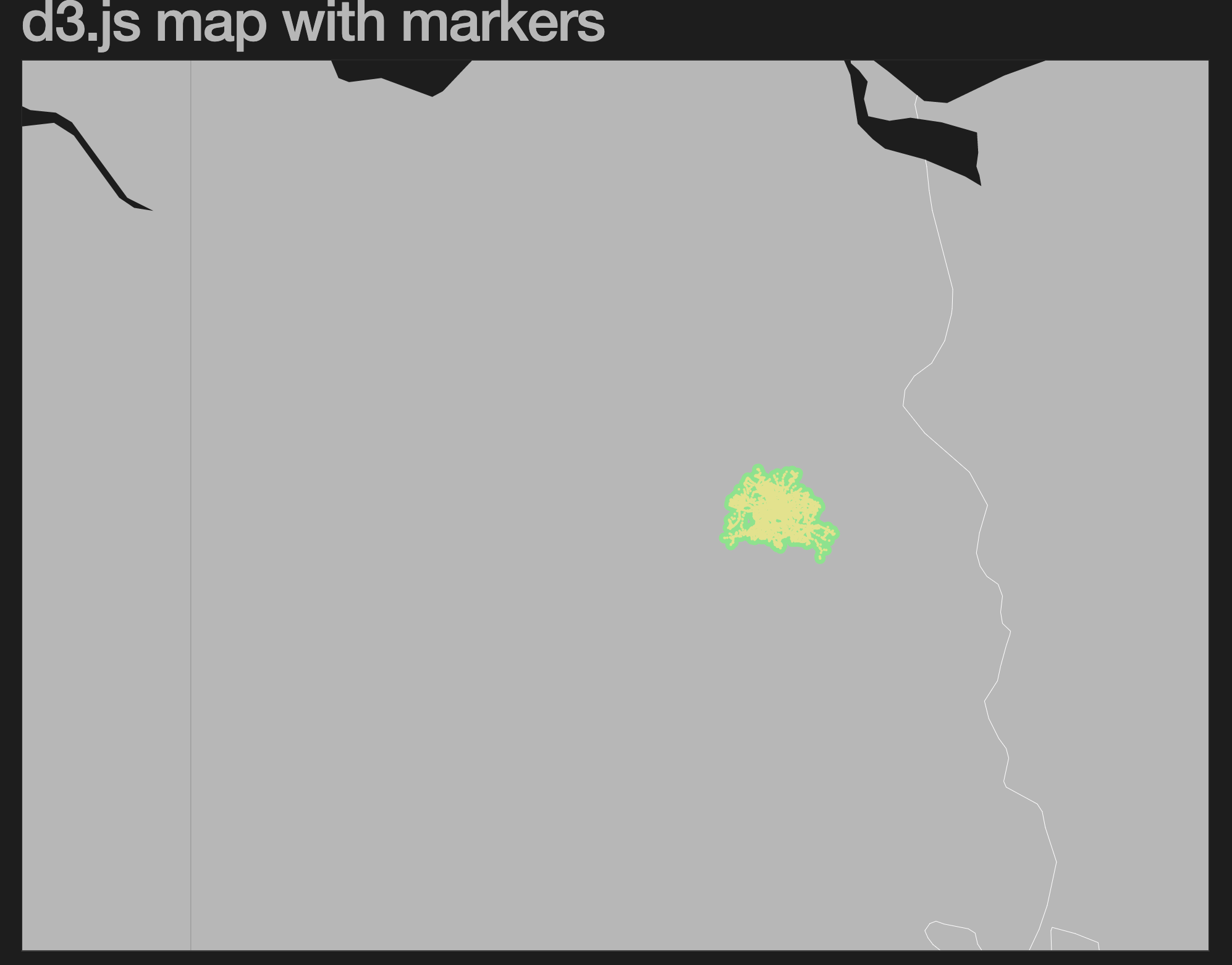
Really struggling with clustering of icons on a. project and this seem the most promising so far.
What is the actual code that creates the clusters? I've laid out my location dots with this but they do not cluster. Data is in a CSV format and the x, y. placement is accurate. No errors.
Any pointers welcomed & much appreciated!

svg
.append("g")
.attr("class", "cluster-markers")
.selectAll("g")
.data(locations)
.enter()
.append("g")
.attr("data-date", (d) => console.log(d))
.attr("transform", function (d) {
return "translate(" + projection([d.lng, d.lat]) + ")";
})
.append("circle")
.attr("r", 1);
data
data,,city,country,region,lat,lng,ccode,maintext,Tier,Category,,,
1979-02-01,,,Yemen,Middle East,15.552727,48.516388,YE,,,,,,
1979-02-11,,,Iran,Middle East,32.427908,53.688046,IR,,,,,,
You are using circles as the markers and it works. The example does not do clustering, it just overlays all the circles.
The green outline is created by
svg.append("path")
.datum(data)
.classed("geopath", true)
.attr("d", path)
which makes it look like they are fused together.
Hope this answers your question.
I have downloaded the zip file but the map does not work. In the browser, it shows only a vertical line. It shows generated and elements when I inspected in developer toolbar.
Any help to get this example working?
I believe it's because the 'translate' values and the 'scale' values are too high. I cancelled the 'translate' attribute and reduced the scale to 100. If you do this, you can se the graticule
how would I go about using svg images as icons for my location dot markers?
is there a way to add them to the data directly?
as in:" icon,city,country,region,lat,lng,ccode
" (mysvgimage) ,Aden, Yemen,Middle East,15.552727,48.516388,YE ?
yes that should be doable by replacing the circles with images:
.append("circle")
.attr("r", 1);
to
.append("image")
.attr("width", 10)
.attr("height", 10)
.attr("href", d => d.icon)

I have downloaded the zip file but the map does not work. In the browser, it shows only a vertical line. It shows generated and elements when I inspected in developer toolbar.
Any help to get this example working?